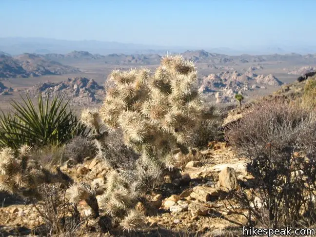
Ryan Mountain offers a fairly straight forward out and back hike to a round summit at the center of Joshua Tree National Park. The 3-mile round trip trail climbs 1,050 feet up a dirt trail with numerous stone steps. The sun-exposed trail crowns a 5,457-foot mountain with impressive panoramic views of the jumbled rock formations and Joshua tree forests that surround the peak. The summit of Ryan Mountain is the best place to get a top-down view of the heart of the park.
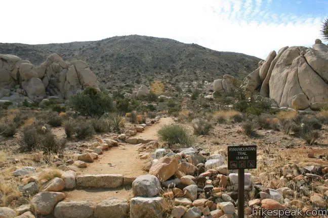
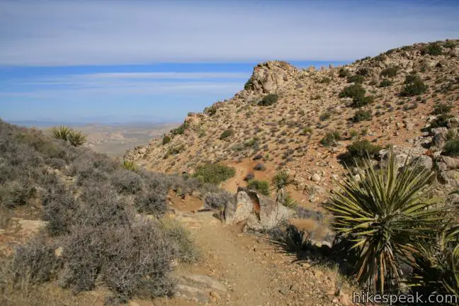
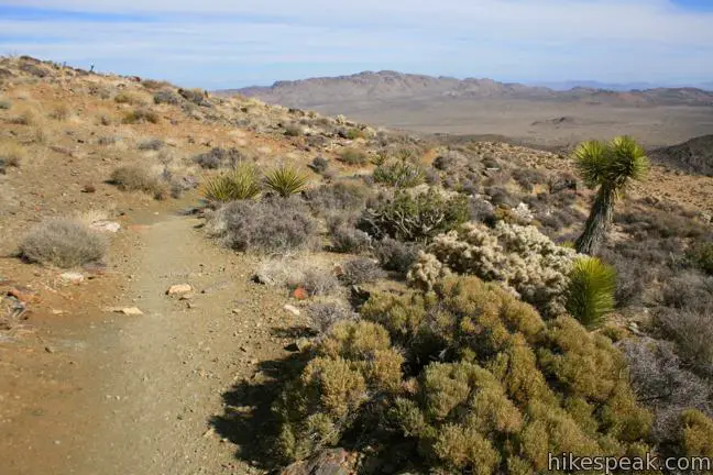
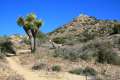
Slap on some sunscreen and set out southbound up the trail, slipping between pillars of tall misshapen granite. There is a fair amount of elevation to gain and only 1.5 miles to do it in, so the trail starts climbing right away. To assist with the ascent, rocks from the surrounding landscape have been built into steps. The trail is well constructed and in great shape.
After 0.2 miles, you will come to the trail’s one and only junction. To the left, a trail extends to Sheep Pass Group Camp, an alternate starting point for the hike. Turn right to press on for the summit.
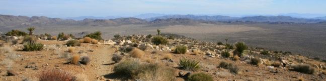
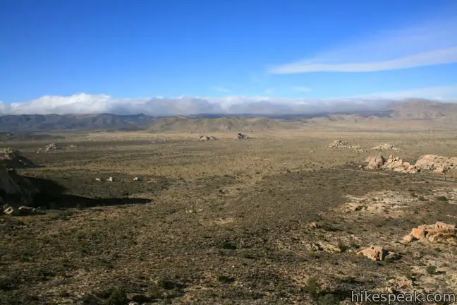
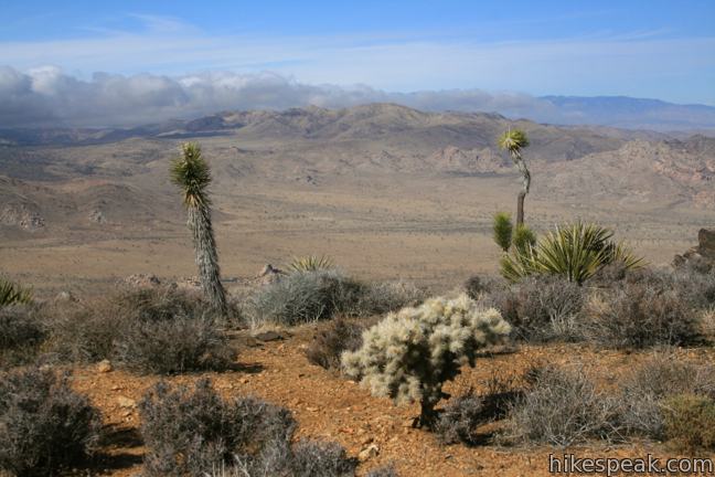
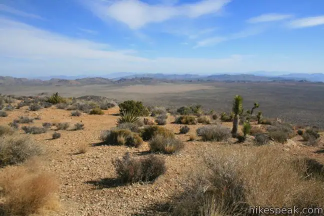
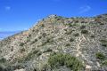
As the trail continues to climb, you will wrap around the west side of the mountain. Enjoy an excellent view to the northwest toward the Wonderland of Rocks, jumbled rock formations that define the classic Joshua Tree landscape. Farther to the west and southwest, the Little San Bernardino Mountains rise over the park.
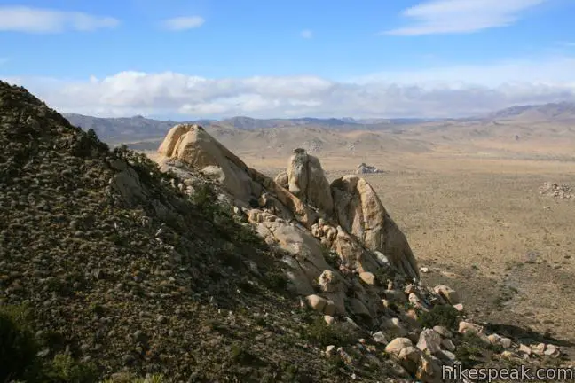
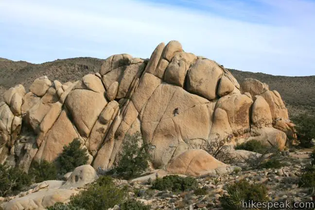
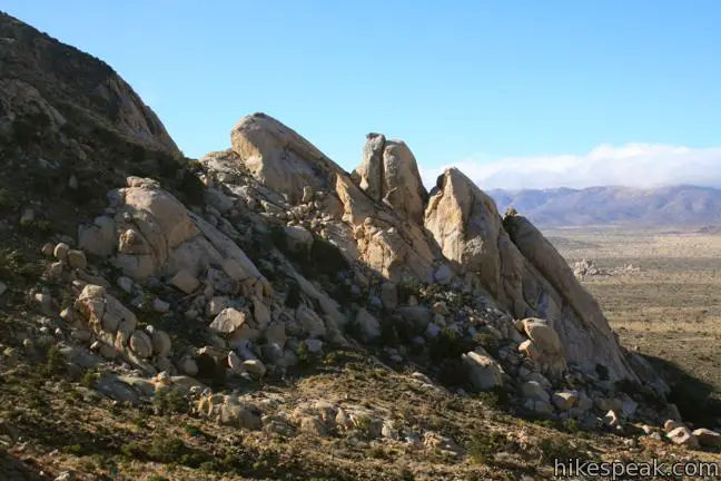
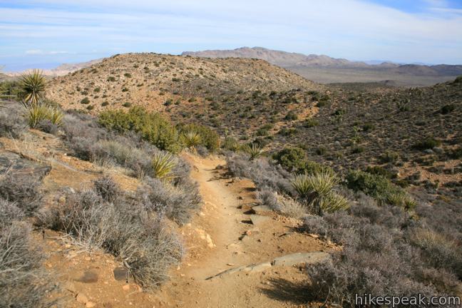
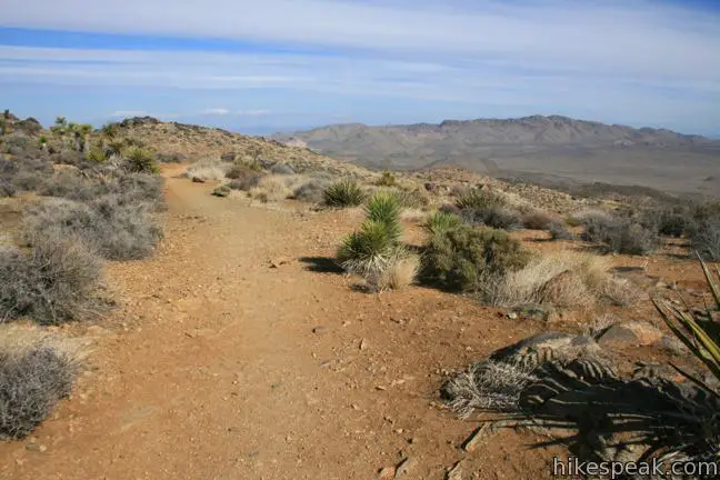
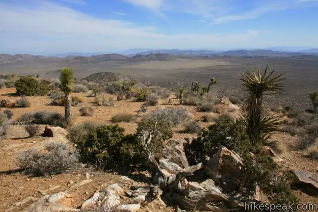
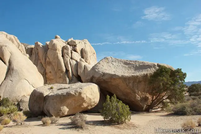
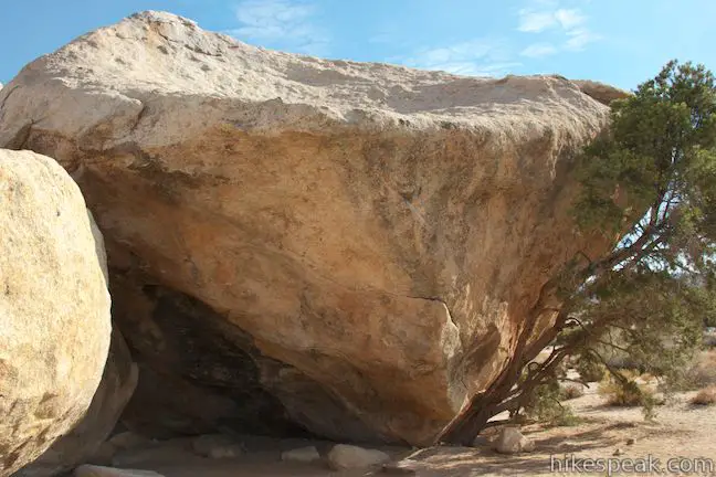
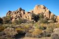
A quarter-mile above the junction, the trail rounds a corner and enters a draw in the mountainside. Here you get a head-on view of an impressive rock formation on the slope of Ryan Mountain. From some angles the granite creation looks like a face and from others it resembles praying hands. Study this feature over the next 0.45 miles as the trail maintains course for the top of the draw. Slip through a gap in the ridgeline as the trail bends to the right and continues southward. To the north and east are lower false summits on Ryan Mountain. To reach the true summit, it is another 0.6 miles of hiking with 400 feet of elevation gain.
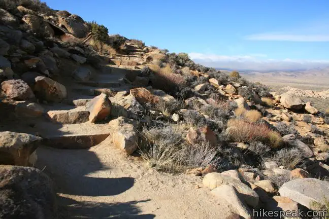
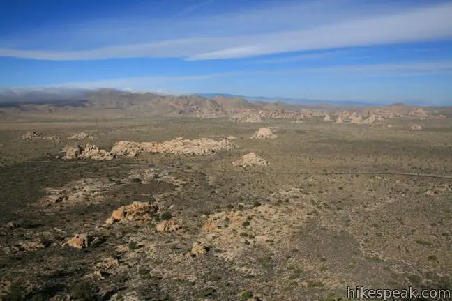
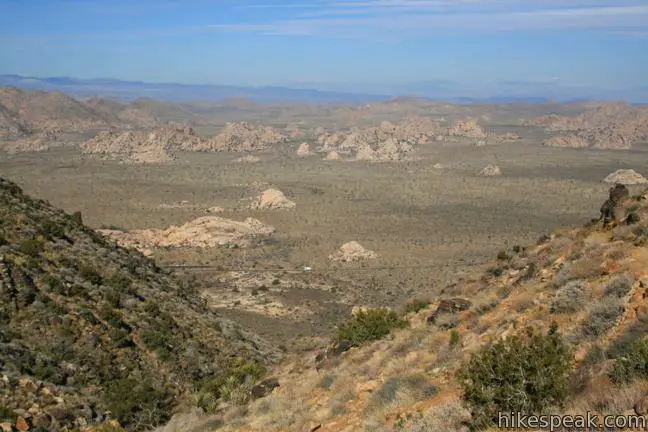
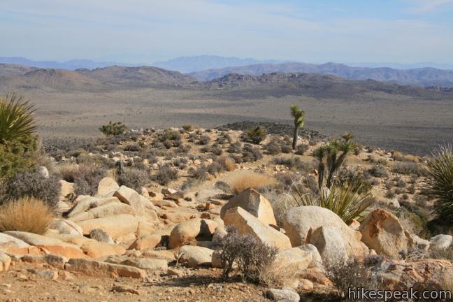
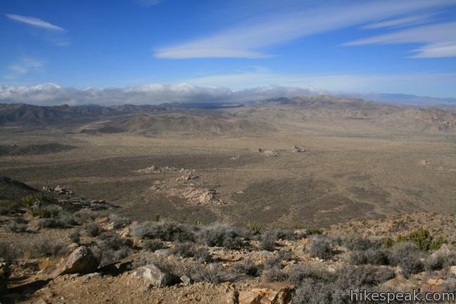
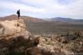
The top section of the trail offers new views to the north and east over Pinto Basin. By now you will have realized that Ryan Mountain Trail has some of the most panoramic views in the park, and the biggest view of all comes at the top.
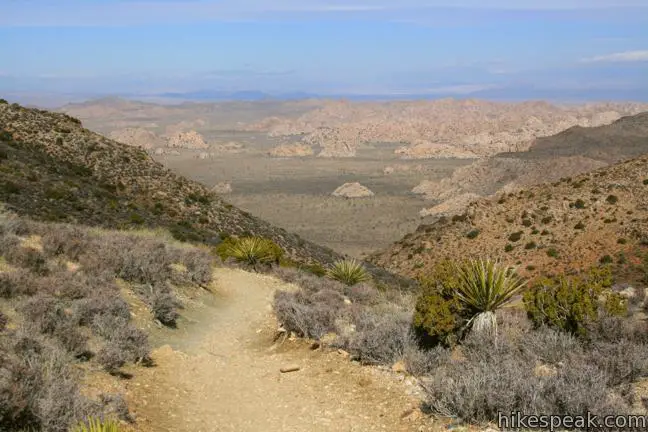
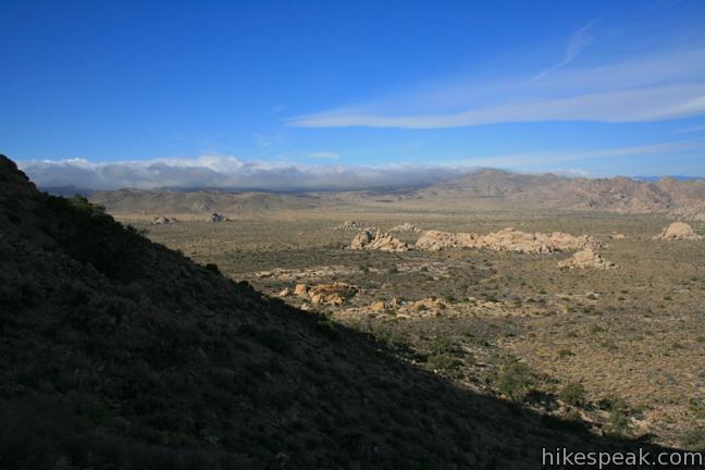
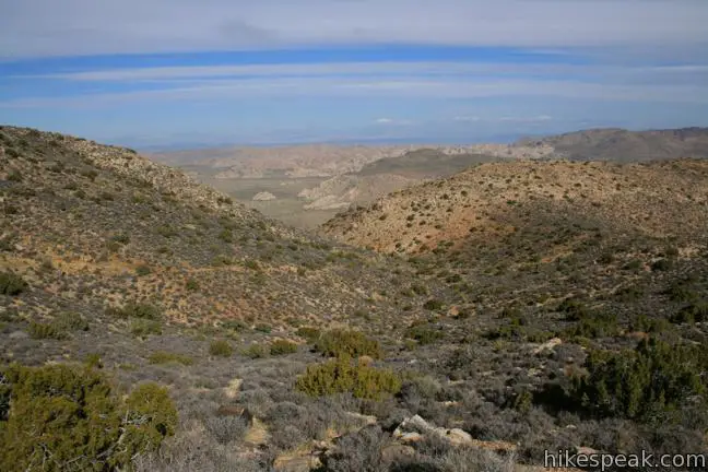
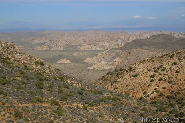
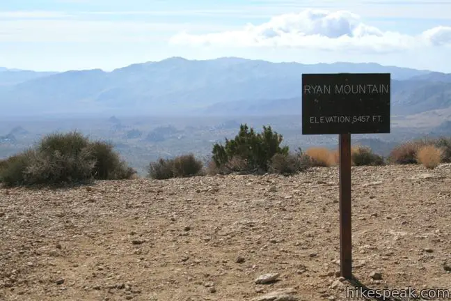
The trail tapers out, reaching a sign marking the 5,457-foot summit next to a pile of rocks. The lofty vantage seems to look out over every inch of Joshua Tree National Park, and beyond. On a clear day, you can gaze southwest toward Mount San Jacinto and Mount San Gorgonio. At the southwest base of Ryan Mountain, look down on Ryan Campground and the ruins of Ryan Ranch. Lost Horse Mountain rises above the other summits to the south, completing the view. Circle around the summit to take in each panoramic perspective of Joshua Tree.
When you are ready to hike back, return the way you came. it is all downhill from the summit. Back at the trailhead, walk to the west end of the parking lot where you will find a marker for a level path traveling a hundred feet to “Indian Cave.” Blackened rock on the ceiling of this cave-like enclosure is evidence of the park’s former inhabitants.
To get to the trailhead: Take Park Boulevard 2.1 miles east of the intersection with Keys View Road to a turn off for Ryan Mountain on the south side of the road. There is a large parking area and a bathroom at the start of the trail.
Trailhead address: Park Boulevard (Loop Road), Joshua Tree National Park, CA 92277
Trailhead coordinates: 34.00257, -116.13594 (34° 00′ 09.25″N 116° 08′ 09.4″W)
View Joshua Tree National Park in a larger map
Or view a regional map of surrounding California Desert trails and campgrounds.


Indian Cave


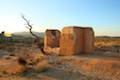 | Ryan Ranch This 0.8 or 1.2-mile round trip hike visits the ruins of an old adobe homestead beneath Ryan Mountain. |
 | Crown Prince Lookout This easy 3.25-mile round trip hike crosses a desert plateau to a pair of overlook near the site of an World War II era observation post. |
 | Barker Dam This level 1.5-mile loop visits a small foreign-looking reservoir within the Wonderland of Rocks. |
 | Wall Street Mill This level 1.55 to 2.15-mile hike visits a well-reserved gold mill, exploring the mining history of Joshua Tree National Park. |
 | Hidden Valley This one mile loop circles the interior of a small valley surrounded by tall rocks that serves as an excellent bouldering arena. |
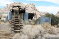
 | Lost Horse Mine This 4-mile hike visits a well-preserved mine and mill. |
 | Inspiration Peak This 1.2-mile hike leaves the crowds at Keys View for even grander views at a 5,550-foot summit that looks out on the Coachella Valley, the Salton Sea, Mount San Jacinto, and much of Joshua Tree National Park. |
 | Desert Queen Mine This 1.6-mile hike follows a level trail to an overlook before crossing a canyon to visits the ruins of one the most profitable gold mines in the California desert. |
 | Lucky Boy Vista This level 2.5-mile hike visits a modest overlook at the site of an old mine. |
 | Contact Mine This 3.9-mile hike ascends 700 feet up a wash, a canyon, and an old road to a mountainside mine site that offers a glimpse into the mining history of Joshua Tree. |
 | Warren Peak This 5.5-mile hike summits a peak with impressive views over the west side of Joshua Tree. |
 | High View Nature Trail This 1 1/3-mile loop climbs a ridge on the west side of the park that offers views of San Gorgonio Mountain and Yucca Valley, along with an introduction to desert plants. |
 | Hikes in the California Desert Explore more trails in Death Valley National Park, Joshua Tree National Park, Anza-Borrego Desert State Park, and Mojave National Preserve. |
 | Teutonia Peak This 3.4 to 4-mile round trip hike crosses the world's densest Joshua tree forest, passing an abandoned silver mine to reach a rocky summit with views of Cima Dome. |
 | Joshua Tree Campgrounds Nine campgrounds with 500 total sites are spread throughout the park to facilitate your visit. |
 | Joshua Tree Wildflowers The desert in bloom is something any outdoor enthusiast in California should see. |
Camped at Ryan Campground (really nice and very popular with rock climbers) and hiked Ryan Mtn after setting up. It’s everything you said and very well groomed, but frankly, I found the steps to be exhausting. I’d much rather have a more natural trail. I hiked Inspiration Mtn, Lost Horse Mtn and most of the peaks around them for a total of about 24 miles in 3 days. The stepped portions of the Ryan Mtn trail were the most tiring. Nevertheless, a highly recommended hike for anyone with even average fitness. Likely cold and windy in Fall and Winter so layer clothes. Several hikers left quickly without fully enjoying the view because they were too lightly dressed for the summit.
[…] information: Trip descriptions here, here and here; video of the hike […]
[…] Ryan Mountain […]
[…] and campfire singalongs to mostly Flight of the Conchords songs, so our day excursion was a hike up Ryan Mountain, which was a fairly easy 3 mile hike and offers really stunning views of the […]
[…] to take on Ryan Mountain, which was described in the Joshua Tree map as three mile loop, and moderately strenuous. I was looking forward to the elevation gain, as trail running and hiking is something I would like […]
[…] Ryan Mountain is a three-mile out-and-back to the top of a peak with constant views: distant mountains, jumbled boulders, kooky cacti. The panorama at the top gives you a bird’s eye view of much of the park. It’s one of the most popular hikes in the park, so get there early. […]
[…] can take you high — as it did when I climbed 3 miles and 1,000 vertical feet up Ryan Mountain — or low, through sandy washes and canyons on the 8-mile Boy Scout Trail. Even the […]
[…] longest objective that day was a hike up Ryan Mountain, the highest point in the park. From the summit, you are treated to a 360 view of the park’s […]
[…] trails in Joshua Tree within 800,000 acres of California desert. The toughest trail: Ryan MountainSee park-trails […]