Mount Hillyer
in the San Gabriel Mountains
Rising to just over 6,200 feet, Mount Hillyer is actually one of the easier summits to reach in the high country of the San Gabriel Mountains. Beyond its boulder piles and pine forests, the stretched-out summit offers several sweeping views of nearby peaks and canyons. The shortest route to the summit involves hiking 1.33 miles up Mount Hillyer Trail from Horse Flats Campground, gaining 575 feet. A firebreak clears the ridge that runs along the top of Mount Hillyer, and you will want to hike a mile around the summit to pursue all the views. For a longer hike, you may start from a nearby trailhead located between the Chilao Visitor Center and Chilao Campground, and hike an additional 1.25 miles up Silver Moccasin Trail to reach Horse Flats Campground. There is 1,000 feet of elevation gain on this longer venture, spread out over a 6.25-mile round trip hike.
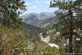
Starting on Silver Moccasin Trail, you will hike north up the dirt single track, gaining 400 feet in the first 0.9 miles as you enjoy westward views over Chilao Campground toward Big Tujunga Canyon. The trail levels out and finds the shade of Jeffrey pines before coming to a marked junction with Mount Hillyer Trail. Turn left here. After a tenth of a mile, the trail passes Horse Flats Campground, where you may meet hikers setting out from the closer starting point.
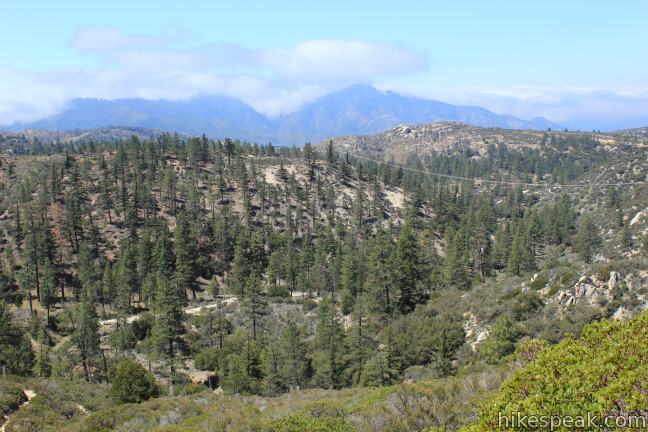
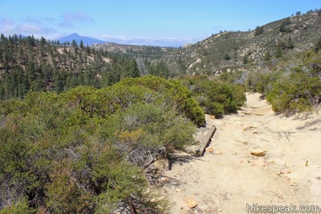
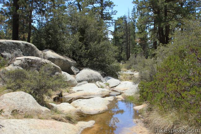
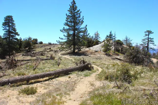
From Horse Flats Campground, Mount Hillyer Trail continues through an aromatic forest of thigh-high sage and lofty pines that reach up toward the piercing blue sky. Hop across a small seasonal creek and begin the westward climb to the summit.
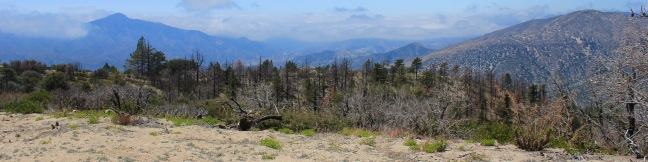
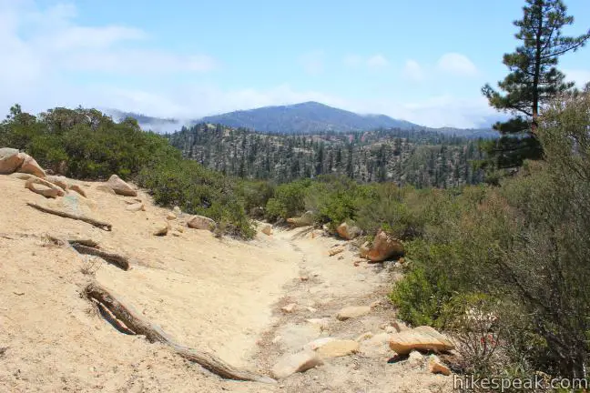
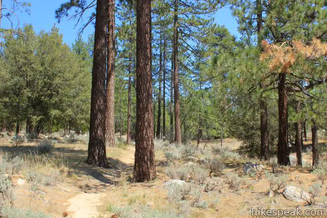
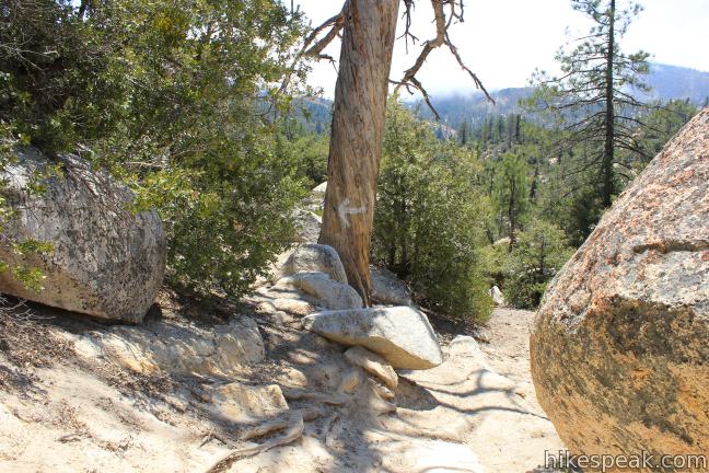
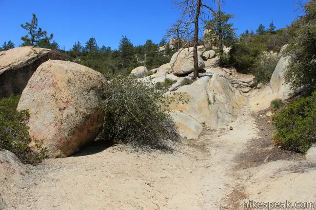
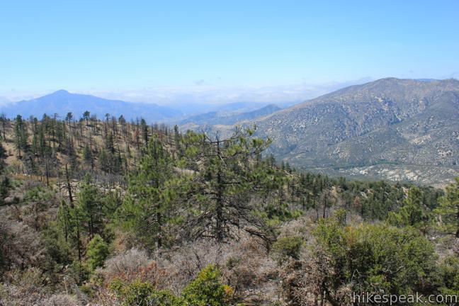
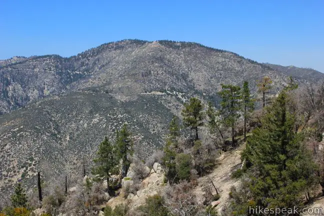
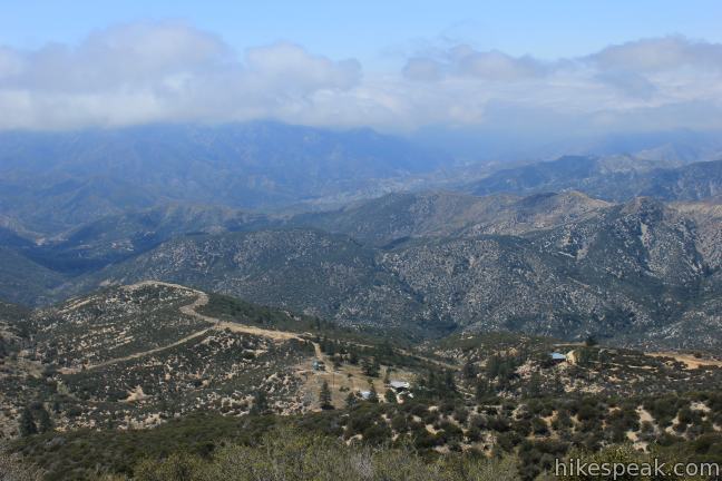
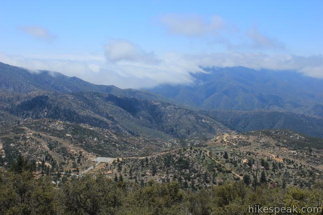
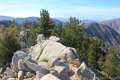
The trail rarely gets uncomfortably steep as it ascends over and around granite boulders, and weaves through thick tree trunks. Two-thirds of a mile from Horse Flats Campground, Mount Hillyer Trail passes a clearing on the right that would make a nice spot for backpackers to set up camp. There are interesting boulder formations nearby too. Around this point, the trail becomes a bit tricky to follow in a few places. Stay vigilant and continue up the mountain. To reward the effort you’ll have refreshing views east over pine treetops toward Mount Waterman and Twin Peaks.
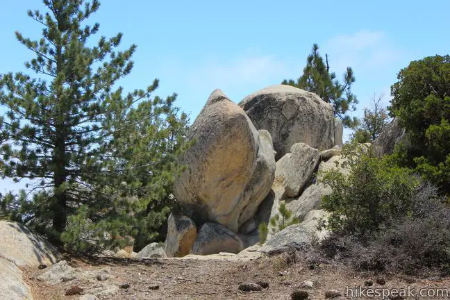
The trail breaks out of the forest onto a firebreak, and before you realize it, you’ve reached the 6,215-foot summit (just under 2.6 miles from the trailhead between Chilao Campground and the Chilao Visitor Center).
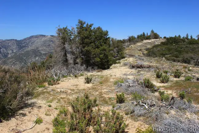
It is hard to tell when you’ve arrived because the high point does not distinguish itself by rising far above the rest of the mountain. Instead, a long ridge runs across Mount Hillyer that crowns at the unpronounced summit. Mount Hillyer Trail angles north across a shallow saddle to another rise on the ridge, a quarter mile up the firebreak. This northern rise is only a few feet shorter then the actual summit. Ahead, the trail drops off the mountain, eventually reaching Santa Clara Divide Road. If you continued descending this way, you could turn right on the road to loop back to Horse Flats Campground. This is an optional return route that can be used by those who prefer to hike along a paved road rather than go out-and-back along the same trail. Before leaving Mount Hillyer, be sure to see what else the summit has to offer.
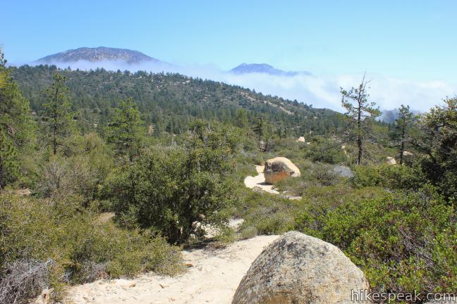
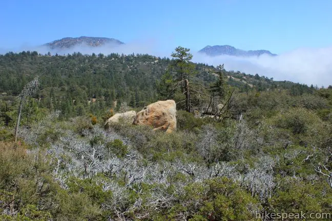
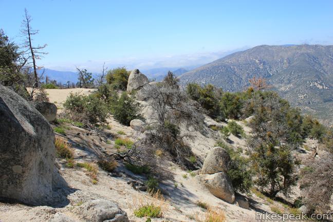
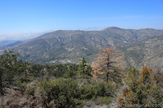
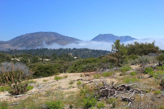
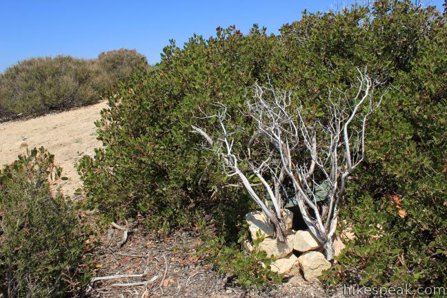
A rock pile stands in the dip on the ridge between the two bumps topping Mount Hillyer. This is a natural spot to take a break and rest your legs. On the backside of the boulders, you’ll find a great view looking west toward canyons carved by Alder Creek and north toward Mount Pacifico. Because Mount Hillyer has a round top, the tall dense pines make it is hard to get clear panoramic views elsewhere on the summit.
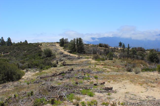
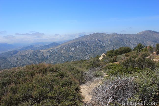
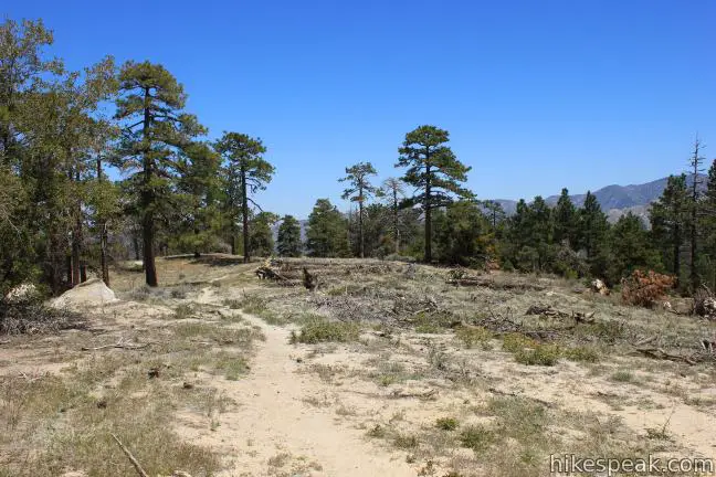
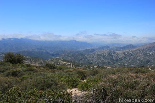
The best views from Mount Hillyer by far come from the vantage point at the southwest end of the firebreak. Follow the use trail heading down the firebreak, which breaks off from Mount Hillyer Trail near the summit. To the east, you’ll have clear views toward Mount Waterman and Twin Peaks. The south face of the mountain is covered with short brush instead of pines, to allow unobstructed views. To the south, you can look out over Mount Mooney, Vetter Mountain and several lower summits in the San Gabriel Mountains. To the west, you get a panoramic look at the expansive drainage carved by Alder Creek that feeds into Big Tujunga Canyon. The path ends at Mount Hillyer’s premier viewpoint. Only a very faint path continues down off the mountain, so this is a good place to head back. As a bonus, if you have a look around before you turn around, you’ll find a hidden geocache.
Prepare to regain about fifty feet as you hike a quarter mile back to the junction with Mount Hillyer Trail. Turn right at the summit and hike 1 1/3 miles back down to Horse Flats Campground, or 2.6 miles back to the trailhead between Chilao Campground and the Chilao Visitor Center. No permit is required to hike Mount Hillyer Trail. A day use pass (adventure pass) is required to park a vehicle at either trailhead. If you pay to camp at Horse Flats Campground (or Chilao Campground) and leave your vehicle at your site, an adventure pass is not needed to hike Mount Hillyer Trail.
Mount Hillyer Trail is a worthwhile venture. While the summit might not appear to offer great views at first, by exploring the mountaintop you can discover fantastic sights of the surrounding San Gabriel Mountains. Dogs and mountain bikes are welcome (though bikers will likely have trouble over rocky parts of the trail between Horse Flats Campground and the summit), so get out and enjoy!
To get to Horse Flats Campground: From the 210 Freeway in La Cañada Flintridge, head northeast on Angeles Crest Highway (CA 2) for 28.4 miles to Santa Clara Divide Road (Forest Road 3N17), which is two miles past Newcomb Ranch. Turn left on Santa Clara Divide Road and drive 2.3 miles west over a winding road, until you turn left again on a final narrow paved road into the campground.
Campground address: Forest Service Road 3N17, San Gabriel Mountains National Monument, Pearblossom, CA 93553
Campground coordinates: 34.345048, -118.010675 (34° 20′ 42.17″N 118° 00′ 38.43″W)
Directions to the Trailhead
Silver Moccasin Trailhead:
- From the 210 Freeway in La Canada, head northeast on Angeles Crest Highway (CA 2) for 26.2.
- A mile after the turnoff for Chilao Campground, and a quarter mile before Newcomb Ranch, turn left toward Chilao Visitor Center.
- Drive 0.7 miles, passing the visitor center and a picnic area, to reach a small parking area for the trailhead for Silver Moccasin Trail on the right side of the road.
Trailhead Location
Trailhead address: 1 Moccasin Trail, San Gabriel Mountains National Monument, Palmdale, CA 93550
Trailhead coordinates: 34.33111, -118.01198 (34° 19′ 52″N 118° 00′ 43.1″W)
View San Gabriel Mountains in a larger map
Or view a regional map of surrounding Los Angeles trails and campgrounds.
Silver Moccasin Trail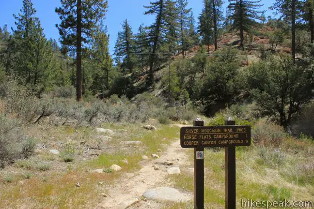


Mount Hillyer Trail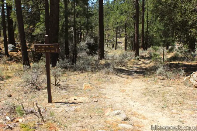


 | Vetter Mountain This 3.8 or 4.4-mile hike ascends from Charlton Flats Picnic Area to Vetter Mountain, where the site of an old fire lookout tower has exceptional 360-degree views. |
 | Winston Ridge and Winston Peak This 4.85-mile partial loop bags a summit and a scenic ridge in the high San Gabriel Mountains. |
 | Mount Waterman The 5.5 to 6 miler can be completed as an out and back hike or a loop, traveling through a pine forest to a round summit. Add six miles to the hike by dropping across a saddle and climbing to the summit of Twin Peaks. |
 | Cooper Canyon Falls This 3-mile hike leaves from Buckhorn Campground and visits a short waterfall in an enchanting glen of tall pines. |
 | Mount Baden-Powell This 8.25-mile round trip hike ascends 2,834 feet to one of the tallest summits in the San Gabriel Mountains and a monument to Lord Baden-Powell, a BSA icon and the founder of the Scout Movement. |
 | More trails in the San Gabriel Mountains Explore other destinations in the range. |
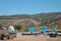
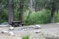
 | Horse Flats Campground This 25-site campground in the Angeles National Forest in the San Gabriel Mountains offers first-come first-serve equestrian-friendly sites. |
 | Coulter Group Campground This single-site campground accommodates up to 50 people per night, offering fresh mountain air and sweeping views at 5,300 feet. |
 | Buckhorn Campground Buckhorn Campground is an hour drive up the Angeles Crest Highway from LA and a great weekend spot for summer tent camping. |
Common Questions about Mount Hillyer in the San Gabriel Mountains
- Is the trail open?
- Yes. You should expect to find that Silver Moccasin Trail & Mount Hillyer Trail is open. There are no recent reports of trail closures. If you discover that the trail is closed, please help your fellow hikers by reporting a closure.
- Do I need a permit for this hike?
- Yes. National Park Entrance Fee.
- How much time does this hike take?
- It takes approximately 3 hours 15 minutes to hike Silver Moccasin Trail & Mount Hillyer Trail. Individual hiking times vary. Add extra time for breaks and taking in the views.
- How long is this hike?
- The hike to Silver Moccasin Trail & Mount Hillyer Trail is a 6.25 mile out and back with 1000 feet of elevation change.
- Are dogs allowed on this trail?
- Yes, dogs are allowed on Silver Moccasin Trail & Mount Hillyer Trail. The trail is open to hikers, dogs, bikes.
- Does this trail go to a summit?
- Yes, Silver Moccasin Trail & Mount Hillyer Trail reaches a summit with panoramic views.
- What mountain range is this trail in?
- Silver Moccasin Trail & Mount Hillyer Trail is located in the San Gabriel Mountains.
- Where is the trailhead located?
- The trailhead for Silver Moccasin Trail & Mount Hillyer Trail is located in Pearblossom, CA.
Trailhead Address:
Forest Service Road 3N17
Pearblossom, CA 93553
Trailhead Coordinates:
34.345048, -118.010675 - What are the driving directions to the start of the hike?
To get to the trailhead: Silver Moccasin Trailhead: From the 210 Freeway in La Canada, head northeast on Angeles Crest Highway (CA 2) for 26.2. A mile after the turnoff for Chilao Campground, and a quarter mile before Newcomb Ranch, turn left toward Chilao Visitor Center. Drive 0.7 miles, passing the visitor center and a picnic area, to reach a small parking area for the trailhead for Silver Moccasin Trail on the right side of the road.
View custom Google Maps directions from your current location.
- Are there other trails near Silver Moccasin Trail & Mount Hillyer Trail?
- Yes, you can find other nearby hikes using the Hikespeak Hike Finder Map.

4 Comments on Mount Hillyer in the San Gabriel Mountains
What hikers are saying:
✨ Generated summary of user commentsHikers find this trail beautiful and enjoy the bouldering opportunities found among the rocks. Lara recommends starting early and carrying bug repellent to ward off persistent gnats and flies. The trailhead at Horse Flats Campground can be difficult to locate, so look for the path across the loop road from the horse hitching area.
I hiked this with a friend a couple of days ago. It was very dry up there but beautiful none the less.
The trailhead at Horse Flats Campground is a little hard to spot. It’s at the far end of the campground, just across the loop road from the horse hitching area. It’s bordered by two traffic signs and two man-placed rocks. You walk between all of that.
I have a photo I could send in if you’d like to add that to this page.
I just went this past week with my boys and had a blast. The Area looks great and I don’t think it looks dry. Great area for bouldering and climbing. I really enjoy this area and its a blast when there is snow! Check out my latest adventure link below.
Mount Hillyer – Silver Moccasin Trail – Hiking Los Angeles (HD)
https://www.youtube.com/watch?v=3Kht9Eg5a9c
Beautiful hike! I tried last week but went to the wrong trailhead by mistake (from the Charlton Flat picnic area). I went back today and got it right, and boy was it worth it. I started from the Chilao picnic area at about 9 AM and only saw a few mountain bikers coming down, on my way up the trail. There are a lot of wildflowers blooming now all along the trail; it was a little steeper than I thought it would be but I’m not in the best shape right now so I wouldn’t say it’s that challenging for most HikesPeak folks. My only advice: bring bug repellent to keep away gnats and flies, and start early.
Has anyone Hiked or drove to Alder Creek nearby. Google Earth shows a lot of structures, but no info can be found.