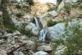
Millard Falls
in the San Gabriel Mountains
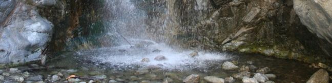
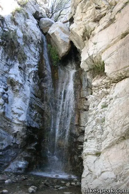
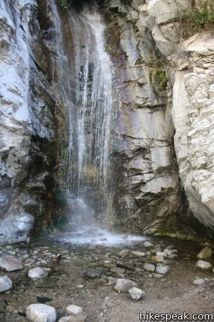
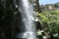
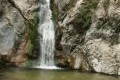
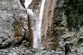
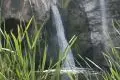
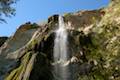
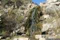
Millard Falls is just half a mile from the trailhead, up one of the most pleasant canyon in the San Gabriel Mountains. The 50-foot tall boulder-topped beauty makes a great destination for a short, sylvan hike.
- Millard Falls is one of the Los Angeles waterfall hikes.
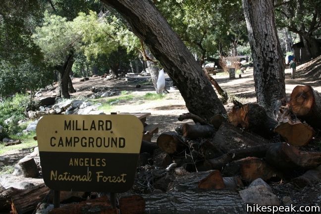
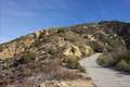
To see Millard Falls, embark up a dirt road through Millard Campground. Just beyond the campground, the trail up the canyon turns off to the right. Millard Falls Trail is easy to spot, located along a creek that spills over the dirt road. If there is a strong flow of water, you are in luck; the falls above will be spectacular. If the water is so high that you would be afraid to cross the road in a sedan, use the same caution before heading to the falls (the trek may be wetter than you bargained for). On most days, you can make it to the falls with dry feet. Then again, you will have to cross over several slippery rocks, so be careful.
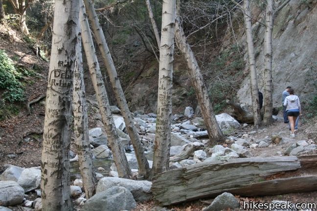
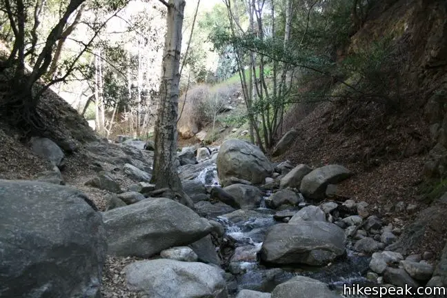
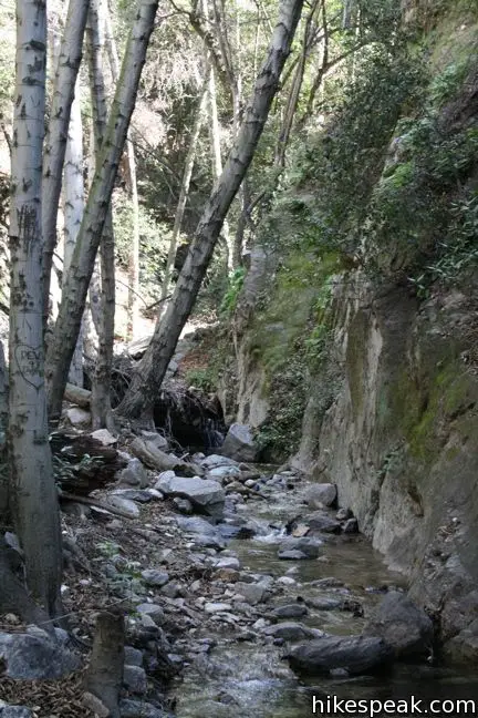
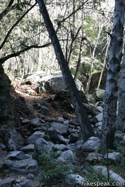
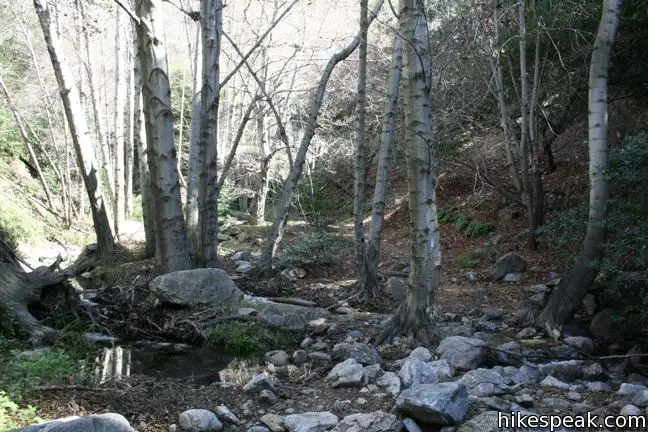
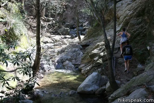
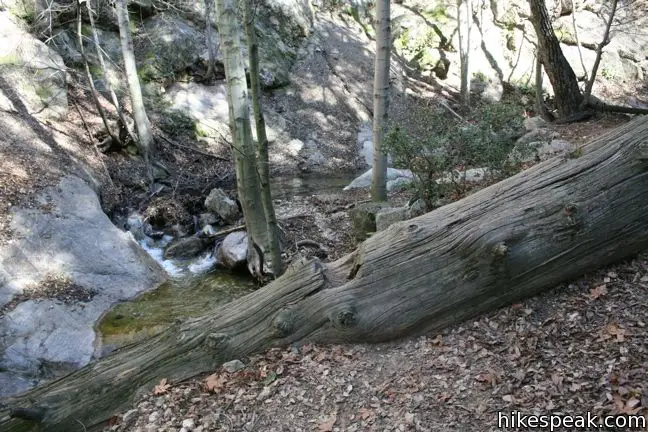
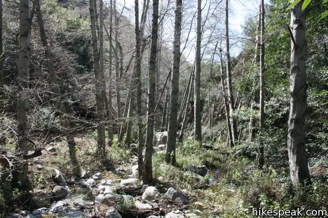
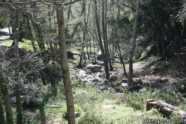
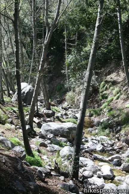
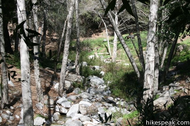
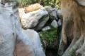
Millard Canyon is fairly narrow, measuring less than a hundred feet across in most areas. Getting to the waterfall requires numerous creek crossings as the trail searches for room up the canyon. Smooth-walking sections are interspersed between rock-hopping regions. Enjoy this calisthenics workout under the shade of tall California bays.
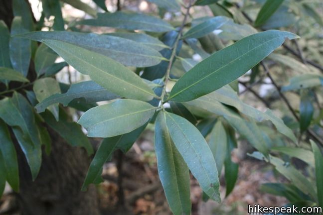
The clear creek waters glisten in patches of sunlight, creating a serene ambiance. Even the ubiquitous carvings that desecrate most of the bays on the trail cannot detract from the splendor of the journey. Let the fresh air fill your lungs while the soothing water sings in your ears. The creek is a delight, and the falls are a tremendous sight. Keep to the canyon, and no matter your path, you will reach the falls.
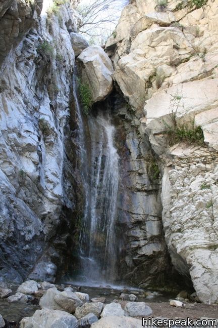
The boulders wedged atop this fifty-footer look like they could fall the next time the creek floods. They haven’t budged in years, and lets hope then never do.
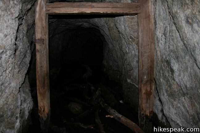
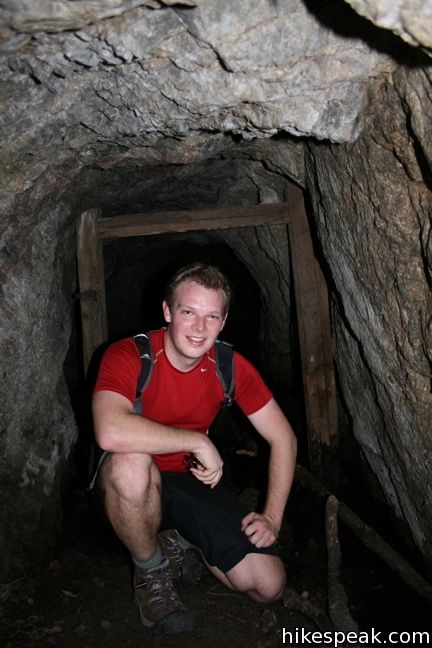
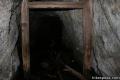
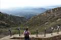
If the first half mile of canyon leaves you yearning for more, the hike can be extended. The trail continues above the falls to Dawn Mine, a great excursion. Half a mile before the Millard Falls Trailhead, Chaney Trail passes Mount Lowe Road, which can be used to connect to Sunset Ridge Trail to ascend to Cape of Good Hope or access Dawn Mine more easily.
Directions to the Trailhead
- Take the 210 Freeway to Pasadena.
- Exit Lake Avenue and head north.
- After 3.5 miles, turn left at the T onto Loma Alta Drive.
- After one mile, make a right on Chaney Trail.
- The 1.5-mile road winds up to Sunset Ridge and down to the parking lot for Millard Campground and the trail to Millard Falls.
Trailhead Location
Trailhead address: Chaney Trail, Angeles National Forest, Altadena, CA 91001
Trailhead coordinates: 34.2162, -118.1463 (34° 12′ 58.3″N 118° 08′ 46.7″W)
You may also view a regional map of surrounding Los Angeles trails and campgrounds.
Millard Falls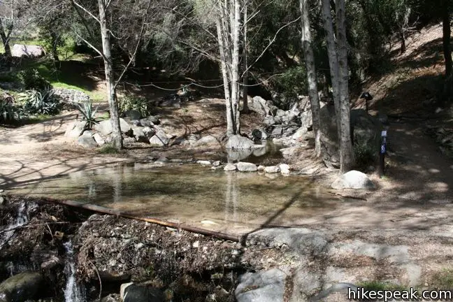


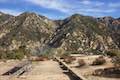
Dawn Mine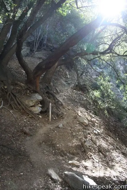


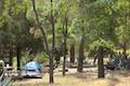
Millard Campground
 | Dawn Mine This 6-mile hike from Millard Campground leads past Millard Falls to an old gold mine. |
 | Mount Lowe Road & Sunset Ridge Trail to Cape of Good Hope This pair of trails can be combined for a 5.2-mile round trip hike to a historic viewpoint called Cape of Good Hope. Follow the old route of Mount Lowe Railway to the ruins on Echo Mountain to extend the hike by two miles round trip or bring the distance up to 11.85 miles by visiting Echo Mountain, Inspiration Point, Mount Lowe Trail Camp, and other landmarks. |
 | Castle Canyon Trail to Inspiration Point (and beyond) This 2-mile long trail ascends from the ruins on Echo Mountain to a historic viewpoint that still offers hike-worthy panoramas. Form a loop back to Echo Mountain to visit Mount Lowe Trail Camp, Cape of Good Hope, and other landmarks on Mount Lowe Railway. |
 | Echo Mountain via Sam Merrill Trail This 5.8-mile hike visits a historic railway and ruins from a century old resort overlooking Pasadena. |
 | Gabrielino Trail to Gould Mesa Trail Camp This 5.1-mile hike venturing up an canyon along the Arroyo Seco is one of a couple routes to a 5-site trail camp in Angeles National Forest. |
 | Rubio Canyon Trail This 1.3-mile round trip hike ventures into a rustic canyon to a double waterfall. |
 | More trails in the San Gabriel Mountains Explore other destinations in the range. |
 | Fish Canyon Falls This 4.8-mile round trip hike leaves from an active rock quarry and progresses up a beautiful canyon to a mesmerizing multi-tiered waterfall. |
 | Sturtevant Falls This 3.3-mile hike visits a 60-foot waterfall and a lush cottage-lined canyon. |
 | Eaton Canyon Falls This 3.5-mile hike goes up Eaton Wash to a narrow stretch of Eaton Canyon containing a pleasant 40-foot waterfall. |
 | San Antonio Falls This 1.4-mile hike visits a multi-tier waterfall along the trail to Mount Baldy. |
 | Santa Ynez Falls This 2.5-mile follows a shaded creek to a gorge containing a short waterfall. |
 | Paradise Falls This 40-foot waterfall is located within Wildwood Park in Thousand Oaks and is reachable via several trails. |
 | Escondido Falls This 3.8-mile out and back hike visits a 200-foot waterfall that is split into two tiers. The upper tier is 150 feet tall and stunning after a rainstorm. |
 | More waterfalls around Los Angeles Explore other waterfalls in the Santa Monica and San Gabriel Mountains. |
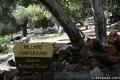 | Millard Campground This is the place to camp at the base of the San Gabriel Mountains. Or, the place to start on a hike to Millard Falls or Dawn Mine. |
Common Questions about Millard Falls in the San Gabriel Mountains
- Is the trail open?
- Yes. You should expect to find that Millard Falls Trail is open. There are no recent reports of trail closures. If you discover that the trail is closed, please help your fellow hikers by reporting a closure.
- Do I need a permit for this hike?
- Yes. National Forest Adventure Pass.
- How much time does this hike take?
- It takes approximately 30 minutes to hike Millard Falls Trail. Individual hiking times vary. Add extra time for breaks and taking in the views.
- How long is this hike?
- The hike to Millard Falls Trail is a 1 mile out and back with 150 feet of elevation change.
- Are dogs allowed on this trail?
- Yes, dogs are allowed on Millard Falls Trail. The trail is open to hikers, dogs.
- Is Millard Falls Trail good for kids?
- Yes, this hike is likely suitable for children. It is relatively short (1 miles) with manageable elevation gain.
- Will I see a waterfall on this hike?
- Yes, Millard Falls Trail features a waterfall.
- What mountain range is this trail in?
- Millard Falls Trail is located in the San Gabriel Mountains.
- Where is the trailhead located?
- The trailhead for Millard Falls Trail is located in Altadena, CA.
Trailhead Address:
Chaney Trail
Altadena, CA 91001
Trailhead Coordinates:
34.2162, -118.1463 - What are the driving directions to the start of the hike?
To get to the trailhead: Take the 210 Freeway to Pasadena. Exit Lake Avenue and head north. After 3.5 miles, turn left at the T onto Loma Alta Drive. After one mile, make a right on Chaney Trail. The 1.5-mile road winds up to Sunset Ridge and down to the parking lot for Millard Campground and the trail to Millard Falls.
View custom Google Maps directions from your current location.
- Are there other trails near Millard Falls Trail?
- Yes, you can find other nearby hikes using the Hikespeak Hike Finder Map.

29 Comments on Millard Falls in the San Gabriel Mountains
What hikers are saying:
✨ Generated summary of user commentsThis trail offers a scenic journey through the canyon featuring multiple creek crossings and a rewarding waterfall. Hikers find the scenery beautiful and recommend arriving by 6 a.m. to beat the crowds, though Angie warns that the entry gate does not always open on schedule.
“Hike has plenty of beautiful scenery to enjoy along the way especially creek crossings.” Jump to comment ↓
Could you please tell me as soon as possible if this information on Millard Trail being closed is correct? Plannning on taking a bunch of children on hike tomorrow July Tenth. Thankyou.
Hi Cali-
Millard Canyon is still within the closure area of the Station Fire. You may call a ranger to confirm, but I believe it is still closed.
Called to check 8/21/2012: Still Closed.
as off sept 15 2012 , all of millard creek closed from millard campground all way past dawn gold mine . via taking sunset trail , once your in millard creek your in closure area also . dawn gold mine is also in closure area .
As of 01/02/13, Millard falls trail is closed to hiking. It’s cr#ppy that the forest service hasn’t posted a sign saying this at vehicle entrance or parking lot. So you most likely bought a day pass to park, unloaded your gear, started walking up the road (past Chester’s double wide) to the water line, and up to a fence with a sign saying “trail closed due to fire damage”.
The tiny Camp/ picnic area (non-potable water) is available. Camping there isn’t great since it’s right along the trail that goes up to the fenced off area of the Fall’s trail. So you are going to get alot of people walking past you, looking at you, and asking YOU about why the trail is closed.
There is a camp ground chester that lives onsite to monitor the parking lot and “other activities”. So don’t try to park in the parking lot without a day pass. He will ride his ten speed down in a blaze of glory to your spot and call a tow on your vehicle.
BTW:It is a felony to punch him in the face, so don’t do it. He has direct comms with the Sheriff’s down the road. It isn’t worth ruining your weekend.
Day passes can be bought at any ranger stations or Big 5, sports chalet, etc. for a couple bucks. The campsite chester can be identified by the double wide trailer located at the right of the trail, next to the camp site. He has a hidden video camera (hidden by a tarp or pieces of wood) that looks onto the camp site. Did I mention that the camp site is mainly used by cub scouts?
Thanks to the park rangers for looking out for us.
B Mac – I’m planning a scout camping trip to Millard. Is there any hiking available from Millard or are you pretty much trapped in confines of the camp?
Millard Canyon is still closed following the Station Fire. I spoke to a ranger last week who said that the campground was still closed as well, although it is not listed as closed on the Angeles NF website. You will probably have a better trip camping elsewhere…
We just camped there and not a cub scout in sight Actually pretty quiet. The trails up to Mt. Lowe Road (Lower Sunset Ridge Trail) and beyond that up to the Saddle and Sunset Ridge Trail were all open. Lots of mountain bikers but they were all very respectful, carefull and polite. Every one said thank you when we stood aside. We camped and hiked mid week-though it was a Spring Break- and less than half the sites were occupied. It will probably be busier at weekends and now that it’s warmer. The high country sites were due to open April 1st. Sulphur Springs was supposed to be open year round but the roads were all closed even though it was dry as a bone and not a speck of snow so you can’t go by what it says on the Forest Service site as noted above.
caretaker at millard has no 10 speed bike or a double wide trailer lol and they do not tow away vehicles if not have a pass ,and there is no camera on the campers in campgrounds . and yes waterfall area is closed yet as so is all area in millard creek from campground even dawn gold mine closed , , but the campgrounds are open to camp . hiking can hike on fire road /campground for miles brown mnt fire road , . another close campground is gould mesa hike in , , yes b mac altadena LA sheriffs dept is closeby , and USFS law enforcement also patrol area ,,,,,
UPDATE Dawn Gold Mine and Millard Falls are still in the closure area – no hiking, etc. – update as of June 1st, 2013. Area will remain closed for up to 1 more year.
Hi I’m a local that camps here 14 days out of every year.The falls are closed and will not open again from what the ranger tells me every year, but the campgrounds hiking and bike trails are still one
As of May 5, 2014, trail to Millard Falls and Dawn Mine still closed, 5 years after the Station Fire. I think this is disgraceful. Somebody should force the issue.
Any update on the re-opening of the trail? This is a great time of the year for hiking…let’s get it open!
Is the trail to Millard Falls reopened yet ?
Is Millard Falls reopened now ?
Yes. Millard Canyon has reopened and the waterfall is flowing!
Thank you !
Is the waterfall still flowing now in Augest???
does any body know if the water waterfall is flowing im planning to go next week
We enjoy hiking Millard falls the most. Beautiful tall waterfall with decent amount of water (5/27/17). SAT was crowded @7am but SUN @6am was empty. Hike has plenty of beautiful scenery to enjoy along the way especially creek crossings.
Any recent visitors that can update the waterfall.
Waterfall is flowing
Does anyone know if the Millard Falls are open now and if there is water? I plan to go this week, probably 7/5/18.
I’ve hiked many times in Malibu, above Pasadena, near JPL, etc. I’ve NEVER needed a day pass. Why is it stated (in Hikespeak re waterfalls near LA) that we need a day pass to go to Millard Falls?
Angeles National Forest relies on funding from the National Forest Adventure Pass as well as the annual “interagency pass” that’s also used at national parks.
Is Millard trail and surrounding areas open after the October 2019 fires? Does anyone know what trails are still closed?
Millard Canyon never open on time. Sign states 6am to 8 pm. It is 7am, and the gate is still lock.
Tried calling for info on hike to falls but mailbox full, was hoping to go tomorrow. Is it still opn to the public?
I was wondering if anyone know if we can get sick if we drink the water from the falls?