Hart Tree and Fallen Goliath Loop in the Redwood Mountain Grove in Kings Canyon National Park
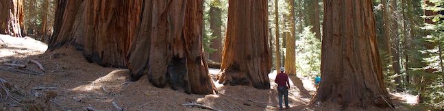
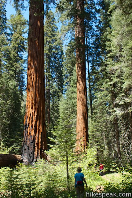
Despite being the world’s largest grove of giant sequoias, the Redwood Mountain Grove receives far fewer visitors than the Giant Forest and the General Grant Grove. Those that do visit are in for a treat. Redwood Mountain Grove is a haven for hikers. Three long trails exploring the Redwood Mountain Grove (Sugar Bowl Trail, Redwood Creek Trail, and Hart Tree Trail) can be coupled to form three different loops through the peaceful grove. Combine Hart Tree Trail and Redwood Creek Trail for a moderate 8.3-mile loop that contains a highlight reel of giant sequoias. You will pass the Log Cabin, which was built out of one giant log, the Fallen Tunnel Tree, which you can walk through, the Hart Tree, which is one of the world’s largest, and the Fallen Goliath, which is big enough to be a school bus wrapped in bark. The trail also passes several tranquil streams, including one with a short waterfall. In all, the crowd-free hike will immerse you in an immense sequoia grove like nowhere else in Kings Canyon National Park.
The hike begins from the end of a dirt road at Redwood Saddle, at the north end of Redwood Mountain at an elevation of 6,225 feet. The total difference between the high and low points of the loop is 925 feet, but the profile of the trail is not a straight up and back. The trail starts by descending to 6,000 feet and then climbs to a high point at 6,425 feet, only to descend to the loops lowest point at 5,500 feet, before climbing back to the start. While there is over a thousand feet of climbing along this loop, the trail is entirely gradual, except for two short steep spots. Please note that park map lists the distance of the Hart Tree and Fallen Goliath Loop as 7.3 miles. The distance of 8.3 miles used in this write-up was reached through GPS recordings. If your legs start to get tired on the final climb, hopefully you won’t have to go the extra mile.
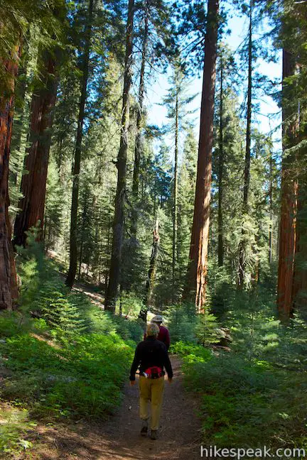
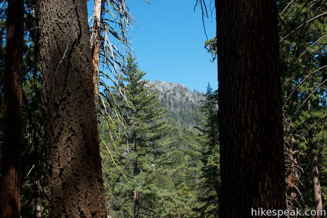
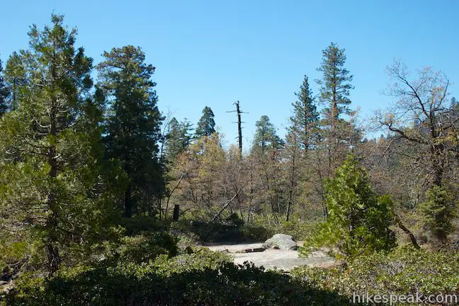
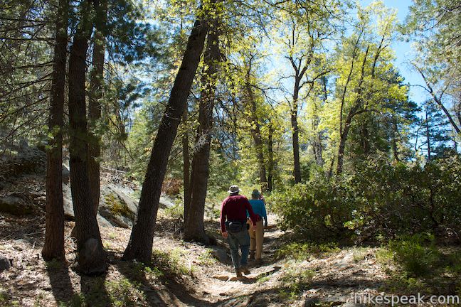
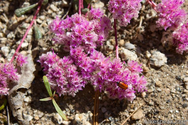
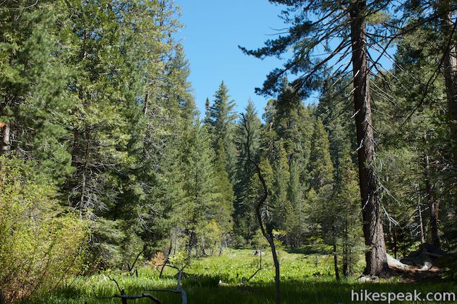
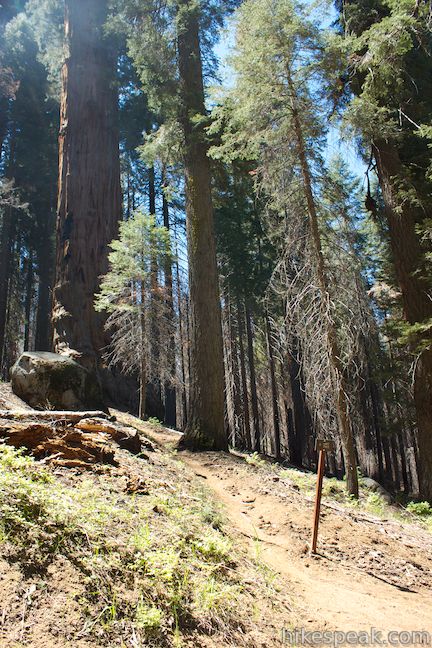
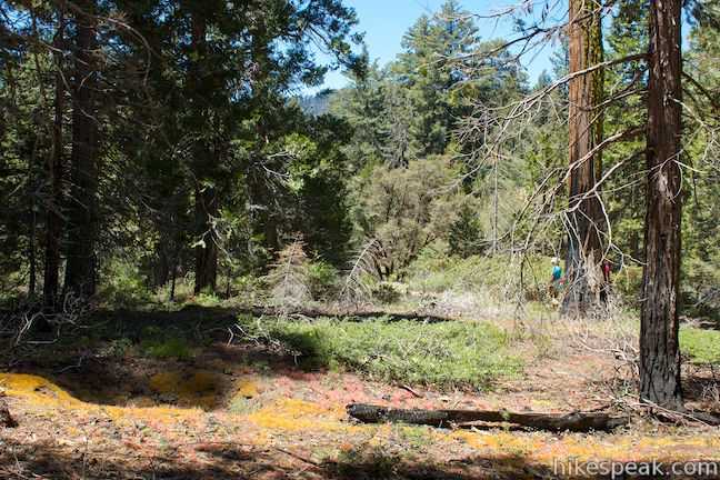
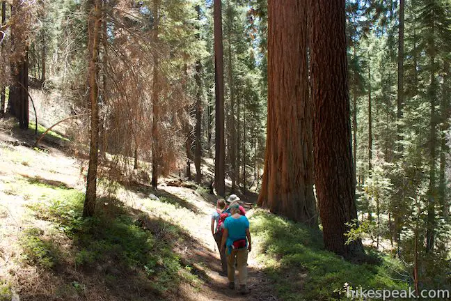
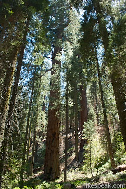
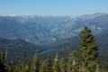
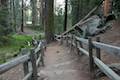
Get started down the trail on the left side of the trailhead marked with a sign for Hart Tree and Redwood Canyon (not the other trail labeled Sugarbowl Trail). The dirt trail gradually descends through a forest of sugar pines and giant sequoias on the east side of Redwood Mountain. You will immediately notice that this is not your typical trodden down trail through a touristy giant sequoia grove. Beneath the giants, is a forest floor of sword ferns, wild rose, and wild strawberries, adding charming greenery between the trail and the trees. As the trail makes one horseshoe bend to the left, look east through the pines toward Big Baldy Ridge and Buena Vista Peak, towering over the opposite side of Redwood Canyon.
After 0.35 miles, you will reach a split in the trail at the start of the loop. Redwood Creek Trail continues down the canyon to the right. Turn left on Hart Tree Trail to hike the loop in a clockwise direction.
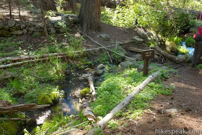
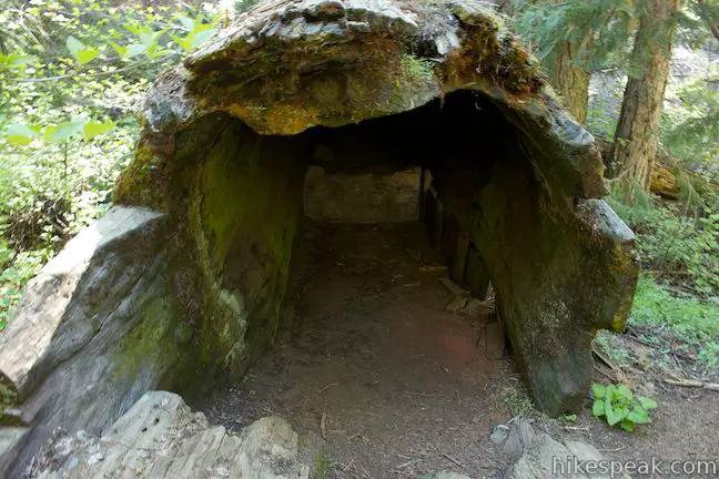
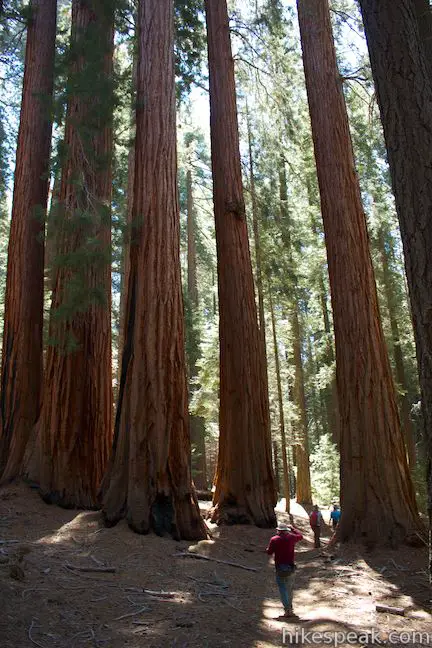
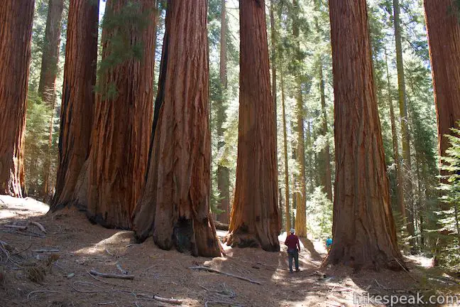
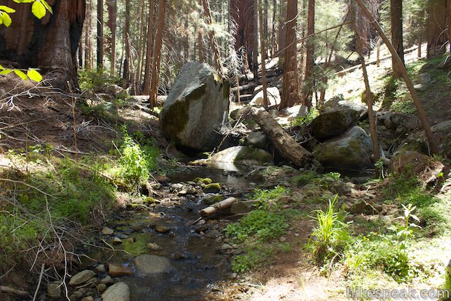
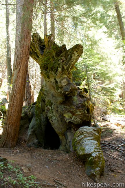
Hart Tree Trail passes through a cluster of giant sequoias and comes to a crossing of Barton Creek, a tributary of Redwood Creek at the north end of the canyon (and the north end of this loop). Hop across the trickling stream as the trail heads temporarily uphill along a ridge, before descending to a fork of Redwood Creek. On the far side of the creek you will spot a marker for the Log Cabin on the left side of the trail, 0.95 miles from the start. The cabin, built inside the hollow end of a fallen sequoia, is no longer being upheld as a home. The door and fireplace are gone, but you can still step inside and imagine what it must have been like for the logger who lived inside.
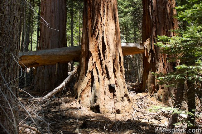
Limited logging occurred in Redwood Canyon in the 1870s. While there are not many stumps along the trail, you will pass a few curious sequoia stumps that are about ten feet off the ground. The trees were cut down that high up because they were too big at their bases for the loggers to cut through. The loggers had to weld a couple long saws together in order to cut down the big trees, and even these double saws were not big enough to cut through the bases of some sequoias. The loggers built scaffolding around trees so that they could cut through higher up where the massive trees were a bit skinnier.
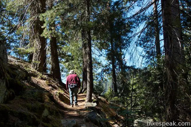
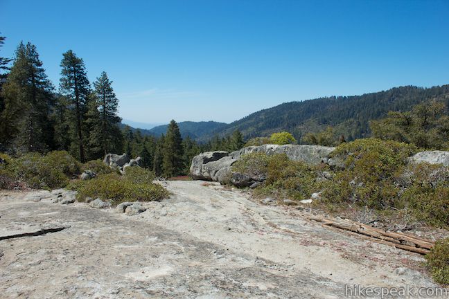
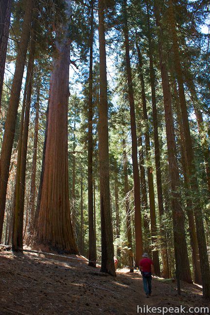
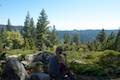
Continue up Hart Tree Trail, which ascends past a small open area of granite and manzanitas on the right that would make a nice backcountry camping spot. There are a few potential campsites along the loop for backpackers (more information on that later). Proceed up the trail and hop over another branch of Redwood Creek before tackling a couple gradual switchbacks. A carpet of pine needles atop the dirt trail makes for a cushioned hiking surface.
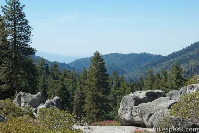
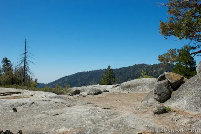
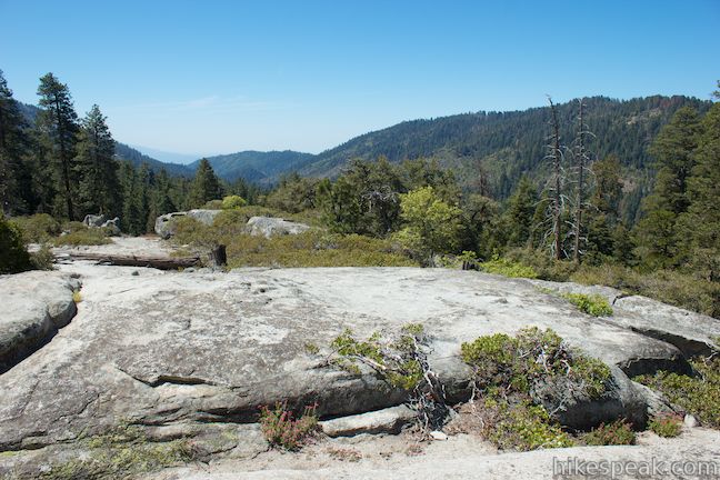
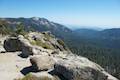
Above the switchbacks, you will cross another creek as the trail aims southeast up the side of Redwood Canyon. At 2.05 miles, the trail passes a large area of exposed granite on the right side of the trail. Take a shot stroll out onto this wide opening. This spot is out from under the trees and offers the biggest views of the loop, so take them in. Look south down Redwood Canyon over the tops of giant sequoias framed by Big Baldy and Redwood Mountain. If you walk out far enough over the rock, you’ll get a view to the northeast of Buena Vista Peak, a sheer granite peak rising over the sequoias just above the trail. The open spot would be another nice area for backpackers to set up camp.
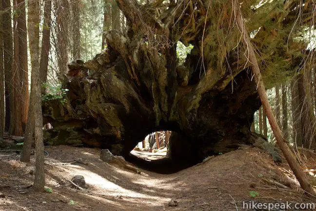
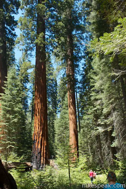
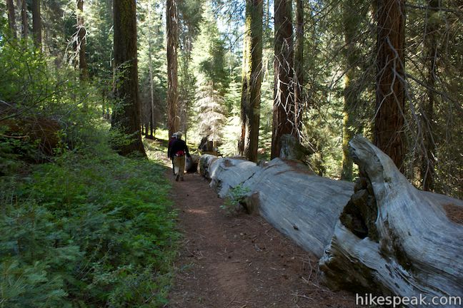
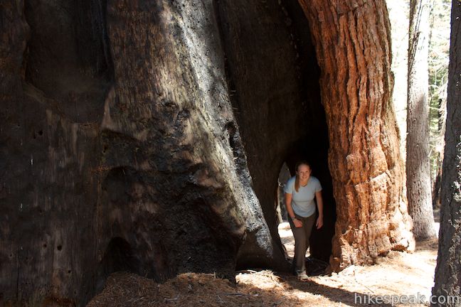
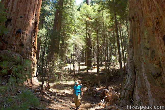
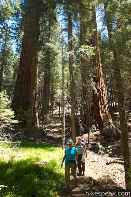
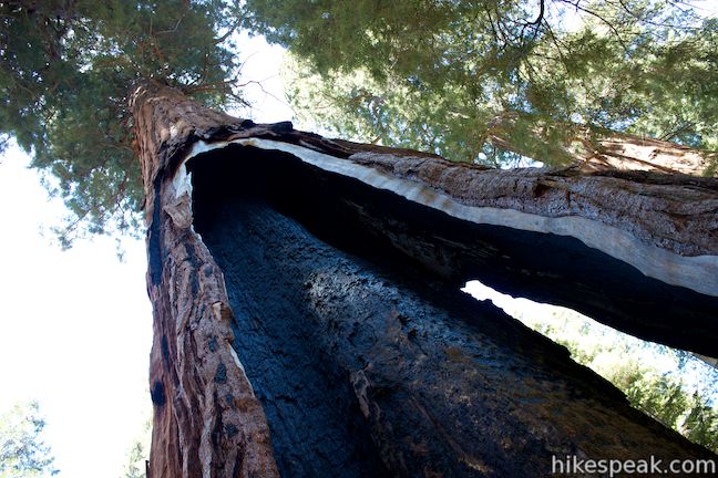
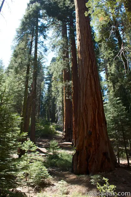
Continue up Hart Tree Trail, which gradually crests at the loops high point of 6,425 feet. Rock hop across Buena Vista Creek, the lines of water flowing from a small green meadow named Hart Meadow. The trail proceeds on a level course through pines into a lovely sequoia grove. After turning downhill through the clusters of enormous sequoia, the trail passes directly beneath a section of a fallen sequoia. The trail runs end to end beneath a burned out trunk of the big tree. There is a path along the outside of the Fallen Tunnel Tree for those who don’t feel like using the tunnel, but it is way more fun to hike through the tree.
On the opposite side of the Fallen Tunnel Tree, the trail turns sharply downhill. This is the first steep section on the trail, 2.85 miles from the start. After the short steep spurt, the trail resumes a gradual descent to the East Fork of Redwood Creek, the largest stream crossing so far. A few nice small cascades in the creek just upstream from the crossing might make you want to linger here, 3.4 miles from the start, but press on because the Hart Tree is just ahead!
After another tenth of a mile you will come to a spur trail on the left with a pair of signs pointing to the Hart Tree. Turn left up the steep path, which reaches the Hart Tree after a tenth of a mile. This is the second and final steep section on this otherwise gradual and moderate loop.
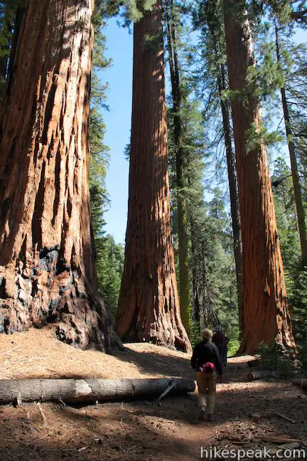
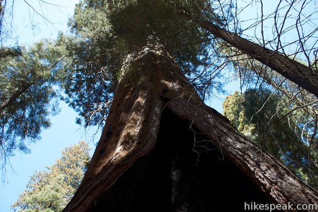
As you walk up to the Hart Tree, you will pass another giant sequoia that seems to be nearly just as large. Both trees have large fire scars on the east side of their bases. Fire scars are common in sequoia groves and as a sign at the trailhead explains:
It was here in the mid-1960s that scientists discovered the strong, fascinating connection between healthy sequoia groves and natural fire cycles.
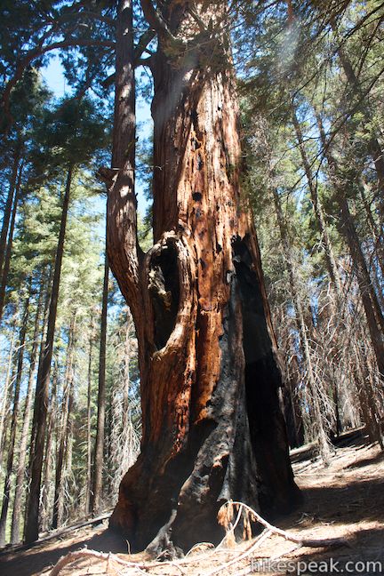
Sequoias rely on fires to clear out other plants that compete for sunlight, water, and nutrients. Giant sequoias are well adapted to survive fires and tree rings have shown that most mature sequoias put up with a few wildfires per century. Mature sequoias, like the Hart Tree, have their branches high off the ground, so that there is less to burn at ground level. The bark on the outside of giant sequoia trunks is soft and filled with air pockets that can help to insulate the trees from hot fires. This bark contains a minimal amount of sap so that it is not particularly flammable. Fire scars show that even if the outer layers of bark burn off, most of the tree will remain intact, allowing the tree to continue to grow and heal from the fire scar over time.
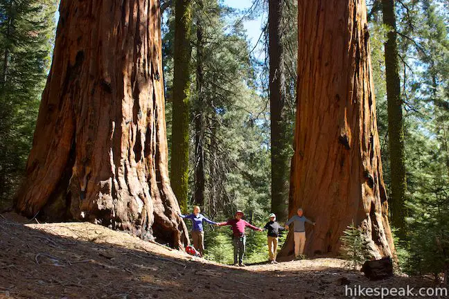
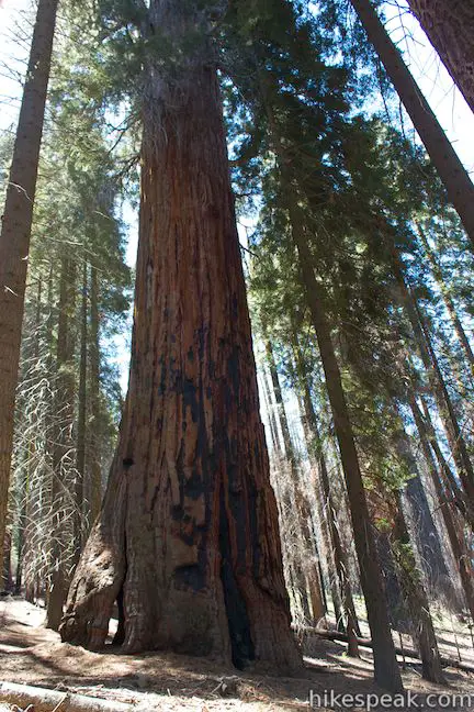
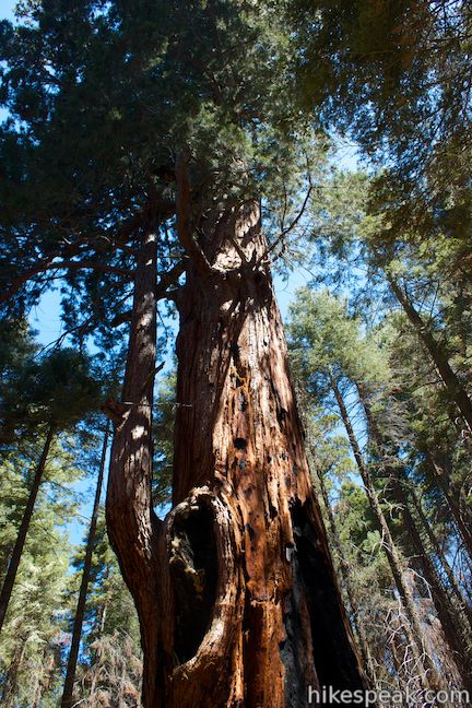
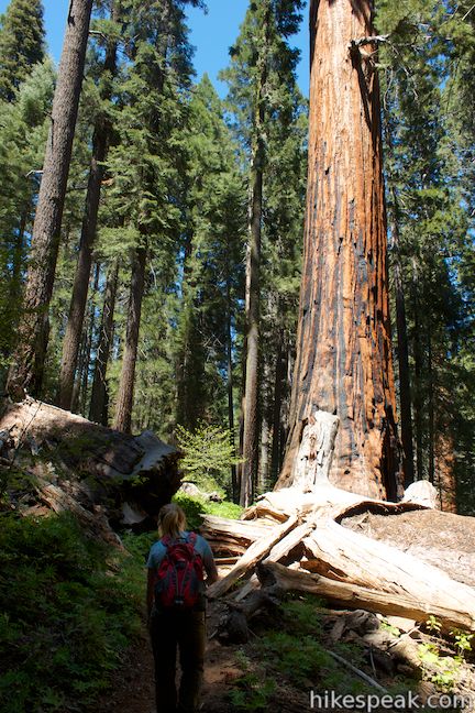
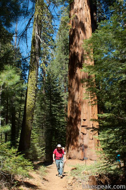
A fire burned a hole in the left side of the Hart Tree, which you can actually step through to reach the uphill side of the tree. The Hart Tree was discovered by Michael Hart in the 1880s. Once the 4th largest know sequoia, the Hart Tree has slipped in the rankings to the 24th largest sequoia in the world. The Hart Tree has a diameter at breast height of 21.3 feet, a height of 277.9 feet, and a staggering volume of 34,307 cubic feet. It is one big tree!
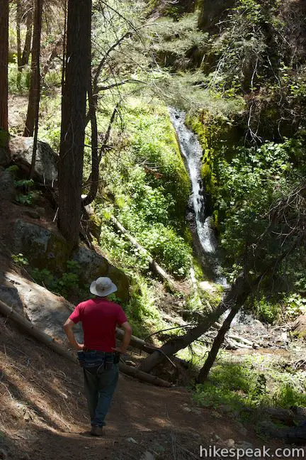
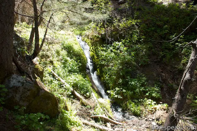
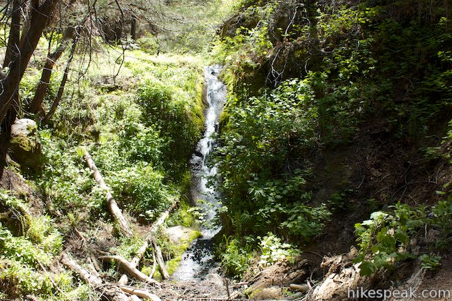
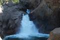
After admiring the Hart Tree (3.6 miles from the start), return to the main trail and continue with the loop. If you’re worried that the best is behind you, don’t fret. This loop still has a lot to offer. After a gradual 0.3 miles, the trail passes another little stream, but this time there is a thin 15-foot waterfall just upstream from the trail that slides down a mossy fern-lined gully.
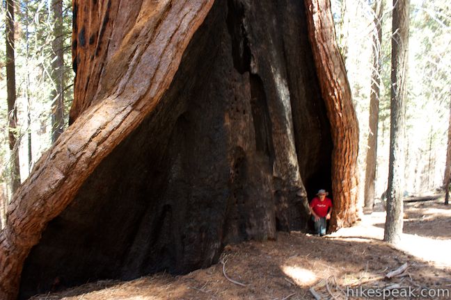
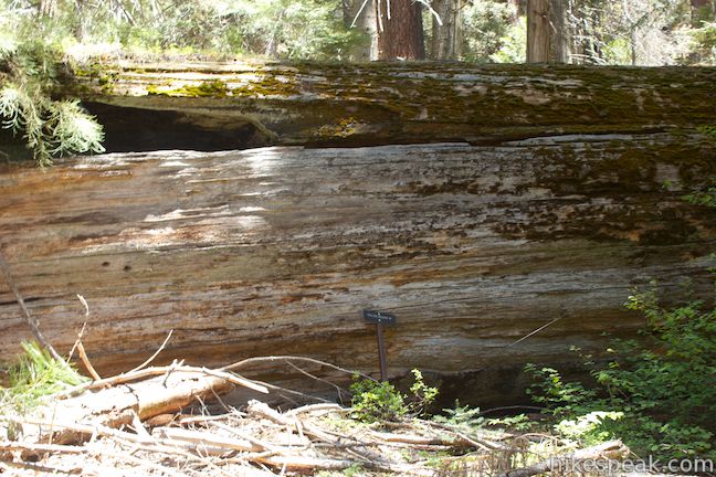
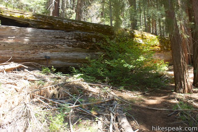
Past the waterfall, the trail turns west and downhill toward the bottom of Redwood Canyon. Of course there is one more creek crossing as you descend through sugar pines and clusters of giant sequoias. At 5.25 miles from the start, or 1.55 miles from the spur trail to the Hart Tree, you will come to a point where the trail appears to split. The two paths soon reunite, but take the high road to the right and you will quickly arrive at the Fallen Goliath. This massive tree lying sideways on the ground would be impossible to walk past, but there is a marker labeling the tree in case there was any doubt.
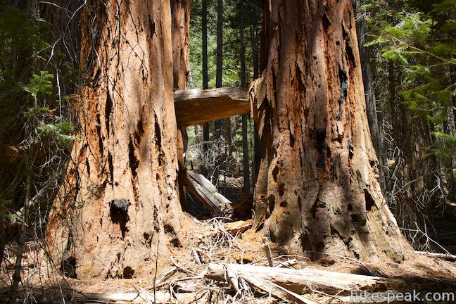
Ahead, the trail continues to descent past more giant sequoias toward Redwood Creek Trail. On the right side of the trail, you will pass an interesting scene where a giant sequoia fell, dropped right between two other sequoias that were about one giant sequoia’s width apart and impaled a fourth giant sequoia. What a shot!
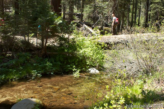
Another 0.45 miles past the Giant Goliath, and 5.75 miles from the start, you will reach Redwood Creek, a clean, peaceful flow down the bottom of the canyon. You can rock hop across, or make use of a natural bridge provided by another fallen tree (thankfully not as massive as the Fallen Goliath).
On the other side of Redwood Creek, you will come to a junction with Redwood Creek Trail. Turn right and begin hiking upstream along the trail. This is the low point of the loop at 5,500 feet. After a short distance, and 5.95 miles from the start, you will come to a junction with Sugar Bowl Trail on the left. Continue straight up Redwood Creek Trail, unless you prefer to take a longer, tougher route across the top of Redwood Mountain back to the trailhead.
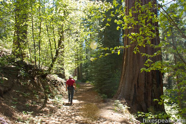
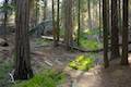
Redwood Creek Trail eases alongside the babbling creek through a lush woodland at the bottom of the canyon. The sequoias and sugar pines are joined by dogwoods that bloom beautifully in late spring, along with alders, sword ferns, wild rose, broadleaf lupines and horsetail. After about 2/3 of a mile hiking along the creek through this verdant forest, the trail will bend to the left and rise above Redwood Creek. The trail maintains a fairly gradually uphill grade with a few moderate stretches.
At 7.4 miles from the start, or 1.45 miles from the junction with Sugar Bowl Trail, the trail passes through a pair of fallen sequoias, neither as big as the Fallen Goliath, but still grand. As you hike through cut out sections of the immense logs, you’ll get one last chance to appreciate the enormity of giant sequoias.
Two miles from the Sugar Bowl Trail Junction, and 7.95 miles from the start, you will close the loop and return to the initial junction with the Hart Tree Trail. Turn left and hike the last 0.35 miles back up to the trailhead to finish the 8.3-mile hike.
The basic directions for the Hart Tree and Fallen Goliath Loop are:
- Start down Redwood Creek Trail from Redwood Saddle, hiking east into Redwood Canyon (0 miles)
- Turn left on Hart Tree Trail (0.35 miles)
- Cross Barton Creek (0.6 miles)
- Pass the Log Cabin (0.95 miles)
- Pass the first opening in the forest (1.1 miles)
- Pass the larger opening with the loop’s best view down Redwood Canyon (2.05 miles)
- Cross Buena Vista Creek below Hart Meadow (2.25 miles)
- Pass through the Fallen Tunnel Tree (2.83 miles)
- Cross the East Fork of Redwood Creek (3.4 miles)
- Turn left up the spur to the Hart Tree (3.5 miles)
- Admire the Hart Tree (3.6 miles)
- Return to the Hart Tree Trail and continue the loop (3.7 miles)
- Pass below a small waterfall (4.0 miles)
- Pass the Fallen Goliath (5.3 miles)
- Cross Redwood Creek (5.75 miles)
- Turn right up Redwood Creek Trail (5.78 miles)
- Pass Sugar Bowl Trail (5.95 miles)
- Pass through the first fallen sequoia along the trail (7.4 miles)
- Pass through another fallen sequoia along the trail (7.55 miles)
- Turn left at the junction with the Hart Tree Trail, closing the loop (7.95 miles)
- Return to Redwood Saddle to complete the hike (8.3 miles)
As another reference, the map at the trailhead lists the measurements for the hike as 0.3 from the trailhead down to the start of Hart Tree Trail, 2.9 miles to the Hart Tree, 1.9 miles down to Redwood Creek, and 1.9 miles up Redwood Creek Trail to the initial junction for a 7.3 mile-loop.
Dogs and mountain bikes are prohibited on trails in Kings Canyon National Park. There is an entrance fee to get into the park, but no permit is required to day hike in the Redwood Mountain Grove. Wilderness permits are required for all overnight trips, and permits can be procured from the visitor center at Grant Village. There is a two-night limit for backpacking trips in this area and groups may not exceed ten people. Wood fires are prohibited. Camp on bare ground at least 100 feet from water and pack out all trash.
To get to the trailhead: From Fresno, drive east on Route 180. After some 50 miles, you will reach the Big Stump Entrance Station for Kings Canyon National Park. Proceed 1.7 miles to a three-way intersection. Grant Village is 1.4 miles to the north, but turn right on Route 198, which heads south toward Sequoia National Park. Drive 3.6 miles and turn right down Redwood Saddle Road (Forest Route 14S75), located just across from the paved Ten Mile Road to Quail Flat and Hume Lake. There will be a sign for Redwood Canyon at the top of the dirt road down to Redwood Saddle. Proceed 1.7 miles down the narrow dirt road to a split, turn left and drive 0.2 miles to the trailhead parking area at the end of the road.
Trailhead address: Redwood Saddle Road (Forest Route 14S75), Kings Canyon National Park, CA 93628
Trailhead coordinates: 36.707444, -118.92093 (36° 42′ 26.79″N 118° 55′ 15.34″W)
View Redwood Mountain Grove in a larger map
Or view Kings Canyon National Park in a larger map
Or view a regional map of surrounding Sierra Nevada trails and campgrounds.


 | Buena Vista Peak This 2-mile round trip hike ascends 420 feet to a granite summit with 360-degree views over the Redwood Mountain Sequoia Grove and Kings Canyon. |
 | Panoramic Point This 0.5-mile round trip hike reaches an exception overlook with views into Kings Canyon. |
 | General Grant Tree Trail This 0-8 mile loop in the Grant Grove passes through a Fallen Monarch to reach the General Grant Tree, one of the world's largest sequoias. |
 | North Boundary Trail This 3.55-mile hike starts on the trail between Grant Grove and Grant Village and passes the General Grant Tree to reach a 2.75-mile loop through the pine forest north of the Grant Grove. |
 | North Grove Trail This 2-mile loop explores a quiet grove of sequoias near the crowded Grant Grove and can combine with Dead Giant Loop Trail for 3.25-mile hike. |
 | Dead Giant Loop Trail This 2.25-mile loop passes a small meadow and a large dead sequoia to reach Sequoia Lake Overlook and can combine with nearby North Grove Trail for 3.25-mile hike. |
 | Grant Village to Grant Grove Trail This mile-long trail connects the visitor center at Grant Village with the parking lot at Grant Grove, passing through Azalea Campground to reach giant sequoias, including the General Grant Tree. |
 | Roaring River Falls This paved 0.3-mile round trip hike reaches a thundering little waterfall on a tributary of the Kings River in Kings Canyon National Park. |
 | Kanawyer Loop Trail This 5-mile loop is scenic and easy, exploring east from the backcountry gateway at Road's End along both sides of the South Fork Kings River in Kings Canyon. |
 | More trails in the Sierra Nevada Mountains Explore other destinations in Kings Canyon National Park and the rest of the range. |
 | Sequoia and Kings Canyon National Parks Campgrounds There are 14 campgrounds with over 1,000 total sites spread throughout the parks to facilitate your visit. |
Hart Tree Loop in Sequoia and Kings Canyon National Parks: Your Complete Hiking Guide by Mike White
Hart Tree and Fallen Goliath Loop in 50 Hikes in the Sierra Nevada by Julie Smith
Hart Tree and Fallen Goliath Loop on tostepharmd.net
Redwood Mountain Grove on redwoodhikes.com
We hiked the Sugar Bowl Trail on Thursday, June 25th, and it was a fantastic hike. The only problem with the Redwood Mountain Grove, and maybe the reason why it doesn’t receive that many visitors, is because of the 2-mile access road that must be taken to get to it. That dirt road is only wide enough for a single vehicle for many parts, and there are no guardrails to keep a car from going over the side. On our way back up, we encountered 3 cars that were making their way down, and had to squeeze by them. Other then that, I agree, the Redwood Grove is the best because of the number of giants, and the condition that it’s in.
Beautiful canyon full of giant sequoias!! Here’s a link to a full virtual hike of the Redwood Canyon trail in 4K UHD:
https://youtu.be/yVGCcnPnRfU
Super useful for trip planning and treadmill training!