Cistern Trail, Lookout Trail, and Cage Creek Trail
in Malibu Creek State Park

While relatively short, Cistern Trail and Lookout Trail offer some of the very best views of Malibu Creek State Park. By entering the park at the middle of Crags Road (the main trail across the park), these less-used trails provide quick access to many of Malibu Creek’s major hiking destinations.
A number of possible hikes begin from Cistern Trail. A short loop to Century Lake is 2.25 miles long with 425 feet of elevation change, while a hike to the MASH site is 3.65 miles round trip with 400 feet of elevation change.
The basic directions for the hike from Cistern Trail to Century Lake are:
- Set out down Cistern Trail from Mulholland Highway (0 miles)
- At the bottom of Cistern Trail, turn left down Lookout Trail (0.25 miles)
- At the bottom of Lookout Trail, turn right on Crags Road (0.74 miles)
- Turn left down Century Lake Trail (0.77 miles)
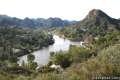
- Come to the dam by the small reservoir and turn around (0.92 miles)
- Turn left on Crags Road (1.07 miles)
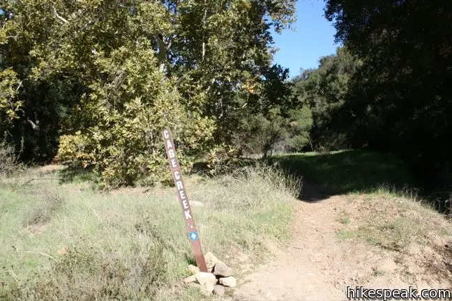
- Turn right up Cage Creek Trail (1.32 miles)
- Optionally, continue another 0.85 miles on Crags Road to the MASH Site, and another 0.85 miles back, to then ascends Cage Creek Trail
- At the top of Cage Creek Trail, turn right on Lookout Trail (1.57 miles)
- Turn left up Cistern Trail (2 miles)
- Return to Mulholland Highway at the to of Cistern Trail (2.25 miles)
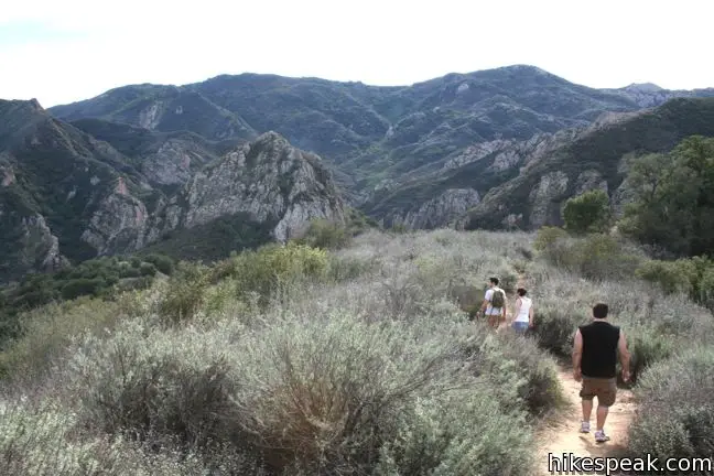
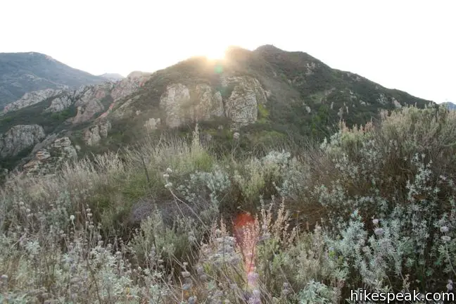
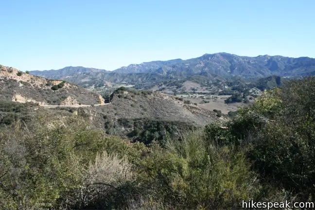
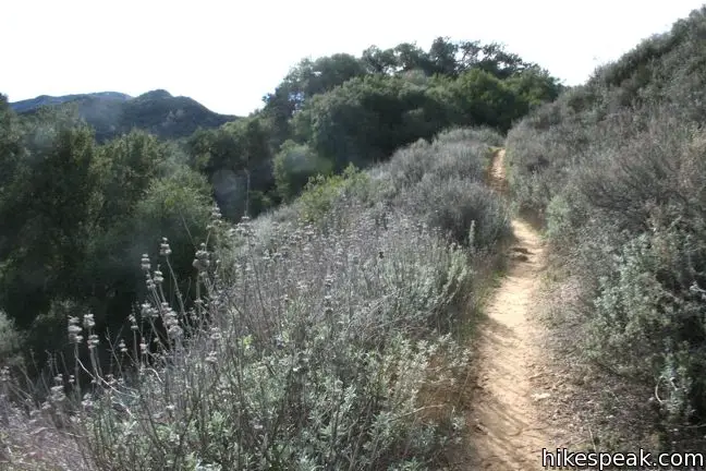
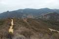
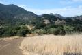
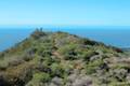
Cistern Trail is just a quarter mile from end to end, meeting the middle of the 0.9-mile-long Lookout Trail. Cistern Trail and the east half of Lookout Trail are immensely scenic, overlooking the Goat Buttes on their descent to Crags Road. The west end of Lookout Trail crosses through a mixture of grasslands and chaparral to a junction with Cage Creek Trail, which descends a quarter mile to Crags Road – allowing for loops to be created. The west end of Lookout Trail also joins Yearling Trail, which continues west and connects to Lake Vista Trail (overlooking Malibu Lake).
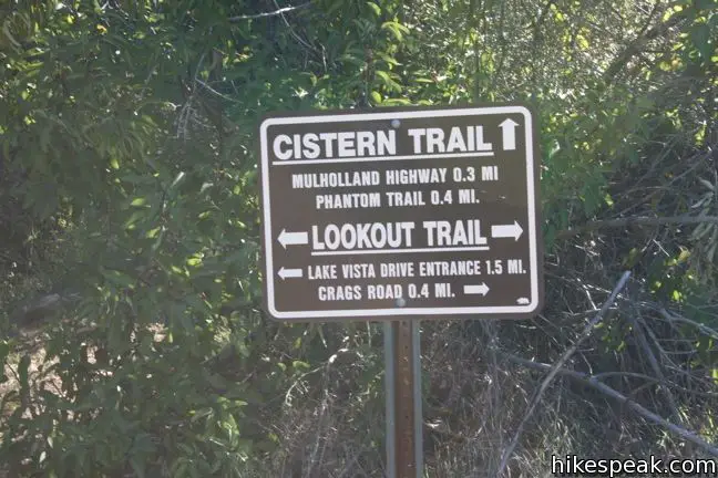
Cistern Trail
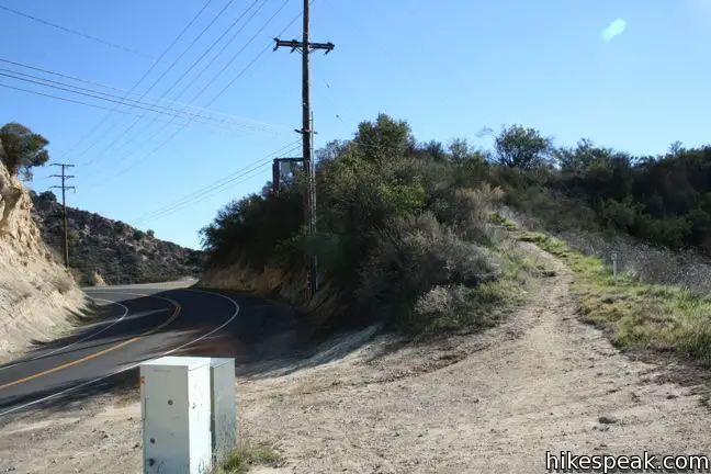
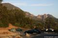
The trailhead for Cistern Trail is located on Mulholland Highway, 1.8 miles west of Las Virgenes Road and almost across the road from Phantom Trail. The beginning of Cistern Trail is not obviously marked (see the directions below), but roadside parking is ample.
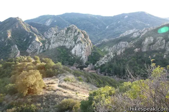
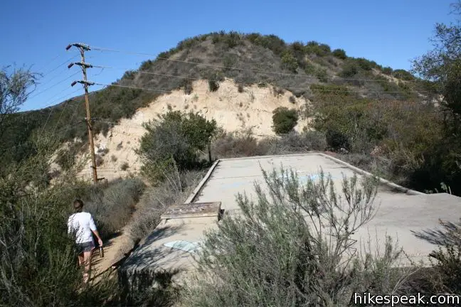
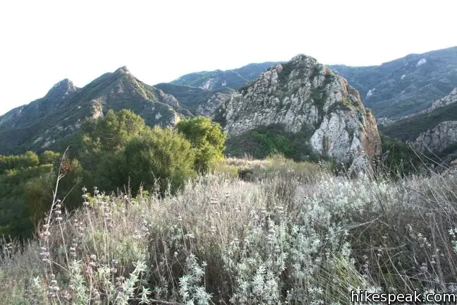
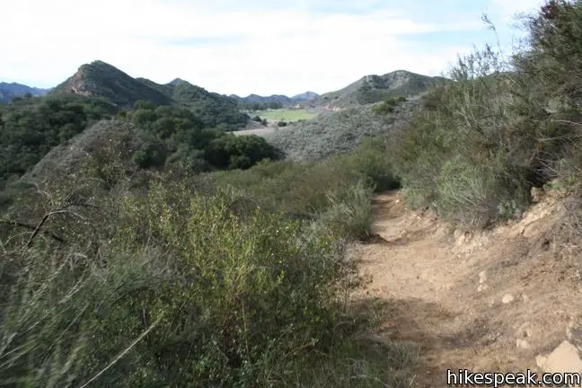
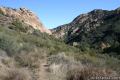
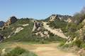
Follow the dirt single track up a short rise to a large cement platform. (A former cistern, perhaps?) The trail curves to the right, heading south down a ridgeline into the park. To the east are fine views across Malibu Creek State Park toward Saddle Peak and Calabasas Peak. Westward views feature Castro Peak and more of the Santa Monica Mountains. Directly ahead of the trail, the iconic Goat Buttes stand out from the surrounding green peaks.
Cistern Trail makes a scenic, relatively steep descent, dropping 125 feet over a quarter mile. The short-but-sweet Cistern Trail comes to a T-junction with Lookout Trail.
Lookout Trail
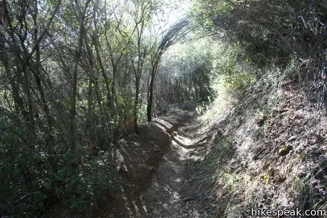
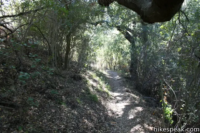
At the bottom of Cistern Trail, Lookout Trail descends to the left for 0.47 miles to Crags Road. To the right, Lookout Trail progresses 0.43 miles west to a junction with Cage Creek Trail. Tall brush and overhanging trees shade Cage Creek Trail’s descent to Crags Road, blocking out the surrounding scenery. On the other hand, the east half of Lookout Trail offers grand views on its descent to Crags Road and is the best way to hike down. If you are hiking both ends of Lookout Trail as a loop, head east first.
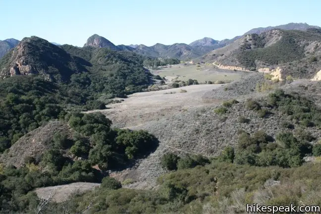
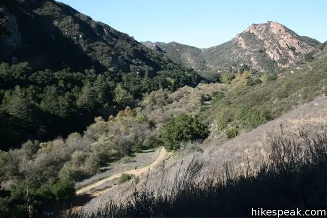
The east half of Lookout Trail is quite picturesque, offering an inspiring vantage of the beautiful rock formation, the Goat Buttes. The single track descends 255 feet to Crags Road, meeting the principal trail through Malibu Creek State Park just east of Century Lake.
Crags Road & Century Lake
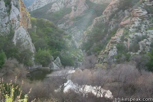
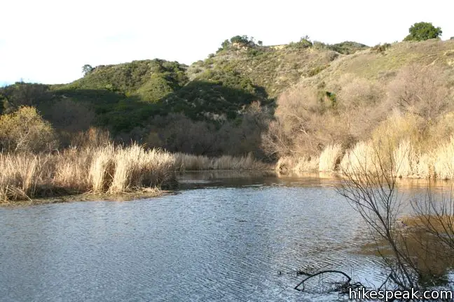
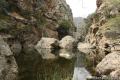
At the bottom of Lookout Trail, turn right and walk west on the wide trail known as Crags Road. You will quickly hit another junction, where a 0.15-mile long trail descends to the left. Turn down Century Lake Trail visit shaded picnic tables along the murky waters of Century Lake.
Century Lake is a relaxing retreat, and Malibu Creek State Park has plenty of nearby areas to visit:
- Farther east down Crags Road, Rock Pool is about half a mile from the bottom of Lookout Trail
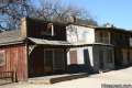
- Up the road to the west, the site where the MASH television show was filmed is about 1.1 miles from the bottom of Lookout Trail
Returning to Crags Road from Century Lake, turn left to head west on Crags Road in the direction of the MASH Set. After a quarter-mile, you will come to a junction with Cage Creek Trail on the right.
Cage Creek Trail
Cage Creek Trail leaves Crags Road and heads back up the hill toward Mulholland Highway. This is a pleasant quarter-mile track that switches up an overgrown slope. At the bottom of Cage Creek Trail, avoid the footpath breaking up the ridge to the left and stick to the actual trail alongside the creek. Cage Creek Trail passes through a dense thicket, and climbs 145 feet to a junction with the west end of Lookout Trail.
To the left, Yearling Trail goes west toward Reagan Ranch and Lake Vista Drive. Yearling Trail connects to Deer Leg Trail, which meets up with Lake Vista Trail, a single track to an vista point over Malibu Lake.
To return to Mulholland Highway, turn right on Lookout Trail and ascends another 150 feet to the bottom of Cistern Trail over 0.43 miles. Turn left and take this trail back up to your starting point.

In closing
Cistern Trail is a less popular but highly enjoyable entry point to Malibu Creek State Park. The views of the Goat Buttes on the descent to Century Lake are quite impressive. If you are looking for new trails to explore in the park, give Cistern Trail, Lookout Trail, and Cage Creek Trail a try. No fee or permit is required to enter Malibu Creek State Park via Cistern Trail, so get out and enjoy.
Woolsey Fire Update: This hike and most of Malibu Creek State Park have reopened following the November 2018 Woolsey Fire, which burned through the park. Check the Malibu Creek State Park page for more information.
To get to the trailhead: From Las Virgenes Canyon Road near the main entrance of Malibu Creek State Park, head west on Mulholland Highway for 1.8 miles. The trailhead is on the south side of the road, just east of a dirt turnout. The trail sign is set back from the road, making it difficult to spot. Just west of Cistern Trail is another trailhead on the north side of the road for Phantom Trail. This trail sign is easier to spot. Turn around when you see it, and the start of Cistern Trail will be apparent on the south side of the road.
Trailhead address: 27800 Mulholland Highway, Agoura Hills, CA 91301
Trailhead coordinates: 34.1052, -118.7318 (34° 06′ 19″N 118° 43′ 54.5″W)
View Santa Monica Mountains in a larger map
Or view a regional map of surrounding Los Angeles trails and campgrounds.


 | Phantom Trail This 4.8-mile round trip hike crosses a panoramic ridge on the north side of Malibu Creek State Park. |
 | Lake Vista Trail This 4.1-mile hike beginning from Cistern Trail crosses the west end of Malibu Creek State Park and climbs to a scenic view over Malibu Lake. |
 | Grassland Trail to Crags Road and Rock Pool This easy 3-mile hike enters Malibu Creek State Park on South Grassland Trail, then forms a loop around Crags Road to visit Rock Pool, a popular park retreat. |
 | M*A*S*H Set This hike visits the site where the exteriors of the television show MASH were filmed, a 4.75-mile trek from the park entrance. |
 | Lost Cabin Trail This 1.5-mile round trip extension to the MASH set hike dead-ends in a mountain canyon at the site of a now nonexistent cabin. |
 | Talepop Loop This 4.75-mile hike climbs 500 feet over a scenic mountain between Liberty Canyon and Las Virgenes Canyon. |
 | Malibu Creek Traverse This adventure hike explores the C-shaped gorge between Rock Pool and Century Lake in Malibu Creek State Park. |
 | Paramount Ranch This segment of the Santa Monica Mountains National Recreation Area includes Western Town, an outdoor set cast as frontier towns in TV and film since the 1950s. There are also several miles of hiking trails to explore. |
 | Mesa Peak from Corral Canyon Road This 6.5-mile hike travels along a ridge adorned with sandstone outcroppings to approach a peak with ocean views over Malibu. Shorten the outing to 5.35 miles round trip by stopping at a crest above Mesa Peak with a prominent boulder. |
 | Mesa Peak from Malibu Canyon Road (Piuma Trailhead) This 6.5-mile round trip hike ascends 1,375 feet up the Backbone Trail from Malibu Creek State Park to a subtle summit with substantial ocean views. |
 | More trails in the Santa Monica Mountains Explore other destinations in the range. |
 | Malibu Creek State Park The year-round campground has 63 sites with picnic tables, fire rings, flush toilets, coin showers, and a dump station. |
[…] information: here (similar route) […]
i can only walk the shortest distance possible to the M.A.S.H site. Where can i legally park the car and not get towed away ?? I will be there November 21th 2014……..Thanks in advance for you help.
While longer, the route to the MASH site from the main parking area is going to be the most level and would be the easiest route. While it will be shorter to start from Cistern Trail, there are steep hillsides to cross.
Enjoyed cistern trail this morning, amazing number of lupines. Also saw owl clover, Indian paint brush, onion and California poppies. There were hundreds of migrating Painted Lady butterflies as well. A magical morning, and so nice to see the recently burned areas green. New growth is starting from burned oak trees, too.
I hiked this trail about the same time as you. Painted Ladies were out in force by the thousands.