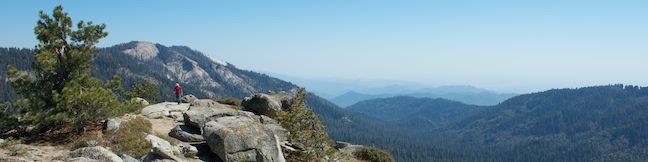
What’s taller than a giant sequoia? In the Redwood Mountain Grove, the world’s largest sequoia grove, the something taller is Buena Vista Peak, a granite summit that rises above the big trees. The hike to the top of Buena Vista Peak is just 2 miles round trip with 420 feet of elevation gain, making it one of the easier summits to reach in the Sierra. The 360-degree views from Buena Vista Peak would be worthy of a much greater effort. In addition to its perspective over the Redwood Mountain Sequoia Grove, Buena Vista Peak also boasts a sterling panorama of Kings Canyon and snowy summits on the Sierra Crest.
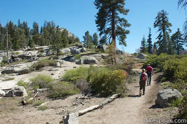
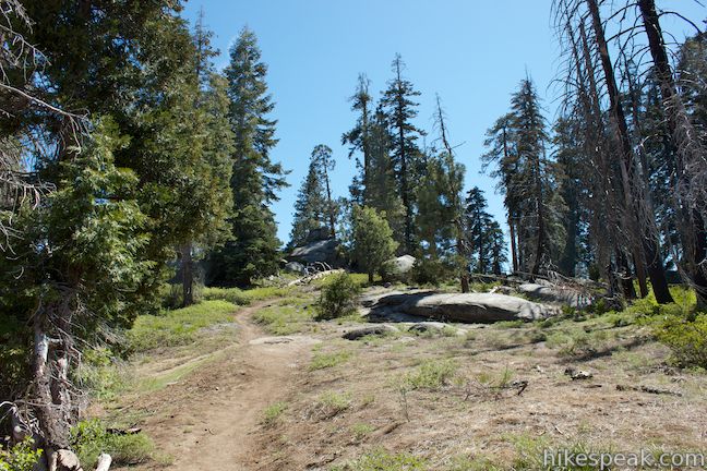
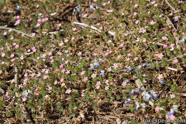
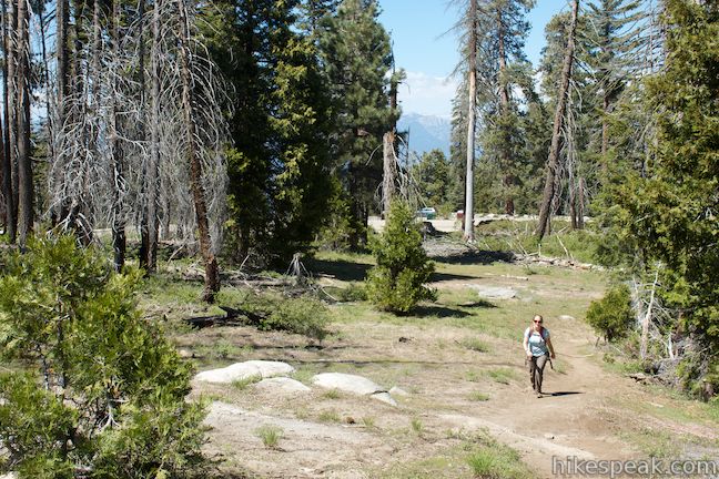
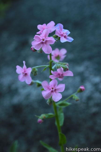
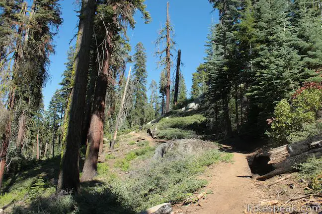
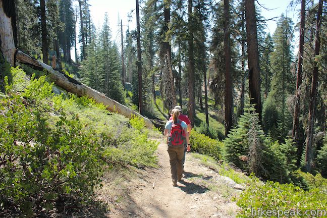
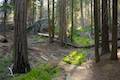
The hike to Buena Vista Peak begins from a trailhead on Generals Highway almost directly across from Kings Canyon Overlook. If the views are overlook-worthy at the start, just wait. They improve the farther you hike up the mountain. The single track crosses dirt and exposed granite bedrock as it shoots south toward the summit. In the late spring and early summer there will be a colorful carpet of mustang clover and Torrey’s blue-eyed Mary blooming on the forest floor beneath spaced out pines and incense cedars.
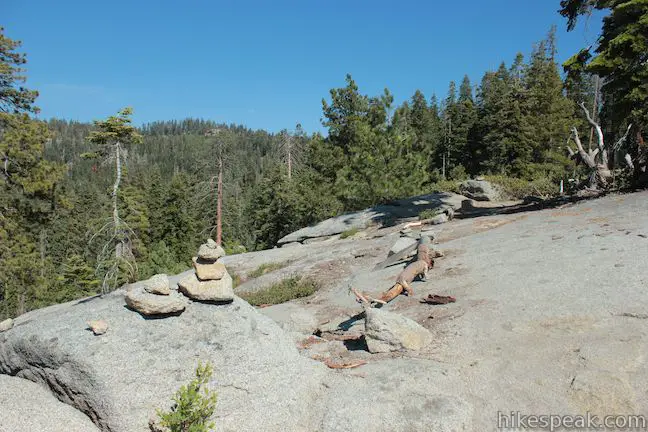
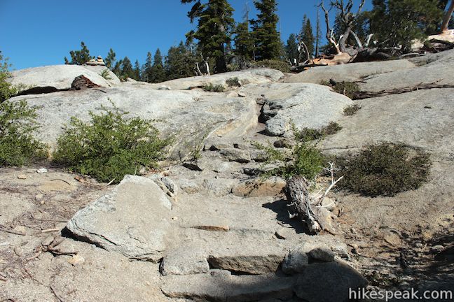
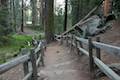
There are no junctions along Buena Vista Peak Trail, but there is one tricky spot where you need to be attentive to avoid getting off course. At 0.35 miles from the start, in an area where the trees clear to present open views of the granite crown of Buena Vista Peak, watch for a little flight of stairs built into the granite underfoot. At the top of these steps, cairns should lead you slightly to the left where the trail continues below the summit. This way can be hard to see because of a crest in the rock, and because your eyes may be drawn to the right toward the ridge below the summit. There is a clearly trodden path venturing to the right between boulders and manzanitas to help lure you off course. If you do stray up the path to the right, you will actually reach a good preview of the summit perspective over the Redwood Mountain Grove to the west. The path fades and if you continue up the mountain, you’ll run into a very steep face of Buena Vista Peak where there is no trail and climbing is the only way up. If you do get off course and find yourself hiking on a narrowing path, it’s best to backtrack to the actual trail.
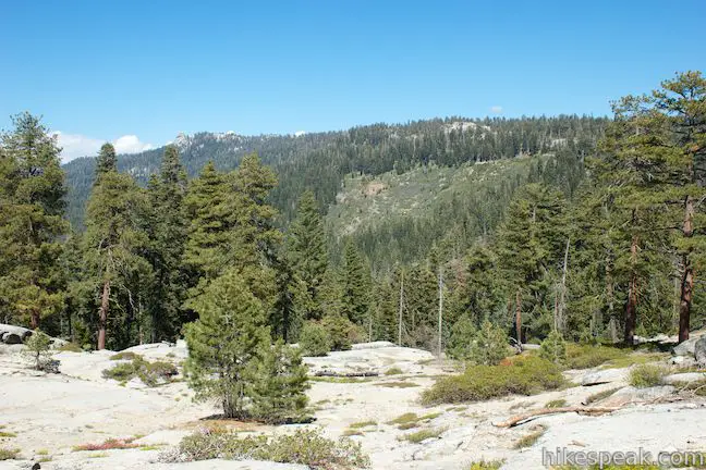
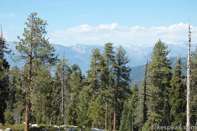
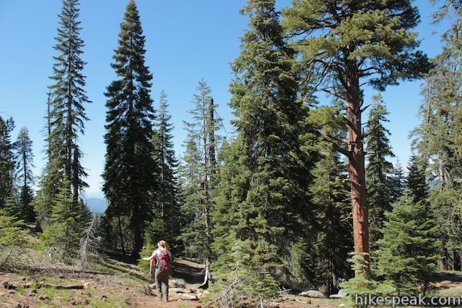
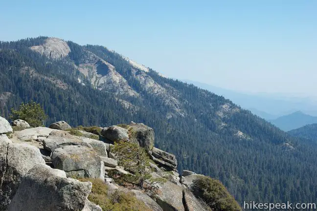
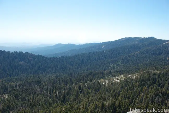
Beyond the potentially confusing spot, Buena Vista Peak Trail continues across a slope below the peak, entering a forest of pines and firs. Before you enter the forest, be sure to look over your shoulder for views above the treetops toward Spanish Mountain and Kings Canyon to the north. To the east, on a pine ridge closer to Buena Vista Peak, you’ll spot Buck Rock, a thimble shaped granite peak topped with a fire lookout tower.
The trail swings around the east side of the peak, maintaining a gradual ascent. It can actually feel like the trail is avoiding the summit until you reach the top. Toward the end of the trail, you will get a nice view south down the ridge toward Big Baldy, before the trail makes a sharp right turn and finally points toward the summit of Buena Vista Peak, approaching it from the southwest.
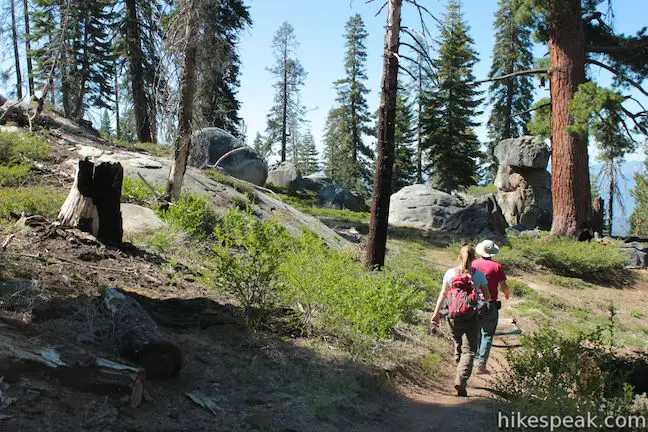
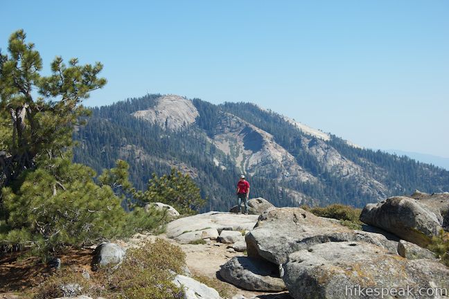
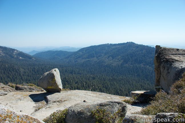
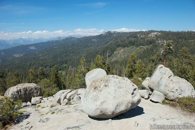
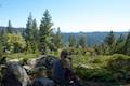
The seemingly lightly-traveled trail fades as you reach the exposed granite atop Buena Vista Peak. Make a note of where the trail ends, so that you can find it again when you decide to hike back. Buena Vista Peak Trail stops just south of the actual high point. Cross the bare rock and climb up onto a summit boulder to truly capture Buena Vista Peak.
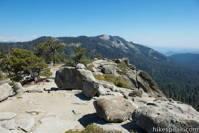
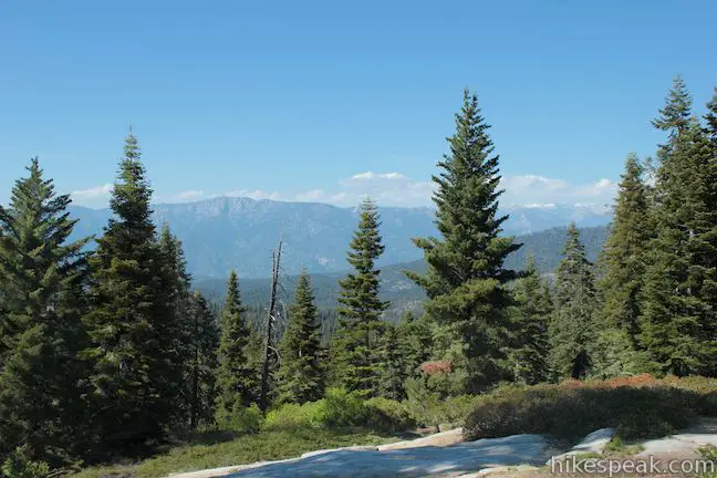
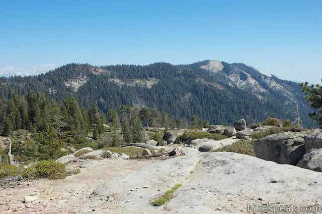
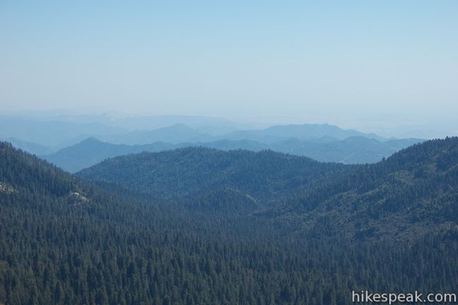
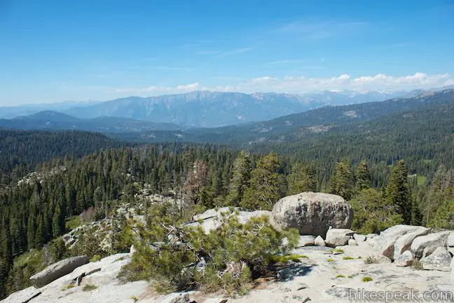
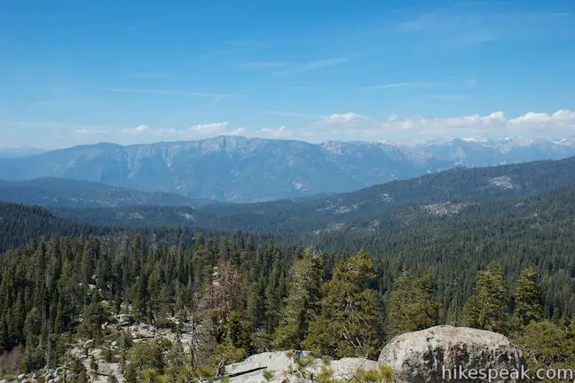
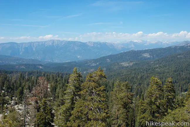
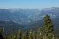
The views from the 7,604-foot summit are pan-o-ramic! Big Baldy Ridge extends to the south, capped off with a granite dome about 500 feet higher than Buena Vista Peak. To the southeast, you’ll spot a distant line of snowy summits on the Great Western Divide. To the east, Buck Rock pops out of a pine covered ridge, and to the north there are jaw-dropping views into Kings Canyon. The steep walls of the dramatic canyon are backed by Monarch Divide and distant snowcapped peaks.
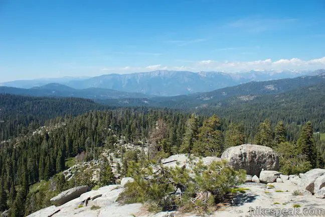
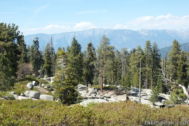
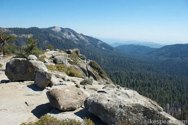
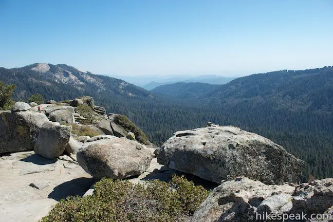
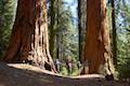
To the west, Buena Vista Peak drops away suddenly into a green canyon filled with giant sequoias. On the other side of the canyon, Redwood Saddle lies dues west of Buena Vista Peak, on the north end of Redwood Mountain, which tops out 600 feet below Buena Vista Peak. Redwood Saddle is the starting point for Hart Tree and Fallen Goliath Loop, which explores the sequoia grove below Buena Vista Peak. Look southwest out the bottom of Redwood Canyon toward the San Joaquin Valley, almost visible through a screen of haze.
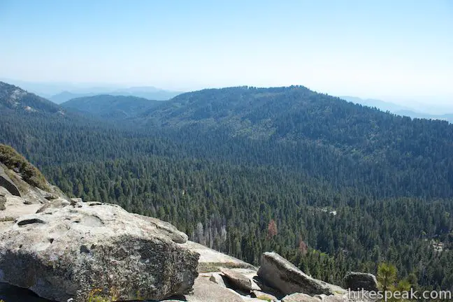
The Redwood Mountain Grove is the world’s largest remaining sequoia grove with 2,172 giant sequoias over ten feet in diameter (and many that are much larger). Because these trees are so massive, they can actually play a trick on your eyes. If your brain assumes that the trees are normal sized it will try to shrink the entire scene, making the canyon to the west look smaller than it actually is. All tricks aside, Buena Vista Peak has satisfying views in all directions.
Find the trail again and begin the easy all-downhill one-mile hike back to the trailhead. As you hike down, you’ll be facing Spanish Mountain and Kings Canyon to the north ― not a bad souvenir of Buena Vista Peak. Dogs and mountain bikes are prohibited on trails in Kings Canyon National Park. A national park entrance fee is required to visit the park, but you will not need a permit to hike to Buena Vista Peak, so get out and enjoy!
To get to the trailhead: From Fresno, drive east on Route 180. After some 50 miles, you will reach the Big Stump Entrance Station for Kings Canyon National Park. Proceed 1.7 miles to a three-way intersection. Grant Village is 1.4 miles to the north, but turn right on Route 198, which heads south toward Sequoia National Park. The Buena Vista Trailhead will be on the right after 4.7 miles. The trailhead is on the inside of a horseshoe bend, just past the turnout for Kings Canyon Overlook. Coming from the south, Buena Vista Trailhead is 20 miles up Generals Highway (Route 198) from the Lodgepole Visitor Center in Sequoia National Park.
Trailhead address: Generals Highway (Route 198), Kings Canyon National Park, CA 93262
Trailhead coordinates: 36.718234, -118.896935 (36° 43′ 05.64″N 118° 53′ 48.96″W)
You may also view a regional map of surrounding Sierra Nevada trails and campgrounds.


 | Hart Tree and Fallen Goliath Loop This 8.3-mile loop on Hart Tree Trail and Redwood Creek Trail passes tranquil streams and interesting sequoias in the Redwood Mountain Grove in Kings Canyon National Park. |
 | Panoramic Point This 0.5-mile round trip hike reaches an exception overlook with views into Kings Canyon. |
 | General Grant Tree Trail This 0-8 mile loop in the Grant Grove passes through a Fallen Monarch to reach the General Grant Tree, one of the world's largest sequoias. |
 | North Boundary Trail This 3.55-mile hike starts on the trail between Grant Grove and Grant Village and passes the General Grant Tree to reach a 2.75-mile loop through the pine forest north of the Grant Grove. |
 | North Grove Trail This 2-mile loop explores a quiet grove of sequoias near the crowded Grant Grove and can combine with Dead Giant Loop Trail for 3.25-mile hike. |
 | Dead Giant Loop Trail This 2.25-mile loop passes a small meadow and a large dead sequoia to reach Sequoia Lake Overlook and can combine with nearby North Grove Trail for 3.25-mile hike. |
 | Grant Village to Grant Grove Trail This mile-long trail connects the visitor center at Grant Village with the parking lot at Grant Grove, passing through Azalea Campground to reach giant sequoias, including the General Grant Tree. |
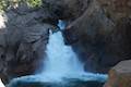 | Roaring River Falls This paved 0.3-mile round trip hike reaches a thundering little waterfall on a tributary of the Kings River in Kings Canyon National Park. |
 | Kanawyer Loop Trail This 5-mile loop is scenic and easy, exploring east from the backcountry gateway at Road's End along both sides of the South Fork Kings River in Kings Canyon. |
 | More trails in the Sierra Nevada Mountains Explore other destinations in Kings Canyon National Park and the rest of the range. |
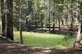
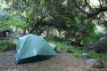 | Sequoia and Kings Canyon National Parks Campgrounds There are 14 campgrounds with over 1,000 total sites spread throughout the parks to facilitate your visit. |
Go the extra miles...
Submit a rating of this hike to go with your comment. Contribute to the average trail rating.