Hikes in Joshua Tree National Park
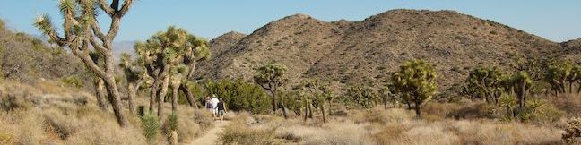
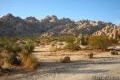
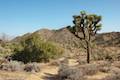
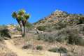
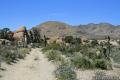
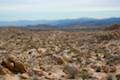
Joshua Tree protects over 1,200 square miles northeast of Palm Springs. The park contains a meeting of the higher Mojave Desert to the west and the lower Colorado Desert to the east. The result is a diverse mixture of vegetation that includes the park’s namesake tree. Withing the rocky landscapes of Joshua Tree National Park, you’ll find a variety of great hiking trails.
Highlights of Joshua Tree National Park


Visit Joshua Tree National Park
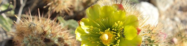
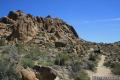
Known for its mountains of boulders and and crazy-looking trees, Joshua Tree National Park is the most popular national park in Southern California. When conservationists first tried to protect the land in the 1930s, they proposed the name Desert Plants National Park, which doesn’t quite have the same ring to it. The Joshua trees seen around the park are a strange and beautiful addition to the desert landscapes.
Summer temperatures in Joshua Tree can reach the triple digits. The best time to visit the park is early spring and late fall. A spring visit has the added potential for wildflower viewing. On Thanksgiving weekend and New Years weekend (the Memorial Day and Labor Day of the desert), expect the park to be crowded and the campgrounds to be full. Most other weekends, visitors should not have a problem driving in and setting up camp at one of the park’s 500 sites. Joshua Tree empties on weekdays to offer a great feeling of seclusion. Joshua Tree is the closest national park to Los Angeles. The roughly two and a half hour drive makes for an easy weekend getaway.
What are the best hikes in Joshua Tree National Park?
If you are you visiting Joshua Tree for the first time and looking for Joshua Tree hiking tips like which trails are essential to visit, check out or Visitor Recommendations page, intended to help find the best hikes in the park for you!
Joshua Tree National Park Hiking
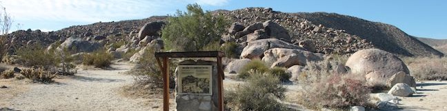
This collection of trails in Joshua Tree National Park, California lists the hikes from north to south and west to east. The table can be sorted alphabetically or by distance to help you plan a trip to Joshua Tree National Park. Each trail links to its own report complete with directions, photos, GPS maps, elevation profiles, and everything else needed to explore each hike. You can also view hikes around Joshua Tree National Park on the Hike Finder Map.
Trail | Description | Distance | Location |
|---|---|---|---|
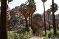
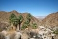 560 560 | Fortynine Palms Oasis The out and back hike visits a palm tree oasis in the desert on the north side of Joshua Tree. | 3 miles 350 feet | 34.1193, -116.1120 |
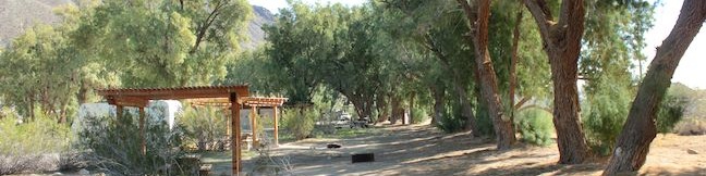
 570 570 | Indian Cove The 101-site campground is home to a 0.6-mile interpretive trail and endless bouldering and rock climbing opportunities. | 0.6 - 2 miles (or more) 25 feet | 34.09488, -116.1685 |
 580 580 | Contact Mine This out and back hike travels up a wash, a canyon, and an old road to a mountainside mine site. | 3.9 miles 700 feet | 34.0723, -116.0327 |
 587 587 | High View Nature Trail This loop climbs a ridge on the west side of the park that offers views of San Gorgonio Mountain and Yucca Valley, along with an introduction to desert plants. | 1.35 miles 325 feet | 34.076169, -116.399369 |
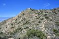
 590 590 | Warren Peak This out and back hike summits a peak with impressive views over the west side of Joshua Tree. | 5.5 miles 1,000 feet | 34.07155, -116.3909 |
 600 600 | Desert Queen Mine This out and back hike follows a level desert trail to an overlook before crossing a canyon to visits the ruins of an old gold mine. | 1.6 miles 150 feet | 34.0236, -116.0776 |
 610 610 | Lucky Boy Vista This level out and back hike visits a modest overlook at the site of an old mine. | 2.5 miles 125 feet | 34.01795, -116.0824 |
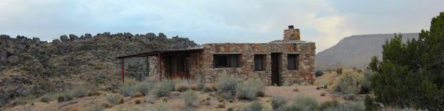
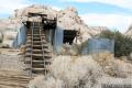 620 620 | Wall Street Mill This level out and back hike visits a well-reserved gold mill, exploring the mining history of Joshua Tree National Park. | 1.55 - 2.15 115 feet | 34.0251, -116.1419 |
 630 630 | Wonderland Wash This level out and back hike travels past the ruins of Wonderland Ranch up a use trail into the Wonderland of Rocks. | 2.1 miles (or more) 75 feet | 34.0251, -116.1419 |
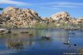 640 640 | Barker Dam This level loop visits a small foreign-looking reservoir within the Wonderland of Rocks. | 1.5 miles 50 feet | 34.0251, -116.1420 |
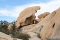
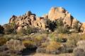 650 650 | Hidden Valley This loop circles the interior of a small valley surrounded by tall rocks that serves as an excellent bouldering arena. | 1 mile (or more) 75 feet | 34.01237, -116.1680 |
 660 660 | Ryan Mountain This out and back hike offers summit views from the center of Joshua Tree National Park. | 3 miles 1,050 feet | 34.00257, -116.13594 |
 670 670 | Ryan Ranch This out and back hike from Ryan Campground or Park Boulevard visits the ruins of an old adobe homestead beneath Ryan Mountain. | 0.8 - 1.2 miles (or more) 85 feet | 33.988821, -116.153846 |
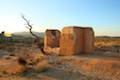
 680 680 | Lost Horse Mine This out and back hike visits a well-preserved mine and mill. | 4 miles 400 feet | 33.9507, -116.15982 |
 690 690 | Keys View to Inspiration Peak This out and back hike leaves the crowds at Keys View for even grander views from a 5,550-foot summit. | 1.2 miles 425 feet | 33.9272, -116.18745 |
 700 700 | Crown Prince Lookout This easy out and back hike crosses a desert plateau to a pair of overlook near the site of an World War II era observation post. | 3.25 miles 50 feet | 33.991885, -116.067908 |
 710 710 | Arch Rock This lollipop loop visits a natural arch in the granite formations around White Tank Campground. | 1.3 miles 100 feet | 33.9899, -116.02275 |
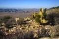
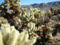 720 720 | Cholla Cactus Garden This loop offers a stroll through an intense concentration of cholla cacti. | 0.25 miles 0.1 miles | 33.9253, -115.9289 |
 730 730 | Mastodon Peak This loop visits a 3,400-foot summit with panoramic views of southeastern Joshua Tree. | 2.6 miles 440 feet | 33.7370, -115.8107 |
 740 740 | Lost Palms Oasis This out and back hike visits an oasis nestled between mountains in the southeast corner of the park. | 7.2 miles 400 feet | 33.7370, -115.8107 |
 750 750 | Bajada Trail This level nature trail loop explores the plants living on a desert bajada. | 0.3 miles 5 feet | 33.681238, -115.801784 |
Or explore hikes around Joshua Tree National Park on the Hike Finder Map
Are you looking for other places to explore around Joshua Tree? The California desert has more great parks to visit, like: