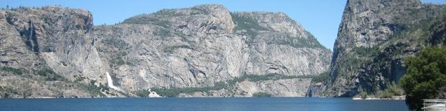
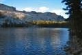
In the northwest corner of Yosemite National Park is a valley that John Muir described as “a wonderfully exact counterpart of the great Yosemite.” Since Muir’s time, Hetch Hetchy Valley has changed. It was dammed in 1923 and a large blue reservoir now covers the valley. Muir opposed the dam, and fellow conservationists lost a long battle to preserve the valley. An effort persists to return the valley to its natural state by removing the dam. Residents of San Francisco and outlying areas use water held in Hetch Hetchy Valley. It is argued today, as it was a century ago, that a dam placed farther downstream could deliver the water more efficiently while preserving the beautiful valley.
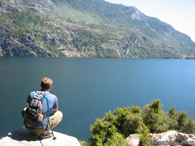
Even in its altered state, Hetch Hetchy Valley is beautiful. The trail around the reservoir provides impressive views of up to three waterfalls. To the powerful Wapama Falls and back is a 5-mile day hike with 200 feet of elevation gain. Beyond, the trail continues deeper into the Yosemite Wilderness and is a great route for backpackers.
Hetch Hetchy Valley receives far fewer visitors than its more popular neighbor, and this picturesque mostly level trail is a great way to explore an enjoyable pocket of Yosemite National Park.
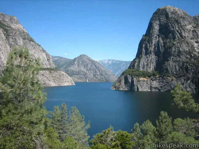
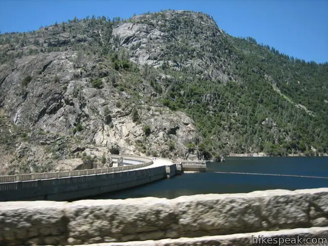
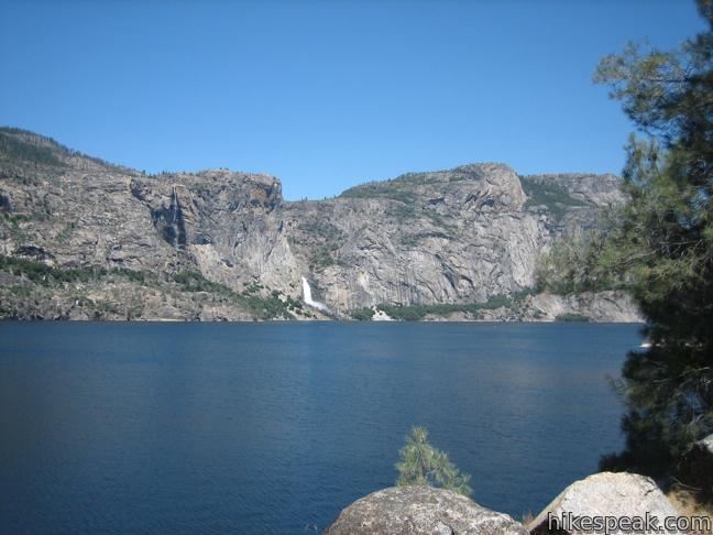
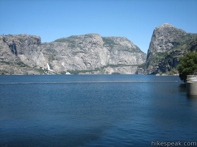
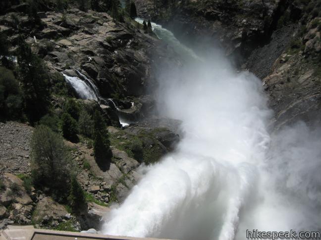
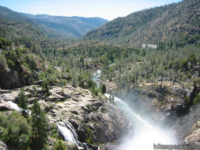
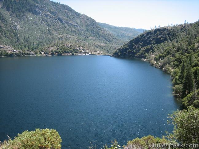
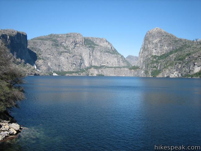
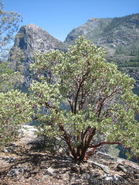
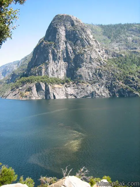
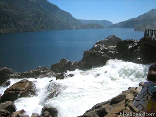
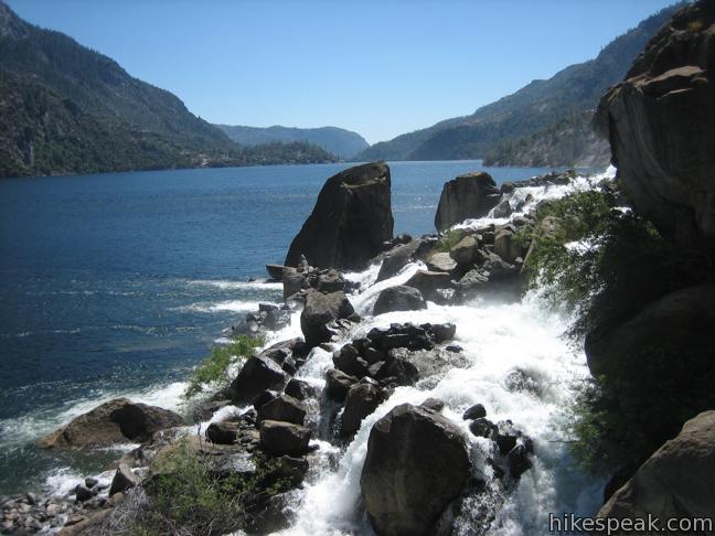
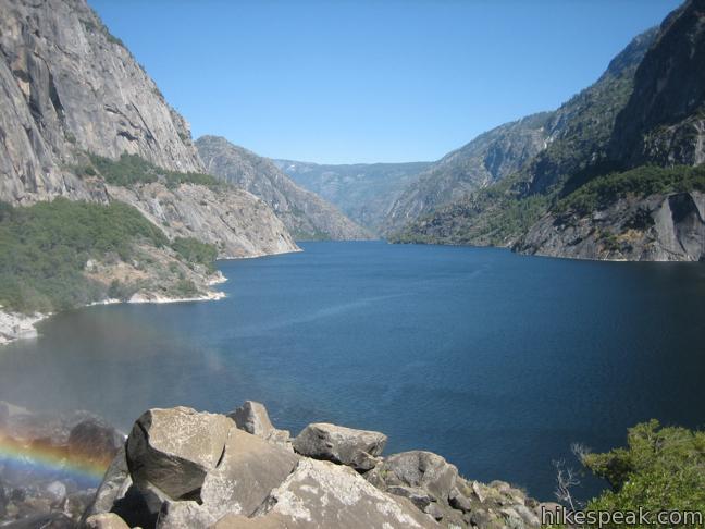
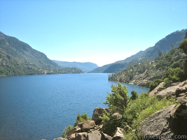
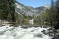
Begin by hiking across O’Shaughnessy Dam. Off the dam to the left, water spills into the Touloumne River. To the right lies eight miles of protected waters, the largest body in Yosemite National Park. Boating and swimming is not permitted, reserving the pristine reservoir for hikers. Pass through a tunnel on the far side of the dam and continue along the northwest side of the lake. Cross Tueeulala Falls, which cascades down the granite slope to the left. This falls is less impressive than the one to come, so continue up the trail, gaining minimal elevation to a scenic rise along the lake. This high point along the hike has a superb view up and down the lake that includes the dynamic summit of Kolana Rock, which rises up from the opposite side of the big blue body.
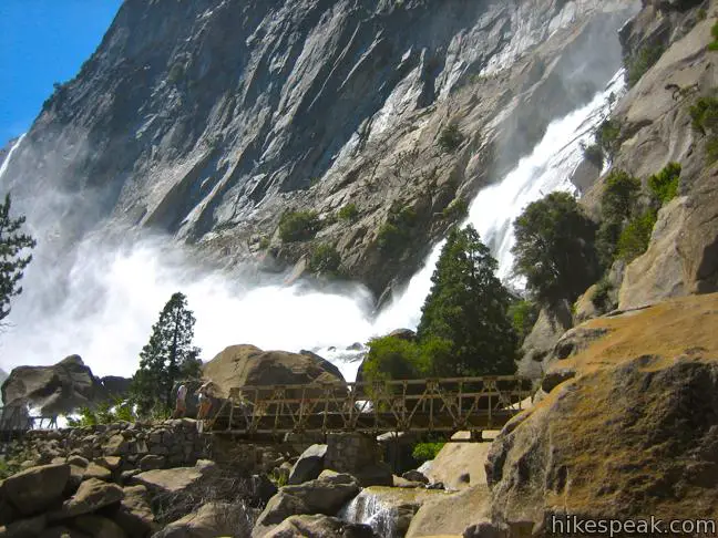
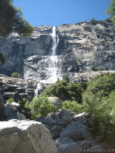
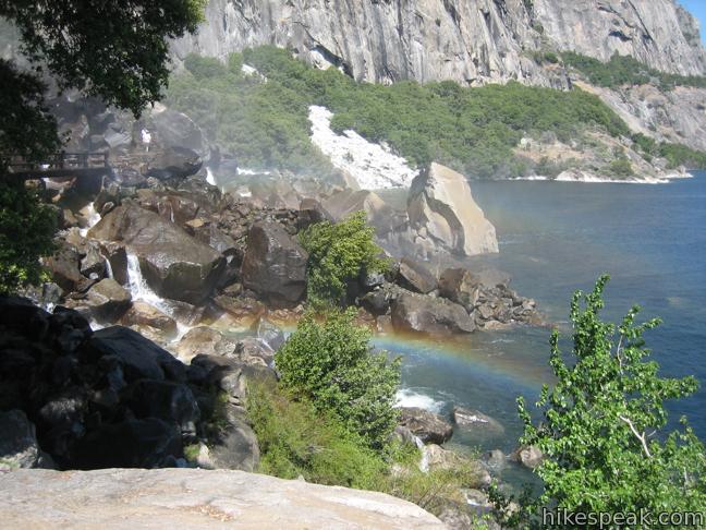
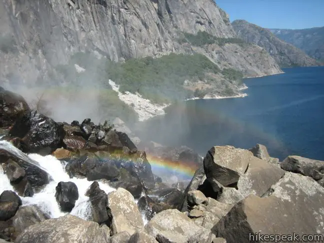
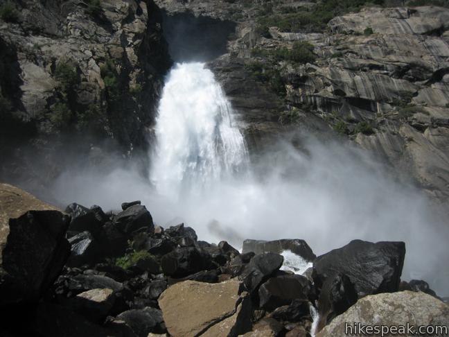
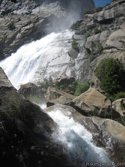
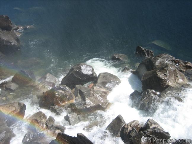
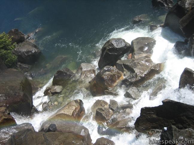
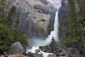
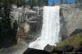
Proceed along the gradual rocky trail to wooden footbridges that cross the spillway below Wapama Falls. The waterfall is over one thousand feet tall, separated into segmented drops and cascades. Before the dam was built, Wapama Falls fell hundreds of feet farther to the bottom of Hetch Hetchy Valley, but the truncated tumbler is still impressive. Dart across the bridges, enjoying a refreshing mist from the powerful falls. Look for rainbows in the area where the falls meets the lake. The view from the bridge includes mountains, a waterfall, and a lake. What more could you want?
Energetic hikers may continue another four miles to Rancharia Falls or deeper into the Yosemite Wilderness and neighboring Stanislaus National Forest. Since swimming back is not an option, return the way your came.
Directions to the Trailhead
- From the west entrance of Yosemite National Park, continue another mile outside the park on Route 120 (Big Flats Road).
- Turn right (east) on Evergreen Road.
- Drive 7.5 miles on winding miles through forest and farms to Mather.
- Turn right on to Hetch Hetchy Road - Evergreen Road and continue another 7.5 miles to the parking area for Hetchy Hetchy Reservoir next to the dam.
Trailhead Location
Trailhead address: Evergreen Road (Hetch Hetchy Road), Yosemite National Park, CA 95321
Trailhead coordinates: 37.946905, -119.787376 (37° 56′ 48.85″N 119° 47′ 14.55″W)
View Yosemite National Park in a larger map
Or view a regional map of surrounding Sierra Nevada trails and campgrounds.


 | May Lake This short east hike off Tioga Road visits a peaceful alpine lake in the high elevation region of Yosemite north of Yosemite Valley. |
 | Mirror Lake This 2 to 2.8-mile hike visits a reflective pool on the east end of Yosemite Valley. |
 | Lower Yosemite Fall Trail This 1.2-mile hike delivers visitors to the base of the tallest waterfall in North America. The experience is not to be missed. |
 | The Mist Trail to Vernal Fall and Nevada Fall This 1.8 to 6.1-mile hike takes an exciting course past two of Yosemite's prize waterfalls. |
 | Half Dome This epic 16-mile hike climbs 4,800 feet on one of Yosemite's most popular and most challenging trails. |
 | More trails in the Sierra Nevada Mountains Explore other destinations in Yosemite National Park and the rest of the range. |
 | Yosemite National Park Campgrounds Thirteen campgrounds with over 1,600 total sites are spread throughout the park to facilitate your visit. |
Common Questions about Hetch Hetchy Reservoir Trail to Wapama Falls in Yosemite National Park
- Is the trail open?
- Yes. You should expect to find that Hetch Hetchy Reservoir Trail to Wapama Falls is open. There are no recent reports of trail closures. If you discover that the trail is closed, please help your fellow hikers by reporting a closure.
- Do I need a permit for this hike?
- Yes. National Park Entrance Fee.
- How much time does this hike take?
- It takes approximately 2 hours 15 minutes to hike Hetch Hetchy Reservoir Trail to Wapama Falls. Individual hiking times vary. Add extra time for breaks and taking in the views.
- How long is this hike?
- The hike to Hetch Hetchy Reservoir Trail to Wapama Falls is a 5 mile out and back with 200 feet of elevation change.
- Are dogs allowed on this trail?
- No, dogs are likely not allowed on Hetch Hetchy Reservoir Trail to Wapama Falls. The trail is primarily open to hikers.
- Will I see a waterfall on this hike?
- Yes, Hetch Hetchy Reservoir Trail to Wapama Falls features a waterfall.
- Is there a lake on this hike?
- Yes, Hetch Hetchy Reservoir Trail to Wapama Falls visits a lake.
- Where is the trailhead located?
- The trailhead for Hetch Hetchy Reservoir Trail to Wapama Falls is located in Yosemite National Park, CA.
Trailhead Address:
Hetch Hetchy Road
Yosemite National Park, CA 95321
Trailhead Coordinates:
37.946905, -119.787376 - What are the driving directions to the start of the hike?
To get to the trailhead: From the west entrance of Yosemite National Park, continue another mile outside the park on Route 120 (Big Flats Road). Turn right (east) on Evergreen Road. Drive 7.5 miles on winding miles through forest and farms to Mather. Turn right on to Hetch Hetchy Road - Evergreen Road and continue another 7.5 miles to the parking area for Hetchy Hetchy Reservoir next to the dam.
View custom Google Maps directions from your current location.
- Are there other trails near Hetch Hetchy Reservoir Trail to Wapama Falls?
- Yes, you can find other nearby hikes using the Hikespeak Hike Finder Map.

Where does one stay if hiking the Hetch Hetchy Valley?
Hi ,
We planning to visit Yosemite park in late July. Is Hetch Hetchy trail (hike) doable with almost 2 year kid ?
What are the Landmarks / Points best doable with toddlers ?
Thanks
Manisha
Some friends and i are headed there this weekend, we’d like to check out this trail. Do you think this is a hikable trail during the fall months? I’ve read some winter permitting hikes that makes it difficult to access. Please let me know!
Are dogs allowed in this area?