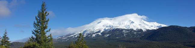
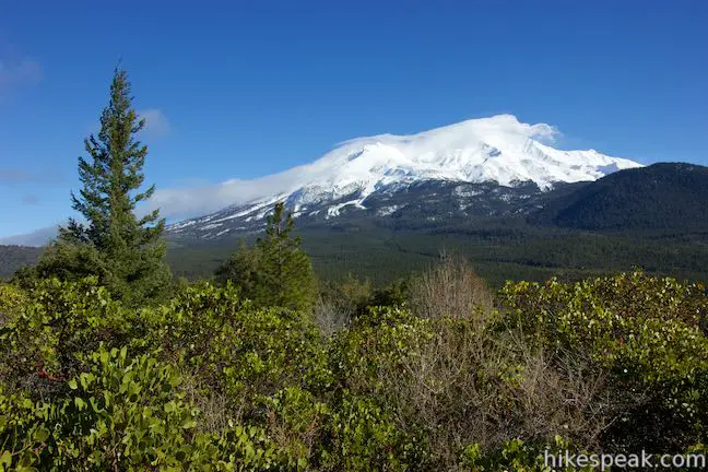
The Mount Shasta Area is full of daunting mountain peaks (not the least of which is Mount Shasta) but that doesn’t mean you can’t find a shorter summit hike with rewarding views. Spring Hill Trail is located conveniently close to Mount Shasta City and while this hike is just 2.9 miles round trip with 625 feet of elevation gain, you’ll get an eyeful off the beautiful surroundings, including nice views of nearby Black Butte and Mount Shasta. A short loop near the top of the trail allows you to take advantages of even more vantages that were earned on the ascent.
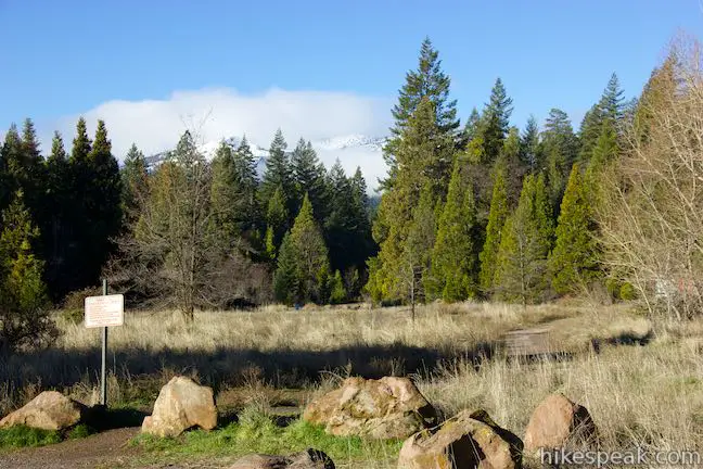
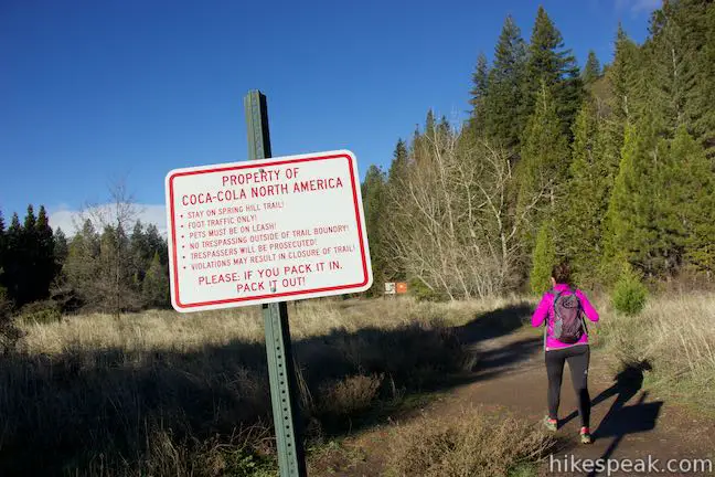
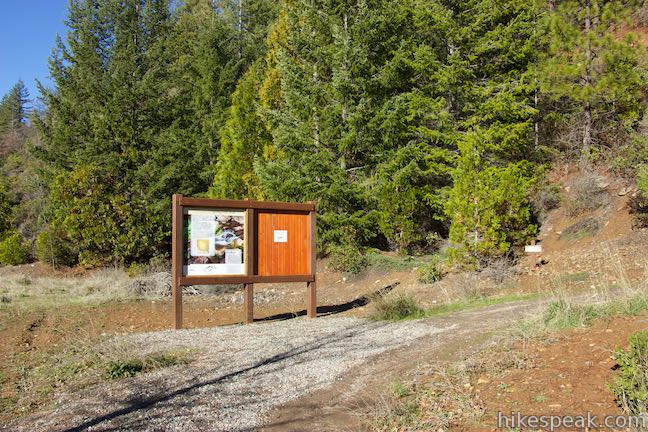
Set out from a trailhead off Mount Shasta Boulevard between Mount Shasta City and Interstate 5. A sign at the start indicates that you are entering the property of Coca-Cola. The land may now be owned by Crystal Geyser, but either way, as long as you stay on the trail, you are welcome to enter the property and drink up the views. Walk up the trail to an information panel at a horseshoe bend to the right. Here a sign explains that Spring Hill gets its name from the nearby Big Springs, where cold, clear water flows out of a lava tube from a source beneath Mount Shasta. The water takes a long journey from there, as Big Springs are the headwaters of the Sacramento River. The panel also provides some geologic information about Spring Hill:
Spring Hill is considered a “parasitic” or “satellite” cone. It formed by eruptions from unstable fractures on the flank of Mount Shasta. Eventually, the fractures reached the magma chamber and generated eruptions called flank eruptions, which in turn produced a parasitic cone.
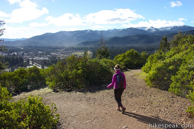
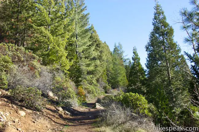
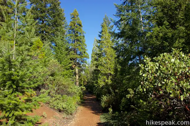
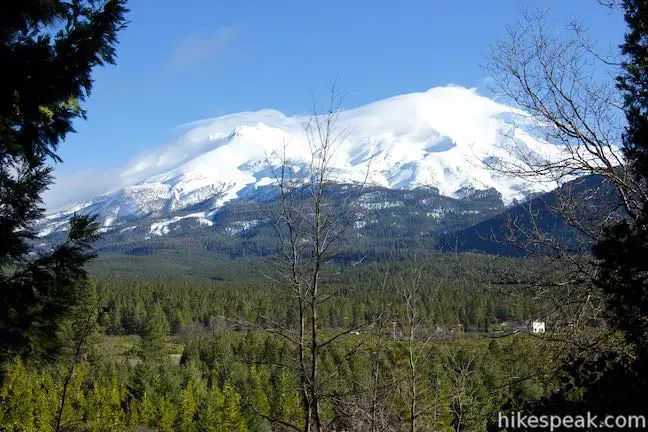
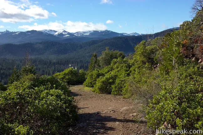
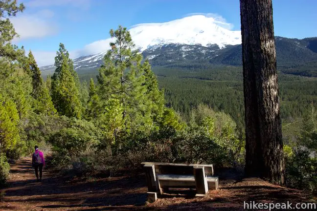
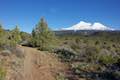
With today’s lesson out of the way, begin hiking up the trail. Spring Hill is covered in a mix of tall evergreens, manzanitas, and other brush. Once you get underway, you’ll be able to grab early glimpses of Mount Shasta, but the best views of the mountain come higher up.
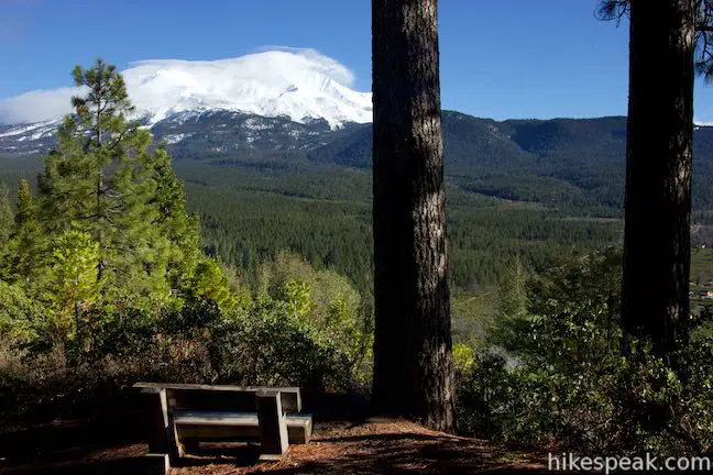
After just over a quarter mile, bear left at a point where another path up from Mount Shasta City joins the ascent. In another 0.3 miles, you will reach a horseshoe bend to the left. A short path on the outside of the curve ventures out to a bench with a nice view of Mount Shasta framed by evergreens.
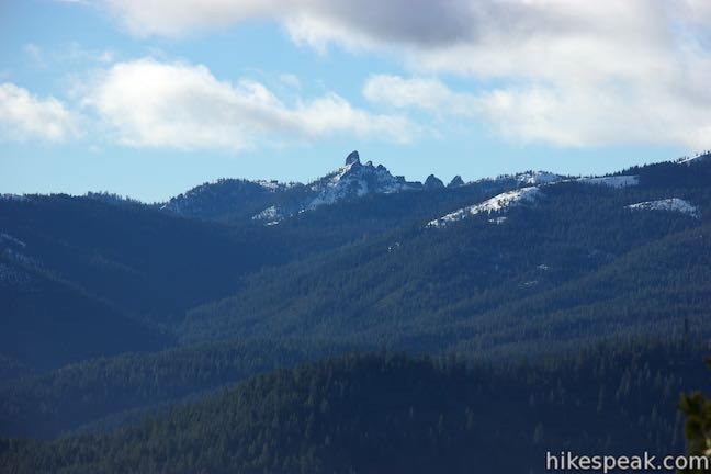
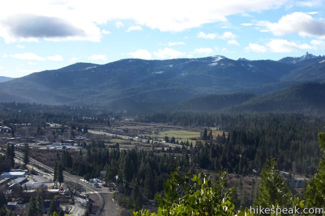
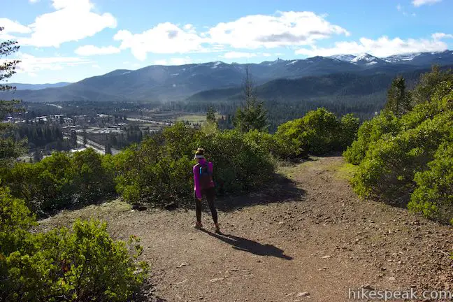
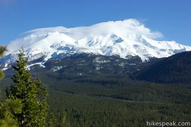
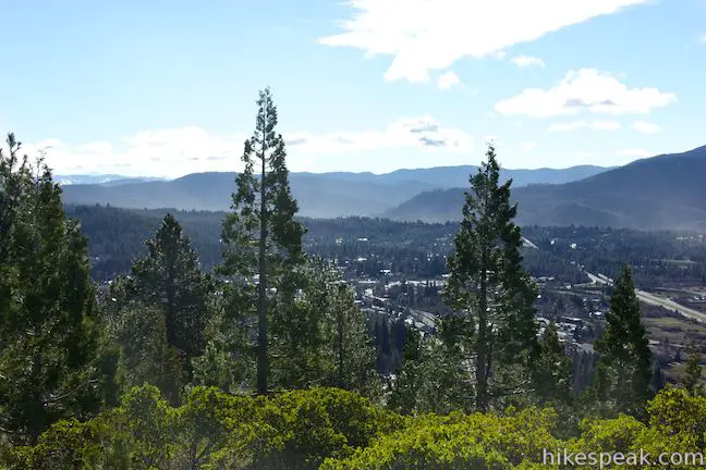
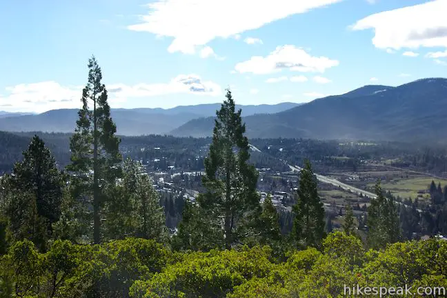
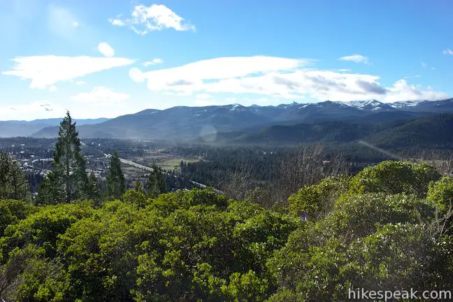
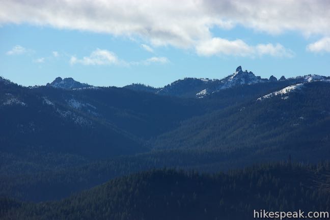
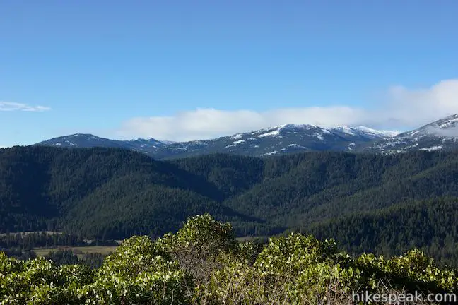
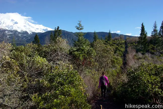
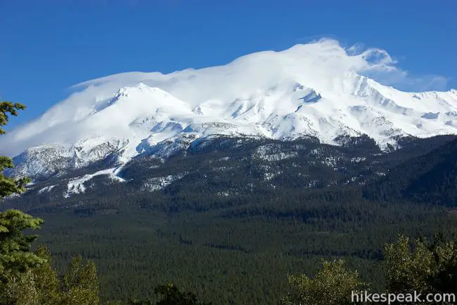
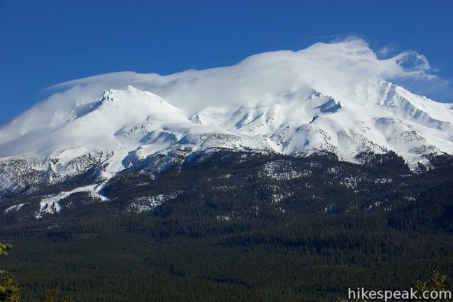
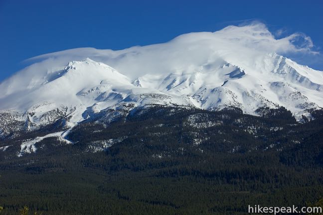
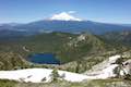
Proceed up the trail, passing through a sweeping bend to the right at 0.8 miles. From here you’ll get a postcard view south over Mouth Shasta in Strawberry Valley. Farther to the south, the Castle Crags can be seen jutting out of surrounding evergreen wilderness in the Trinity Mountains.
As you continue to ascend, there will be a bench on the left side of the trail, positioned for another nice view of Mount Shasta. Many of the views of the great volcano will be over your shoulder on the hike up, putting you in a position to enjoy head-on views of Mount Shasta on the hike down.
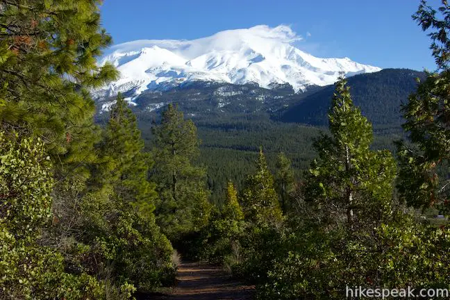
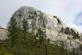
At 1 mile from the start, you will come to the first of two junctions with Rocky Point Loop Trail. This 0.4-mile long trail crosses a rocky outcropping and explores a tapered area near the top of Spring Hill. The loop has fine views and is certainly worth exploring. To save the loop for the hike down, bear left and continue up Spring Hill Trail.
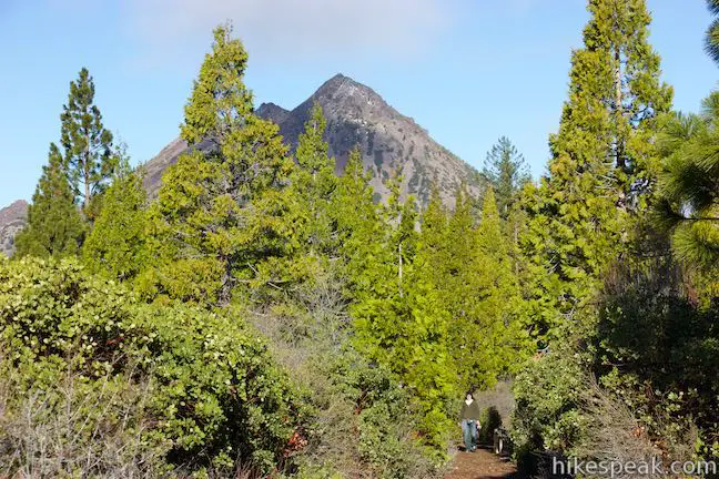
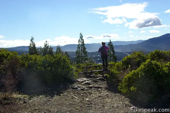
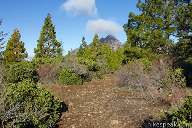
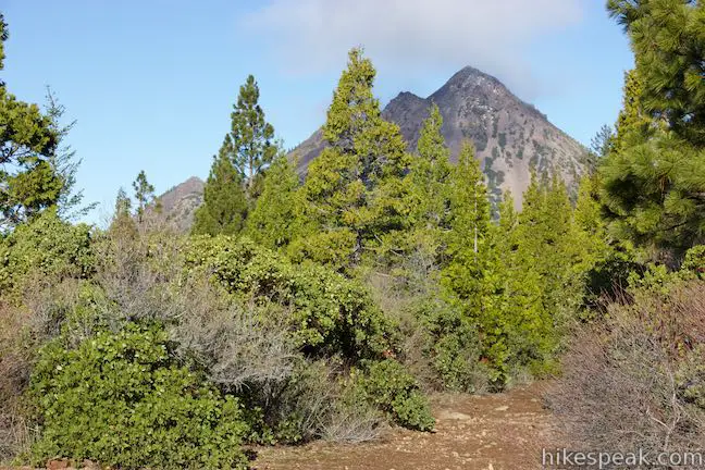
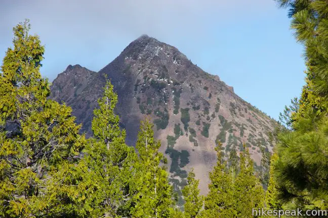
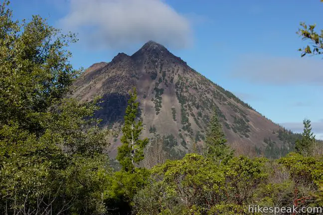
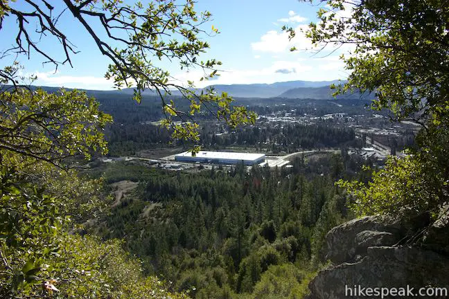
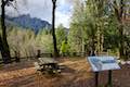
In another 0.16 miles you will pass the other end of Rocky Point Loop. Bear left again and take the trail to the summit, reaching it 1 1/3 miles from the start. The final ascent is quite gradual. After a sharp turn to the left, you will arrive at a pair of picnic tables at the crown with views south over Mount Shasta City. The views to the south and west are expansive, featuring the Castle Crags and the Trinity Divide. Between the trees there is a view of Mount Shasta. If you turn around and look back up the trail you’ll spot Black Butte, a steep volcanic cone northwest of Spring Hill.
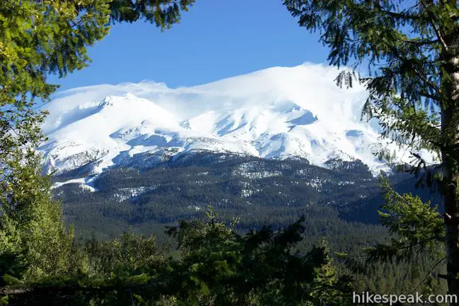
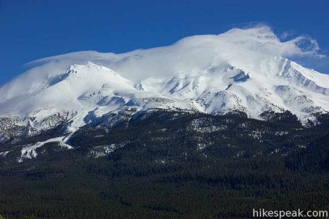
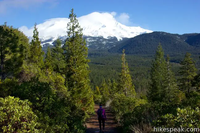
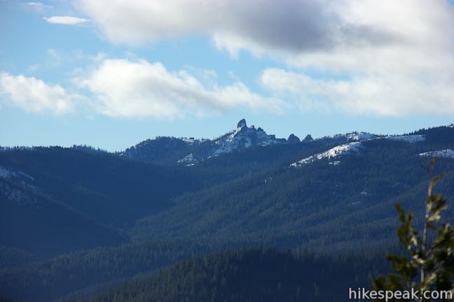
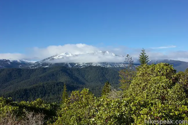
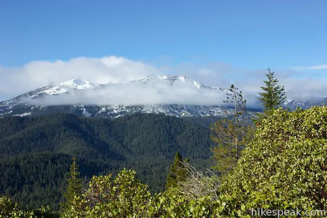
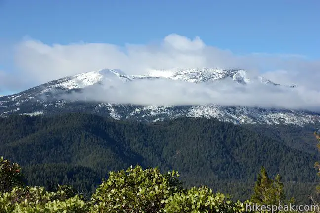
You can actually get a better look at Mount Shasta from Rocky Point Loop, so when you’re ready, leave the summit and hike back down to the top of Rocky Point Loop Trail. Turn onto this single-track trail, which passes through brush to ledges with some pretty big views. As you approach the halfway point of this side trail, you’ll find an unobscured perspective of Mount Shasta, which is a rugged windswept mountain of snow in the winter months. If you look over your shoulder, there will be opportunities for more views of Black Butte.
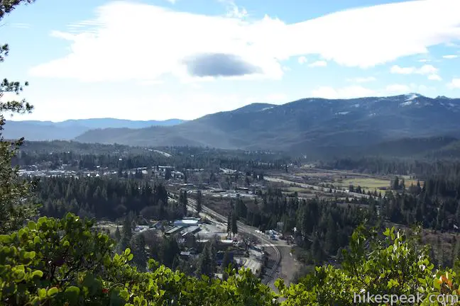
Cross a rocky outcropping and continue back to the main trail, completing the 0.4-mile long Rocky Point Loop Trail. Turn left and hike the last mile down Spring Hill Trail, enjoying a second helping of views of Mount Shasta and Mount Shasta City as you descend.
- For a nearby hike with more views of Mount Shasta, check out Haystack Trail.
This hike to the summit of Spring Hill is 2.9 miles round trip, including Rocky Point Loop. Without this side trail, the hike would be 2 2/3 miles long. No permit is required to hike Spring Hill Trail and access is free. Dogs are allowed, but bikes are not.
Directions to the Trailhead
- From the north, take Interstate 5 south to exit 740.
- The offramp will become Mount Shasta Boulevard.
- Drive half a mile and turn left onto Ski Village Drive.
- After 300 feet, when Ski Village Drive will curve to the right, continue straight onto a rough paved road.
- The parking area for the trailhead is 300 feet ahead at the turnaround at the end of the road.
- From the south, take Interstate 5 south to exit 738.
- At the end of the offramp, turn right onto Lake Street.
- Drive 0.4 miles and turn left on Mount Shasta Boulevard.
- Drive 1.1 miles and turn right onto Ski Village Drive.
- After 300 feet, when Ski Village Drive will curve to the right, continue straight onto a rough paved road.
- The parking area for the trailhead is 300 feet ahead at the turnaround at the end of the road.
Trailhead Location
Trailhead address: Road No 2M16, Mount Shasta, CA 96067
Trailhead coordinates: 41.3288, -122.322 (41° 19′ 43.68″N 122° 19′ 19.20″W)
You may also view a regional map of surrounding Northern California trails and campgrounds.


 | Haystack Trail This 2.55-mile lollipop loop hike tours the top of a volcanic dome with excellent views of Mount Shasta. |
 | Lake Siskiyou Trail (South Shore Loop) This short and easy lakefront loop offers great views across Lake Siskiyou toward Mount Shasta and the surrounding evergreen wilderness. |
 | Faery Falls and Ney Springs This short hike travels along a creek up to an impressive 50-foot waterfall, passing the ruins of an old resort along the way. |
 | Heart Lake and Little Castle Lake This 2 to 3-mile hike visits lakes in a beautiful area of Shasta-Trinity National Forest, including the charming-contoured waters of Heart Lake. |
 | Castle Peak and Heart Lake This approximately 3.2-mile hike ventures off trail above Heart Lake to a summit with extraordinary views of the Castle Crags and Mount Shasta. |
 | Crags Trail to Castle Dome This 5.6-mile round trip hike in Castle Crags State Park ascends 2,150-feet through a garden of granite crags to the base of Castle Dome. This hike can be extended to 6 miles round trip by taking a worthy side trail to Indian Springs. |
 | Root Creek Trail This 2.2-mile round trip hike in Castle Crags State Park takes a level and easy course to a tumbling creek in a mossy forest. |
 | Vista Point Trail This short hike reaches the principal viewpoint in Castle Crags State Park, which has a great perspective of granite peaks known as the Castle Crags, along with views of Mount Shasta and the surrounding wilderness. |
 | Hedge Creek Falls Trail This short hike leads to a forest-wrapped waterfall, passing behind the falls to arrive at a Sacramento River Overlook. |
 | Bailey Cove Trail This easy 3.1-mile loop circles a hill-covered peninsula on the McCloud Arm of Shasta Lake, providing both lake views and shade. |
 | More hikes in Northern California Explore more trails in Northern California, including redwood grove and oceanfront parks along the North Coast. |
 | Antlers Campground This well-shaded 59-site campground in Shasta-Trinity National Forest has level sites on a bluff next to Shasta Lake. |
 | Castle Crags State Park Campground There are 76 developed campsites within this state park that are nestled within a pine forest with access to nearby trails. |
 | Castle Lake Campground This six-site campground in Castle Lake is shaded by conifers in Shasta-Trinity National Forest. |
Common Questions about Spring Hill in Mount Shasta
- Is the trail open?
- Yes. You should expect to find that Spring Hill Trail & Rocky Point Loop is open. There are no recent reports of trail closures. If you discover that the trail is closed, please help your fellow hikers by reporting a closure.
- Is this trail free to access?
- Yes, Spring Hill Trail & Rocky Point Loop is free to access. No entrance fee, pass, or permit is required. If you discover that access rules have changed, please provide feedback on your experience.
- How much time does this hike take?
- It takes approximately 1 hour 30 minutes to hike Spring Hill Trail & Rocky Point Loop. Individual hiking times vary. Add extra time for breaks and taking in the views.
- How long is this hike?
- The hike to Spring Hill Trail & Rocky Point Loop is a 2.9 mile lollipop loop with 625 feet of elevation change.
- Are dogs allowed on this trail?
- Yes, dogs are allowed on Spring Hill Trail & Rocky Point Loop. The trail is open to hikers, dogs.
- Does this trail go to a summit?
- Yes, Spring Hill Trail & Rocky Point Loop reaches a summit with panoramic views.
- Where is the trailhead located?
- The trailhead for Spring Hill Trail & Rocky Point Loop is located in Mount Shasta, CA.
Trailhead Address:
Road No 2M16
Mount Shasta, CA 96067
Trailhead Coordinates:
41.3288, -122.322 - What are the driving directions to the start of the hike?
To get to the trailhead: From the north, take Interstate 5 south to exit 740. The offramp will become Mount Shasta Boulevard. Drive half a mile and turn left onto Ski Village Drive. After 300 feet, when Ski Village Drive will curve to the right, continue straight onto a rough paved road. The parking area for the trailhead is 300 feet ahead at the turnaround at the end of the road.
From the south, take Interstate 5 south to exit 738. At the end of the offramp, turn right onto Lake Street. Drive 0.4 miles and turn left on Mount Shasta Boulevard. Drive 1.1 miles and turn right onto Ski Village Drive. After 300 feet, when Ski Village Drive will curve to the right, continue straight onto a rough paved road. The parking area for the trailhead is 300 feet ahead at the turnaround at the end of the road.
View custom Google Maps directions from your current location.
- Are there other trails near Spring Hill Trail & Rocky Point Loop?
- Yes, you can find other nearby hikes using the Hikespeak Hike Finder Map.

Is it safe to wear shorts on Spring Hill trail? Any snakes? Dogs on leash ok?