
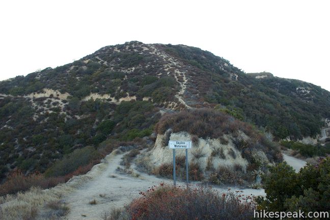
Within the Verdugo Mountains, the small mountain range north of Burbank, you’ll find a big league suburban hike up an abandoned fire road called Skyline Motorway. Skyline Motorway should probably be renamed Skyline Trail since the overgrown track is no longer suitable for vehicles. The Skyline half of the name is still quite valid though, as the trail presents sensational sights over the skyline of downtown Los Angeles (as well as Glendale, Studio City, and Burbank).
Skyline Motorway climbs 1,600 feet in 2.9 miles to a junction with Verdugo Fire Road, the major trail across the principal peaks at the top of the Verdugo Mountains, presenting many possible hike extensions. Finish things off with a short path to an overlook off the end of Skyline Motorway for a fitting 6.1-mile round trip hike, or push things farther up to a summit above Skyline Motorway for a 6.6-mile trek. California buckwheat and other scratchy plants have overtaken the old roadway, so be sure to wear long pants and be prepared to get some burs stuck in your clothes. If you’re game for a little adventure, Skyline Motorway should not disappoint.
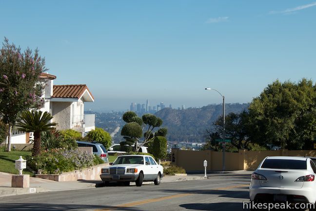
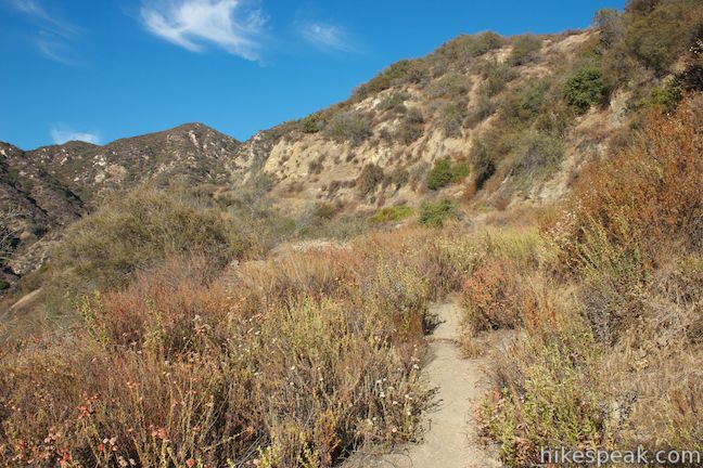
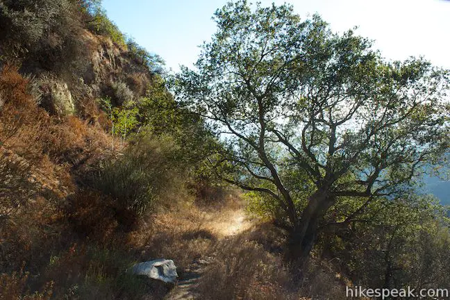
Start hiking from an unmarked trailhead at the base of the Verdugo Mountains at the corner of South Via Montana and East Tujunga Avenue. The beginning of the trail is not obvious unless you know what you’re looking for (check the photos below), as it is just a dirt path heading up the ridge from the road. You’ll quickly reach the bed of the old roadway and turn left, passing through a gate to venture up Skyline Motorway. There is 1,600 feet to tackle in just under 3 miles, so get ready for a steady (and scenic) ascent.
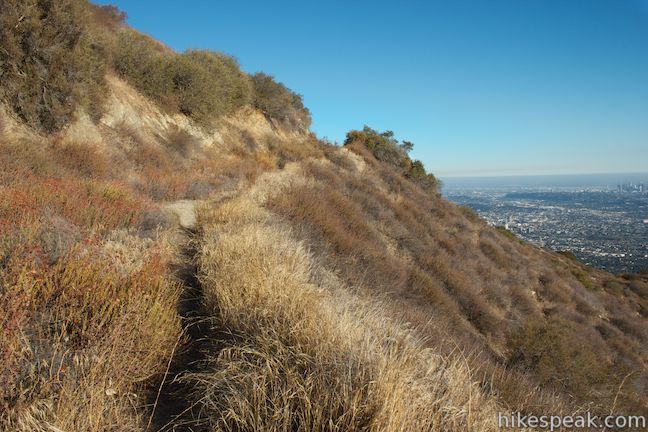
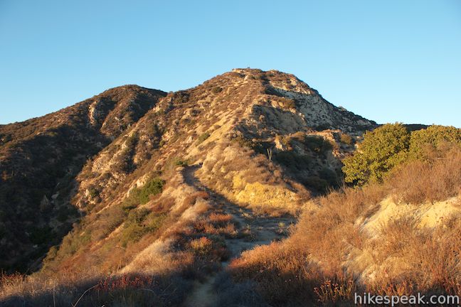
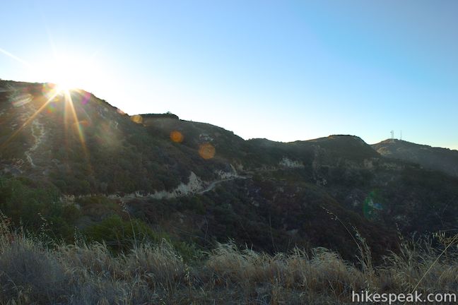
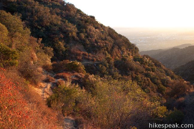
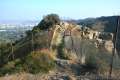
At one time Skyline Motorway was clearly a dirt road that service vehicles could drive on, but that time has passed (the motorway may have been abandoned when a section of the road was washed out about 2 miles up, but more on that later). Vegetation has crept in, leaving only a single track, or a double track in some places, that is fun for hikers to explore. As you go around the first few corners on the trail, you’ll spot the “Burbank B” on the ridge just to the west. The large white B, which is built into the mountainside, is an easy-to-spot landmark from the valley below, and Skyline Motorway delivers one of the closest possible views. The ridge is fenced off below the B, so it appears that you might have to trespass to actually hike to the Burbank B. Instead, enjoy the close view from Skyline Motorway.
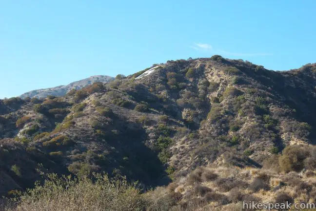
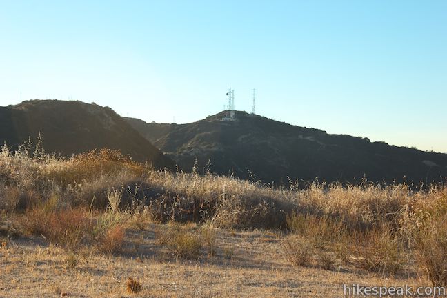
At 0.4 miles from the start, you will pass through a gap cut into the ridge and discover new views north up Sunset Canyon toward Verdugo Peak, the radio tower-covered summit at the top of the Verdugo Mountains. There are houses and trees in Sunset Canyon below the trail, but the rest of the mountainside is covered in chaparral and brush.
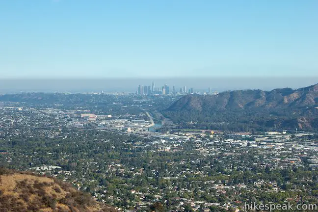
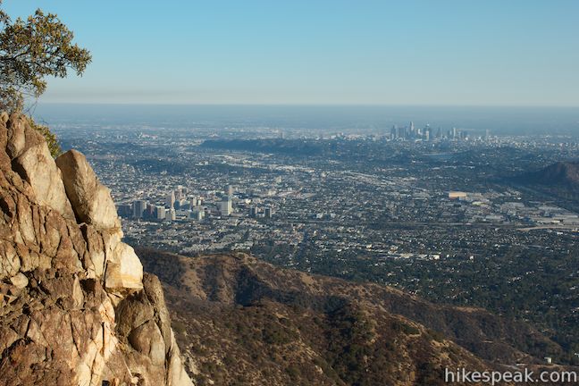
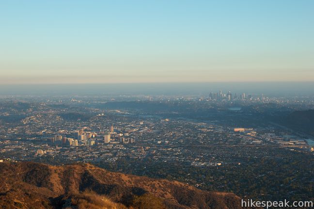
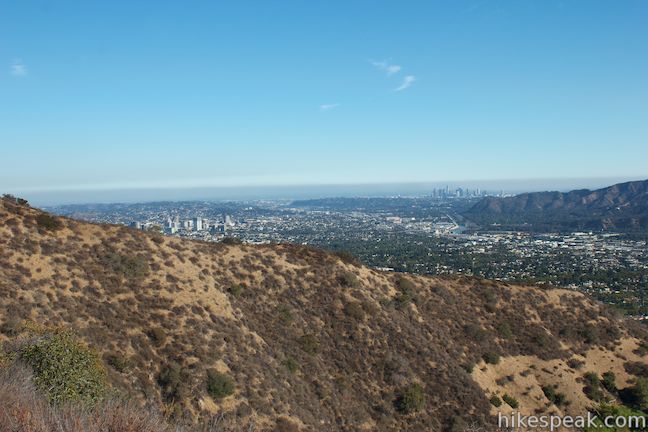
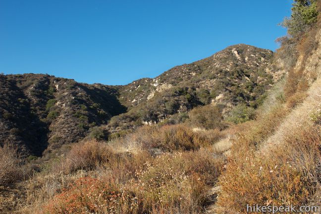
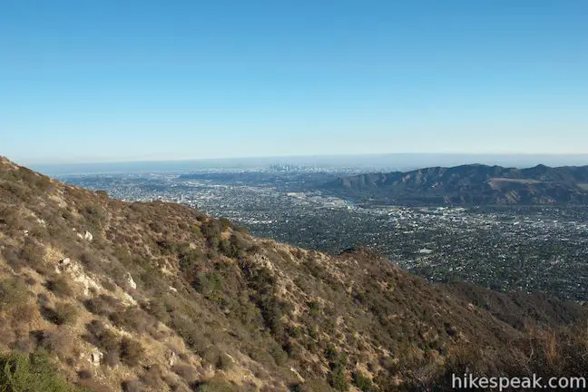
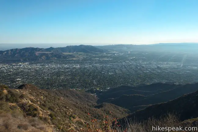
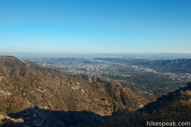
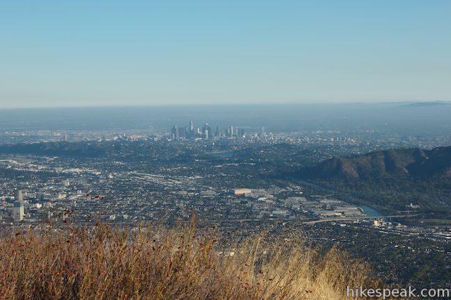
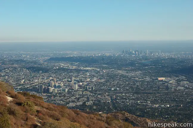
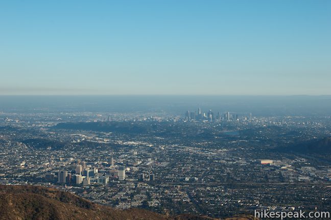
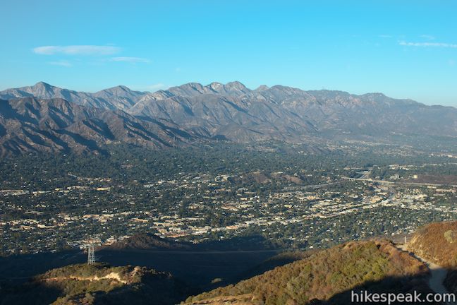
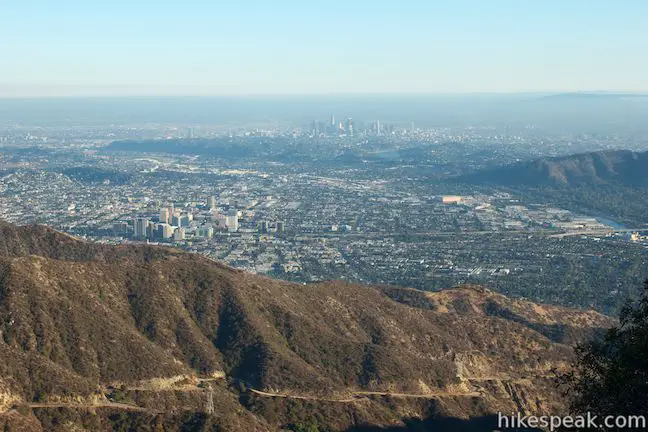
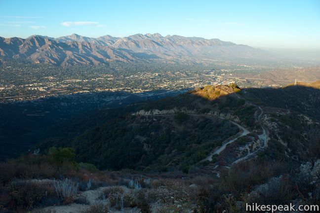
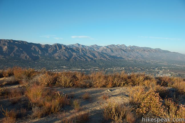
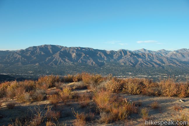
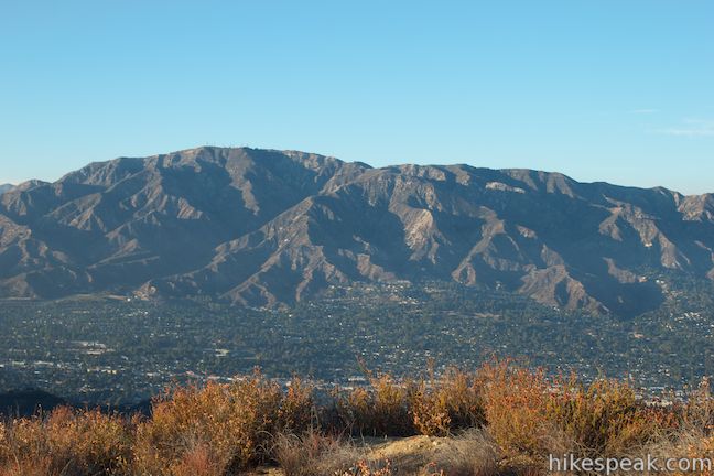
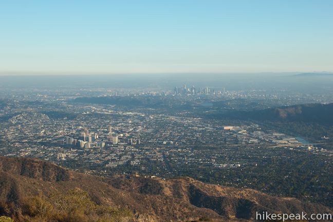
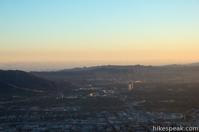
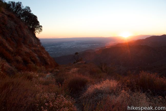
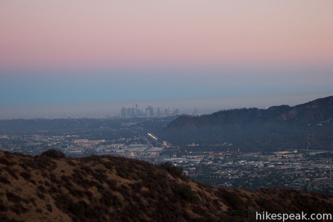
Continuing up Skyline Motorway, the mountain views are replaced with city views. At 0.8 miles, you will flip to the other side of the ridge for an inspiring perspective southeast over downtown Los Angeles and Glendale. The Los Angeles River bends around the east end of the Santa Monica Mountains in Griffith Park, flowing toward the skyscraper skyline of downtown LA.
Switch back to the west side of the ridgeline for more views of Sunset Canyon and Verdugo Peak, before coming to a saddle at 1.25 miles that presents even higher view of the skylines below.
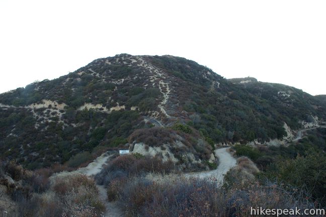
After ascending for 1.7 miles you will reach a solitary oak along the old motorway. A rock seat next to the trail offers a place to take a break in the afternoon shade. A tricky washed out section of the trail comes next, so those who wish to avoid it can use the tree as a nice turn around point for a 3.4-mile hike with 1,025 feet of elevation gain.
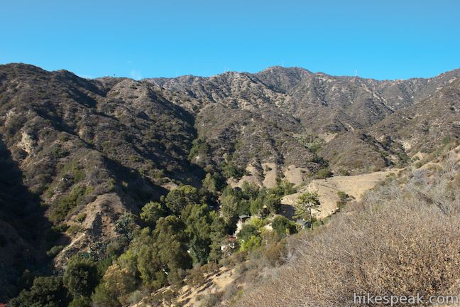
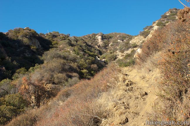
Skyline Motorway continues above the tree, curving to the right into a narrowing canyon. Evidence of the past motorway disappears, probably washed away by a large storm long ago, as the trail diminishes to a narrow track. Carefully cross the loose dirt trail and ascend to a small landing at the back of the canyon where the trail makes a sharp right turn. As you climb out of the canyon, you will leave the washed out zone and return to hiking up a wide abandoned road overgrown by brush.
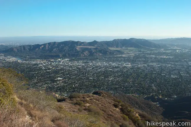
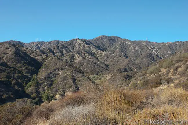
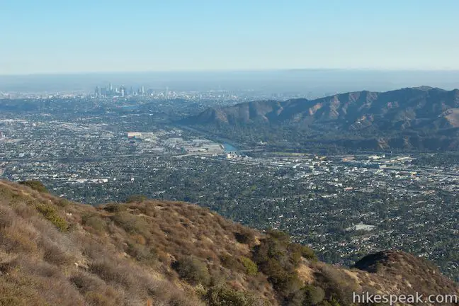
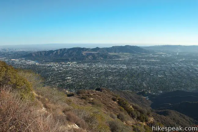
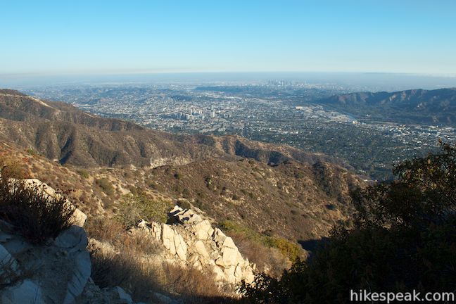
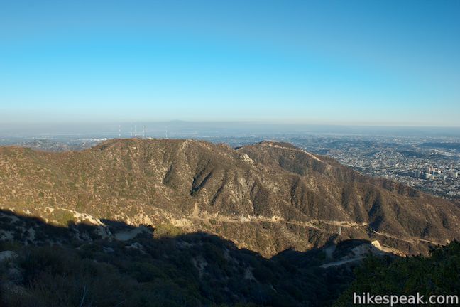
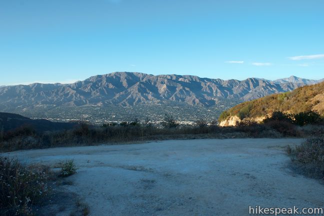
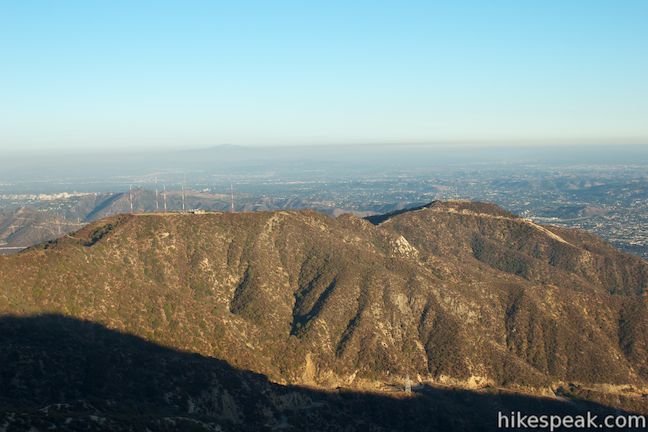
Above the canyon, the road wraps around the south side of the ridge and provides the best views yet over Burbank, the San Fernando Valley, downtown Los Angeles, and downtown Glendale. After 0.15 miles looking south (and 2.25 miles from the start), the road bends to the left, offering views over the east end of the Verdugo Mountains, dominated by the flat tower-topped summit of Tongva Peak (which you will be familiar with if you have hiked Beaudry Motorway Loop). After another tenth of a mile, you’ll cross a saddle on the ridge where a spur path on the left backs up to a crest on the ridge.
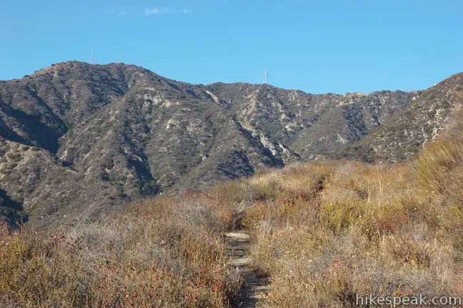
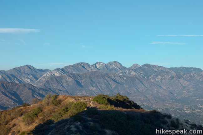
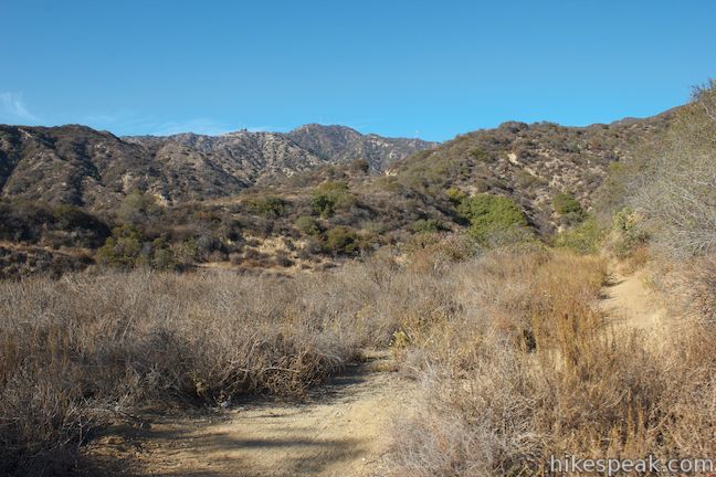
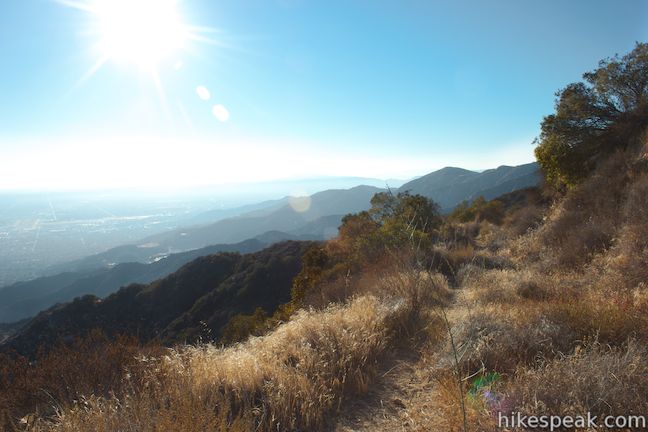
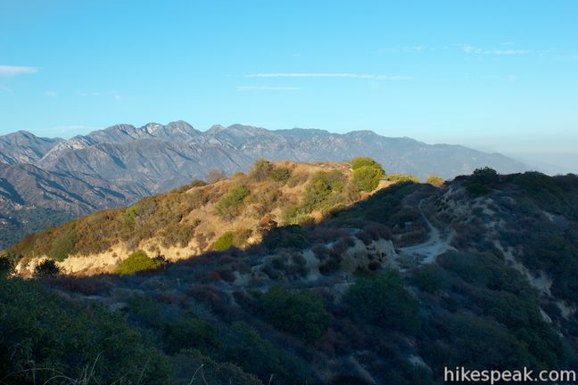
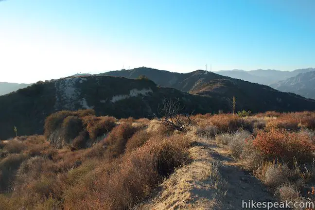
Straight ahead, Skyline Motorway continues climbing to the northeast, displaying LA’s skyline in an ever-expanding scope. When you reach a small ridge, 2.75 miles from the start, a path will descend to the right. Stay true and stick with the motorway, which bends left around the mountainside and aims north. You’ll be impressed by new views of the San Gabriel Mountains, which rise like a blockade to the north and east.
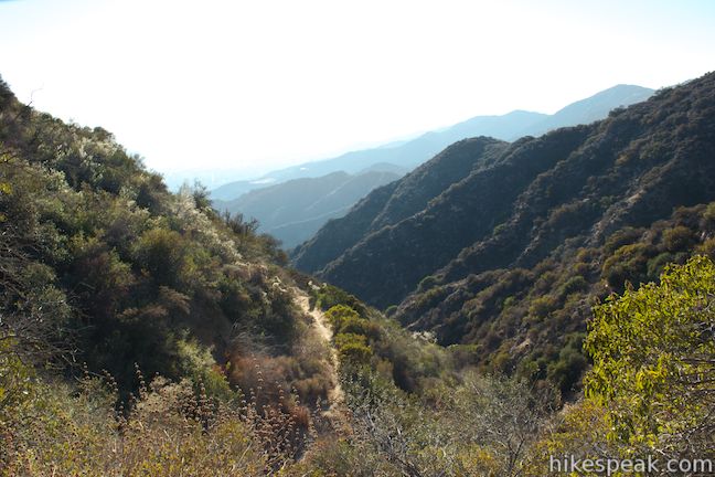
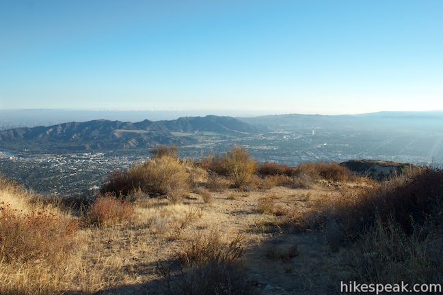
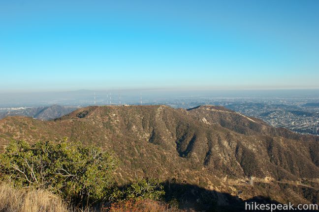
After 2.9 miles of hiking, you will come to the end of Skyline Motorway at a junction with Verdugo Fire Road. Just before you reach the wide road, you can take a trail to the right that ventures out to a nearby rise on the ridgeline that makes a fitting destination for an out-and-back hike on Skyline Motorway. The overlook offers tremendous views of the San Gabriel Mountains to the north and east. Below the overlook to the east, Tongva Peak rises above that section of the Verdugo Mountains, and Brand Canyon drops away to the south exposing yet more views of downtown Los Angeles. If you are simply planning to hike up and back on Skyline Motorway, this overlook is an opportune ending.
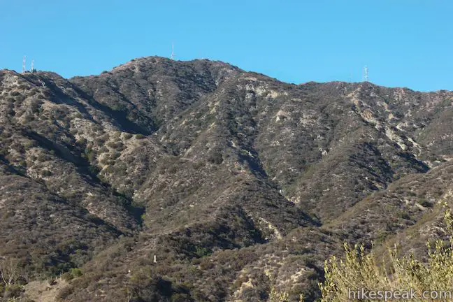
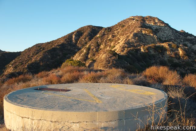
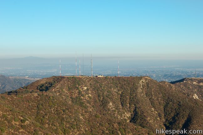
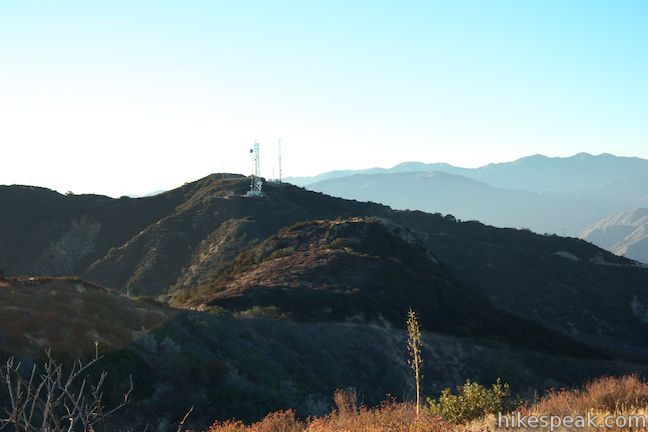
Those who want to push things farther have a couple options on how to go even higher. To reach Verdugo Peak, the 3,126-foot high point of the Verdugo Mountains, simply turn left at the end of Skyline Motorway and hike 1.25 miles up Verdugo Fire Road to the prominent summit topped by radio towers. For a shorter extension to a tower-free peak, pursue a path to the 2,995-foot twin summits just above Skyline Motorway, adding half a mile round trip to your hike.
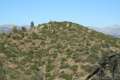
Backtrack 0.05 miles down Skyline Motorway and take the path on the right (which would be on your left as you hiked up Skyline Motorway). The path wastes no time ascending a steep slope to the unnamed summit. You’ll gain about 150 feet in the first tenth of a mile, before a tapered approach to the first summit, 0.15 miles from Skyline Motorway. From here you can continue another tenth of a mile northwest across a dip in the ridgeline to a second summit that appears to be around the same elevation, marked on topographical maps as Peak 2,995. The views from the mountaintop above Skyline Motorway are pan-o-ramic! Much like the overlook below, you’ll spot Verdugo Peak to the northeast, the mighty San Gabriel Mountains to the north and east, downtown Los Angeles and the San Gabriel Valley to the southeast, and the Santa Monica Mountains to the south across from Burbank and the San Fernando Valley.
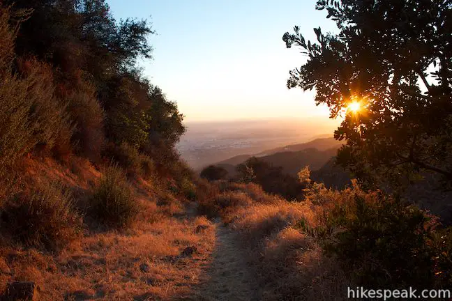
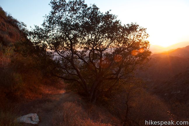
Whether you hike to the overlook (6.1 miles and 1,625 feet), or to the overlook and the summits (6.6 miles and 1,825 feet), you’ll enjoy a good workout with epic views. No fee or permit is required to hike Skyline Motorway in the Verdugo Mountains and dogs and mountain bikers are welcome. Don’t forget to wear long pants! The trail does not have time restrictions, making it a good candidate for a sunset hike. Be sure to start hiking back down well before sunset or bring flashlights (more photos below).
Directions to the Trailhead
- Take the 5 Freeway to Burbank to Exit 146A for Olive Avenue.
- Make your way to Olive Ave. from the off ramp and head north.
- After 1.2 miles, when Olive Ave. comes to an end, continue straight onto Country Club Drive.
- Proceed 0.3 miles and turn right on South Via Montana (before Country Club Drive drops into Sunset Canyon).
- Go a quarter mile and park at the intersection of East Tujunga Avenue.
- Skyline Motorway begins from the north side of S. Via Montana, just west of the intersection.
Trailhead Location
Trailhead address: South Via Montana & East Tujunga Avenue, Burbank, CA 91501
Trailhead coordinates: 34.1953, -118.29372 (34° 11′ 43.08″N 118° 17′ 37.4″W)
View Verdugo Mountains in a larger map
Or view a regional map of surrounding Los Angeles trails and campgrounds.


 | Vital Link Trail This hike of 3 miles round trip or more ascends 1,275 feet (or more) up a ridge on the side of the Verdugo Mountains for a steep hike with satisfying views. |
 | Old Youth Camp Loop in Stough Canyon This 2.6-mile loop passes the ruins of an abandoned camp in the Verdugo Mountains with views across the San Fernando Valley. |
 | Hostetter Fire Road to Verdugo Peak This 7.5-mile round trip hike on the north side of the Verdugo Mountains ascends from La Tuna Canyon to the highest summit in the range. |
 | La Tuna Canyon Trail This 4.5-mile round trip hike ascends a ridge and a pair of canyons in La Tuna Canyon Park on the northwest side of the Verdugo Mountains. |
 | Beaudry Motorway Loop to Tongva Peak This 6.15-mile loop climbs 1,475 feet to the summit of Tongva Peak on the east end of the Verdugo Mountains. |
 | Las Flores Motorway to Mount Thom This 5.3-mile hike follows a wide dirt road to the summit of Mount Thom, offering panoramic views from the southeast end of the Verdugo Mountains. |
 | Beacon Hill This 2.75 to 3.9-mile hike in Griffith Park climbs 500 feet to the easternmost summit in the Santa Monica Mountains. |
 | Bee Rock This hive-shaped point on the east side of Griffith Park is reached via a 1.7 to 4-mile round trip hike. |
 | More trails in Los Angeles Explore other destinations around Los Angeles. |
Common Questions about Skyline Motorway in the Verdugo Mountains
- Is the trail open?
- Yes. You should expect to find that Skyline Motorway & Extensions is open. There are no recent reports of trail closures. If you discover that the trail is closed, please help your fellow hikers by reporting a closure.
- Is this trail free to access?
- Yes, Skyline Motorway & Extensions is free to access. No entrance fee, pass, or permit is required. If you discover that access rules have changed, please provide feedback on your experience.
- How much time does this hike take?
- It takes approximately 3 hours 30 minutes to hike Skyline Motorway & Extensions. Individual hiking times vary. Add extra time for breaks and taking in the views.
- How long is this hike?
- The hike to Skyline Motorway & Extensions is a 6.1 mile out and back with 1625 feet of elevation change.
- Are dogs allowed on this trail?
- Yes, dogs are allowed on Skyline Motorway & Extensions. The trail is open to hikers, dogs, bikes.
- What mountain range is this trail in?
- Skyline Motorway & Extensions is located in the Verdugo Mountains.
- Where is the trailhead located?
- The trailhead for Skyline Motorway & Extensions is located in Burbank, CA.
Trailhead Address:
South Via Montana
Burbank, CA 91501
Trailhead Coordinates:
34.1953, -118.29372 - What are the driving directions to the start of the hike?
To get to the trailhead: Take the 5 Freeway to Burbank to Exit 146A for Olive Avenue. Make your way to Olive Ave. from the off ramp and head north. After 1.2 miles, when Olive Ave. comes to an end, continue straight onto Country Club Drive. Proceed 0.3 miles and turn right on South Via Montana (before Country Club Drive drops into Sunset Canyon). Go a quarter mile and park at the intersection of East Tujunga Avenue. Skyline Motorway begins from the north side of S. Via Montana, just west of the intersection.
View custom Google Maps directions from your current location.
- Are there other trails near Skyline Motorway & Extensions?
- Yes, you can find other nearby hikes using the Hikespeak Hike Finder Map.

Make sure you wear pants. Trail is overgrown most of the way and your legs get scratched up. However, views are amazing and the hike is fun!
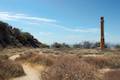
About a quarter mile up, before image 4752, a side trail turns downward to meet Country Club drive. Along this is the rusted body of a 1930’s car off the embankment. Junk, but a local curiosity.
Just got back from this hike and I had a few notes/additions.
You don’t need to scamper up that hill to get to the trailhead. If you look to the right (closer to the intersection) there’s a grassy patch next to the driveway up to an apartment complex. In that grassy area there’s an obvious beginning to the trail. This will save you approximately 10 feet of hiking. Totally worth it.
The washed out section is really washed out. I don’t know if it’s gotten worse since this guide was written but now you’re hanging onto brush while your feet are finding a five inch wide ledge. There is zero chance you could take a pet on this part of the hike.
The “path” that ascends 150 feet to the summit (from the top) is more of a “wall.” It’s almost all dry dirt with some rocks to find footholds on, but this is much closer to a 150 foot climb than it is to a hike. On the way down there’s not much to do but slide down. It’s fun, but you get all scratchy. The view from the top of the optional peak is amazing. A full 360 of Los Angeles. But once I got up there I saw other paths leading off, making me certain there are simpler and saner ways to get to that peak, probably from the fire road.
To confirm your suspicion, yes on a clear day you can see the ocean. From the top I could see Century City, Downtown, Long Beach, Catalina, and the entirety of the Valley up until the hills at the West.
Trail is damaged in one section about half way up. Loose soil on the edge of a cliff. I turned back, didn’t want to risk it!
The trail is completely impassable at the moment once you get about 2 miles up, due to cliff collapse as the result of the La Tuna Canyon Fire. You can hike for a bit in the burn area, which is kind of fascinating. FYI that starting in the spring this area may have lots of poodle dog bush.
My brother and I have done this hike dozens of times. As Heather mentioned, the fire (and fire fighting) really did a number on this trail. The last time we went up was in October of 2017. When we got to the section that was impassable, we decided to do a little slope climbing to get up to where the trail continued above. It was one of those times where you’re in the middle of it and thinking “oh no, what have we done?” The slope is very steep and it’s difficult to get a foothold. One wrong step and the shifting soil will surf you down into the canyon. We made it up but, in retrospect, the risk wasn’t worth taking.
The trail is amazing but a welcome challenge compared to all of the fire road hikes. Like the other comments, wear pants, sliding hillside and at times you will definitely say to yourself “What have I done?”. Because of all the 2019 rains, it was overgrown but it was a extraordinary hike.