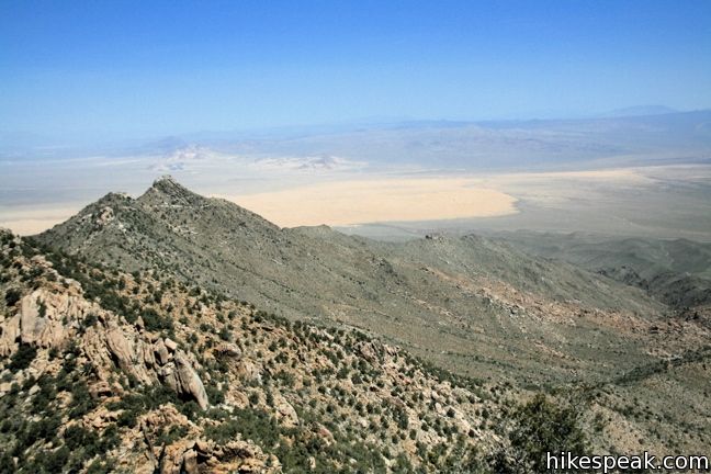
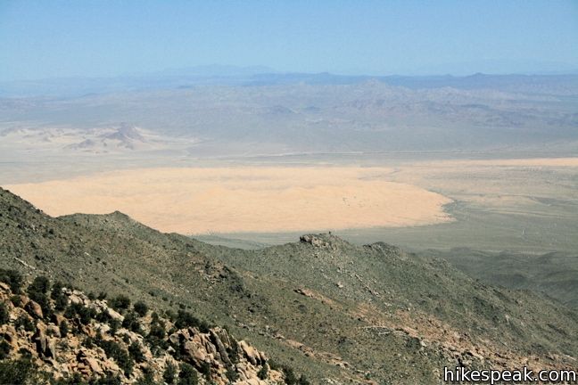
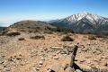
This 8.5-mile hike ascends 2,500 feet to summit a 6,365-foot peak in the small range of mountains in the southwestern corner of Mojave National Preserve. Silver Peak looks out across the Granite Mountains toward the Kelso Dunes, Cima Dome, and the peaks of the Providence Range – a worthy view of Mojave National Preserve to be sure. Nearby Granite Peak is the tallest mountain in the range (6,762 feet), but Silver Peak is an easier hike because there is a rough trail leading almost all the way to the summit. Those hiking to Granite Peak must leave the road to forge an off-trail cross-desert ascent through tough terrain (read Bob Burd’s report for more info on bagging this peak).
Note: This trail may be closed to the public.
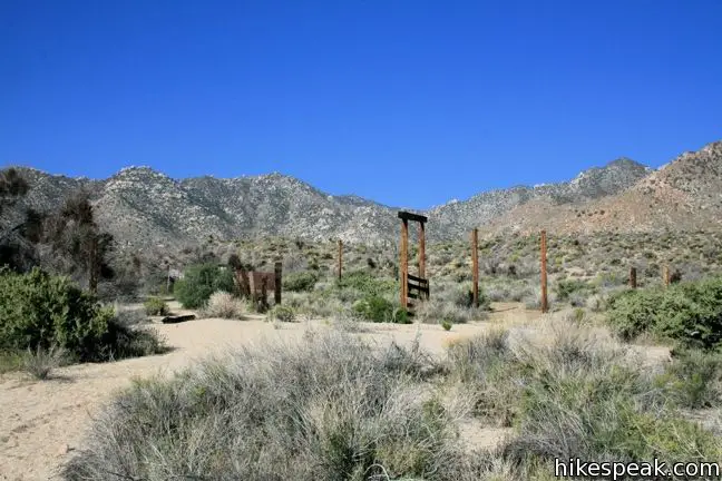
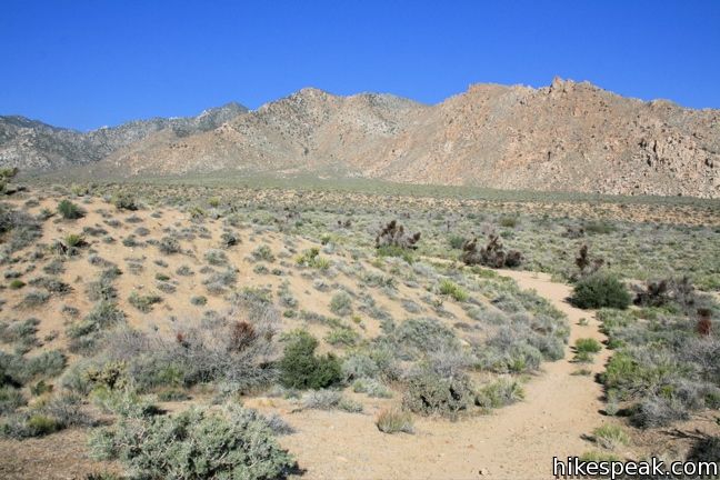
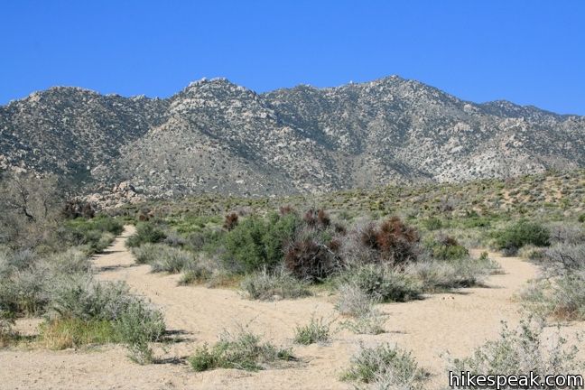
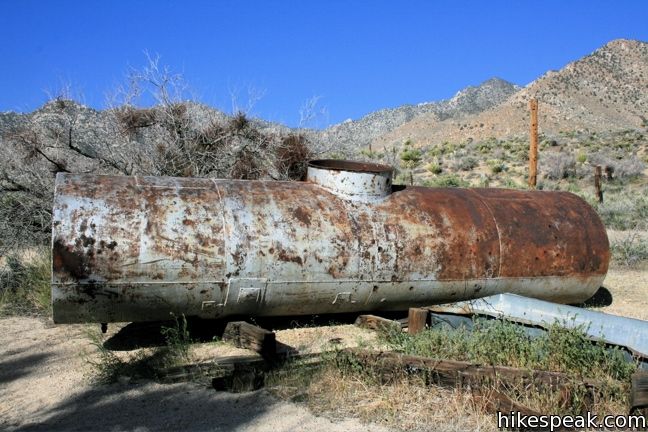
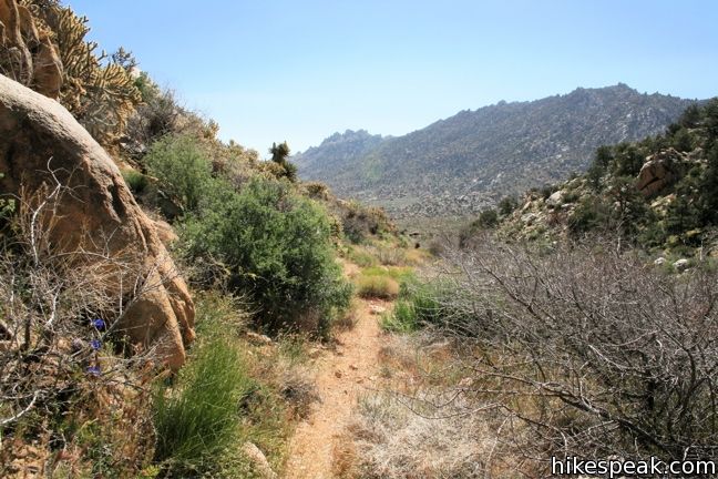
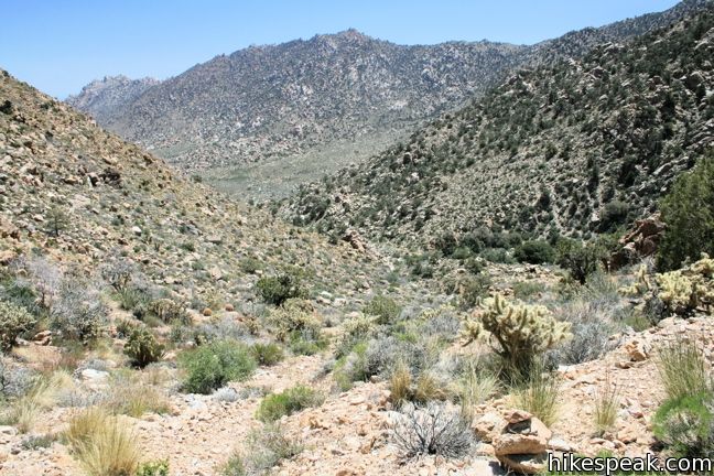
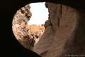
The trail to Silver Peak is unmarked, but easy to follow, if you pay attention to a few important directions. Just 1/4 mile from the trailhead, the trail/wash comes to a Y. The remains of a corral at the site of an old ranch can be seen up the left fork, luring you that way. Instead, take the right fork, which quickly reveals itself to be a jeep trail. After a short distance the road passes to the right the corral. Feel free to jump trail and explore the ruins, but return to the road afterward. There are footprints continuing up the wash, but this is the more circuitous route to Silver Peak. The wash passes through Cottonwood Springs, treating hikers to slower terrain and deceptive side-washes.
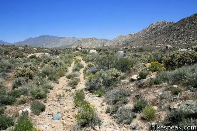
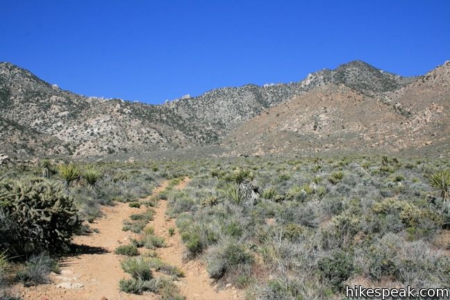
Stay on the road to the right of the corral, which is more direct and made of packed dirt instead of sand. There are a few turns in the road, but by and large it is a straight gradual uphill hike to the base of Silver Peak. Hike up the tire ruts and enjoy the view of the surrounding mountains.
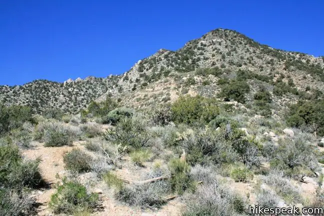
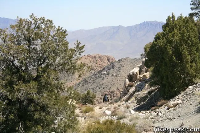
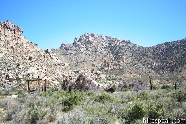
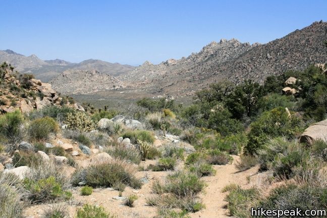
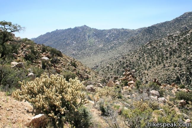
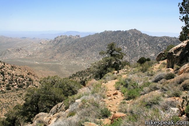
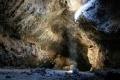
At 2.5 miles, the road crosses through the mouth of a brief canyon between ridges on the south side of the peak. Here the trail becomes a bit tricky to follow. Referring to this section as a trail actually broadens the definition considerably. Stay observant and follow the footpath as it crosses from the right side of the canyon to the left. Pass through a stretch of high grasses and get a clear sense of how infrequently hikers visit Silver Peak.
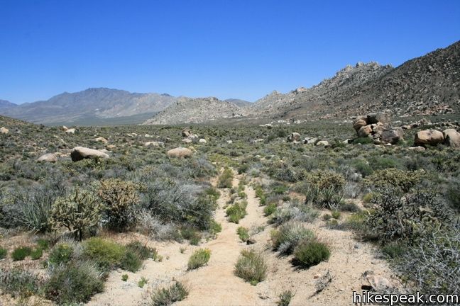
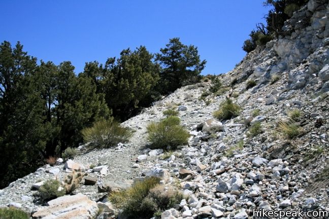
A quarter-mile farther, the trail comes back to center and begins a more serious ascent. 1500 feet remain to be climbed over the next 1.8 miles. Follow the cairns leading up a steep slope below the summit. Above, the line of the road can be seen crossing the mountain toward the east. March up the gravel slope and turn right, continuing up the road.
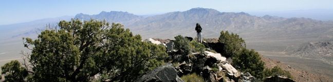
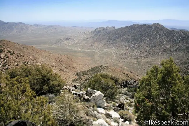
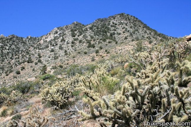
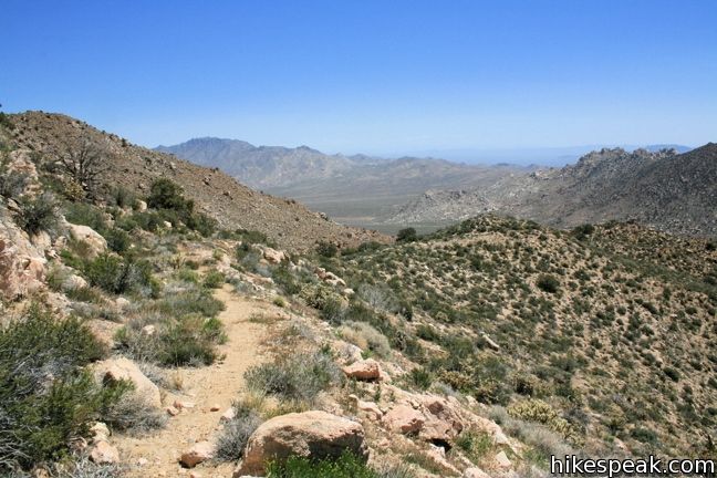
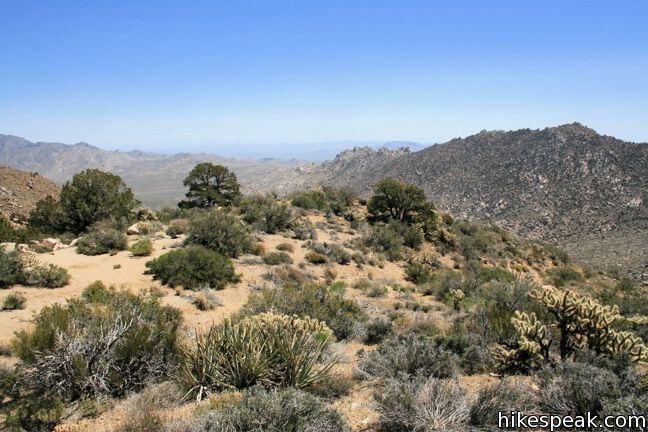
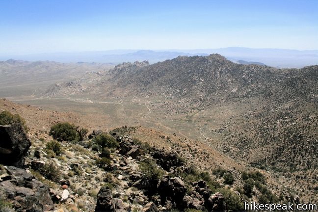
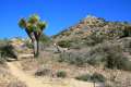
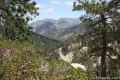
The trail becomes easy to follow again, as it carves up the ridge past a few landings were tents could be set up (3.2 miles from the start). As the road progresses to the north, Pinyon pines replace the yucca and cacti of the lower desert. Enjoy the fine view of the Kelso Dunes, Cima Dome, and the Providence Range.
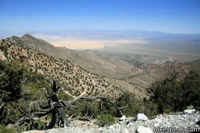
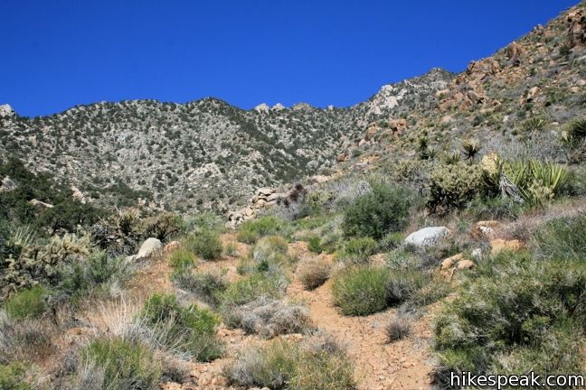
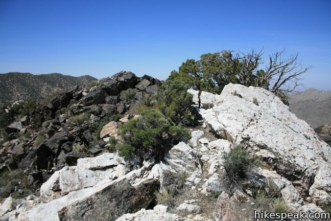
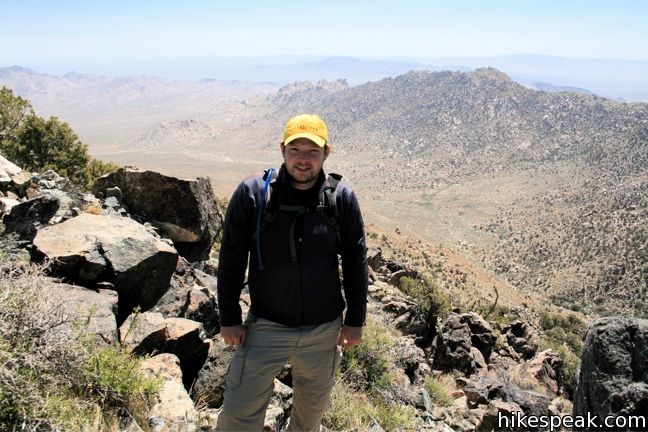
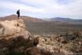
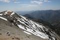
The trail switches back to the south and abruptly comes to and end, 0.15 miles and 250 feet below the summit. Turn right and take the worn path up the side of the mountain. Forge your way over and around rock outcroppings to the top of Silver Peak. At the summit, the trees give way to bolder piles and panoramic views. Have a look down at the jeep trail leading back to the trailhead and think of how far you’ve come.
The faint path down to the top of the road is harder to follow in reverse, so do your best. Beyond that, the return hike is quick and downhill almost the entire way. This trail passes through the University of California Granite Mountains Nature Reserve, so stay on trail and be courteous not to disturb their outdoor classroom. As a commenter notes below, public access may now longer be allowed on the land owned by University of California, preventing hikers from reaching Silver Peak. Observe the ‘no trespassing’ signs. Otherwise, no fee or permit is required to visit Silver Peak or take other hikes in Mojave National Preserve.
Directions to the Trailhead
- From Kelso Depot, head south on Kelbaker Road.
- Drive 4.7 miles past Kelso Dunes Road and turn right onto an unmarked dirt road which heads straight across the desert for 1.6 miles to the trailhead.
- The road is passable for most vehicles.
- At the end of the road, turn left into the trailhead parking area.
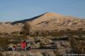
- There is roadside camping at the trailhead and in a wash halfway up the dirt road.
Trailhead Location
Trailhead address: Unnamed Road off Kelbaker Road, Mojave National Preserve, CA 92309
Trailhead coordinates: 34.8206, -115.6476 (34° 49′ 14.2″N 115° 38′ 51.4″W)
View Mojave National Preserve in a larger map
Or view a regional map of surrounding California Desert trails and campgrounds.
 | Fountain Peak This 5-mile off trail trek summits a peak with commanding views over the Providence Mountains. |
 | Hole-in-the-Wall Rings Trail This 1.5-mile loop takes visitors through a landscape of pocketed rocks. Ringbolts allow fun passage through narrow canyons. |
 | New York Peak This 7 to 9-mile round trip hike summits the highest point of the New York Range in the northeast corner of the preserve. |
 | Rock Spring Loop Trail This 1 1/3-mile loop visits a rare desert spring, a Rock House built in the 1920s, a miners' mill site, and an old U.S. Army post on a short and scenic circuit. |
 | Kelso Dunes This 3-mile round trip hike climbs 470 feet to the highest point in this 45 square mile dune field. |
 | Teutonia Peak This 3.4 to 4-mile round trip hike crosses the world's densest Joshua tree forest, passing an abandoned silver mine to reach a rocky summit with views of Cima Dome. |
 | Lava Tube This short 0.6-mile hike drops below the surface into an old lava tube. |
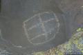 | Petroglyphs near Seventeen Mile Point This quarter-mile path visits ancient engravings in the volcanic rock at the western rim of the cinder fields just off Kelbaker Road. |
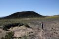 | Amboy Crater This 3-mile round trip hike travels up and into this crater adjacent to Mojave National Preserve. |
 | Hikes in the California Desert Explore more trails in Death Valley National Park, Joshua Tree National Park, Anza-Borrego Desert State Park, and Mojave National Preserve. |
 | Warren Peak in Joshua Tree National Park This 5.5-mile hike summits a peak with impressive views over the west side of Joshua Tree. |
 | Wildrose Peak in Death Valley National Park This 8.4-mile hike summits a 9,064-foot peak in the Panamint Mountains north of Telescope Peak. |
 | Mount Waterman The 5.5 to 6 miler can be completed as an out and back hike or a loop, traveling through a pine forest to a round summit. Add six miles to the hike by dropping across a saddle and climbing to the summit of Twin Peaks. |
 | Mount Baldy in the Angeles National Forest This 11.3-mile hike incorporates Devil's Backbone and Baldy Bowl - Ski Hut Trail into one see-all loop. |
 | Mojave National Preserve There are a few campgrounds and endless roadside camping within the preserve. |
Common Questions about Silver Peak in Mojave National Preserve
- Is the trail open?
- Alert: Silver Peak Trail is currently marked as Closed. Please check official websites for current status.
- Is this trail free to access?
- Yes, Silver Peak Trail is free to access. No entrance fee, pass, or permit is required. If you discover that access rules have changed, please provide feedback on your experience.
- How much time does this hike take?
- It takes approximately 5 hours to hike Silver Peak Trail. Individual hiking times vary. Add extra time for breaks and taking in the views.
- How long is this hike?
- The hike to Silver Peak Trail is a 8.5 mile out and back with 2500 feet of elevation change.
- Are dogs allowed on this trail?
- Yes, dogs are allowed on Silver Peak Trail. The trail is open to hikers, dogs.
- Is Silver Peak Trail a difficult hike?
- This hike should be considered strenuous. Hikers should be prepared for a workout covering 8.5 miles and 2500 feet of climbing.
- Does this trail go to a summit?
- Yes, Silver Peak Trail reaches a summit with panoramic views.
- Where is the trailhead located?
- The trailhead for Silver Peak Trail is located in Mojave National Preserve, CA.
Trailhead Address:
Kelbaker Road
Mojave National Preserve, CA 92309
Trailhead Coordinates:
34.8206, -115.6476 - What are the driving directions to the start of the hike?
To get to the trailhead: From Kelso Depot, head south on Kelbaker Road. Drive 4.7 miles past Kelso Dunes Road and turn right onto an unmarked dirt road which heads straight across the desert for 1.6 miles to the trailhead. The road is passable for most vehicles. At the end of the road, turn left into the trailhead parking area. There is roadside camping at the trailhead and in a wash halfway up the dirt road.
View custom Google Maps directions from your current location.
- Are there other trails near Silver Peak Trail?
- Yes, you can find other nearby hikes using the Hikespeak Hike Finder Map.

This described hike leads visitors through the UC Granite Mtns Desert Research Center, lands owned not by NPS but the University of California since 1978. The GMDRC is the location of more than 200 highly sensitive research projects, many used to inform land managers on best science for managing desert lands, such as the Mojave Natl. Preserve. Trespass into the GMDRC is a criminal act, and numerous arrests are made each year.
Why would Hillspeak post a route that provides information that helps folks trespass across lands with sensitive biological studies in progress? Plus, this area is closed to the public.
Are there many petroglyphs?
I’d like to stay out of the off limits area. Can I buy a map at Kelso depot?
Maps should be available at the Kelso Depot Visitor Center. You can find so easy-to-reach petroglyphs along Kelbaker Road.
[…] Devil’s Playground (you will have earned an awesome run or slide down the dunes afterward), hike up Silver Peak for amazing ridgeline views, go horseback riding, enjoy seasonal wildflower blooms, or explore […]