Nicholas Flat via Malibu Springs Trail
in the Santa Monica Mountains
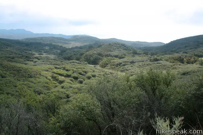
Near the west end of Mulholland Highway north of Leo Carrillo State Park, you will find an almost hidden trailhead for Malibu Springs Trail. This spring-loaded single track is faint and overgrown in areas, providing a sense of adventure as you take in fantastic views of the highest peaks Santa Monica Mountains. At the end of an arduous climb, you will drop down to Nicholas Flat in Nicholas Flat Natural Preserve. Circle mountain meadows to reach Nicholas Pond and an overlook of the Pacific Ocean – the relaxing destination for this scenic 7-mile round trip hike with 1,425 feet of elevation gain. You could also hike to Nicholas Flat via Nicholas Flat Trail from the entrance of Leo Carrillo State Park.
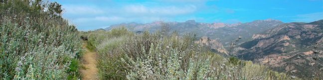
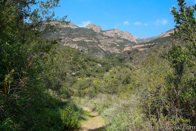
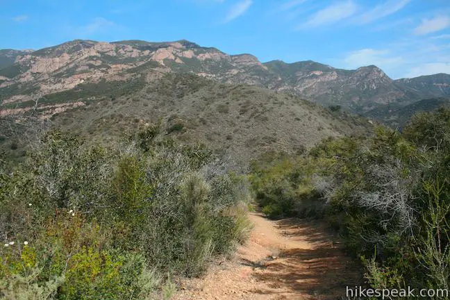
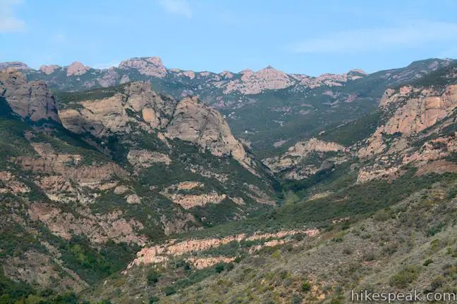
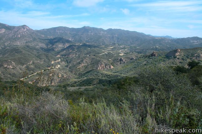
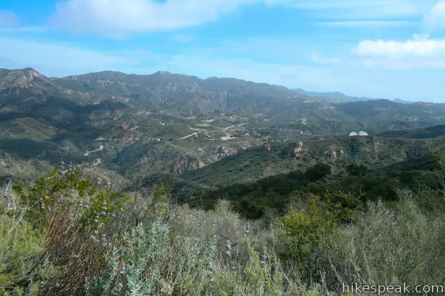
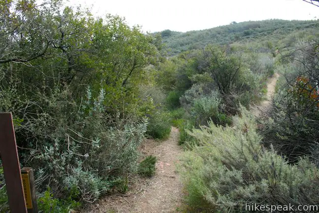
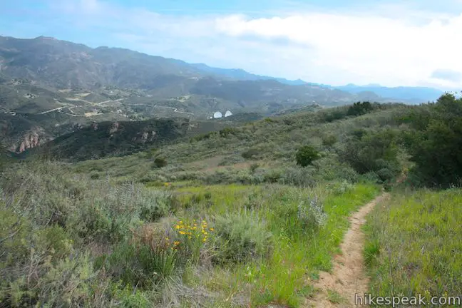
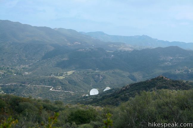
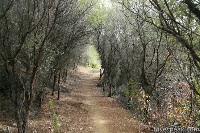
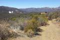
The trail begins from a turnout along Mulholland Highway, 3.25 miles from PCH, in a deep coastal canyon carved by the Arroyo Sequit. There is a small sign marking the start of the trail and the distance to Nicholas Flat (three miles). Begin up the trail, passing around a chain-link gate designed to block vehicles and bikes. The trail quickly narrows to a single track surrounded by tall brush that ascends switchbacks on a mountainside of oaks and chaparral. Almost immediately, you will discover great views of the Boney Mountains to the northwest. These are the highest summits in the Santa Monica Mountains, including the 3,111-foot Sandstone Peak.
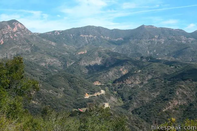
Tall brush encroaches on the trail, nearly consuming it completely in places, making the route not entirely clear at times. Nevertheless, you should be able to follow the steep track up the mountainside for 1.9 miles to a marked split in the trail. The junction is located at the boundary between federally protected land in the Santa Monica Mountains National Recreation Area and Nicholas Flats Natural Preserve in Leo Carrillo State Park. Straight ahead, a section of Malibu Springs Trail continues east for half a mile to Decker School Road (which hikers could use to form a larger loop on Nicholas Flat). Turn right at the split to take Ridgeline Trail (basically an upper section of Malibu Springs Trail) to Nicholas Flat.
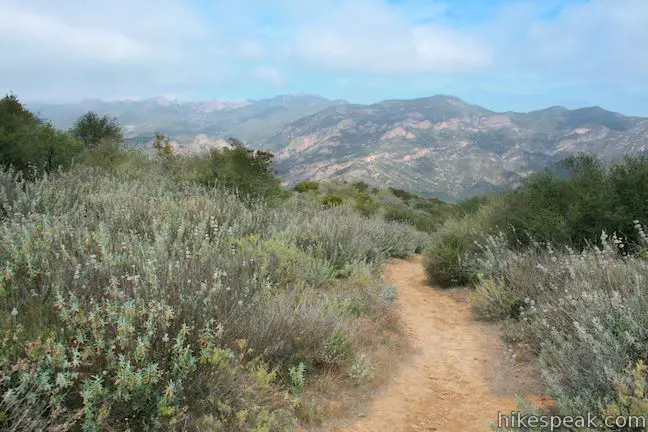
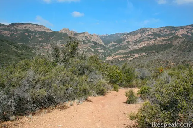
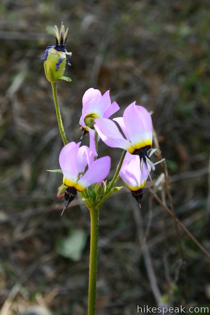
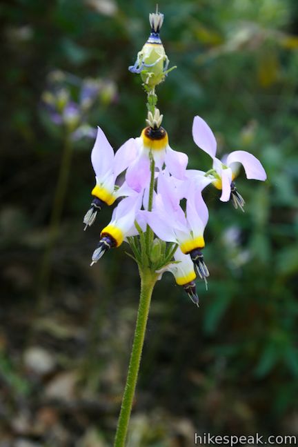
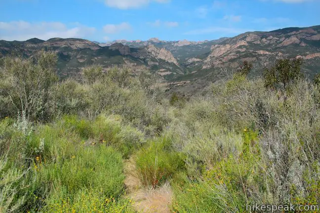
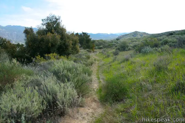
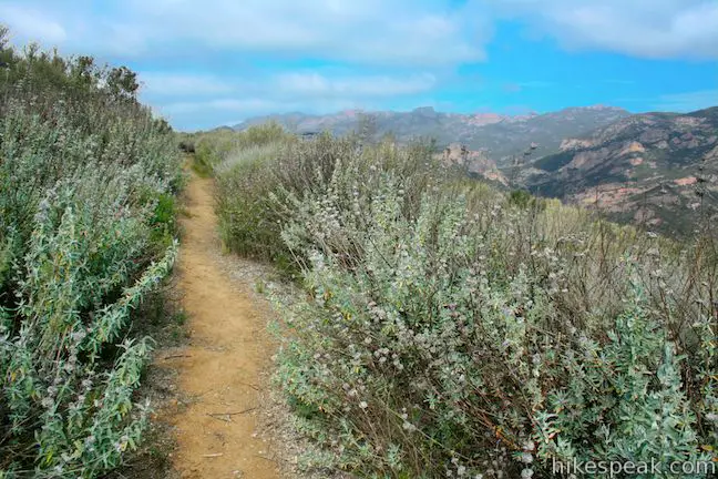
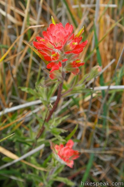
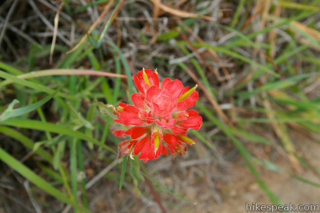
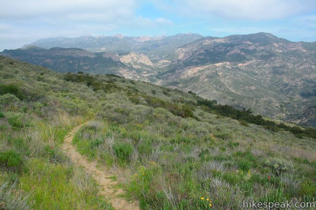
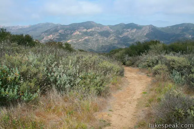
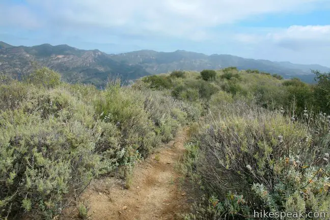
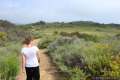
More switchbacks on the narrow track bring you farther up the sage-covered slope toward even broader views of the mountains to the north. Spring wildflowers like shooting star and Indian paintbrush soak in the sun, adding seasonal color to the trail. About 0.3 miles above the marked junction, you will pass a couple paths breaking off to the left. Stay to the right up the main trail, which is now clear and obvious to follow. You will cross the 1,825-foot high point of the trail and begin to descend toward Nicholas Flat. The mountain-wrapped meadow comes into view, beckoning you forward.
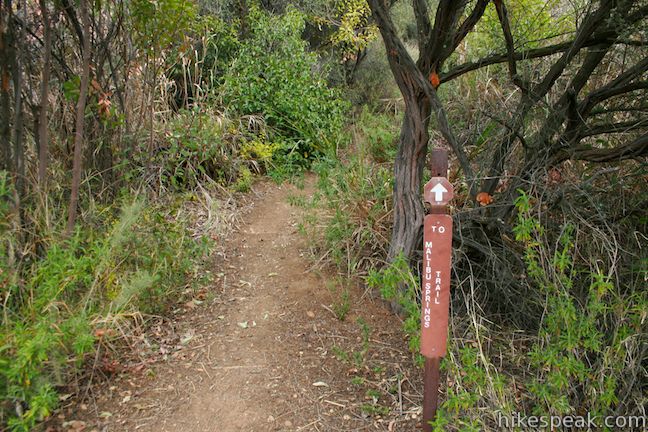
Hike down a slope of tall chaparral to reach Meadows Trail on Nicholas Flat. A sign at the bottom of Ridgeline Trail (2.65 miles from the start) reads, “To Malibu Springs Trail.” It will be important to find this sign again when you return from the loop around Nicholas Flat.
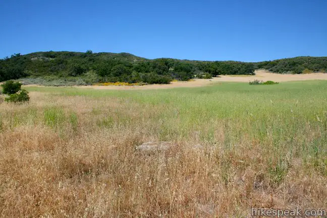
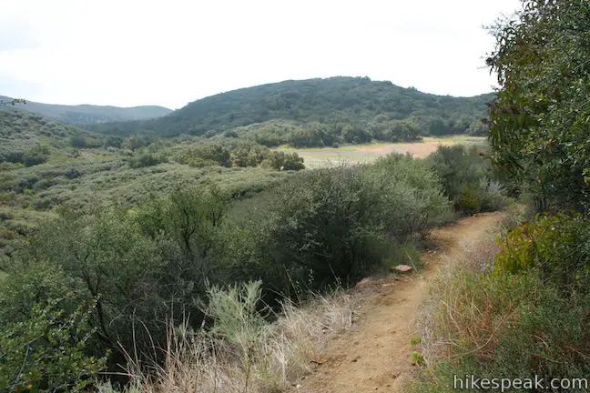
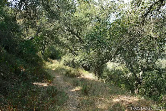
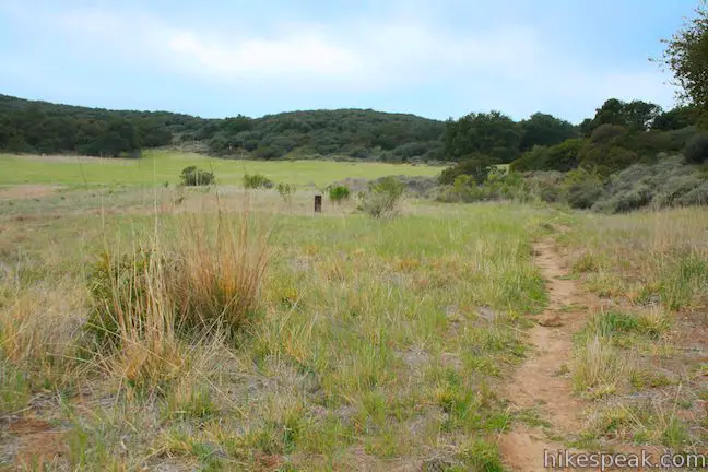
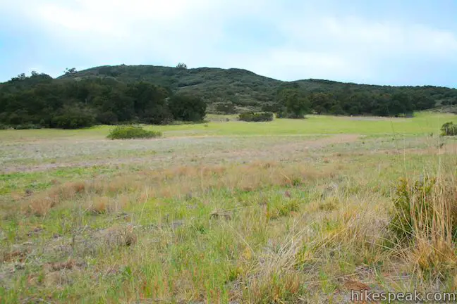
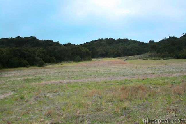
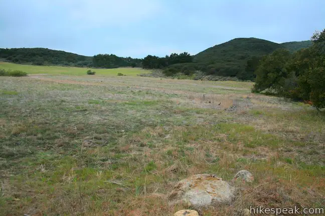
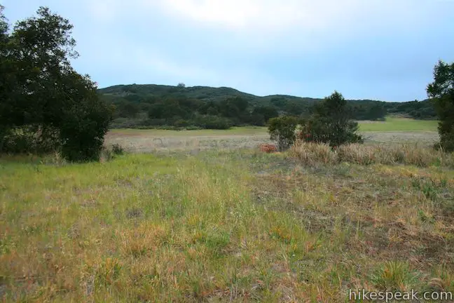
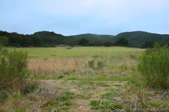
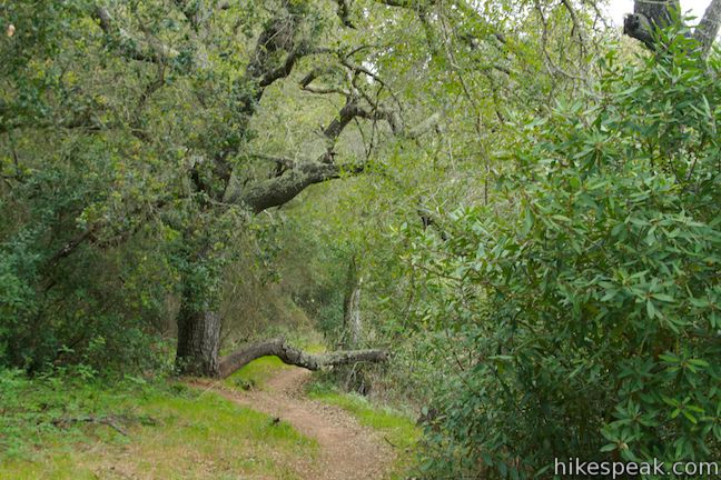
Turn left and hike southeast along Meadows Trail. The single track follows the northern border of the pleasant meadow on Nicholas Flat. The grassy pasture is circled by a ring of short, round, oak-covered mountaintops that give the area the feeling of a self-enclosed wilderness. Hike a quarter mile down Meadows Trail to a junction with Nicholas Flat Trail. Nicholas Flat Trail heads to the right down to a trailhead at the main entrance to Leo Carrillo State Park. This trail can be used as an alternate route to Nicholas Flat.
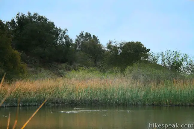
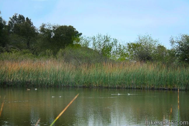
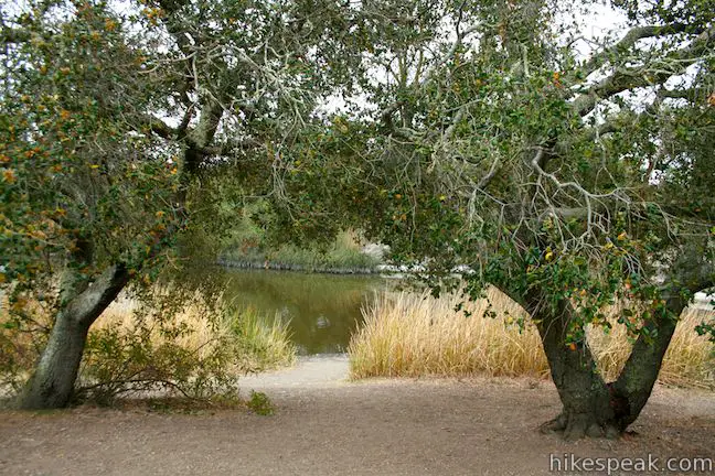
Pass Nicholas Flat Trail and continue straight for a hundred feet to a second junction. This is the beginning of one of the possible loops on Nicholas Flat (and the one described here). Pond Trail, the most direct route to Nicholas Pond breaks off to the right, but for now continue straight on Meadows Trail, which swings to the left before continuing east through a lovely oak grove. After 0.3 miles you will come to a T-junction with a dirt section of Decker School Road. Turn right, bordering a creek that flows into Nicholas Pond, and hike the last 0.2 miles south to the old cattle pond. Watch ducks floating lazily on the reed-lined pond, which is framed by a wall of boulders and oaks on the south side. Walk west around the pond to a welcoming pair of shade-providing oaks cozying up to the bank of Nicholas Pond. This is a perfect place to take a break after 3.5 miles of hiking.
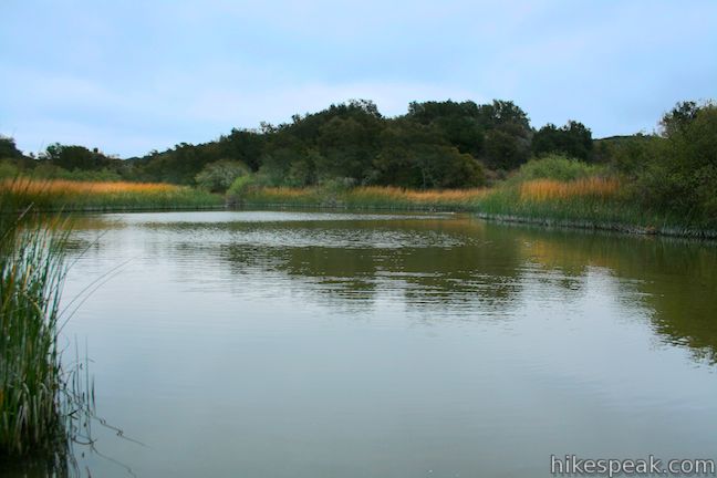
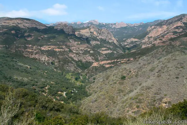
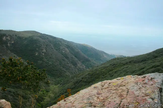
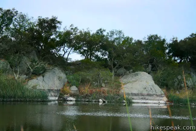
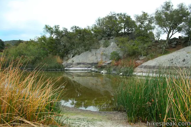
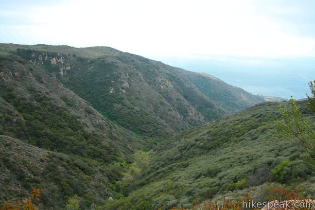
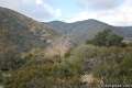
Continuing past the couplet of oaks, you will find a path that goes farther around the pond and out along the boulder-covered ridge on the south shore. Watch out for poison oak (which is abundant) if you venture out across the boulders. The reward for the risk is a dramatic view south down Nicholas Canyon, which rapidly drops 1,400 feet to the Pacific Ocean.
Return to the pair of oaks by Nicholas Pond where you will find the unmarked Pond Trail heading northwest away from the pond. Hike this way to complete the loop. The single track passes through charming grasses and oaks for 0.3 miles, bringing you back to the junction with Meadows Trail next to the junction with Nicholas Flat Trail. Turn left and take Meadows Trail back along the edge of the big field at the high end of Nicholas Flat. Turn right up the trail to Malibu Springs Trail and leave Nicholas Flat the way you arrived, completing this challenging and rewarding 7-mile venture.
There is a 1,425-foot climb to the top of Malibu Springs Trail, followed by a 425-foot descent to Nicholas Pond. On the way back, you will climb 425 feet before the long 1,425-foot descent. Malibu Springs Trail is very overgrown in areas so long pants are recommended. Dogs and bikes are not allowed on this hike. No fee or permit is required to hike Malibu Springs Trail to Nicholas Flat, so get out and enjoy!
Directions to the Trailhead
- Take PCH to the west side of Malibu and turn inland up Mulholland Highway.
- The intersection is just west of the entrance to Leo Carrillo State Park, 1.7 miles east of Yerba Buena Road, and 8.3 miles west of Kanan Dume Road.
- Drive 3.25 miles up Mulholland Highway and park alongside the road at the start of Malibu Springs Trail, which is under pronounced, but located on the right (east) side of the road.
Trailhead Location
Trailhead address: Mulholland Highway, Malibu, CA 90265
Trailhead coordinates: 34.083743, -118.918329 (34° 05′ 01.47″N 118° 55′ 05.98″W)
View Santa Monica Mountains in a larger map
Or view a regional map of surrounding Los Angeles trails and campgrounds.


 | Nicholas Flat Trail - Willow Creek Trail Loop This 2.05-mile loop in Leo Carrillo State Park wraps around a coastal ridge and tops out at an ocean vista with broad views. |
 | Nicholas Flat via Nicholas Flat Trail This scenic 7 to 7.6-mile hike ventures from the coast in Leo Carrillo State Park up into the mountains to a grassy flat with a small pond. |
 | Arroyo Sequit This 2.05-mile loop winds around the upper reaches of a canyon carved by the East Fork of Arroyo Sequit and has grand views of the Santa Monica Mountains. |
 | Charmlee Wilderness Park This 3.25-mile loop is one of several possible hikes in this bluff-top park with ocean views over Malibu. |
 | Zuma Canyon This 2.8-mile hike leaves a coastal Malibu neighborhood to explore rustic Zuma Canyon. |
 | Sandstone Peak This 6.25-mile loop summits the tallest peak in the Santa Monica Mountains. |
 | The Grotto This 3-mile out and back hike visits a remote grotto in the Santa Monica Mountains National Recreation Area. |
 | More trails in the Santa Monica Mountains Explore other destinations in the range. |
 | Leo Carrillo State Park Campground This coastal Malibu campground offers 135 sites with easy beach access and nearby trails. |
 | More campgrounds around LA Check out a few other places to camp in Los Angeles County. |
Common Questions about Nicholas Flat via Malibu Springs Trail in the Santa Monica Mountains
- Is the trail open?
- Yes. You should expect to find that Malibu Springs Trail to Nicholas Flat is open. There are no recent reports of trail closures. If you discover that the trail is closed, please help your fellow hikers by reporting a closure.
- Is this trail free to access?
- Yes, Malibu Springs Trail to Nicholas Flat is free to access. No entrance fee, pass, or permit is required. If you discover that access rules have changed, please provide feedback on your experience.
- How much time does this hike take?
- It takes approximately 3 hours 45 minutes to hike Malibu Springs Trail to Nicholas Flat. Individual hiking times vary. Add extra time for breaks and taking in the views.
- How long is this hike?
- The hike to Malibu Springs Trail to Nicholas Flat is a 7 mile lollipop loop with 1425 feet of elevation change.
- Are dogs allowed on this trail?
- No, dogs are likely not allowed on Malibu Springs Trail to Nicholas Flat. The trail is primarily open to hikers.
- Are there ocean views on this hike?
- Yes, Malibu Springs Trail to Nicholas Flat offers views of the ocean.
- Is this a good hike for wildflowers?
- Yes, Malibu Springs Trail to Nicholas Flat is known for its seasonal wildflower displays.
- What mountain range is this trail in?
- Malibu Springs Trail to Nicholas Flat is located in the Santa Monica Mountains.
- Where is the trailhead located?
- The trailhead for Malibu Springs Trail to Nicholas Flat is located in Malibu, CA.
Trailhead Address:
Mulholland Highway
Malibu, CA 90265
Trailhead Coordinates:
34.083743, -118.918329 - What are the driving directions to the start of the hike?
To get to the trailhead: Take PCH to the west side of Malibu and turn inland up Mulholland Highway. The intersection is just west of the entrance to Leo Carrillo State Park, 1.7 miles east of Yerba Buena Road, and 8.3 miles west of Kanan Dume Road. Drive 3.25 miles up Mulholland Highway and park alongside the road at the start of Malibu Springs Trail, which is under pronounced, but located on the right (east) side of the road.
View custom Google Maps directions from your current location.
- Are there other trails near Malibu Springs Trail to Nicholas Flat?
- Yes, you can find other nearby hikes using the Hikespeak Hike Finder Map.

Very nice trail that my boyfriend and I went on today 3/26/13. Great diversity of landscape… unfortunately pond was almost entirely dried up and we were constantly picking ticks off one another. Make sure you wear long sleeve and pants.
Ticks, ticks, ticks! Everywhere! My girlfriend and I were picking them off ourselves constantly. A number of ticks in Malibu Creek recently tested positive for Lyme Disease, so be aware: http://www.malibutimes.com/news/article_0662db72-a3df-11e2-aba1-001a4bcf887a.html
The trail is overgrown (hence ticks). Really a shame, because this could be a great trail with some maintenance.
I can understand the complaints about ticks, as grasses and shrubs do encroach on the trail. However, I did a thorough check, and I picked up none. This hike is underrated. It’s an excellent single track, lots of varied vegetation, and the scenery is top notch. Footing on the trail is hard to beat. Mostly sand and silt, even some fallen leaf cushioning in spots. Very little rock and stones.
I was there on a perfect day for a hike, started just before 9:00 and finished by 11:00. Saw no one else there. This hike should get more traffic than it does.
Perhaps the difficulty discourages people. It is a steady grind for the first two miles, with several level (relatively) stretches, but they are short. The description suggesting that the trail is hard to follow in spots due to overgrowth is way overstated, although it may be that maintenance since has made it clearer. There was a 0.1 mile stretch that had been recently bushwhacked to widen it.
Once you crest at the high point, the trail descends toward Nicholas Flat before heading up a steep trail to a point that had magnificent views of the ocean and Channel Islands. It reminds me a lot of the Boney Mountain hike, which gets to a high point, with a valley in between you and the endpoint, and down and up (both directions) that adds to the difficulty. At the point I stopped and turned around there was a Geodetic Survey marker dated 1927.
If you are up for a challenge and enjoy being in the middle of nowhere, do this hike.
Long, tough slog to the top. As Dan said, the trail is easy to follow, but overgrown in spots with thistles, etc. Long pants may have saved the flogging that my shins took. Got a late start, and labored under a hot sun. Very little shade, and no breeze. Nice views back into the canyon, and the pacific was a relief when we finally made it to the top.
this trail is VERY overgrown. lots of thistles and spiky plants, so jeans and boots are recommended. I didn’t see a pond but there was a heavy fog that felt like mist from the ocean. Very rewarding for a hike with little shade.
Wife and I did this hike on Friday 1/26/18. We started out on the Malibu Springs Trail head. It started out overgrown and with a number of felled trees we were able to cut through. Once you get through the jungle, this hike was awesome. There is water in the pond. When we got back, we found 2 ticks on us. The next morning I realized one tick found my warm belly! With just a small amount of maintenance this would bee an excellent place to start out, maybe the boy scouts could do a project.
Is there natural spring in the area?