Las Flores Motorway to Mount Thom
in the Vedugo Mountains
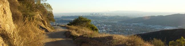
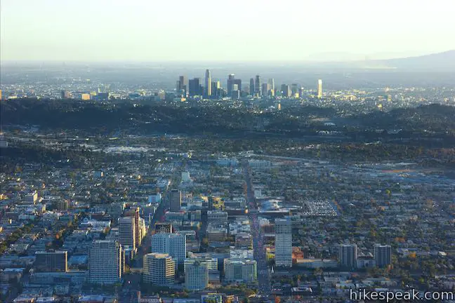
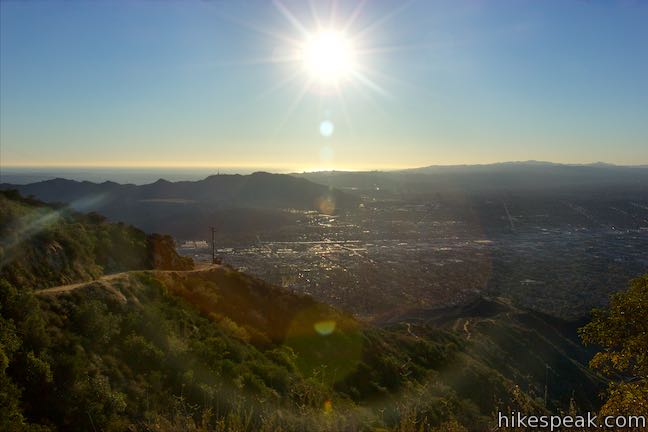
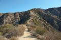
Las Flores Motorway weaves its way up ridges on the southeast end of the Verdugo Mountains in Glendale. The wide dirt trail blooms when it reaches Mount Thom, a 2,460-foot summit with panoramic views over surrounding city-flanked mountain ranges and the skyline of downtown Los Angeles. Las Flores Motorway gains 1,220 feet in 2.5 miles to join Beaudry Motorway just below the summit. Strut around the fenced-in mountaintop of Mount Thom for a 5.3-mile round trip hike or venture farther on Beaudry Motorway.
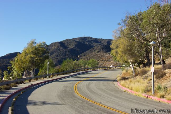
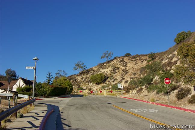
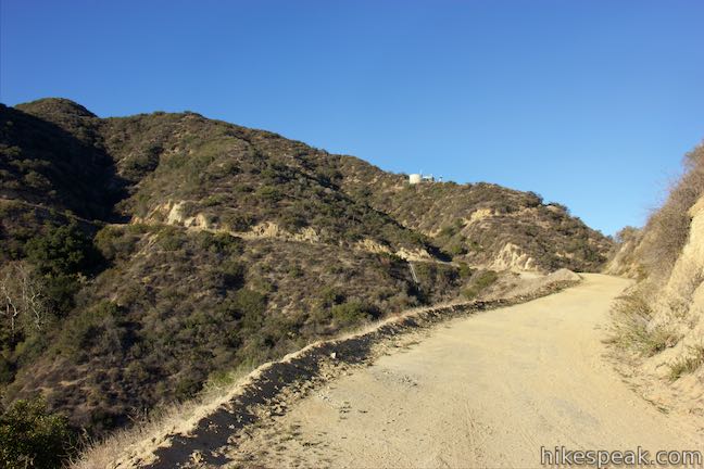
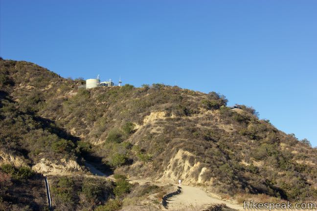
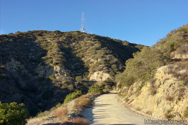
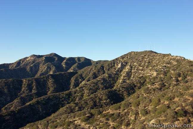
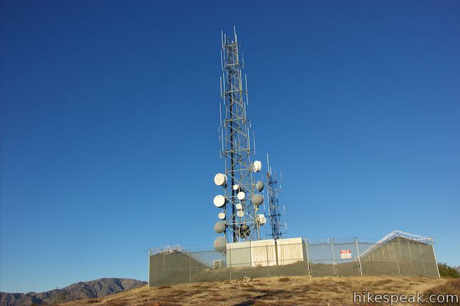
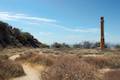
This hike actually begins before the trail does. Roadside parking isn’t allowed at the trailhead. Unless you are dropped off, you’ll need to park about 0.15 miles from the gate at the bottom of Las Flores Motorway, effectively extending the hike to Mount Thom to 5.6 miles round trip with 1,310 feet of elevation change. Park at the intersection of Balmoral Drive and Sunshine Drive in a neighborhood that drapes the lower slopes of the Verdugo Mountains. Walk up the sidewalk along Sunrise Drive, which curves to the right and meets the start of Las Flores Motorway. Cross the gate and begin up the trail, which is paved for the first 320 yards. Straight ahead, communication towers stand out above a high point in the Verdugo Mountains. This is Mount Thom, your destination.
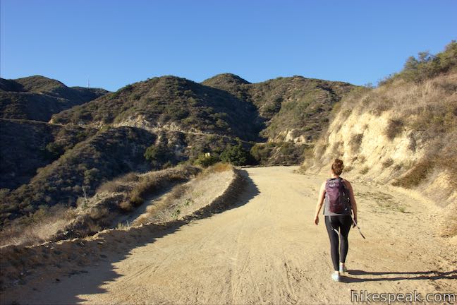
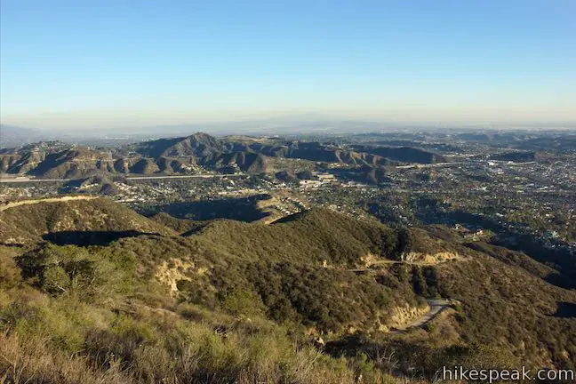
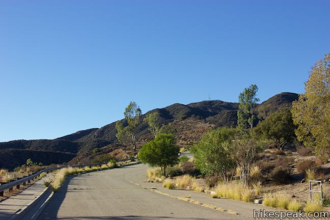
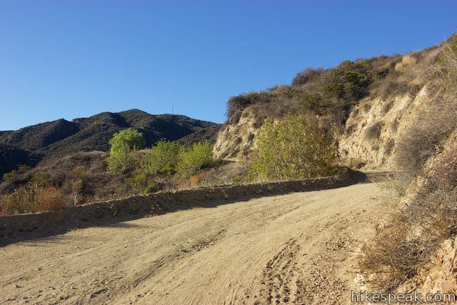
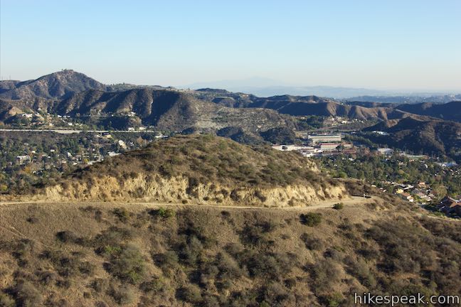
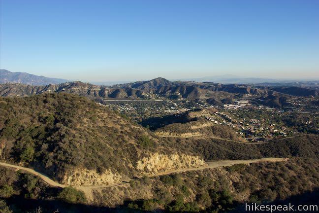
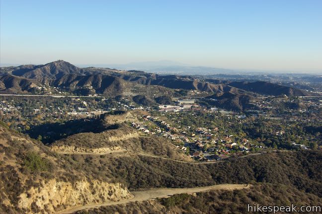
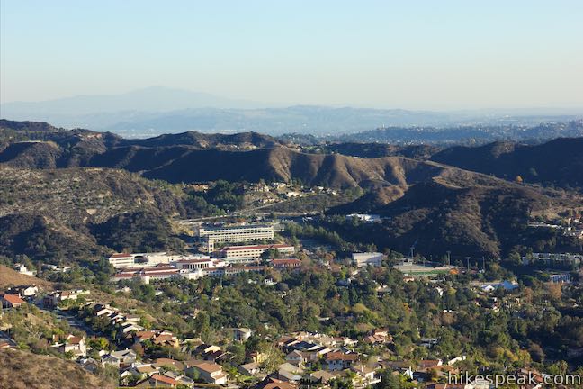
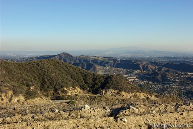
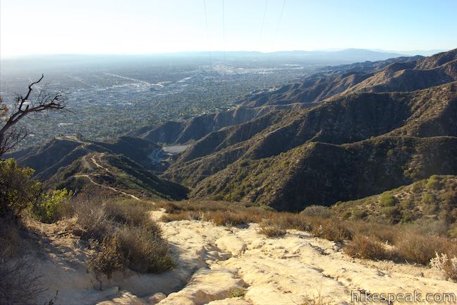
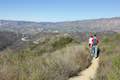
When the pavement ends, continue west up the wide paved trail, gradually ascending into this small, mostly chaparral-covered mountain range. At the half mile mark, a spur breaks off to the left and heads out along the spine of a side ridge. Continue straight up the main trail. Las Flores Motorway curves to the right and crosses a saddle in the ridgeline. Just past that, stick with the trail as it curves sharply to the left, passing a steep spur that ascends to a holding tank. The trail progresses west toward a viewpoint on the left side of the trail with views over the cities to the south. Dead Horse Canyon drops below this part of the trail as you look back over the bottom of Las Flores Motorway toward the San Rafael Hills and the neighborhoods surrounding Glendale Community College.
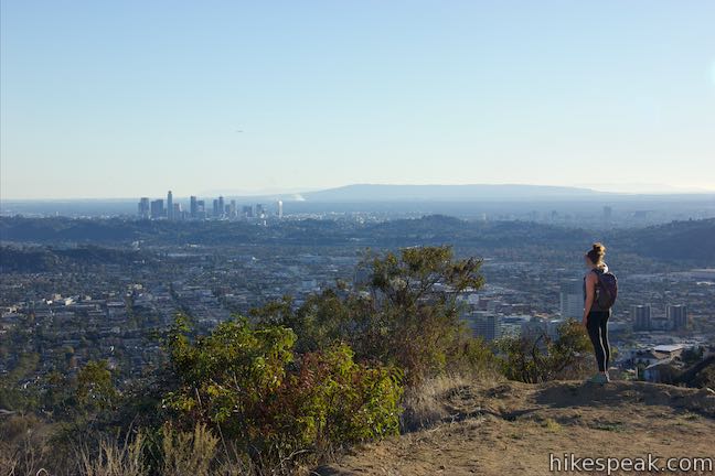
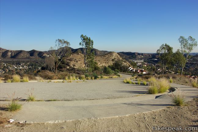
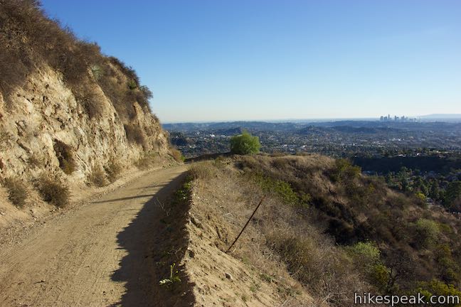
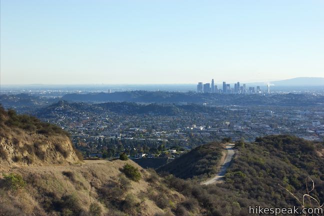
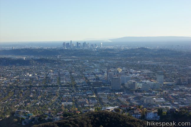
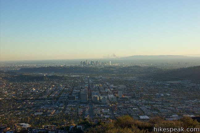
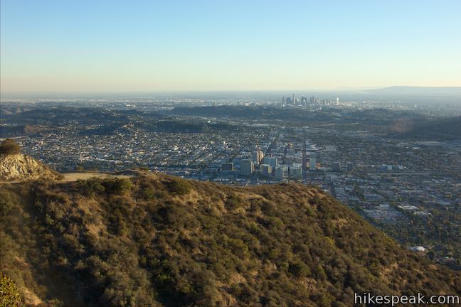
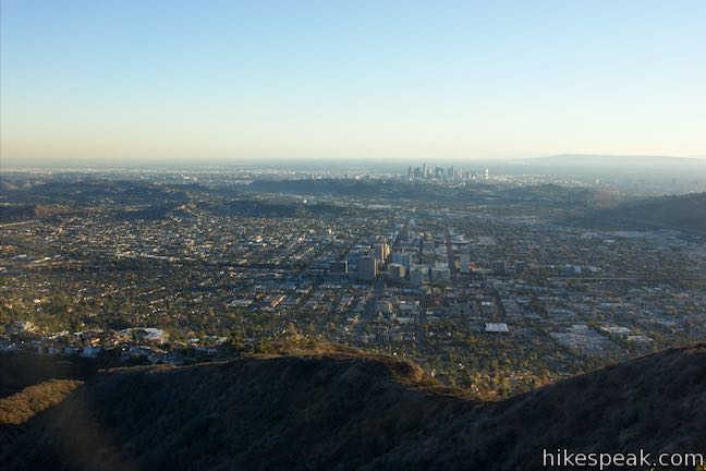
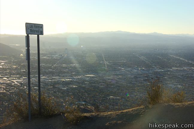
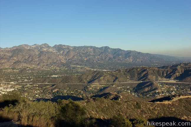
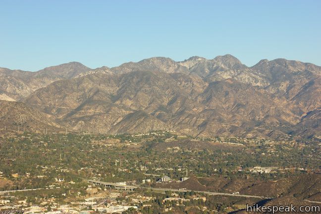
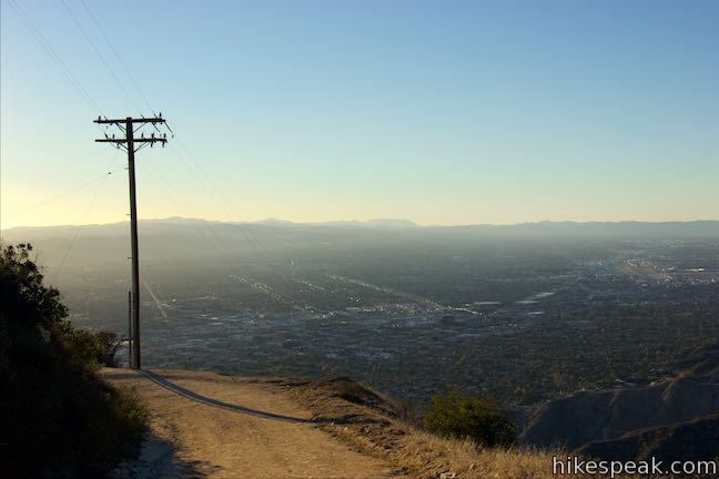
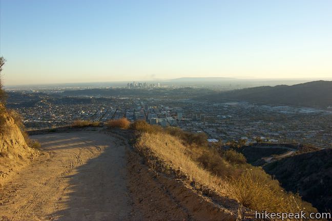
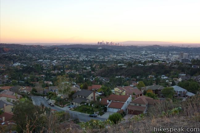
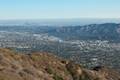
After 0.9 miles on Las Flores Motorway, step out to a landing on the left and enjoy a sweeping vista. Downtown Glendale is just beyond the foot of the mountain. Farther south, the skyline of downtown Los Angeles rises above the surrounding communities. The east end of the Santa Monica Mountains preserved by Griffith Park is to the southwest. On clear days, the ocean will be visible beyond that.
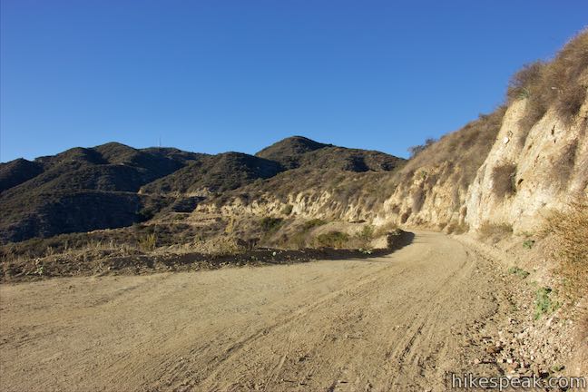
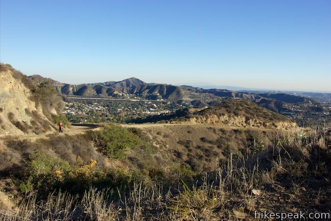
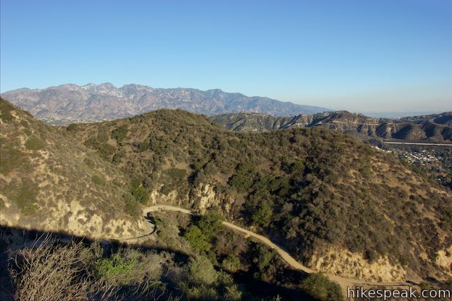
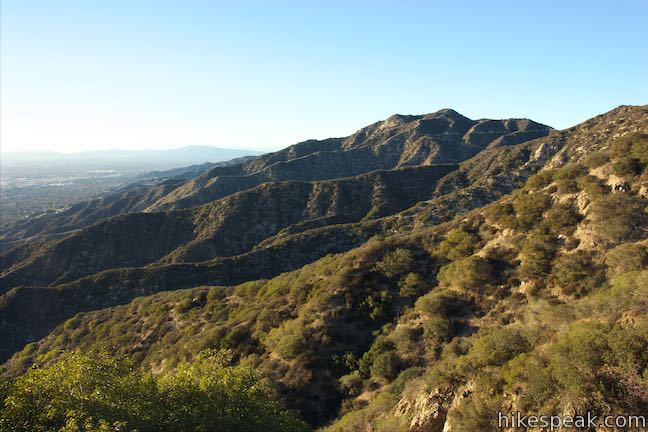
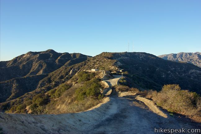
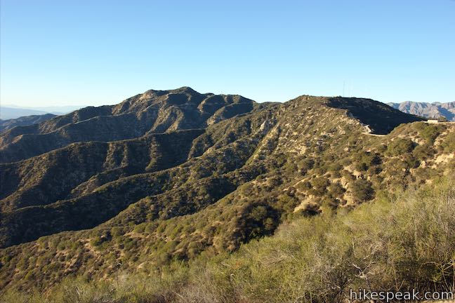
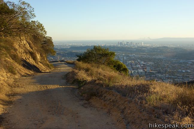
Continue up Las Flores Motorway, which takes a winding course across the south side of the rippled ridges on the eastern flank of Mount Thom. Each bend offers slightly different views looking out from the mountain. The end of the trail wraps all the way around the top of Mount Thom, finally approaching the summit from the northwest.
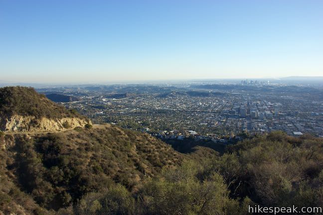
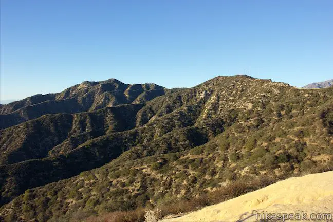
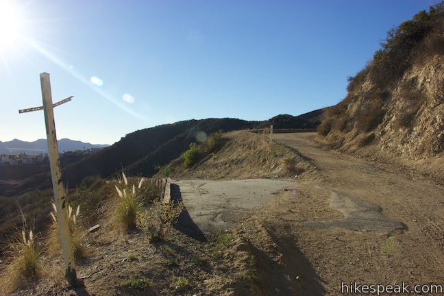
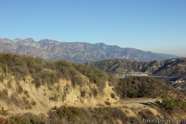
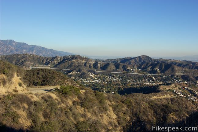
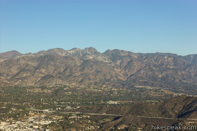
At 0.2 miles below the top of the trail, pass a firebreak plunging down a ridgeline to the left with a rough trail that descends to Brand Canyon. As you complete Las Flores Motorway, enjoy new views over the heart of the small mountain range. Across Pomeroy Canyon in front of you, Tongva Peak rises to 2,656 feet. Beyond that, Verdugo Mountain rises to 3,126 feet at the highest point in the range.
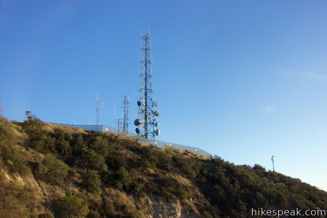
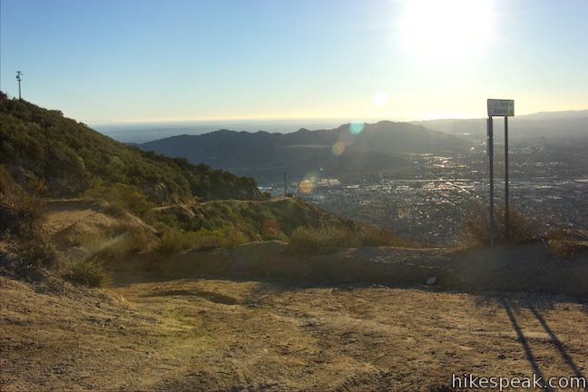
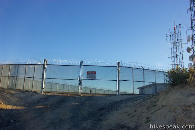
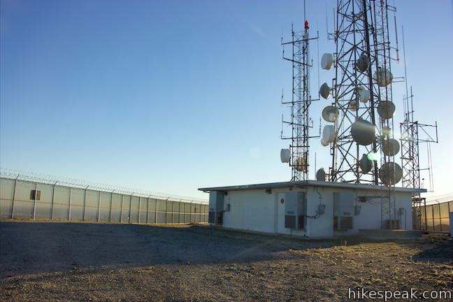
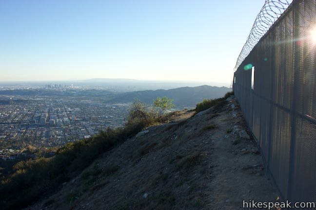
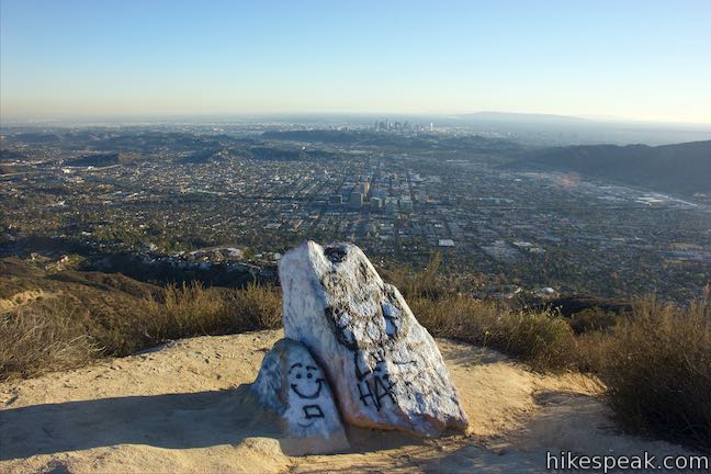
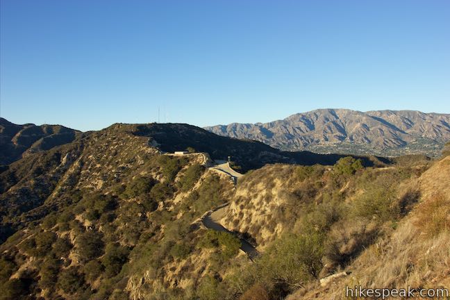
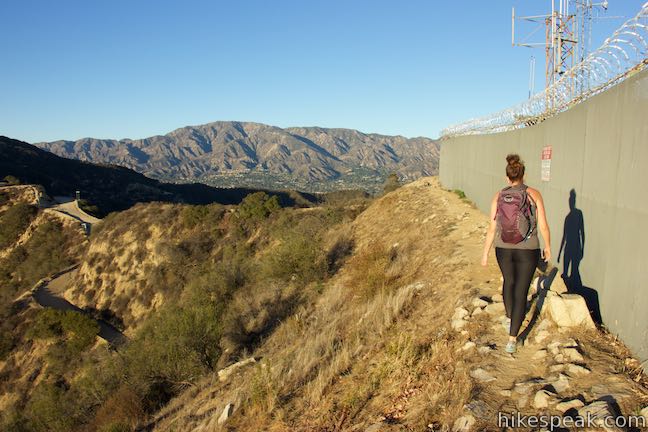
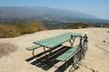
Las Flores Motorway comes to an end after 2.5 miles, hitting a T-junction with another wide dirt trail, Beaudry Motorway. This trail can be used on another hike, Beaudry Motorway Loop, and you could turn left to hike 0.6 miles along this trail to the top of Tongva Peak. For Mount Thom, turn right and make an immediate right off Beaudry Motorway toward the summit. A short dirt road rises to the fenced-in area on the flattened mountaintop. Communication towers rise from inside the fence. Take a path along either the east or west side of the fenced-in area to reach a viewpoint on the south side of the summit.
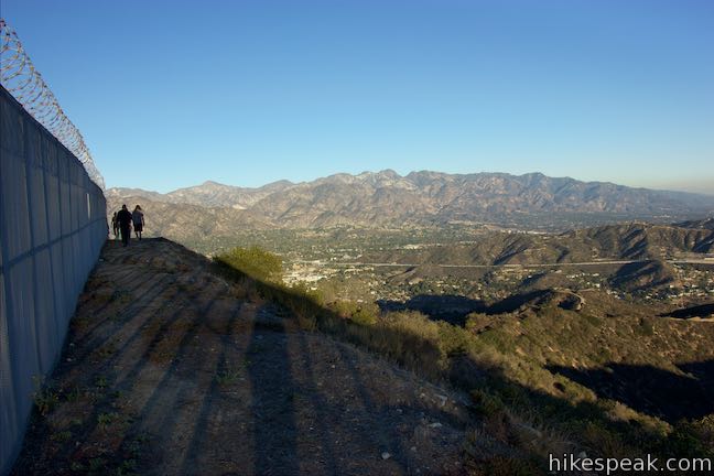
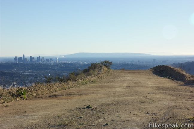
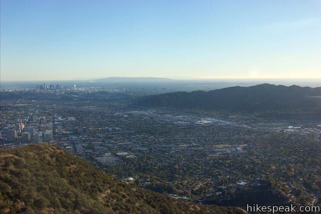
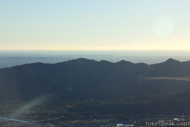
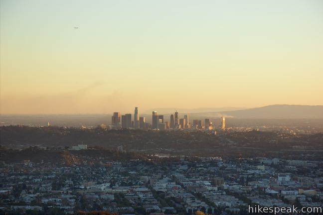
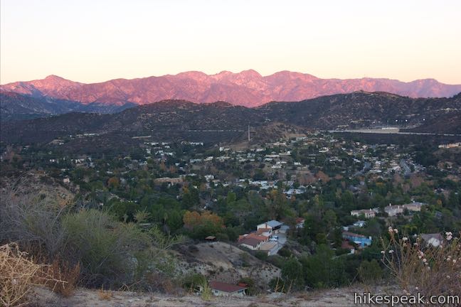
Gaze southwest over Griffith Park and the Santa Monica Mountains toward the Pacific Ocean. Downtown Glendale is below the mountains to the south, backed by the skyline of downtown Los Angeles. The San Rafael Hills pop up the east. Highest of all, the San Gabriel Mountains rise to the northeast. The views from Mount Thom are sweeping and the summit supplies a satisfying destination.
When you are ready to leave, walk around the summit and back to Las Flores Motorway. Turn left to return the way you came. Dogs and mountain bikes are welcome on Las Flores Motorway and other trails in the Verdugo Mountains. Excluding the warm-up on Sunshine Drive, Las Flores Motorway provides a 5.3-mile round trip hike with 1,260 feet of elevation change. No permit is required for this hike and there is no cost to park near the trailhead, so get out and enjoy!
Directions to the Trailhead
- Take CA 134 to the Glendale Avenue Exit (exit 8), which is one mile west of CA 2 and four miles east of Intestate 5.
- Drive northeast on Glendale Avenue.
- After half a mile, it becomes Vedugo Road.
- Go another half mile and bear left at a split onto Cañada Boulevard.
- In another quarter mile, turn left up Sunshine Drive.
- Come to the nearest roadside parking after 0.4 miles, which will be on the right across from an intersection with Balmoral Drive.
- The trailhead is 0.15 miles ahead.
Trailhead Location
Trailhead address: Sunshine Drive, Glendale, CA 91208
Trailhead coordinates: 34.1766, -118.2385 (34° 10′ 35.76″N 118° 14′ 18.60″W)
View Verdugo Mountains in a larger map
Or view a regional map of surrounding Los Angeles trails and campgrounds.
 | Beaudry Motorway Loop to Tongva Peak This 6.15-mile loop climbs 1,475 feet to the summit of Tongva Peak on the east end of the Verdugo Mountains. |
 | Skyline Motorway This 6.1 to 6.6-mile hike (or more) ascends an abandoned fire road in the Verdugo Mountains with expansive views that include the skyline of downtown Los Angeles. |
 | Vital Link Trail This hike of 3 miles round trip or more ascends 1,275 feet (or more) up a ridge on the side of the Verdugo Mountains for a steep hike with satisfying views. |
 | Old Youth Camp Loop in Stough Canyon This 2.6-mile loop passes the ruins of an abandoned camp in the Verdugo Mountains with views across the San Fernando Valley. |
 | Hostetter Fire Road to Verdugo Peak This 7.5-mile round trip hike on the north side of the Verdugo Mountains ascends from La Tuna Canyon to the highest summit in the range. |
 | La Tuna Canyon Trail This 4.5-mile round trip hike ascends a ridge and a pair of canyons in La Tuna Canyon Park on the northwest side of the Verdugo Mountains. |
 | Cherry Canyon Park This 2.5-mile hike in the San Rafael Hills rises to panoramic views at Ultimate Destination Vista Point and a summit with an old lookout tower. |
 | More trails in Los Angeles Explore other destinations around Los Angeles. |
Common Questions about Las Flores Motorway to Mount Thom in the Vedugo Mountains
- Is the trail open?
- Yes. You should expect to find that Las Flores Motorway is open. There are no recent reports of trail closures. If you discover that the trail is closed, please help your fellow hikers by reporting a closure.
- Is this trail free to access?
- Yes, Las Flores Motorway is free to access. No entrance fee, pass, or permit is required. If you discover that access rules have changed, please provide feedback on your experience.
- How much time does this hike take?
- It takes approximately 3 hours to hike Las Flores Motorway. Individual hiking times vary. Add extra time for breaks and taking in the views.
- How long is this hike?
- The hike to Las Flores Motorway is a 5.3 mile out and back with 1260 feet of elevation change.
- Are dogs allowed on this trail?
- Yes, dogs are allowed on Las Flores Motorway. The trail is open to hikers, dogs, bikes.
- Does this trail go to a summit?
- Yes, Las Flores Motorway reaches a summit with panoramic views.
- What mountain range is this trail in?
- Las Flores Motorway is located in the Verdugo Mountains.
- Where is the trailhead located?
- The trailhead for Las Flores Motorway is located in Glendale, CA.
Trailhead Address:
Sunshine Drive
Glendale, CA 91208
Trailhead Coordinates:
34.1766, -118.2385 - What are the driving directions to the start of the hike?
To get to the trailhead: Take CA 134 to the Glendale Avenue Exit (exit 8), which is one mile west of CA 2 and four miles east of Intestate 5. Drive northeast on Glendale Avenue. After half a mile, it becomes Vedugo Road. Go another half mile and bear left at a split onto Cañada Boulevard. In another quarter mile, turn left up Sunshine Drive. Come to the nearest roadside parking after 0.4 miles, which will be on the right across from an intersection with Balmoral Drive. The trailhead is 0.15 miles ahead.
View custom Google Maps directions from your current location.
- Are there other trails near Las Flores Motorway?
- Yes, you can find other nearby hikes using the Hikespeak Hike Finder Map.

I really appreciate this website! You have done such a great job! I used it for the first time today because I was looking for a fireroad to ride by bike on, went with Mesa Peak via Mesa Peak Motorway. Had so much fun riding that today! Your directions were so clear. The information about each hike is very thorough as well. I’m already looking for my next adventure. Thank you thank you thank you!
Thanks very much. Enjoy your next outing!
I’ve loved this site having used it this past decade. This hike was one hell of a fat burner as I haven’t hiked this whole pandemic. It was a foggy June morning so I didn’t get a view but it felt like being in the clouds. There are orange trail markers keeping you on the trail as well so it helped even though I had already thoroughly studied the trail map. Trail started getting busy around 0900 on a Sunday morning by that I mean I saw a person every 5 minutes as well on my hike down going up at 0600 was fairly quiet. Thanks for the trail write up.