Faery Falls and Ney Springs
in Mount Shasta

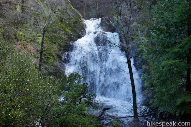
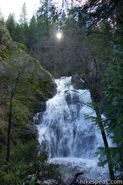
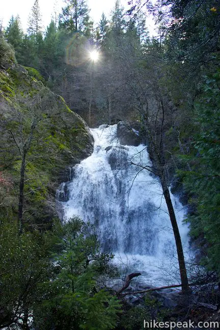
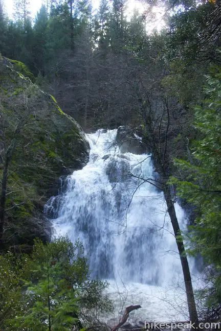
Want to visit historic ruins and a waterfall you’ll be wild about, all on a hike that’s under 1.5 miles round trip? Set out for Ney Springs Creek near Mount Shasta City, where you can hike 0.7-miles (one way) up an evergreen canyon to Faery Falls, which plunges about 50 feet. Along the way to this beautiful attraction, you’ll pass what remains of Ney Springs Resort, a former destination for its silica springs that has since been overtaken by nature.
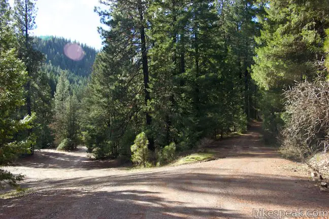
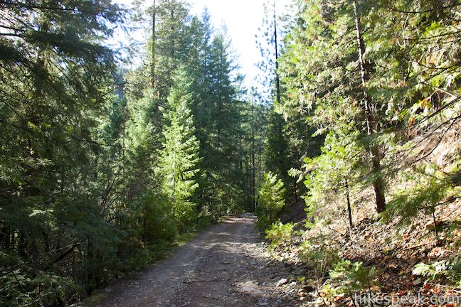
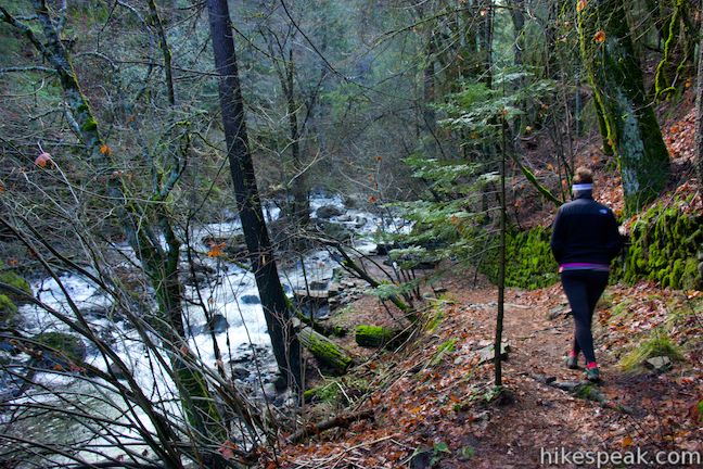
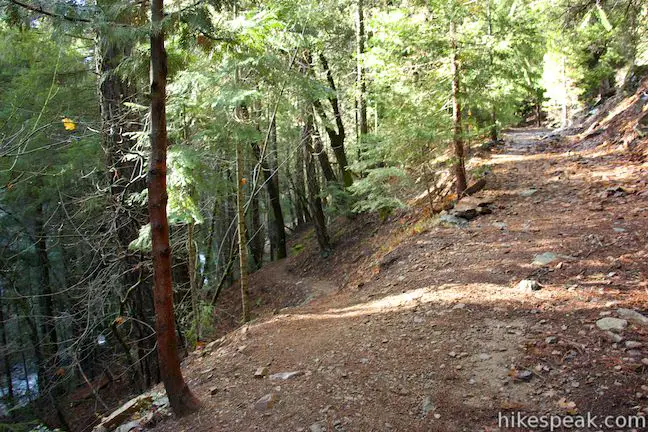
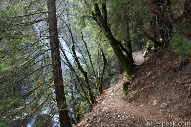
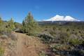
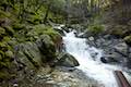
The hike ventures up Ney Springs Canyon, a V-shaped cut into the mountains south of Lake Siskiyou, southeast of Mount Shasta City. The hike follows an old dirt road along the side of the canyon above Ney Springs Creek.
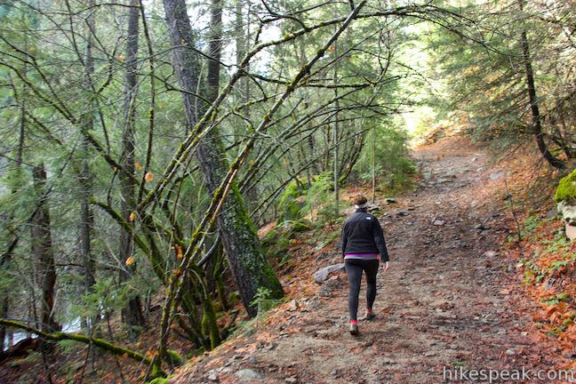
You can actually drive a high clearance vehicle up the first 0.4 miles of this rough road if you prefer an even shorter hike. Otherwise, walk straight up this one-lane dirt road between tall pines. To your left, the side of the canyon drops down to Ney Springs Creek. You’ll get a closer look at the creek as the hike continues.
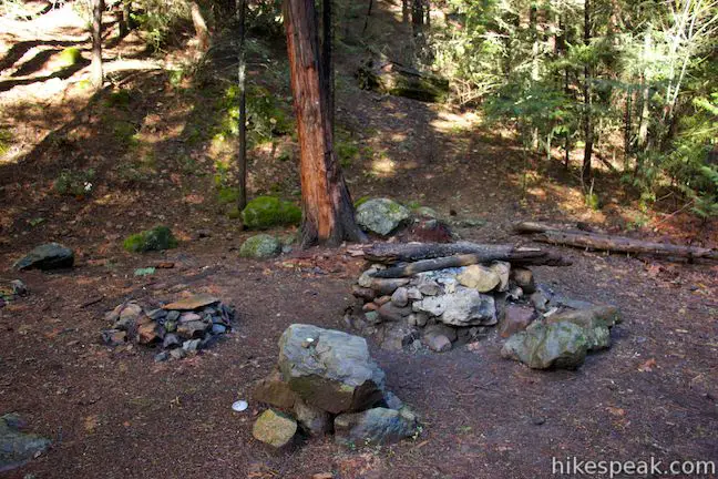
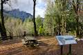
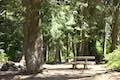
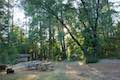
At 0.4 miles, reach a wide spot in the road where another dirt road ascends to the right. Also on the right there is a clearing where it appears you could camp, complete with a pair of fire rings. Continue straight up the road, which narrows temporarily between some younger pines before widening back out.
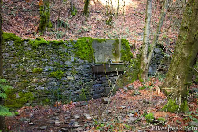
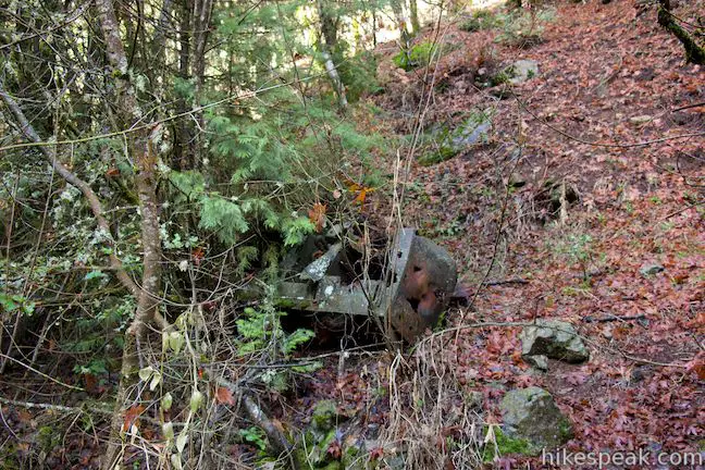
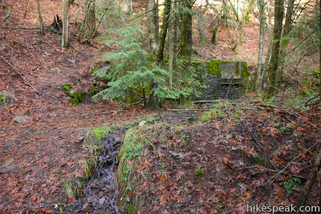
You will soon arrive at the site of the old Ney Springs Resort. On the right, there will be a bit of rusting machinery and then you will see and old stone retaining wall and a spigot that still flows. According to the Mount Shasta Trail Association:
Ney Spring was discovered by John Ney in 1887. It became a destination health resort based on the mineral waters there. The water has a pH of 11.6 and a silica content of 4,000 parts per million, the highest values known to occur in natural ground waters.
Ney Springs Resort had accommodations for 50 guests and several outbuildings, however little of the resort remains. On the left side of the road, a trail descends 150 feet to Ney Springs Creek. There are more stone ruins on the landing by the water.
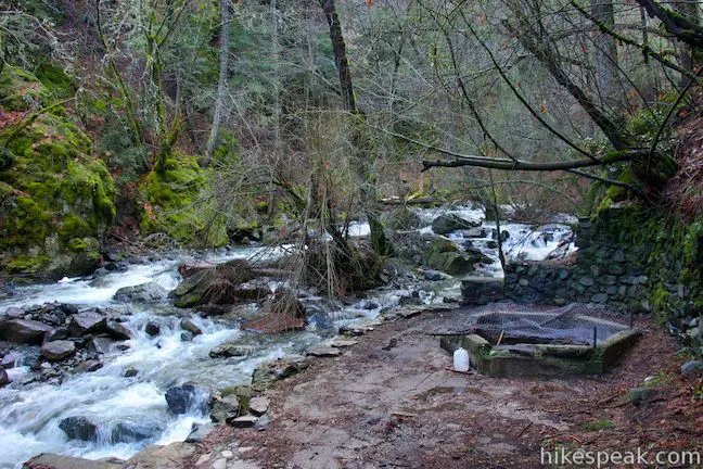
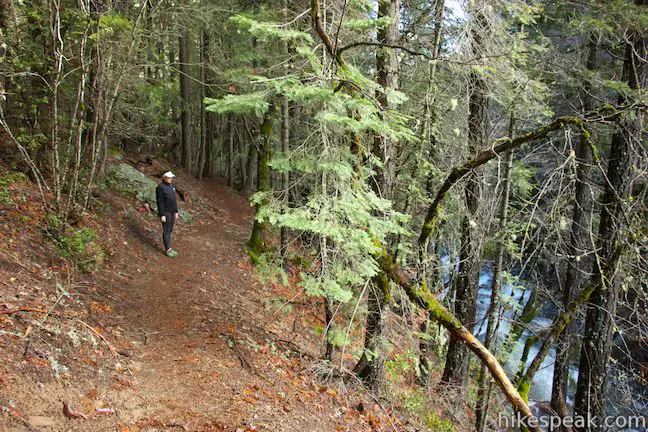
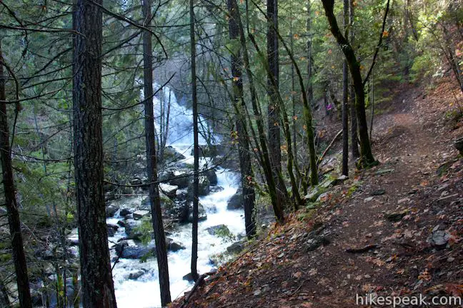
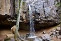
Reach Faery Falls by continuing up the road past the ruins of Ney Springs Resort. The road gets a bit steeper, but press on another 0.15 miles (0.63 miles from the start) until you see an unmarked trail breaking off to the left. Take it to reach Faery Falls.
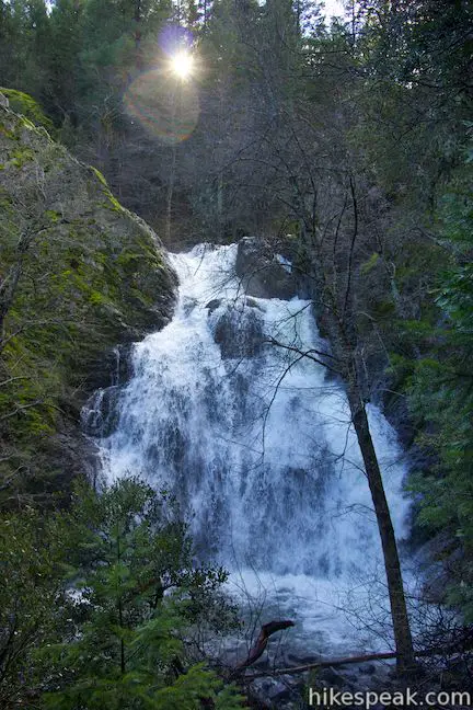
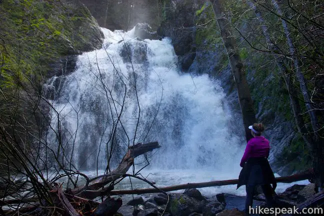
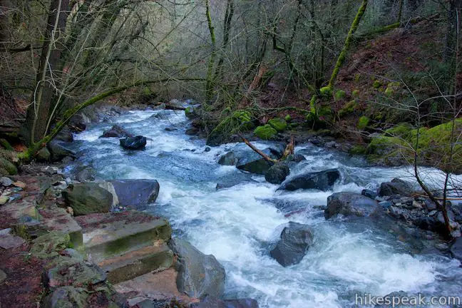
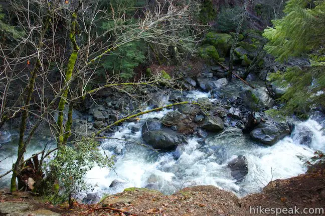
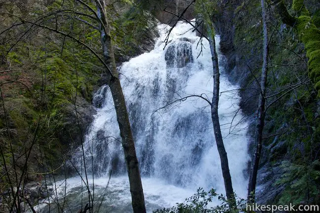
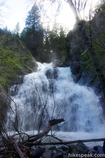
The narrow trail skirts along the side of the canyon above the creek. The water rises toward the trail as you get closer to the waterfall, which appears through the trees. At the end of the trail, enjoy a head-on view of the waterfall, which is straight across the canyon, thanks to a change in the stream’s direction. Faery Falls drops around 50 feet down the canyon wall. The waterfall fans out as it tumbles, growing widest at its base below two distinct drops. While the waterfall can narrow to more of a cord during dry summer months, you’ll find a thundering flurry of water during the wet season.
With just a bit of effort, you can put a little loop onto the end of the trail and make your way down to the rocky edge of the creek across from the waterfall. Expect to be sprayed with mist if you stand here while the waterfall is really gushing.
When you’ve had your fill of Faery Falls, hike back up the road and return downhill through Ney Springs Resort the way you came, completing the 1.4-mile round trip hike with 250 feet of elevation gain. No permit is required to hike this trail and access is free. Dogs and bikes appear to be allowed as well.
Directions to the Trailhead
- Take Interstate 5 to the Central Mount Shasta Exit (738).
- At the end of the offramp turn west, away from the city, on Lake Street, which becomes Hatchery Lane.
- Turn left at an intersection with Old Stage Road.
- Drive a quarter mile south and turn right at the split onto Barr Road.
- Drive 2.3 miles and, after crossing the Box Canyon Dam, turn left up Castle Lake Road.
- After just a tenth of a mile, make the first left onto Ney Springs Road, which is unpaved.
- Drive 1.4 miles to a split in the road.
- The road on the right leads to the resort and falls.
- Park alongside the bottom of this road or leave your vehicle in a larger turnout along then main branch of Ney Springs Road just below the intersection.
- The start of the hike is unmarked.
Trailhead address: Ney Springs Road, Mount Shasta, CA 96067
Trailhead coordinates: 41.265953, -122.32439 (41° 15′ 57.43″N 122° 19′ 27.80″W)
You may also view a regional map of surrounding Northern California trails and campgrounds.


 | Lake Siskiyou Trail (South Shore Loop) This short and easy lakefront loop offers great views across Lake Siskiyou toward Mount Shasta and the surrounding evergreen wilderness. |
 | Spring Hill This 2.9-mile hike hits a short summit near Mount Shasta with excellent views of Mount Shasta, Black Butte, and the surroundings. |
 | Haystack Trail This 2.55-mile lollipop loop hike tours the top of a volcanic dome with excellent views of Mount Shasta. |
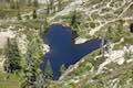 | Heart Lake and Little Castle Lake This 2 to 3-mile hike visits lakes in a beautiful area of Shasta-Trinity National Forest, including the charming-contoured waters of Heart Lake. |
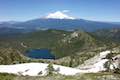 | Castle Peak and Heart Lake This approximately 3.2-mile hike ventures off trail above Heart Lake to a summit with extraordinary views of the Castle Crags and Mount Shasta. |
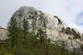 | Crags Trail to Castle Dome This 5.6-mile round trip hike in Castle Crags State Park ascends 2,150-feet through a garden of granite crags to the base of Castle Dome. This hike can be extended to 6 miles round trip by taking a worthy side trail to Indian Springs. |
 | Root Creek Trail This 2.2-mile round trip hike in Castle Crags State Park takes a level and easy course to a tumbling creek in a mossy forest. |
 | Vista Point Trail This short hike reaches the principal viewpoint in Castle Crags State Park, which has a great perspective of granite peaks known as the Castle Crags, along with views of Mount Shasta and the surrounding wilderness. |
 | Hedge Creek Falls Trail This short hike leads to a forest-wrapped waterfall, passing behind the falls to arrive at a Sacramento River Overlook. |
 | Bailey Cove Trail This easy 3.1-mile loop circles a hill-covered peninsula on the McCloud Arm of Shasta Lake, providing both lake views and shade. |
 | More hikes in Northern California Explore more trails in Northern California, including redwood grove and oceanfront parks along the North Coast. |
 | Castle Lake Campground This six-site campground in Castle Lake is shaded by conifers in Shasta-Trinity National Forest. |
 | Castle Crags State Park Campground There are 76 developed campsites within this state park that are nestled within a pine forest with access to nearby trails. |
 | Antlers Campground This well-shaded 59-site campground in Shasta-Trinity National Forest has level sites on a bluff next to Shasta Lake. |
Common Questions about Faery Falls and Ney Springs in Mount Shasta
- Is the trail open?
- Yes. You should expect to find that Ney Springs Creek To Faery Falls is open. There are no recent reports of trail closures. If you discover that the trail is closed, please help your fellow hikers by reporting a closure.
- Is this trail free to access?
- Yes, Ney Springs Creek To Faery Falls is free to access. No entrance fee, pass, or permit is required. If you discover that access rules have changed, please provide feedback on your experience.
- How much time does this hike take?
- It takes approximately 45 minutes to hike Ney Springs Creek To Faery Falls. Individual hiking times vary. Add extra time for breaks and taking in the views.
- How long is this hike?
- The hike to Ney Springs Creek To Faery Falls is a 1.4 mile out and back with 250 feet of elevation change.
- Are dogs allowed on this trail?
- Yes, dogs are allowed on Ney Springs Creek To Faery Falls. The trail is open to hikers, dogs, bikes.
- Is Ney Springs Creek To Faery Falls good for kids?
- Yes, this hike is likely suitable for children. It is relatively short (1.4 miles) with manageable elevation gain.
- Will I see a waterfall on this hike?
- Yes, Ney Springs Creek To Faery Falls features a waterfall.
- Where is the trailhead located?
- The trailhead for Ney Springs Creek To Faery Falls is located in Mount Shasta, CA.
Trailhead Address:
Ney Springs Road
Mount Shasta, CA 96067
Trailhead Coordinates:
41.265953, -122.32439 - What are the driving directions to the start of the hike?
- To get to the trailhead: Take Interstate 5 to the Central Mount Shasta Exit (738). At the end of the offramp turn west, away from the city, on Lake Street, which becomes Hatchery Lane. Turn left at an intersection with Old Stage Road. Drive a quarter mile south and turn right at the split onto Barr Road. Drive 2.3 miles and, after crossing the Box Canyon Dam, turn left up Castle Lake Road. After just a tenth of a mile, make the first left onto Ney Springs Road, which is unpaved. Drive 1.4 miles to a split in the road. The road on the right leads to the resort and falls. Park alongside the bottom of this road or leave your vehicle in a larger turnout along then main branch of Ney Springs Road just below the intersection. The start of the hike is unmarked.
View custom Google Maps directions from your current location. - Are there other trails near Ney Springs Creek To Faery Falls?
- Yes, you can find other nearby hikes using the Hikespeak Hike Finder Map.

Hi, what is the weather like at the end of December?
Faery Falls is a great hike year round. I’ve been there several times and it’s beautiful to see how the area changes with the seasons.
snow
Beware that access to the falls can be tricky if you’re not fit. The last portion of the path is narrow and you could easily misstep and fall down the hillside into the Rocky waters below. Well worth it if you can make the trek.
Yes, this almost happened to me— very scary!
Hi, I was wondering if anyone knows of a perfect spot near this waterfall to set up a nice proposal area with a picnic and all?
Are dogs allowed on this trail?
Yes
Lots of rattlesnakes so beware
Thanks for the heads up
The path down to the water needs some serious work, it is narrow and slippery so be very careful. Not reccomended for small children, it’s potentially dangerous getting down that narrow path.
[…] The hike is rather easy. There’s a parking lot nearby and then it’s a 45-minute hike (1.4 miles return) with only about 250 feet of elevation gain, making it a great choice for beginner hikers and families. It can be a bit tough to find the trailhead, which is unmarked, so read here for some details. […]
There are two roads going out of the parking area. You want the uphill road. This hike is getting very crowded. Yesterday there were 15 cars in the parking area. Waterfall and area around to see it are fairly small.
The pictures shown in this article are of the falls at very high flows. It normally looks much less impressive.