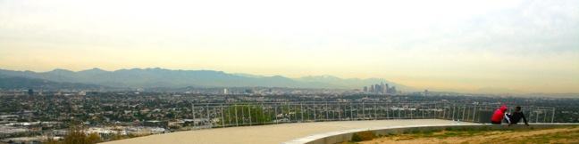
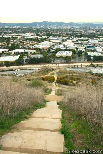
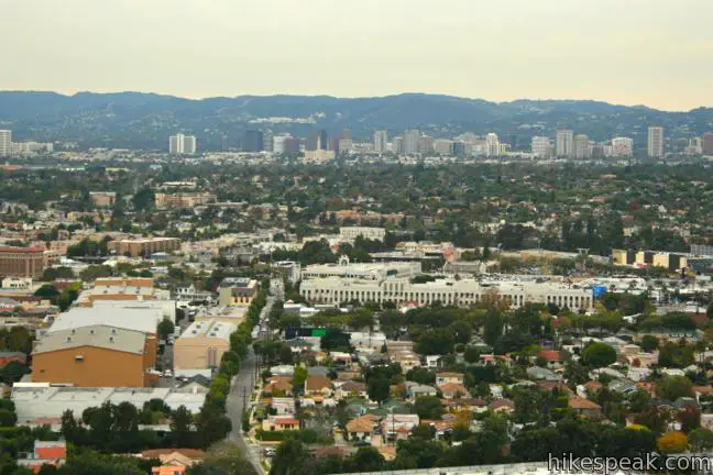
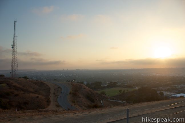
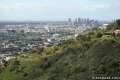
Baldwin Hills Scenic Overlook provides a grand view over LA from a steep hill south of Culver City. The unique perspective looks north over the Los Angeles Basin that extends from Santa Monica Bay to the west, across the Hollywood Hills toward downtown Los Angeles and the San Gabriel Mountains to the east.
At Baldwin Hills Scenic Overlook State Park you don’t choose between taking the elevator and taking the stairs. Here you decide between the stairs and a meandering dirt trail. You can also drive up to a parking lot near the overlook in this 58-acre park, but we’ll choose to overlook that for now.
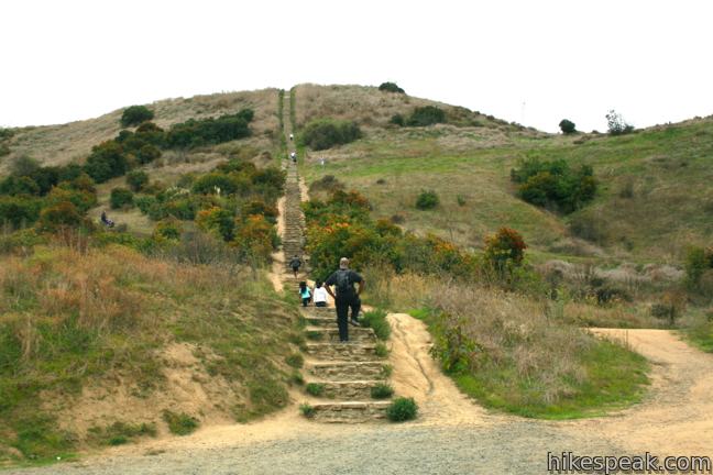
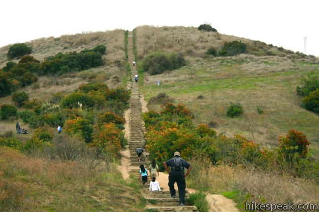
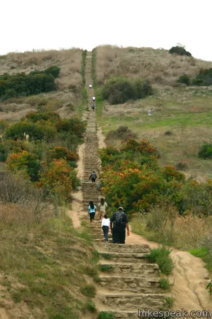
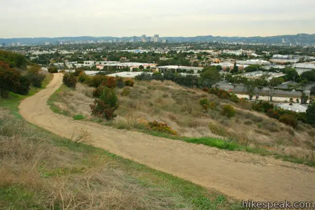
The dirt trail to the top gains 315 feet over 1.25 miles of zigzagging switchbacks. At several points, the trail crosses a stone staircase that takes a direct line to the top, tackling the same elevation in less that two tenths of a mile for a challenging workout.
Take the stairs up and back for a 2/3 of a mile round trip exercise or stroll up to the summit and down on the single track for a 2.5-mile hike. You can also go up one way and down the other. There’s no wrong way to visit Baldwin Hills Scenic Overlook. You can’t mess up the views!
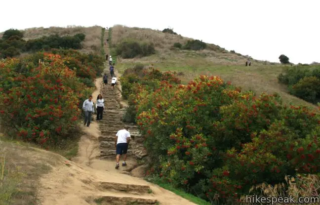
Park along the south side of Jefferson Boulevard at the base of the park. The trail begins from the east side of the intersection of Hetzler Road, a paved roadway into the park and up to the overlook. A large concrete sign for Baldwin Hills Scenic Overlook State Park at the start of the trail makes it hard to miss. Proceed to the left of the sign up a wide dirt single track, reaching the bottom of the stone staircase after 0.15 miles. Here the choice must be made. The stairs are a straight shot tackling approximately 300 vertical feet in 0.18 miles. The trail is more gradual and presents a greater variety of views as it switchbacks up the hillside.
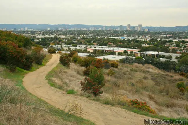
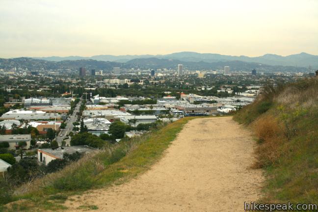
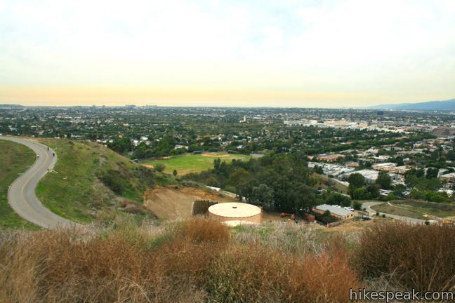
To continue up the trail, circle around the base of the steps and head west, gaining an elevated perspective over Culver City. Several recognizable landmarks stand out in the cityscape below, like Sony Pictures Studios and the triangle-shaped Culver City Hotel in downtown Culver City.
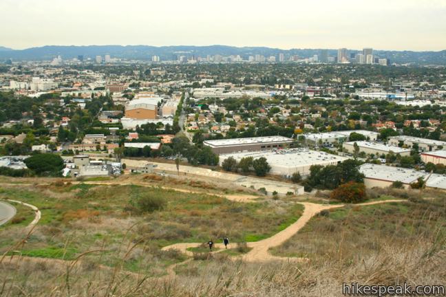
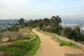
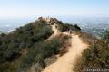
The trail continues up the hillside through three more crossings of the stairs. At around 0.6 miles from the start, stay to the left through a junction with a trail descending toward the road, and continue to climb toward the overlook. Since the overlook is visible for most of the hike, it is easy to stay on course. The ascent is steady all the way except for one short, steep section about halfway up the trail.
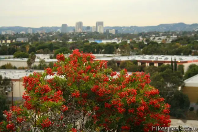
The hillside is largely grass covered, dotted with clumps of sagebrush and bushes like toyon. The park asks that you avoid trail cutting to help the vegetation grow and prevent the Baldwin Hills from balding.
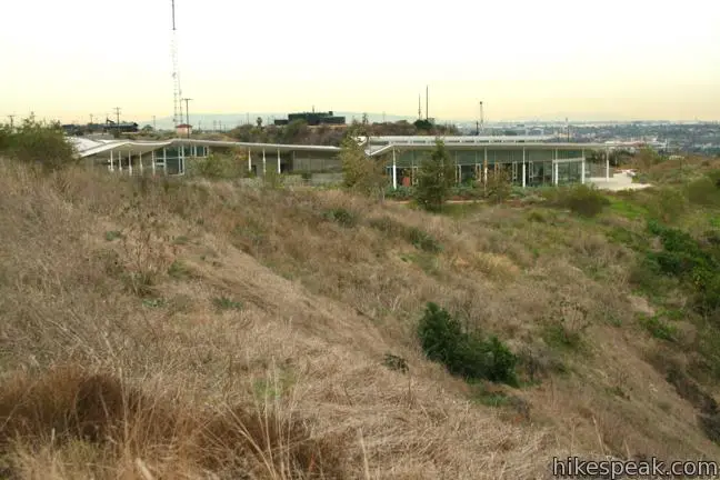
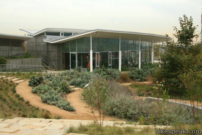
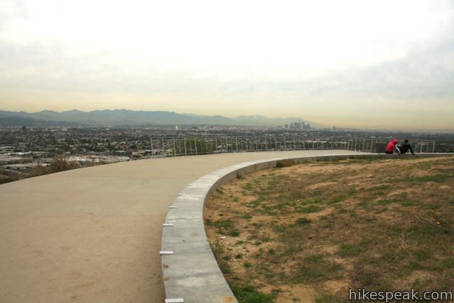
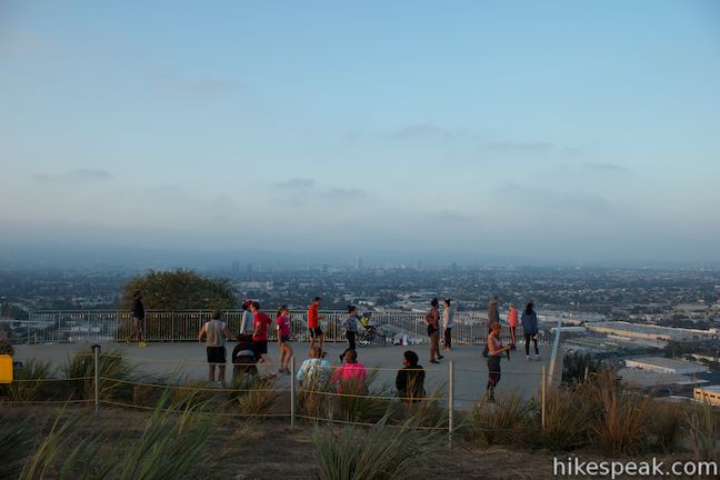
The final crossing of the staircase comes just below the overlook. From here, the trail makes an oversized curve to the right to reach the overlook itself. Just before the vista point, a trail to the left takes you to the Baldwin Hills Visitor Center and Botanical Gardens.
Just beyond the visitor center is a parking lot that those less inclined to hike may use to reach the overlook. A $6 day use fee is charged to park in this lot.
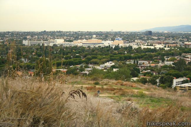
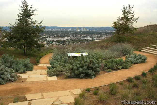
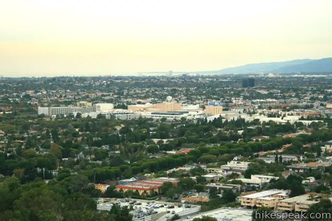
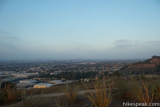
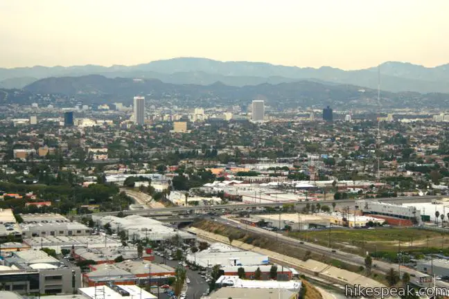
After stopping by the visitor center, continue up to the overlook where panoramic views await. To the west, the cityscape stretches toward Santa Monica Bay. To the northwest, the mountain ridges of Malibu are in view. The Getty Center is visible in the mountains beyond Century City and the Hollywood Sign and the Griffith Observatory can be seen above Hollywood. Finally to the east, downtown LA is visible, framed by the San Gabriel Mountains beyond. It is an expansive view of Southern California’s great metropolis, and a more than worthwhile destination for such a short trail.
Return by taking a calf-stretching descent of the staircase or weave your way back down the trail (or combine the two). Dogs and bicycles are not allowed on Baldwin Hills Scenic Overlook Trail. No permit is required and parking is free at the lower trailhead, so get out and enjoy!
To get to the trailhead: From the Overland Exit of the 10 Freeway, just east of the 405, take Overland Avenue south for 1.2 miles to Washington Boulevard. Turn left and drive 0.6 miles into downtown Culver City and turn right on Duquesne Avenue. Proceed another 0.6 miles to Jefferson Boulevard. Turn left and drive 0.4 miles to the intersection of Hetzler Road. Park on Jefferson Boulevard just before or after Hetzler Road. The trailhead begins from the southeast corner of the intersection.
Trailhead address: Hetzler Road & Jefferson Boulevard, Culver City, CA 90232
Trailhead coordinates: 34.020234, -118.382324 (34° 01′ 12.84″N 118° 22′ 56.36″W)
You may also view a regional map of surrounding Los Angeles trails and campgrounds.


 | Community Trail This 2.5-mile hike delivers views over Los Angeles from Kenneth Hahn State Recreation Area in the Baldwin Hills. |
 | LMU Trail This easy hike of up to 4.7 miles round trip follows the Westchester Bluffs west below the campus of Loyola Marymount University. |
 | Runyon Canyon Tour Hollywood's most popular dog park on loops of various lengths, offering good exercise and views over Los Angeles. |
 | Trebek Open Space This 2.5-mile hike incorporated Bantam Trail and Castair Trail in a park adjacent to Runyon Canyon. |
 | More trails in the Los Angeles Explore other destinations in the Santa Monica Mountains, San Gabriel Mountains, and elsewhere. |

Hi, in visiting the Baldwin Hill State Overlook park for an architecturally related project, I am having a hard time searching for more photographs. Also, do you happen to know of where I could find accurately measured topographic maps? Thank you.
Are dogs allowed on the trails or just in the boneyard?
Dogs are not allowed on the trail.
What is the story behind the step? How did they get there & how many steps total?thx
[…] the LA area but if i can’t make the trek out I am super fortunate to live very close to the Baldwin Hills Stairs (as pictured in this […]
West of the trailhead, there is now parking in the lower area but it is fee based by CA State Parks. There is also metered parking on that same side that is for 10 hours. Also the entrance to Hetzler Rd is closed off so cars cannot come in.
How early can we climb the steps bc I wanna go like 5am
[…] the LA River – concrete paved and homeless encampments. I was hoping to hike to the Baldwin Hills Scenic Overlook, but alas it was closed. I’m planning on walking the portion of the Park to Playa Trail from […]
[…] This area is quite famous in Los Angeles for both the overlook and the Culver City Stairs. The Baldwin Hills Scenic Overlook provides fantastic views of Los Angeles. But you need to get to the top. I took the trail route […]
Apparently there is no feasible way for elderly or disabled people to reach the viewing area. Is that right?