Mount Ollivier from Mueller Hut Aoraki Mount Cook National Park Southern Alps Summit New Zealand
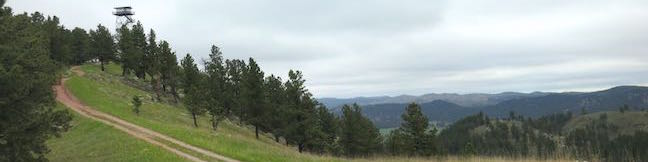
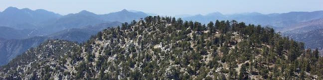
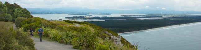
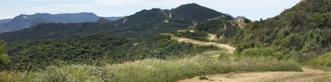
Mount Ollivier is a 1,933-meter tall peak in the Sealy Range of the Southern Alps in Aoraki Mount Cook National Park. In 1939, Sir Edmond Hillary summited the mountain in what is recognized as his first major climb. (He went on to bag some other noteworthy peaks as well...) To get to the top of Mount Ollivier, you will first need to make your way to Mueller Hut, which is accomplished by trekking up Sealy Tarns Track and Mueller Hut Route, gaining 1,045 meters over 5. ...Read more.
My Hikes: Completed hikeA green icon of shows a picture of a landscape with a check mark in the upper right corner, signifying that this is a hike you would like to put on your completed list.OK! Add to trails I've hiked
My Hikes: Want to hikeA green icon of shows a picture of a landscape with a heart in the upper right corner, signifying that this is a hike you would like to put on your to-do list.OK! Add to trails I want to hike
TagsA green icon depicting a tags represents a list of words and phrases that this content is tagged with Tagged with · Mount Cook · New Zealand Department of Conservation · New Zealand National Parks · Off Trail · Summits · Aoraki Mount Cook National Park
Hike DistanceA green icon of a hiker used to label information about the length of the hike Distance: 1.2 kilometers / 0.75 miles · Elevation change: 125 meters / 410 feet
By: Published: Last updated: December 5, 2025
East Cuesta Ridge Road Mount Lowe Road Santa Lucia Mountain East Cuesta Ridge Hike San Luis Obispo
East Cuesta Ridge Road, also known as Mount Lowe Road, is a dirt road that crosses the dominant ridgeline in the Santa Lucia Mountains northeast of San Luis Obispo. Views from the trail extend over San Luis Obispo and its surrounding peaks toward the ocean to the west at Morro Bay and to the south by Oceano Dunes. The hike starts just off Highway 101 at the top of Cuesta Grade. ...Read more.
My Hikes: Completed hikeA green icon of shows a picture of a landscape with a check mark in the upper right corner, signifying that this is a hike you would like to put on your completed list.OK! Add to trails I've hiked
My Hikes: Want to hikeA green icon of shows a picture of a landscape with a heart in the upper right corner, signifying that this is a hike you would like to put on your to-do list.OK! Add to trails I want to hike
TagsA green icon depicting a tags represents a list of words and phrases that this content is tagged with Tagged with · Free Trails · Los Padres National Forest · Ocean Views · Santa Lucia Mountains · Santa Lucia Wilderness · Summits
Hike DistanceA green icon of a hiker used to label information about the length of the hike Distance: 8.4 miles · Elevation change: 1075 feet
By: Published: Last updated: December 5, 2025
Mount Hollywood Hiking Trail Griffith Park Western Canyon Griffith Observatory hike Los Angeles California
Mount Hollywood is a prominent peak in Griffith Park, located above and behind Griffith Observatory. While it isn't the park's tallest peak at 1,625 feet, the summit offers excellent 360-degree views. The trails on Mount Hollywood have postcard perspectives of the Hollywood Sign and Griffith Observatory, plus views of downtown Los Angeles and the San Gabriel Mountains. ...Read more.
My Hikes: Completed hikeA green icon of shows a picture of a landscape with a check mark in the upper right corner, signifying that this is a hike you would like to put on your completed list.OK! Add to trails I've hiked
My Hikes: Want to hikeA green icon of shows a picture of a landscape with a heart in the upper right corner, signifying that this is a hike you would like to put on your to-do list.OK! Add to trails I want to hike
TagsA green icon depicting a tags represents a list of words and phrases that this content is tagged with Tagged with · Free Trails · Summits · Dog-Friendly Trails · Griffith Park · Santa Monica Mountains
Hike DistanceA green icon of a hiker used to label information about the length of the hike Distance: 2.65 miles · Elevation change: 500 feet
By: Published: Last updated: December 5, 2025
Rankin Ridge Trail Hike Wind Cave National Park Black Hills South Dakota Rankin Ridge Fire Tower Lookout Tower Hike
Rankin Ridge forms part of the southeast edge of the Black Hills and at 5,013 feet in elevation, it is the highest point in Wind Cave National Park. A lookout tower rises above the ridge top, which can be reached via a 250-foot ascent on a 0.55-mile long single track. Take a wide dirt trail back down the ridge to form a one-mile loop. Although this hike is short, it is not short on rewards. ...Read more.
My Hikes: Completed hikeA green icon of shows a picture of a landscape with a check mark in the upper right corner, signifying that this is a hike you would like to put on your completed list.OK! Add to trails I've hiked
My Hikes: Want to hikeA green icon of shows a picture of a landscape with a heart in the upper right corner, signifying that this is a hike you would like to put on your to-do list.OK! Add to trails I want to hike
TagsA green icon depicting a tags represents a list of words and phrases that this content is tagged with Tagged with · Black Hills · Custer · Free Trails · Lookout Towers · National Parks · Nature Trails · Summits
Hike DistanceA green icon of a hiker used to label information about the length of the hike Distance: 1 mile · Elevation change: 250 feet
By: Published: Last updated: December 5, 2025
Twin Peaks hike Angeles National Forest San Gabriel Mountains National Monument Mount Waterman Trail Twin Peaks East
The double-crested mountain of Twin Peaks is located close to the absolute center of the San Gabriel Mountains, making it an ideal mountain for catching big views over the range, including high points like Mount Wilson, Mount Baldy, and a slew of other summits. A trail leads to the 7,761-foot summit of Twin Peaks East, the higher of Twin Peak's sibling summits. ...Read more.
My Hikes: Completed hikeA green icon of shows a picture of a landscape with a check mark in the upper right corner, signifying that this is a hike you would like to put on your completed list.OK! Add to trails I've hiked
My Hikes: Want to hikeA green icon of shows a picture of a landscape with a heart in the upper right corner, signifying that this is a hike you would like to put on your to-do list.OK! Add to trails I want to hike
TagsA green icon depicting a tags represents a list of words and phrases that this content is tagged with Tagged with · Adventure Pass · Angeles National Forest · La Cañada Flintridge · San Gabriel Mountains National Monument · Summits · Dog-Friendly Trails · San Gabriel Mountains
Hike DistanceA green icon of a hiker used to label information about the length of the hike Distance: 11.65 miles · Elevation change: 3640 feet
By: Published: Last updated: December 5, 2025
Mount Maunganui Track Base Track Walk Summit Hike Mauao Tauranga New Zealand Mt Maunganui
Mount Maunganui is an extinct volcano crowning the tip of a peninsula at the mouth of Tauranga Harbour in the Bay of Plenty Region of New Zealand. The mountain has stunning sea views from its base all the way up to the summit, so it is a delight to hike. Next to Mount Maunganui, a beach city with the same name covers the flat part of the peninsula between sandy strips and is a popular spot for summer visitors. ...Read more.
My Hikes: Completed hikeA green icon of shows a picture of a landscape with a check mark in the upper right corner, signifying that this is a hike you would like to put on your completed list.OK! Add to trails I've hiked
My Hikes: Want to hikeA green icon of shows a picture of a landscape with a heart in the upper right corner, signifying that this is a hike you would like to put on your to-do list.OK! Add to trails I want to hike
TagsA green icon depicting a tags represents a list of words and phrases that this content is tagged with Tagged with · Free Trails · Mount Maunganui · Ocean Views · Summits · Tauranga
Hike DistanceA green icon of a hiker used to label information about the length of the hike Distance: 6.8 kilometers / 4.2 miles · Elevation change: 230 meters / 755 feet
By: Published: Last updated: December 5, 2025
Temescal Ridge Trail Hub Junction Temescal Peak Reseda Boulevard Hike Santa Monica Mountains Topanga State Park Dirt Mulholland Marvin Braude Mulholland Gateway Park
Reseda Boulevard gives hikers in the San Fernando Valley easy access to Topanga State Park and other areas of the Santa Monica Mountains. From the top of Reseda Boulevard, it is just 0.2 miles up to an unpaved stretch of Mulholland Drive (called Dirt Mulholland) that runs east and west across the range, connecting to lots of other trails, including nearby Temescal Ridge Trail. ...Read more.
My Hikes: Completed hikeA green icon of shows a picture of a landscape with a check mark in the upper right corner, signifying that this is a hike you would like to put on your completed list.OK! Add to trails I've hiked
My Hikes: Want to hikeA green icon of shows a picture of a landscape with a heart in the upper right corner, signifying that this is a hike you would like to put on your to-do list.OK! Add to trails I want to hike
TagsA green icon depicting a tags represents a list of words and phrases that this content is tagged with Tagged with · Backbone Trail · Free Trails · Marvin Braude Mulholland Gateway Park · Summits · Tarzana · Mountain Biking Trails · Santa Monica Mountains · Topanga State Park
Hike DistanceA green icon of a hiker used to label information about the length of the hike Distance: 5.45 miles · Elevation change: 400 feet
By: Published: Last updated: December 5, 2025
Kakepuku Mountain Historic Reserve Kakepuku Track Mount Kakepuku Walk Te Awamutu Waikato Region Hike New Zealand
Kakepuku Track offers a farm-to-summit trek in Kakepuku Mountain Historic Reserve. The track to the summit of Kakepuku Mountain is 8 kilometers (5 miles) round trip with 407 meters (1,335 feet) of elevation change. A lookout tower atop the 449-meter summit garners round-the-compass views above the treetops. A wooden viewing platform and benches along the track provide spots to relax and look out over the mountain's current surroundings, while panels placed at pa sites around the summit allow visitors to appreciate the Māori past. ...Read more.
My Hikes: Completed hikeA green icon of shows a picture of a landscape with a check mark in the upper right corner, signifying that this is a hike you would like to put on your completed list.OK! Add to trails I've hiked
My Hikes: Want to hikeA green icon of shows a picture of a landscape with a heart in the upper right corner, signifying that this is a hike you would like to put on your to-do list.OK! Add to trails I want to hike
TagsA green icon depicting a tags represents a list of words and phrases that this content is tagged with Tagged with · Free Trails · Lookout Towers · New Zealand Department of Conservation · Rainforests · Summits · Te Awamutu
Hike DistanceA green icon of a hiker used to label information about the length of the hike Distance: 8 kilometers / 5 miles · Elevation change: 407 meters / 1335 feet
By: Published: Last updated: December 5, 2025
Mesa Peak hike Backbone Trail Mesa Peak Motorway hike Corral Canyon Road ocean view summit Malibu California Corral Canyon Cave Jim Morrison Cave
It is pretty unusual to hike to a peak from a trailhead at a higher elevation. In the case of Mesa Peak, the lofty trailhead along Corral Canyon Road treats hikers to summit-worthy views right from the get-go. While the elevation profile is atypical, the hike along Mesa Peak Motorway to Mesa Peak in Malibu is quite enjoyable. Ocean overlooks appear all along the wide dirt road, which also passes some very impressive sandstone formations. ...Read more.
My Hikes: Completed hikeA green icon of shows a picture of a landscape with a check mark in the upper right corner, signifying that this is a hike you would like to put on your completed list.OK! Add to trails I've hiked
My Hikes: Want to hikeA green icon of shows a picture of a landscape with a heart in the upper right corner, signifying that this is a hike you would like to put on your to-do list.OK! Add to trails I want to hike
TagsA green icon depicting a tags represents a list of words and phrases that this content is tagged with Tagged with · Backbone Trail · Malibu · Ocean Views · Santa Monica Mountains National Recreation Area · Summits · Malibu Creek State Park · Mountain Biking Trails · Santa Monica Mountains
Hike DistanceA green icon of a hiker used to label information about the length of the hike Distance: 6.5 miles · Elevation change: 465 feet
By: Published: Last updated: December 5, 2025
Calabasas Peak hike Calabasas Peak Motorway from Old Topanga Canyon Road Calabasas Peak North Approach Santa Monica Mountains
Also known as Calabasas Peak Trail, Calabasas Peak Motorway is a 3.8-mile long dirt fire road that passes below the summit of Calabasas Peak. Hikers on the trail can examine interesting sandstone rock formations on and around Calabasas Peak and enjoy broad views over a scenic part of the Santa Monica Mountains between Topanga and Agoura Hills. One way to reach the summit of Calabasas Peak is to hike from the northeast end of Calabasas Peak Motorway where the fire road meets Old Topanga Canyon Road at the top of the valley west of Topanga. ...Read more.
My Hikes: Completed hikeA green icon of shows a picture of a landscape with a check mark in the upper right corner, signifying that this is a hike you would like to put on your completed list.OK! Add to trails I've hiked
My Hikes: Want to hikeA green icon of shows a picture of a landscape with a heart in the upper right corner, signifying that this is a hike you would like to put on your to-do list.OK! Add to trails I want to hike
TagsA green icon depicting a tags represents a list of words and phrases that this content is tagged with Tagged with · Free Trails · Summits · Topanga · Dog-Friendly Trails · Mountain Biking Trails · Santa Monica Mountains
Hike DistanceA green icon of a hiker used to label information about the length of the hike Distance: 4.2 miles · Elevation change: 635 feet
By: Published: Last updated: December 5, 2025

Tag!

You've come to a tag page, one of the blogiest ways to browse hikespeak.com.

Here are some more tags. The most common tags are the big ones at the top of the list. Have a look around. You may also find what you seek with the search feature on the Hike Finder Map.

Free TrailsNational ParksOcean ViewsCalifornia State ParksSummitsWaterfallsTent CampingCreeksLakesNature TrailsAngeles National ForestMalibuAdventure PassCascade RangeNew Zealand Department of ConservationDesert CanyonsOff TrailWildflowersBeachesLos Padres National ForestNew Zealand National ParksMountains Recreation and Conservation AuthoritySan Gabriel Mountains National MonumentGriffith ParkBig SurWheelchair-FriendlyCampervan CampingRuinsSequoia GrovesOregon State ParksLos OsosPacific Crest TrailHydrothermalCavesHollywoodBackpackingMontaña de Oro State ParkAustralian National ParksTopanga State ParkYosemite ValleyRedwood GrovesAltadenaSanta Ynez MountainsSanta Monica Mountains National Recreation AreaTopangaIrish HillsLone PineMalibu Creek State ParkBorrego SpringsAgoura HillsTrail CampArchesBureau of Land ManagementLookout TowersPacific PalisadesBoulderingDeschutes National ForestColumbia River Gorge National Scenic AreaBackbone TrailLavaWest Hills of PortlandMorrosTualatin MountainsArthur's Pass VillageMinesNevada State ParksTongariro National ParkMammoth LakesWalk-in CampingFruitaGrand JunctionArthur's Pass National ParkBendGiant ForestLa Cañada FlintridgeTide PoolsMorro BayCleveland National ForestRotoruaAzusaJohn Muir TrailAccommodationsOvertonArcadiaPasadenaZion CanyonLava TubesGoletaIsland in the SkyCalabasasTasmania's 60 Great Short WalksHot SpringsSanta Lucia MountainsClaremontGaviota State ParkBadlandsVerdugo MountainsBoardwalksGolden Trout WildernessClosedTillamookPhillip IslandAoraki Mount Cook National ParkRainforestsShasta-Trinity National ForestClosed SeasonallyVolcanoesNorthwest PortlandLas VegasSan Bernardino National ForestGrand Canyon of the YellowstoneForest ParkMount CookVolcanoNewbury ParkPetroglyphsGrant GroveGeyser BasinsStairsButtesBrentwoodGifford Pinchot National ForestFreycinet PeninsulaSan Ysidro MountainsColes BayMorro Bay State ParkTopatopa MountainsThousand OaksPalos Verdes PeninsulaSand DunesOakhurstOnondaga CountyAdirondack ParkAdirondack MountainsMorterosGiant Sequoia National MonumentAnsel Adams WildernessOhakuneOjaiMemorialsFreycinet National ParkLighthousesJohn Muir WildernessTasman PeninsulaTrabuco Ranger DistrictSan Bernardino MountainsWestern DivideSanta Ana MountainsSilver Moccasin TrailOrange County ParksPoint Mugu State ParkWestridge-Canyonback Wilderness ParkPaicinesSunriverWestern Divide Ranger DistrictNatural BridgesWill Rogers State ParkCratersNelder GroveTopanga CanyonStevensonWhakapapa VillageLava Butte Lava FlowWashington State ParksMount Hood National ForestCastle Crags State ParkMount ShastaThree Capes Scenic RouteNewberry National Volcanic MonumentWater SlidesMount HoodTarzanaContinental DivideSouth Lake TahoeSistersHobartReservoir Canyon Natural ReserveDomesPfeiffer Big Sur State ParkHumboldt Redwoods State ParkSouthwest PortlandOasesLeo Carrillo State ParkMoabGovernment CampNewhallLaguna BeachJulianSouth Coast WildernessTemescal Gateway ParkSilver Falls State ParkCambriaHutsSublimityGlacier LakesCliff JumpingGoing-to-the-Sun RoadPearblossomMontecitoHawaii State ParksKlamath MountainsSpringvilleRancho Palos VerdesWawonaDeschutes RiverCamp ShermanWildlife ViewingBeacon Rock State ParkLos Robles Open SpaceTanksYellowstone RiverSan Vicente Mountain ParkSwimming HolesObservatoriesIdyllwildSan Jacinto Ranger DistrictWaiotapuBurbankPalomar Ranger DistrictCalifornia Coastal TrailTasman National ParkLabrador Hollow Unique AreaCortland CountyTullyNew York State ForestsMount William National ParkVestalPicnic AreaWind CavesSan Jacinto MountainsSilver Peak WildernessBinghamton University Nature PreserveCedar GroveBlack HillsAvila BeachJulia Pfeiffer Burns State ParkCinder ConesLake ElsinoreMurrietaWenatche National ForestElephant SealsGlendaleSnowshoeingSan Mateo Canyon WildernessWilsons Promontory National ParkCrestlineEmma Wood State BeachWhananaki NorthCarpinteriaPlacerita Canyon Natural AreaPlacerita Canyon State ParkBike TrailSan PedroTujungaSanta Susana MountainsNew York State ParksSun ValleyCrescent CityRedwood Mountain GroveBishop Peak Natural ReserveAvila ValleySimi HillsSheep Mountain WildernessCrystal Cove State ParkSierra Pelona MountainsSanta MargaritaBeverly HillsConejo ValleyBlue Mountain LakeNicholas Flat Natural PreserveHume Lake Ranger DistrictGlaciersTe AwamutuRangitikeiSummit ValleySummit Valley Edmund D. Edelman ParkFish HatcheryWoodland HillsCastle Crags WildernessPepperwoodTryon Creek State Natural AreaTaurangaTaupoLodgeSanta PaulaTwentynine PalmsSherman OaksWillamette National ForestSouthern AlpsPortlandMount Thomas Forest Conservation AreaOkukuCusterCal PolyMacleay ParkWaimangu Volcanic ValleyPictographsOkere Falls Scenic ReserveOkere FallsArroyo GrandeMarvin Braude Mulholland Gateway ParkHood RiverEaglehawk NeckCampervan ReviewMount WellingtonWellington ParkTree MoldsLauncestonWaipio ValleyAndrew Molera State ParkCatalina IslandLimekiln State ParkHiloMount Field National ParkBritzRichardson Grove Redwoods State ParkColumbia River GorgeLake Tahoe Basin National Forest LandsPuakoCampervan RentalRocky MountainsLyleSaltwater RiverDeschutes River State Recreation AreaBlowholesWascoLord of the RingsBoat CruiseHarmony Headlands State ParkCayucosSanta Clarita Woodlands ParkAgua DulceCrazy Horse MemorialMonrovia Canyon ParkMonroviaRefugio State BeachPrimitive CampingSatellite CommunicatorsSOS BeaconsMount MaunganuiCulver CityHigh LineMatamataMount San Jacinto State ParkSan Jacinto WildernessMuruparaBanningFiscalini Ranch PreserveKings CanyonWhitewater RaftingTop 10 Holiday ParkPapamoaAerial GreenwayManhattanGPS NavigatorsPalomar MountainsAmboy Crater National Natural LandmarkPetrified LogsPowell Butte Nature ParkSoutheast PortlandBig Bear LakeCross Country SkiingCarpinteria Salt Marsh Nature ParkSonoraCarpinteria Bluffs Nature PreserveLas CrucesVentura RiverPilot Butte State ParkOak ParkMount Lowe RailwayLaguna Coast Wilderness ParkWarner SpringsOrangePeters Canyon Regional ParkSanta Lucia WildernessCarpinteria Seal SanctuaryGetty View ParkHearst San Simeon State ParkMalibu Lagoon State BeachKura Tawhiti / Castle Hill Conservation AreaCastle HillCentral ParkHuntington BeachAwbrey ButteHobbitonLiffeyFallbrookBerriedaleVasquez Rocks Natural Area ParkJamesvilleClark Reservation State ParkBeaver Lake Nature CenterBaldwinsvilleOnondaga County ParkWhitewater PreserveDocent-led HikesPlaya VistaAnaheimCataract Gorge ReserveSan SimeonTauwhara BayLiffey Falls State ReserveGreat Western TiersCape Woolamai State Faunal ReserveKoalasSaint Columba Falls State ReservePyenganaFallbrook Land ConservancyHokianga HarbourDouglas-Apsley National ParkBechinoOtamure BayOtamure Recreation ReserveYucca ValleySan Rafael HillsApp ReviewGuy W. Talbot State ParkEugeneMission Trails Regional ParkTurangiSanteeSanta Rosa and San Jacinto Mountains National MonumentGreen Lakes State ParkFayettevilleConcretionsMangawekaHuntervilleBel AirNewport BeachNewport BayJedediah Smith Redwoods State ParkSantiago Oaks Regional ParkMacKerricher State ParkSalt Point State ParkWeir Canyon Wilderness ParkB&BEl Capitán State BeachFreeride TrailsWest HillsBackpackers LodgeUpper Newport Bay Nature PreserveLake Tikitapu Scenic ReserveMotor LodgeSespe WildernessMyers FlatKlamath National ForestSeasideBaldwin Hills Scenic Overlook State ParkLaCrosseLas Virgines View ParkPalouse Falls State ParkArcoEl Chorro Regional ParkOregon CityWillamette RiverHappy ValleyCamassia Natural AreaWest LinnMontagueWeedCorbettGeorge Himes Nature ParkWeottOrickFort BraggJennerWhite SalmonCamasLacamas Lake Regional ParkPrairie Creek Redwoods State ParkMcKenzie BridgeDuartePalos Verdes EstatesThe Nature ConservancyLincoln CityDepoe BayCooke CityClatskanieGlenbrookCarson CityDevils TowerLake MichiganTuna Canyon ParkWelchesRhododendronOceansideNative American HeritageBass LakeStroller-FriendlyBisonDunsmuirSiletz Bay National Wildlife RefugeSanta ClaritaFishpondsKonaCastaicKohala Forest ReserveKenneth Hahn State Recreation AreaHonomuHollywood HillsStudio CityPu‘uhonua O Hōnaunau National Historical ParkHonaunauLongridge ParkYurtsBreaCape Meares State ParkArroyo Sequit ParkOceano Dunes State Vehicular Recreation AreaCape Lookout State ParkNipomoCannon BeachEldorado State ParkColorado State ParksBoulderMarquam Nature ParkShasta LakeCalaveras Big Trees State ParkMojave Trails National MonumentAtascaderoCape Kiwanda Natural AreaCucamonga WildernessPacific CityCarbon Canyon Regional ParkCape Meares State Scenic ViewpointEcola State ParkMosierSimi ValleyCanoe & KayakAdirondack High PeaksMonserate Mountain PreserveTumalo CreekMaricopaShevlin ParkKlamathPortervilleTualatin Hills Nature ParkBeavertonGarbervilleUpper Ojai ValleyArchie Briggs Natural AreaArboretumsPismo BeachAmboySan BernardinoSkyforestCascade LocksLake ArrowheadLake Placid