Rainbow Canyon Trail Anza-Borrego Desert State Park
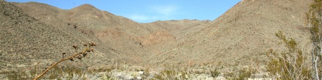
For an exciting 2.2-mile hike on an undeveloped trail through a colorful canyon, make your way to Rainbow Canyon, located south of Blair Valley in Anza-Borrego Desert State Park. A bit of scrambling is required on this hike, to climb several sloped dry falls within the canyon. This hike has 300 feet of elevation gain between the trailhead and the turnaround point, with plenty to see along the way. ...Read more.
My Hikes: Completed hikeA green icon of shows a picture of a landscape with a check mark in the upper right corner, signifying that this is a hike you would like to put on your completed list.OK! Add to trails I've hiked
My Hikes: Want to hikeA green icon of shows a picture of a landscape with a heart in the upper right corner, signifying that this is a hike you would like to put on your to-do list.OK! Add to trails I want to hike
TagsA green icon depicting a tags represents a list of words and phrases that this content is tagged with Tagged with · California State Parks · Desert Canyons · Free Trails · Julian · Off Trail
Hike DistanceA green icon of a hiker used to label information about the length of the hike Distance: 2.2 miles · Elevation change: 300 feet
By: Published: Last updated: December 5, 2025
Calcite Mine Trail Anza-Borrego Desert State Park
For a brief period at the start of America's involvement in World War Two, this area was heavily mined for its high-grade calcite, a mineral then used to make bomb sights. This approximately 4-mile long expedition follows an old mining road into the Santa Rosa Mountains, crossing a narrow ravine with slot canyons that hikers may explore to add variety and excitement to this trek in Anza-Borrego Desert State Park. ...Read more.
My Hikes: Completed hikeA green icon of shows a picture of a landscape with a check mark in the upper right corner, signifying that this is a hike you would like to put on your completed list.OK! Add to trails I've hiked
My Hikes: Want to hikeA green icon of shows a picture of a landscape with a heart in the upper right corner, signifying that this is a hike you would like to put on your to-do list.OK! Add to trails I want to hike
TagsA green icon depicting a tags represents a list of words and phrases that this content is tagged with Tagged with · California State Parks · Desert Canyons · Free Trails · Mines · Off Trail
Hike DistanceA green icon of a hiker used to label information about the length of the hike Distance: 4 miles · Elevation change: 600 feet
By: Published: Last updated: December 5, 2025
The Slot Canyon Narrows hike in Anza-Borrego Desert State Park California Slot Canyon Anza Borrego
Simply named The Slot, this narrow siltstone canyon provides one of the most exciting hikes in Anza-Borrego Desert State Park. This 0.8-mike trek is capped off with a passage beneath a gravity-defying rock span. This short hike has just 100 feet of elevation loss, but the memory will be much more profound. The Slot lacks a defined trail marker. From the parking area, look for footprints leading down into the ravine below. ...Read more.
My Hikes: Completed hikeA green icon of shows a picture of a landscape with a check mark in the upper right corner, signifying that this is a hike you would like to put on your completed list.OK! Add to trails I've hiked
My Hikes: Want to hikeA green icon of shows a picture of a landscape with a heart in the upper right corner, signifying that this is a hike you would like to put on your to-do list.OK! Add to trails I want to hike
TagsA green icon depicting a tags represents a list of words and phrases that this content is tagged with Tagged with · Borrego Springs · California State Parks · Desert Canyons
Hike DistanceA green icon of a hiker used to label information about the length of the hike Distance: 0.8 miles · Elevation change: 100 feet
By: Published: Last updated: December 5, 2025
Contact Mine in Joshua Tree National Park: Contact Mine was in operation at the start of the 20th century, extracting gold and silver from the mountains south of Twentynine Palms, California. A hundred years of desert decay have left the mine rusty but recognizable. The old road to the mine is worn down and eroded, now a little-used trail that provides access to hikers. This 3.95-mile round trip trek ascends 710 feet up a wash, a canyon, and an old road to a mountainside mine site that offers a glimpse into the mining history of Joshua Tree National Park.
Contact Mine was in operation at the start of the 20th century, extracting gold and silver from the mountains south of Twentynine Palms, California. A hundred years of desert decay have left the mine rusty but recognizable. The old road to the mine is worn down and eroded, now just a little-used hiking trail. This 3.95-mile round trip trek ascends 700 feet up a wash, a canyon, and an old road to a mountainside mine site that offers a glimpse into the mining history of Joshua Tree National Park. ...Read more.
My Hikes: Completed hikeA green icon of shows a picture of a landscape with a check mark in the upper right corner, signifying that this is a hike you would like to put on your completed list.OK! Add to trails I've hiked
My Hikes: Want to hikeA green icon of shows a picture of a landscape with a heart in the upper right corner, signifying that this is a hike you would like to put on your to-do list.OK! Add to trails I want to hike
TagsA green icon depicting a tags represents a list of words and phrases that this content is tagged with Tagged with · Desert Canyons · Mines · National Parks · Off Trail
Hike DistanceA green icon of a hiker used to label information about the length of the hike Distance: 3.95 miles · Elevation change: 700 feet
By: Published: Last updated: December 5, 2025
Devils Kitchen Trail is located near the south end of Colorado National Monument at the bottom of rugged No Thoroughfare Canyon. This 1.2-mile hike ascends 225 feet to visits an intriguing rock formation on the side of the canyon where tall boulders have enclosed a rock grotto
Devils Kitchen Trail is located near the south end of Colorado National Monument at the bottom of rugged No Thoroughfare Canyon. This 1.2-mile hike ascends 225 feet to visits an intriguing rock formation on the side of the canyon where tall boulders have enclosed a rock grotto. No Thoroughfare Canyon Two junctions are along the way and the path gets faint toward the end, so follow the directions on this one. ...Read more.
My Hikes: Completed hikeA green icon of shows a picture of a landscape with a check mark in the upper right corner, signifying that this is a hike you would like to put on your completed list.OK! Add to trails I've hiked
My Hikes: Want to hikeA green icon of shows a picture of a landscape with a heart in the upper right corner, signifying that this is a hike you would like to put on your to-do list.OK! Add to trails I want to hike
TagsA green icon depicting a tags represents a list of words and phrases that this content is tagged with Tagged with · Desert Canyons · Fruita · Grand Junction
Hike DistanceA green icon of a hiker used to label information about the length of the hike Distance: 1.2 miles · Elevation change: 225 feet
By: Published: Last updated: December 9, 2025
Monument Canyon Trail to Independence Monument in Colorado National Monument near Grand Junction Colorado
Monument Canyon Trail is six miles long in one direction, dropping from Rim Rock Drive across Monument Canyon to a second trailhead on the eastern edge of the park. Three and a half miles (and 850 vertical feet) from the top, the trail passes Independence Monument, the largest freestanding rock formation in the park. A popular hike along Monument Canyon Trail is a 7-mile out and back from Rim Rock Drive to Independence Monument. ...Read more.
My Hikes: Completed hikeA green icon of shows a picture of a landscape with a check mark in the upper right corner, signifying that this is a hike you would like to put on your completed list.OK! Add to trails I've hiked
My Hikes: Want to hikeA green icon of shows a picture of a landscape with a heart in the upper right corner, signifying that this is a hike you would like to put on your to-do list.OK! Add to trails I want to hike
TagsA green icon depicting a tags represents a list of words and phrases that this content is tagged with Tagged with · Desert Canyons · Fruita · Grand Junction
Hike DistanceA green icon of a hiker used to label information about the length of the hike Distance: 7 miles · Elevation change: 850 feet
By: Published: Last updated: December 5, 2025
Coke Ovens Trail hike Colorado National Monument Canyon
Coke Oven's Trail shares a trailhead with Monument Canyon Trail and the collection of rock domes can be visited as their own destination or as a side attraction on a longer trek into Monument Canyon. The hike to Coke Ovens is one-mile round trip with 180 feet of elevation loss. From the turnout along Rim Rock Drive, begin hiking east into the canyon. ...Read more.
My Hikes: Completed hikeA green icon of shows a picture of a landscape with a check mark in the upper right corner, signifying that this is a hike you would like to put on your completed list.OK! Add to trails I've hiked
My Hikes: Want to hikeA green icon of shows a picture of a landscape with a heart in the upper right corner, signifying that this is a hike you would like to put on your to-do list.OK! Add to trails I want to hike
TagsA green icon depicting a tags represents a list of words and phrases that this content is tagged with Tagged with · Desert Canyons · Fruita · Grand Junction
Hike DistanceA green icon of a hiker used to label information about the length of the hike Distance: 1 mile · Elevation change: 180 feet
By: Published: Last updated: December 5, 2025
Otto's Trail Colorado National Monument Ottos Trail Hike
Otto's Trail is one of the shorter hikes along Rim Rock Drive in Colorado National Monument. Like Window Rock Trail, this 0.75-mile stroll descends gradually to a cliff overlooking Monument Canyon. The view showcases Independence Monument, the tallest freestanding formation in the canyon, and a point of fascination for visitors dating back to the first park supervisor, John Otto, for whom this trail is named. ...Read more.
My Hikes: Completed hikeA green icon of shows a picture of a landscape with a check mark in the upper right corner, signifying that this is a hike you would like to put on your completed list.OK! Add to trails I've hiked
My Hikes: Want to hikeA green icon of shows a picture of a landscape with a heart in the upper right corner, signifying that this is a hike you would like to put on your to-do list.OK! Add to trails I want to hike
TagsA green icon depicting a tags represents a list of words and phrases that this content is tagged with Tagged with · Desert Canyons · Fruita · Grand Junction
Hike DistanceA green icon of a hiker used to label information about the length of the hike Distance: 0.75 miles · Elevation change: 85 feet
By: Published: Last updated: December 5, 2025
Alcove Nature Trail in Colorado National Monument near Grand Junction Colorado
Across the road from the park visitor center (and Canyon Rim Trail) is Alcove Nature Trail. This track is set back from the canyon rim, which limits views of the great landscape. What this trail offers instead is an informative hike with numbered markers that coincide with entries in a guide booklet. The entries describe plants and animals in the park as well as the geological history. ...Read more.
My Hikes: Completed hikeA green icon of shows a picture of a landscape with a check mark in the upper right corner, signifying that this is a hike you would like to put on your completed list.OK! Add to trails I've hiked
My Hikes: Want to hikeA green icon of shows a picture of a landscape with a heart in the upper right corner, signifying that this is a hike you would like to put on your to-do list.OK! Add to trails I want to hike
TagsA green icon depicting a tags represents a list of words and phrases that this content is tagged with Tagged with · Desert Canyons · Fruita · Grand Junction · Nature Trails
Hike DistanceA green icon of a hiker used to label information about the length of the hike Distance: 1 mile · Elevation change: 175 feet
By: Published: Last updated: December 5, 2025
Canyon Rim Trail Colorado National Monument
For a view of Praying Hands, Independence Monument, and the other statuesque monoliths in Monument Canyon, take a stroll along Canyon Rim Trail. The track crosses the canyon rim between Saddlehorn Visitor Center and Book Cliff View, and is a great way to begin your visit of Colorado National Monument. The trail is half a mile one-way or one mile round trip. ...Read more.
My Hikes: Completed hikeA green icon of shows a picture of a landscape with a check mark in the upper right corner, signifying that this is a hike you would like to put on your completed list.OK! Add to trails I've hiked
My Hikes: Want to hikeA green icon of shows a picture of a landscape with a heart in the upper right corner, signifying that this is a hike you would like to put on your to-do list.OK! Add to trails I want to hike
TagsA green icon depicting a tags represents a list of words and phrases that this content is tagged with Tagged with · Desert Canyons · Fruita · Grand Junction
Hike DistanceA green icon of a hiker used to label information about the length of the hike Distance: 1 mile · Elevation change: 100 feet
By: Published: Last updated: December 5, 2025

Tag!

You've come to a tag page, one of the blogiest ways to browse hikespeak.com.

Here are some more tags. The most common tags are the big ones at the top of the list. Have a look around. You may also find what you seek with the search feature on the Hike Finder Map.

Free TrailsNational ParksOcean ViewsCalifornia State ParksSummitsWaterfallsTent CampingCreeksLakesNature TrailsAngeles National ForestMalibuAdventure PassCascade RangeNew Zealand Department of ConservationDesert CanyonsOff TrailWildflowersBeachesLos Padres National ForestNew Zealand National ParksMountains Recreation and Conservation AuthoritySan Gabriel Mountains National MonumentGriffith ParkBig SurWheelchair-FriendlyCampervan CampingRuinsSequoia GrovesOregon State ParksLos OsosPacific Crest TrailHydrothermalCavesHollywoodBackpackingMontaña de Oro State ParkAustralian National ParksTopanga State ParkYosemite ValleyRedwood GrovesAltadenaSanta Ynez MountainsSanta Monica Mountains National Recreation AreaTopangaIrish HillsLone PineMalibu Creek State ParkBorrego SpringsAgoura HillsTrail CampArchesBureau of Land ManagementLookout TowersPacific PalisadesBoulderingDeschutes National ForestColumbia River Gorge National Scenic AreaBackbone TrailLavaWest Hills of PortlandMorrosTualatin MountainsArthur's Pass VillageMinesNevada State ParksTongariro National ParkMammoth LakesWalk-in CampingFruitaGrand JunctionArthur's Pass National ParkBendGiant ForestLa Cañada FlintridgeTide PoolsMorro BayCleveland National ForestRotoruaAzusaJohn Muir TrailAccommodationsOvertonArcadiaPasadenaZion CanyonLava TubesGoletaIsland in the SkyCalabasasTasmania's 60 Great Short WalksHot SpringsSanta Lucia MountainsClaremontGaviota State ParkBadlandsVerdugo MountainsBoardwalksGolden Trout WildernessClosedTillamookPhillip IslandAoraki Mount Cook National ParkRainforestsShasta-Trinity National ForestClosed SeasonallyVolcanoesNorthwest PortlandLas VegasSan Bernardino National ForestGrand Canyon of the YellowstoneForest ParkMount CookVolcanoNewbury ParkPetroglyphsGrant GroveGeyser BasinsStairsButtesBrentwoodGifford Pinchot National ForestFreycinet PeninsulaSan Ysidro MountainsColes BayMorro Bay State ParkTopatopa MountainsThousand OaksPalos Verdes PeninsulaSand DunesOakhurstOnondaga CountyAdirondack ParkAdirondack MountainsMorterosGiant Sequoia National MonumentAnsel Adams WildernessOhakuneOjaiMemorialsFreycinet National ParkLighthousesJohn Muir WildernessTasman PeninsulaTrabuco Ranger DistrictSan Bernardino MountainsWestern DivideSanta Ana MountainsSilver Moccasin TrailOrange County ParksPoint Mugu State ParkWestridge-Canyonback Wilderness ParkPaicinesSunriverWestern Divide Ranger DistrictNatural BridgesWill Rogers State ParkCratersNelder GroveTopanga CanyonStevensonWhakapapa VillageLava Butte Lava FlowWashington State ParksMount Hood National ForestCastle Crags State ParkMount ShastaThree Capes Scenic RouteNewberry National Volcanic MonumentWater SlidesMount HoodTarzanaContinental DivideSouth Lake TahoeSistersHobartReservoir Canyon Natural ReserveDomesPfeiffer Big Sur State ParkHumboldt Redwoods State ParkSouthwest PortlandOasesLeo Carrillo State ParkMoabGovernment CampNewhallLaguna BeachJulianSouth Coast WildernessTemescal Gateway ParkSilver Falls State ParkCambriaHutsSublimityGlacier LakesCliff JumpingGoing-to-the-Sun RoadPearblossomMontecitoHawaii State ParksKlamath MountainsSpringvilleRancho Palos VerdesWawonaDeschutes RiverCamp ShermanWildlife ViewingBeacon Rock State ParkLos Robles Open SpaceTanksYellowstone RiverSan Vicente Mountain ParkSwimming HolesObservatoriesIdyllwildSan Jacinto Ranger DistrictWaiotapuBurbankPalomar Ranger DistrictCalifornia Coastal TrailTasman National ParkLabrador Hollow Unique AreaCortland CountyTullyNew York State ForestsMount William National ParkVestalPicnic AreaWind CavesSan Jacinto MountainsSilver Peak WildernessBinghamton University Nature PreserveCedar GroveBlack HillsAvila BeachJulia Pfeiffer Burns State ParkCinder ConesLake ElsinoreMurrietaWenatche National ForestElephant SealsGlendaleSnowshoeingSan Mateo Canyon WildernessWilsons Promontory National ParkCrestlineEmma Wood State BeachWhananaki NorthCarpinteriaPlacerita Canyon Natural AreaPlacerita Canyon State ParkBike TrailSan PedroTujungaSanta Susana MountainsNew York State ParksSun ValleyCrescent CityRedwood Mountain GroveBishop Peak Natural ReserveAvila ValleySimi HillsSheep Mountain WildernessCrystal Cove State ParkSierra Pelona MountainsSanta MargaritaBeverly HillsConejo ValleyBlue Mountain LakeNicholas Flat Natural PreserveHume Lake Ranger DistrictGlaciersTe AwamutuRangitikeiSummit ValleySummit Valley Edmund D. Edelman ParkFish HatcheryWoodland HillsCastle Crags WildernessPepperwoodTryon Creek State Natural AreaTaurangaTaupoLodgeSanta PaulaTwentynine PalmsSherman OaksWillamette National ForestSouthern AlpsPortlandMount Thomas Forest Conservation AreaOkukuCusterCal PolyMacleay ParkWaimangu Volcanic ValleyPictographsOkere Falls Scenic ReserveOkere FallsArroyo GrandeMarvin Braude Mulholland Gateway ParkHood RiverEaglehawk NeckCampervan ReviewMount WellingtonWellington ParkTree MoldsLauncestonWaipio ValleyAndrew Molera State ParkCatalina IslandLimekiln State ParkHiloMount Field National ParkBritzRichardson Grove Redwoods State ParkColumbia River GorgeLake Tahoe Basin National Forest LandsPuakoCampervan RentalRocky MountainsLyleSaltwater RiverDeschutes River State Recreation AreaBlowholesWascoLord of the RingsBoat CruiseHarmony Headlands State ParkCayucosSanta Clarita Woodlands ParkAgua DulceCrazy Horse MemorialMonrovia Canyon ParkMonroviaRefugio State BeachPrimitive CampingSatellite CommunicatorsSOS BeaconsMount MaunganuiCulver CityHigh LineMatamataMount San Jacinto State ParkSan Jacinto WildernessMuruparaBanningFiscalini Ranch PreserveKings CanyonWhitewater RaftingTop 10 Holiday ParkPapamoaAerial GreenwayManhattanGPS NavigatorsPalomar MountainsAmboy Crater National Natural LandmarkPetrified LogsPowell Butte Nature ParkSoutheast PortlandBig Bear LakeCross Country SkiingCarpinteria Salt Marsh Nature ParkSonoraCarpinteria Bluffs Nature PreserveLas CrucesVentura RiverPilot Butte State ParkOak ParkMount Lowe RailwayLaguna Coast Wilderness ParkWarner SpringsOrangePeters Canyon Regional ParkSanta Lucia WildernessCarpinteria Seal SanctuaryGetty View ParkHearst San Simeon State ParkMalibu Lagoon State BeachKura Tawhiti / Castle Hill Conservation AreaCastle HillCentral ParkHuntington BeachAwbrey ButteHobbitonLiffeyFallbrookBerriedaleVasquez Rocks Natural Area ParkJamesvilleClark Reservation State ParkBeaver Lake Nature CenterBaldwinsvilleOnondaga County ParkWhitewater PreserveDocent-led HikesPlaya VistaAnaheimCataract Gorge ReserveSan SimeonTauwhara BayLiffey Falls State ReserveGreat Western TiersCape Woolamai State Faunal ReserveKoalasSaint Columba Falls State ReservePyenganaFallbrook Land ConservancyHokianga HarbourDouglas-Apsley National ParkBechinoOtamure BayOtamure Recreation ReserveYucca ValleySan Rafael HillsApp ReviewGuy W. Talbot State ParkEugeneMission Trails Regional ParkTurangiSanteeSanta Rosa and San Jacinto Mountains National MonumentGreen Lakes State ParkFayettevilleConcretionsMangawekaHuntervilleBel AirNewport BeachNewport BayJedediah Smith Redwoods State ParkSantiago Oaks Regional ParkMacKerricher State ParkSalt Point State ParkWeir Canyon Wilderness ParkB&BEl Capitán State BeachFreeride TrailsWest HillsBackpackers LodgeUpper Newport Bay Nature PreserveLake Tikitapu Scenic ReserveMotor LodgeSespe WildernessMyers FlatKlamath National ForestSeasideBaldwin Hills Scenic Overlook State ParkLaCrosseLas Virgines View ParkPalouse Falls State ParkArcoEl Chorro Regional ParkOregon CityWillamette RiverHappy ValleyCamassia Natural AreaWest LinnMontagueWeedCorbettGeorge Himes Nature ParkWeottOrickFort BraggJennerWhite SalmonCamasLacamas Lake Regional ParkPrairie Creek Redwoods State ParkMcKenzie BridgeDuartePalos Verdes EstatesThe Nature ConservancyLincoln CityDepoe BayCooke CityClatskanieGlenbrookCarson CityDevils TowerLake MichiganTuna Canyon ParkWelchesRhododendronOceansideNative American HeritageBass LakeStroller-FriendlyBisonDunsmuirSiletz Bay National Wildlife RefugeSanta ClaritaFishpondsKonaCastaicKohala Forest ReserveKenneth Hahn State Recreation AreaHonomuHollywood HillsStudio CityPu‘uhonua O Hōnaunau National Historical ParkHonaunauLongridge ParkYurtsBreaCape Meares State ParkArroyo Sequit ParkOceano Dunes State Vehicular Recreation AreaCape Lookout State ParkNipomoCannon BeachEldorado State ParkColorado State ParksBoulderMarquam Nature ParkShasta LakeCalaveras Big Trees State ParkMojave Trails National MonumentAtascaderoCape Kiwanda Natural AreaCucamonga WildernessPacific CityCarbon Canyon Regional ParkCape Meares State Scenic ViewpointEcola State ParkMosierSimi ValleyCanoe & KayakAdirondack High PeaksMonserate Mountain PreserveTumalo CreekMaricopaShevlin ParkKlamathPortervilleTualatin Hills Nature ParkBeavertonGarbervilleUpper Ojai ValleyArchie Briggs Natural AreaArboretumsPismo BeachAmboySan BernardinoSkyforestCascade LocksLake ArrowheadLake Placid