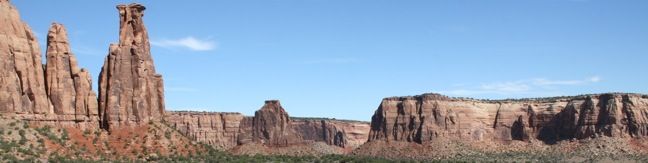
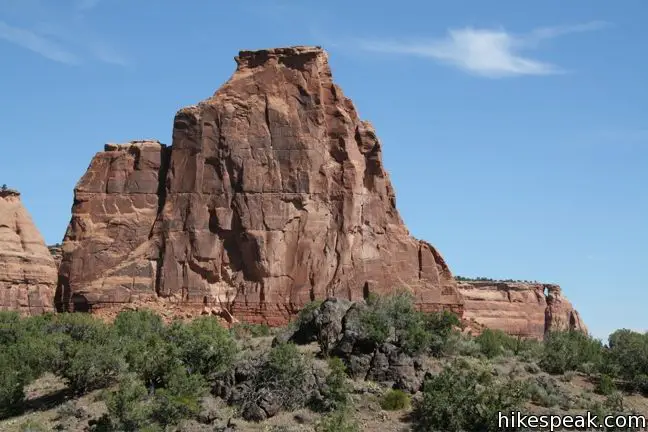
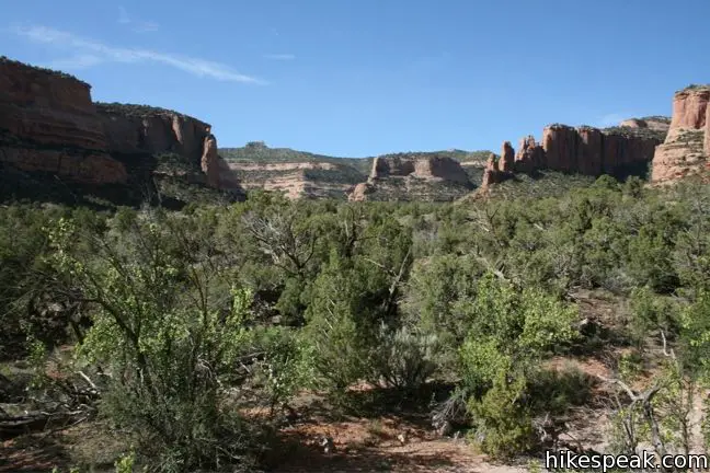
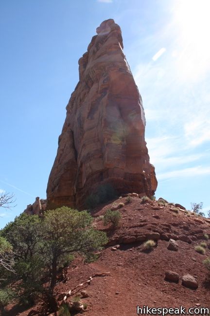
Monument Canyon Trail is six miles long in one direction, dropping from Rim Rock Drive across Monument Canyon to a second trailhead on the eastern edge of the park. Three and a half miles (and 850 vertical feet) from the top, the trail passes Independence Monument, the largest freestanding rock formation in the park. A popular hike along Monument Canyon Trail is a 7-mile out and back from Rim Rock Drive to Independence Monument. The hike passes another notable natural monument named Kissing Couple, and offers views of other towering sandstone formations as it travels through Monument Canyon.
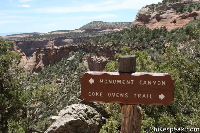
Monument Canyon Trail begins with a steep descent from Rim Rock Drive down to the canyon floor. The trail’s only junction comes 0.14 miles and 70 feet below the road. To the right, Coke Ovens Trail continues for 1/3 of a mile along a ledge to Cove Ovens.
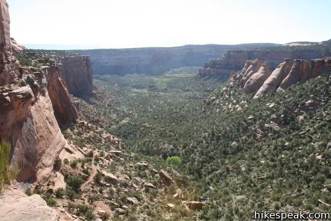
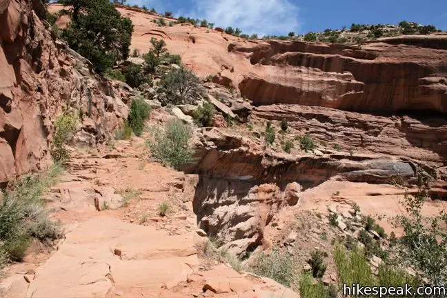
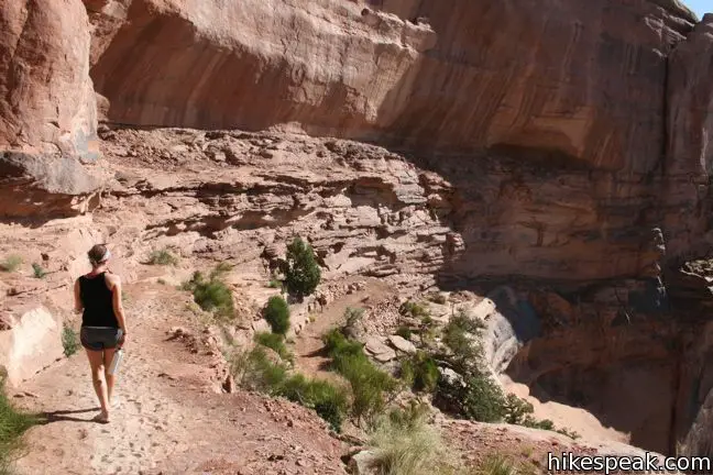
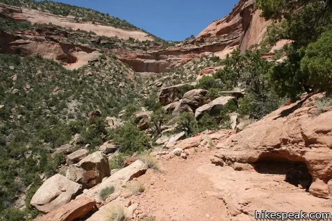
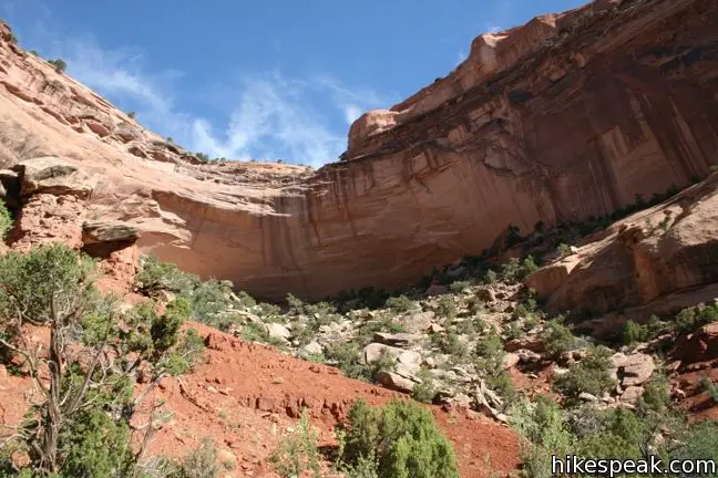
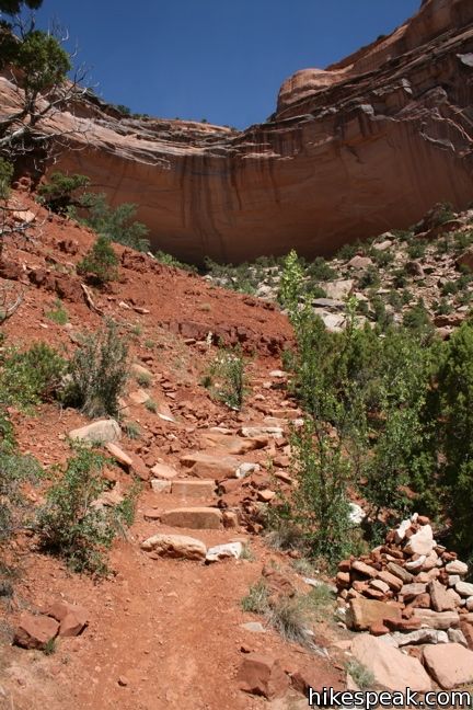
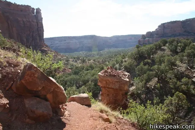
Turn left to follow Monument Canyon Trail deeper into the canyon. The trail crosses narrow ledges and tall alcoves as it winds down the canyon wall, sacrificing 550 over the next 0.75 miles. While there are no junctions to worry about beyond Coke Ovens Trail, you will have to deal with all this elevation on the way back up.
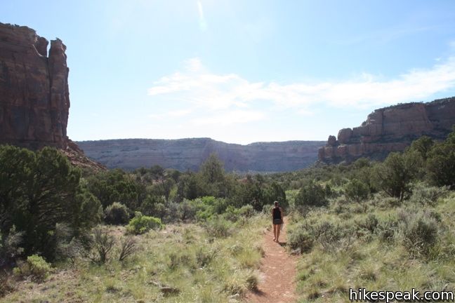
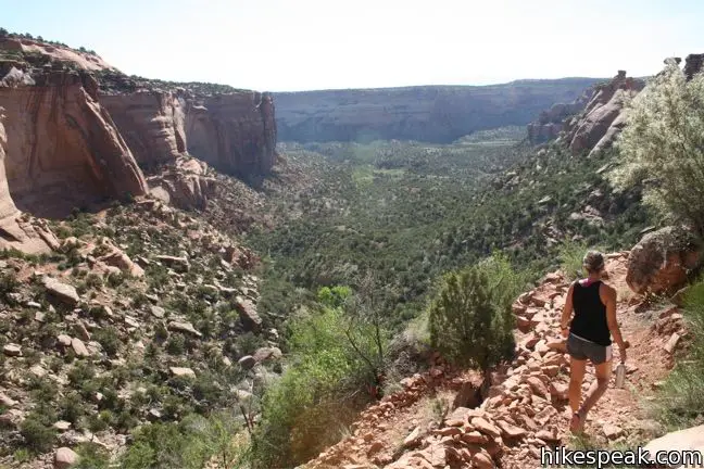
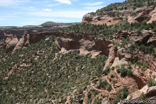
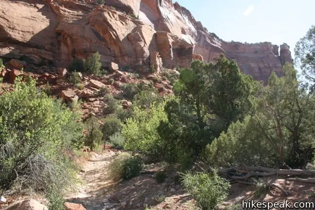
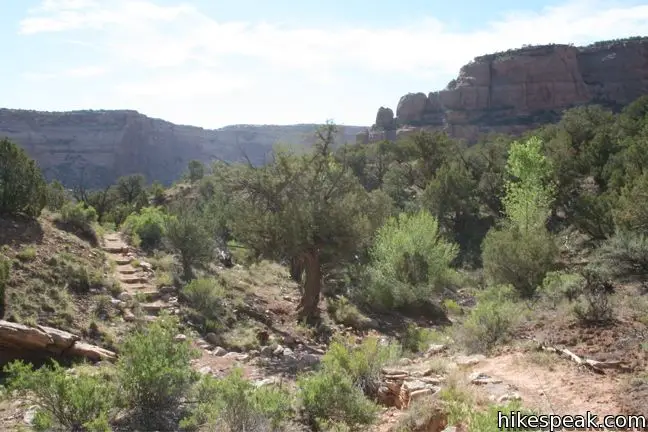
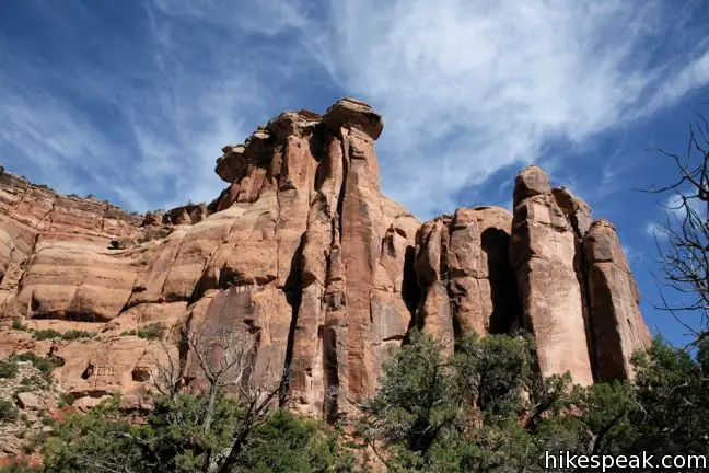
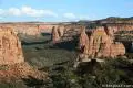
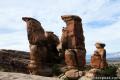
Below the switchbacks of the canyon wall, the trail crosses a wash and straightens out. There is less juniper and pine down on the canyon floor and more cacti, yucca, and other desert vegetation. Continue east toward the main channel of Monument Canyon. The well-built trail crosses rolling terrain and curves to the left, north, following the contours of the canyon. The single-track remains close to the west wall of the canyon, arriving at the base of Kissing Couple 2.6 miles from the start. There is less than 200 feet of elevation lost over this first section along the canyon floor. The hiking is fairly level, and along the way there are several motivating views of Kissing Couple, a rock spire resembling two embracing heads with a hole in between.
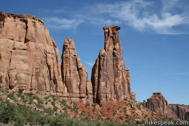
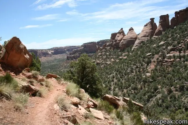
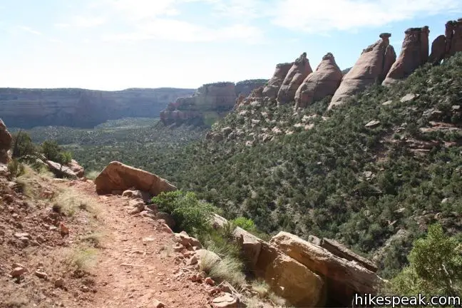
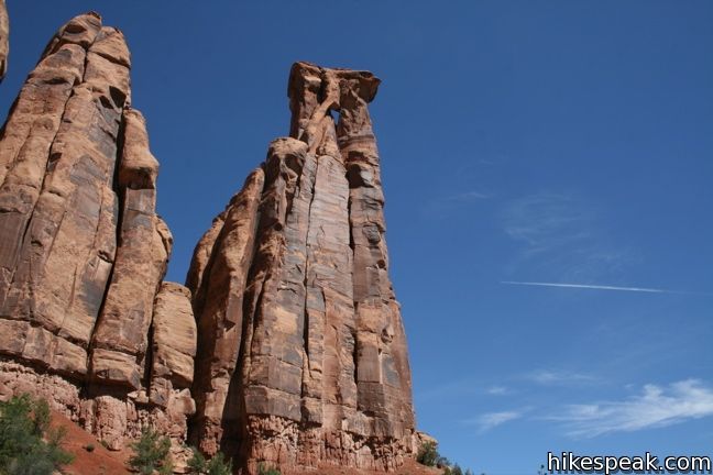
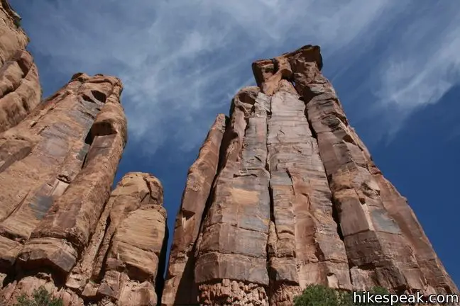
Once you pass the amorous rock, there is a clear view of Independence Monument, less than a mile away. Follow the dirt track as it traces the contours of the canyon toward the iconic 450-foot tall Independence Monument.
Each Fourth of July, rock climbers scale this noble monolith and raise the American flag at the summit. The event attracts hundreds of climbers and spectators. The tradition was started in 1911, the year the monument was created, by the park’s legendary champion, John Otto.
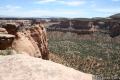
For a nice view down Monument Canyon toward Window Rock and all the sandstone in between, break off trail and hike up to the crest at the western base of Independence Monument.
Beyond Independence Monument, the trail continues for two and a half miles to a trailhead off Highway 340 on the east side of the park. For a 7-mile down-and-back hike, turn around here and begin hiking back up and out of the canyon. The trail is fairly gentle until the last 0.9 miles, when you must make a strenuous ascent to Rim Rock Drive. The hike may be extended to 7.7 miles by taking a left at the junction and adding the level track to Coke Ovens to this excursion. Above the junction, there are just a few more easy switchbacks before you can catch your breath in the parking area along Rim Rock Drive.
Directions to the Trailhead
- From Saddlehorn Visitor Center, drive south on Rim Rock Drive for 3.8 miles and turn left into the turnout for Monument Canyon and Coke Ovens.
Trailhead Location
Trailhead address: Rimrock Drive, Colorado National Monument, Grand Junction, CO 81507
Trailhead coordinates: 39.077713, -108.728112 (39° 04′ 39.76″N 108° 43′ 41.20″W)
View Colorado National Monument in a larger map
Or view a regional map of surrounding Colorado trails and campgrounds.

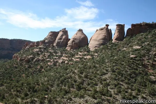


 | Coke Ovens Trail This one-mile hike visits a line of sandstone domes decorating the rim of Monument Canyon. |
 | Otto's Trail This 0.75-mile round trip hike visits an overlook near the Pipe Organs with an excellent view of Independence Monument and Monument Canyon. |
 | Canyon Rim Trail This one-mile round trip hike begins at Saddlehorn Visitor Center and travels along the cliffs edge overlooking Monument Canyon. |
 | More trails in Colorado Explore other destinations in Colorado National Monument. |
 | Saddlehorn Campground This 80-site campground is the only designated camping area in Colorado National Park, conveniently located near Saddlehorn Visitor Center. |
- Monument Canyon Trail on protrails.com (opens in a new tab)
- Climbing Independence Monument on 14ers.com (opens in a new tab)
- Colorado National Monument on wikipedia.org (opens in a new tab)
- Colorado National Monument on summitpost.org (opens in a new tab)
- The official website for Colorado National Monument (opens in a new tab)
Common Questions about Monument Canyon Trail to Independence Monument in Colorado National Monument
- Is the trail open?
- Yes. You should expect to find that Monument Canyon Trail is open. There are no recent reports of trail closures. If you discover that the trail is closed, please help your fellow hikers by reporting a closure.
- Do I need a permit for this hike?
- Yes. National Monument Entrance Fee.
- How much time does this hike take?
- It takes approximately 3 hours 30 minutes to hike Monument Canyon Trail. Individual hiking times vary. Add extra time for breaks and taking in the views.
- How long is this hike?
- The hike to Monument Canyon Trail is a 7 mile out and back with 850 feet of elevation change.
- Are dogs allowed on this trail?
- No, dogs are likely not allowed on Monument Canyon Trail. The trail is primarily open to hikers.
- Where is the trailhead located?
- The trailhead for Monument Canyon Trail is located in Colorado National Monument, CA.
Trailhead Address:
Rimrock Drive
Colorado National Monument, CA 81507
Trailhead Coordinates:
39.077713, -108.728112 - What are the driving directions to the start of the hike?
To get to the trailhead: From Saddlehorn Visitor Center, drive south on Rim Rock Drive for 3.8 miles and turn left into the turnout for Monument Canyon and Coke Ovens.
View custom Google Maps directions from your current location.
- Are there other trails near Monument Canyon Trail?
- Yes, you can find other nearby hikes using the Hikespeak Hike Finder Map.

We are looking to do this hike in mid June. We would arrive in the area around 10am… will it be too hot to hike this time of year and day?
June is balmy indeed. The hike may take you about two hours which puts you at noon.
I’ve done this hike many times and is beautiful. I would not do it later than 10. Although doable maybe a bit too hot for me. This is a good late in the day hike as well. In June the days are longer so perhaps doing it as a later in the afternoon hike.
I’m also looking to do this hike next month. Is it legal to camp near the trail, and not at a campsite?