Devils Kitchen Trail
in Colorado National Monument
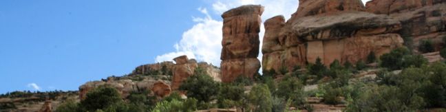
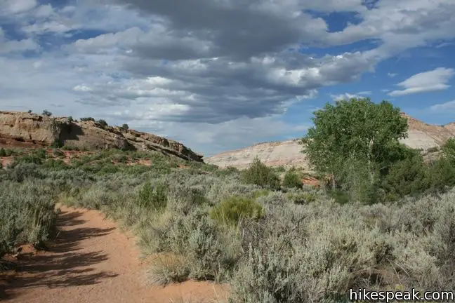
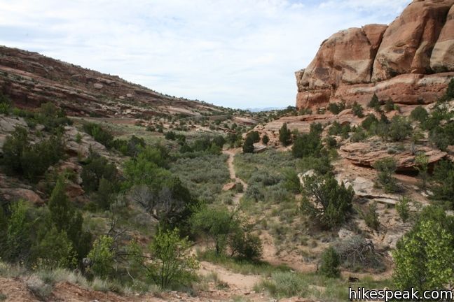
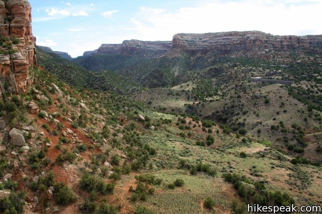
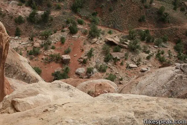
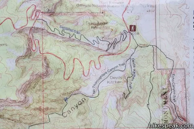
Devils Kitchen Trail is located near the south end of Colorado National Monument at the bottom of rugged No Thoroughfare Canyon. This 1.2-mile hike ascends 225 feet to visits an intriguing rock formation on the side of the canyon where tall boulders have enclosed a rock grotto.
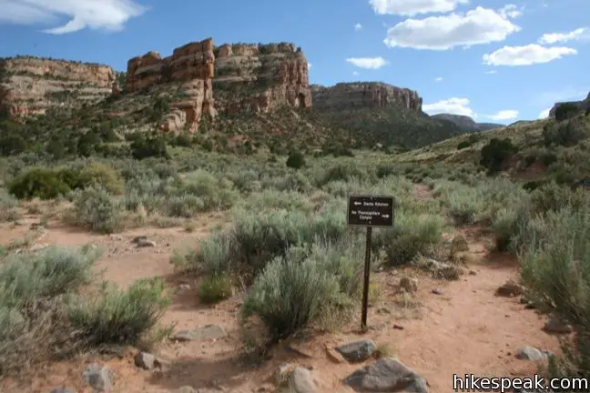
Two junctions are along the way and the path gets faint toward the end, so follow the directions on this one.
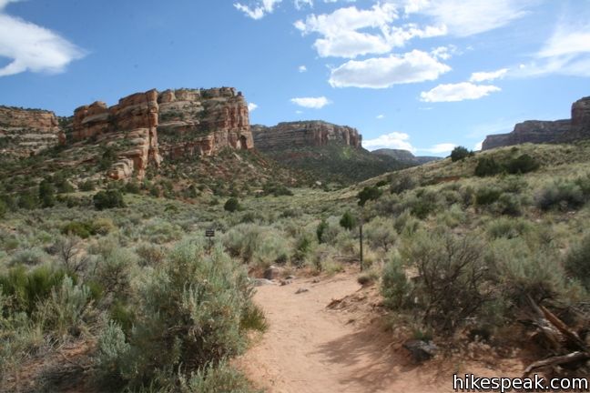
Devils Kitchen Trail starts out quite level, actually loosing 20 feet of elevation over 0.13 miles leading to the first junction. Follow the sign and turn right, taking the single track up No Thoroughfare Canyon. After another 0.13 miles make a left at the second junction leaving the canyon bottom toward Devils Kitchen.
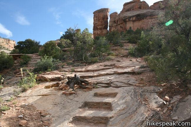
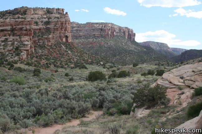
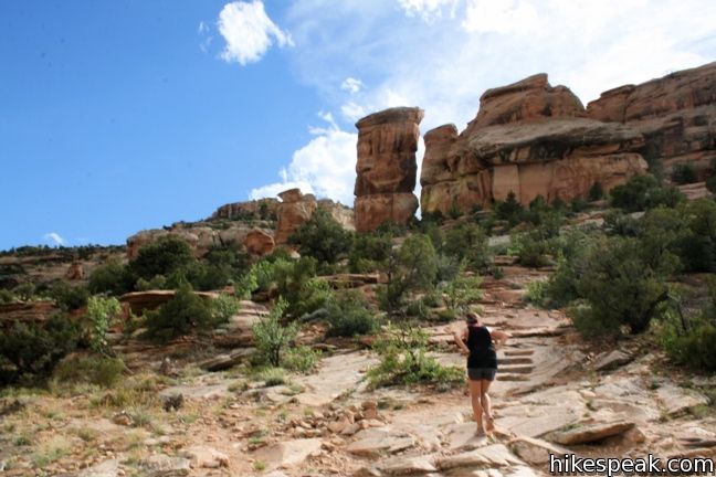
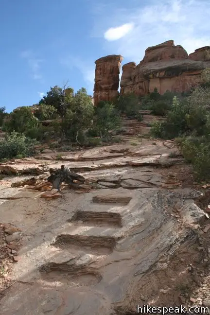
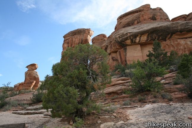
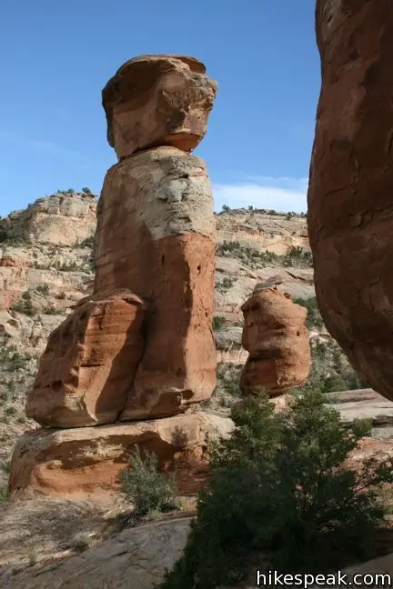
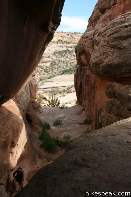
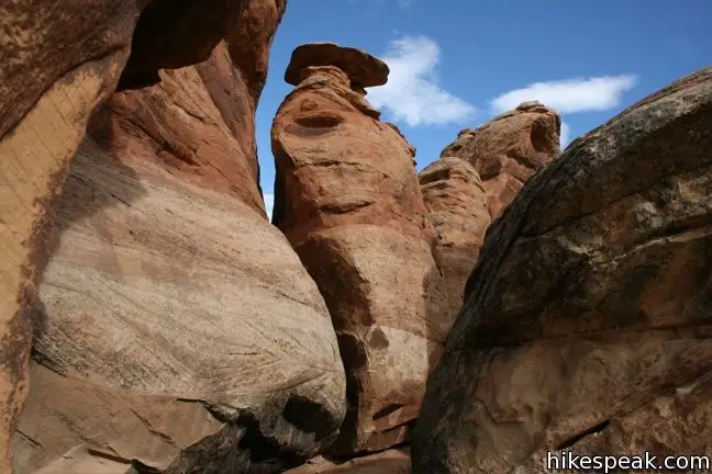
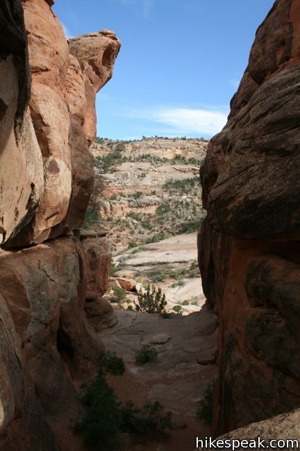
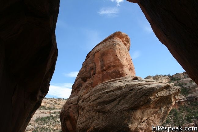
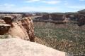
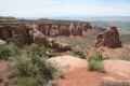
Devils Kitchen lies within a tower of tall boulders perched on the south side of No Thoroughfare Canyon. As the trail heads south, you will begin to ascend the 225 feet of elevation gain. Follow the dirt track as it swings to the right and begins up a series of steps cut into the rock. At the top of the stairs, the trail fades. March straight uphill to the tall standing bounders. Ascend slick rock slope to the opening on the left side of the boulders, and steps inside.
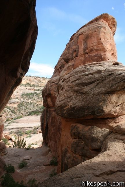
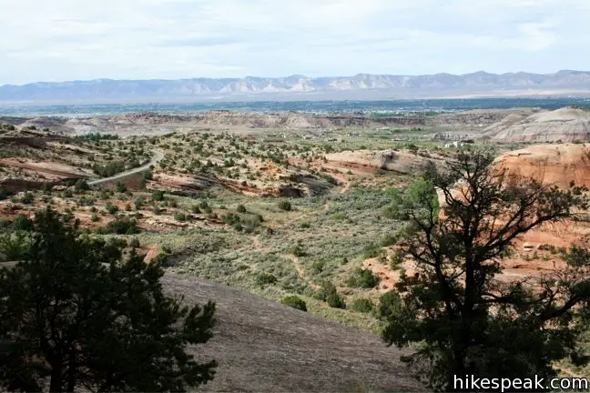
The rock enclosure creates a cool arena that attracts many visitors. Climb up the wall on the east side of the grotto to a window overlooking No Thoroughfare Canyon. When you are satisfied with the view, or can’t take the heat, get out of the kitchen and return the 0.6 mile single-track to the trailhead.
Directions to the Trailhead
- From the east entrance of Colorado National Monument near Grand Junction, drive 1/4 mile south on Rim Rock Drive.
- Turn left into the parking area for Devils Kitchen Trail (and No Thoroughfare Canyon Trail and Old Gordon Trail).
- From the opposite direction, drive 17.8 miles from Saddlehorn Visitor Center to the start of the trail.
- The trailhead is directly across from a picnic area with bathrooms.
Trailhead Location
Trailhead address: 2377 Glade Park Road – Monument Road, Colorado National Monument, Grand Junction, CO 81507
Trailhead coordinates: 39.03177, -108.63075 (39° 01′ 54.4″N 108° 37′ 50.7″W)
View Colorado National Monument in a larger map
Or view a regional map of surrounding Colorado trails and campgrounds.


 | Coke Ovens Trail This one-mile hike visits a line of sandstone domes decorating the rim of Monument Canyon. |
 | Monument Canyon Trail This 7-mile hike travels down into Monument Canyon to visit the tallest freestanding rock formation in the park. |
 | Otto's Trail This 0.75-mile round trip hike visits an overlook near the Pipe Organs with an excellent view of Independence Monument and Monument Canyon. |
 | More trails in Colorado Explore other destinations in Colorado National Monument. |
 | Saddlehorn Campground This 80-site campground is the only designated camping area in Colorado National Park, conveniently located near Saddlehorn Visitor Center. |
Common Questions about Devils Kitchen Trail in Colorado National Monument
- Is the trail open?
- Yes. You should expect to find that Devils Kitchen Trail is open. There are no recent reports of trail closures. If you discover that the trail is closed, please help your fellow hikers by reporting a closure.
- Do I need a permit for this hike?
- Yes. National Monument Entrance Fee.
- How much time does this hike take?
- It takes approximately 30 minutes to hike Devils Kitchen Trail. Individual hiking times vary. Add extra time for breaks and taking in the views.
- How long is this hike?
- The hike to Devils Kitchen Trail is a 1.2 mile out and back with 225 feet of elevation change.
- Are dogs allowed on this trail?
- No, dogs are likely not allowed on Devils Kitchen Trail. The trail is primarily open to hikers.
- Is Devils Kitchen Trail good for kids?
- Yes, this hike is likely suitable for children. It is relatively short (1.2 miles) with manageable elevation gain.
- Where is the trailhead located?
- The trailhead for Devils Kitchen Trail is located in Colorado National Monument, Colorado.
Trailhead Address:
Monument Road
Colorado National Monument, Colorado 81507
Trailhead Coordinates:
39.03177, -108.63075 - What are the driving directions to the start of the hike?
To get to the trailhead: From the east entrance of Colorado National Monument near Grand Junction, drive 1/4 mile south on Rim Rock Drive. Turn left into the parking area for Devils Kitchen Trail (and No Thoroughfare Canyon Trail and Old Gordon Trail).
From the opposite direction, drive 17.8 miles from Saddlehorn Visitor Center to the start of the trail. The trailhead is directly across from a picnic area with bathrooms.
View custom Google Maps directions from your current location.
- Are there other trails near Devils Kitchen Trail?
- Yes, you can find other nearby hikes using the Hikespeak Hike Finder Map.

Did this hike 7/12/11 Got rained out before I could do much hiking though.
https://trailtip.com/Member/DerekHolmes/Trails/Devils-Kitchen-_Colorado-National-Monument/ShowTrail.aspx
Yes we do
Great hike but they don’t allow dogs!
Why is Devil’s kitchen named that?
What is the trail that goes by a creek and at the end is a crystal wall?