Bay of Plenty

Bay of Plenty is a region on the North Island of New Zealand, centered around the large bay at the northeast end of the island. It is one of the most populous regions of New Zealand and includes the cities of Rotorua and Tauranga. Rotorua is a major tourist draw thanks to its unique hydrothermal features and adventurous spirit. The region has a beautiful coastline as well as inland lakes and rivers, making it a fine place in New Zealand to get outdoors.
Highlights of Bay of Plenty

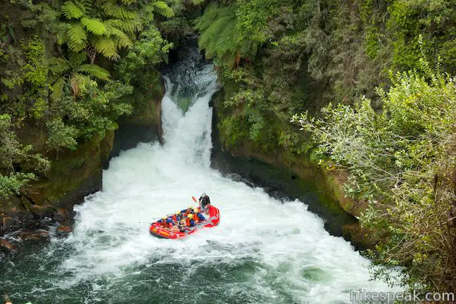
  • Take a thrilling trip through Okere Falls Scenic Reserve, plunging over the tallest commercially rafted waterfall in the world.
  • Walk past Frying Pan Lake, the largest hot spring in the world, and see other spectacular geothermal features while crossing though Waimangu Volcanic Valley.
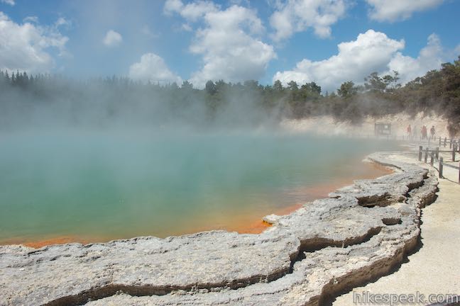
  • Take three successive loops through an action-packed thermal area full of mud pots, fumaroles, and hot springs, including the celebration-worthy Champagne Pool.
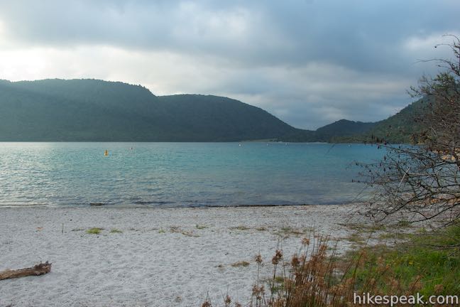
  • Take a lap around Blue Lake in the forest near Rotorua for a pleasant path to beaches and scenic viewpoints.
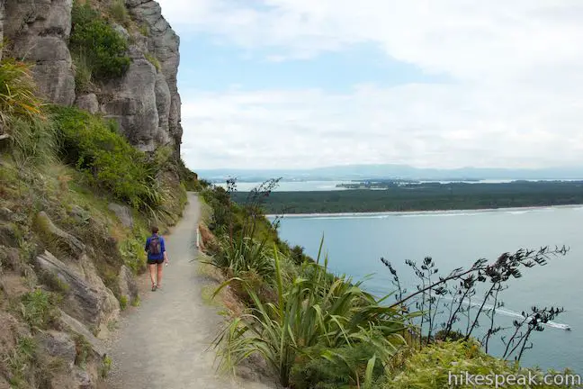
  • Combine tracks around the base of this extinct volcano at the end of a peninsula with tracks to the summit for a coastal hike with sweeping views.
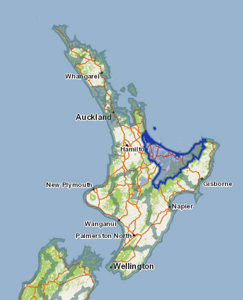
Bay of Plenty Region Map
The Bay of Plenty Region of New Zealand

Tracks in Bay of Plenty

This collection of walking tracks (hiking trails) in the Bay of Plenty Region of New Zealand is listed from north to south. The table may also be sorted alphabetically or by distance to help you pick your next outing. Each track links to its own report complete with photos, maps, directions, and all the other information needed to locate and enjoy these hikes.

TrailDescriptionDistance Location
Mount Maunganui90Mount Maunganui
This trek combines picturesque tracks around the base and up to the summit of a peninsula-topping peak in the Bay of Plenty Region of New Zealand.
3.4 - 7.3 km
20 - 230 meters
-37.63345,
176.1747
Okere Falls Track130Okere Falls Track
This scenic walk through Okere Falls Scenic Reserve has views of multiple waterfalls, cascades, and pools on the Okere River near Rotorua.
3 km
55 meters
-38.01424,
176.34396
Crater Lake Track135Blue Lake
This circuit near Rotorua provides a pleasant loop across lakeside beaches and forests, rising to a lookout over Blue Lake and nearby Green Lake.
6.15 km
40 meters
-38.1875,
176.332
Waimangu Volcanic Valley138Waimangu Volcanic Valley
This route descends through a landscape of spectacular geothermal features like Frying Pan Lake, the largest hot spring in the world, and can be paired with Lake Rotomahana Boat Cruise for a memorable geothermal experience in Rotorua.
4.75 km
115 meters
-38.2857,
176.387
Crater Lake Track140Crater Lake
This short walk in Rainbow Mountain Scenic Reserve goes to an overlook with views of a turquoise pool below vibrant cliffs.
1 km
18 meters
-38.3154,
176.3759
Kerosene Creek Hot Pool142Kerosene Creek
This short walk follows Kerosene Creek down to a hot pool below a crescent-shaped waterfall. Bring your bathing suit and wade into warm, welcoming waters.
0.33 km
14 meters
-38.33425,
176.38613
Waiotapu Thermal Wonderland145Wai-O-Tapu Thermal Wonderland
This thermal area full of hot pools, geysers, fumaroles, and mud pots can be explored on three successive loops.
1.35 - 3.05 km
20 meters
-38.35573,
176.3674

More outdoor fun in Bay of Plenty

You don’t need to hike to have a great experience.

Kaituna River Whitewater RaftingKaituna River Whitewater Rafting
Take a memorable trip down the Kaituna River (Okere River) through Okere Falls Scenic Reserve that includes a thrilling plunge over Tutea Falls, the tallest commercially rafted waterfall in the world!
Lake Rotomoahana Boat CruiseLake Rotomoahana Boat Cruise
Take a boat tour over the lake at the bottom of Waimangu Volcanic Valley, getting close to steaming vents and geysers right along the lakeshore for a unique on-the-water experience. The cruise is reachable by bus or a hike down Waimangu Volcanic Valley.


Lodging in Bay of Plenty

There are good places to stay throughout the Bay of Plenty Region.

Murupara Motor CampMurupara Motor Camp
Set in a small town in the Bay of Plenty Region of New Zealand, this motor camp is half holiday park and half motor lodge, offering a variety of accommodations in a location that is both removed from busy tourist centers and close to lots of fun outdoor activities.
Papamoa Beach ResortPapamoa Beach Resort
This oceanfront holiday park offers scenic lodging and campsites on grass-covered dunes above a beautiful beach on the Bay of Plenty near Tauranga.
Rotorua Top 10 Holiday ParkRotorua Top 10
This holiday park has campsites, cabins, and motel accommodations in a fun setting near the center of Rotorua with amenities that include mineral hot pools.


View New Zealand tracks, campgrounds, and lodging in a larger map
Or explore tracks in New Zealand on the Oceania Hike Finder Map
hikespeak
Devils Punchbowl Falls Arthur's Pass National Park Hike Devils Punchbowl Walking Track Arthur's Pass Village Hiking Track Devils Punchbowl Waterfall New Zealand Devil's Punchbowl
Devils Punchbowl Falls is a star attraction in Arthur's Pass National Park. The dynamic waterfall plunges 131 meters into a canyon near Arthur's Pass Village. The area's Māori named the waterfall Hinekakai, taking inspiration from its beautiful threads of water. Visitors can reach the waterfall on a 2-kilometer (1.4-mile) round trip walk beginning from Arthur's Pass Village. Devils... Read more.
By: Published: Last updated: May 6, 2017
Otira Valley Track Arthur's Pass National Park Hike Arthur's Pass Village Hiking Track New Zealand
Just over the north side of Arthur's Pass and 5 kilometers from Arthur's Pass Village, you'll find Otira Valley Track, which ascends a trough-shaped valley off the west side of the pass. The track ends at Otira River Footbridge. Under normal circumstances, a bridge would be an odd place to end a hike (since a bridge lead to something on the other side). The route beyond Otira River... Read more.
OK! Add to trails I’ve hiked
OK! Add to trails I want to hike
Tagged with · Arthur's Pass Village · Creeks · Free Trails · New Zealand Department of Conservation · New Zealand National Parks · Arthur's Pass National Park
Distance: 3.8 kilometers / 2.35 miles · Elevation change: 125 meters / 410 feet
By: Published: Last updated: May 6, 2017
Bealey Chasm Walk Arthur's Pass National Park Hike Bealey River Hiking Track Bealey Valley Track Footbridge Arthur's Pass Village New Zealand
North of Arthur's Pass Village, Bealey River passes through a narrow gorge, creating a mix of tumbling white water and blue pools. A footbridge on Bealey Valley Track crosses over this point on the river, called Bealey Chasm. Visit the chasm on a short walk beginning from State Highway 73. Bealey Chasm Walk starts with a short section of Arthur's Pass Walking Track and connects to Bealey... Read more.
OK! Add to trails I’ve hiked
OK! Add to trails I want to hike
Tagged with · Arthur's Pass Village · Creeks · Free Trails · New Zealand Department of Conservation · New Zealand National Parks · Arthur's Pass National Park
Distance: 0.65 kilometers / 0.4 miles · Elevation change: 12 meters / 40 feet
By: Published: Last updated: May 6, 2017
Old Coach Road Walk Arthur's Pass National Park Hike Greyneys Shelter Arthur's Pass Hiking Track New Zealand
This mostly unremarkable woodland walk explores the forest a few kilometers south of Arthur's Pass Village. Much of the track follows an old coach road that went to Arthur's Pass so the walk provides a history lesson on the area's earlier travelers. The easy walk is 1 to 1.4 kilometers long, starting and ending at Greynes Shelter Campground. With just 15 meters of elevation change along... Read more.
OK! Add to trails I’ve hiked
OK! Add to trails I want to hike
Tagged with · Arthur's Pass Village · Free Trails · New Zealand Department of Conservation · New Zealand National Parks · Arthur's Pass National Park
Distance: 1.4 kilometers / 0.9 miles · Elevation change: 15 meters / 50 feet
By: Published: Last updated: May 6, 2017
Millennium Walk Avalanche Creek Waterfall Arthur's Pass National Park Hike Avalanche Creek Falls Arthur's Pass Hiking Track New Zealand
Millennium Walk is a very short hike from the visitor center for Arthur's Pass National Park to a viewing platform alongside Avalanche Creek Waterfall. This walk is 500 meters round trip with only a few meters of elevation change, covered over stone steps at the end of the walk. If you stop by the visitor center in Arthur's Pass Village, this short walk to the waterfall is well worth your... Read more.
By: Published: Last updated: May 6, 2017