Hikes on California’s Central Coast

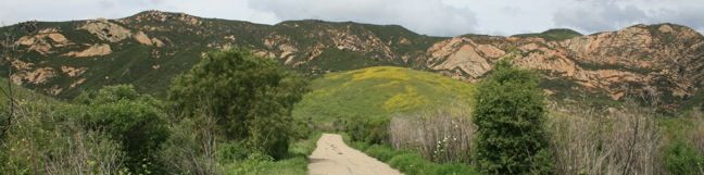
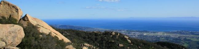
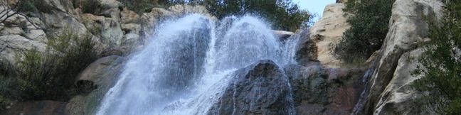
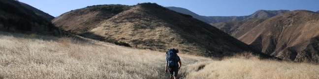
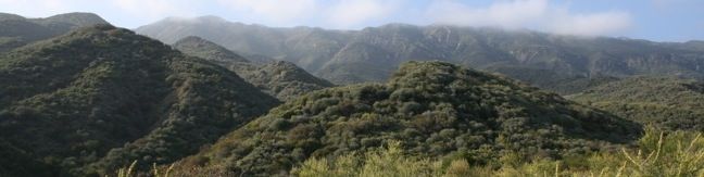
The Central Coast possesses some of the most scenic hiking in California, especially for those who enjoy ocean views. Numerous small parks protect the area's green spaces and many are free to the public. Highlights of California's Central Coast [wp_ad_wide_page] Hiking California's Central Coast Los Padres National Forest is the major protective body on the Central Coast, preserving mountain ranges that span across Monterey, San Luis Obispo, Santa Barbara, and Ventura counties. ... Read more.
Gaviota Wind Caves in Gaviota State Park
The Gaviota Wind Caves are a sandstone formation located a mile from the Pacific Ocean in the Santa Ynez Mountains west of Santa Barbara. The hike to the wind-swept caves is 2.5 miles round trip with 600 feet of elevation gain. One good thing about the Gaviota Wild Caves is that they are easy to get to from the 101. In fact, the wind caves can be seen from the freeway. ...Read more.
Distance: 2.5 miles · Elevation change: 600 feet
By: Published: March 15, 2010 Last updated: December 5, 2025
Lizard’s Mouth in Los Padres National Forest
Lizard's Mouth is a mountain top rock formation overlooking Santa Barbara. Wind-carved pockets on the underside of this sandstone outcropping give the rock a resemblance to a frog or lizard's mouth. The short hike to Lizard's Mouth offers sensational views and is a quick excursion for anyone traveling the 154 between Santa Barbara and Lake Cachuma or Los Olivos. ...Read more.
Distance: 0.5 miles · Elevation change: 25 feet
By: Published: March 14, 2010 Last updated: April 8, 2026
Tangerine Falls in Los Padres National Forest
After a spring rain, the 100-foot Tangerine Falls blooms into the most beautiful waterfall in Santa Barbara. The seasonal waterfall dries out for much of the year, but is spectacular at the peak of the rainy season. The 2.5-mile excursion to Tangerine Falls has 875 feet of elevation gain and everything a hiker could want — a soothing creek, plenty of shade, ocean views, and even a bit of off-trail rock hopping and scrambling (not to mention an exceptional waterfall). ...Read more.
Distance: 2.5 miles · Elevation change: 875 feet
By: Published: March 12, 2010 Last updated: December 5, 2025
Sespe Creek to Willett Hot Springs in Los Padres National Forest
Located just north of Ojai, Sespe Wilderness is the largest wilderness area within Los Padres National Forest, occupying 342 square miles. Sespe Creek cuts through this land and the adjacent trail offers great views of a wide valley and scenic creek. The trail starts from Piedra Blanca trailhead near Rose Valley Falls and leaves the dense green of the bays, oaks, and chaparral for grassland plains that feel surprisingly southwestern. ...Read more.
Distance: 19 miles · Elevation change: 500 feet
By: Published: February 26, 2010 Last updated: December 5, 2025
Wheeler Gorge Campground and Nature Trail in Los Padres National Forest
Wheeler Gorge offers a campground and a nature trail. If you are planning an overnight visit to the Los Padres near Ojai, keep Wheeler Gorge campground as an option. When the free campgrounds fill up with weekend fishermen, Wheeler Gorge is an attractive alternative. Single sites go for $25 a night (and $10 for additional vehicles). Double sites are available for $50 per night (all prices as of 2018). ...Read more.
Distance: 0.7 miles · Elevation change: 100 feet
By: Published: February 25, 2010 Last updated: April 6, 2026