Pipeline Trail Hood River Oregon Penstock Flume Hike Columbia River Gorge Powerdale Corridor
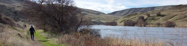
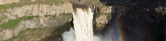
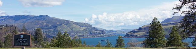
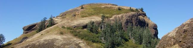
Most of the trails in Columbia River Gorge lead to big waterfalls or big views, but one of these trails is not like the others. The Pipeline Trail near downtown Hood River has a hiking experience that could very well be a one-of-a-kind. This route exchanges the average dirt trail for a catwalk built on top of a penstock pipeline. That catwalk stands a dozen feet off the ground and whisks... Read more.
OK! Add to trails I’ve hiked
OK! Add to trails I want to hike
Tagged with · Free Trails · Hood River · Ruins
Distance: 2.8 miles · Elevation change: 100 feet
By: Published: Last updated: September 13, 2018
Camassia Natural Area Loop Trail West Linn Wildflower Hike Camas Lilies Portland Oregon
Camassia Natural Area contains something special – one of the best wildflower displays in the greater Portland area. From April to May, the grassy plateaus in this 27-acre preserve boasts beautiful purples, blues, pinks and yellows created by Camas lilies, blue-eyed Mary, rosy plectritis, and buttercups (as well as other flowers). Explore this West Linn jewel on an easy 0.8-mile loop... Read more.
OK! Add to trails I’ve hiked
OK! Add to trails I want to hike
Tagged with · Camassia Natural Area · Free Trails · The Nature Conservancy · West Linn · Wildflowers
Distance: 0.8 miles · Elevation change: 70 feet
By: Published: Last updated: August 4, 2018
Scouters Mountain Nature Park Hike Portland Mount Hood View Happy Valley Boomer Trail Scouters Mountain Shelter
Searching for a short hike in the Portland area? Scouters Mountain Nature Park in Happy Valley makes a worthwhile destination for a 1.2-mile hike. Explore a forested cinder cone east of Portland, plotting your way through tall firs to a summit clearing with a direct sight of Mount Hood. If you work up an appetite, picnic under a pavilion at the top of Scouters Mountain. Abundant shade makes... Read more.
OK! Add to trails I’ve hiked
OK! Add to trails I want to hike
Tagged with · Cinder Cones · Free Trails · Happey Valley
Distance: 1.2 miles · Elevation change: 180 feet
By: Published: Last updated: August 4, 2018
Canemah Bluff Nature Park Oregon City Hike Camas Springs Trail Canemah Bluff Hike Willamette Falls Portland Oregon
What's so appealing about Canemah Bluff Nature Park in Oregon City? Start with fields of spring wildflowers and views of Willamette Falls. Then add ferny forests and a historical cemetery to give visitors plenty of reasons to take this 1.7-mile hike. In April and early May, Camas lilies steal the show at Canemah Bluff Nature Park, providing pops of purple to a meadow on a landing above the... Read more.
OK! Add to trails I’ve hiked
OK! Add to trails I want to hike
Tagged with · Free Trails · Oregon City · Willamette River
Distance: 1.7 miles · Elevation change: 165 feet
By: Published: Last updated: September 9, 2019
Camping Deschutes River State Recreation Area Campground Columbia River Tent RV camp Oregon
Deschutes River State Recreation Area is located east of The Dalles, Oregon (where spring arrives earlier than it does in areas west of the Columbia River Gorge). Bordering the Deschutes River beside its meeting with the Columbia River, the park's grassy and shaded campground is a relaxing place to stay. This 63-site campground (with 34 sites with electrical hookups, 25 more primitive sites,... Read more.
By: Published: Last updated: August 15, 2020
River Trail Loop Deschutes River State Recreation Area Atiyeh Deschutes River Trail Loop Oregon Blackberry Trail Riverview Trail Loop
Right before spilling into the Columbia River, the Deschutes River flows down a canyon between grass and sagebrush-covered ridges with basalt outcroppings. Alongside the river, a pair of parallel trails allow hikers to enjoy a 3.1-mile loop with a variety of fine views. The level River Trail (also known as Blackberry Trail) hugs the riverbank, while the rolling Upper Trail (also known... Read more.
By: Published: Last updated: June 24, 2018
Palouse Falls State Park Waterfall Trail Campground Viewpoint Washington
Palouse Falls appears like magic. The drive into Palouse Falls State Park crosses a broad grassy plain where you would never expect to find a waterfall. At the end of the dusty road, the land opens up to reveal a beautiful scene. A 180-foot waterfall plunges from the basalt wall of a gouged-out canyon. A short, 0.15-mile round trip walk explores a clifftop viewpoint with great... Read more.
OK! Add to trails I’ve hiked
OK! Add to trails I want to hike
Tagged with · LaCrosse · Palouse Falls State Park · Washington State Parks · Waterfalls
Distance: 0.15 miles · Elevation change: 40 feet
By: Published: Last updated: June 5, 2018
Catherine Creek Arch Columbia River Gorge National Scenic Area Hike Washington
Catherine Creek Arch is a surprising creation - a bridge-like span of rock along a ledge of basalt. A 1-mile round trip hike leads to the foot of Catherine Creek Arch (and longer loops in the area are also possible). This short and sweet outing entertains hikers of all ages. Part of the Columbia River Gorge National Scenic Area, Catherine Creek is located on the Washington side of the west... Read more.
OK! Add to trails I’ve hiked
OK! Add to trails I want to hike
Tagged with · Arches · Columbia River Gorge National Scenic Area · Free Trails · Lyle
Distance: 1 mile · Elevation change: 100 feet
By: Published: Last updated: May 9, 2018
Catherine Creek Trail Columbia River Gorge National Scenic Area Wildflower Loop Hike Washington
Hikers pack the slopes of Dog Mountain to see spring wildflowers, but tackling a lot of elevation is not required to see one of the best blooms in Columbia River Gorge National Scenic Area. Instead, visit Catherine Creek, where an easy, paved 0.9-mile loop (with just 100 feet of elevation change) floods with wildflowers in the spring and early summer. Catherine Creek Interpretive Trail... Read more.
OK! Add to trails I’ve hiked
OK! Add to trails I want to hike
Tagged with · Columbia River Gorge National Scenic Area · Free Trails · Lyle · Nature Trails · Wildflowers
Distance: 0.9 miles · Elevation change: 100 feet
By: Published: Last updated: May 9, 2018
Saddle Mountain Trail Saddle Mountain State Natural Area Coast Range Summit Hike Seaside Oregon
One hike in Northwest Oregon really rises above the rest. Saddle Mountain is the highest point in the northern half of the Coast Range with sweeping 360-degree from a 3,283-foot summit that look out over the Pacific Ocean, the Columbia River, and inland toward the Cascade Range. The hike up Saddle Mountain Trail is 5 miles round trip with 1,635 feet of elevation change (including steep... Read more.
OK! Add to trails I’ve hiked
OK! Add to trails I want to hike
Tagged with · Free Trails · Seaside · Summits
Distance: 5 miles · Elevation change: 1635 feet
By: Published: Last updated: June 28, 2021