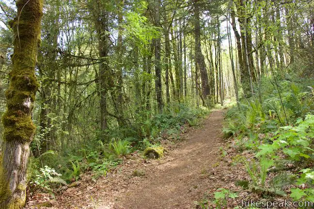
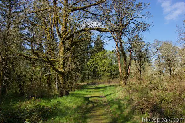
What’s so appealing about Canemah Bluff Nature Park in Oregon City? Start with fields of spring wildflowers and views of Willamette Falls. Then add ferny forests and a historical cemetery to give visitors plenty of reasons to take this 1.7-mile hike. In April and early May, Camas lilies steal the show at Canemah Bluff Nature Park, providing pops of purple to a meadow on a landing above the Willamette River. Throughout the year, the dense forest in the rest of the park serves as a shaded retreat.
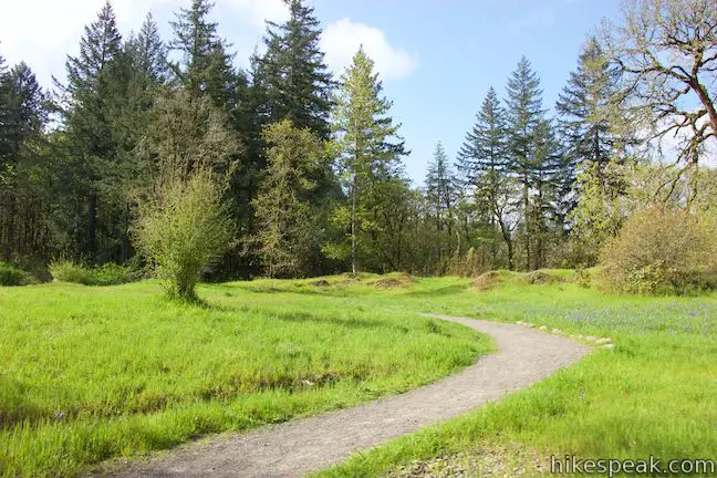
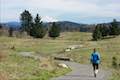
Although it is short, the route outlined here combines six different trails and is shaped like three linked loops. The southernmost loop, composed of Big Slide Trail and Licorice Fern Trail, tackles most of the hike’s 165 feet of elevation change. By only doing two of the three loops, the outing could be trimmed to under a mile long with just 35 feet of elevation change. No one should miss the first trail on the loop, Camas Springs Trail, which passes an overlook on the edge of the bluff above the Willamette River and weaves through grasses where spring wildflowers appear.
The turn-by-turn directions of the Canemah Bluff hike are:
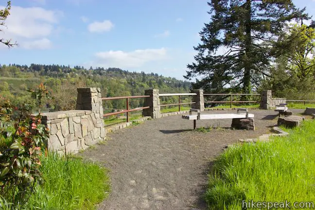
- Start by walking around Canemah Children’s Park for views of Willamette Falls (0 miles)
- Leave Canemah Children’s Park, traveling west on Camas Springs Trail (0.08 miles)
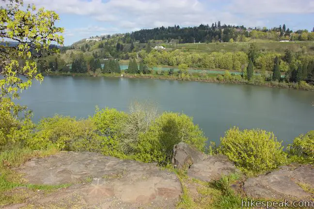
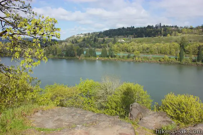
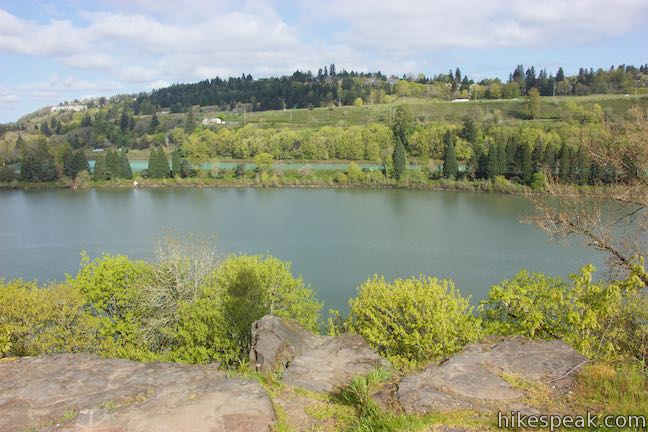
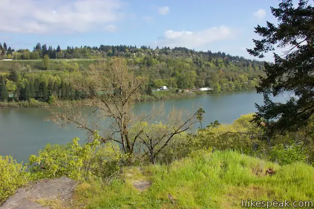
- Stray off the right side of the trail to a Willamette River overlook(0.18 miles)
- Come to the end of Camas Springs Trail and turn right onto Canemah Historic Pioneer Cemetery Road (0.3 miles)
- Proceed west past the bottom of Licorice Fern Trail (0.35 miles)
- Reach the end of Canemah Historic Pioneer Cemetery Road, look in on the cemetery, and turn left up Spur Trail (0.5 miles)
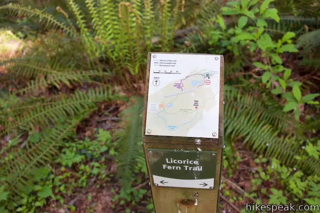
- At the end of Spur Trail, turn right on Licorice Fern Trail (0.55 miles)
- After fifty yards on Licorice Fern Trail, bear right at a split onto Old Slide Trail (0.58 miles)
- Bear left through a junction with a maintenance road to continue on Old Slide Trail (0.63 miles)
- Stay on Old Slide Trail past a path (0.74 miles)
- Turn left to stay on Old Slide Trail past another maintenance road (0.77 miles)
- Crest the high point of the loop and bear left to stay on Old Slide Trail past another path (0.87 miles)
- At the end of Old Slide Trail, turn left onto Licorice Fern Trail (1.03 miles)
- Pass the junction with the other end of Old Slide Trail and stay to the right on Licorice Fern Trail (1.3 miles)
- Stay to the right through a junction with Spur Trail to continue north on Licorice Fern Trail (1.33 miles)
- At the end of Licorice Fern Trail, turn right onto Canemah Historic Pioneer Cemetery Road (1.45 miles)
- Pass Camas Springs Trail and continue east on Canemah Historic Pioneer Cemetery Road (1.5 miles)
- Turn left down Frog Pond Trail (1.6 miles)
- Return to Canemah Children’s Park (1.7 miles)
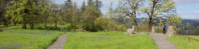
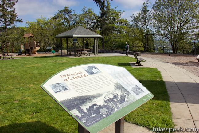
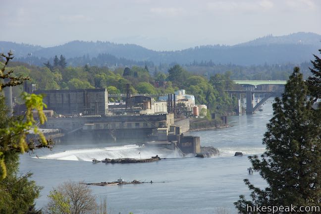
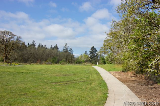
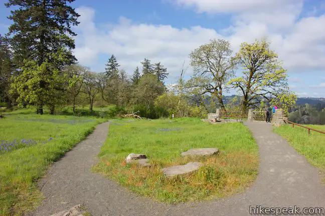
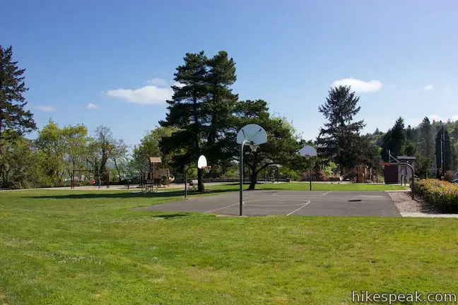
The hike begins from Canemah Children’s Park, which is a developed park bordering Canemah Bluff Nature Park. Even if you’re not interested in the playgrounds, picnic area, and basketball court, be sure to take the concrete path around the permitted of the park. Leaving the parking area, this walkway is on the right and curves around the east side of Canemah Children’s Park to offer views north through the trees toward downtown Oregon City and Willamette Falls, backed by the old paper mill, and the West Linn side of the river. The roughly horseshoe shaped waterfalls is, by volume, the biggest waterfall in the Pacific Northwest and the second biggest in America, behind Niagara Falls. (Before it was eliminated by the Dalles Dam, Celilo Falls in the Columbia River handled more water than any other waterfall in North America).

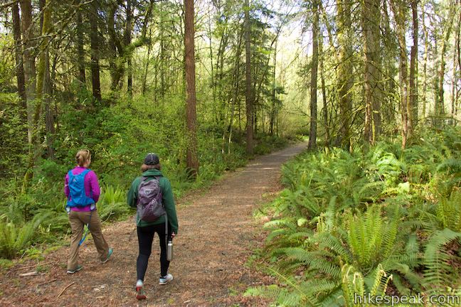
Continue around to the northwest side of the Children’s Park where a wide, nicely groomed trail begins. Walk along Camas Springs Trail for a tenth of a mile as it weaves through grassland and comes to a split. A short extension off the trail ventures out to a viewpoint on the edge of Canemah Bluff. Walk over and take a look across the Willamette River. McLoughlin Boulevard (99E) is just below the bluff, but out of view, allowing you to enjoy a sweeping river vista.
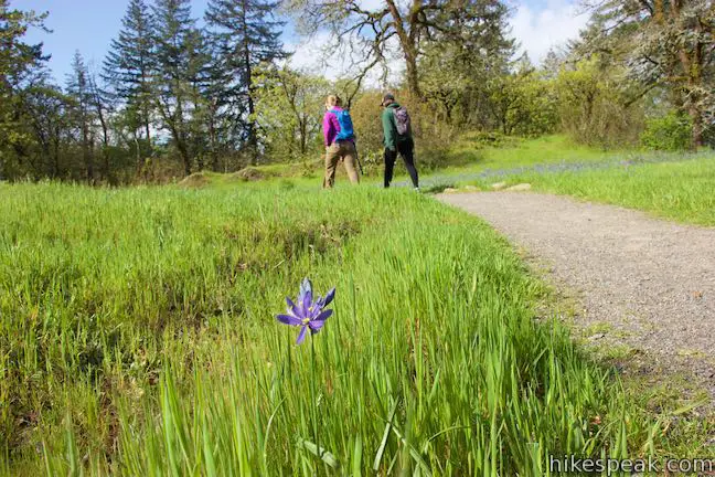
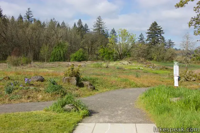
Leave the overlook and continue west along the trail, which dips across a gully and turns south. Oregon white oaks dot the grassland for intermittent shade.
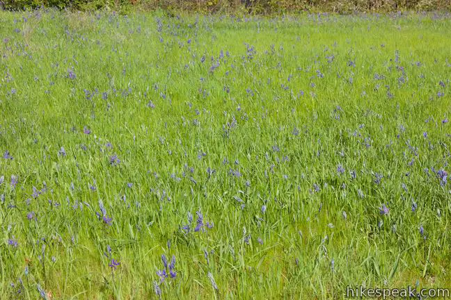
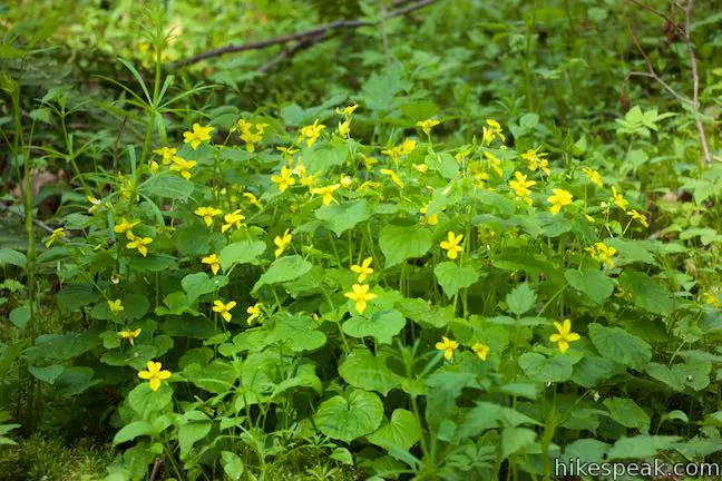
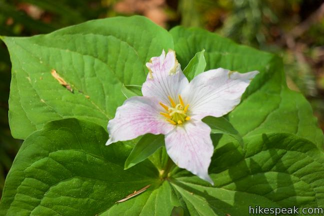
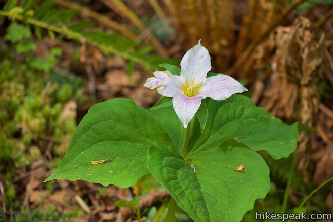
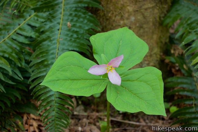
spring visitors can find a wonderful display of wildflowers along the trail. Camas lilies are the most common, along with Brodiaea lilies, which rise from the grasses to make a statement with their purple petals. White flowers flourish too, like white fawn lilies and white rock larkspur (which have some blue as well). Oregon sunshine are there to add doses of yellow and rosy plectritis wave balls of pink above the grasses.
- As of 2018, the area is undergoing a prairie restoration, which will remove invasive plants and increase the population of native grasses and wildflowers.
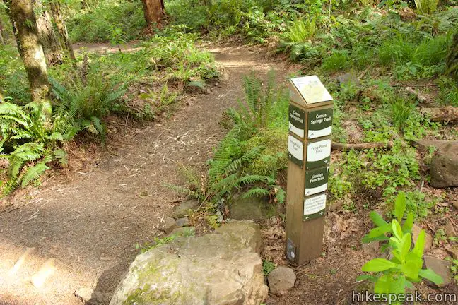
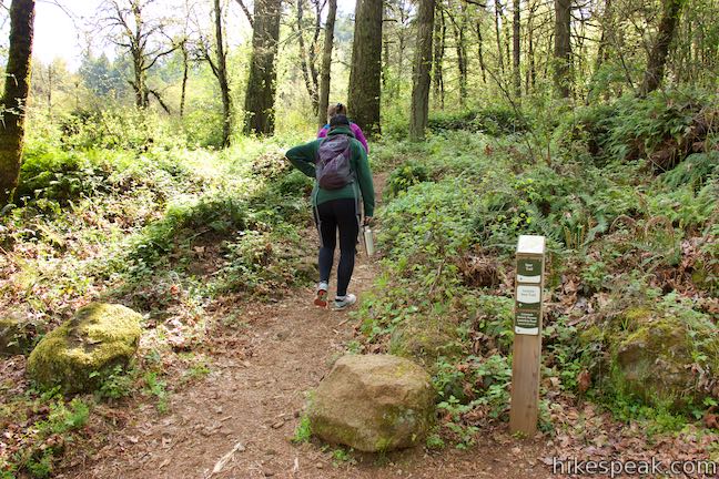
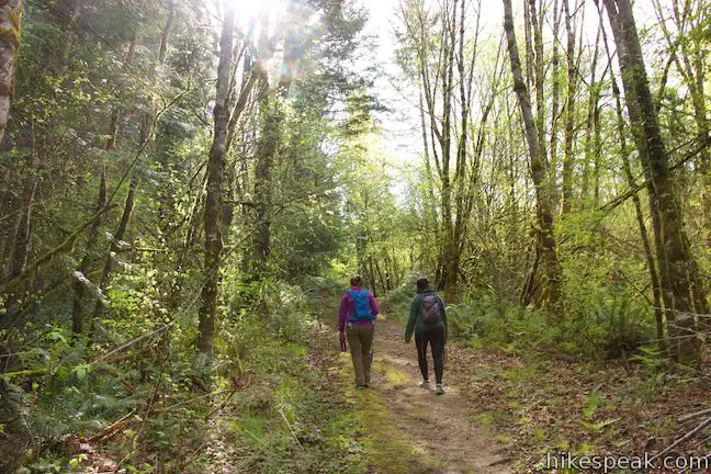
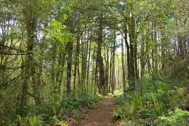
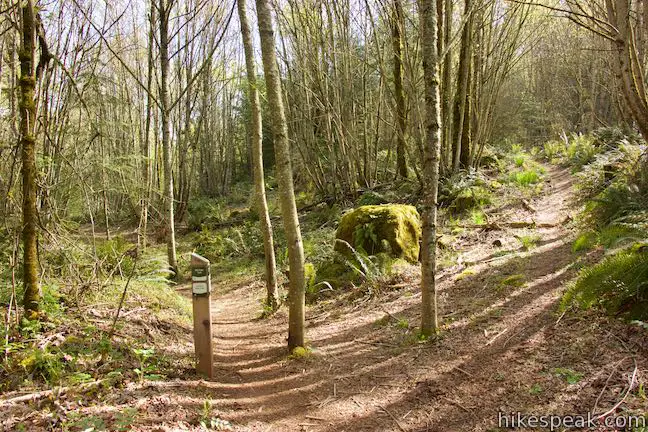
Just a tenth of a mile past the overlook, the wildflower display is diminished as Camas Springs Trail leaves the meadows for a forest of conifers and hardwoods. Shortly thereafter, come to the first of several junctions along the hike, which are each marked by posts with small maps and signs with trail names and arrows. Turn right on Canemah Historic Pioneer Cemetery Road to venture toward a civil war-era cemetery.
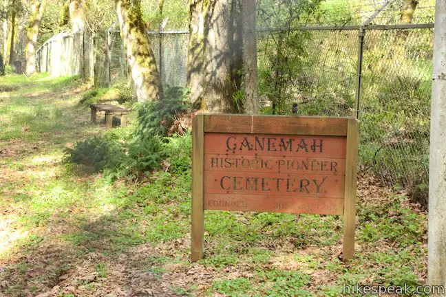
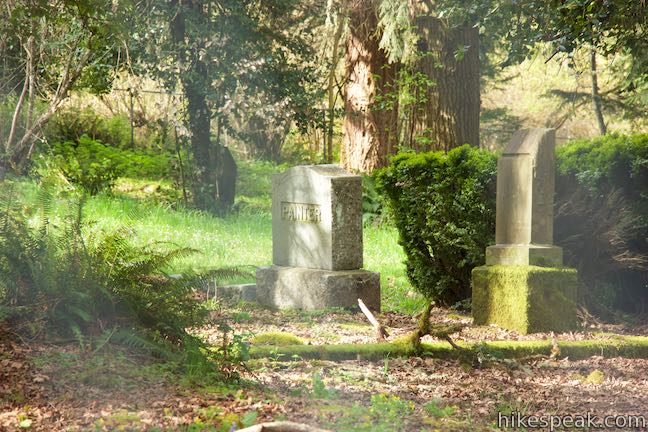
In just 250 feet, pass another junction where Licorice Fern Trail meets the road. You could turn left here to hike the next couple loops in reverse. Otherwise, continue hiking east on the dirt road to the cemetery. In another 0.15 miles, and half a mile from the start of the hike, arrive at Canemah Historic Pioneer Cemetery. The road ends beside a cemetery wrapped by a modern chain-link fence. A sign indicated that the cemetery was founded in June of 1864.
History Break
This might be a good point in the hike to reflect on the area’s past (which is outlined in a couple panels at the Children’s Park). The name Canemah dates back to the Native Americans who lived in this area and is based on their word for canoe. Before settlers arrived, the tribes that lived here, known as the Clackamas People, had a village of plank house in Canemah and operated a portage around Willamette Falls. The Clackamas controlled Willamette Falls and access to the Lower Willamette River and Clackamas River. This geographical significance brought them into contact with European fur traders and pioneers. From the 1820s to the 1840s, the introduction of European diseased devastated the Native Americans, as a panel by the park explains:
The Clackamas People helped early pioneers portage the steep terrain around the falls and served as guides for travel south into the Willamette Valley. Close contact with early pioneers spread unfamiliar diseases to the Native people and by 1851, approximately 97% of the Native people in the Willamette Valley had died from smallpox and other foreign diseases.
The Clackamas had their land taken and moved to a reservation. Settlers wrote the next chapter for Canemah, as the area became a boat-building and trading hub in the second half of the nineteenth century. Canemah’s first public school was built in 1870 on the site of Canemah’s Children’s Park. Oregon City grew alongside Canemah and annexed the town in 1928. When a school was no longer needed, a park for kids was created on Canemah Bluff in 1949.
Back to the hike
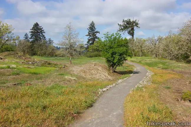
Leaving the cemetery, do not just walk back down the road. Instead, turn left on Spur Trail, which is a shortcut to the next area of the park. This single track rises through the forest by the cemetery and quickly links up with Licorice Fern Trail. If you turned left, you could start closing down the first couple rings on the route, getting back to the children’s park after an effort of 0.92 miles round trip with 30 feet of elevation change. Unless you’re looking for an easy, less-than-a-mile long hike, bear right on Licorice Fern Trail.
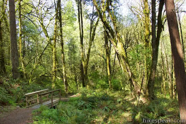
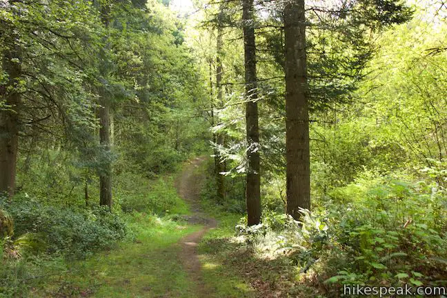
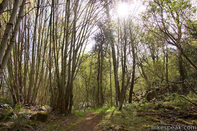
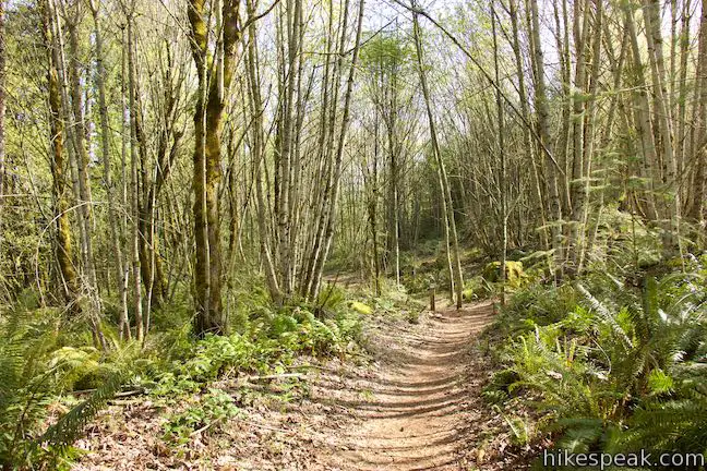
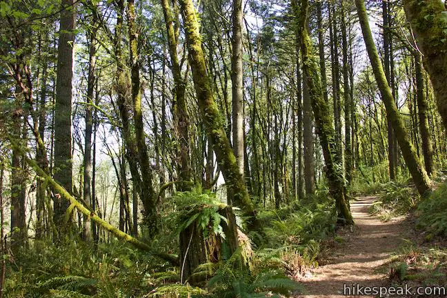
Keep the directions handy, because you’ll come to another marked split after fifty yards. The third loop begins here, where Big Slide Trail parts to the right. To the left, Licorice Fern Trail slips through what is probably the nicest stretch of forest along the hike. For now, bear right on Big Slide Trail. With the first third of this hike being so very level, the 150 feet of elevation gained along Big Slide Trail may catch you off guard.
Before it reunites with Licorice Fern Trail, Big Slide Trail goes through four minor junctions with diverging paths. After just fifty yards on Big Slide Trail, meet a maintenance trail (no public access) and bear left to stay on Big Slide Trail, which begins to climb. The trails rolls and rises up the hillside, following the route of an old road.
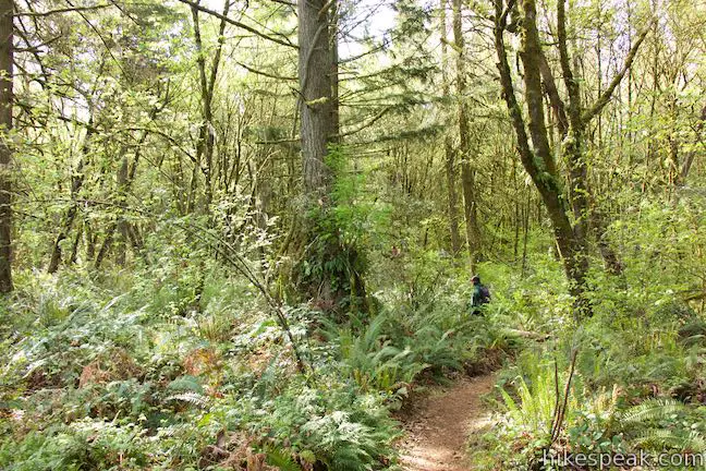
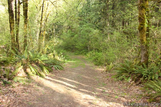
Hike through a junction with a narrow path after another tenth of a mile and proceed to a junction with another maintenance road. Bear left to stick with Big Slide Trail as it turns eastward. Sunlight penetrates the verdant forest as you get higher up the hill. Sword ferns line the wide single-track trail. In another tenth of a mile, crest the high point of Big Slide Trail and come to a junction with one last path. Stay to the left, following the marker for Big Slide Trail toward Licorice Fern Trail.
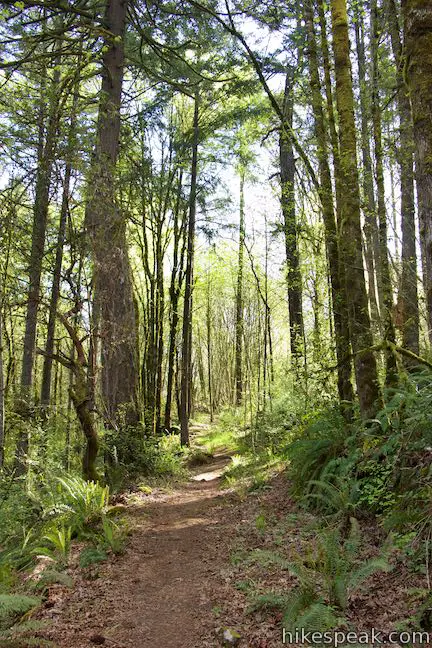
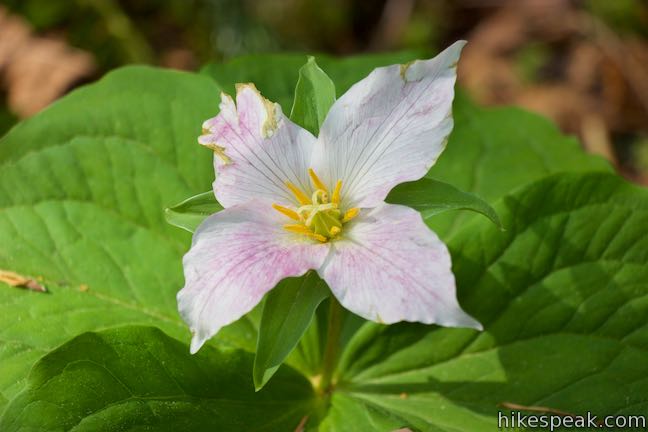
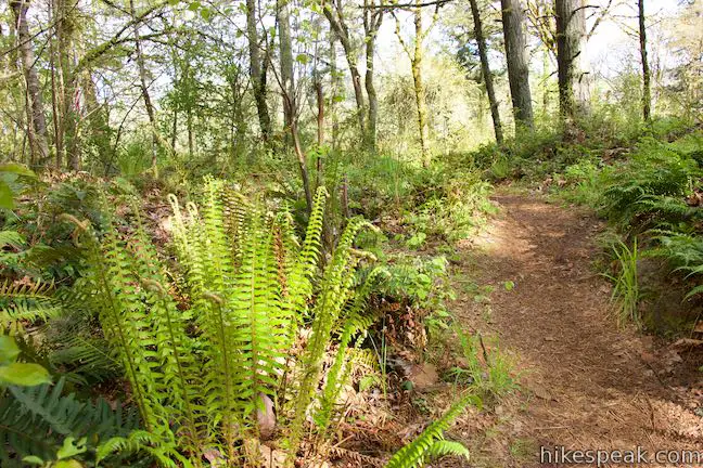
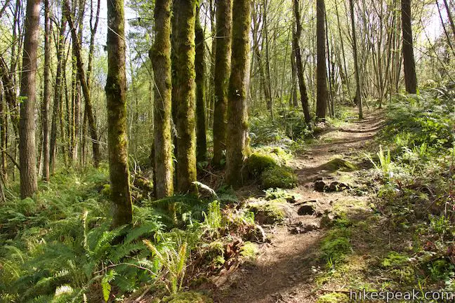
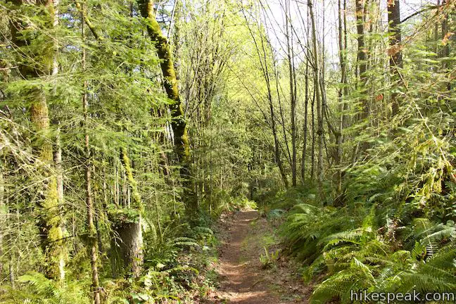
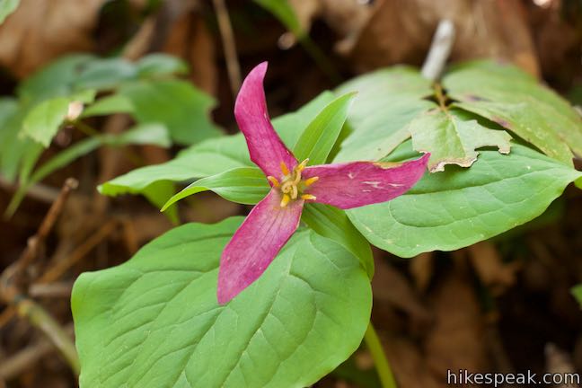
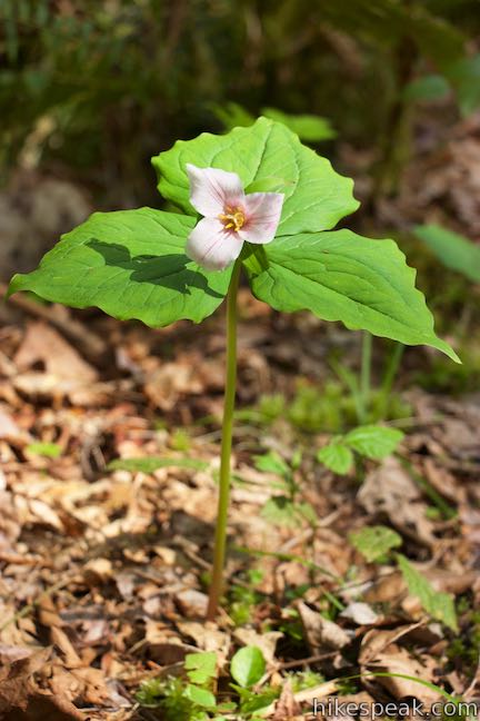
Big Slide Trail travels downhill for the next 0.15 miles through a forest that charms with an attractive ground cover. Mossy boulders are framed by ferns and flowering natives like Pacific bleeding heart, candy flower, and yellow violets. Trillium steal the show in the spring, and you may even be fortunate enough to spot a rare four-petal trillium.
Meet back up with Licorice Fern Trail after 0.45 miles on Big Slide Trail. One extension of Licorice Fern Trail extends to the right, making its way toward the neighborhood above Canemah Children’s Park (presenting an alternate route back to the starting point). Bear left and make your way down Licorice Fern Trail.
The alluded to licorice ferns sprout from the sides of the mossy tree trunks along your path. A tenth of a mile from the junction, cross a footbridge over a small stream flowing down the hillside. Take a moment to look around this lush opening in the forest before continuing down the trail.
The terrain levels out and in no time at all, Licorice Fern Trail passes the other end of Big Slide Trail. Blow through this junction and then breeze past Spur Trail to proceed down Licorice Fern Trail, notching off 1 1/3 miles of hiking.
Licorice Fern Trail eases through the forest for another eighth of a mile and comes to an end at Canemah Historic Pioneer Cemetery Road (at a spot you crossed 0.35 miles into the hike). Bear right on the old road (away from the cemetery) and travel east.
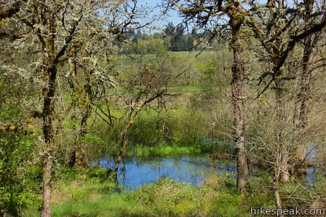
Approach the junction at the end of Camas Springs Trail after 250 feet (and 1.5 miles of total hiking). If the wildflowers were popping along this prairie-crossing trail that you took to start the hike, you may want to abandon the next couple directions and simply retrace your steps down Camas Springs Trail. To explore more areas of Canemah Bluff Nature Park, continue east on Canemah Historic Pioneer Cemetery Road for another tenth of a mile. The road rises to a junction with Frog Pond Trail. Bear left and follow this single track for a tenth of a mile, passing through a marshy area with a small pond located uphill from Camas Springs Trail.
Frog Pond Trail ends at the edge of Canemah Children’s Park, bringing to a close this short but nuanced 1.7-mile hike with many trail junctions. Dogs and bikes are not allowed in Canemah Bluff Nature Park. The park is open daily from sunrise to sunset. No permit is required for this hike and parking at the trailhead is free, so get out and enjoy!
- To see even more wildflowers, take a hike through nearby Camassia Natural Area.
Directions to the Trailhead
- From the interchange between Interstate 84 and Interstate 205 in Portland, take Interstate 205 south for 12 miles.
- Get off at exit 9, following signs for 99E toward downtown Oregon City.
- At the end of the offramp, turn left onto McLoughlin Boulevard (99E).
- Drive 1.8 miles south, passing through downtown Oregon City, and turn left up Hedges Street.
- Make the next left up 3rd Avenue.
- Then turn right on Ganong Street, which rises through a curve and becomes 4th Avenue.
- Drive a third of a mile to the end of the road and find Canemah Children's Park on the right.
Trailhead Location
Trailhead address: Canemah Children’s Park, 815 4th Ave, Oregon City, OR 97045
Trailhead coordinates: 45.3449, -122.6256 (45° 20′ 41.6″N 122° 37′ 32.2″W)
View Canemah Bluff in a larger map
Or view a regional map of surrounding Oregon trails and campgrounds.


 | Camassia Natural Area This 0.8-mile loop tours wildflower-packed meadows and surrounding forests in a blossoming West Linn preserve. |
 | Trillium Trail in Tryon Creek State Natural Area This short nature trail is packed with plant-identifying panels as well as benches and viewing platforms. |
 | Two-Mile Loop in Tryon Creek State Natural Area Combine Old Main Trail, Red Fox Trail, Cedar Trail, Middle Creek Trail, and Maple Ridge Trail to loop through rolling woodland and across 3 bridges. |
 | George Himes Trail This short lollipop loop ascends into Portland's West Hills for a woodland walk with a view of Mount Hood. |
 | Marquam Nature Park Hike through peaceful forest in a pocket of Portland's West Hills on a 1.3, 3, or 4.25-mile loop. |
 | Scouters Mountain Nature Park This 1.2-mile loop explores a forested mountain east of Portland, rising to a shelter and a viewpoint facing Mount Hood. |
 | Powell Butte This 2.15-mile lollipop loop combines Mountain View Trail and Summit Lane to explore the top of Powell Butte and its big views from Southeast Portland. |
 | Trails in Oregon Explore more hikes in Oregon in and beyond the Greater Portland Area. |
- Canemah Bluff Nature Park on oregonhikers.org (opens in a new tab)
- Canemah Bluff Nature Park on theoutbound.com (opens in a new tab)
- A Portland Monthly article about hiking in Canemah Bluff Nature Park (opens in a new tab)
- The official Oregon City website for Canemah Children's Park (opens in a new tab)
- The official trail map for Canemah Bluff Nature Park (opens in a new tab)
- The official website for Canemah Bluff Nature Park (opens in a new tab)
Common Questions about Canemah Bluff Nature Park in Oregon City
- Is the trail open?
- Yes. You should expect to find that Canemah Bluff Hike is open. There are no recent reports of trail closures. If you discover that the trail is closed, please help your fellow hikers by reporting a closure.
- Is this trail free to access?
- Yes, Canemah Bluff Hike is free to access. No entrance fee, pass, or permit is required. If you discover that access rules have changed, please provide feedback on your experience.
- How much time does this hike take?
- It takes approximately 45 minutes to hike Canemah Bluff Hike. Individual hiking times vary. Add extra time for breaks and taking in the views.
- How long is this hike?
- The hike to Canemah Bluff Hike is a 1.7 mile loop with 165 feet of elevation change.
- Are dogs allowed on this trail?
- No, dogs are likely not allowed on Canemah Bluff Hike. The trail is primarily open to hikers.
- Is Canemah Bluff Hike good for kids?
- Yes, this hike is likely suitable for children. It is relatively short (1.7 miles) with manageable elevation gain.
- Where is the trailhead located?
- The trailhead for Canemah Bluff Hike is located in Oregon City, Oregon.
Trailhead Address:
815 4th Ave
Oregon City, Oregon 97045
Trailhead Coordinates:
45.3449, -122.6256 - What are the driving directions to the start of the hike?
To get to the trailhead: From the interchange between Interstate 84 and Interstate 205 in Portland, take Interstate 205 south for 12 miles. Get off at exit 9, following signs for 99E toward downtown Oregon City. At the end of the offramp, turn left onto McLoughlin Boulevard (99E). Drive 1.8 miles south, passing through downtown Oregon City, and turn left up Hedges Street. Make the next left up 3rd Avenue. Then turn right on Ganong Street, which rises through a curve and becomes 4th Avenue. Drive a third of a mile to the end of the road and find Canemah Children's Park on the right.
View custom Google Maps directions from your current location.
- Are there other trails near Canemah Bluff Hike?
- Yes, you can find other nearby hikes using the Hikespeak Hike Finder Map.

When does the cemetery open?