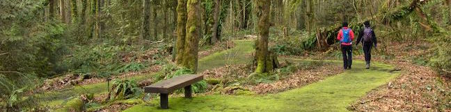
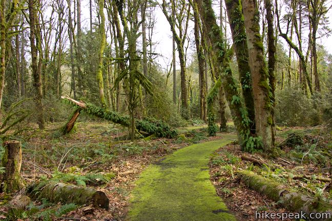
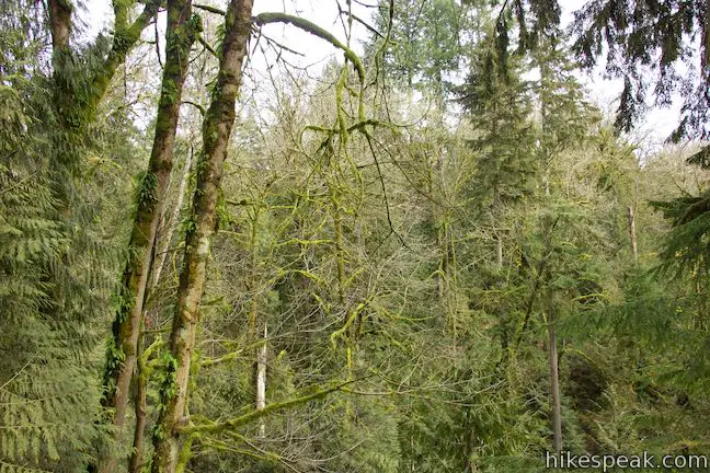
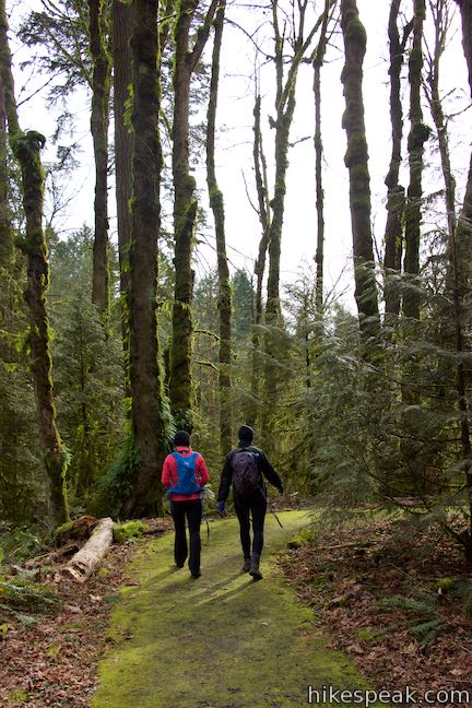
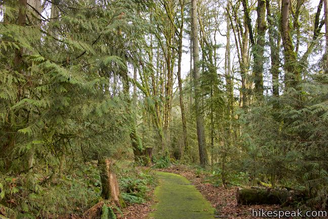
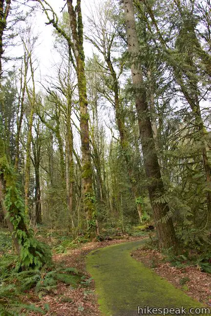
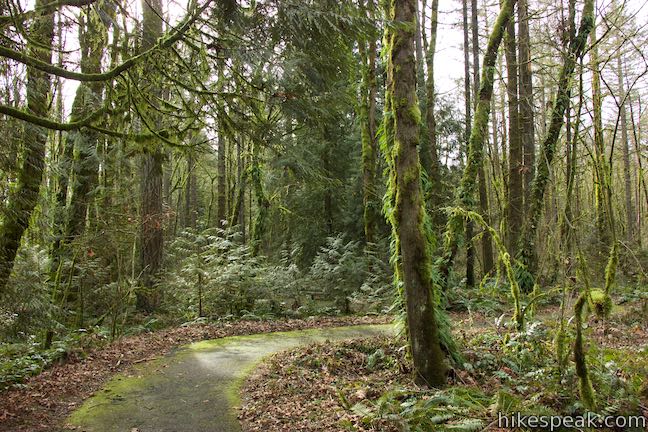
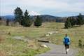
Want to learn about the native plants growing in Tryon Creek State Natural Area and elsewhere in the forests around Portland? Take an easy stroll (or roll a wheelchair) around Trillium Trail. This pair of paved loops is located next to Tryon Creek Nature Center and totals just 0.37 miles in length. Markers identify the green things growing along the trail and viewing decks peer into different layers of the forest to add insights to Trillium Trail.
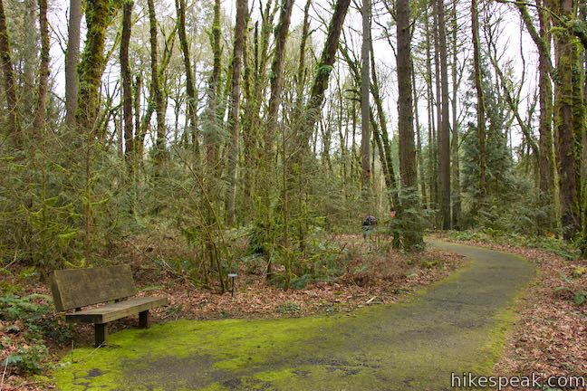
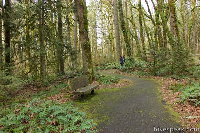
Find the start of Trillium Trail on the south side of Tryon Creek Nature Center next to the parking area and a curved stone bench. Trillium Trail is just to the left of Old Main Trail, which ventures father south for a longer loop through Tryon Creek State Natural Area. A kiosk at the trailhead explains how native plants are critical for healthy forests.
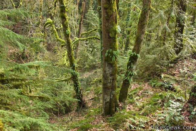
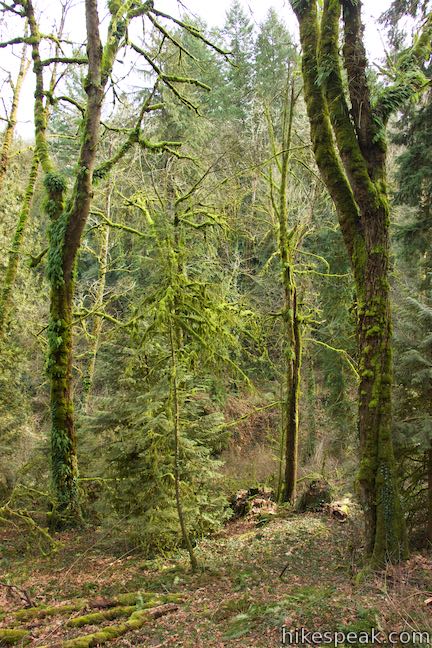
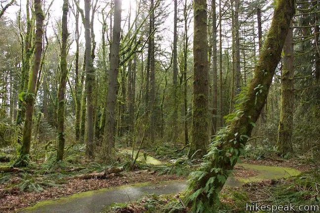
The forest surrounding the Trillium Trail hasn’t always looked this lush and healthy. Invasive species, like English ivy, had taken over and made it difficult for native plants to grow. Thanks to volunteers who removed the ivy, the native plants are now flourishing. Native plants filter water and keep it cool, clear, and clean, three essential elements to maintaining a healthy watershed.
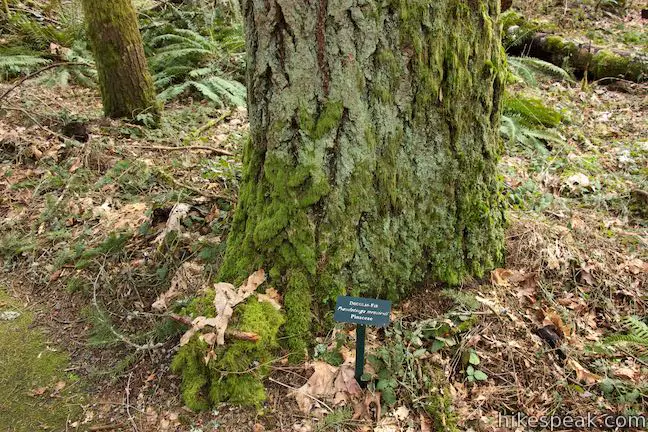
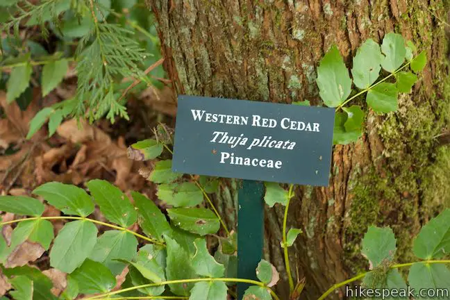
Markers along Trillium Trail identify a wide variety of native trees, shrubs, and ground-covering plants, like baneberry, bigleaf maple, common snowberry, Douglas fir, evergreen huckleberry, fairy lantern, Hooker’s fairybells, Indian plum, inside-out flower, lady fern, Pacific dogwood, red elderberry, red huckleberry, stinging nettle, sweet coltsfoot, western red cedar, western trillium, wild ginger, and wood fern.
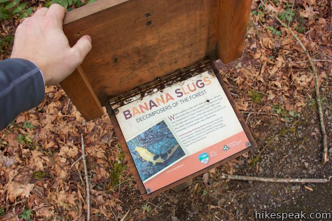
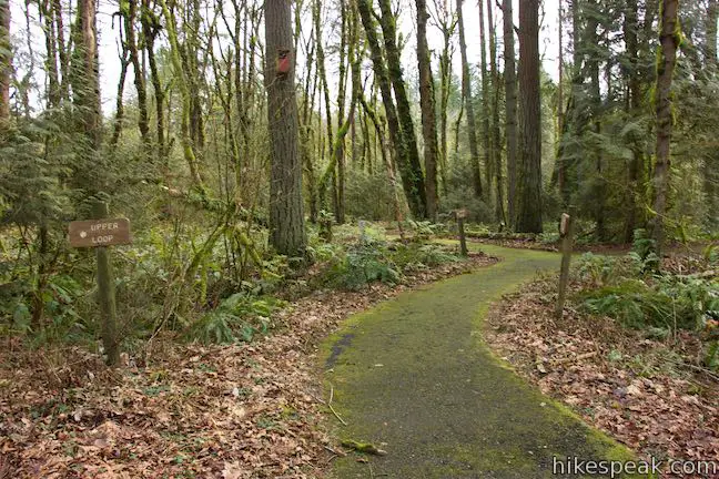
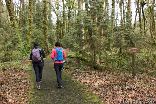
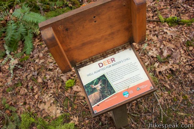
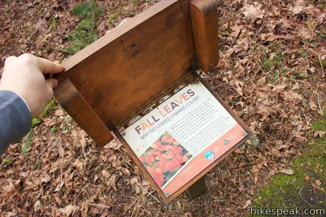
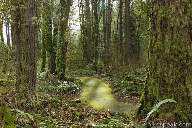
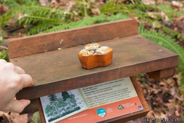
Walk up the paved trail for less than 100 yards to a marked split. The upper loop on Trillium Trail begins to the left. Both loops are quite short and easy to connect. Walking along the upper loop, you may notice a thin layer of moss growing over the trail, giving the illusion that you are following a green carpet through the forest. In addition to the markers naming different plants, you’ll find several covered panels along Trillium Trail. Flip open the wooden top to learn more about the forest. Expose the first panel on the upper loop to learn about banana slugs:
What is yellow and tan with dark splotches all over and looks like a ripe banana? The banana slug! This inhabitant of Tryon Creek is most often seen in the wet, warm times of fall and spring. During the dry, warn weather, slugs go into torpor (a period of inactivity). In the winter, they hibernate.
Another waiting-to-be-revealed panel explains how deer adapt for the winter by growing thicker coats with hollow hair for increased insulation. Deer also bulk up with added body fat around organs and beneath their skin. Other panels on Trillium Trail have primers on lichens and mushrooms, and one explains why leaves change color in the autumn.
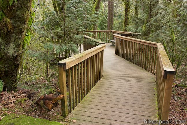
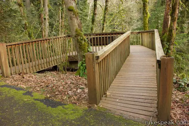
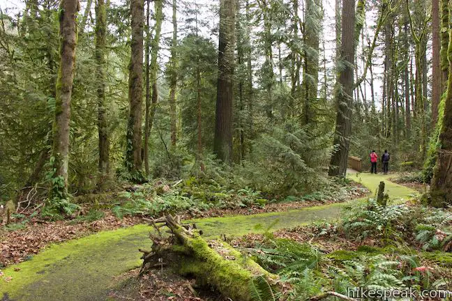
The upper and lower loops each have viewing decks that lead out over a hillside for a look into the understory of the forest.
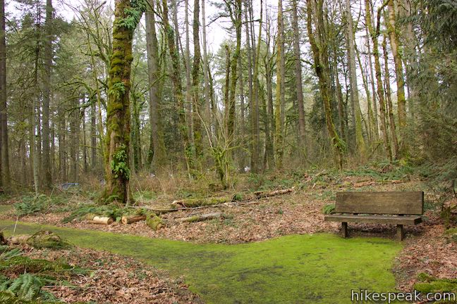
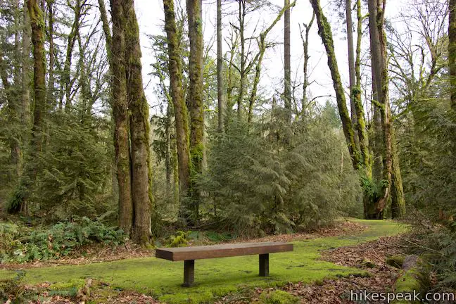
Leave the first viewing deck and walk past one of the loop’s many benches to come to a junction with the lower loop, just 0.18 miles from the start. If you turned right, you could walk straight back to the trailhead. Instead, turn left onto the lower loop to walk through more forest.
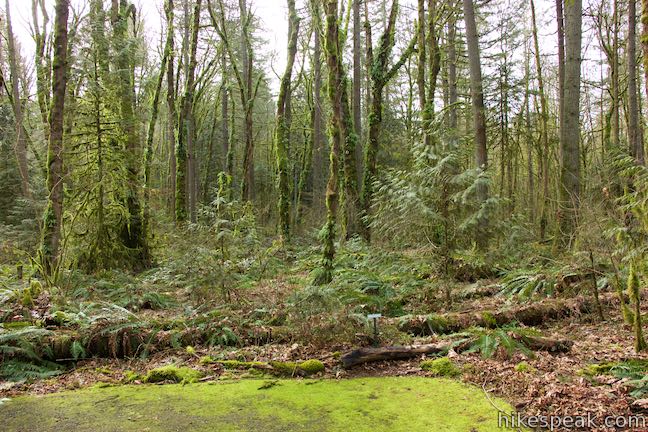
Much like the upper loop, the second loop has markers for plants and a viewing deck that takes the trail out to a hillside perch.
When the lower loop concludes, make two left turns to head back to the nature center, completing an easy 0.37-mile long trail with a mere 15 feet of elevation change.
Leashed dogs are welcome on Trillium Trail, but bikes are not allowed. Trillium Trail’s more formal name is Ruth Pennington Trillium Trail, named after a champion for Tryon Creek’s preservation who helped create Trillium Trail. No permit is needed for Trillium Trail, which is an ADA nature trail. Parking at the trailhead is free, so an Oregon State Park’s pass is not required.
Directions to the Trailhead
- From Portland, take Interstate 5 south to exit 297 for Terwilliger Boulevard.
- At the end of the ramp, you will merge onto SW Barbur Boulevard and come to an intersection with SW Terwilliger Boulevard.
- Turn right, drive 2.4 miles down SW Terwilliger Boulevard, and turn right into the main entrance for Tryon Creek State Natural Area.
- Find parking in the lots in front of the nature center.
Trailhead Location
Trailhead address: 11321 SW Terwilliger Boulevard, Portland, OR 97219
Trailhead coordinates: 45.4411, -122.6759 (45° 26′ 27.95″N 122° 40′ 33.23″W)
View Tryon Creek State Natural Area in a larger map
Or view a regional map of surrounding Oregon trails and campgrounds.


 | Two-Mile Loop in Tryon Creek State Natural Area Combine Old Main Trail, Red Fox Trail, Cedar Trail, Middle Creek Trail, and Maple Ridge Trail to loop through rolling woodland and across 3 bridges. |
 | George Himes Trail This short lollipop loop ascends into Portland's West Hills for a woodland walk with a view of Mount Hood. |
 | Marquam Nature Park Hike through peaceful forest in a pocket of Portland's West Hills on a 1.3, 3, or 4.25-mile loop. |
 | Lower Macleay Trail to Stone House This 1.8 to 2-mile hike starts by following Balch Creek to fern-covered ruins and can finish with a loop that exits Forest Park and passes through the Willamette Heights Neighborhood in Northwest Portland. |
 | Lower Macleay Park to Pittock Mansion This 5.4-mile hike in Forest Park takes Lower Macleay Trail to the Stone House ruins and ascends Wildwood Trail to Pittock Mansion, bagging a big view over Portland. |
 | Cornell Road to Pittock Mansion This 2.5-mile hike on Wildwood Trail and Upper Macleay Trail in Forest Park goes up a wooded hillside to Pittock Mansion, a landmark with panoramic views over Portland. |
 | Holman Lane – Wildwood Trail – Birch Trail Loop This 2.7-mile loop combines three trails in Forest Park for a refreshing woodland walk. |
 | Tualatin Hills Nature Park This 2.1-mile hike on Vine Maple Trail, Old Wagon Trail, and Oak Trail loops through forests and wetlands in a pocket of wilderness on the west side of Beaverton. |
 | Powell Butte This 2.15-mile lollipop loop combines Mountain View Trail and Summit Lane to explore the top of Powell Butte and its big views from Southeast Portland. |
 | Trails in Oregon Explore more hikes in Oregon outside Greater Portland. |
Common Questions about Trillium Trail in Tryon Creek State Natural Area
- Is the trail open?
- Yes. You should expect to find that Trillium Trail in Tryon Creek State Natural Area is open. There are no recent reports of trail closures. If you discover that the trail is closed, please help your fellow hikers by reporting a closure.
- Is this trail free to access?
- Yes, Trillium Trail in Tryon Creek State Natural Area is free to access. No entrance fee, pass, or permit is required. If you discover that access rules have changed, please provide feedback on your experience.
- How much time does this hike take?
- It takes approximately 15 minutes to hike Trillium Trail in Tryon Creek State Natural Area. Individual hiking times vary. Add extra time for breaks and taking in the views.
- How long is this hike?
- The hike to Trillium Trail in Tryon Creek State Natural Area is a 0.37 mile loop with 15 feet of elevation change.
- Are dogs allowed on this trail?
- Yes, dogs are allowed on Trillium Trail in Tryon Creek State Natural Area. The trail is open to hikers, dogs.
- Is Trillium Trail in Tryon Creek State Natural Area good for kids?
- Yes, this hike is likely suitable for children. It is relatively short (0.37 miles) with manageable elevation gain.
- Is this trail wheelchair accessible?
- Yes, Trillium Trail in Tryon Creek State Natural Area is designated as wheelchair-friendly.
- Where is the trailhead located?
- The trailhead for Trillium Trail in Tryon Creek State Natural Area is located in Portland, Oregon.
Trailhead Address:
11321 SW Terwilliger Boulevard
Portland, Oregon 97219
Trailhead Coordinates:
45.4411, -122.6759 - What are the driving directions to the start of the hike?
To get to the trailhead: From Portland, take Interstate 5 south to exit 297 for Terwilliger Boulevard. At the end of the ramp, you will merge onto SW Barbur Boulevard and come to an intersection with SW Terwilliger Boulevard. Turn right, drive 2.4 miles down SW Terwilliger Boulevard, and turn right into the main entrance for Tryon Creek State Natural Area. Find parking in the lots in front of the nature center.
View custom Google Maps directions from your current location.
- Are there other trails near Trillium Trail in Tryon Creek State Natural Area?
- Yes, you can find other nearby hikes using the Hikespeak Hike Finder Map.

Go the extra miles...
Submit a rating of this hike to go with your comment. Contribute to the average trail rating.