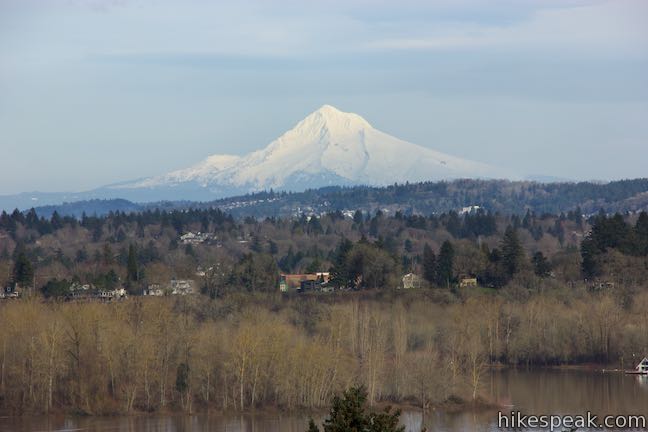
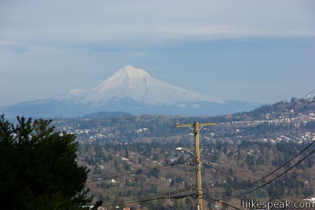
George Himes Trail explores a small patch of forest in Southwest Portland between Interstate 5 and Terwilliger Boulevard. The single-track trail rises to a view over Johns Landing and the Willamette River toward Mount Hood before looping through woods bedecks in licorice ferns, moss, and English ivy. The top of the loop touches a picnic area in George Himes Park. Without additions, George Himes Trail is 1.4 miles round trip. If you take the early spur to a view of Mount Hood and venture into the picnic area in George Himes Park, the hike will be about 1.5 miles round trip with 400 feet of elevation change.
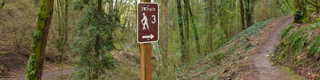
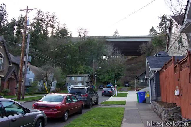
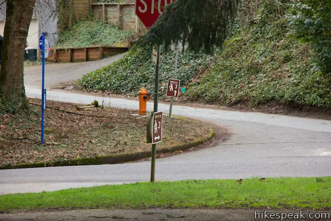
Begin from the top of SW Iowa Street, a block west of SW Corbett Avenue and 1/3 of a mile west of the Willamette River in the Johns Landing neighborhood of Southwest Portland. The start of the trail is like a secret waiting to be discovered, with little more than a stone staircase tucked between houses. A “SWTrails 3” sign provides the initial clue that this staircase is part of a trail. (“SWTrails 3” is a route through Southwest Portland on roads and trails that begins from nearby Willamette Park.)
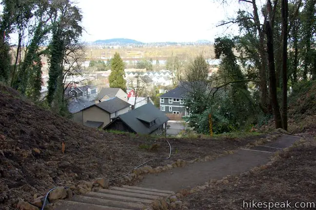
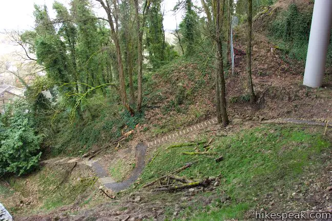
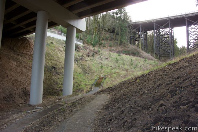
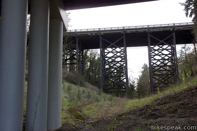
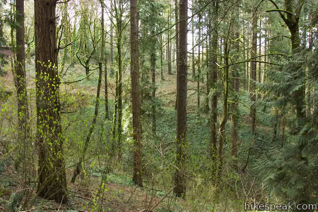
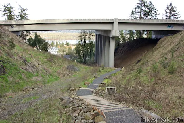
Launch up the steps past another reassuring sign from Portland Parks and Recreation that indicates that you are entering George Himes Natural Area. Push through an arch of trees and rise into a ravine cut into the West Hills. Switchbacks and staircases take you up toward bridges on Interstate 5 and SW Barbur Boulevard that span the ravine.
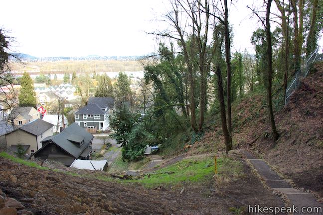
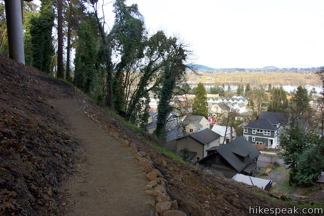
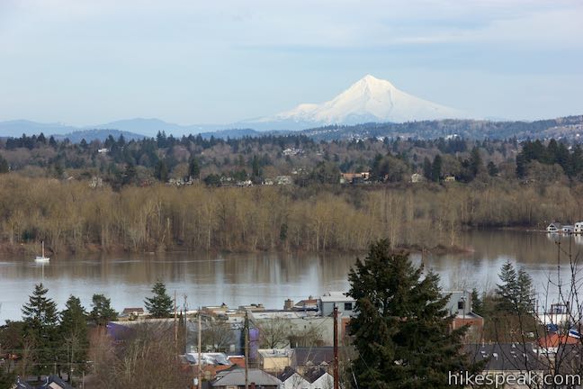
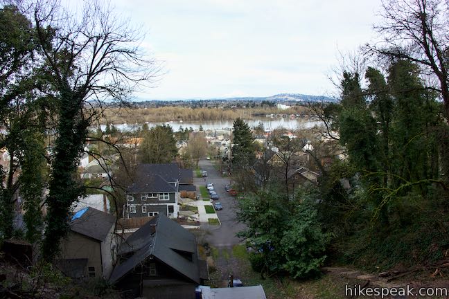
While hiking under the freeway isn’t the most appealing, don’t get dissuaded. After 125 yards, you will come to a junction with a spur that doubles back to the right. Though it doesn’t look like much, take this spur out to the north side of the ravine, walking 100 feet to a surprisingly good view out over Johns Landing and east toward the Willamette River. On days that are clear, the view of Mount Hood from this easy-to-reach overlook is excellent.
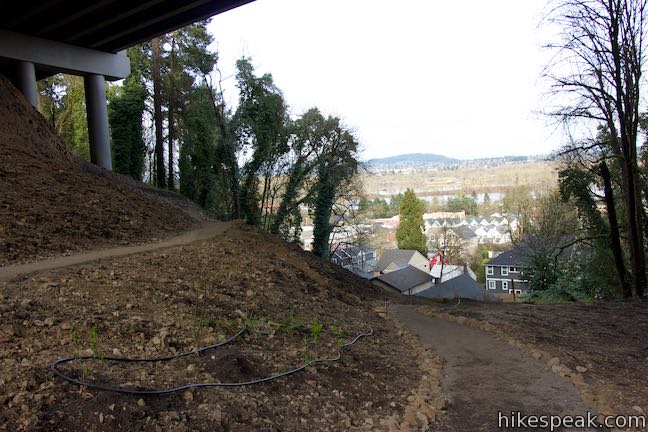
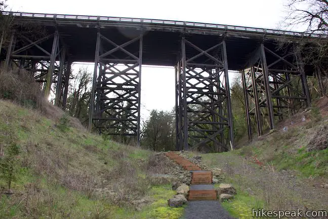
You’ve hiked a tenth of a mile and enjoyed the hike’s broadest view. Now return to George Himes Trail and continue hiking up the ravine. Pas under the southbound lanes of Interstate 5 and up more steps to an older trestle bridge under Barbur Boulevard.
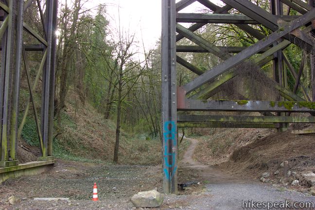
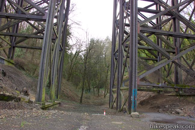
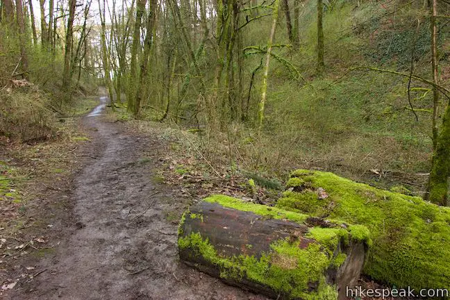
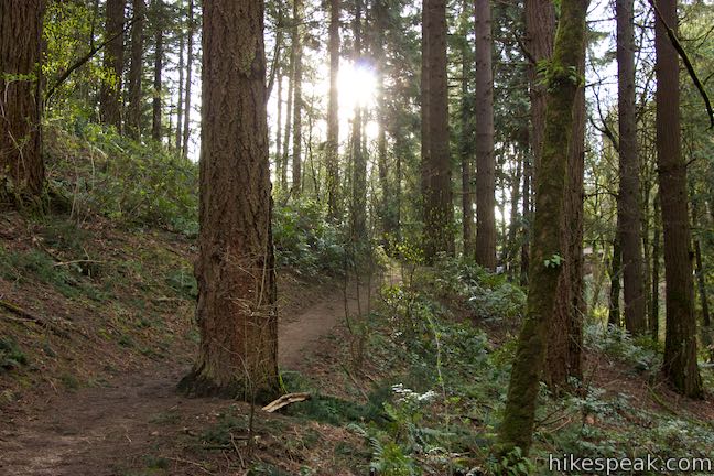
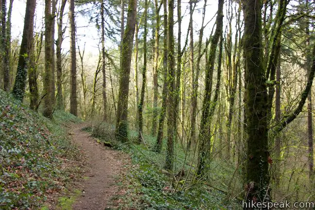
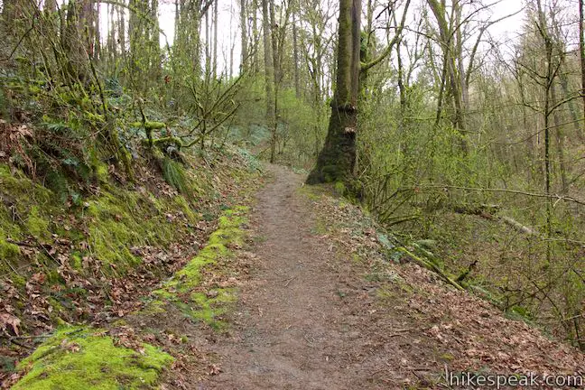
The trail passes through one of the trestles supporting the street and enters the forest. Walk up the green canyon to the right of a small, seasonal stream.
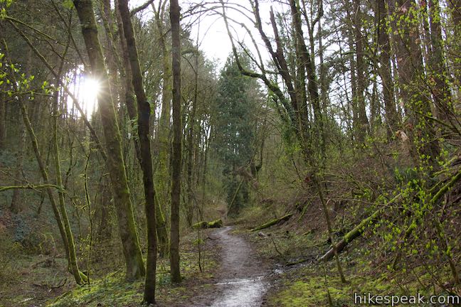
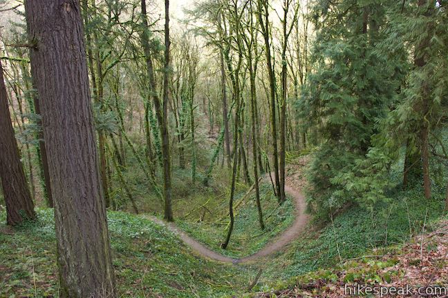
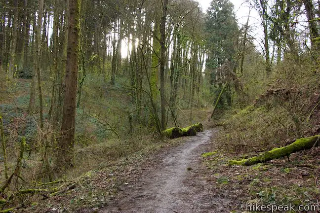
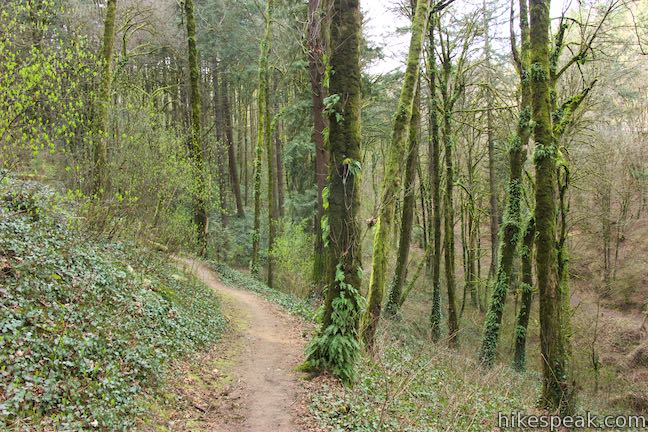
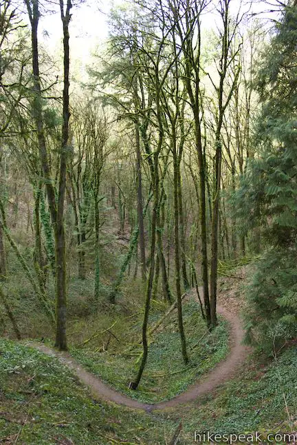
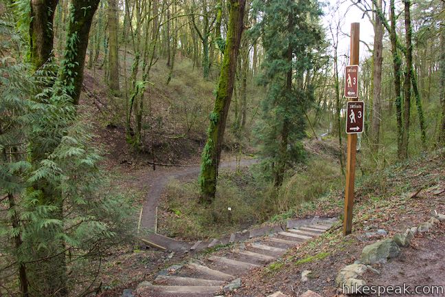
The road noise fades as you walk about 0.15 miles into the forest where the trail curves to the left and drops across the bottom of the ravine and rises up steps to a junction. This is the start of the loop on George Himes Trail, 0.37 miles from SW Iowa Street (or 1/3 of a mile without the spur to the view of Mount Hood). You could take the loop in either direction, but it seems best to turn left at the T-junction, following another “SWTrails 3” sign to hike clockwise around the loop.
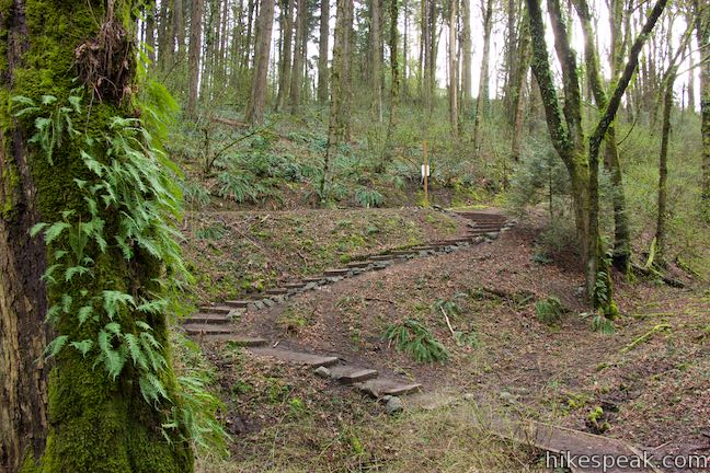
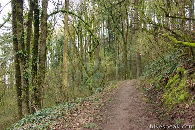
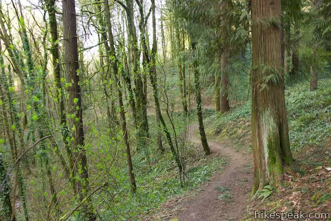
After turning left, George Himes Trail rises into forest that seems to grow greener with moss and ferns. Cross a footbridge, 0.05 miles past the junction where the trail curves around a draw in the hillside.
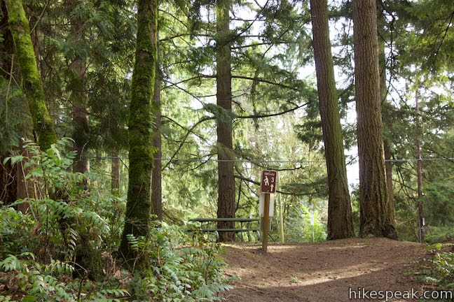
Rise to the east until a switchback sends you west and up to a junction, 2/3 of a mile from the start, just below a picnic area in George Himes Park. To immediately continue with the second half of the loop, bear right. Otherwise, stay to the left and enter the picnic area.
The picnic area in George Himes Park is well shaded, with half a dozen picnic tables, but no views. However, if you walk down SW Nebraska Street, which runs along the side of the picnic area, you can get another look at Mount Hood. Signs for “SWTrails 3” show the route heading west across SW Terwilliger Boulevard.
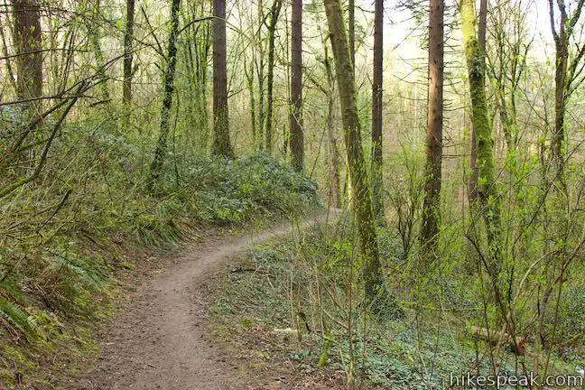
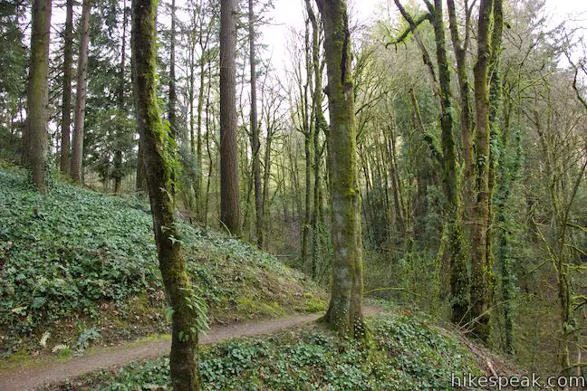
Leave the picnic area, return to the junction and head north on the next stretch of George Himes Trail, crossing a slope below Terwilliger Boulevard. After 0.2 miles, the trail actually pops out of the woods and meets the sidewalk along Terwilliger Boulevard. Turn right, walk 70 yards, and find a dirt trail leaving the sidewalk. Turn right to take this trail down into a depression on the inside of a bend in Terwilliger Boulevard.
In another 50 yards, you will come to another junction. Terwilliger Trail continues to the north. Turn right once again to hike down into the wooded ravine on George Himes Trail.
Descend eastward through one bend to take George Himes Trail back down to the junction where the loop began. Turn left to go down the ravine for the final 1/3 of a mile back to the trailhead.
The lollipop loop on George Himes Trail is less than 1.5 miles round trip if you don’t explore the picnic area. Alternatively, if you start at the picnic area and hike just the loop without the stretch of trail up from SW Iowa Street, this hike could be just 3/4 of a mile round trip. For something longer, use Terwilliger Boulevard to connect to Marquam Nature Park, just to the north.
Dogs are welcome on leashes, but bikes are not allowed. Street parking is available and no fee or permit is needed to hike George Himes Trail in the Tualatin Mountains (also know as Portland’s West Hills), so get out and enjoy this short hike!
Directions to the Trailhead
- For the interchange of Interstate 84 and Interstate 205 in Northeast Portland, take I-84 west for 5 miles.
- Merge onto I-5 South and drive across the Willamette River.
- Take exit 299A, with signs for Route 43 toward Lake Oswego.
- Pass below the interstate and bear right to merge onto SW Macadam Avenue.
- Drive south for 0.9 miles and turn right on SW Iowa Street.
- Drive 5 blocks to the end of Iowa Street at a T-intersection with SW View Point Terrace.
- George Himes Trail starts on the west side of SW View Point Terrace across from SW Iowa Street.
Trailhead Location
Trailhead address: SW View Point Terrace & SW Iowa Street, Portland, OR 97239
Trailhead coordinates: 45.47985, -122.6779 (45° 28′ 47.5″N 122° 40′ 40.4″W)
View George Himes Trail in a larger map
Or view a regional map of surrounding Oregon trails and campgrounds.


 | Marquam Nature Park Hike through peaceful forest in a pocket of Portland's West Hills on a 1.3, 3, or 4.25-mile loop. |
 | Lower Macleay Trail to Stone House This 1.8 to 2-mile hike starts by following Balch Creek to fern-covered ruins and can finish with a loop that exits Forest Park and passes through the Willamette Heights Neighborhood in Northwest Portland. |
 | Lower Macleay Park to Pittock Mansion This 5.4-mile hike in Forest Park takes Lower Macleay Trail to the Stone House ruins and ascends Wildwood Trail to Pittock Mansion, bagging a big view over Portland. |
 | Cornell Road to Pittock Mansion This 2.5-mile hike on Wildwood Trail and Upper Macleay Trail in Forest Park goes up a wooded hillside to Pittock Mansion, a landmark with panoramic views over Portland. |
 | Holman Lane – Wildwood Trail – Birch Trail Loop This 2.7-mile loop combines three trails in Forest Park for a refreshing woodland walk. |
 | Dogwood Trail - Alder Trail Loop This 2.8-mile hike uses 5 trails (Keil Trail, Dogwood Trail, Leif Erikson Drive, Alder Trail, and Wildwood Trail) to form a lovely woodland loop in Forest Park. |
 | Trillium Trail in Tryon Creek State Natural Area This short nature trail is packed with plant-identifying panels as well as benches and viewing platforms. |
 | Two-Mile Loop in Tryon Creek State Natural Area Combine Old Main Trail, Red Fox Trail, Cedar Trail, Middle Creek Trail, and Maple Ridge Trail to loop through rolling woodland and across 3 bridges. |
 | Powell Butte This 2.15-mile lollipop loop combines Mountain View Trail and Summit Lane to explore the top of Powell Butte and its big views from Southeast Portland. |
 | Trails in Oregon Explore more hikes in Oregon outside Greater Portland. |
Common Questions about George Himes Trail in George Himes Natural Area, Portland
- Is the trail open?
- Yes. You should expect to find that George Himes Trail is open. There are no recent reports of trail closures. If you discover that the trail is closed, please help your fellow hikers by reporting a closure.
- Is this trail free to access?
- Yes, George Himes Trail is free to access. No entrance fee, pass, or permit is required. If you discover that access rules have changed, please provide feedback on your experience.
- How much time does this hike take?
- It takes approximately 45 minutes to hike George Himes Trail. Individual hiking times vary. Add extra time for breaks and taking in the views.
- How long is this hike?
- The hike to George Himes Trail is a 1.5 mile lollipop loop with 400 feet of elevation change.
- Are dogs allowed on this trail?
- Yes, dogs are allowed on George Himes Trail. The trail is open to hikers, dogs.
- Is George Himes Trail good for kids?
- Yes, this hike is likely suitable for children. It is relatively short (1.5 miles) with manageable elevation gain.
- Where is the trailhead located?
- The trailhead for George Himes Trail is located in Portland, Oregon.
Trailhead Address:
SW View Point Terrace
Portland, Oregon 97239
Trailhead Coordinates:
45.47985, -122.6779 - What are the driving directions to the start of the hike?
To get to the trailhead: For the interchange of Interstate 84 and Interstate 205 in Northeast Portland, take I-84 west for 5 miles. Merge onto I-5 South and drive across the Willamette River. Take exit 299A, with signs for Route 43 toward Lake Oswego. Pass below the interstate and bear right to merge onto SW Macadam Avenue. Drive south for 0.9 miles and turn right on SW Iowa Street. Drive 5 blocks to the end of Iowa Street at a T-intersection with SW View Point Terrace. George Himes Trail starts on the west side of SW View Point Terrace across from SW Iowa Street.
View custom Google Maps directions from your current location.
- Are there other trails near George Himes Trail?
- Yes, you can find other nearby hikes using the Hikespeak Hike Finder Map.

Go the extra miles...
Submit a rating of this hike to go with your comment. Contribute to the average trail rating.