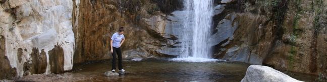
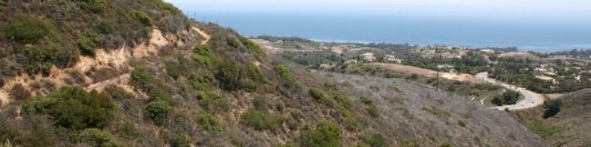
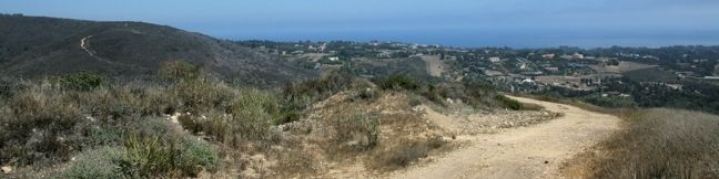
Eaton Canyon Falls in the San Gabriel Mountains
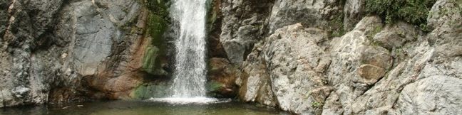
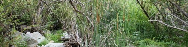
The forty-foot waterfall in Eaton Canyon fills an amphitheater at the top of Eaton Canyon Trail, tumbling into a wide pool that you can rest alongside or wade in. The waist-deep water is so refreshing, you are likely to see hikers in bathing suits on a warm day. The hike to Eaton Canyon Falls can be summed up this way: 1.1 miles of wide flat, relatively uneventful dirt trail, followed by 0. ...Read more.
Distance: 3.5 miles · Elevation change: 375 feet
By: Published: January 20, 2010 Last updated: April 9, 2026
Switzer Falls in the San Gabriel Mountains
Switzer Falls might be the best know waterfall hike in Los Angeles County. This 50-foot waterfall is reached via a 4.5 mile out-and-back trek on Gabrielino Trail that follows a shaded babbling creek down into a wooded canyon. This is one of the most popular hikes in front range of the San Gabriel Mountains, with a picnic area at the trailhead that gets crowded too. ...Read more.
Distance: 4.5 miles · Elevation change: 650 feet
By: Published: January 20, 2010 Last updated: December 5, 2025
Trail Canyon Falls in the San Gabriel Mountains
The west side of the San Gabriel Mountains offers fewer trails than the rest of the range, but it is home to one terrific waterfall. This four-mile round trip hike on Trail Canyon Trail tackles 700 feet of elevation gain to reach a sublime 30-foot waterfall. Trail Canyon Falls is one of the Los Angeles waterfall hikes. Approach this waterfall via Trail Canyon Trail (a trail so good they named it twice). ...Read more.
Distance: 4 miles · Elevation change: 700 feet
By: Published: January 20, 2010 Last updated: December 6, 2025
Lizard Rock in Wildwood Park
To add extra mileage and views to a visit to Paradise Falls in Thousand Oaks, consider placing Lizard Rock on your itinerary. Lizard Rock rises over five hundred feet from the canyon below to offer fine views of Stagecoach Bluff and beyond. This write-up describes a 4.35-mile loop with 570 feet of elevation change that visits both Lizard Rock and Paradise Falls. ...Read more.
Distance: 4.35 miles · Elevation change: 570 feet
By: Published: January 19, 2010 Last updated: December 5, 2025
Paradise Falls in Wildwood Park
Paradise Falls drops 40 feet into a large pool along the Arroyo Conejo in Thousand Oaks. The waterfall is located within Wildwood Park, and thanks to an almost excessive network of trails, Paradise Falls may be reached via several routes, including a 2.15-mile out and back hike or a 2.55-mile loop that visits a small cave. It is a downhill hike from the trailhead to Paradise Falls with 260 feet of elevation change. ...Read more.
Distance: 2.55 miles · Elevation change: 260 feet
By: Published: January 19, 2010 Last updated: December 5, 2025
Hostetter Fire Road to Verdugo Peak in the Verdugo Mountains
The Verdugo Mountains are a small range situated north of Burbank and Glendale. While the trails in this range can't get at as remote as those in the nearby San Gabriel Mountains, they can be quite scenic and convenient to reach. Hikers may enjoy a trek on the north side of the Verdugo Mountains from La Tuna Canyon to the highest point in the range, Verdugo Peak. ...Read more.
Distance: 7.5 miles · Elevation change: 1400 feet
By: Published: January 19, 2010 Last updated: April 8, 2026
Traversing the gorge between Rock Pool and Century Lake in Malibu Creek State Park
Between Rock Pool and Century Lake in Malibu Creek State Park lies a large C-shaped gorge that can be traversed by experienced hikers who are willing to get wet and engage in a bit of rock climbing. Dangerous conditions may occur and this hike is not recommended for most hikers. Your safety is your responsibility. To get to Rock Pool, leave the main trailhead parking area and begin hiking west on Crags Road, the principal trail through the park. ...Read more.
Distance: 4 miles · Elevation change: 200 feet
By: Published: January 15, 2010 Last updated: April 8, 2026
Zuma Canyon Ocean View Trail – Canyon View Trail loop in the Santa Monica Mountains
The appeal of Ocean View and Canyon View Trails is self-evident. Both offer fine views of the Pacific Ocean and Zuma Canyon. Located on the opposite side of Zuma Canyon as Zuma Ridge Trail, Ocean View and Canyon View Trails combine to form a 3.1-mile loop with 750 feet of elevation gain. To complete the loop, leave from the Bonsall Trailhead and start up Zuma Canyon Trail. ...Read more.
Distance: 3.1 miles · Elevation change: 3.1 feet
By: Published: January 12, 2010 Last updated: April 9, 2026
Zuma Ridge Trail in the Santa Monica Mountains
Zuma Ridge Trail (also known as Zuma Ridge Motorway) is a wide dirt service road that weaves northwest up the ridge west of Zuma Canyon. The hike starts at the base of the flood plane, but quickly leaves the shrubby canyon for grassy mountain slopes. The views improve as the trail climbs, offering several great lookouts over Zuma Beach, Point Dune, Malibu High School, and the ocean beyond. ...Read more.
Distance: 5.4 miles · Elevation change: 1390 feet
By: Published: January 12, 2010 Last updated: December 6, 2025
Zuma Canyon Narrows – Zuma Ridge Loop in the Santa Monica Mountains
This demanding 8-mile loop includes two miles off-trail, trekking through a lush untamed canyon. Begin the loop on Zuma Canyon Trail. The sandy single track traverses a brushy open space, crossing and following a stony creek bed. After 1.4 miles, Zuma Canyon narrows and the trail dissolves. The true challenge begins! From the end of Zuma Canyon Trail, it is two miles to the next maintained path, an Edison Fire Road. ...Read more.
Distance: 8 miles · Elevation change: 1715 feet
By: Published: January 12, 2010 Last updated: April 9, 2026