Mount Zion via Lower Zion Trail in the San Gabriel Mountains
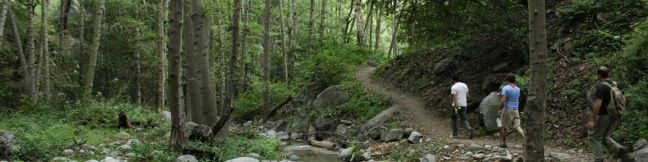
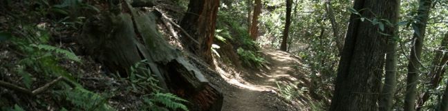
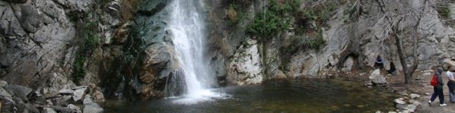
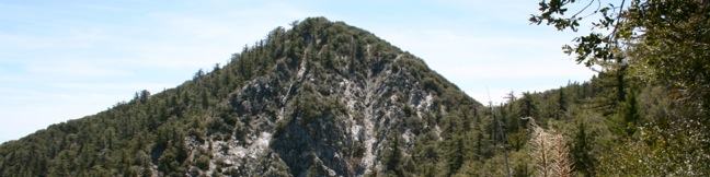
If you enjoy the 4.25-mile round trip hike to Hoegees Camp, press on to Mount Zion. This trail leaves the banks of Winter Creek for higher ground and panoramic views of Santa Anita Canyon. Less than a quarter mile above Hoegees Camp on Lower Winter Creek Trail, is a junction with Lower Zion Trail. Upper Winter Creek Trail continues straight ahead, returning to Chantry Flats, but if you turn right, the summit of Mount Zion is just 1 3/4 away. ...Read more.
Distance: 1.75 miles · Elevation change: 1000 feet
By: Published: January 26, 2010 Last updated: April 8, 2026
Hoegees Camp via Lower Winter Creek Trail in the San Gabriel Mountains
Hoegees Camp lies along Winter Creek in the canyon adjacent to Sturtevant Falls. Both trails begin from Chantry Flats. And while the hike to Hoegees Camp does not offer a waterfall, it does offer a 4.25-mile out-and-back hike through a lush canyon with 700 feet of elevation change. You may also continue on Upper Winter Creek Trail to return to Chantry Flats for a 4. ...Read more.
Distance: 4.25 miles · Elevation change: 700 feet
By: Published: January 26, 2010 Last updated: April 9, 2026
Spruce Grove Camp in the San Gabriel Mountains
If the short hike to Sturtevant Falls leaves you yearning for more, get more by continuing up Santa Anita Canyon to Spruce Grove Camp. Beyond the falls, the trail takes on a greater feeling of wilderness immersion. This section of Gabrielino Trail gets less foot traffic, making it a great retreat for those times when you need to feel far from LA. To get to Spruce Grove Camp, start from the trailhead at Chantry Flats, descend to Roberts Camp and follow the directions up Gabrielino Trail to Sturtevant Falls. ...Read more.
Distance: 8 miles · Elevation change: 1300 feet
By: Published: January 26, 2010 Last updated: April 9, 2026
Sturtevant Falls in the San Gabriel Mountains
Sturtevant Falls is one of the finest waterfalls in Angeles National Forest. The 3.3-mile hike from Chantry Flats to Sturtevant Falls follows a pristine creek past resort era cabins. This is among the most popular hikes in the San Gabriel Mountains, and with good reason. Sturtevant Falls is one of the Los Angeles waterfall hikes. To get to Sturtevant Falls, start from Chantry Flats and head down the paved road toward Roberts Camp, a quaint collection of quiet cabins surrounded by ivy-covered oaks and bays. ...Read more.
Distance: 3.3 miles · Elevation change: 400 feet
By: Published: January 26, 2010 Last updated: December 5, 2025
Mount Disappointment Fire Road to San Gabriel Peak in the San Gabriel Mountains
Often, an ideal hike starts with a level warm-up and gradually works into a rewarding climb. This hike is different, beginning with a jolt of several steep switchbacks. Your heart rate will go up quickly, and then the trail keeps climbing all the way to San Gabriel Peak. It is 4 miles round trip to the summit, gaining 1,400 feet of elevation gain. Visit the adjacent summit of Mount Disappointment for a 4. ...Read more.
Distance: 4 miles · Elevation change: 1400 feet
By: Published: January 22, 2010 Last updated: April 9, 2026
Mount Lowe Road to San Gabriel Peak in the San Gabriel Mountains
One of the routes to San Gabriel Peak begins on Mount Lowe Road, creating a 3.2-mile round trip hike that climbs 1,050 feet. This trek leaves from a trailhead at Eaton Saddle along Mount Wilson Road and delivers great views the entire way to the summit. Start hiking up Mount Lowe Road (Mount Lowe Fire Road) where you will be greeted immediately by a head-on view of Mount Markham. ...Read more.
Distance: 3.2 miles · Elevation change: 1050 feet
By: Published: January 22, 2010 Last updated: April 9, 2026
Buckhorn Campground in the San Gabriel Mountains
Need to get out of LA? Fresh air can be found camping within a hardy forest of pines and incense cedars at Buckhorn Campground. A small nearby creek provides a popular swimming hole for summer visitors, and away from the light pollution of LA, there are opportunities to eye shooting stars in the night sky. Day-hikers can venture off on nearby trails including Mount Waterman and Cooper Canyon Falls. ...Read more.
By: Published: January 21, 2010 Last updated: October 8, 2024
Mount Waterman in the San Gabriel Mountains
The round summit of Mount Waterman offers boulders to climb and views to enjoy. Mount Waterman Trail provides a pleasant route to the top, passing through a sylvan mixed forest of incense cedars and Jeffrey pines as it ascends 1,265 feet over 2.75 miles. Descend the same way for a 5.5-mile out and back hike or return by a dirt road for a 5.65-mile (or longer) loop. ...Read more.
Distance: 5.5 miles · Elevation change: 1265 feet
By: Published: January 21, 2010 Last updated: December 5, 2025
Cooper Canyon Falls in the San Gabriel Mountains
Cooper Canyon offers a relaxing summer waterfall for those staying overnight at Buckhorn Campground or venturing into San Gabriel Mountains National Monument for a get-away day hike. The three-mile round trip trek descends 745 feet into a mountain canyon through an enchanting old-growth forest to reach a small waterfall. Cooper Canyon Falls is one of the Los Angeles waterfall hikes. ...Read more.
Distance: 3 miles · Elevation change: 745 feet
By: Published: January 21, 2010 Last updated: December 5, 2025
Fish Canyon Falls in the San Gabriel Mountains
Fish Canyon Falls is beautiful three-tiered waterfall that drops over eighty feet in a canyon in the front range of the San Gabriel Mountains near Azusa. Early spring is the perfect time to visit the dynamic waterfall, when the water flows well and the canyon is green. A rock quarry occupies the bottom of Fish Canyon and for many years Fish Canyon Falls Trail could only be reached by shuttle on special access days. ...Read more.
Distance: 4.8 miles · Elevation change: 650 feet
By: Published: January 20, 2010 Last updated: April 8, 2026