Trebek Open Space Bantam Trail Castair Trail hike Santa Monica Mountains Conservancy park donated by Jeopardy host Alex Trebek
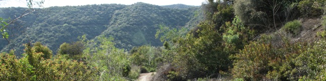
Two half-mile long fire roads cross the 62-acre Trebek Open Space, providing short hikes on the south face of the Hollywood Hills. Bantam Trail begins from Nichols Canyon Road and climbs to a ridge running down the east side of the park. Castair Trail begins from a trailhead lower down the ridge and drops into Nichols Canyon, coming to a dead-end above the road. ...Read more.
My Hikes: Completed hikeA green icon of shows a picture of a landscape with a check mark in the upper right corner, signifying that this is a hike you would like to put on your completed list.OK! Add to trails I've hiked
My Hikes: Want to hikeA green icon of shows a picture of a landscape with a heart in the upper right corner, signifying that this is a hike you would like to put on your to-do list.OK! Add to trails I want to hike
TagsA green icon depicting a tags represents a list of words and phrases that this content is tagged with Tagged with · Free Trails · Hollywood · Mountains Recreation and Conservation Authority · Dog-Friendly Trails · Mountain Biking Trails · Santa Monica Mountains
Hike DistanceA green icon of a hiker used to label information about the length of the hike Distance: 2.5 miles · Elevation change: 375 feet
By: Published: Last updated: December 7, 2018
Mandeville Canyon to San Vicente Mountain Loop Hollyhock Fire Road Westridge Canyonback Ridge hike
Mandeville Canyon is a north-south running trench in Brentwood area of the Santa Monica Mountains. Above Mandeville Canyon is San Vicente Mountain, a 1,960-foot summit that was used at the start of the cold war as a defense site to protect Los Angeles from Soviet attacks. Mandeville Canyon is enclosed by two long finger-like ridges, Westridge and Canyonback Ridge. ...Read more.
My Hikes: Completed hikeA green icon of shows a picture of a landscape with a check mark in the upper right corner, signifying that this is a hike you would like to put on your completed list.OK! Add to trails I've hiked
My Hikes: Want to hikeA green icon of shows a picture of a landscape with a heart in the upper right corner, signifying that this is a hike you would like to put on your to-do list.OK! Add to trails I want to hike
TagsA green icon depicting a tags represents a list of words and phrases that this content is tagged with Tagged with · Brentwood · Free Trails · Lookout Towers · Mountains Recreation and Conservation Authority · San Vicente Mountain Park · Summits · Westridge-Canyonback Wilderness Park · Dog-Friendly Trails · Mountain Biking Trails · Santa Monica Mountains
Hike DistanceA green icon of a hiker used to label information about the length of the hike Distance: 5 miles · Elevation change: 770 feet
By: Published: Last updated: December 7, 2018
Mugu Peak Trail Point Mugu State Park hike malibu ocean view santa monica mountains trek Mugu Peak Hike
Just inland from that similarly named point along the California coast, Mugu Peak towers over the Pacific Ocean from an elevation of 1,266 feet. The hike from the bottom of nearby La Jolla Canyon to the top of Mugu Peak is 6.5 miles round trip with 1,225 feet of elevation gain. This is a strenuous trek, rewarded by ridiculous scenery. There is also a longer way to reach the peak, the 11. ...Read more.
My Hikes: Completed hikeA green icon of shows a picture of a landscape with a check mark in the upper right corner, signifying that this is a hike you would like to put on your completed list.OK! Add to trails I've hiked
My Hikes: Want to hikeA green icon of shows a picture of a landscape with a heart in the upper right corner, signifying that this is a hike you would like to put on your to-do list.OK! Add to trails I want to hike
TagsA green icon depicting a tags represents a list of words and phrases that this content is tagged with Tagged with · California State Parks · Malibu · Newbury Park · Ocean Views · Point Mugu State Park · Summits
Hike DistanceA green icon of a hiker used to label information about the length of the hike Distance: 6.5 miles · Elevation change: 1225 feet
By: Published: Last updated: February 19, 2018
La Jolla Canyon Falls hike Point Mugu State Park La Jolla Canyon Malibu California Pacific Ocean Santa Monica Mountains waterfall trek
La Jolla Canyon Falls is a short seasonal waterfall located 3/4 of a mile up La Jolla Canyon Trail in Point Mugu State Park. The twenty-foot cascade offers one of the easiest hikes in the park, with just 250 feet of elevation between the trailhead and the falls. La Jolla Canyon Trail continues above the waterfall, ascending a rocky V-shaped canyon. ...Read more.
My Hikes: Completed hikeA green icon of shows a picture of a landscape with a check mark in the upper right corner, signifying that this is a hike you would like to put on your completed list.OK! Add to trails I've hiked
My Hikes: Want to hikeA green icon of shows a picture of a landscape with a heart in the upper right corner, signifying that this is a hike you would like to put on your to-do list.OK! Add to trails I want to hike
TagsA green icon depicting a tags represents a list of words and phrases that this content is tagged with Tagged with · California State Parks · Malibu · Newbury Park · Point Mugu State Park · Waterfalls · Los Angeles Waterfalls · Santa Monica Mountains
Hike DistanceA green icon of a hiker used to label information about the length of the hike Distance: 1.5 miles · Elevation change: 250 feet
By: Published: Last updated: February 19, 2018
Point Mugu State Park La Jolla Canyon Ray Miller Trail Mugu Peak Trail valley loop hike Malibu California Pacific Ocean Views
Point Mugu State Park protects 15,000 acres of rustic wilderness on the west end of the Santa Monica Mountains between Oxnard and Malibu. More than 70 miles of trails explore this sprawling park, leaving hikers with options. An excellent way to experience Point Mugu State Park is to set out on a daunting and rewarding 11.75-mile loop. Start at the mouth of La Jolla Canyon just across Highway One from the Pacific Ocean. ...Read more.
My Hikes: Completed hikeA green icon of shows a picture of a landscape with a check mark in the upper right corner, signifying that this is a hike you would like to put on your completed list.OK! Add to trails I've hiked
My Hikes: Want to hikeA green icon of shows a picture of a landscape with a heart in the upper right corner, signifying that this is a hike you would like to put on your to-do list.OK! Add to trails I want to hike
TagsA green icon depicting a tags represents a list of words and phrases that this content is tagged with Tagged with · Backbone Trail · Backpacking · California State Parks · Closed · Malibu · Newbury Park · Ocean Views · Point Mugu State Park · Summits · Waterfalls · Santa Monica Mountains
Hike DistanceA green icon of a hiker used to label information about the length of the hike Distance: 11.75 miles · Elevation change: 1225 feet
By: Published: Last updated: May 18, 2024
Paramount Ranch Western Town Santa Monica Mountains National Recreation Area film set hiking trails Agoura Hills California Paramount Ranch Hollywood filming location outdoor studio
Located in Agoura Hills, California near Malibu Creek State Park, Paramount Ranch served as a Hollywood filming location and outdoor studio for Paramount Pictures. This cinematic history of the ranch is now preserved by the National Park Service as part of the Santa Monica Mountains National Recreation Area. The park's main attraction and most interesting facet is Western Town, a couple blocks of prop buildings used from the 1950s to present day as an outdoor set for film and television show. ...Read more.
My Hikes: Completed hikeA green icon of shows a picture of a landscape with a check mark in the upper right corner, signifying that this is a hike you would like to put on your completed list.OK! Add to trails I've hiked
My Hikes: Want to hikeA green icon of shows a picture of a landscape with a heart in the upper right corner, signifying that this is a hike you would like to put on your to-do list.OK! Add to trails I want to hike
TagsA green icon depicting a tags represents a list of words and phrases that this content is tagged with Tagged with · Agoura Hills · Free Trails · Malibu · Santa Monica Mountains National Recreation Area · Dog-Friendly Trails · Mountain Biking Trails · Santa Monica Mountains
Hike DistanceA green icon of a hiker used to label information about the length of the hike Distance: 4 miles · Elevation change: 150 feet
By: Published: Last updated: February 26, 2024
Lake Vista Trail Malibu Creek State Park scenic vista point view over Malibu Lake and Sugarloaf Peak Cistern Trail
The scenic vista point at the top of Lake View Trail provides a beautiful view overlooking Malibu Lake and the surrounding mountains. The network of trails through Malibu Creek State Park offer several routes to the overlook, including a short 2.1-mile loop from a trailhead off Lake Vista Drive and a longer 4.1-mile out and back trek that begins down Cistern Trail from Mulholland Highway. ...Read more.
My Hikes: Completed hikeA green icon of shows a picture of a landscape with a check mark in the upper right corner, signifying that this is a hike you would like to put on your completed list.OK! Add to trails I've hiked
My Hikes: Want to hikeA green icon of shows a picture of a landscape with a heart in the upper right corner, signifying that this is a hike you would like to put on your to-do list.OK! Add to trails I want to hike
TagsA green icon depicting a tags represents a list of words and phrases that this content is tagged with Tagged with · Agoura Hills · California State Parks · Free Trails · Lakes · Malibu · Malibu Creek State Park · Santa Monica Mountains
Hike DistanceA green icon of a hiker used to label information about the length of the hike Distance: 4.1 miles · Elevation change: 350 feet
By: Published: Last updated: May 13, 2025
Cistern Trail Lookout Trail Crags Road Malibu Creek State Park Hike Cage Creek Trail MASH set Century Lake Malibu Hike
While relatively short, Cistern Trail and Lookout Trail offer some of the very best views of Malibu Creek State Park. By entering the park at the middle of Crags Road (the main trail across the park), these less-used trails provide quick access to many of Malibu Creek's major hiking destinations. A number of possible hikes begin from Cistern Trail. ...Read more.
My Hikes: Completed hikeA green icon of shows a picture of a landscape with a check mark in the upper right corner, signifying that this is a hike you would like to put on your completed list.OK! Add to trails I've hiked
My Hikes: Want to hikeA green icon of shows a picture of a landscape with a heart in the upper right corner, signifying that this is a hike you would like to put on your to-do list.OK! Add to trails I want to hike
TagsA green icon depicting a tags represents a list of words and phrases that this content is tagged with Tagged with · Agoura Hills · California State Parks · Free Trails · Malibu · Malibu Creek State Park · Santa Monica Mountains
Hike DistanceA green icon of a hiker used to label information about the length of the hike Distance: 2.25 miles · Elevation change: 425 feet
By: Published: Last updated: May 13, 2025
Lost Cabin Trail Malibu Creek State Park California Hiking Trail
Lost Cabin Trail is a 0.75-mile long dead-end single track departing from Crags Road near the location where the MASH television show was filmed. The trail ends in a mountain canyon at an empty plot where a cabin once stood. Though there is no longer evidence of the cabin's existence, the trek still offers hikers immersion into a remote section of Malibu Creek State Park behind the Goat Buttes. ...Read more.
My Hikes: Completed hikeA green icon of shows a picture of a landscape with a check mark in the upper right corner, signifying that this is a hike you would like to put on your completed list.OK! Add to trails I've hiked
My Hikes: Want to hikeA green icon of shows a picture of a landscape with a heart in the upper right corner, signifying that this is a hike you would like to put on your to-do list.OK! Add to trails I want to hike
TagsA green icon depicting a tags represents a list of words and phrases that this content is tagged with Tagged with · Agoura Hills · Calabasas · California State Parks · Free Trails · Malibu · Malibu Creek State Park · Santa Monica Mountains
Hike DistanceA green icon of a hiker used to label information about the length of the hike Distance: 1.5 miles · Elevation change: 190 feet
By: Published: Last updated: December 22, 2018
MASH television set Malibu Creek State Park hike
Far from the Hollywood Sign and the Walk of Fame, Malibu Creek State Park holds its own bit of Hollywood history. The exterior set for the long-running television show M*A*S*H was filmed in a Korea-resembling corner of park. While the medic tents have been removed, the location is still recognizable, and Malibu Creek State Park has gone above and beyond to create a rich experience for hikers. ...Read more.
My Hikes: Completed hikeA green icon of shows a picture of a landscape with a check mark in the upper right corner, signifying that this is a hike you would like to put on your completed list.OK! Add to trails I've hiked
My Hikes: Want to hikeA green icon of shows a picture of a landscape with a heart in the upper right corner, signifying that this is a hike you would like to put on your to-do list.OK! Add to trails I want to hike
TagsA green icon depicting a tags represents a list of words and phrases that this content is tagged with Tagged with · Agoura Hills · Calabasas · California State Parks · Free Trails · Malibu · Malibu Creek State Park · Mountain Biking Trails · Santa Monica Mountains
Hike DistanceA green icon of a hiker used to label information about the length of the hike Distance: 4.75 miles · Elevation change: 200 feet
By: Published: Last updated: May 13, 2025