Seascape Trail on Palos Verdes Peninsula
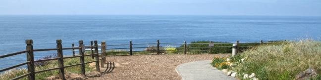
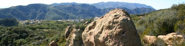
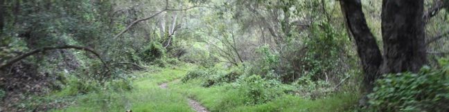
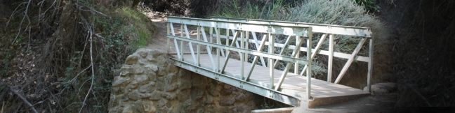
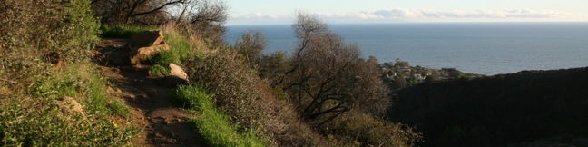
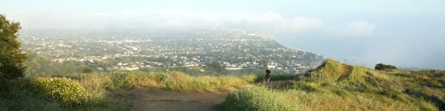
Looking for an easy family-friendly trail on the Palos Verdes Peninsula that also has great views? Seascape Trail is for you - crossing scenic coastal bluffs north of Point Vicente Lighthouse. The level trail is about 0.7 miles long with a meager 40 feet of elevation change. Starting from the Terrace Trail Access Point, this is a 1.5-mile hike with excellent ocean views. ...Read more.
Distance: 1.5 miles · Elevation change: 40 feet
By: Published: April 26, 2011 Last updated: April 8, 2026
White Point Nature Preserve on Palos Verdes Peninsula
White Point Nature Preserve is located at the southern end of Palos Verdes Peninsula, offering a unique window into the regions past. Rings of trails connect the visitor center with the park's main attraction, a retired military bunker with everlasting ocean views. This 102-acre history-packed park provides a one to 2.5-mile loop with 150 feet of elevation gain. ...Read more.
Distance: 2.5 miles · Elevation change: 150 feet
By: Published: April 25, 2011 Last updated: April 9, 2026
Parker Mesa Overlook from Trippet Ranch in Topanga State Park
Parker Mesa Overlook is one of the best vista points in the Santa Monica Mountains, serving up panoramic views over Santa Monica Bay from a 1,525-foot oceanfront ridge in Topanga State Park. The overlook is located along East Topanga Fire Road, a north-south running ridge trail spanning between Trippet Ranch, the park's main trailhead in the north, and Paseo Miramar in the Pacific Palisades to the south. ...Read more.
Distance: 6.7 miles · Elevation change: 375 feet
By: Published: April 16, 2011 Last updated: April 9, 2026
Eagle Rock from Trippet Ranch in Topanga State Park
With its unique craggy surface and panoramic views, Eagle Rock is one of the most exciting hiking destinations in Topanga State Park. There are several ways to get to the 1,957-foot summit. For hikers leaving from the park's main trailhead at Trippet Ranch, Musch Trail is an excellent route. The narrow trail is half a mile longer than the more traveled Eagle Springs Fire Road, and is off limits to bikers as it cuts through sagebrush terrain. ...Read more.
Distance: 4.5 miles · Elevation change: 800 feet
By: Published: April 15, 2011 Last updated: April 18, 2026
Temescal Peak in the Santa Monica Mountains from Pacific Palisades
Temescal Peak rises over a wide region of the Santa Mountains triangulated between the Pacific Palisades, Topanga, and Calabasas. The peak sits on Temescal Ridge, which runs north to south between Santa Ynez Canyon and Temescal Canyon in Topanga State Park. Only seventy vertical feet separate the summit from Temescal Ridge Trail, a service road running down the ridge, making the final climb to the top a near effortless ascent. ...Read more.
Distance: 5.8 miles · Elevation change: 575 feet
By: Published: April 13, 2011 Last updated: April 7, 2026
Skull Rock in the Santa Monica Mountains
Skull Rock sits on the shoulders of Temescal Ridge north of Temescal Gateway Park, delivering broad views over Santa Monica Bay. The head-shaped sandstone formation can be reach as an extension of Temescal Canyon Loop, bringing the hike to 3.8 miles. Skull Rock can also be reached via trailheads farther up Temescal Ridge. The nearest trailhead, located in the Palisades Highlands, provides a scenic 1. ...Read more.
Distance: 1.5 miles · Elevation change: 275 feet
By: Published: April 11, 2011 Last updated: April 9, 2026
Rivas Canyon in the Santa Monica Mountains
Rivas Canyon lies between Will Rogers State Park and Temescal Gateway Park. Rivas Canyon Trail crosses the ridge east of Temescal Canyon and travels down rustic Rivas Canyon to connect the two parks on a single-track that is 2.1 miles from end to end with 480 feet of elevation between the high and low points of the trail. Looking up Temescal Canyon from the start of Rivas Canyon Trail This scenic trail can be accessed from both parks. ...Read more.
Distance: 4.2 miles · Elevation change: 480 feet
By: Published: April 10, 2011 Last updated: April 8, 2026
Temescal Canyon Loop in the Santa Monica Mountains
Temescal Canyon Loop offers a good workout along with ocean and canyon views. Temescal Gateway Park is situated just off Sunset Blvd in the Pacific Palisades, and this convenient urban location makes Temescal Canyon Loop a very popular hike. The basic dimensions of the loop is 2.6 miles with 860 feet of elevation gain, but the hike can be expanded to four miles or longer thanks to a variety of extensions. ...Read more.
Distance: 2.6 miles · Elevation change: 860 feet
By: Published: April 9, 2011 Last updated: April 8, 2026
Los Liones Trail in the Santa Monica Mountains
Los Liones Trail weaves up a lush canyon at the south end of Topanga State Park, just a mile from the Pacific Ocean. The ivy and chaparral-lined hike offers glimpses of Santa Monica Bay. After 1.3 miles and 550 feet of elevation gain, Los Liones Trail arrives at a clearing on a ridge at a bench that looks down on the Pacific Palisades, Santa Monica, and the ocean beyond. ...Read more.
Distance: 2.6 miles · Elevation change: 550 feet
By: Published: April 8, 2011 Last updated: December 5, 2025
Parker Mesa Overlook via East Topanga Fire Road and Los Liones Trail in the Santa Monica Mountains
Parker Mesa Overlook offers panoramic views of Santa Monica Bay and the Pacific Ocean. The coastline spans from Palos Verdes to Malibu, with nothing but blue in between. Parker Mesa Overlook is located on the west side of Topanga State Park, which holds the distinction of being the: World's largest wildland within the boundaries of a major city. This distinguishes it from Griffith Park, which is the: Largest municipal park and urban wilderness area in the United States. ...Read more.
Distance: 7.8 miles · Elevation change: 1300 feet
By: Published: April 8, 2011 Last updated: April 8, 2026