El Capitan State Beach Campground Santa Barbara area camp Goleta California beach camping
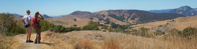
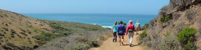
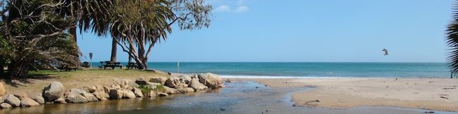
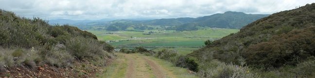
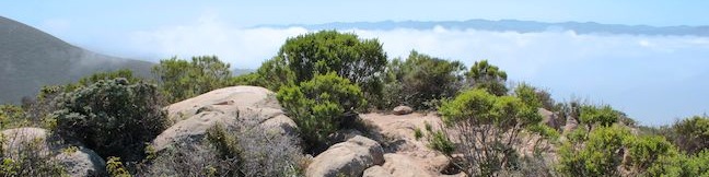
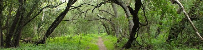
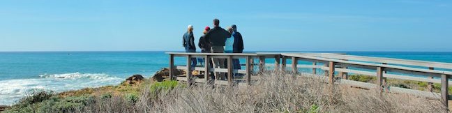
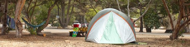
Santa Barbara County is famous for its beautiful beaches, and El Capitán State Beach is one worth noting, allowing visitors to camp on a low bluff just above the ocean. El Capitán State Beach is a fun place to camp with family and friends, relaxing by the ocean and falling asleep to the sound of the waves each night. The campground is located on a point 17 miles west of Santa Barbara,... Read more.
TagsA green icon depicting a tags represents a list of words and phrases that this content is tagged with Tagged with · California State Parks · El Capitán State Beach · Goleta · Ocean Views · Tent Camping
By: Published: Last updated: October 8, 2024
Stenner Creek Canyon to The Eucs in San Luis Obispo Cal Poly hike bike trail
Crafty mountain bikers have built a playground for themselves in a eucalyptus grove in the foothills of the Santa Lucia Mountains near Cal Poly. It is 1.85 miles from a trailhead on Stenner Creek Road to The Eucs, where bikers can zip down freeride trails with impressive banked turns and jumps. Hikers can enjoy the trail up Stenner Creek Canyon too, taking in views of nearby Bishop Peak and... Read more.
My Hikes: Completed hikeA green icon of shows a picture of a landscape with a check mark in the upper right corner, signifying that this is a hike you would like to put on your completed list.OK! Add to trails I've hiked
My Hikes: Want to hikeA green icon of shows a picture of a landscape with a heart in the upper right corner, signifying that this is a hike you would like to put on your to-do list.OK! Add to trails I want to hike
TagsA green icon depicting a tags represents a list of words and phrases that this content is tagged with Tagged with · Creeks · Free Trails · Freeride Trails · Santa Lucia Mountains · Waterfalls
Hike DistanceA green icon of a hiker used to label information about the length of the hike Distance: 3.7 miles · Elevation change: 650 feet
By: Published: Last updated: January 10, 2018
Cave of Munits hike Upper Las Virgenes Open Space Preserve Castle Peak El Escorpion Park Simi Hills El Escorpion Trail West Hills California
Are you looking for a hike that's an action-packed adventure? Rarely does a 2.1-mile loop offer as much excitement as the hike to the Cave of Munits and Castle Peak. You'll start with a gradual warm-up across El Escorpion Park to Upper Las Virgenes Open Space Preserve to find a fun vertical cave just begging to be explored. You won't need any ropes or gear to get through the cave, just an... Read more.
My Hikes: Completed hikeA green icon of shows a picture of a landscape with a check mark in the upper right corner, signifying that this is a hike you would like to put on your completed list.OK! Add to trails I've hiked
My Hikes: Want to hikeA green icon of shows a picture of a landscape with a heart in the upper right corner, signifying that this is a hike you would like to put on your to-do list.OK! Add to trails I want to hike
TagsA green icon depicting a tags represents a list of words and phrases that this content is tagged with Tagged with · Caves · Free Trails · Mountains Recreation and Conservation Authority · Off Trail · Simi Hills · West Hills · Dog-Friendly Trails · Mountain Biking Trails
Hike DistanceA green icon of a hiker used to label information about the length of the hike Distance: 2.1 miles · Elevation change: 725 feet
By: Published: Last updated: May 13, 2025
Felsman Loop Trail San Luis Obispo Hike Bishop Peak Natural Reserve Felsman Trail SLO
Bishop Peak rises high over San Luis Obispo and there is nothing it overshadows more than Felsman Loop Trail. This 2.7-mile loop in Bishop Peak Natural Reserve crosses oak, sagebrush, and grass-covered slopes around the base of Bishop Peak, providing excellent views of that notable rocky summit and its San Luis Obispo surroundings. Felsman Loop Trail can be combined with Bishop Peak Trail... Read more.
My Hikes: Completed hikeA green icon of shows a picture of a landscape with a check mark in the upper right corner, signifying that this is a hike you would like to put on your completed list.OK! Add to trails I've hiked
My Hikes: Want to hikeA green icon of shows a picture of a landscape with a heart in the upper right corner, signifying that this is a hike you would like to put on your to-do list.OK! Add to trails I want to hike
TagsA green icon depicting a tags represents a list of words and phrases that this content is tagged with Tagged with · Bishop Peak Natural Reserve · Free Trails
Hike DistanceA green icon of a hiker used to label information about the length of the hike Distance: 2.7 miles · Elevation change: 525 feet
By: Published: Last updated: April 2, 2019
Harmony Headlands State Park hike Headlands Trail Cayucos Cambria California central coast easy ocean view hike
Harmony Headlands State Park preserves 784 acres along California's Central Coast between Cayucos and Cambria. Setting out from Highway One, a gradual 4.5-mile lollipop loop through the park crosses a coastal valley to reach picturesque ocean bluffs. The easy bench-lined hike ascends about 85 feet up a wide dirt road before descending 135 feet to the coast where a footpath can be used to... Read more.
My Hikes: Completed hikeA green icon of shows a picture of a landscape with a check mark in the upper right corner, signifying that this is a hike you would like to put on your completed list.OK! Add to trails I've hiked
My Hikes: Want to hikeA green icon of shows a picture of a landscape with a heart in the upper right corner, signifying that this is a hike you would like to put on your to-do list.OK! Add to trails I want to hike
TagsA green icon depicting a tags represents a list of words and phrases that this content is tagged with Tagged with · California State Parks · Cambria · Cayucos · Harmony Headlands State Park · Ocean Views
Hike DistanceA green icon of a hiker used to label information about the length of the hike Distance: 4.5 miles · Elevation change: 135 feet
By: Published: Last updated: January 9, 2018
Refugio State Beach Campground Santa Barbara area camp Goleta California Campers RV beach camping
Located along the Pacific Ocean, twenty miles west of Santa Barbara, Refugio State Beach has 66 standard sites and one group site that can be reserved in advance for an ocean view camping experience. Palm trees line the beachfront campground, which is split down the middle by the leisurely flowing Refugio Creek. The meeting of the Refugio Creek and the Pacific Ocean makes the campground a... Read more.
TagsA green icon depicting a tags represents a list of words and phrases that this content is tagged with Tagged with · California State Parks · Goleta · Ocean Views · Refugio State Beach · Tent Camping
By: Published: Last updated: October 8, 2024
Johnson Ranch Open Space to Irish Hills Natural Reserve Connector Trail hike Froom Canyon San Luis Obispo California Froom Ranch to Johnson Ranch Connector
If one park is good, than two parks are better, and a trail between those parks brings out the best of both. Opened in the spring of 2013, the Connector Trail between Johnson Ranch Open Space and the Irish Hills Natural Reserve links two of San Luis Obispo County's great parks. The new trail also connects hikers with grassy slopes and oak-covered ridges with views across San Luis Obispo and... Read more.
My Hikes: Completed hikeA green icon of shows a picture of a landscape with a check mark in the upper right corner, signifying that this is a hike you would like to put on your completed list.OK! Add to trails I've hiked
My Hikes: Want to hikeA green icon of shows a picture of a landscape with a heart in the upper right corner, signifying that this is a hike you would like to put on your to-do list.OK! Add to trails I want to hike
TagsA green icon depicting a tags represents a list of words and phrases that this content is tagged with Tagged with · Free Trails · Irish Hills
Hike DistanceA green icon of a hiker used to label information about the length of the hike Distance: 5 miles · Elevation change: 575 feet
By: Published: Last updated: September 10, 2019
Black Hill Trail Morro Bay State Park San Luis Obispo hike California Morros Nine Sisters Black Mountain
Of all the Morros in San Luis Obispo County, Black Hill is the easiest to summit (even easier than Islay Hill. This 661-foot volcanic peak in Morro Bay State Park can be reached by hiking 0.6 miles round trip up a dirt single track with 190 feet of elevation gain and views over the city of Morro Bay. For those looking for more, there are longer hikes to the summit starting farther down Black... Read more.
My Hikes: Completed hikeA green icon of shows a picture of a landscape with a check mark in the upper right corner, signifying that this is a hike you would like to put on your completed list.OK! Add to trails I've hiked
My Hikes: Want to hikeA green icon of shows a picture of a landscape with a heart in the upper right corner, signifying that this is a hike you would like to put on your to-do list.OK! Add to trails I want to hike
TagsA green icon depicting a tags represents a list of words and phrases that this content is tagged with Tagged with · California State Parks · Free Trails · Morro Bay · Morro Bay State Park · Morros · Ocean Views · Summits
Hike DistanceA green icon of a hiker used to label information about the length of the hike Distance: 0.6 miles · Elevation change: 190 feet
By: Published: Last updated: April 14, 2017
Ennisbrook Trail in Montecito Creekside Trail San Ysidro Creek Preserve
If you are looking for a peaceful stroll in the peaceful Central Coast city of Montecito, examine Ennisbrook Trail. This 1.85-mile lollipop loop with 150 feet of elevation change explores an oak woodland in the 44-acre San Ysidro Creek Preserve. The easy trail is charmed by old stone bridges spanning San Ysidro Creek, which you will follow on this creekside hike. In the spring, there are... Read more.
My Hikes: Completed hikeA green icon of shows a picture of a landscape with a check mark in the upper right corner, signifying that this is a hike you would like to put on your completed list.OK! Add to trails I've hiked
My Hikes: Want to hikeA green icon of shows a picture of a landscape with a heart in the upper right corner, signifying that this is a hike you would like to put on your to-do list.OK! Add to trails I want to hike
TagsA green icon depicting a tags represents a list of words and phrases that this content is tagged with Tagged with · Free Trails · Montecito · Wildflowers
Hike DistanceA green icon of a hiker used to label information about the length of the hike Distance: 1.85 miles · Elevation change: 150 feet
By: Published: Last updated: February 12, 2018
Moonstone Beach Boardwalk in Cambria San Luis Obispo County California Big Sur Coast beach hike stroll walk central coast
The city of Cambria is located on Highway One at the north end of San Luis Obispo County, and has earned the nickname "Gateway to the Big Sur Coast." Like that stunning area to the north, Cambria has its own beautiful waterfront. Explore sandy beaches and rocky tide pools on a 2.85-mile round trip hike down Moonstone Beach Boardwalk, crossing a pristine beach that is preserved by Hearst San... Read more.
My Hikes: Completed hikeA green icon of shows a picture of a landscape with a check mark in the upper right corner, signifying that this is a hike you would like to put on your completed list.OK! Add to trails I've hiked
My Hikes: Want to hikeA green icon of shows a picture of a landscape with a heart in the upper right corner, signifying that this is a hike you would like to put on your to-do list.OK! Add to trails I want to hike
TagsA green icon depicting a tags represents a list of words and phrases that this content is tagged with Tagged with · Big Sur · Boardwalks · California State Parks · Cambria · Free Trails · Hearst San Simeon State Park · Ocean Views · Tide Pools · Wheelchair-Friendly
Hike DistanceA green icon of a hiker used to label information about the length of the hike Distance: 2.85 miles · Elevation change: 40 feet
By: Published: Last updated: April 16, 2017