Wildrose Peak resides on the northern end of a group of peaks that form the top of the Panamint Mountain Range, which runs down the west side of Death Valley National Park. The 9,064-foot peak is about seven miles north of Telescope Peak, the highest point in the park at 11,049 feet. Wildrose sports an expansive view of the Panamint Mountains, Badwater Basin, and the surrounding desert landscape. The sweeping summit looks as far west as Mount Whitney and the High Sierra. A scenic 8.4-mile round trip trail to the summit provides an arduous but enjoyable hike. This is a perfect outing in the late spring and summer when temperatures down the valley crest 100 degrees.
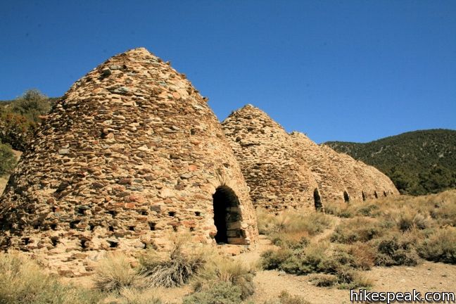
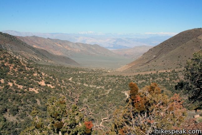
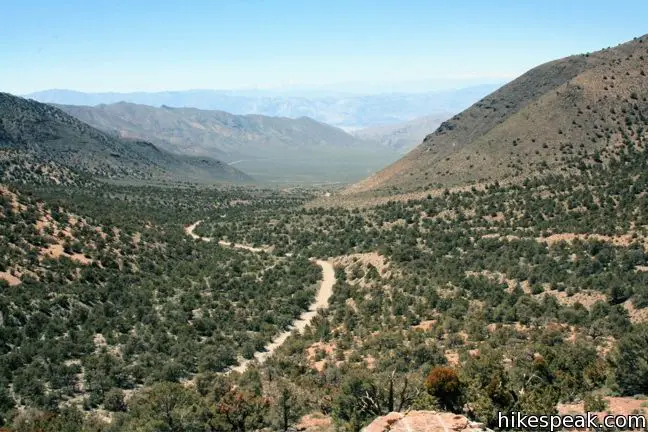
The trail begins at the Charcoal Kilns at an elevation of 6,800 feet. Step inside one of these well-preserved structures, which converted lumber to charcoal for nearby silver miners at the end of the 19th century. When you are ready to go, find the trailhead to the north of the first kiln. From here it is 2,200 vertical feet to the summit, but you won’t have to wait that long for good views. Those come ¼ mile from the start, at an outcropping that looks out over Wildrose Canyon and the road you just drove up from Wildrose Campground.
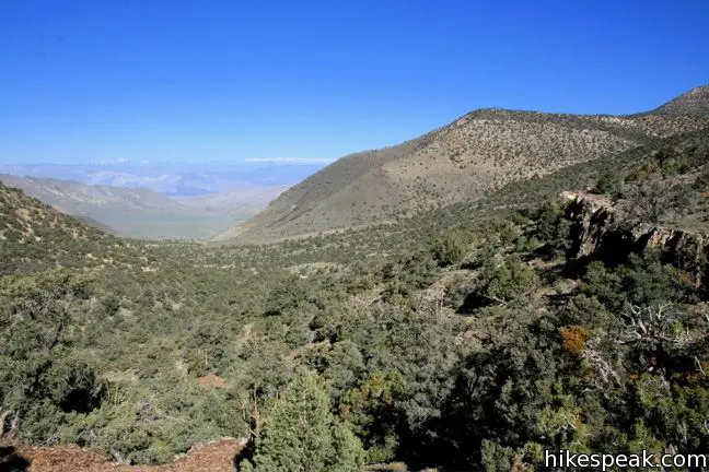
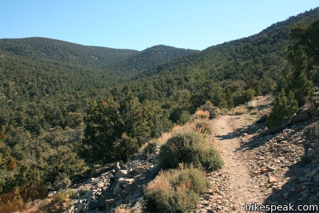
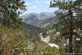
The single-track continues north across the rock ledge, ascending quite gradually. The southern side of Wildrose Peak appears as the trail curves to the right, heading east with the contours of the mountain through a forest of Pinyon pines.
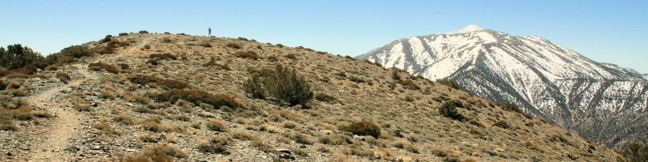
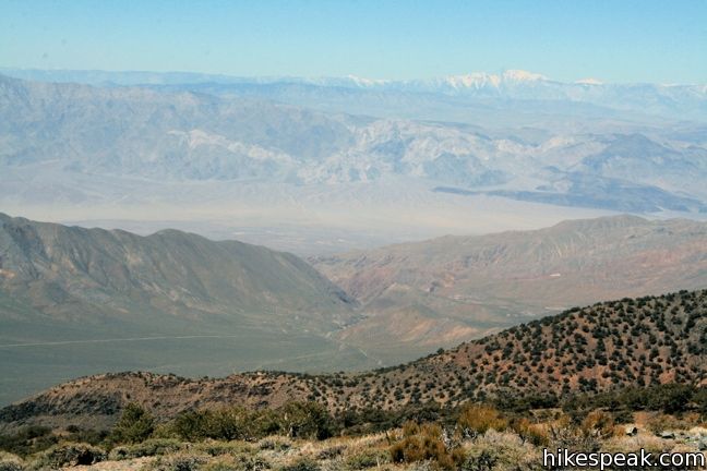
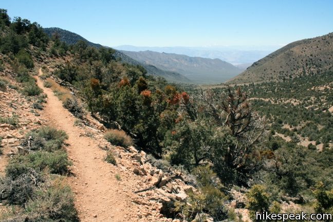
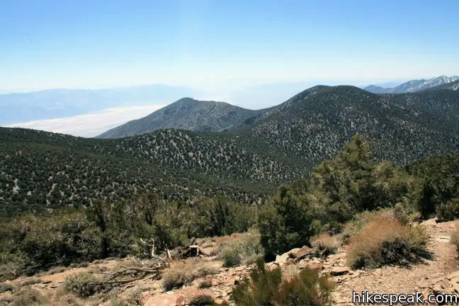
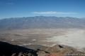
Suddenly the trail decides to stop being so gentle and gradual, and starts aggressively climbing toward a low point in the ridgeline, 1.9 miles from the start. Crest the ridge and reap the benefit of the effort, an outstanding view east over the other side of the mountain into the depths of Death Valley. The salt flats below almost resemble fields of snow, like those found on the Wildrose Peak Trail in the winter months.
The trail turns to the left heading north toward Wildrose. Instead of continuing up the west side of the ridge, the trail takes a slightly roundabout (and possibly more scenic) course. You actually lose a bit of elevation hiking along the eastern side of the ridge before ascending switchbacks up a rise in the ridge.
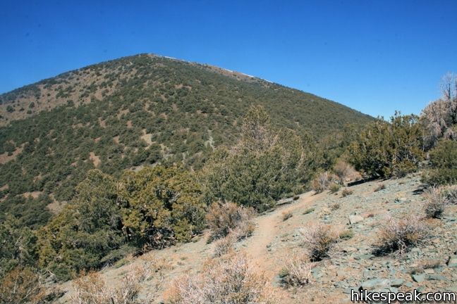
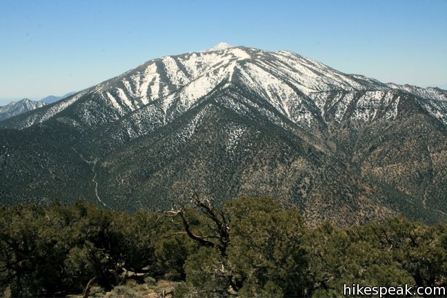
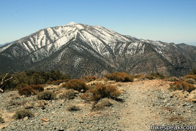
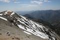
Enjoy the view of Rogers Peak to the south as the trail straightens out and arrives at a saddle below the peak. From here, the summit is 1.1 miles and 900 feet away. Get ready to climb.
The relentless switchbacks are rewarded by ever-improving views. After 0.95 miles, the slope you have been climbing reveals itself to be a false summit that is 50 feet shorter than the actual high point. This would be disappointing if the last 0.15 miles to the actual summit weren’t so pleasant. Take the easy stroll north across the ridge to the true top of Wildrose Peak.
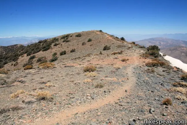
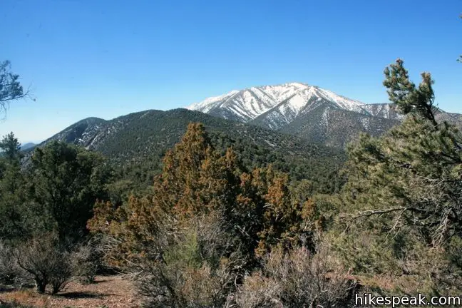
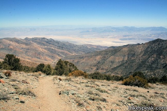
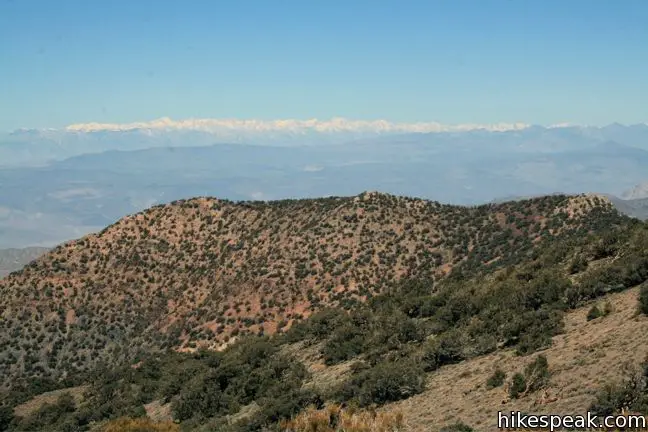
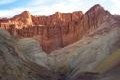
Panoramic is one word to describe the views from this bald summit. Epic might be another. To the south are higher peaks in the Panamint Range — Rogers, Bennet, and Telescope. To the east are the long-stretching salt flats of Death Valley. To the north are the lower Panamint Mountains with their abandoned mining remnants. And to the west is a dramatic line of snowcapped mountains, the high peaks of the Sierra Nevada Mountains.
The way down is the way you came, so take a well-earned break atop Wildrose Peak before returning to the kilns. There are no junctions to worry about on Wildrose Peak Trail.
To get to the trailhead: From Stovepipe Wells, head west on Route 190 for 9 miles. Turn left (south) just past Emigrant Campground on to Emigrant Canyon Road. Drive 21 miles to Wildrose Campground, and continue another 7 miles to the parking area at the Charcoal Kilns. The last 4.5 miles are unpaved graded gravel (which may close in winter).
Trailhead address: Emigrant Canyon Road, Death Valley National Park, Death Valley, CA 92328
Trailhead coordinates: 36.2467, -117.0763 (36° 14′ 48.1″N 117° 04′ 34.7″W)
View Death Valley National Park in a larger map
Or view a regional map of surrounding California Desert trails and campgrounds.


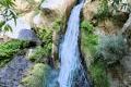 | Darwin Falls This 2-mile hike visits a refreshing year-round waterfall on the western edge of Death Valley. |
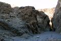
 | Mosaic Canyon This 1 to 4-mile hike starts up a smooth marble slot canyon and exposes visitors to plenty of great Death Valley geology. |
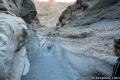
 | Grotto Canyon This 2 to 4 mile hike requires a bit of climbing and is a lesser-visited trail in Death Valley. |
 | Golden Canyon - Gower Gulch Loop This 4-mile loop visits stunning terrain in the badlands region near Furnace Creek. |
 | Dante's View This towering overlook above Badwater Basin offers panoramic views of Death Valley. |
 | Death Valley Explore more destinations in Death Valley National Park. |
 | Mount Waterman The 5.5 to 6 miler can be completed as an out and back hike or a loop, traveling through a pine forest to a round summit. Add six miles to the hike by dropping across a saddle and climbing to the summit of Twin Peaks. |
 | Mount Baldy in the Angeles National Forest This 11.3-mile hike incorporates Devil's Backbone and Baldy Bowl - Ski Hut Trail into one see-all loop. |
 | Silver Peak in Mojave National Preseve This 8.5-mile hike summits a 6,365-foot peak in the Granite Mountains. |
 | New York Peak in Mojave National Preserve This 7 to 9-mile round trip hike summits the highest point of the New York Range in the northeast corner of the preserve. |
 | Warren Peak in Joshua Tree National Park This 5.5-mile hike summits a peak with impressive views over the west side of Joshua Tree. |
 | Death Valley Campgrounds Nine campgrounds are spread throughout this large park to facilitate your visit. |
The Death Valley National Park is located east of the Sierra Nevada mountains in the arid Great Basin of the United State of America. The park also extends into the southern Inyo County and the northern San Bernardino County in the eastern California and the southwestern Nye County and the southern Esmeralda County in Nevada. The Death Valley National Park is open all year.
I did a solo hike up Wildrose Peak in November 1999 on a beautiful fall day. I did not see a soul on the entire trip up or back. It’s one of the fondest memories of many that I have of America’s National Park that I love the most: Death Valley!
This was my annual Birthday Hike and it was amazing. Death Valley is much more beautiful than we expected and this hike made for a perfect day. The reward at the top was breathtaking and the cold (and very windy) 40 degree temp was refreshing after the steep stints. The trail is not easy to follow at the top but kind hikers before us left rock totums for trail markers. Gotta love your fellow hikers!
The outhouse at the bottom was clean and well stocked. The last stip of gravel road to get to the trail head was super bad (in a car) so just be patient and go slow. It’s worth it.
hi,
I will leave the superlatives to others as I wanted to advise the summit push is steep and fair warning should be given. the last one mile is 17% grade! that is absurd for any park service trail. the route was just a horse track that has become a foot trail. just be sure you are ready and don’t get exhausted or trapped by going for the top if you are not ready physically, the weather is threatening or darkness is a concern. happy trails
Amazing, amazing and breathtaking. Bring snacks, plenty of water and a camera. I recommend layers, April 2nd was windy and chilly (but sunny) at the top. Trekking poles would help if you’ve not trained for a steep ascent and some altitude. Enjoy the vast beauty of Death Valley in the Spring!
Last 0.5 mile is quite winding, steep and hence could be physically challenging. I am an average guy with some muscles and some extra fats and took 2.5 hr to up and 1.2 hr to down in Feb. Lots of gravel and snow on the trails during winter (up to March or April). Thick-sole boots are must. Could get short breath due to height (9000 ft) if you are not trained for frequent hikes like me but can be done for sure if you are prepared and take enough time. Best to start early because it can get dark pretty quickly and cold. Temperature was under 25F when I was at the peak about at noon on a bright sunny day. You will need extra layers when you take rest because it gets pretty chilly with strong wind. As mentioned by others, views are just fantastic and probably any photo can’t do justice. Tough but very rewarding.
By the way, the entrance road to the trail head (Charcoal Klins) is quite rough and it is strongly recommended to have high clearance vehicle. I drove with my sedan and almost gave up. It took 30 min for me to pass 2 miles of this unpaved road because I had to literally drive at 5 mph with first gear because there were so MANY ditches, holes, and large gravels. The handout from the park office could be misleading as it says “passable by most passenger vehicles” (or something like that). Yes, you could but you have to be aware that you will have good scratches under your car if you drive a typical sedan.
Is the trail narrow with steep drop offs on the sides? I can physically handle a steep grade, but steep drop offs on the sides make me nervous and dizzy with the heights.
You should be OK as far as drop-offs. The trail does get steep toward the top and it is a single-track. Enjoy the hike.