San Antonio Falls
in the San Gabriel Mountains
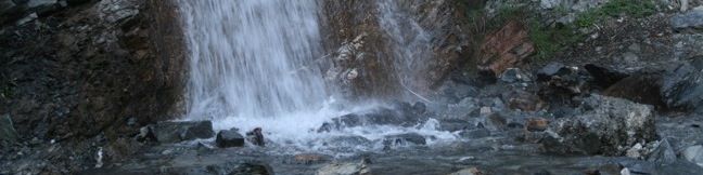
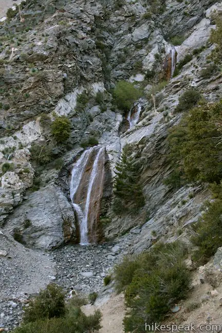
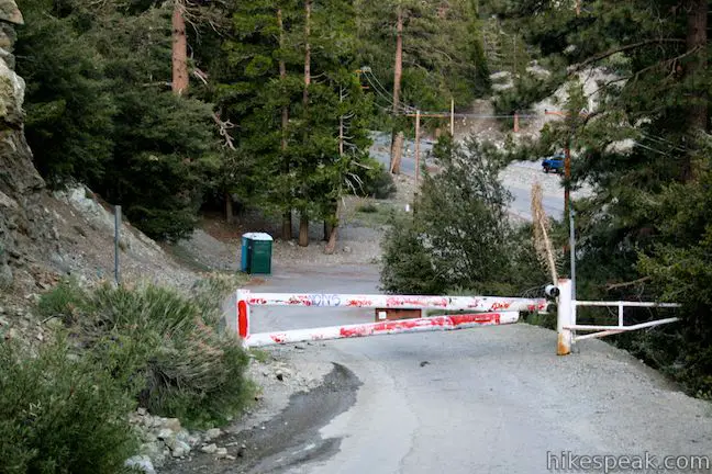
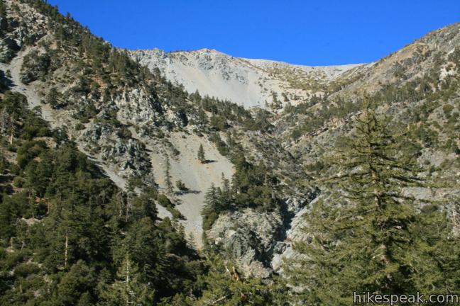
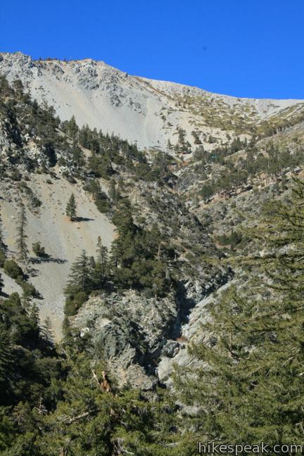
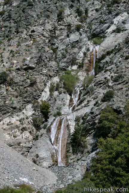
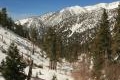
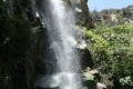
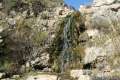
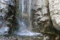
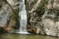
San Antonio is a 75-foot tall multi-tier year-round waterfall carrying water off Mount Baldy. The waterfall swells in late winter and early spring when snow melt increases the flow. The toughest thing about getting to San Antonio Falls isn’t the hike, it’s the long drive to the base of Mount Baldy. The hike to San Antonio Falls is easy. Simply march 0.6 miles up a paved road to a dirt footpath that leads down to the falls. The hike to San Antonio Falls is 1.4 miles round trip with 275 feet of elevation change.
- San Antonio Falls is one of the Los Angeles waterfall hikes.
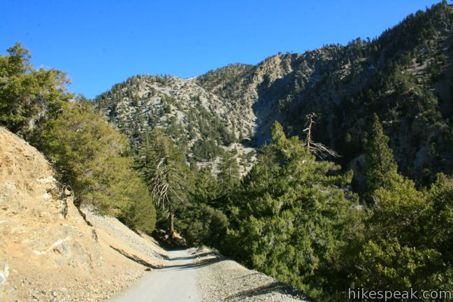
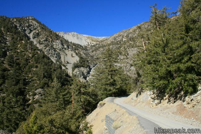
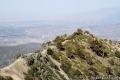
Pavement isn’t the best surface to hike on, but Falls Road does manager to offer nice views up San Antonio Canyon toward towering Mount Baldy, and down the canyon toward Pomona Valley.
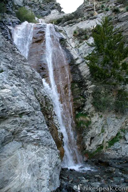
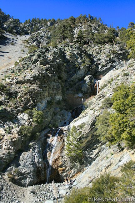
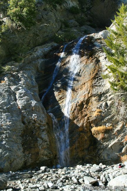
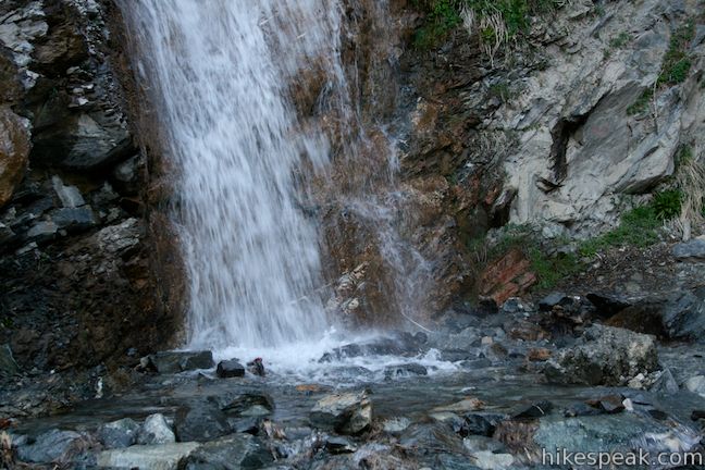
After passing a few mountain cabins, the waterfall will come into view, streaming down the mountainside. When the pavement ends and the road makes a sharp turn to the right, hop of the road and take a dirt path down to the creek at the base of the waterfall. Find a boulder to relax on at the base of the waterfall and enjoy the cascading waters.
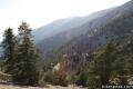
The trail beyond San Antonio Falls continues toward the Sierra Club Ski Hut and the summit of Mount Baldy. If you are visiting the waterfall after making a strenuous hike higher up the mountain, you will find San Antonio Creek to be the prefect place to relax and rinse off. The cold clear water below the waterfall is perfect for soaking soar feet.
Those without ambition to hike far beyond San Antonio Falls, may wish to continue up the trail a quarter mile past the end of the pavement. This will provide a complete view over the waterfall as well as a broader view over Manker Flats Campground and San Antonio Canyon. No permit is required to hike to San Antonio Falls and dogs are welcome, so get out and enjoy!
Directions to the Trailhead
- Take the 210 east and exit on Baseline Road (exit 52).
- Turn left at the light at the end of the ramp on to Baseline Road.
- Make the next right on to Padua Avenue.
- Drive 1.7 miles and turn right onto Mount Baldy Road (at a traffic light).
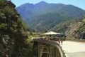
- Continue seven miles up Mount Baldy Road through Mount Baldy Village (which has a visitor center) and follow the road for another 4.4 miles up the mountain past Manker Flats Campground to the bottom of Falls Road on the left.
- Park along Mount Baldy Road, display an adventure pass, and begin hiking up Falls Road.
Trailhead Location
Trailhead address: Mount Baldy Road & Falls Road, Angeles National Forest, Mount Baldy, CA 91759
Trailhead coordinates: 34.266172, -117.62684 (34° 15′ 58.21″N 117° 37′ 36.62″W)
You may also view a regional map of surrounding Los Angeles trails and campgrounds.


 | Baldy Bowl - Ski Hut The Baldy Bowl - Ski Hut Trail offers a steep but scenic ascent up the south side of Mount Baldy, crossing 4.5 miles and 3900 feet to the summit. |
 | Devil's Backbone This 3.2-mile ridge-top trail between Baldy Notch and the summit of Mount Baldy offers incredible views of the San Gabriel Mountains. |
 | Baldy Notch To hike the scenic Devil's Backbone to Mount Baldy, you must pass through Baldy Notch. You can hike to the notch, or take a ski lift. |
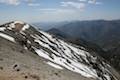 | Mount Baldy Loop This 11.3-mile hike incorporates the Devil's Backbone and the Baldy Bowl - Ski Hut Trail into one see-all loop. |
 | Icehouse Canyon Trail to Icehouse Saddle This 7.2-mile hike climbs 2,600 feet through a picturesque canyon to a saddle with panoramic views and extended hiking opportunities. |
 | Bridge to Nowhere This adventurous 10-mile round trip hike reaches an abandoned and out-of-place bridge with a unique history. |
 | More trails in the San Gabriel Mountains Explore other destinations in the range. |
 | Sturtevant Falls This 3.3-mile hike visits a 60-foot waterfall and a lush cottage-lined canyon. |
 | La Jolla Canyon Falls This 1.5-mile hike visits a short seasonal waterfall in Point Mugu State Park on the west end of the Santa Monica Mountains. |
 | Millard Falls This one mile hike visits a 50-foot waterfall up one of the most scenic canyons in the range. |
 | Eaton Canyon Falls This 3.5-mile hike goes up Eaton Wash to a narrow stretch of Eaton Canyon containing a pleasant 40-foot waterfall. |
 | More waterfalls around Los Angeles Explore other waterfalls in the Santa Monica and San Gabriel Mountains. |
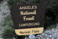 | Manker Flats Twenty-one sites service campers at the base of Mount Baldy. The grounds are nothing exciting, but if want a staging area for your ascent, this is it. |
Common Questions about San Antonio Falls in the San Gabriel Mountains
- Is the trail open?
- Yes. You should expect to find that Falls Road to San Antonio Falls is open. There are no recent reports of trail closures. If you discover that the trail is closed, please help your fellow hikers by reporting a closure.
- Do I need a permit for this hike?
- Yes. National Forest Adventure Pass.
- How much time does this hike take?
- It takes approximately 45 minutes to hike Falls Road to San Antonio Falls. Individual hiking times vary. Add extra time for breaks and taking in the views.
- How long is this hike?
- The hike to Falls Road to San Antonio Falls is a 1.4 mile out and back with 275 feet of elevation change.
- Are dogs allowed on this trail?
- Yes, dogs are allowed on Falls Road to San Antonio Falls. The trail is open to hikers, dogs, bikes.
- Is Falls Road to San Antonio Falls good for kids?
- Yes, this hike is likely suitable for children. It is relatively short (1.4 miles) with manageable elevation gain.
- Will I see a waterfall on this hike?
- Yes, Falls Road to San Antonio Falls features a waterfall.
- What mountain range is this trail in?
- Falls Road to San Antonio Falls is located in the San Gabriel Mountains.
- Where is the trailhead located?
- The trailhead for Falls Road to San Antonio Falls is located in Mt. Baldy, CA.
Trailhead Address:
Mount Baldy Road & Falls Road
Mt. Baldy, CA 91759
Trailhead Coordinates:
34.266172, -117.62684 - What are the driving directions to the start of the hike?
To get to the trailhead: Take the 210 east and exit on Baseline Road (exit 52). Turn left at the light at the end of the ramp on to Baseline Road. Make the next right on to Padua Avenue. Drive 1.7 miles and turn right onto Mount Baldy Road (at a traffic light). Continue seven miles up Mount Baldy Road through Mount Baldy Village (which has a visitor center) and follow the road for another 4.4 miles up the mountain past Manker Flats Campground to the bottom of Falls Road on the left. Park along Mount Baldy Road, display an adventure pass, and begin hiking up Falls Road.
View custom Google Maps directions from your current location.
- Are there other trails near Falls Road to San Antonio Falls?
- Yes, you can find other nearby hikes using the Hikespeak Hike Finder Map.

12 Comments on San Antonio Falls in the San Gabriel Mountains
What hikers are saying:
✨ Generated summary of user commentsHikers enjoy the beautiful scenery and the rewarding sight of the falls after a steep initial climb. Raymond warns visitors to stay alert for falling rocks near the cliffside, as debris can tumble down without warning. Arriving before 7:30 a.m. helps secure parking and camping spots before the area becomes crowded on weekends.
Are dogs allowed on the San Antonio Falls trail?
They sure are! And here is a long list of some of the dog-friendly trails in Los Angeles.
I did this hike taking the ski lift up to the top of Mt Baldy, hiking down the fire road and hitting the falls on the way. Nice 4-5 mile hike.
Do you know if that route is accessible now with snow on the mountain?
What is an adventure pass?
The adventure pass is a day use pass needed to visit some areas of the Angeles National Forest (along with the Cleveland National Forest, San Bernardino National Forest, and Los Padres National Forest). You can purchase a pass for the day or for a year from the ranger station on the road to the waterfall or from several other business. More information here.
[…] Info: San Antonio Falls; Mt. Baldy Chamber of Commerce, Hike Speak […]
San Antonio Falls is another extremely crowded hike. We tried both SAT and SUN @6am and still there were already plenty of folks, parking lot already full plus parked cars along Mt. Baldy Rd. San Antonio Falls still has plenty of water last weekend (6/10/17) and very beautiful to visit.
Be careful of falling rocks at waterfall all most got kill when a rock fell from cliffside and all most hit me in the head next to the falls
Hello, Has anyone gone recently? I want to go this Sunday. Does this have water?
[…] all year long; however, it draws far more people during the summer, fall and late spring months. Hikespeak.com describes the falls as “a 75-foot tall multi-tier year-round waterfall carrying water off Mount […]
My hysband & I loved this hike. It started out steep but then it was fine. It wasn’t crowded surprisingly on a Saturday and we even got a campsite at Manker Flat arriving at 7:30 am. Of course we wore our mask during the hike to the Falls