Mount Lowe Road to Inspiration Point and Mount Lowe Trail Camp in the San Gabriel Mountains
Sometimes it can seem ambitious just to go for a hike in the rugged San Gabriel Mountains, but Thaddeus Lowe was way more determined than that, devising an incline tram and railway to bring guests to a resort, tavern, and mountain overlooks that he created in the San Gabriel Mountains about a century ago. His railway and resorts have long been destroyed, but hikers can still visit the remnants.
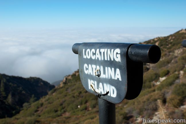
Hike to the site of Lowe’s Alpine Tavern, which is now Mount Lowe Trail Camp, and check out nearby Inspiration Point, which is still a commanding overlook with sighting tubes to help you spot landmarks in the cityscape below. The Alpine Tavern was at the top of the old Mount Lowe Railway that transported guests up from a resort on Echo Mountain, which can be seen from Inspiration Point and can be visited by hiking up Sam Merrill Trail from Altadena.
A few routes reach Inspiration Point and Mount Lowe Trail Camp from the base of the San Gabriel Mountains (including Castle Canyon Trail), but this write-up offers a top-down approach.
Venture down to Inspiration Point and Mount Lowe Trail Camp from the top of Mount Lowe Road where it meets Mount Wilson Red Box Road. Descend 825 feet in 3.7 miles to Inspiration Point. From there, Mount Lowe Trail Camp is nearby, located along Mount Lowe Road. The ruins are worth checking out even if you don’t plan to camp. Visit the trail camp and Inspiration Point, enjoying great views over the San Gabriel Mountains and the city below on a 7.25-mile round trip hike with 900 feet of elevation gain.
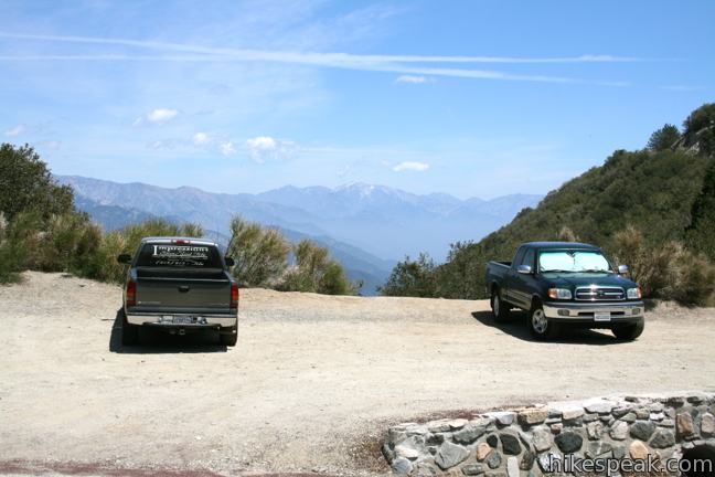
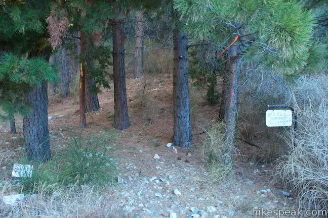
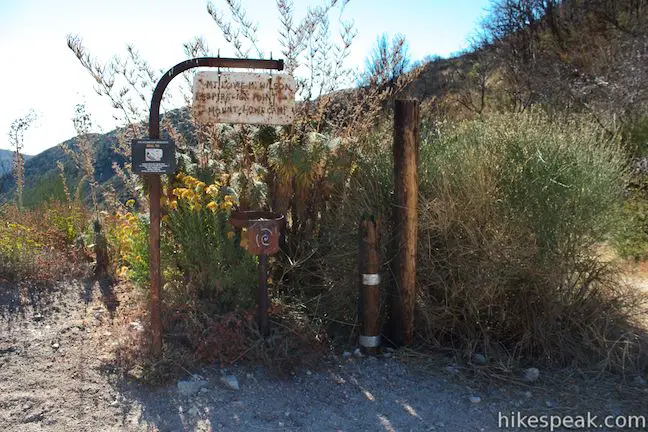
The hike begins from the Markham Trailhead on Mount Wilson Red Box Road, situated in Eaton Saddle between San Gabriel Peak and Occidental Peak west of Mount Wilson. A sign at trailhead offers a short description of the Mount Lowe Railroad to get you ready for the hike:
A railroad to the clouds? As difficult as that was to believe, by the mid 1880’s T.S.C. Lowe and David MacPherson had indeed constructed not only a railroad to the sky but also a small city on Echo Mountain, The Alpine Tavern at Crystal Springs and a fine pavilion in Rubio Canyon. For the next forty years, the famous Mt. Lowe Railroad proved to be Southern California’s most famous tourist attraction. To recapture some of the magic of those early days, the U. S. Forest service in cooperation with the Pacific Railroad Society has installed more than 30 interpretive signs in the Mt. Lowe Railway Area.
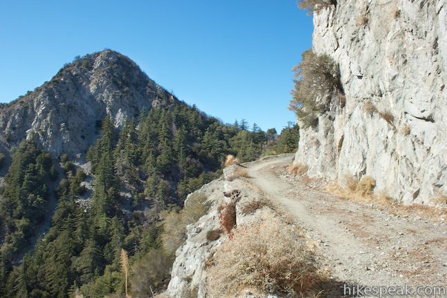
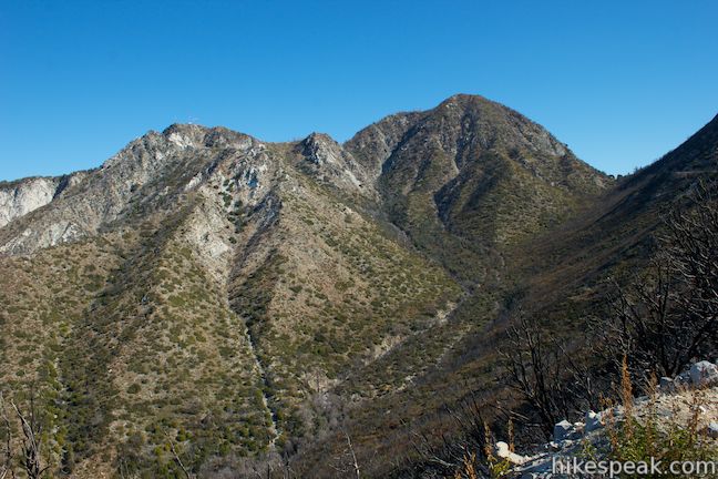
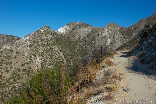
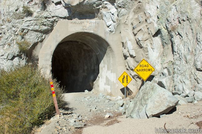
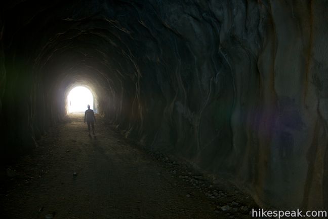
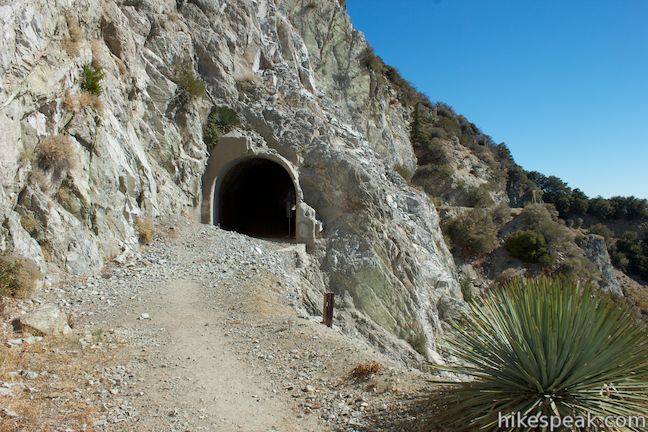
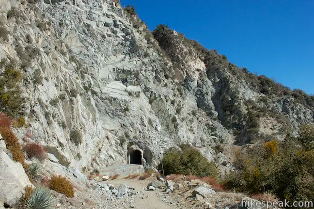
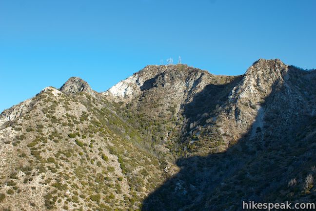
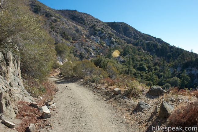
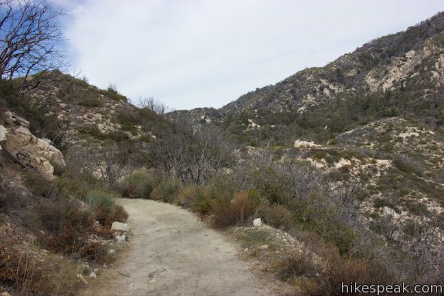
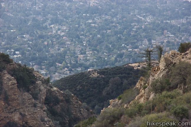
Start hiking up Mount Lowe Road (Mount Lowe Fire Road) where you will be greeted immediately by a head-on view of Mount Markham. On the left side of the wide trail, the mountainside drops away into Eaton Canyon to the east below Mount Wilson and Occidental Peak. Mount Lowe Road curves to the right toward San Gabriel Peak, heading gradually uphill to start the hike. After 0.35 miles, you will reach Mueller Tunnel, which cuts through the steep face of San Gabriel Peak.
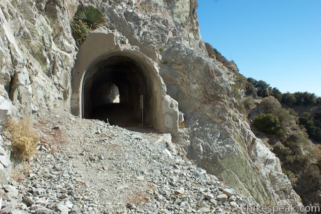
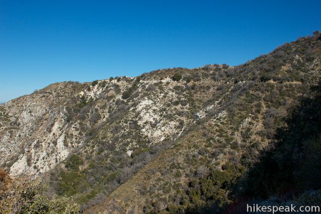
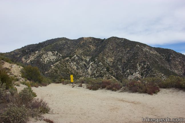
Beyond the tunnel, which was built in 1942, the trail ascends to Markham Saddle, a pass between Mount Markham to the south and San Gabriel Peak to the north. This is the high point of the hike at 5,300 feet. There is a trail junction here, 0.6 miles from the start. A single-track trail to the left heads up to Mount Lowe (Mount Lowe East Trail) and there is another single-track trail to the right that ascends San Gabriel Peak (San Gabriel Peak Trail).
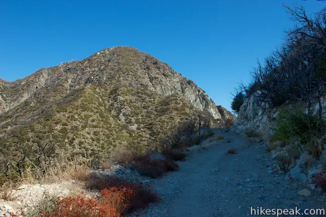
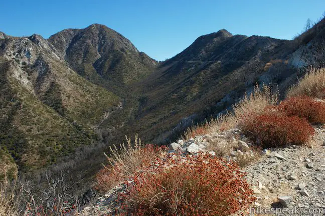
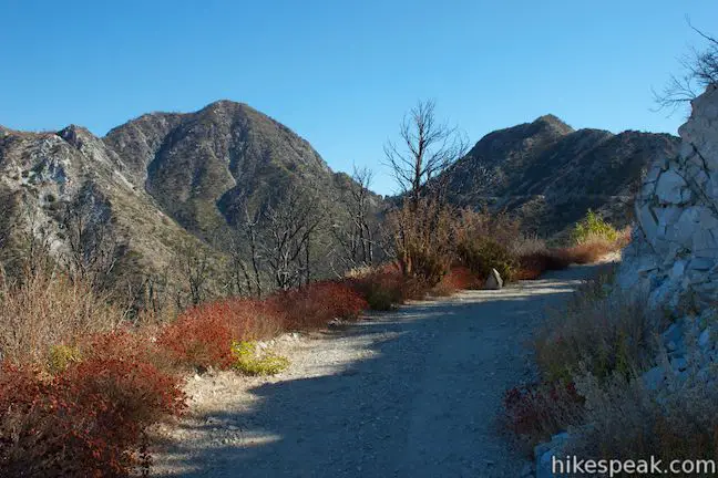
Proceed straight on Mount Lowe Road, which turns downhill and begins a gradual descent on the west side of Mount Markham and Mount Lowe. For about a mile, you will pass through an area that was burned by the 2009 Station Fire. While the road is in good shape, there is poodle-dog bush growing in some areas (as of the fall of 2013), which flourishes after wildfires and can cause skin irritation similar to poison oak. It is recommended that you wear long pants and long sleeves while hiking in areas with poodle-dog bush. Fortunately, Mount Lowe Road is wide enough that you should not have a problem avoiding contact with these irritating plants.
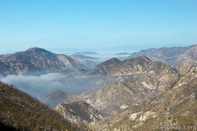
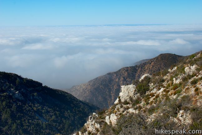
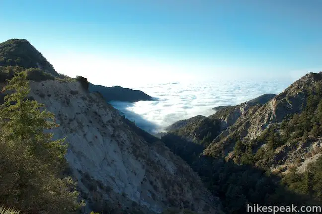
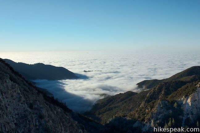
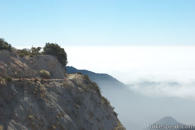
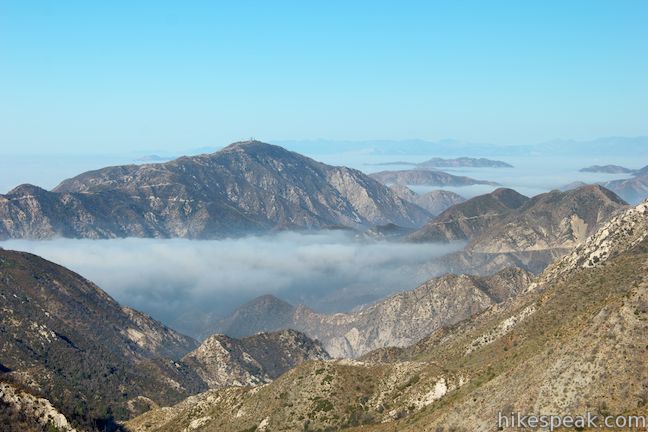
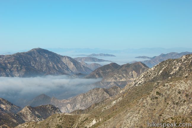
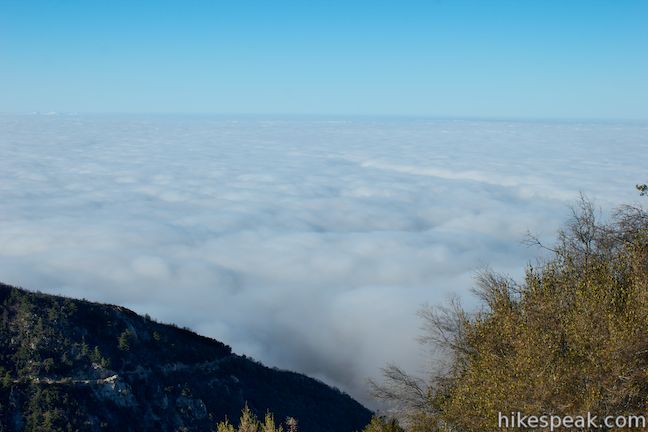
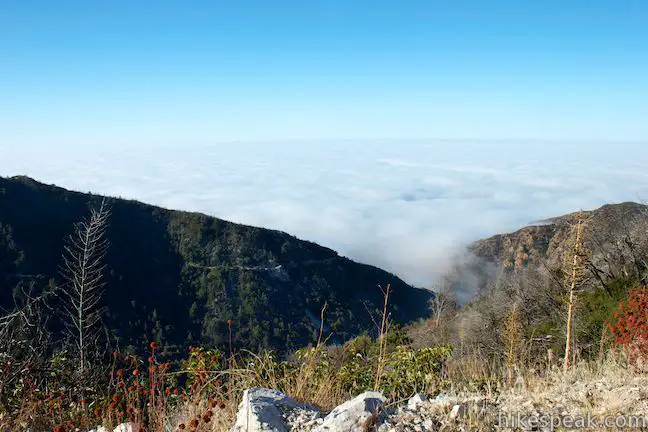
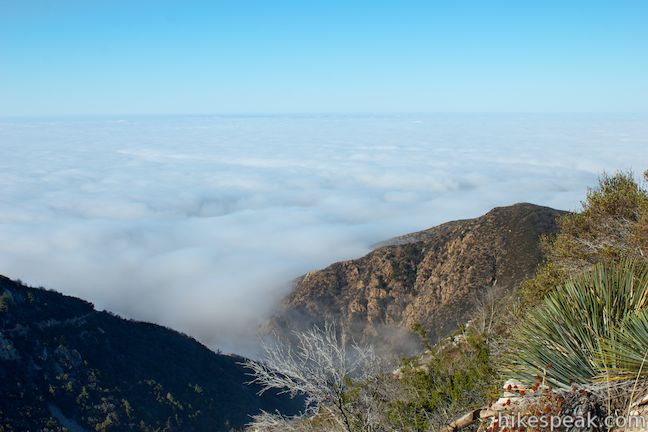
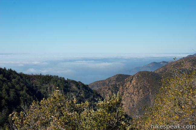
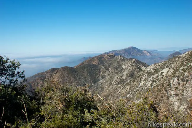
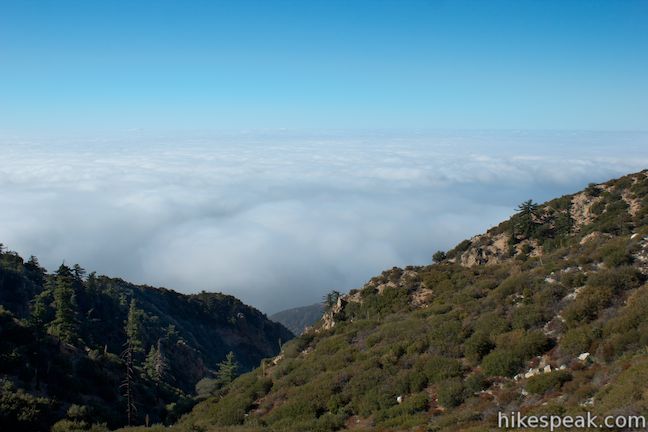
New views reveal themselves to the west, where you can look down Bear Canyon toward Mount Lukens and lower peaks in the San Gabriel Mountains backed by the San Fernando Valley (or clouds depending on the conditions of your hike). As you trek down the road, look over your shoulder for views of San Gabriel Peak and its close neighbor to the west, Mount Disappointment.
After hiking downhill for 1.3 miles (1.9 miles from the start), make a sharp left bend around the ridgeline and switch from hiking west to hiking east. At this point, you will also pass through a junction with Tom Sloan Trail, a single track that continues west down the ridge.
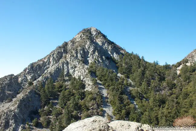
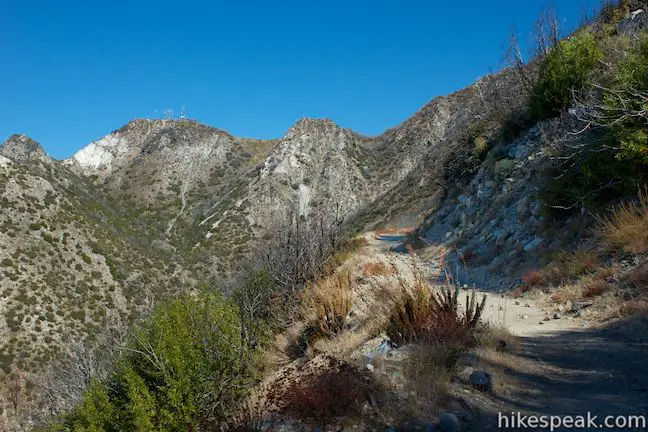
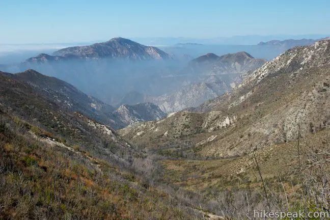
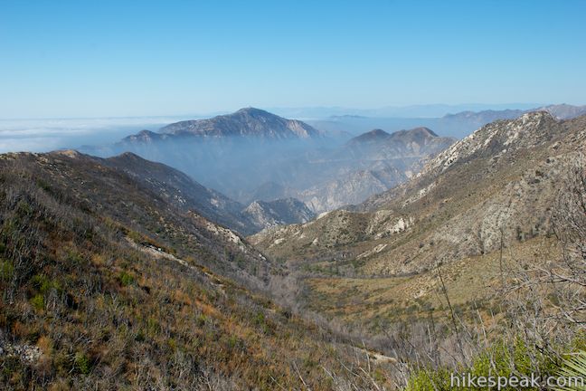
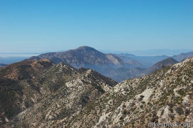
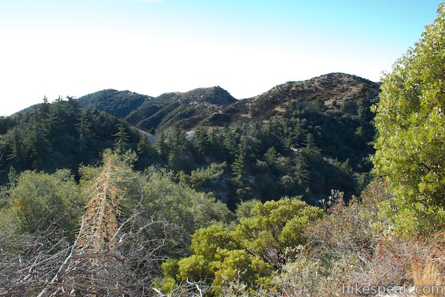
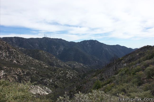
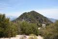
As Mount Lowe Road descends eastward on the south side of the ridge, discover new views south over Grand Canyon, which runs west down into Millard Canyon toward the San Gabriel Valley below. Rugged rust and cream-colored rocks burst out from the chaparral below the trail to create an impressive mountain landscape. Mount Lowe Trail Camp is cradled at the top of Grand Canyon to the east. Above the campground is the tapered summit of Muir Peak, which rises to 5,688 feet, not far from Inspiration Point, which is just out of sight.
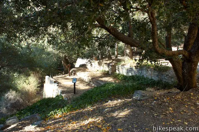
Continue down Mount Lowe Road and you will eventually pass two marked junctions with single tracks that ascend to the left up Mount Lowe. The first trail is Upper Sam Merrill – Mount Lowe West Trail and the second trail is Mount Lowe East Trail. On the right, across from Mt. Lowe East Trail, and 3.15 miles from the start, you will spot a path marked with a sign for Mount Lowe Trail Camp (Alpine Tavern Site). If you don’t plan to visit the trail camp, you should continue 0.3 miles down the road to a junction with Muir Peak Road, turn left, and hike the final quarter mile to Inspiration Point. However, if you wish to visit the trail camp first, turn right here and descend 0.15 miles on a narrow dirt trail to the trail camp. Mount Lowe Trail Camp is also located along Mount Lowe Road, but this path cuts out a half mile long stretch of the road as it goes around a big bend.
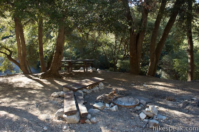
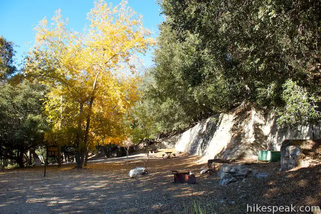
Along the trail down to Mount Lowe Trail Camp, you will pass an area that contained twenty cottages for the support staff at the Alpine Tavern. At the bottom of the trail, reach Mount Lowe Road again where a large Angeles National Forest sign for Mount Lowe Trail Camp to your right will usher you into the campground.
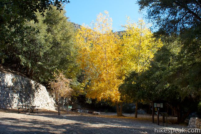
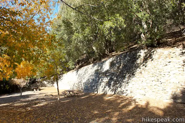
Set in a forest of cedars, oaks, and spruce, the campground rests on a level area where the Alpine Tavern once stood. On your right, you’ll find the ruins of the tavern’s lobby, with parts of the basement wall and grand fireplace still standing. There are several interpretive signs around the trail camp to tell the story of the Alpine Tavern. What’s left of the railway line that brought guests up to the mountain retreat can be seen to the left as you face the trail camp.
An interpretive sign shows a picture of the railway and describes just how impressive it must have been:
The last of the 18 bridges between Echo Mountain and Alpine Tavern was this large “S” shaped bridge which the trolleys crossed to reach the Alpine Tavern. Both end foundations of the bridge are still visible. If you look across the canyon to the road you can see them.
Lowe opened the Alpine Tavern in 1895 at the top of the Mount Lowe Railway. He intended to extend the railway all the way to the summit of Mount Lowe, but never made it that far. When the resort on Echo Mountain was destroyed, the Alpine Tavern was expanded to handle more guests, but it too was wiped out by a wildfire in 1936. In 1959, most of the ruins were destroyed to build the trail camp.
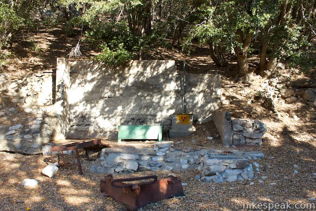
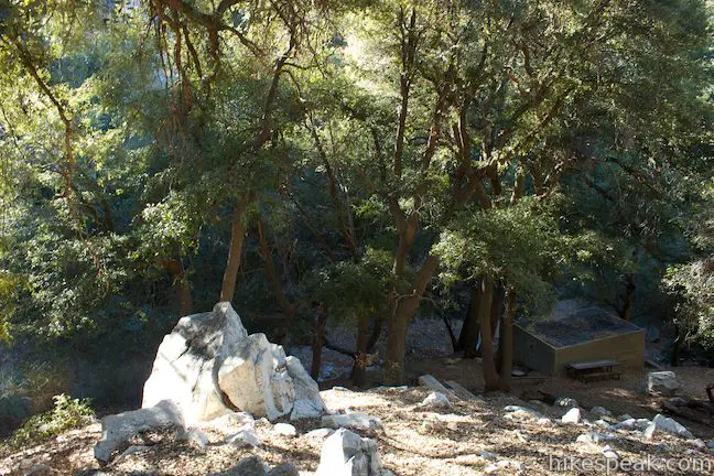
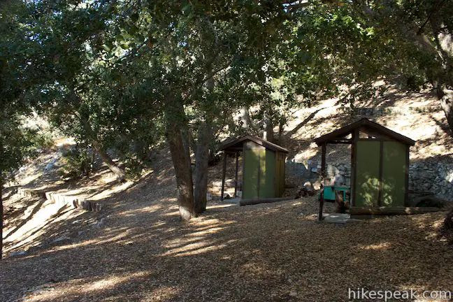
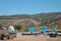
In its day, the Alpine Tavern offered guests the finest amenities: long-distance telephones and private baths with hot and cold water. There were leisure activities like ballroom dancing, billiards, croquet, tennis, and mini-golf. Today’s visitors have to get by on less. There is a pair of vault toilets, a fire ring, picnic tables, benches, and a hitching post for horses. The natural beauty of this place remains a major draw.
The Angeles National Forest website states that the trail camp has five hike-in campsites, but this seems to be less of a situation where there are individual sites and more of a general camping area, with several suitable places to put up tents. Mount Lowe Trail Camp would make a great destination for a group backpacking trip. The trail camp gets light usage and is open year round on a first-come first-served basis. There is no fee to camp at the Mount Lowe Trail Camp and no permit is required. You should plan to carry in your drinking water, but in the spring there may be water available to filter from a nearby stream.
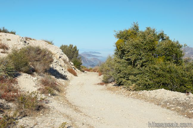
Return to Mount Lowe Road to hike toward Inspiration Point. To your right, Mount Lowe Road descends for 2.8 miles along the old route of Mount Lowe Railway to the Cape of Good Hope and continues another 2.45 down to a paved road called Chaney Trail where Mount Lowe Road comes to an end (8.9 miles below Eaton Saddle). Turn left up Mount Lowe Road to hike 0.2 miles up the road to an intersection leading to Inspiration Point.
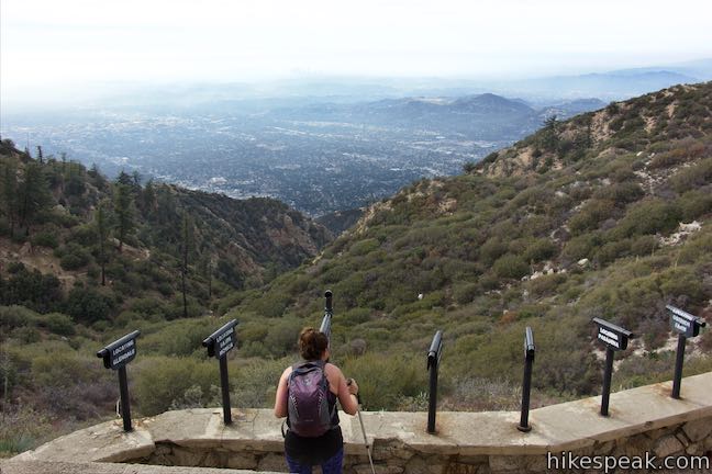
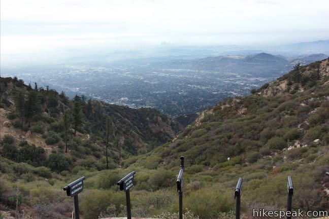
After this short hike up Mount Lowe Road come to a big bend to the left and a junction with Muir Peak Road, another wide dirt Road. A metal sign at the junction indicates that this is the route to Inspiration Point, so turn right to head toward the view. A pair of single-track trails depart from this junction as well, on either side of the wide trail to Inspiration Point. Idlehour Trail descends to the left (east) into Eaton Canyon, eventually connecting to Mount Wilson Toll Road above Henninger Flats. On the right side of the junction is Sam Merrill Trail, which descends 2.5 miles to Echo Mountain before proceeding down to the trailhead at Cobb Estate in Altadena.
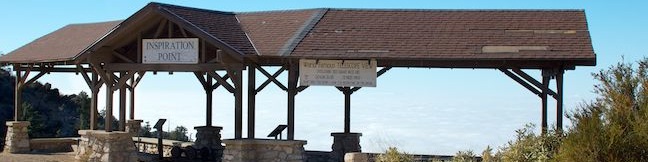
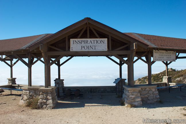
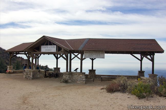
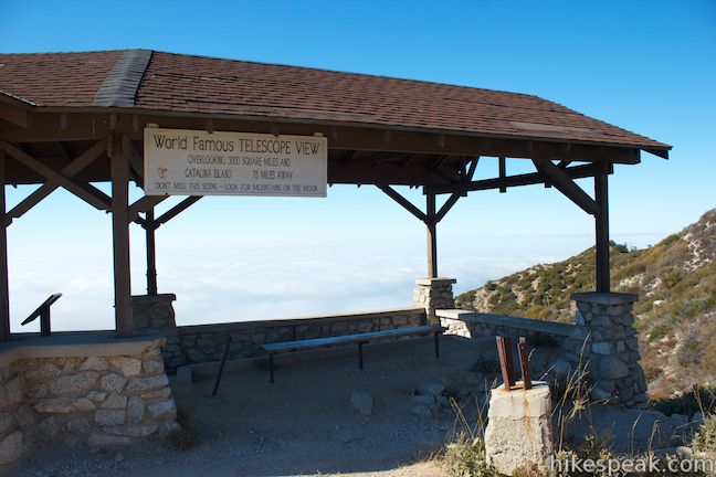
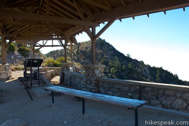
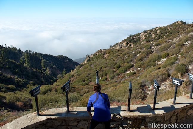
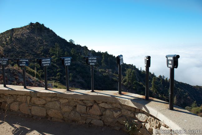
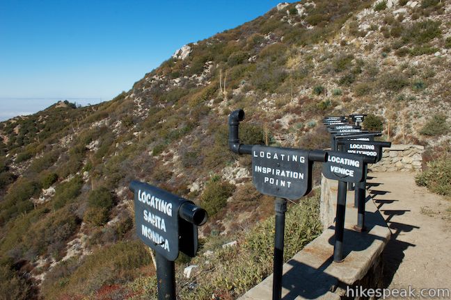
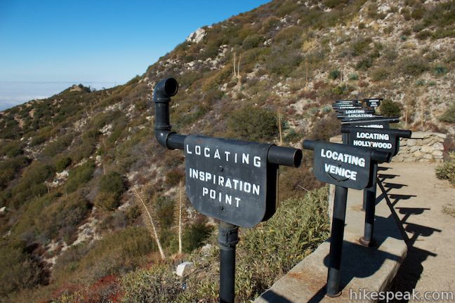
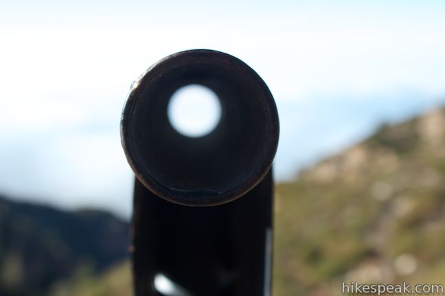
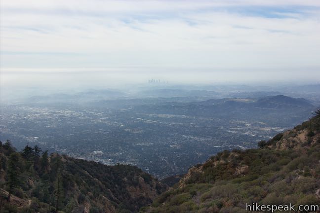
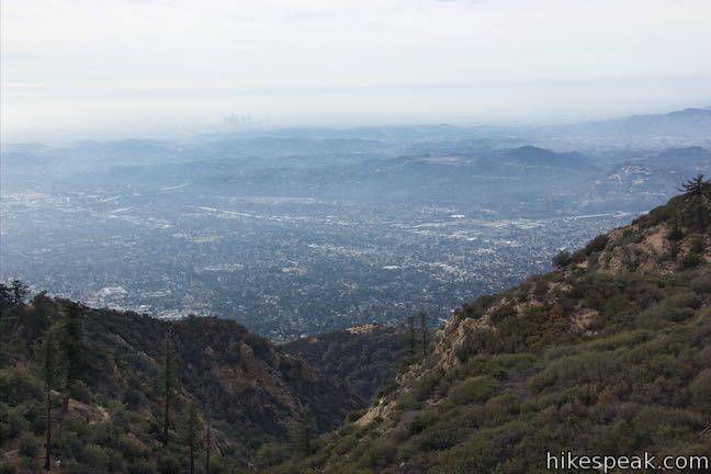
Follow the wide dirt trail between the single tracks for a quarter mile to Inspiration Point. You can’t miss it! There are two large pavilions, rebuilt to match the ones visited by guests at the Alpine Tavern. A sign on the pavilion promotes Inspiration Point’s “world famous telescope view overlooking 3,000 square miles.” Below the pavilion there is a collection of sighting tubes, which you can look through to spot different areas of Los Angeles. On clear days, look through the metal tube pointing toward Catalina Island and examine that island at least 60 miles away.
An interpretive sign explains how Inspiration Point was developed:
Originally only sighting tubes and benches were here. In 1925, two shelters were built. They lasted until the late 1950s. Volunteers reconstructed these shelters in the summer of 1996 on their original foundations.
Beyond Inspiration Point, the wide road continues out to Muir Peak and Easter Rock, where sunrise services were held for Lowe’s guests on Easter Sunday. Branching off the road to the right is Castle Canyon Trail, a single-track trail that descends south for two miles to the ruins on Echo Mountain where it joins Sam Merrill Trail.
Once you have been sufficiently motivated by the views, it’s time to turn around and begin the uphill hike back. Backtrack a quarter mile to the intersection with Mount Lowe Road, where there was once a fox farm to entertain guests. Turn right and hike back up Mount Lowe Road for 3.45 miles. Stay straight through every junction and Mount Lowe Road will take you right back to the trailhead to complete the 7.25-mile round trip hike.
This hike down Mount Lowe Road begins from an amenity-free trailhead within the Angeles National Forest where an Adventure Pass (day use pass) is no longer required. Dogs, mountain bikes, and horses are welcome on Mount Lowe Road and the trail to Inspiration Point. No fee or permit is required to hike to Inspiration Point or Mount Lowe Trail Camp and staying overnight at the trail camp is free. What more inspiration do you need?
Directions to the Trailhead
- From the 210 Freeway in La Cañada Flintridge, head northeast on Angeles Crest Highway (CA 2) for 14 miles and turn right on Mount Wilson Road Box Road (after mile marker 38).
- Drive 2.3 miles to the Markham Trailhead at Eaton Saddle and pull into the dirt lot on the right at the start of Mount Lowe Road.
Trailhead Location
Trailhead address: Mount Wilson Red Box Road & Mount Lowe Road, Angeles National Forest, Altadena, CA 91001
Trailhead coordinates: 34.2393, -118.0934 (34° 14′ 21.5″N 118° 05′ 36.2″W)
View Inspiration Point & Mount Lowe Road in a larger map
Or view a regional map of surrounding Los Angeles trails and campgrounds.


 | San Gabriel Peak from Mount Lowe Road This 3.2-mile hike used Mount Lowe Road and San Gabriel Peak Trail to summit a 6,161 foot peak near Mount Wilson. |
 | San Gabriel Peak from Mount Disappointment Fire Road This 4-mile hike approaches the summit of San Gabriel Peak from the other side, and can be extended to visit nearby Mount Disappointment. |
 | Switzer Falls This 4.5-mile hike starts out above and finishes below a 50-foot tall waterfall. |
 | Mount Lowe Road & Sunset Ridge Trail to Cape of Good Hope This pair of trails can be combined for a 5.2-mile round trip hike to a historic viewpoint called Cape of Good Hope. Follow the old route of Mount Lowe Railway to the ruins on Echo Mountain to extend the hike by two miles round trip or bring the distance up to 11.85 miles by visiting Echo Mountain, Inspiration Point, Mount Lowe Trail Camp, and other landmarks. |
 | Echo Mountain via Sam Merrill Trail This 5.8-mile hike visits a historic railway and ruins from a century old resort overlooking Pasadena. |
 | Castle Canyon Trail to Inspiration Point (and beyond) This 2-mile long trail ascends from the ruins on Echo Mountain to a historic viewpoint that still offers hike-worthy panoramas. Form a loop back to Echo Mountain to visit Mount Lowe Trail Camp, Cape of Good Hope, and other landmarks on Mount Lowe Railway. |
 | Rubio Canyon Trail This 1.3-mile round trip hike ventures into a rustic canyon to a double waterfall. |
 | Henninger Flats via Mount Wilson Toll Road This 6-mile round trip hike ascends 1,325 feet to a trail camp, tree nursery, lookout tower, and visitor center on a landing in the San Gabriel Mountains operated by the Los Angeles County Fire Department. The hike can easily be extended to 8.7 miles by exploring a loop above Henninger Flats. |
 | More trails in the San Gabriel Mountains Explore other destinations in the range. |
 | Henninger Campground in the San Gabriel Mountains This 30-site hike-in campground is spread out on a pine-covered landing that boasts big views over the San Gabriel Valley and can be reached via a 6-mile out-and-back hike up Mount Wilson Toll Road. |
 | Millard Campground in the San Gabriel Mountains This small campground at the base of the San Gabriel Mountains is the starting place for hikes to Millard Falls and Dawn Mine. |
 | More campgrounds around LA Check out a few other places to camp in Los Angeles County. |
- Mount Lowe Railway on wikipedia.org (opens in a new tab)
- A San Diego Reader article by Jerry Schad on hiking down to Inspiration Point from Eaton Saddle (opens in a new tab)
- Inspiration Peak (Inspiration Point) on summitpost.org (opens in a new tab)
- Mount Lowe Trail Camp on alltrails.com (opens in a new tab)
- The official Angeles National Forest webpage for Mount Lowe Trail Camp (opens in a new tab)
- Sam Merrill Trail to Echo Mountain on Inspiration Point on geekhiker.com (opens in a new tab)
- Sam Merrill Trail to Echo Mountain on Inspiration Point on socalhiker.net (opens in a new tab)
- Sam Merrill Trail to Echo Mountain on Inspiration Point on modernhiker.com (opens in a new tab)
- The official website of the Angeles National Forest (opens in a new tab)
Common Questions about Mount Lowe Road to Inspiration Point and Mount Lowe Trail Camp in the San Gabriel Mountains
- Is the trail open?
- Yes. You should expect to find that Eaton Saddle to Mount Lowe Trail Camp and Inspiration Point is open. There are no recent reports of trail closures. If you discover that the trail is closed, please help your fellow hikers by reporting a closure.
- Is this trail free to access?
- Yes, Eaton Saddle to Mount Lowe Trail Camp and Inspiration Point is free to access. No entrance fee, pass, or permit is required. If you discover that access rules have changed, please provide feedback on your experience.
- How much time does this hike take?
- It takes approximately 3 hours 30 minutes to hike Eaton Saddle to Mount Lowe Trail Camp and Inspiration Point. Individual hiking times vary. Add extra time for breaks and taking in the views.
- How long is this hike?
- The hike to Eaton Saddle to Mount Lowe Trail Camp and Inspiration Point is a 7.25 mile out and back with 900 feet of elevation change.
- Are dogs allowed on this trail?
- Yes, dogs are allowed on Eaton Saddle to Mount Lowe Trail Camp and Inspiration Point. The trail is open to hikers, dogs, bikes.
- Are there ruins on this trail?
- Yes, you can encounter ruins on Eaton Saddle to Mount Lowe Trail Camp and Inspiration Point.
- What mountain range is this trail in?
- Eaton Saddle to Mount Lowe Trail Camp and Inspiration Point is located in the San Gabriel Mountains.
- Where is the trailhead located?
- The trailhead for Eaton Saddle to Mount Lowe Trail Camp and Inspiration Point is located in Altadena, CA.
Trailhead Address:
Mount Wilson Red Box Road
Altadena, CA 91001
Trailhead Coordinates:
34.239364, -118.093303 - What are the driving directions to the start of the hike?
To get to the trailhead: From the 210 Freeway in La Cañada Flintridge, head northeast on Angeles Crest Highway (CA 2) for 14 miles and turn right on Mount Wilson Road Box Road (after mile marker 38). Drive 2.3 miles to the Markham Trailhead at Eaton Saddle and pull into the dirt lot on the right at the start of Mount Lowe Road.
View custom Google Maps directions from your current location.
- Are there other trails near Eaton Saddle to Mount Lowe Trail Camp and Inspiration Point?
- Yes, you can find other nearby hikes using the Hikespeak Hike Finder Map.

9 Comments on Mount Lowe Road to Inspiration Point and Mount Lowe Trail Camp in the San Gabriel Mountains
What hikers are saying:
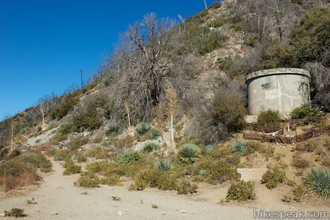
✨ Generated summary of user commentsHikers find this route to be a rewarding, leading to secluded and idyllic destinations. For those heading toward the trail camp, Steve advises that year-round water is available at Alpine Springs in an old water tank above the site. This clear and cold water source remains a reliable staple for visitors despite lacking official recognition.
how was parking?
Year-round water is found at Alpine Springs located on the hillside above the trail camp in the old water tank that formerly serviced the hotel and its guests. USFS makes no mention of it officially but everyone uses it. Clear, cold and delicious.
This description came up when I searched for Idlehour Campground. To reach that secluded and idyllic site – one unaffected by the Station Fire – it’s possible using the Inspiration Point route but best done climbing the Mt. Wilson Toll Road from its start in Altadena, passing Henninger Flats and turning left on the unmarked trail, some mile and half further up the toll road. Returning the same way is possible on a simple day hike but it’s best done on an over-night.
We did it! It was our first mountain walk and we liked it! Thank you for the information, it was very helpful!
I am one of the volunteers who re-constructed the Pavilion at Inspiration Point. You have the date wrong in your text near the beginning of the dialog…. “by the mid 1980’s T.S.C. Lowe and David MacPherson had indeed constructed…” The year should be corrected to state “1880’s”
Yikes. Thanks for catching that typo. I’ve corrected the quote!
Can you collect wood in the surrounding area to build a fire at night? Wondering if this is allowed and possible.
Being disabled, some of us are only able to look forward to the “inspirational point” of many locations but not the hike. Unfortunately, nobody tells you how far can my wheelchair can go up Mount Lowe Road and similar other locations. Could you try to be more inclusive and add a line or two for the rest of us?
Thank you for the comment. We will try to add additional notes for hikes that have accessible beginnings. Hikespeak also tags ADA trails and boardwalks fully designed for wheelchairs.