Devil’s Backbone Trail offers spectacular views from an impressive ridge-top trail. The spine-tingling hike along a tantalizing spine starts from Baldy Notch and ends at Mount Baldy, the highest summit in the San Gabriel Mountain. Devil’s Backbone Trail is 3.3-miles long with 2,350 feet of elevation gain, and can be reached several ways:
- From the summit of Mount Baldy after hiking 4.5 miles up Baldy Bowl Trail as part of the 11.3-mile Mount Baldy Loop
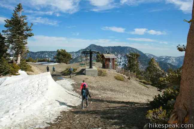
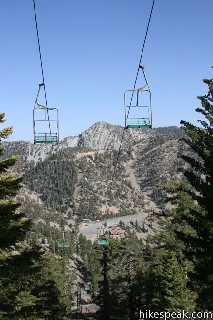
- By riding the Mount Baldy ski lift up 1,500 feet in elevation to Baldy Notch
- By hiking 3.5 mile up a dirt road from Manker Flats to Baldy Notch
- By hiking 2.3 miles from the parking lot at the base of the ski lift to Baldy Notch.
The non-loop options up to Baldy Notch are explained in more detail in the Manker Flats to Baldy Notch report. The Mount Baldy Ski Lift runs seven days a week and costs $25 round trip for adults, $20 for youths age 13 to 17, $15 for children under 12 (must be at least 40″ tall), and $15 for seniors over 65 (prices as of 2018). Lift tickets may be booked in advanced.
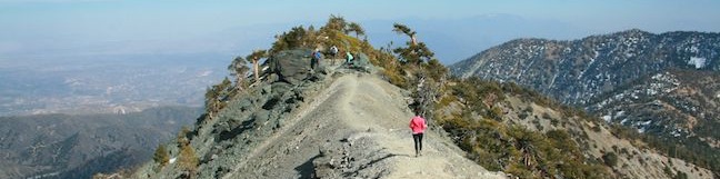
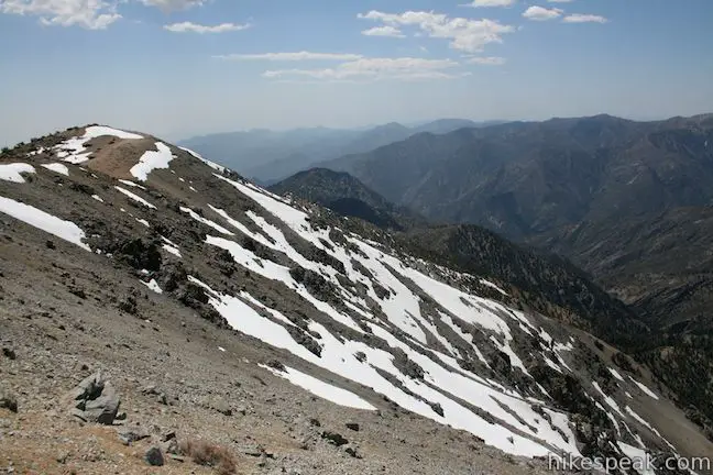
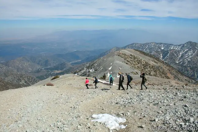
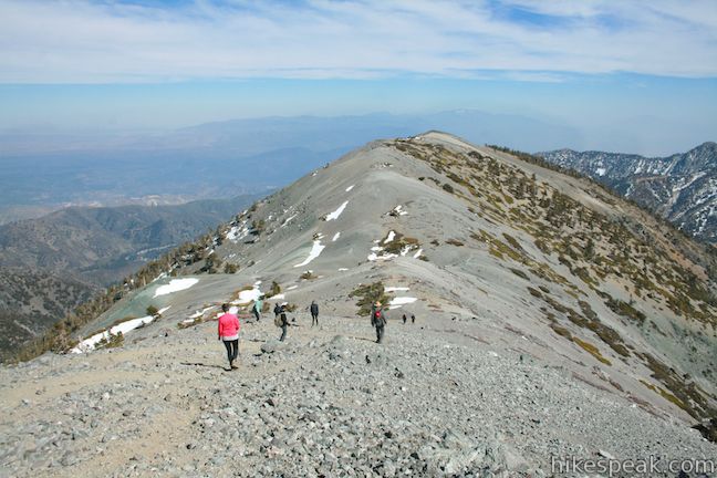
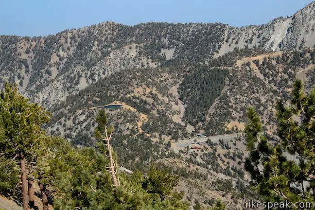
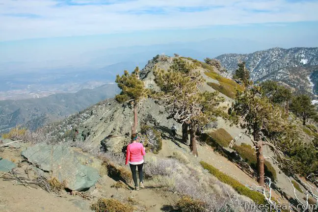
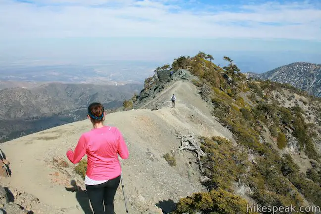
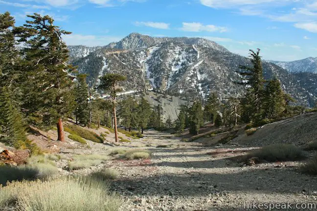
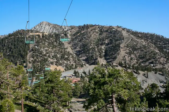
To get to Devil’s Backbone from the top of the ski lift at Baldy Notch, follow the road as it turns up the mountain to the west. You will pass beneath a non-operating ski lift a few times before coming to the top of the lift after 1.05 miles. Continue straight ahead along a narrow ridge known as the Devil’s Backbone.
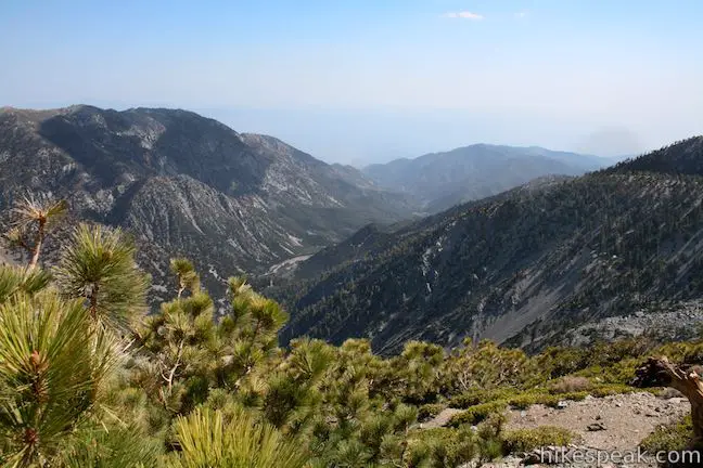
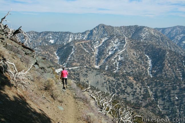
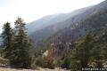
The single track crosses the spine of a skinny ridge with steep drops to the north and south, providing sweeping views and shaky knees for those with a fear of heights. You would not want to hike this way in the winter, but during the summer under normal weather conditions, the trail is devilishly exciting. The views are immense!
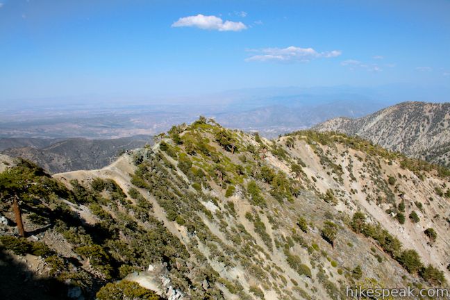
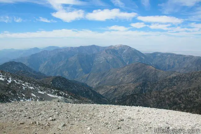
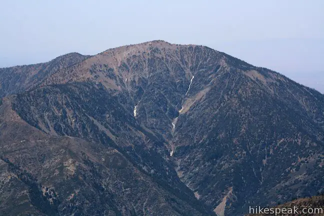
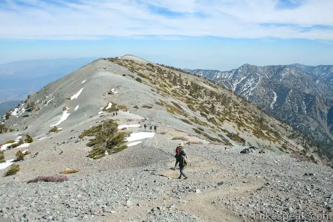
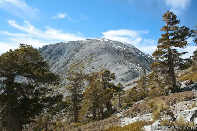
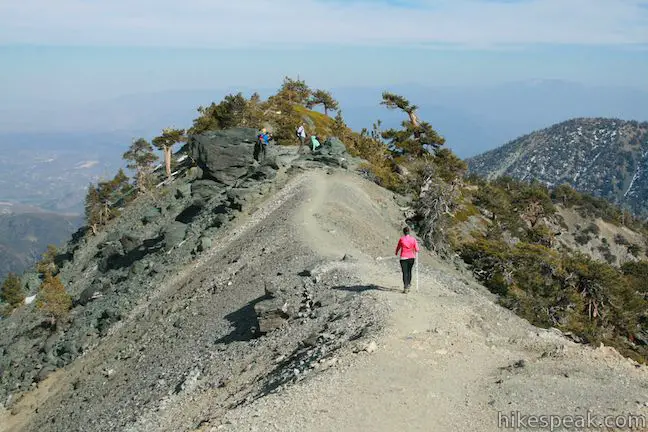
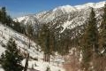
The trail leaves the top of the ridge after 2/3 of a mile and crosses the rocky southern face of Mount Harwood (Baldy’s eastern neighbor). Daunting Mount Baldy appears to the west, but keep an eye on the ground. The narrow trail gives way to a steep slope of scree. Cross a forest of sparse pines to a saddle between Baldy and Harwood. The elevation here is 9,360 feet. The summit is at 10,064 feet, so about vertical 700 feet separate you from the top. That distance is covered in 0.7 miles of steep switchbacks. This is the steepest section of the trail, but push through, the highest point in the San Gabriel Mountains waits for you at the top. As you climb, Mount San Gorgonio and Mount San Jacinto appear over your shoulder in the distance to the east and southeast.
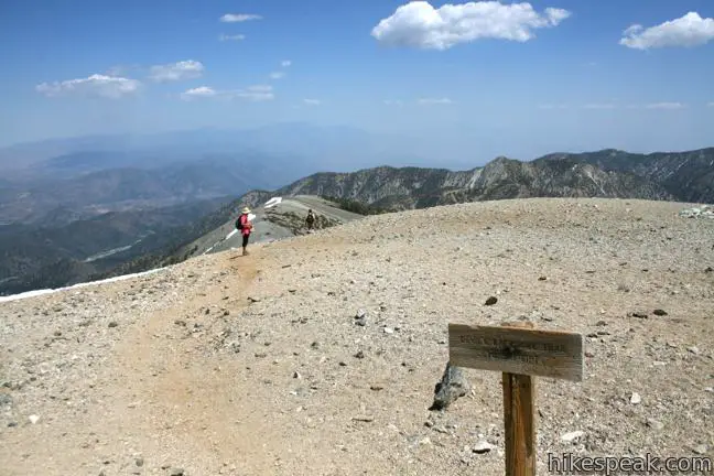
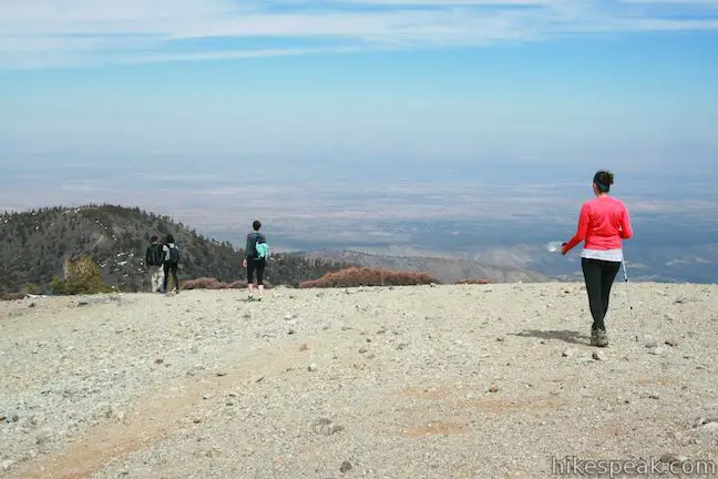
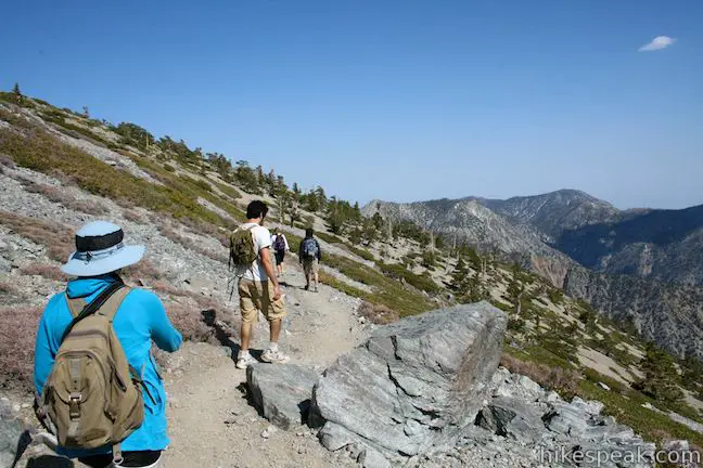
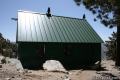
Enjoy 360-degree views at the summit. You may head back the way you came, or return to Manker Flats via the Baldy Bowl – Ski Hut Trail. To hike this scenic loop, take the path heading directly south from the summit. This trail descends a ridge to Baldly Bowl where you will cross a green building, the Sierra Club Ski Hut, before continuing down the canyon past San Antonio Falls. Note that if you parked your car by the ski lifts, you will have to walk another quarter mile up the road from the bottom of the trail to get back to your vehicle. If you are hiking the loop, it is recommended to head up the Baldy Bowl side of the mountain and down the Devil’s Backbone.
Descending from the summit via Devil’s Backbone Trail:
A post on the summit of Mount Baldy marks the start of the eastbound Devil’s Backbone Trail. Descend 0.7 miles to the saddle between Baldy and Mount Harwood. Watch your step. The gravel may be slippery underfoot. From the saddle, follow the trail along the south side of Harwood and on to the Devil’s Backbone. Cross the spine of to steep ridge to the top of the ski resort. Take the dirt road that passes to the left of a non-operational ski lift down to Baldy Notch. The road passes in front of a large ski lodge and wraps down the mountain to return to San Antonio Canyon.
Note: Devil’s Backbone Trail and Mount Baldy can be extremely dangerous in winter conditions. Be safe.
Directions to the Trailhead
- Take the 210 east to Baseline Road (exit 52).
- Turn left at the light at the end of the ramp on to Baseline Road.
- Make the next right on to Padua Avenue.
- Drive 1.7 miles and turn right onto Mount Baldy Road (at a traffic light).
- Continue 7 miles up Mount Baldy Road through Mount Baldy Village (where there is a visitor center) and follow the road for another 4.4 miles up the mountain past Manker Flats Campground to the bottom of Falls Road on the left.
- Park along Mount Baldy Road, display an adventure pass, and begin hiking up Falls Road.
Trailhead Location
Trailhead address: Mount Baldy Road & Falls Road, Angeles National Forest, Mount Baldy, CA 91759
Trailhead coordinates: 34.266172, -117.62684 (34° 15′ 58.21″N 117° 37′ 36.62″W)
View Mount Baldy in a larger map
Or view a regional map of surrounding Los Angeles trails and campgrounds.
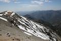
Views from the summit of Mount Baldy
Devil's Backbone Trail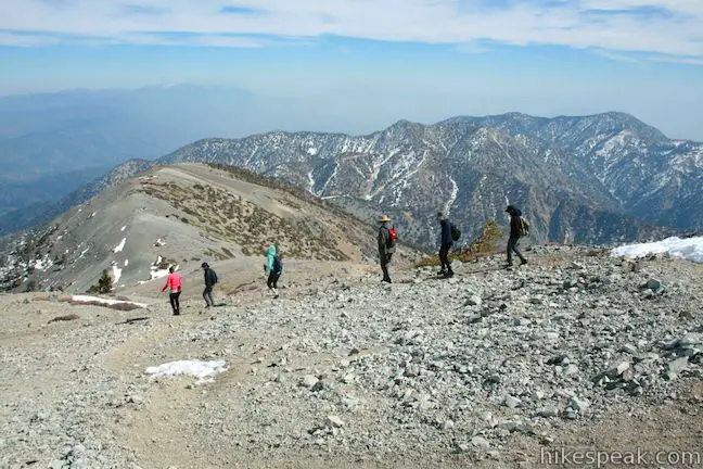


 | Mount Baldy Loop This 11.3-mile hike incorporates the Devil's Backbone and the Baldy Bowl - Ski Hut Trail into one see-all loop. |
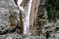 | San Antonio Falls This 1.4-mile hike visits a multi-tier waterfall along the trail to Mount Baldy. |
 | Baldy Bowl - Ski Hut The Baldy Bowl - Ski Hut Trail offers a steep but scenic ascent up the south side of Mount Baldy, crossing 4.5 miles and 3900 feet to the summit. |
 | Baldy Notch To hike the scenic Devil's Backbone to Mount Baldy, you must pass through Baldy Notch. You can hike to the notch, or take a ski lift. |
 | Icehouse Canyon Trail to Icehouse Saddle This 7.2-mile hike climbs 2,600 feet through a picturesque canyon to a saddle with panoramic views and extended hiking opportunities. |
 | More trails in the San Gabriel Mountains Explore other destinations in the range. |
 | Manker Flats Twenty-one sites service campers at the base of Mount Baldy. The grounds are nothing exciting, but if want a staging area for your ascent, this is it. |
Common Questions about Mount Baldy via Devil’s Backbone Trail in the San Gabriel Mountains
- Is the trail open?
- Yes. You should expect to find that Mount Baldy Loop is open. There are no recent reports of trail closures. If you discover that the trail is closed, please help your fellow hikers by reporting a closure.
- Do I need a permit for this hike?
- Yes. National Forest Adventure Pass.
- How much time does this hike take?
- It takes approximately 4 hours 15 minutes to hike Mount Baldy Loop. Individual hiking times vary. Add extra time for breaks and taking in the views.
- How long is this hike?
- The hike to Mount Baldy Loop is a 6.6 mile out and back with 2350 feet of elevation change.
- Are dogs allowed on this trail?
- Yes, dogs are allowed on Mount Baldy Loop. The trail is open to hikers, dogs.
- Is Mount Baldy Loop a difficult hike?
- This hike should be considered strenuous. Hikers should be prepared for a workout covering 6.6 miles and 2350 feet of climbing.
- Does this trail go to a summit?
- Yes, Mount Baldy Loop reaches a summit with panoramic views.
- What mountain range is this trail in?
- Mount Baldy Loop is located in the San Gabriel Mountains.
- Where is the trailhead located?
- The trailhead for Mount Baldy Loop is located in Mt. Baldy, CA.
Trailhead Address:
Mount Baldy Road & Falls Road
Mt. Baldy, CA 91759
Trailhead Coordinates:
34.266172, -117.62684 - What are the driving directions to the start of the hike?
To get to the trailhead: Take the 210 east to Baseline Road (exit 52). Turn left at the light at the end of the ramp on to Baseline Road. Make the next right on to Padua Avenue. Drive 1.7 miles and turn right onto Mount Baldy Road (at a traffic light). Continue 7 miles up Mount Baldy Road through Mount Baldy Village (where there is a visitor center) and follow the road for another 4.4 miles up the mountain past Manker Flats Campground to the bottom of Falls Road on the left. Park along Mount Baldy Road, display an adventure pass, and begin hiking up Falls Road.
View custom Google Maps directions from your current location.
- Are there other trails near Mount Baldy Loop?
- Yes, you can find other nearby hikes using the Hikespeak Hike Finder Map.

15 Comments on Mount Baldy via Devil’s Backbone Trail in the San Gabriel Mountains
What hikers are saying:
✨ Generated summary of user commentsHikers describe this route as a challenging climb rewarded by superb views across the backbone. The narrow, curvy edges along the ridge feel windy and frightening, providing a sense of accomplishment for those who reach the summit. Mark warns that winter travel is strictly for experienced mountaineers with alpine ice skills because of the risk of fatal falls on icy slopes. While dogs are permitted, the rugged terrain is generally unsuitable for most pets.
“For those who haven't crossed the backbone, the views are superb!” Jump to comment ↓
Good description of hiking Mt Baldy via the Devil’s Backbone Trail. For those who haven’t crossed the backbone, the views are superb!
[…] 10,064 foot summit and in the end, we concluded that ascending via Baldy Bowl and descending along The Devil’s Backbone, making for an 11.3 mile hike, was the best route – we stand by this decision (Great post […]
As a pretty fit guy with a quick pace (although I do not hike very often), it took 1:45 to get from the Notch to the summit in July 2016. AMAZING views, and I’d definitely do this hike again. Wish we had stuff like this in Minnesota!
It was our first time on a real hike. Lol I thought I was going to do a “loop” like Claremont.. but I was very wrong. It was very hard for us because we do not go prepared at all! We went in regular gym clothes, not knowing that we were in for a surprise. But I must say, even though the hike to the top was very difficult. I was amazing, and we did get tips from pro hikers. We went through the Devils Backbone and the pictures that are shown online is not the scary part! It was the narrow curvy edges that were most scary. Even though the view was incredible it was windy and frightening. I must say not bad for first timers.
What were the tips from pro hikers? Do share!
Do not do this hike in the winter unless you are a mountaineer with alpine meadows ice/snow travel experience. Multiple fatalities here- people losing footing and sliding down several hundred feet bouncing offf rocks and trees.
Is this trail good for dogs? I know it says it’s open for hikers and dogs, but I’m wondering about the Mount Baldy ski lift and if dogs are allowed on it? I’m imagining it’s like a regular ski lift that comes up behind you and you sit on it.
Dogs are allowed on most trails in the San Gabriel Mountains, but that doesn’t mean that this hike is suitable for most dogs. In reality, it is probably better to do this hike without your dog. I am not sure about the chairlift regulations. Enjoy your outing!
Is the ski lift $20 for round trip?
As an update to the previous information: The Mount Baldy Ski Lift runs 7 days a week and tickets may be booked in advance. The cost of the lift is $25 round trip for adults, $20 for youths age 13 to 17, $15 for children under 12 (must be at least 40″ tall), and $15 for seniors over 65 (prices as of 2018). The one-way cost may be the same as round trip. Contact the ski resort directly for more information and booking.
Just did this hike yesterday. The Trail is Open and it’s a heck of a climb!
Saw a Bobcat on the way up too!
Hello there Will. Just wondering if there was any snow??
How far is the devils backbone trail from manker flat and whats the elevation gain
Hi everyone, I wanted to share my more extensive experience hiking the Baldy Notch -> Devil’s slide as an out-and-back, including what I learned, what I wish I knew before, and how to prepare for the best experience on the mountain Check it out, here: https://metropolitanmolly.com/2021/06/14/hiking-mount-baldy-how-to-successfully-conquer-the-tallest-mountain-in-the-angeles-national-forest-summer-edition/
[…] Known as the Santa Anas, these winds are notorious for driving the most destructive wildfires. Crossing the Devil’s Backbone, a narrow east-west ridge that you must brave to reach Baldy summit along its most popular route, hikers will be exposed to these winds at the absolute peak of their force. […]