Hostetter Fire Road to Verdugo Peak
in the Verdugo Mountains
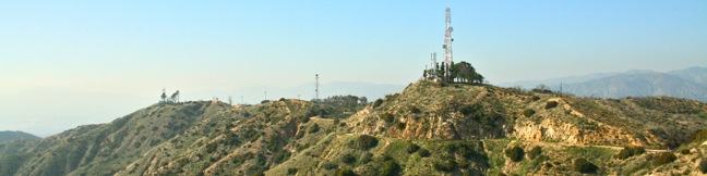
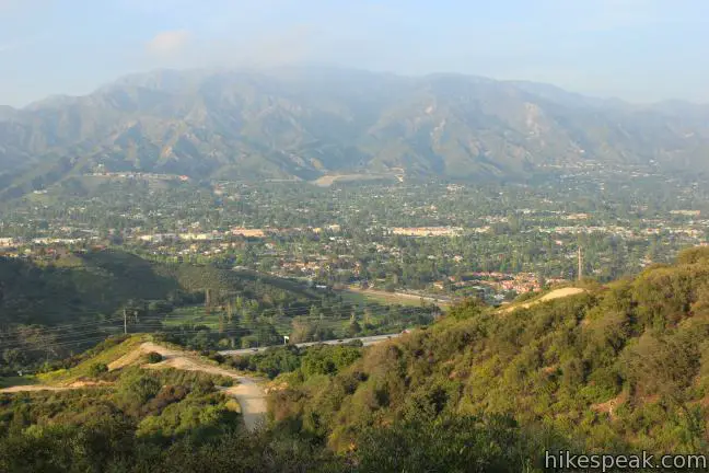
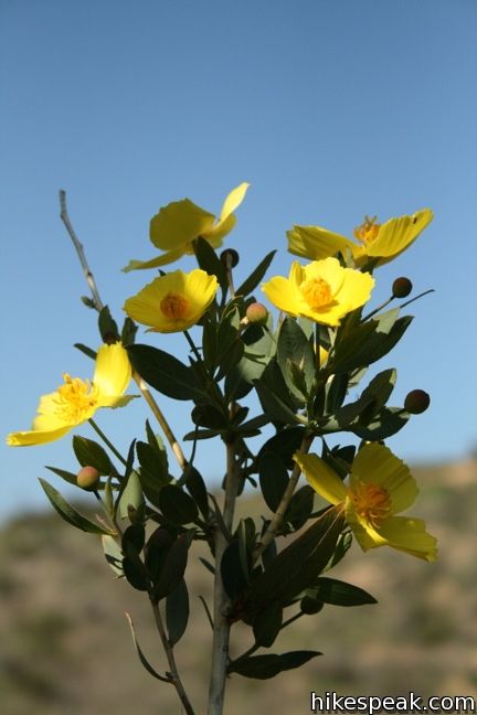
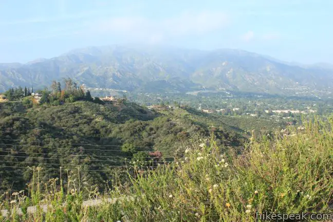
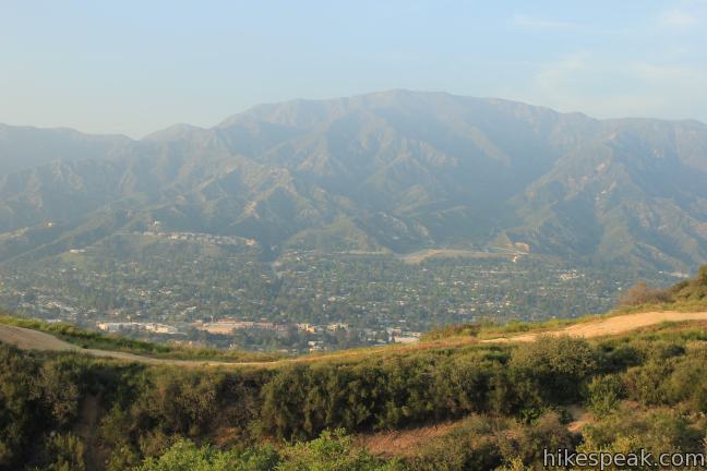
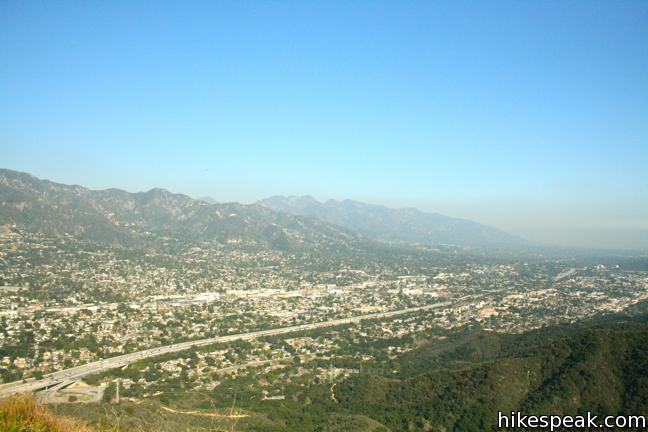
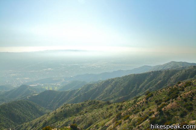
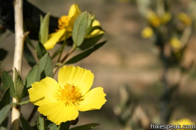
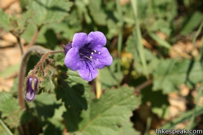
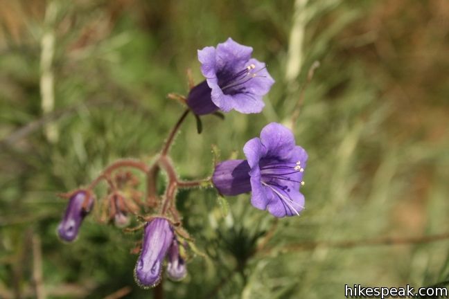
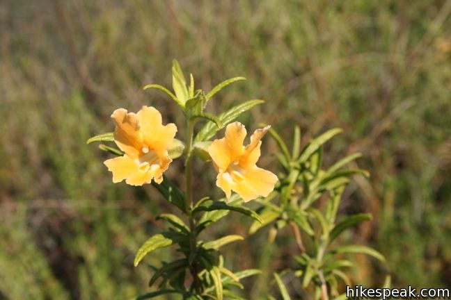
The Verdugo Mountains are a small range situated north of Burbank and Glendale. While the trails in this range can’t get at as remote as those in the nearby San Gabriel Mountains, they can be quite scenic and convenient to reach. Hikers may enjoy a trek on the north side of the Verdugo Mountains from La Tuna Canyon to the highest point in the range, Verdugo Peak. It is a 7.5-mile round trip hike with 1,400 feet of elevation change to reach the 3,126-foot summit of Verdugo Peak, where you’ll get a fine overview of the San Fernando Valley and all the civilization stretching toward downtown Los Angeles. In the spring time, the canyon becomes quite green and wildflowers pop up everywhere.
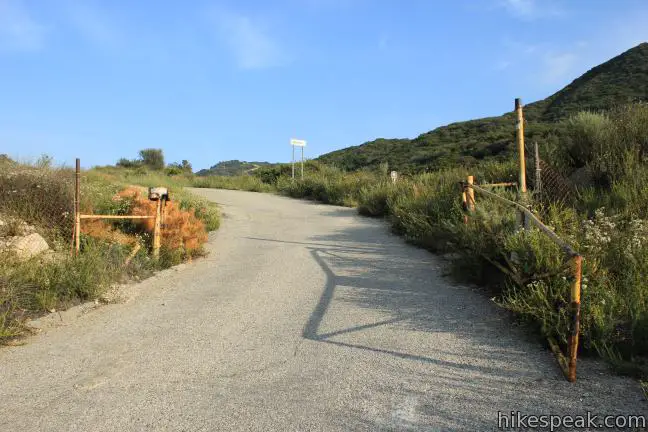
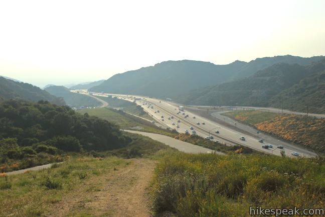
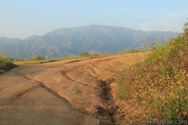
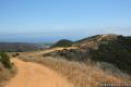
Begin by hiking up a paved road that parallels the 210 Freeway. After 0.4 miles, turn right and leave the freeway behind. The pavement ends after another quarter mile and the wide dirt road continues south toward a canyon cut into the Verdugo Mountains.
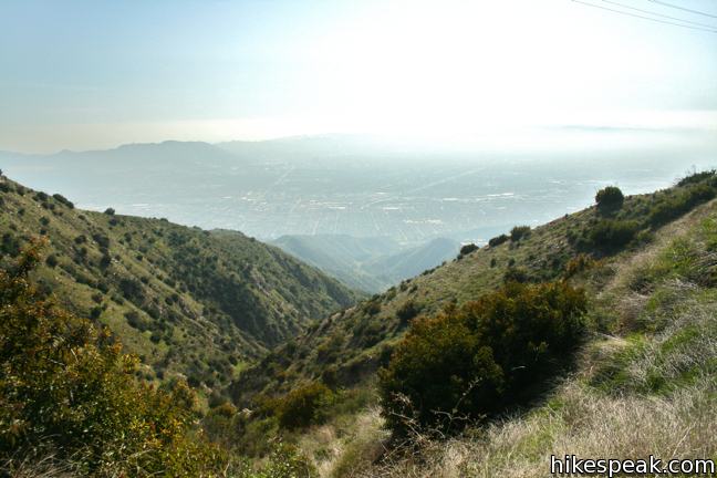
Stay to the right, 0.9 miles from the start, as a steep dirt track breaks of to the left and heads up the ridge (this incredibly steep trail is best reserved daring mountain bikers). Enter the canyon and leave the song of the freeway behind. Despite a few groves of bays in the canyon, you may be exposed to the sun for much of the hike.
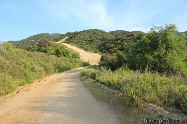
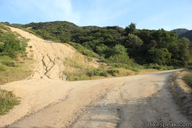
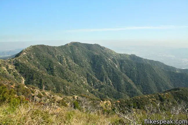
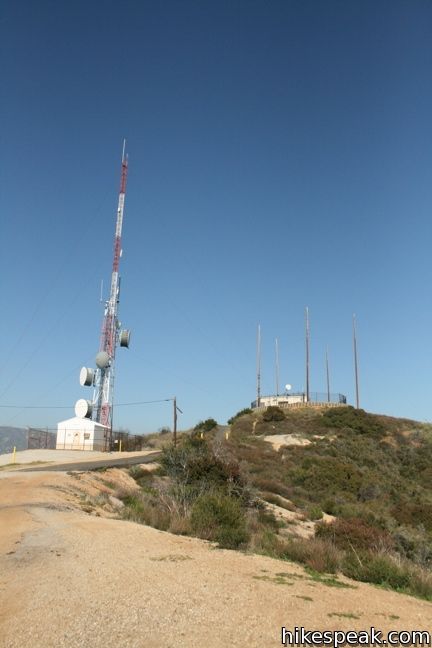
Follow Hostetter Fire Road for a total of 3.5 miles as it winds up the canyon, around a ridge, and up to a saddle near the summit of Verdugo Peak where it meets Verdugo Fire Road (also known as Verdugo Motorway) at at T-junction. To reach the radio tower-covered peak, turn left and hike another quarter mile to the summit.
Verdugo Peak offers clear views east and west over both ends of the range. The San Gabriel Mountains rise high to the north and there is a lot of city below (and usually a bit of smog).
Hostetter Fire Road is open to dogs and bikes. This area is particularly popular with mountain bikers, so be on alert while hiking. No fee or permit is required for this hike to Verdugo Peak, so get out and enjoy!
Directions to the Trailhead
- Take the 210 Freeway exit 14 for La Tuna Canyon Road.
- At the bottom the ramp, turn southwest on La Tuna Canyon Road and find a dirt lot on the south side of the road just past the on-ramp for the 210 East.
- Start hiking up the paved road that heads east parallel to the freeway.
- The trailhead has a high crime area warning sign, so lock your vehicle and do not leave valuables in sight.
Trailhead Location
Trailhead address: La Tuna Canyon Road & West La Tuna Canyon Road, Sun Valley, CA 91352
Trailhead coordinates: 34.23395, -118.29118 (34° 14′ 02.2″N 118° 17′ 28.2″W)
View Verdugo Mountains in a larger map
Or view a regional map of surrounding Los Angeles trails and campgrounds.


 | La Tuna Canyon Trail This 4.5-mile round trip hike ascends a ridge and a pair of canyons in La Tuna Canyon Park on the northwest side of the Verdugo Mountains. |
 | Old Youth Camp Loop in Stough Canyon This 2.6-mile loop passes the ruins of an abandoned camp in the Verdugo Mountains with views across the San Fernando Valley. |
 | Vital Link Trail This hike of 3 miles round trip or more ascends 1,275 feet (or more) up a ridge on the side of the Verdugo Mountains for a steep hike with satisfying views. |
 | Beaudry Motorway Loop to Tongva Peak This 6.15-mile loop climbs 1,475 feet to the summit of Tongva Peak on the east end of the Verdugo Mountains. |
 | Skyline Motorway This 6.1 to 6.6-mile hike (or more) ascends an abandoned fire road in the Verdugo Mountains with expansive views that include the skyline of downtown Los Angeles. |
 | Las Flores Motorway to Mount Thom This 5.3-mile hike follows a wide dirt road to the summit of Mount Thom, offering panoramic views from the southeast end of the Verdugo Mountains. |
 | More trails in Los Angeles Explore other destinations around Los Angeles. |
 | Calabasas Peak This 3.6-mile hike travels an easy-to-follow fire road, climbing 900 feet to panoramic views of the Santa Monica Mountains and San Fernando Valley. |
 | Eagle Rock from Trippet Ranch This 4.5-mile loop takes Musch Trail and Eagle Springs Fire Road to visit an exceptional sandstone summit in Topanga State Park. |
 | Zuma Ridge Trail This wide dirt service road which weaves northwest up the back of the ridge west of Zuma Canyon offering access to several trails in the area. |
Common Questions about Hostetter Fire Road to Verdugo Peak in the Verdugo Mountains
- Is the trail open?
- Yes. You should expect to find that Hostetter Fire Road is open. There are no recent reports of trail closures. If you discover that the trail is closed, please help your fellow hikers by reporting a closure.
- Is this trail free to access?
- Yes, Hostetter Fire Road is free to access. No entrance fee, pass, or permit is required. If you discover that access rules have changed, please provide feedback on your experience.
- How much time does this hike take?
- It takes approximately 4 hours to hike Hostetter Fire Road. Individual hiking times vary. Add extra time for breaks and taking in the views.
- How long is this hike?
- The hike to Hostetter Fire Road is a 7.5 mile out and back with 1400 feet of elevation change.
- Are dogs allowed on this trail?
- Yes, dogs are allowed on Hostetter Fire Road. The trail is open to hikers, dogs, bikes.
- Does this trail go to a summit?
- Yes, Hostetter Fire Road reaches a summit with panoramic views.
- Is this a good hike for wildflowers?
- Yes, Hostetter Fire Road is known for its seasonal wildflower displays.
- What mountain range is this trail in?
- Hostetter Fire Road is located in the Verdugo Mountains.
- Where is the trailhead located?
- The trailhead for Hostetter Fire Road is located in Sun Valley, CA.
Trailhead Address:
La Tuna Canyon Road & West La Tuna Canyon Road
Sun Valley, CA 91352
Trailhead Coordinates:
34.23395, -118.29118 - What are the driving directions to the start of the hike?
To get to the trailhead: Take the 210 Freeway exit 14 for La Tuna Canyon Road. At the bottom the ramp, turn southwest on La Tuna Canyon Road and find a dirt lot on the south side of the road just past the on-ramp for the 210 East. Start hiking up the paved road that heads east parallel to the freeway. The trailhead has a high crime area warning sign, so lock your vehicle and do not leave valuables in sight.
View custom Google Maps directions from your current location.
- Are there other trails near Hostetter Fire Road?
- Yes, you can find other nearby hikes using the Hikespeak Hike Finder Map.

Very informative post on mountainbiking.
There’s more than meets the eye here & if you dig a little deeper, you’ll find more than just a great ride. TY hikespeak.com for making it possible!
Didn’t realize hike was sooooooooo long. But well worth it. Beautiful scenic views.
I did this hike yesterday and was wondering how long it was! Thanks for this info. Great site.
All burnt up. Not much left after the La Tuna fire.
DANGER! I did this hike with a friend today and my car was burglarized. WATCH OUT with your stuff! The officer at the foothills police station said “You wouldn’t believe how many times we get reports of people getting robbed there”, and asked me to put out the word. Stay safe.