
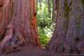
The Sierra Nevada Mountains hold many wonders. Some are famous worldwide, like the silken waterfalls in Yosemite National Park and the giant trees in Sequoia National Park. Others, like the Natural Bridges in Calaveras County, are only famous with locals. These no-less-amazing limestone tunnels make a charming destination for a short hike in the Sierra foothills (and an enthralling summer swimming hole). Starting at 1,500 feet, Upper Natural Bridge Trail descends 300 feet on a 2-mile round trip hike.
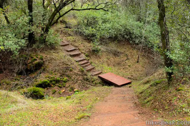
While the sign for the Natural Bridges Day Use Area is easy to spot on Parrots Ferry Road, the start of the trail is less obvious. The trail does not begin from the end of the paved side road as you might expect, but instead starts closer to Parrots Ferry Road. Look for a round metal gate on the east side of the road (designed to block bike traffic) and start hiking down Upper Natural Bridge Trail.
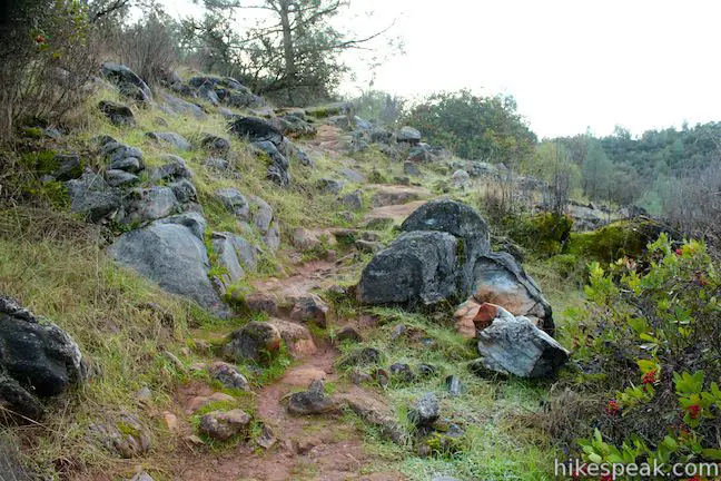
Beyond the trailhead, the paved dead-end road continues another 0.2 miles, passing a bathroom to reach a barrier of boulders blocking the road. From here, you could hike another 0.1 miles down the pavement to a single track that takes a steep course down a rocky slope toward the Upper Natural Bridges (more on this alternate route later).
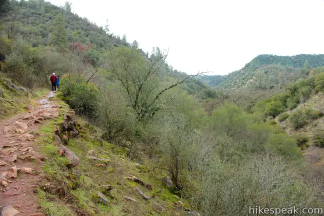
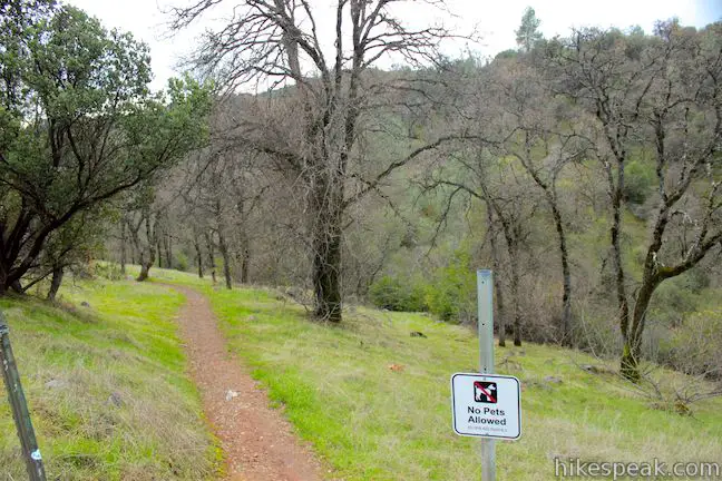
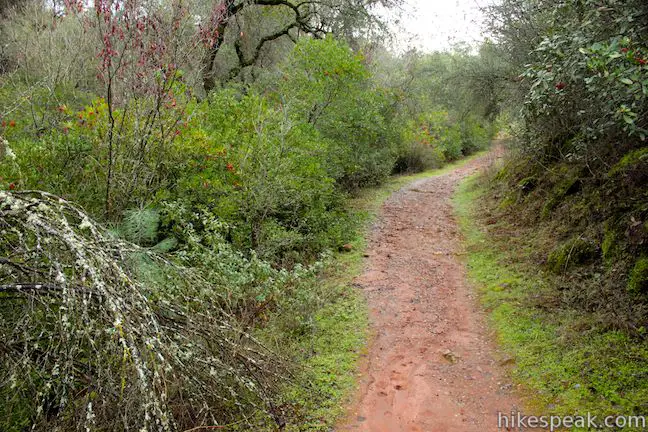
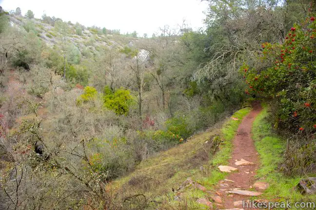
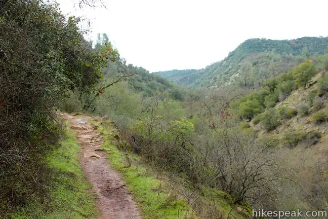
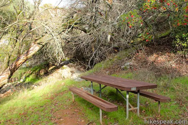
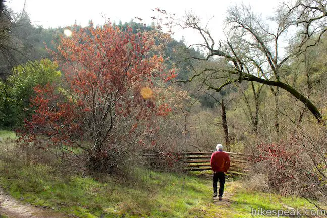
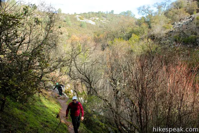
Heading down the main trail, the single track angles southwest, roughly parallel to Parrots Ferry Road. Pass along a fence and down into an oak-shade ravine. Cross a wooden footbridge over a side creek to reach a junction with an old dirt road (0.15 miles from the start). Turn right and continue downhill on this wide trail passing through oaks, toyon, chamise, and other brush. The trail passes a picnic table after 0.3 miles, and picnickers will find a few more tables surrounding the Natural Bridge.
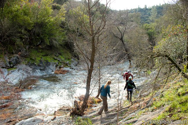
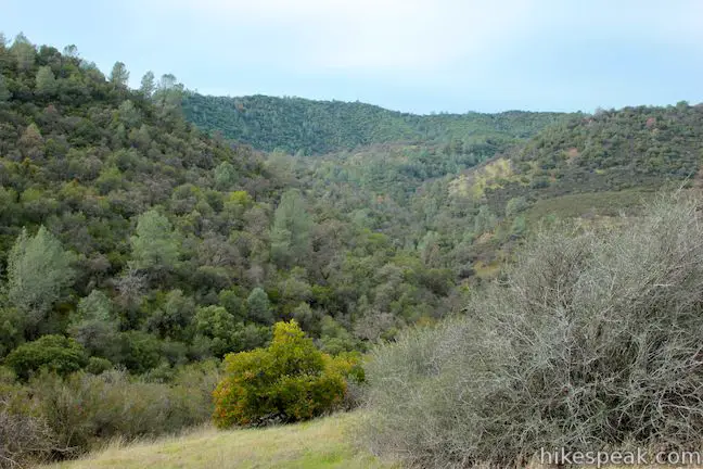
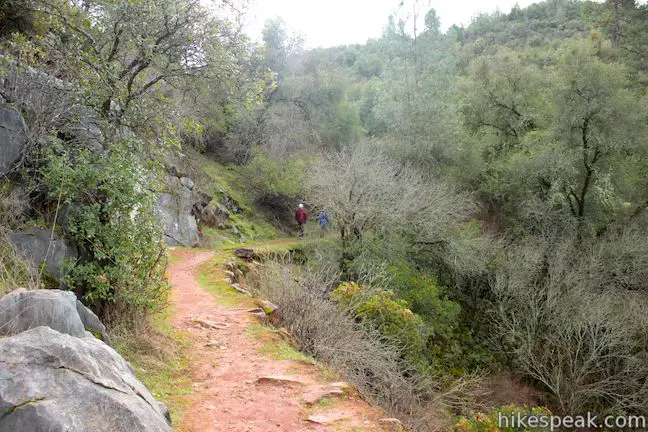
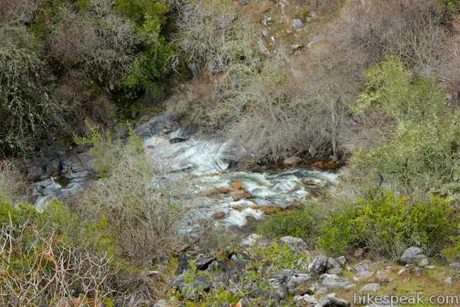
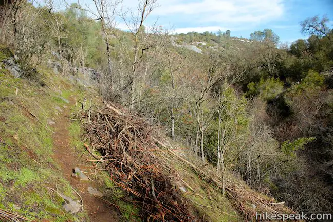
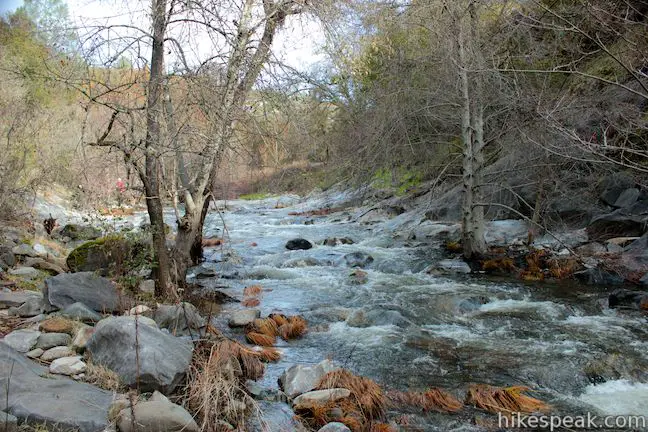
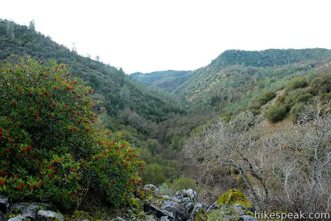
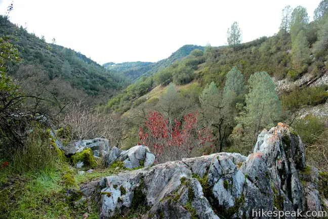
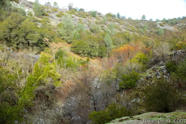
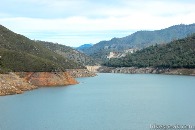
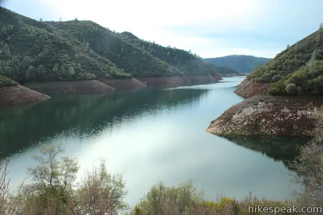
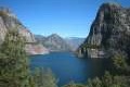
The trail breaks out of the forest onto the wall of the canyon carved by Coyote Creek. The creek flows south toward New Melones Lake (not in view). Enjoy open canyon views as the well-constructed old stage road bends right, heading upstream while continuing to descend.
The sound of the creek gets louder as you approach the bottom of the trail. Stop in front of a large plaque on the right, across from a spur trail that descends to the creek just below the Natural Bridge. The plaque reads:
This Natural Bridge was acquired in 1972 for the public as part of the New Melones Lake project through the cooperation and generosity of Tome M. and Margaret E. Airola, members of a pioneer Calaveras County cattle-raising family. Mr. Airola’s grandfather, Emmanuel Airola, a native of Italy immigrated to the town of Melones, located on the Stanislaus River a few miles south of this Natural Bridge, in 1860. In the cattle business for over 75 years, Tone M. Airola grazed cattle in this area as a small boy.
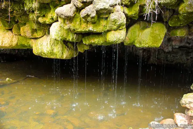
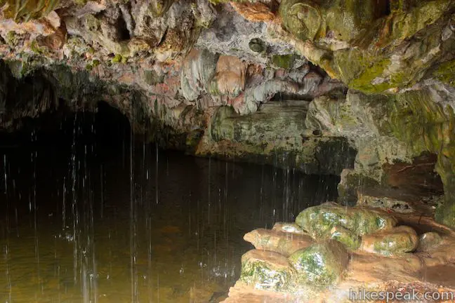
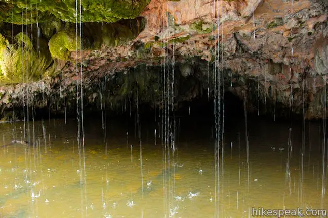
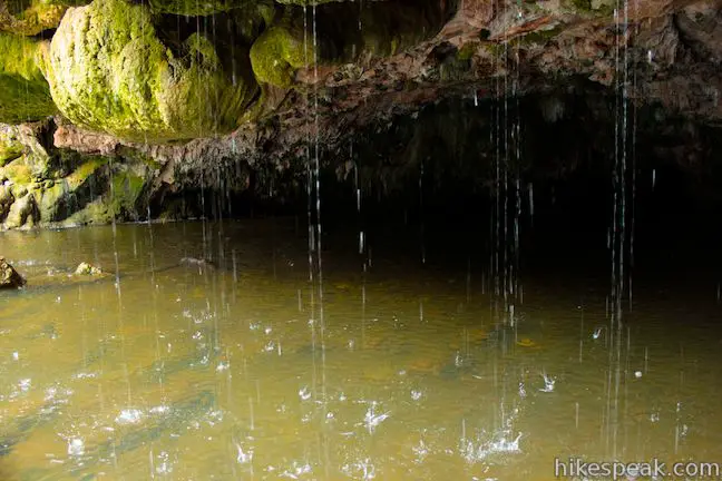
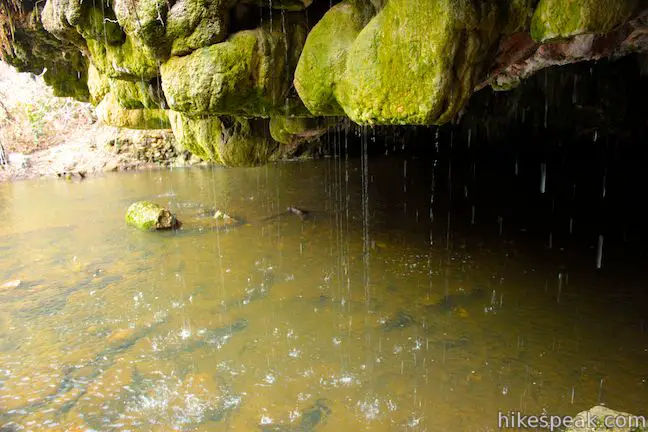
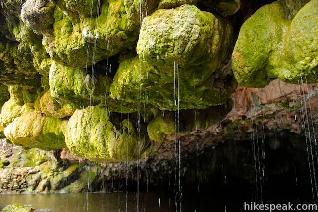
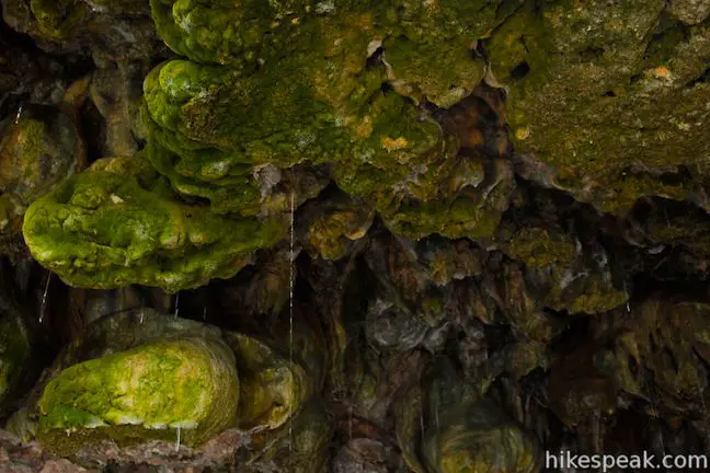
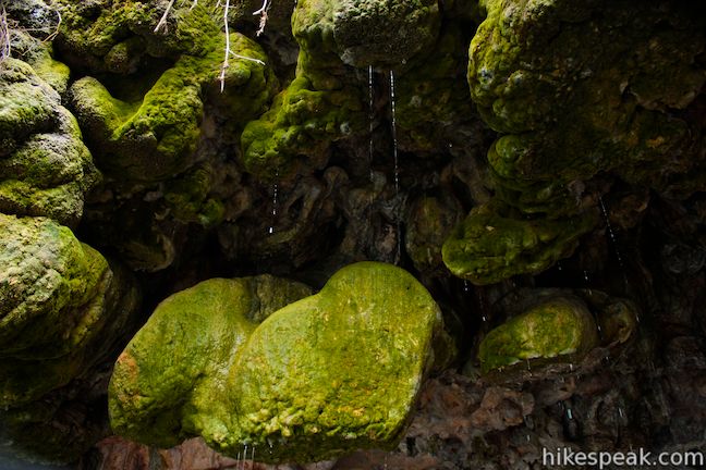
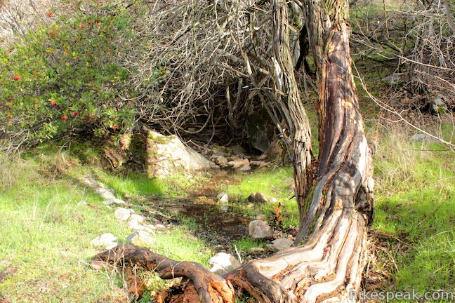
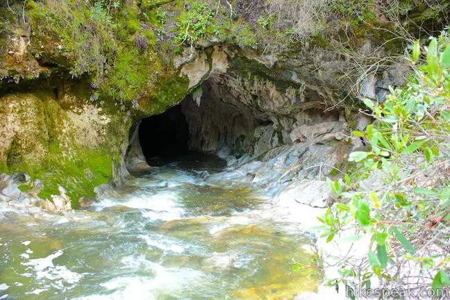
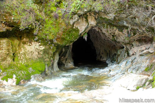
Turn left down steps made from railroad ties, passing through a small picnic area near the water’s edge that is surrounded by blackberry bushes. Walk down to the creek and look upstream for a surprising natural sight. The creek flows out of a wide dark cave in the ground. During the wet season, a hundred beads of water rain down across the mossy mouth, adding enticing sylvan charm.
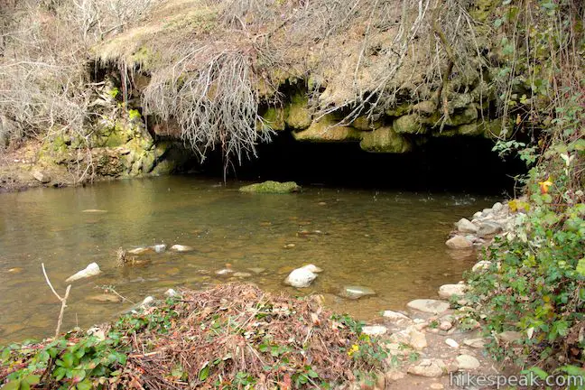
A path along the bank of the creek allows you to step below the overhang for a better look “beneath the bridge.” The ceiling is made up of bumpy, colorful pockets, resembling the limestone formations you would find in a cavern deep below the surface. Within the dark void at the back of the cave, you’ll spot a small halo of light, barely penetrating from the opposite end of the Natural Bridge.

It will require a bathing suit to explore any farther. In the summertime, Coyote Creek become an exciting swimming hole, where visitors float through the cave on rafts, or swim through with the current.
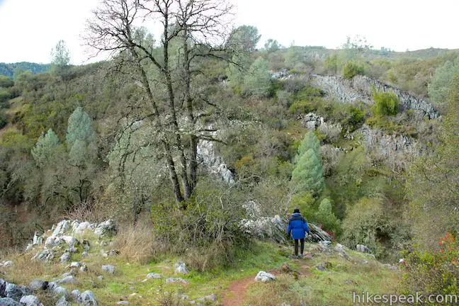
To reach the upper entrance, backtrack to the main trail, turn left, and cross the earth bridge. Before you walk on water, you will pass another picnic table and a small spring, and come to a junction with a trail on the right that climbs up the canyon wall. This is the shorter and steeper alternate route down to the Natural Bridge.
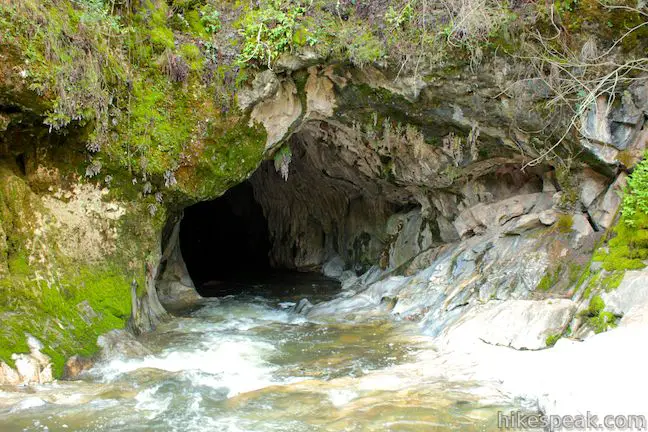
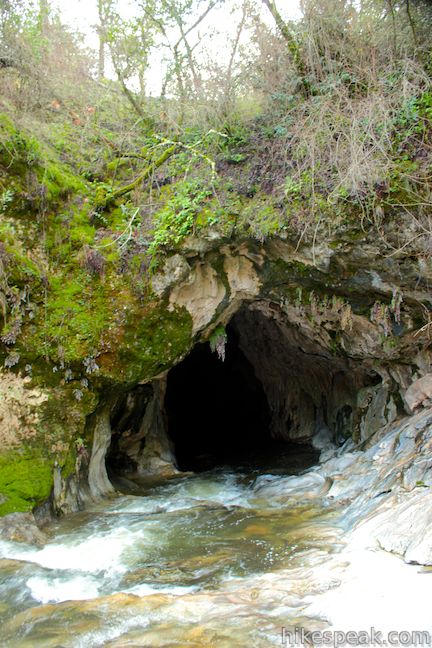
Across the short land bridge, the trail splits, offering two routes down to the upper entrance of the Upper Natural Bridge. The path to the right leads to a steep descent where you can climb 30 feet down a rock slope to the tunnel entrance. The left path goes a little farther upstream to reach an easier route down to the water, where you can backtrack along the creek to the Natural Bridge.
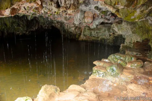
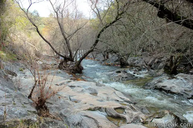
Instead of a wide rectangular gape like the lower end of the Natural Bridge, this side looks more like a tall, round subway tunnel. Ferns hang down over the arched limestone walls to create another exotic landscape. Coyote Creek spills down a smooth-rock channel and disappears in the darkness of the tunnel. Do you dare to follow? It is 250 feet from one end of the Natural Bridge to the other, with dark deep pools in between.
With guts, you can swim or wade through the tunnel (depending on seasonal water levels) and reemerge on the other side. If you choose to enter the cave, avoid touching the rock walls. The oil from your fingers can disturb the growth of the limestone deposits.
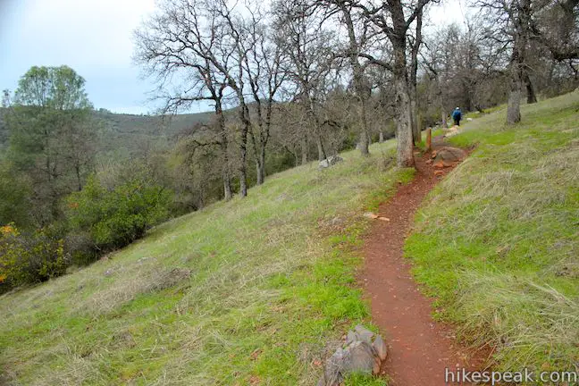
It is 0.75 miles down to the main trail to the spur leading to the lower entrance, and another 0.1 miles to the upper entrance. Via the short steep route, it is 0.5 miles down to the Natural Bridge. To create a fun loop, hike down the steep single track and up the wide gradual trail for a 1.7-mile circuit (vs. 2 miles out and back on the main trail).
A Lower Natural Bridge is about a half a mile downstream from the Upper Natural Bridge and not visited on this trail. Dogs and bikes are not permitted. No fee or permit is required to hike to the Upper Natural Bridge, so get out and enjoy!
To get to the trailhead: Take Highway 4 to the town of Vallecito (4.5 miles east of Angels Camp and 3.3 miles south of Murphys) and turn south on Parrots Ferry Road. Drive 3.7 miles until you spot a large sign marking the “Natural Bridges Day Use Area” on the right. Park along the shoulder of Highway 4 or turn down the paved side road and park on the shoulder. Coming from the south, it is 1.2 miles up Parrots Ferry Road from New Melones Lake to the trailhead, labeled as Airola Road on Google Maps).
Trailhead address: Parrots Ferry Road & Airola Road, Vallecito, CA 95222
Trailhead coordinates: 38.05201, -120.47138 (38° 03′ 07.2″N 120° 28′ 17″W)
View Upper Natural Bridge Trail in a larger map
Or view a regional map of surrounding Sierra Nevada trails and campgrounds.
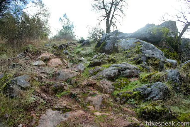
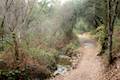
Upper Natural Bridge Trail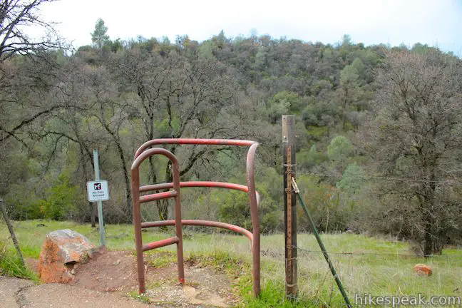


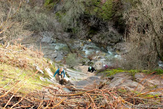
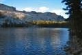
The short steep path to Upper Natural Bridge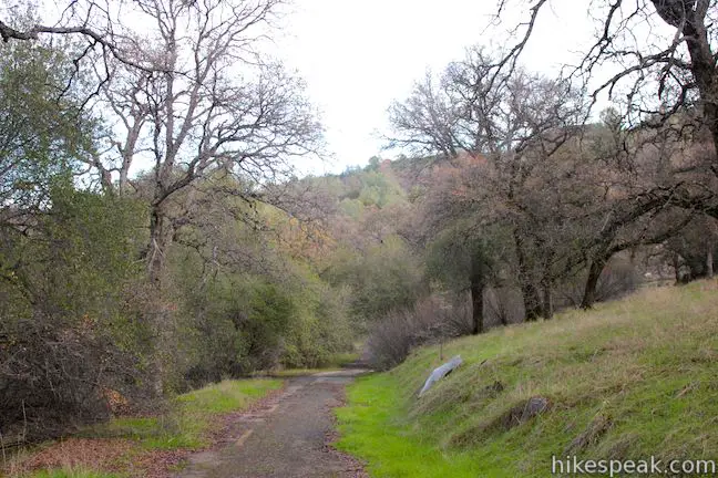


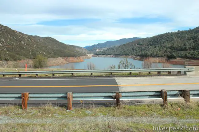
Nearby New Melones Lake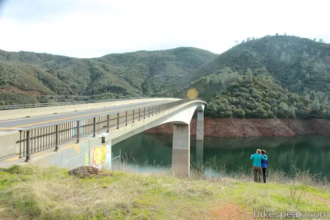

 | Dragoon Gulch Trail This 2.5-mile loop ascends 325 feet along a creek and up a ridge to views over Sonora. |
 | North Grove - Big Trees Trail in Calaveras Big Trees State Park This easy 1.5-mile loop explores the first giant sequoias discovered by settlers in California. |
 | Hetch Hetchy Reservoir and Wapama Falls This 5-mile hike tours a flooded valley to a thundering waterfall in the northwest corner of Yosemite National Park. |
 | May Lake This short east hike off Tioga Road visits a peaceful alpine lake in the high elevation region of Yosemite north of Yosemite Valley. |
 | More trails in the Sierra Nevada Mountains Explore other destinations in the Sierra including Sequoia National Park. |
If you are in the area, we highly recommend a cave tour, spelunk, or zip line adventure at Moaning Caverns. Moaning Caverns is the largest single-chambered public cave and it’s only a few miles up highway 4!!
I went on this trail this weekend with my family after visiting Columbia and the Moaning Caverns. There are a lot of poison oak along the trail and down by the creek. It got to the point were I told my kids, “Don’t touch anything.” We enjoyed the trail.
This place is amazing!! Definitely worth the drive and very short, easy hike. Yes, there is a lot of poison oak, but if you stay on the trail it is easily avoided. Definitely recommend taking a small raft or life jackets for the kids so they can float around and enjoy themselves. Water is very deep inside the cavern, but there is a nice big shallow area at the entrance.
The spot is amazing. Sadly a lot of people go there and you can find a lot garbage left behind everywhere.
At the East end of Main Street in Melones, the road forked into the original Angeles Camp Road and a road continuing onto the original Vallecito-Columbia bridge.Why was the road to Vallecito blocked off by a dirt wall? Was there still an intact paved road beyond that wall during the late 50s and early 60s?
I love your website. Use it always to prepare my trips!!! Thank you. So many details and information. You are the best!!!!!
[…] Hikespeak.com did a fantastic job describing the trailhead and directions […]
I was recently talking to my daughter about natural bridges and she said I was hiking there and she saw a ghost, a woman with a baby and I couldn’t believe it but I’m starting to rethink what she said and believe her now….does anyone know more history about Natural Bridges?
Just visited 7/16/2022 for the first time. The trail really needs better signage en route. Heading down from the parking lot, we crossed a lot of spurs probably created by enthusiastic locals. The trail has a lot of rocks in places, so you would need to wear hiking boots on the way down, then switch to water shoes at the Cave. This is not an easy hike for the inexperienced! The cave is about a quarter mile long. The YouTube clips never state that. I was there Saturday midday and I haven’t seen so many people since my 12 story office building had a fire drill! Special shout out to the friendly locals at Columbia State Park’s Columbia Kate’s Bakery, just six miles from the Cave parking. Overall a fun and unique experience, just be prepared to share it with others if you go on a weekend.