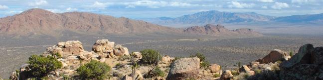
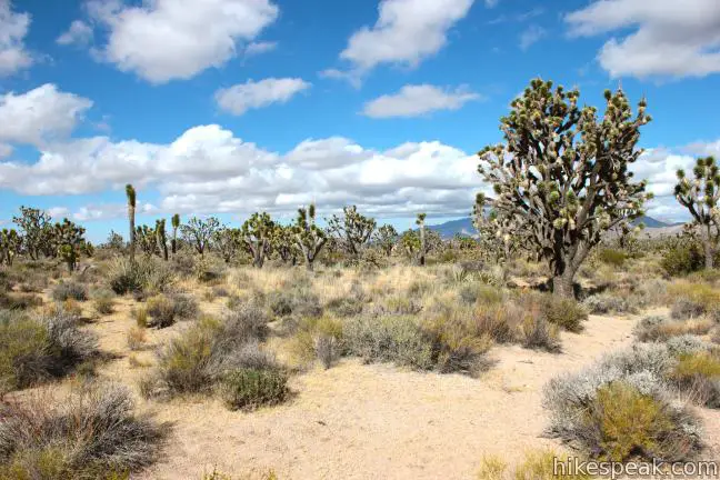
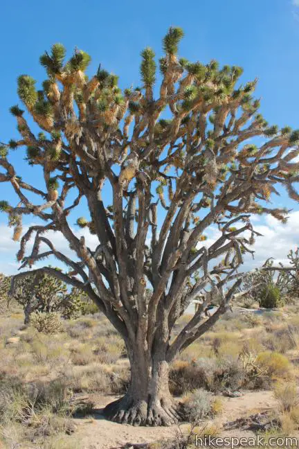
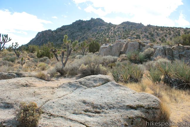
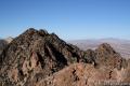
Teutonia Peak is a rocky 5,755-foot mountain on the edge of Cima Dome in Mojave National Preserve. The dome, which is 1,500 feet tall and covers seventy square miles, is the most symmetrical dome of its type in the United States. If that geological geometrical fact doesn’t strike your fancy, the hike to the panoramic rocky summit will. It is 3.4 to 4 miles round trip with 700 feet of elevation gain, passing an abandoned silver mine and a thriving forest of Joshua trees along the way to the summit of Teutonia Peak.
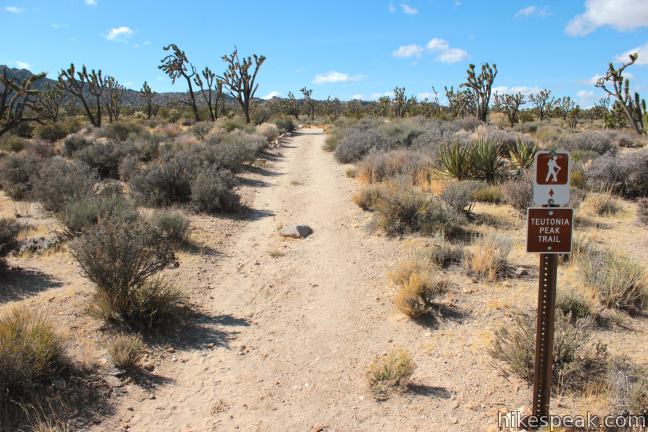
A sign at the trailhead offers this description of Teutonia Peak Trail:
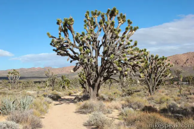
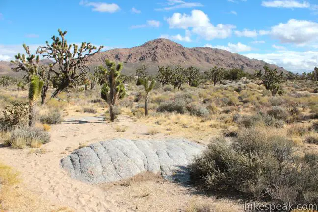
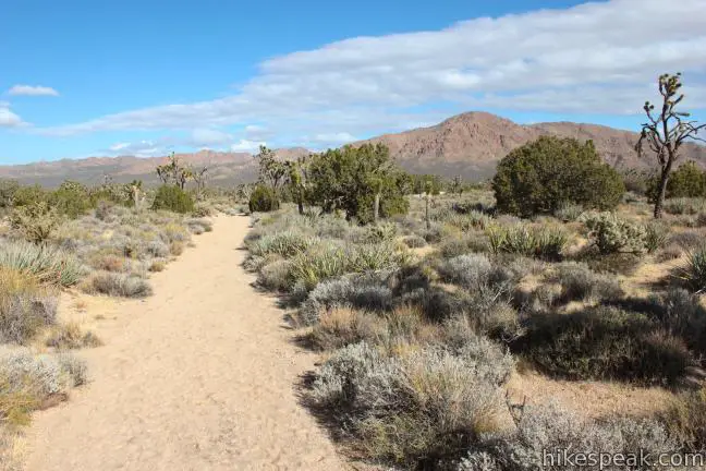
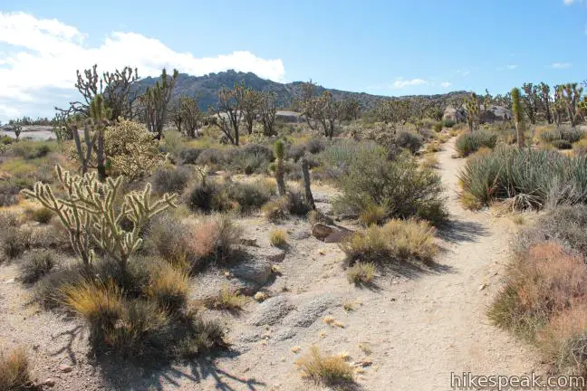
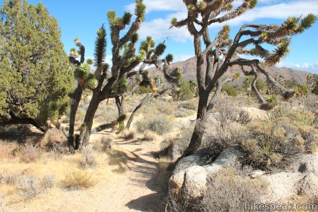
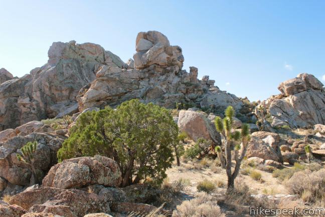
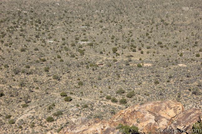
While crossing the slope of Cima Dome in its first mile, Teutonia Peak Trail passes through the densest concentration of Joshua trees in the world. After passing the remnants of the old Teutonia Mine, the trail gains 750 feet ascending the rocky peak in the distance.
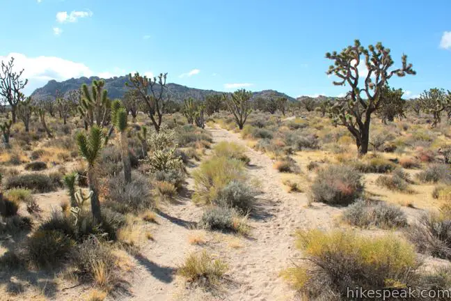
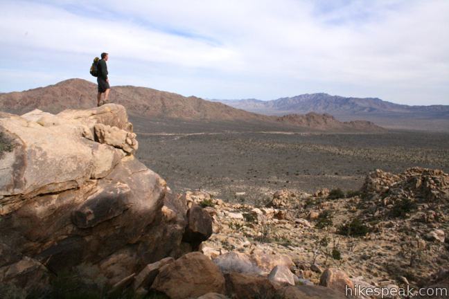
Indeed, the hike starts with a gradual trail through an impressive forest of Joshua Trees, followed by a steep hike through yucca and barrel cactus to the 5,755-foot summit of Teutonia Peak, which offers great views of Cima Dome and the surrounding desert landscapes.
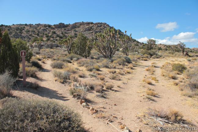
Set out heading south from Cima Road on a gradual jeep trail through a dense forest of large Joshua trees. Maintain a southwest bearing toward the Teutonia Peak, crossing another jeep trail about half a mile from the start.
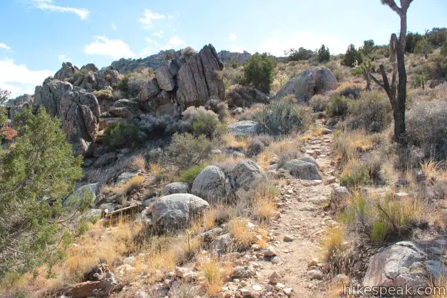
At just under one mile from the start, Teutonia Peak Trail makes a sharp bend to the right, passing a spur trail on the left to Teutonia Mine. Just past this unmarked junction, Teutonia Peak Trail leaves the jeep, heading up a single track trail to Teutonia Peak. This junction is marked, but the route to Teutonia Mine is less clear.
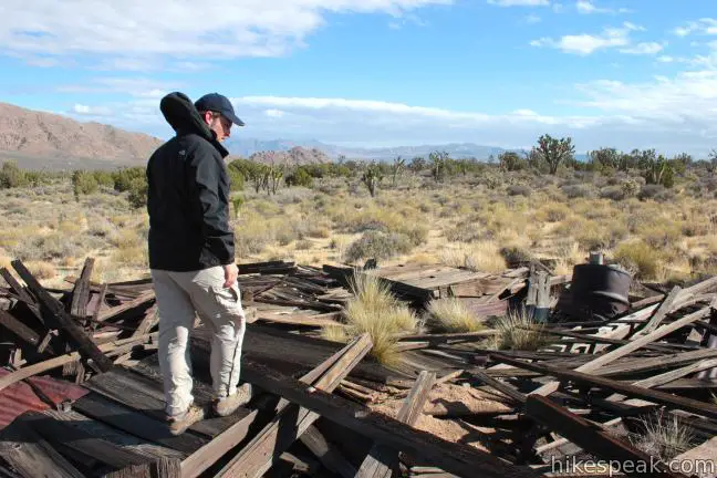
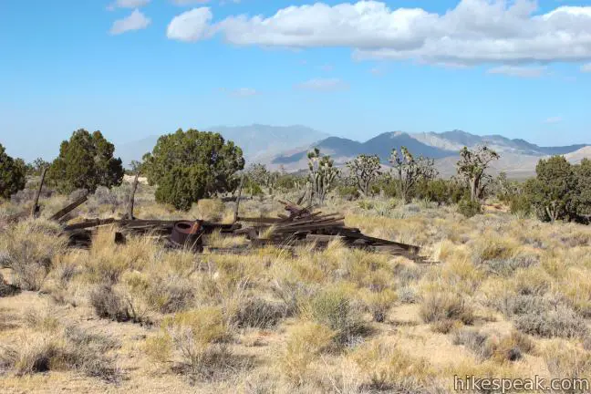
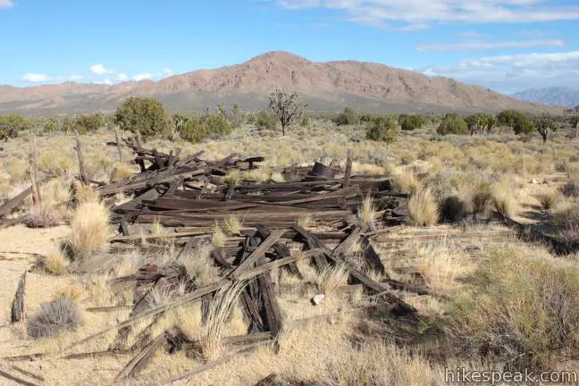
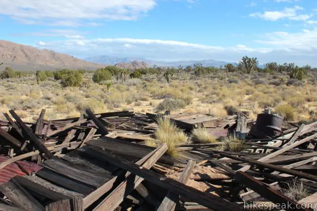
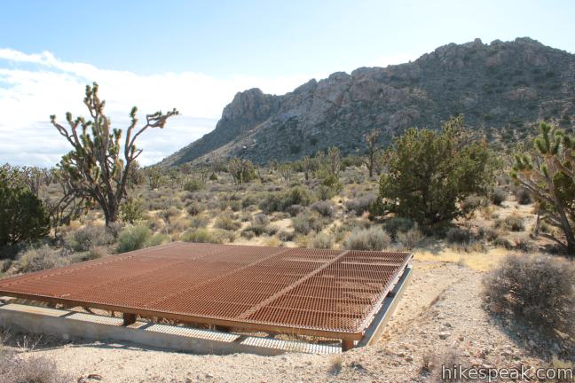
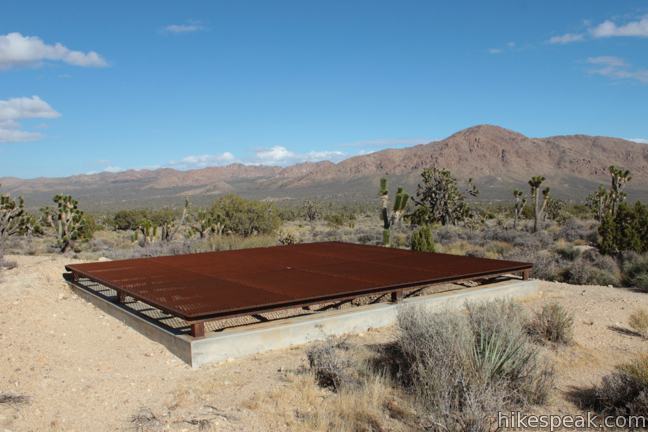
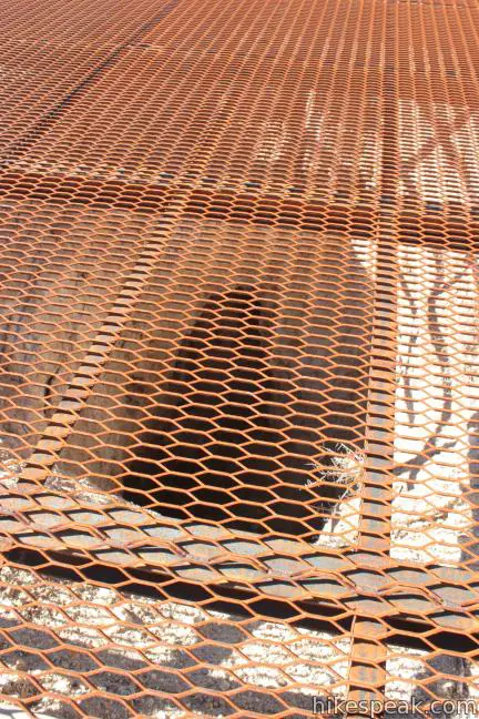
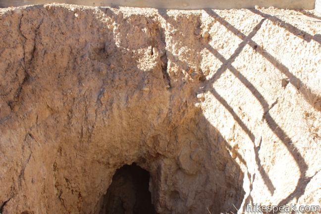
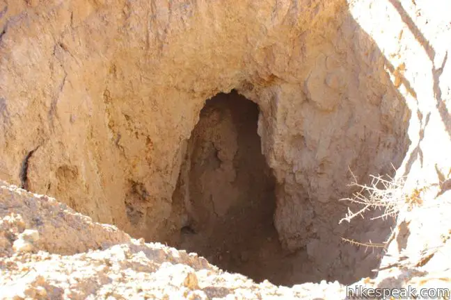
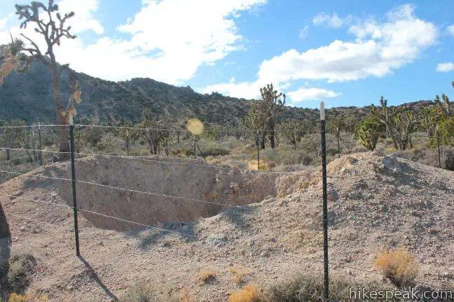
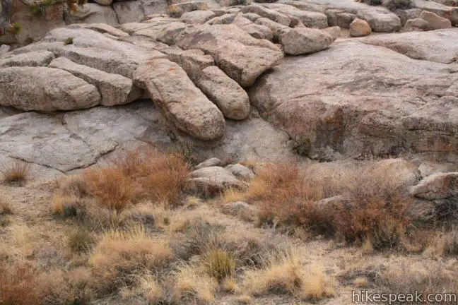
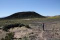
At the spot where Teutonia Peak Trail makes the sharp bend to the right, a jeep trail breaks off to the left toward the mine. The old road is wide, but no markers indicate that this is the route to the mine. If you turn left here, you will pass the small wooden ruins of what looks like a collapsed shed, before arriving at a trio of ruins a quarter mile from Teutonia Peak Trail. On the north side of the jeep trail you will spot the large wooden ruins of a collapsed structure. Just off the south side of the road across from these ruins, is a large mine shaft dropping into the earth that is covered by an iron grate. Straight ahead, between the two, is a fenced-off mine shaft. While this shaft is not covered in a grate, be safe and stay behind the fence.
The history of Teutonia Mine is described by the sign at the trailhead:
This silver mine was first worked in 1896, but was quickly abandoned. In 1906, Charles Togel discovered the old mine, interested investors, and built roads and a small camp called Togel City. However, Teutonia Mine was soon abandoned again – like so many others in the Mojave Desert.
Return to Teutonia Peak Trail and make the left turn up the single track just past the spur to Teutonia Mine. From here it is a short walk, crossing a final jeep road to reach the base of Teutonia Peak, 1.15 miles from the trailhead (excluding the spur trail to Teutonia Mine).
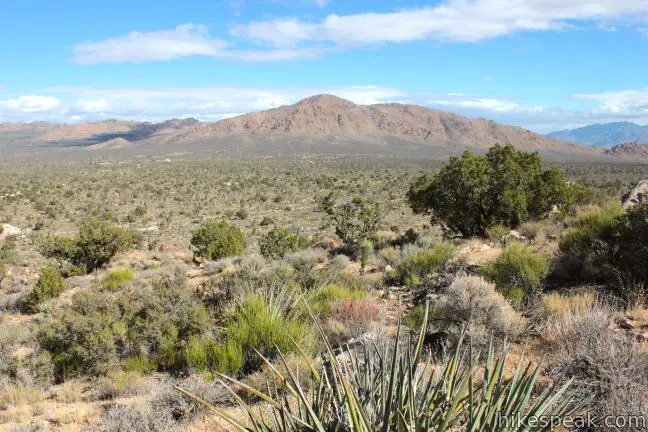
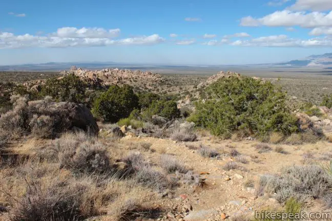
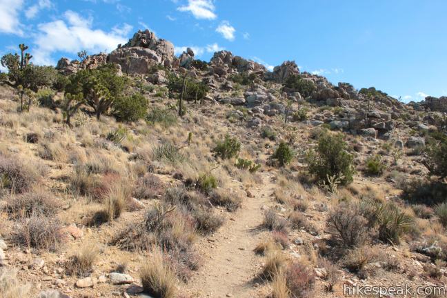
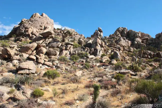
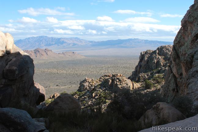
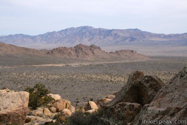
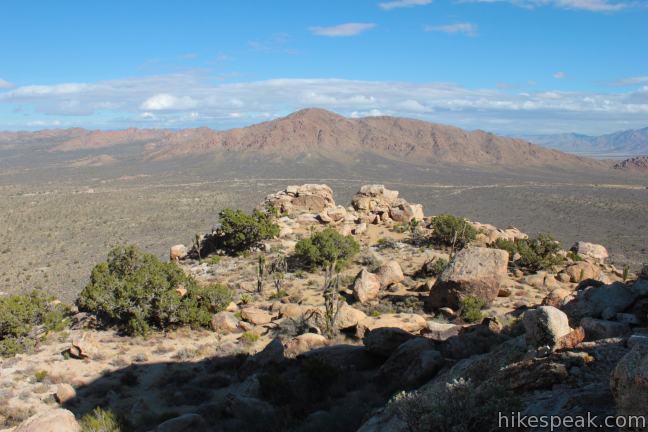
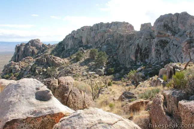
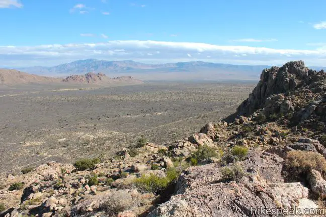
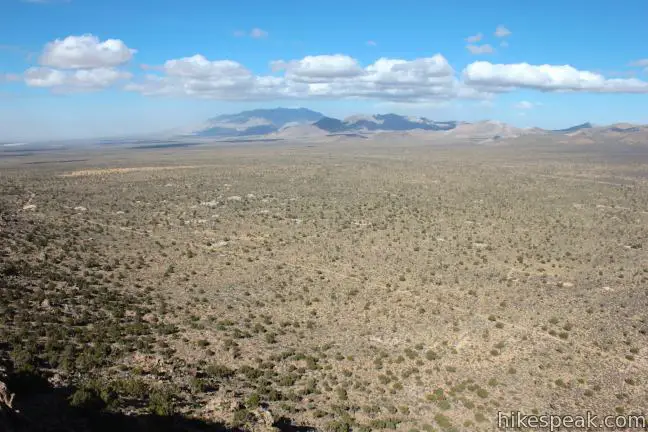
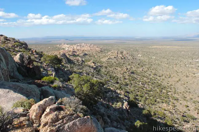
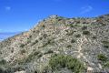
Climb stone steps on the lower slopes of Teutonia Peak as the ascent begins in earnest. After 0.17 miles of switchbacks, the trail reaches a saddle on a ridge northwest of the summit. The grade steepens as you continue toward the top and the views expand. You will be treated to a fantastic perspective of Cima Dome to the southwest. The strange horizon curves away in the shape of a large even dome, looking like a landscape distorted by a fisheye lens.
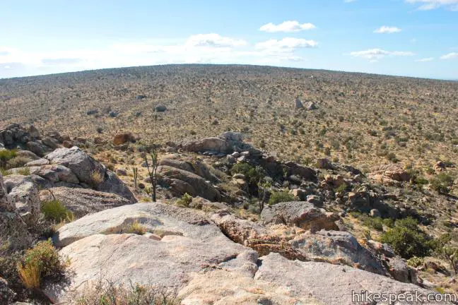
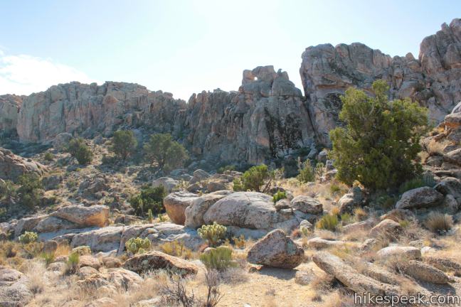
The maintained single track comes to an end 1.7 miles from the start (excluding the spur trail to Teutonia Mine) at a notch just below the rocky pillars at the top of Teutonia Peak. Experienced climbers may scramble up the rocks to the summit, but that is not necessary to enjoy the splendid views offered by this short hike.
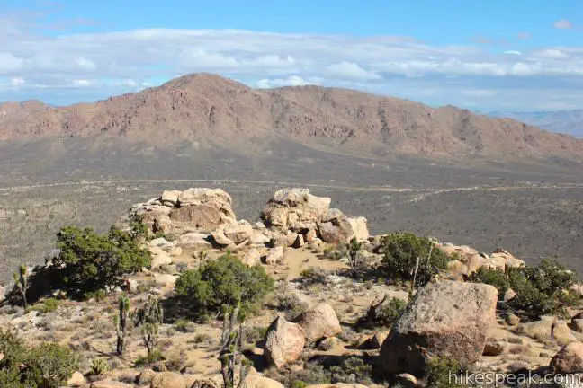
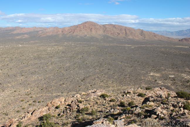
Before returning the way you came, you may wish to descend a tenth of a mile off the east side of the summit for a broad view over the landscape northeast of the peak, including Kessler Peak, which rises from the desert floor on the opposite side of Cima Road. This ledge also has a good perspective back up at the rocky crown of Teutonia Peak.
It is 3.4 miles out and back to the top of Teutonia Peak with 700 feet of elevation gain. Adding Teutonia Mine to the agenda expands the expedition to 4 miles with the same elevation gain. No fee or permit is required to hike to Teutonia Peak in Mojave National Preserve, so get out and enjoy!
Directions to the Trailhead
- From Cima, drive north on Cima Road for 6 miles to a turnout at the trailhead.
- From the 15 Freeway, exit Cima Road and drive south for 11 miles to the turnout.
- The trailhead is on the south side of the road a quarter mile west of the White Cross World War I Memorial.
Trailhead Location
Trailhead address: Cima Road, Mojave National Preserve, CA 92364
Trailhead coordinates: 35.31625, -115.5525 (35° 18′ 58.5″N 115° 33′ 09″W)
View Mojave National Preserve in a larger map
Or view a regional map of surrounding California Desert trails and campgrounds.


 | New York Peak This 7 to 9-mile round trip hike summits the highest point of the New York Range in the northeast corner of the preserve. |
 | Rock Spring Loop Trail This 1 1/3-mile loop visits a rare desert spring, a Rock House built in the 1920s, a miners' mill site, and an old U.S. Army post on a short and scenic circuit. |
 | Lava Tube This short 0.6-mile hike drops below the surface into an old lava tube. |
 | Petroglyphs near Seventeen Mile Point This quarter-mile path visits ancient engravings in the volcanic rock at the western rim of the cinder fields just off Kelbaker Road. |
 | Hole-in-the-Wall Rings Trail This 1.5-mile loop takes visitors through a landscape of pocketed rocks. Ringbolts allow fun passage through narrow canyons. |
 | Fountain Peak This 5-mile off trail trek summits a peak with commanding views over the Providence Mountains. |
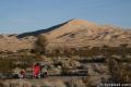 | Kelso Dunes This 3-mile round trip hike climbs 470 feet to the highest point in this 45 square mile dune field. |
 | Silver Peak This 8.5-mile hike summits a 6,365-foot peak in the Granite Mountains. |
 | Amboy Crater This 3-mile round trip hike travels up and into this crater adjacent to Mojave National Preserve. |
 | Hikes in the California Desert Explore more trails in Death Valley National Park, Joshua Tree National Park, Anza-Borrego Desert State Park, and Mojave National Preserve. |
 | Inspiration Peak This 1.2-mile hike leaves the crowds at Keys View for even grander views at a 5,550-foot summit that looks out on the Coachella Valley, the Salton Sea, Mount San Jacinto, and much of Joshua Tree National Park. |
 | Mojave National Preserve A few campgrounds and endless roadside camping are available within the preserve. |
Common Questions about Teutonia Peak in Mojave National Preserve
- Is the trail open?
- Yes. You should expect to find that Teutonia Peak Trail is open. There are no recent reports of trail closures. If you discover that the trail is closed, please help your fellow hikers by reporting a closure.
- Is this trail free to access?
- Yes, Teutonia Peak Trail is free to access. No entrance fee, pass, or permit is required. If you discover that access rules have changed, please provide feedback on your experience.
- How much time does this hike take?
- It takes approximately 1 hour 45 minutes to hike Teutonia Peak Trail. Individual hiking times vary. Add extra time for breaks and taking in the views.
- How long is this hike?
- The hike to Teutonia Peak Trail is a 3.4 mile out and back with 700 feet of elevation change.
- Are dogs allowed on this trail?
- Yes, dogs are allowed on Teutonia Peak Trail. The trail is open to hikers, dogs.
- Does this trail go to a summit?
- Yes, Teutonia Peak Trail reaches a summit with panoramic views.
- Where is the trailhead located?
- The trailhead for Teutonia Peak Trail is located in Mojave National Preserve, CA.
Trailhead Address:
Cima Road
Mojave National Preserve, CA 92364
Trailhead Coordinates:
35.31625, -115.5525 - What are the driving directions to the start of the hike?
To get to the trailhead: From Cima, drive north on Cima Road for 6 miles to a turnout at the trailhead.
From the 15 Freeway, exit Cima Road and drive south for 11 miles to the turnout. The trailhead is on the south side of the road a quarter mile west of the White Cross World War I Memorial.
View custom Google Maps directions from your current location.
- Are there other trails near Teutonia Peak Trail?
- Yes, you can find other nearby hikes using the Hikespeak Hike Finder Map.

Joshua trees can get boring after first minute of hiking.
A problem is Cima Road is a speed trap – we got a ticket doing 65 and no speed limit signs were posted all the way from main highway to trailhead. So avoid like the plague – just makes county police money!
Sounds like you don’t really belong in the preserve. You drive at unsafe speeds and do not appreciate that it is the largest Joshua Tree forest in the world. I’m glad you got a ticket.
[…] FOR MORE INFO: You can read about the trail here. […]
HI all, hope you enjoyed your visit to the Cima Dome. Its burning and will never recover. Joshua trees gone. Cima Rd. South and due North. National Park Service will let it burn as it was a lightning caused event. Wilderness gone, torched. Just like in 2005 when fire struck the Granite Mountains and took out all of the forest in Mid Hills, Round Valley and New York Mountains. Preserve is gone due to lack of proper management.
Wahhhhhh
https://www.nps.gov/moja/learn/nature/dome-fire.htm
They didn’t let it burn because lightning struck. The state of California would not provide resources and fire retardant because many other wildfires were burning in populated areas so unfortunately this jewel in the desert was last on the list to assist. The issue here is invasive grasses. As long as they thrive the preserve will burn.