Taranaki Falls
in Tongariro National Park

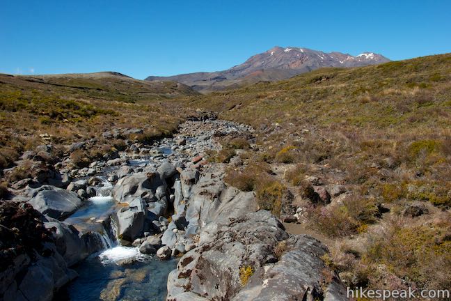
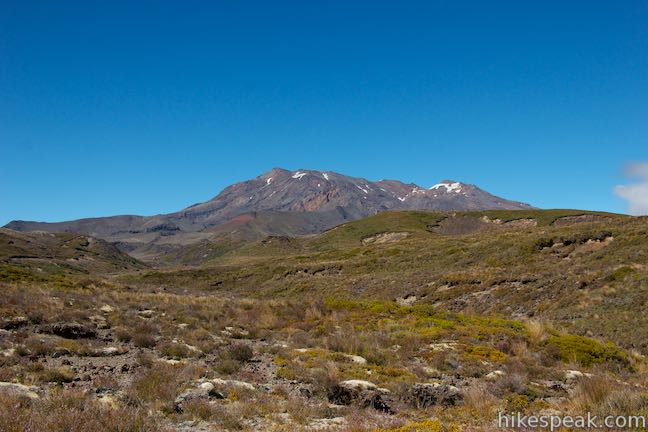
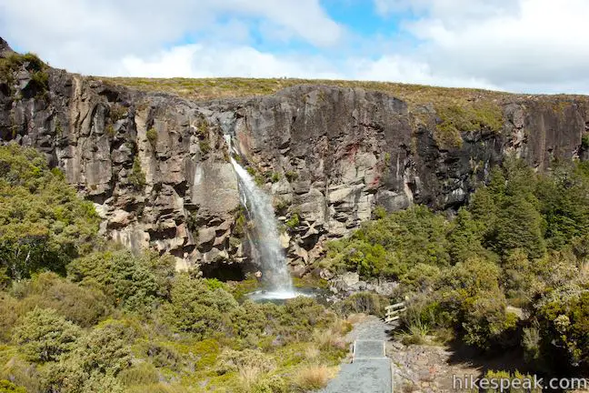
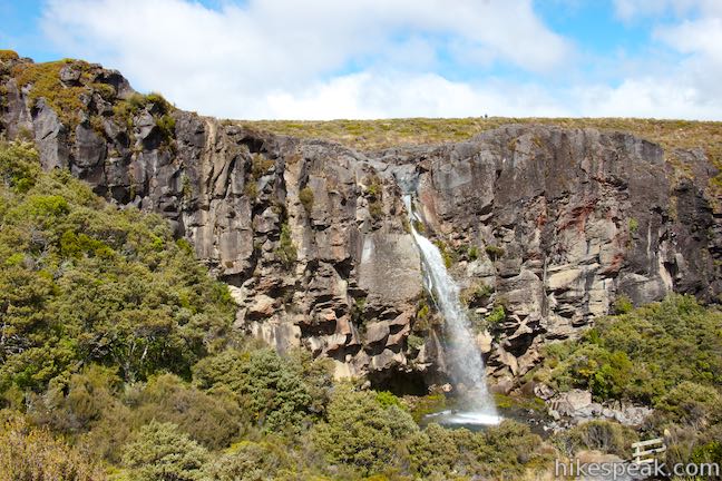
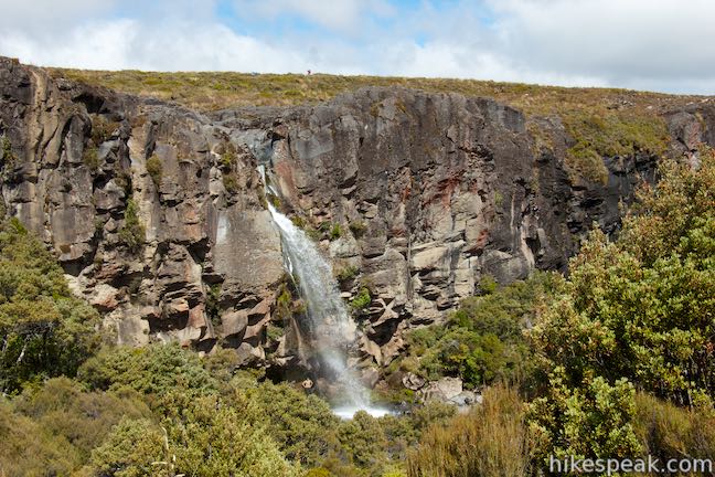
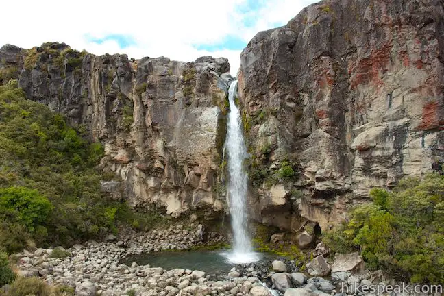
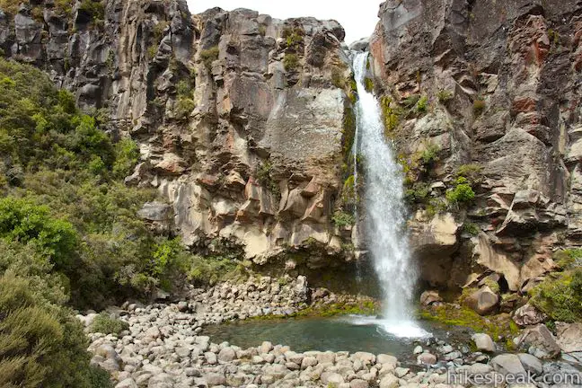
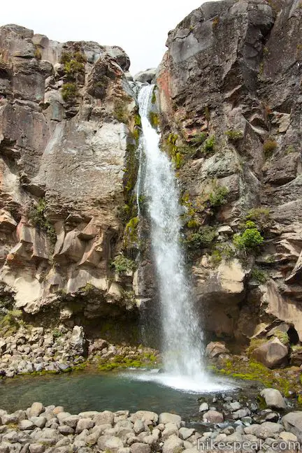
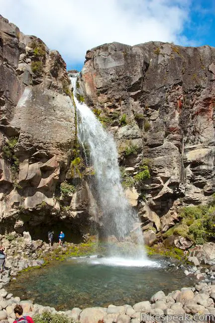
Taranaki Falls Track is an impressive 6.45-kilometer (4-mile) loop starting from Whakapapa Village in Tongariro National Park. The track crosses alpine grasslands, beech forests, and other landscapes shaped by incredible nearby volcanoes. Around the midpoint of the loop, the track reaches Taranaki Falls, which plunges nearly twenty meters (65 feet) from volcanic cliffs into a pleasant pool. In addition to the waterfall, there are views of Mount Ruapehu and Mount Ngauruhoe on this picturesque circuit.
This track is conveniently located in Whakapapa Village, right between Chateau Tongariro and Tongariro National Park’s Whakapapa Visitor Center. There are two halves to the loop to Taranaki Falls, Upper Taranaki Falls Track and Lower Taranaki Falls Track. You can hike the circuit in either direction, but it is probably easiest to travel in a counterclockwise (anti-clockwise) direction, starting from a car park at the end of Ngauruhoe Place where Upper Taranaki Falls Track begins. There are signs at the start for Taranaki Falls and Tongariro Northern Circuit, which is a multi-day trek through Tongariro National Park and one of New Zealand’s Great Walks. The listed times from the “Whakapapa Entrance” are 1 hour to Taranaki Falls, 2 3/4 hours to Lower Tama Lake (a possible extension off this loop), 3 1/4 hours to Upper Tama Lake, and 5 hours to Waihohonu Hut.
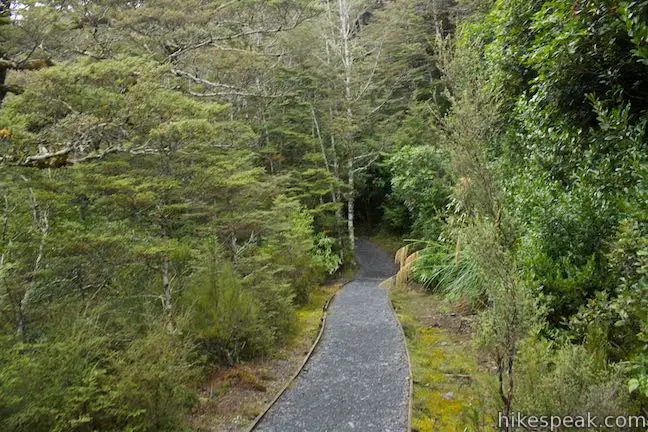
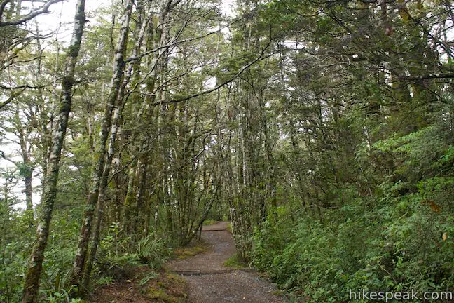
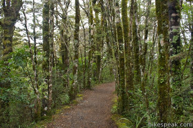
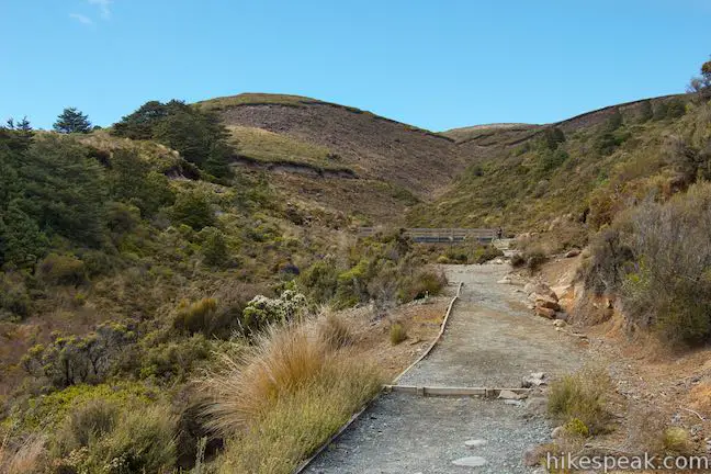
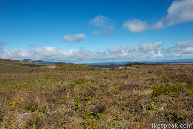
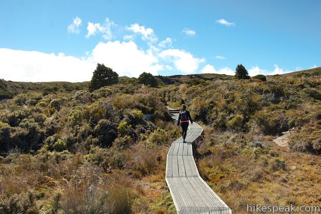
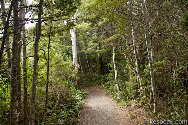
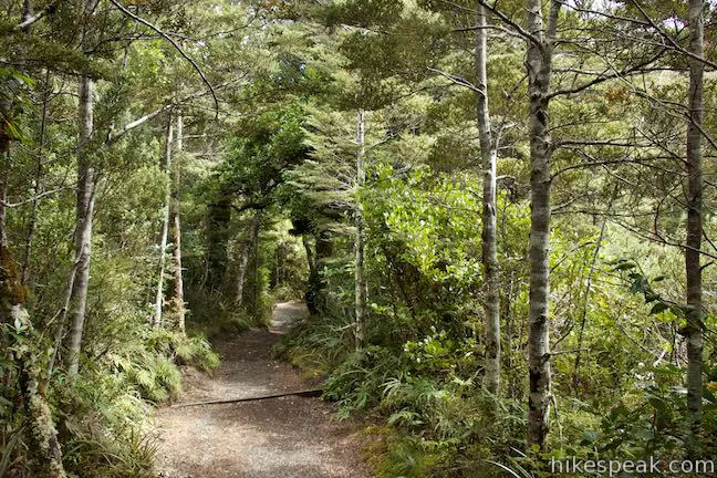
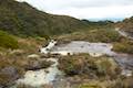
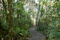
Leaving Whakapapa Village, Upper Taranaki Falls Track ventures east from the end of Ngauruhoe Place, passing through low grasses, tussock, and alpine scrublands. After nearly half a kilometer, the track slips into a shaded forest dominated by beech trees. Cross a stream at the 0.6 kilometer mark and exit the forest after another quarter kilometer. You will pass in and out of forests repeatedly on this loop, as the track rolls across varied landscapes.
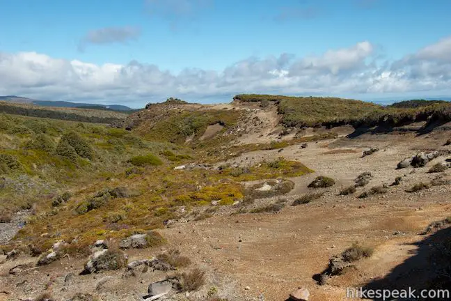
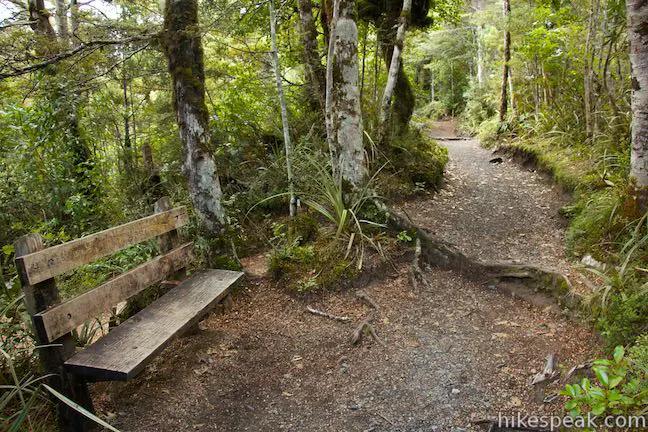
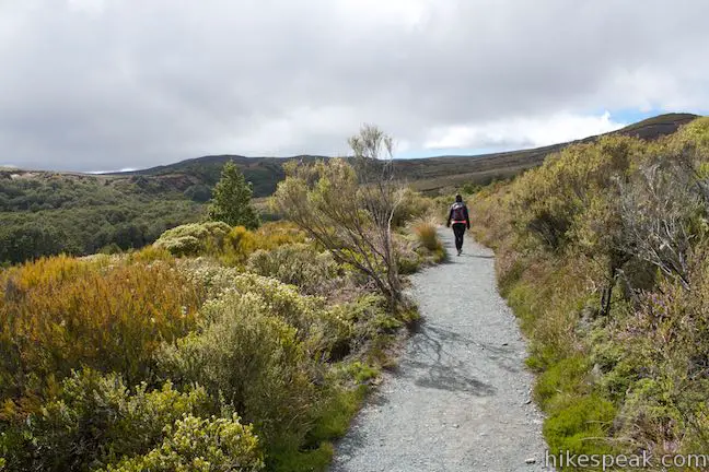
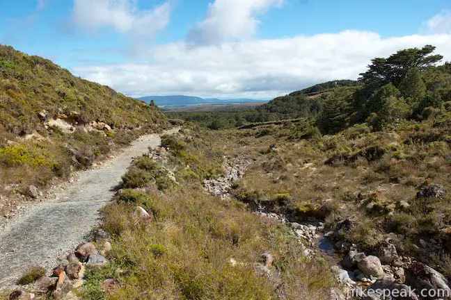
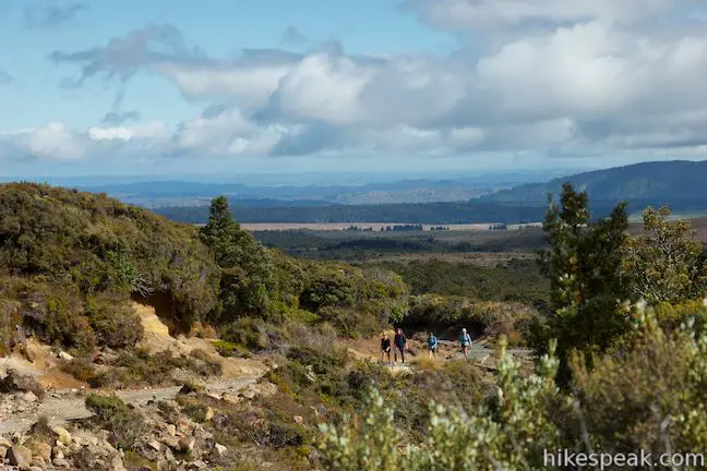
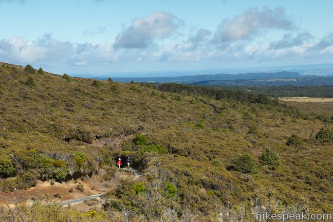
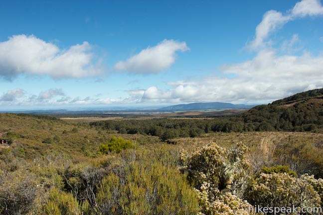
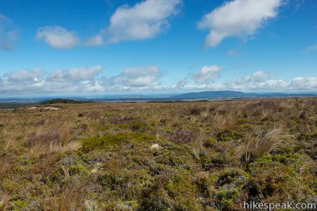
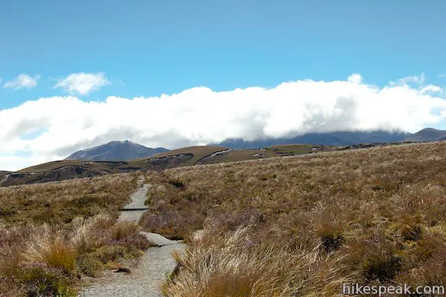
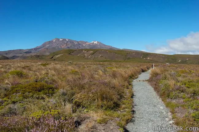
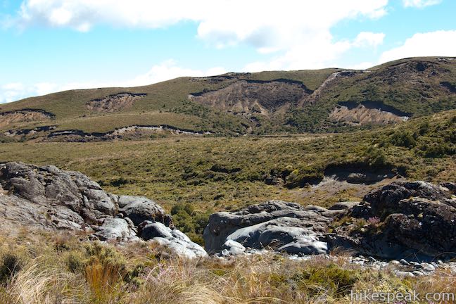
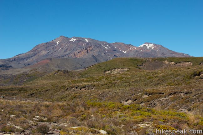
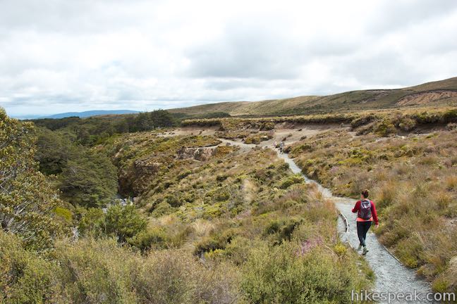
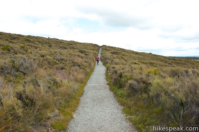
Just after the first 1.5 kilometers, a bench offers the opportunity for a short break. At two kilometers from the start, cross a footbridge and proceed another 150 meter to a sign marking the edge of a lava flow that transformed the landscape. Taranaki Falls Track explores slopes below Mount Ruapehu. Eruptions from that great volcano (the largest volcano in New Zealand and the highest peak on the North Island) have formed and reformed the landscapes around the loop. The broad rust-colored snow-covered ridges of Mount Ruapehu rise to the south on the right side of the track. To the east, as long as clouds don’t interfere, the impressive cone of Mount Ngauruhoe will also be visible. The broadest views are on the left side of the track, looking down grassy slopes toward the valleys to the north. Upper Taranaki Falls Track crosses another footbridge and a ridge formed by a lava flow. From here, descend toward Wairere Stream and Taranaki Falls.
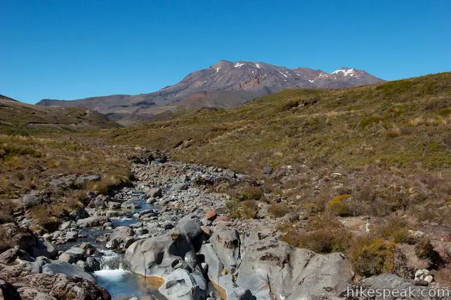
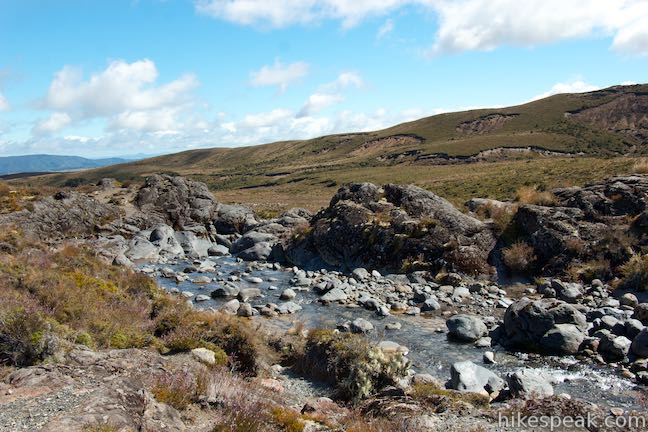
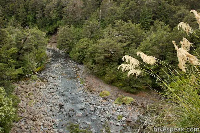
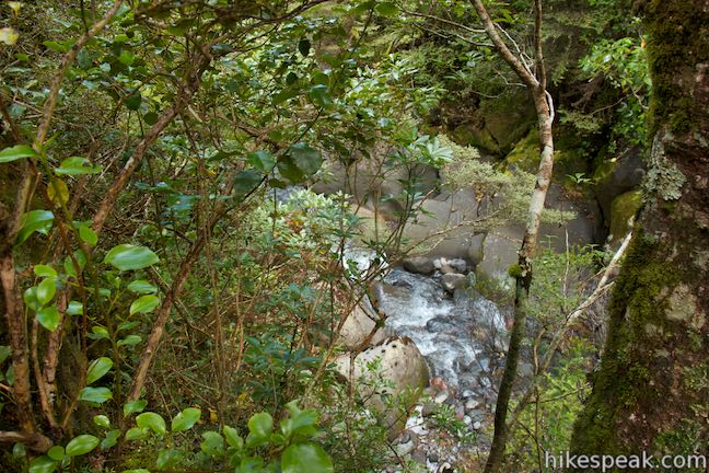
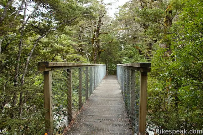
A bridge crossing Wairere Stream above the waterfall is 2.85 kilometers from the start. Look upstream to watch the water flow down from Mount Ruapehu. Look downstream to watch Wairere Stream disappear over the brink of the falls.
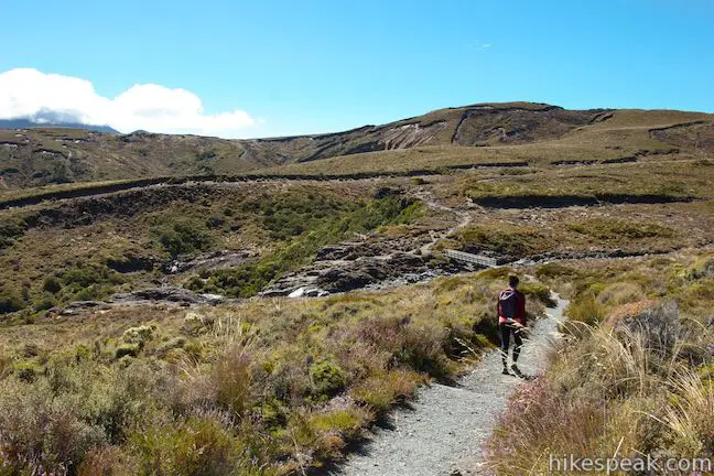
A hundred meters after crossing Wairere Stream, come to a junction with Tama Lakes Track. Turn left to continue to Taranaki Falls. A sign at this junction lists the distance back to Whakapapa Village as one hour. If you decided to venture up Tama Lakes Track, the posted times are two hours to Lower Tama Lake and four hours and thirty minutes to Waihohonu Hut. The good news, as listed on the sign for the track going forward, is that it is just another 5 minutes to Taranaki Falls and a one-hour walk to Whakapapa Village on Lower Taranaki Falls Track. To reach the base of Taranaki Falls, bear left at the junction and continue with the loop (if you want to reach the top of Taranaki Falls, you will need to stray from the track).
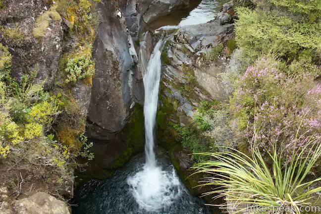
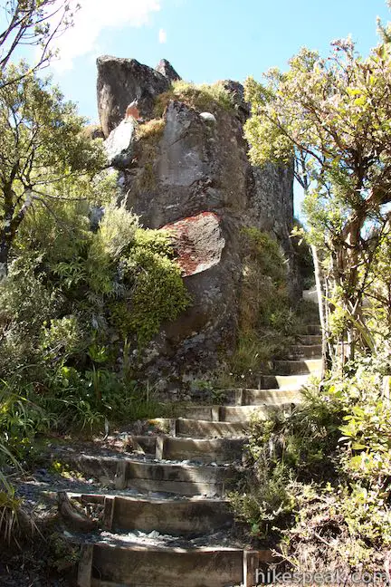
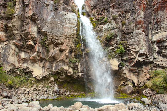
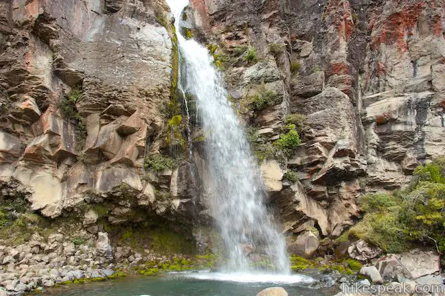
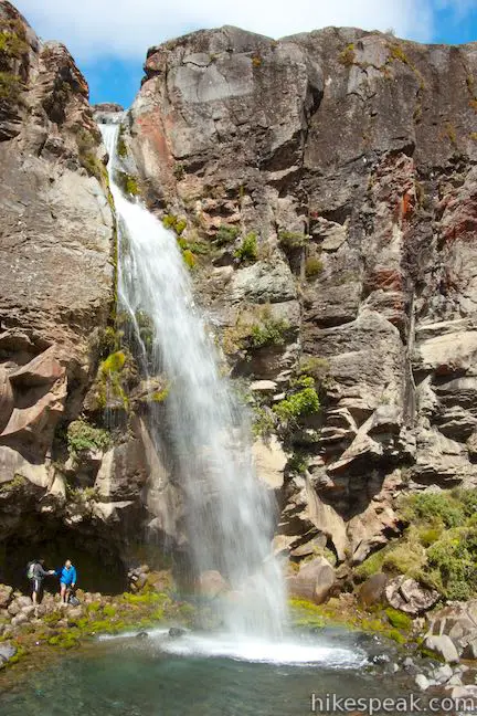
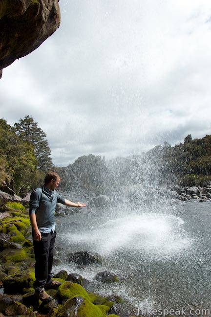
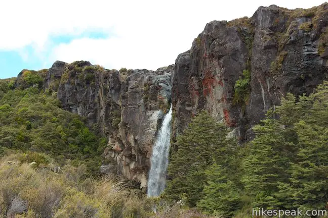
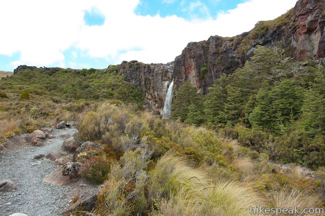
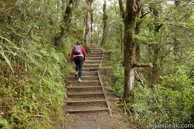
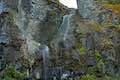
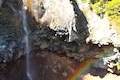
A long staircase through a forest of toatoa trees provides a rapid descent down the cliffs on the east side of the falls. As you reach the bottom of the cliffs, Taranaki Falls appears, leaping from the cliffs into a teal pool. Continue down the track and come alongside Taranaki Falls at 3.1 kilometers from the start.
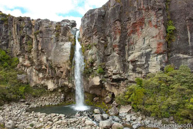
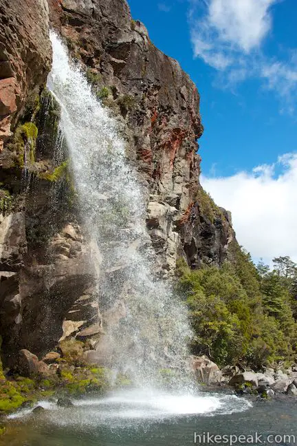
Step off the main track and venture down closer to the waterfall. Have a seat on a rock at the edge of the pool below the falls or walk around the plunge pool to reach an area beneath the overhang behind the waterfall. Here you can look out at the water as it appears overhead and spills out into the pool. Go ahead and reach out and touch the showering water. Taranaki Falls springs from twenty meter tall cliffs of volcanic rock that are colored in creams, reds and blacks, which make a dramatic background for this Tongariro National Park waterfall.
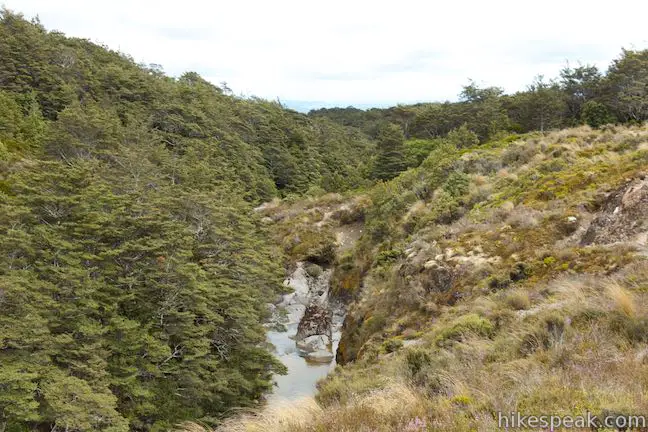
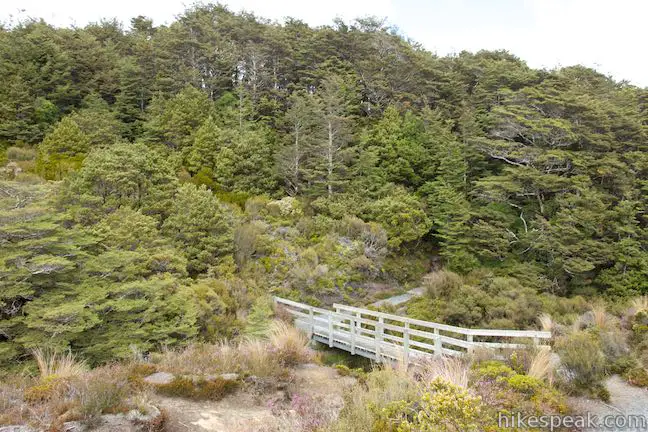
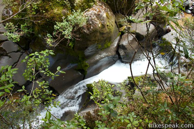
When you a ready to go, continue down Lower Taranaki Falls Track to take the lower route back to the start. The track goes down an open grassy slope, roughly parallel to Wairere stream. There are over-the-shoulder views of Taranaki Falls as you go, crossing a footbridge after another quarter of a kilometer. To your right, Wairere Stream drops from view and cuts a narrow gorge through the volcanic rock. Half a kilometer below Taranaki Falls, and 3.6 kilometers from the start, a bridge crosses the gorge where you can look down on a short waterfall that is just upstream on the narrow gorge. This is Cascade Falls, which you can pause and enjoy, soothing whatever waterfall withdrawal you might be feeling after saying goodbye to Taranaki Falls.
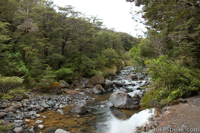
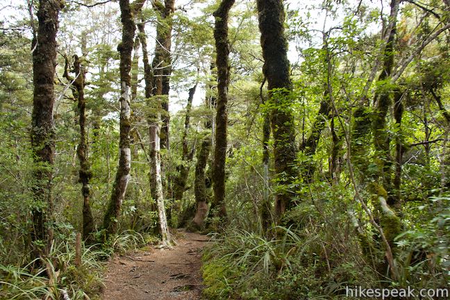
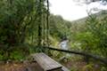
Ahead, Lower Taranaki Falls Track drops into pleasant beach forests. In another 0.8 kilometers, a short spur on the right goes out to Wairere Stream, which has left the gorge and widened as it continues down the mountainside. There are several benches along the way so hikers can linger a little longer in these woods.
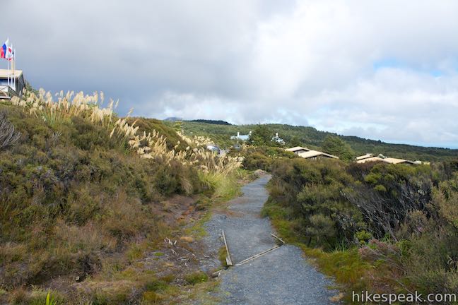
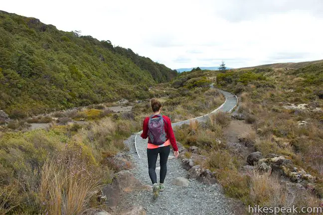
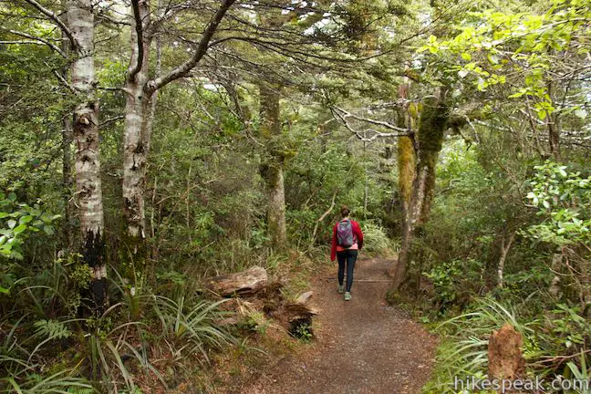
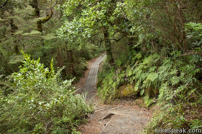
At 1.8 kilometers from Taranaki Falls and 4.9 kilometers from the start, reach another junction along the loop. To the right, Mangatepopo Track heads northeast toward Mangatepopo Hut along Tongariro Alpine Crossing, reaching the hut after 3 hours. Continue to the left on Lower Taranaki Falls Track. The sign says that it is 20 minutes from here back to Whakapapa Village and there are 1.55 kilometers left in the hike. The track crosses rolling terrain covered in alpine grassland, passing in and out of strips of ferny forests.
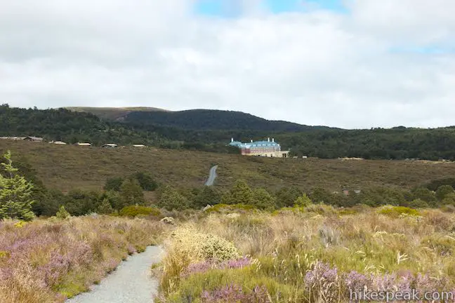
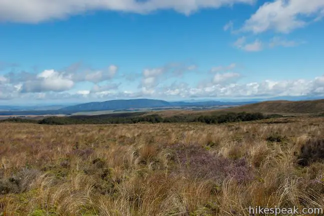
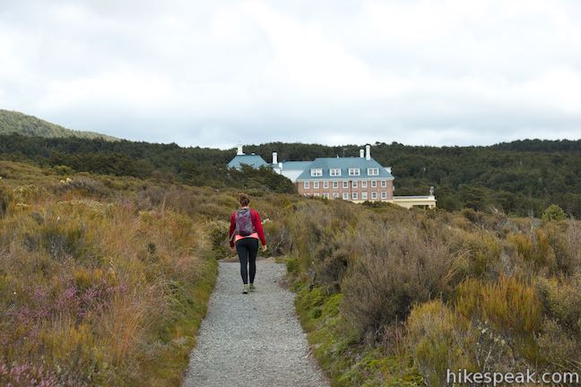
At 5 kilometers from the start of the loop, the track passes a bench at the edge of the forest. This might be the nicest of all the benches along Lower Taranaki Falls Track. Leave the trees for grasses, tussock, and alpine scrublands similar to what you crossed on the upper side of the loop, offering head-on views toward Chateau Tongariro in Whakapapa Village. The track crosses several narrow forests where there are wooden steps down to an up from streams flowing down small gullies in the landscape. Leave the last of these forests, 5.75 kilometers from the start and cross the final stretch of grassland. Chateau Tongariro often lies straight ahead, growing larger the closer that you get.
When you reach the end of Lower Taranaki Falls Track, turn left and walk a final tenth of a kilometer up to the road end where you began the hike on Upper Taranaki Falls Track, completing the 6.45 kilometer circuit. Of course if you walked to the start of the track from the chateau, Whakapapa Holiday Park, or elsewhere in Whakapapa Village, you can turn right at the end of Lower Taranaki Falls Track and walk back into the village. There is 115 meters (375 feet) of fairly easy elevation change along this loop. Dogs and bikes are not allowed, but no fee or permit is required to hike Taranaki Falls Track in Tongariro National Park, so get out and enjoy!
Directions to the Trailhead
- From Taupo, head south on State Highway 1 for about 50 kilometers to Turangi.
- Turn right on State Highway 41.
- Drive 2.7 kilometers and turn left on State Highway 47.
- Take this road for 37 kilometers and turn left up State Highway 48 toward Whakapapa Village.
- Drive 6 kilometers and make the first left after Chateau Tongariro onto Ngauruhoe Place.
- Drive 250 meters to the car park at the road end where Upper Taranaki Falls Track Begins.
- There is additional parking along the main road through Whakapapa Village.
Trailhead address: Ngauruhoe Place, Tongariro National Park, Manawatu-Wanganui, 4691, New Zealand
Trailhead coordinates: -39.19955, 175.5429 (39° 11′ 58.38″S 175° 32′ 34.44″E)
View Tongariro National Park in a larger map
Or view a regional map of surrounding New Zealand tracks, campgrounds, and lodging.


 | Silica Rapids This 5.15-kilometer point-to-point hike or 7.15 kilometer loop leaves from Whakapapa Village in Tongariro National Park and crosses alpine bogs, forests, streams, and ridges of volcanic rock to reach creamy cascades on silica terraces. |
 | Tawhai Falls This 0.8-kilometer return hike visits a short but enticing single-drop waterfall near Whakapapa Village in Tongariro National Park. |
 | Tongariro Alpine Crossing This 19.4-kilometer long through-hike ventures across dynamic volcanic landscapes in Tongariro National Park and ranks among the world's greatest day hikes. |
 | Lake Rotopounamu This 6.4-kilometer loop around Lake Rotopounamu (a.k.a. Greenstone Lake) visits tranquil beaches on a forest-wrapped lake in Tongariro National Park. |
 | Rimu Walk This short, level walk explores a Rimu forest along the Mangawhero River near the town of Ohakune at the south end of Tongariro National Park. |
 | Waitonga Falls This 4-kilometer return hike reaches Tongariro National Park's tallest waterfall and passes through an alpine wetland that reflect views of Mount Ruapehu. |
 | Mangawhero Falls This easy 0.3-kilometer hike leads to a viewpoint for a 25-meter tall waterfall below Mount Ruapehu in Tongariro National Park. |
 | More trails in New Zealand Explore other destinations for walking and hiking (as well camping and lodging) in New Zealand. |
 | Whakapapa Holiday Park This holiday park in Whakapapa Village offers tent sites, campervan sites, cabins, and a backpackers lodge along a stream below Mount Ruapehu in Tongariro National Park. |
 | Whakaipo Lodge This lodge near Lake Taupo blends comfort with luxury and has welcoming owners who can help you take advantage of the area's abundant outdoor opportunities. |
 | Mangawhero Campground This campground in Tongariro National Park near Ohakuna, New Zealand has twelves sites on two loops with views of Mount Ruapehu. |
Taranaki Falls on world-of-waterfalls.com
Taranaki Falls on adinamarguerite.com
Taranaki Falls on freewalks.nz
Whakapapa Village Walking Tracks on adventureshuttles.co.nz
A Department of Conservation webpage for Whakapapa Village Walking Tracks
A Department of Conservation brochure of Walks in and around Tongariro National Park
The Department of Conservation webpage for Tongariro National Park
Common Questions about Taranaki Falls in Tongariro National Park
- Is the trail open?
- Yes. You should expect to find that Taranaki Falls Track is open. There are no recent reports of trail closures. If you discover that the trail is closed, please help your fellow hikers by reporting a closure.
- Is this trail free to access?
- Yes, Taranaki Falls Track is free to access. No entrance fee, pass, or permit is required. If you discover that access rules have changed, please provide feedback on your experience.
- How much time does this hike take?
- It takes approximately 2 hours to hike Taranaki Falls Track. Individual hiking times vary. Add extra time for breaks and taking in the views.
- How long is this hike?
- The hike to Taranaki Falls Track is a 6.45 km / 4 mile circuit loop with 115 meters / 375 feet of elevation change.
- Are dogs allowed on this trail?
- No, dogs are likely not allowed on Taranaki Falls Track. The trail is primarily open to hikers.
- Will I see a waterfall on this hike?
- Yes, Taranaki Falls Track features a waterfall.
- Where is the trailhead located?
- The trailhead for Taranaki Falls Track is located in Tongariro National Park, Manawatu-Wanganui.
Trailhead Address:
Ngauruhoe Place
Tongariro National Park, Manawatu-Wanganui 4691
Trailhead Coordinates:
-39.19955, 175.5429 - What are the driving directions to the start of the hike?
- To get to the trailhead: From Taupo, head south on State Highway 1 for about 50 kilometers to Turangi. Turn right on State Highway 41. Drive 2.7 kilometers and turn left on State Highway 47. Take this road for 37 kilometers and turn left up State Highway 48 toward Whakapapa Village. Drive 6 kilometers and make the first left after Chateau Tongariro onto Ngauruhoe Place. Drive 250 meters to the car park at the road end where Upper Taranaki Falls Track Begins. There is additional parking along the main road through Whakapapa Village.
View custom Google Maps directions from your current location. - Are there other trails near Taranaki Falls Track?
- Yes, you can find other nearby hikes using the Hikespeak Hike Finder Map.

[…] 6.4 km, Taranaki Falls Loop is a brisk little hike you can do in a couple of hours. We chose this hike […]