Strawberry Peak holds the distinction of being the highest summit in the front range of the San Gabriel Mountains, besting nearby San Gabriel Peak by a just a yard. Measuring 6,164 feet tall, Strawberry Peak is taller than other surrounding mountains like Josephine Peak, Mount Lawlor, and Mount Wilson. A hike to the summit from Red Box Picnic Area on Angeles Crest Highway is 7.5 miles round trip with 1,510 feet of elevation change. The first 2.5 miles are gradual on a nicely built trail that was re-established after the Station Fire scorched this area in 2009. When you hit Lawlor Saddle, a rougher 1.25-mile long path ascends the final 950 feet on a steep and undulating ridge to the top of the mountain. The second leg of the hike is a butt-kicker, but the summit-bagging panoramas are worth the effort.
Strawberry Peak Trail
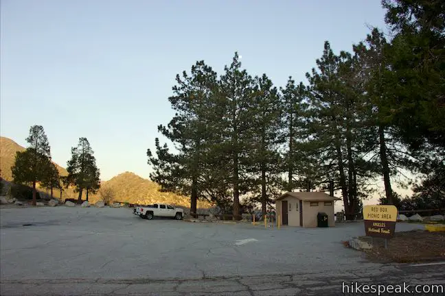
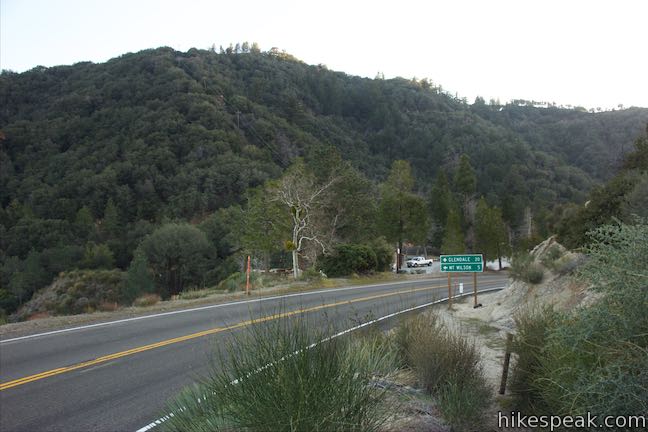
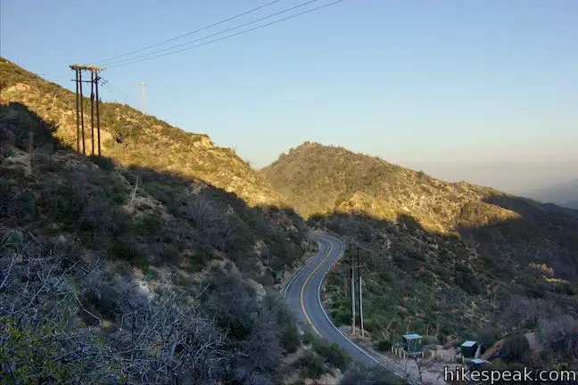
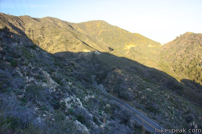
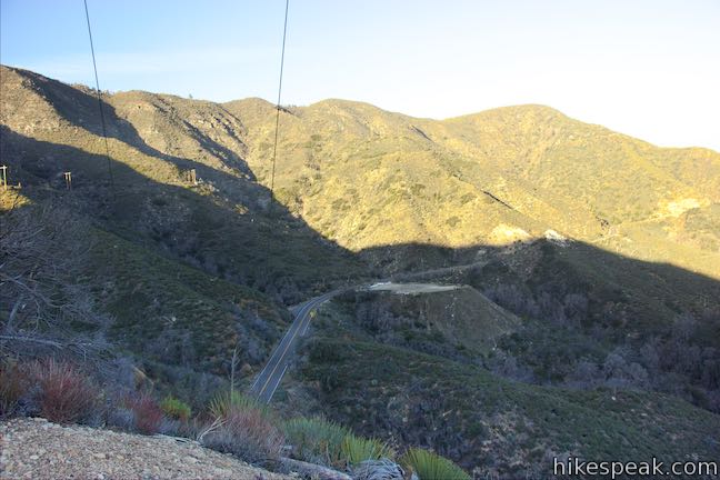
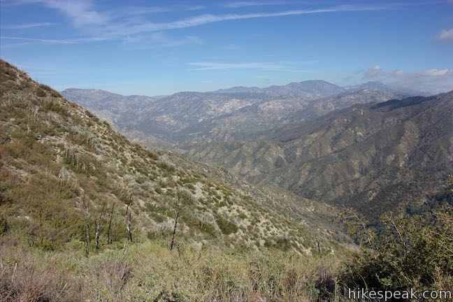
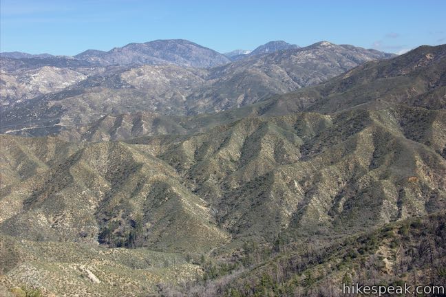
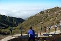
Coming from Los Angeles, this trailhead is easy to reach, 13.8 miles up Angeles Crest Highway from La Cañada Flintridge at an intersection with Mount Wilson Red Box Road (the road to Mount Wilson). Walk to the east end of the picnic area and look down Valley Forge Canyon and other canyons framing the West Fork of the San Gabriel River.
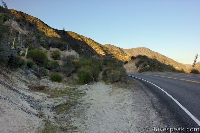
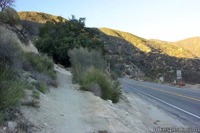
Cross Angeles Crest Highway (waiting for a break in the traffic) and find a trail that begins on the other side of the road, on the east side of Red Box Gap next to mile marker 38.42. Only a wood post marks the start of Strawberry Peak Trail (perhaps a more formal sign will be added in the future).
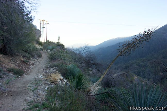
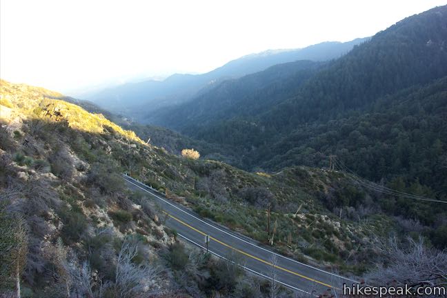
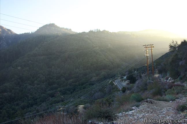
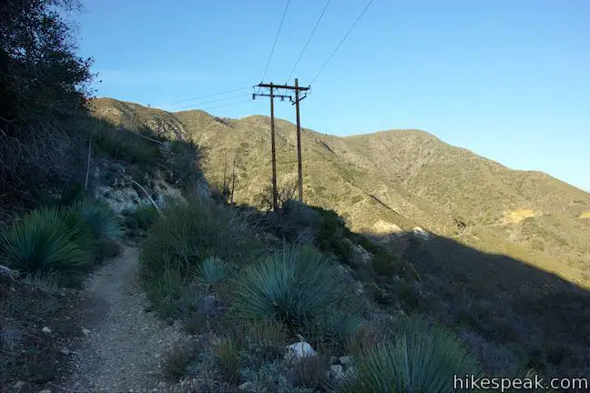
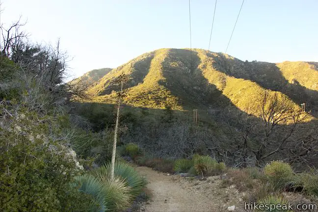
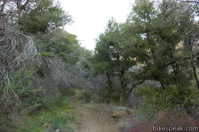
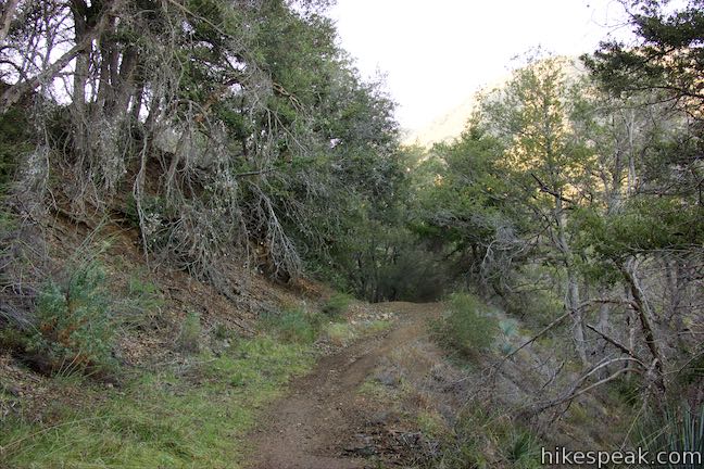
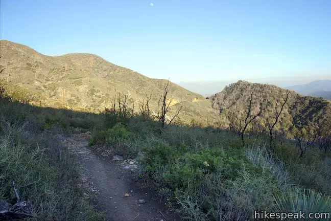
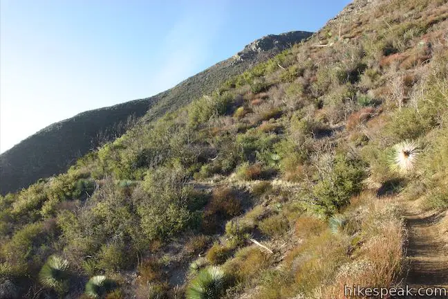
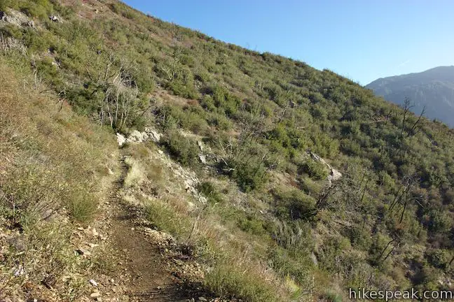
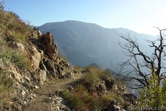
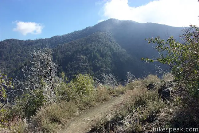
Begin hiking up the dirt single-track that ventures up the ridge above Angeles Crest Highway, passing through brush and pockets of trees. Power lines run along this initial part of the trail, but rest assured that the trail breaks free and becomes more remote. Look down over the roadway and east across rippling canyons.
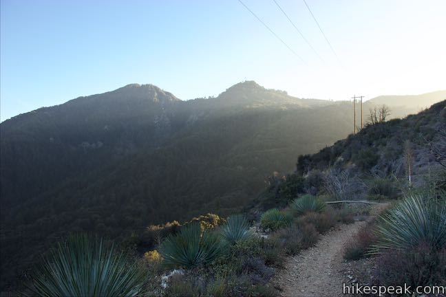
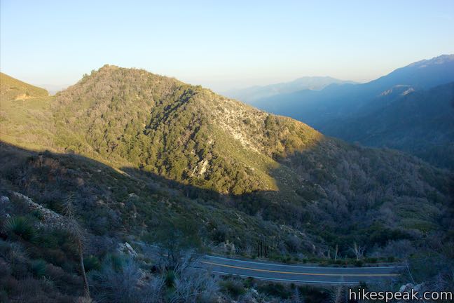
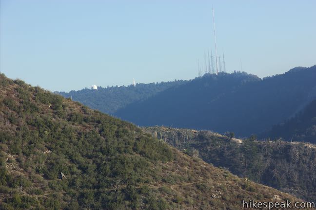
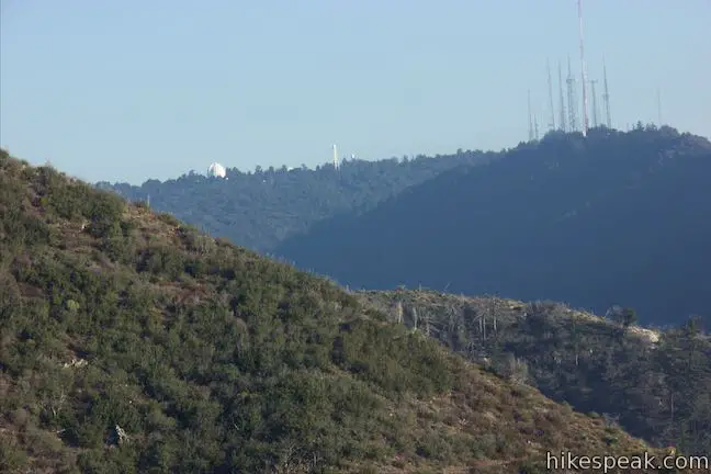
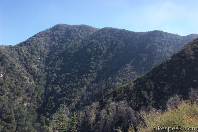
After 0.9 miles, go through a sharp left switchback. The slopes of Mount Lawlor rise above you. Proceed up the trail into a wooded gully below a saddle, 1.15 miles from the start. Crossing the saddle, you will leave the eastern views over Valley Forge Canyon but can still look over your shoulder toward the observatory domes on Mount Wilson to the southeast.
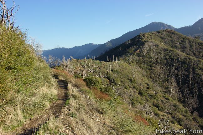
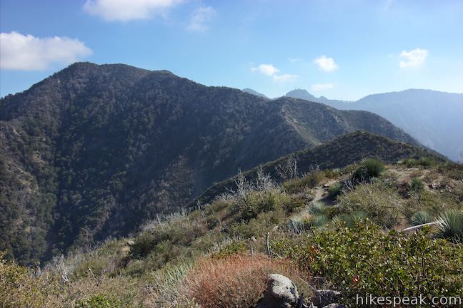
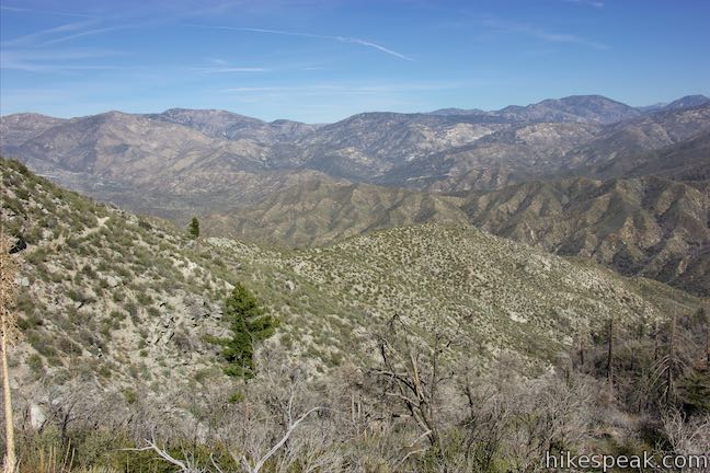
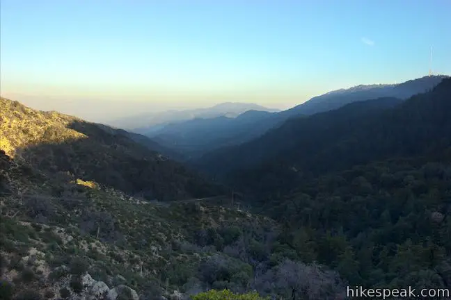
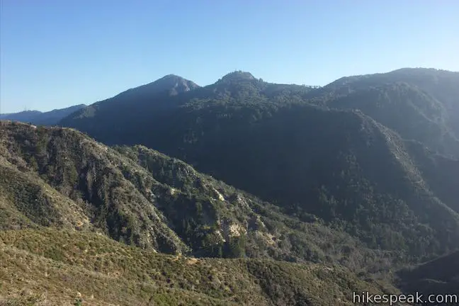
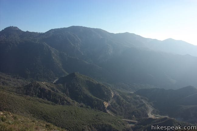
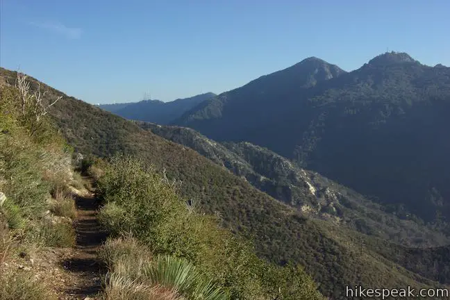
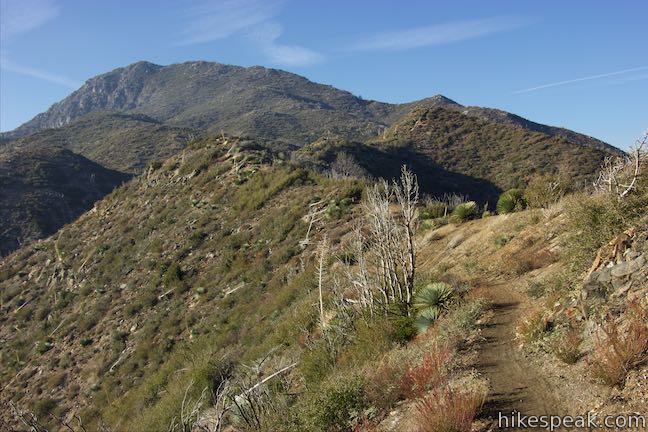
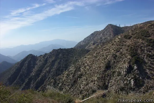
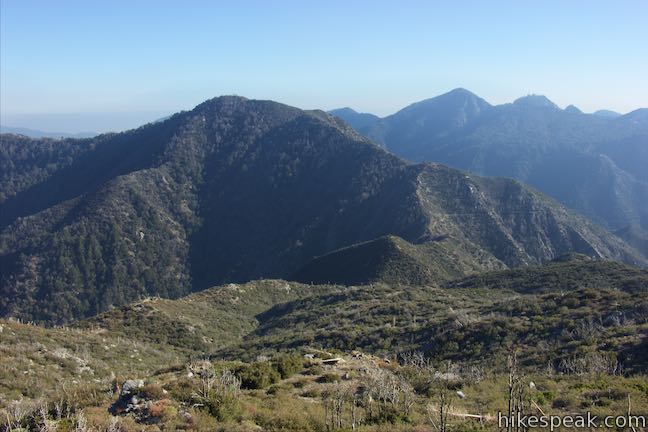
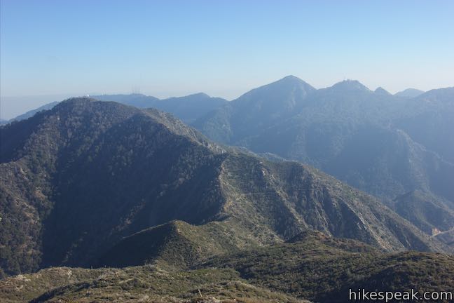
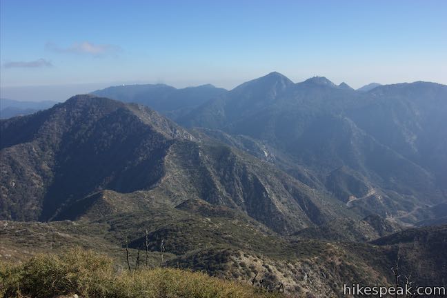
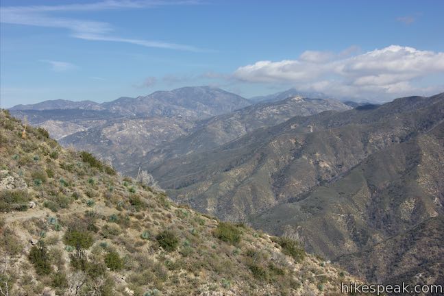
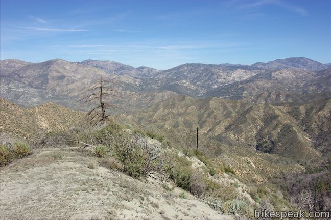
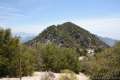
The trail now heads west across the side of Mount Lawlor and ascends gradually across bumps and draws in the terrain. Going around the back of a large crease in the mountainside, 2 miles into the hike, you’ll find views looking down on Angeles Crest Highway and south toward Mount Disappointment and San Gabriel Peak, which rise to the west of Mount Wilson.
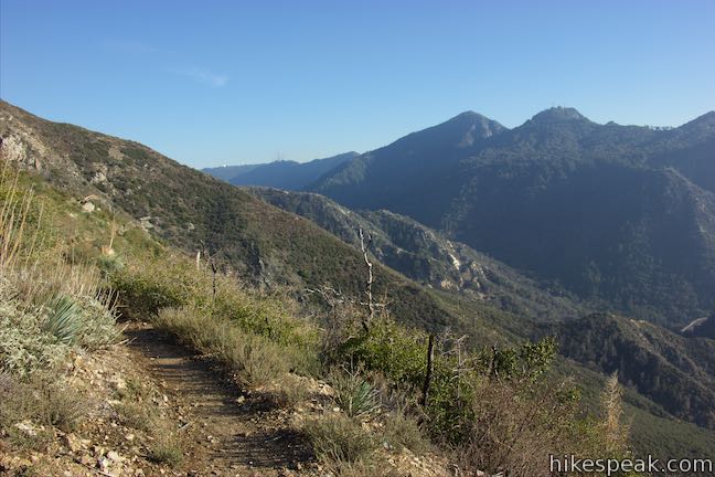
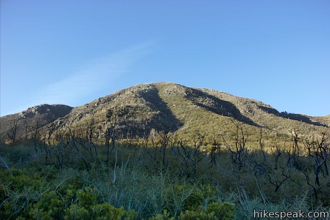
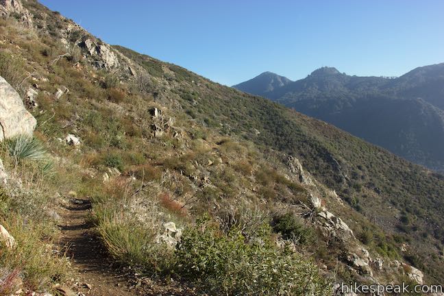
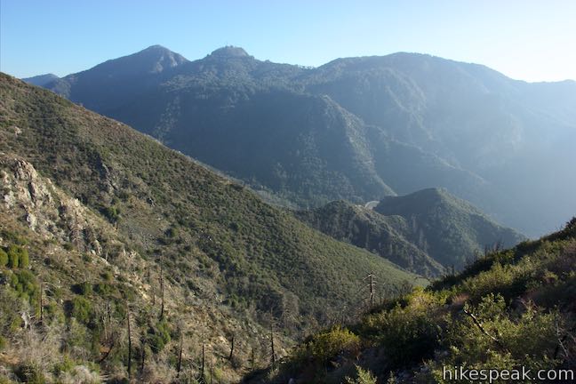
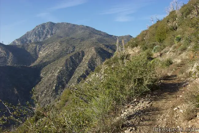
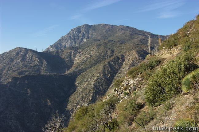
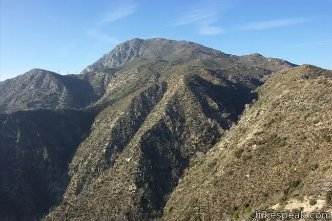
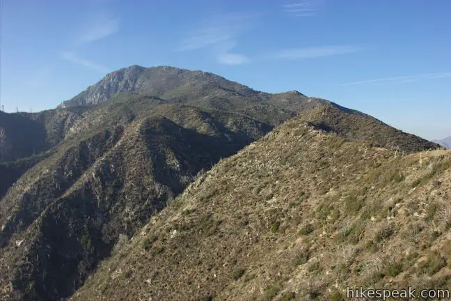
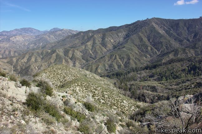
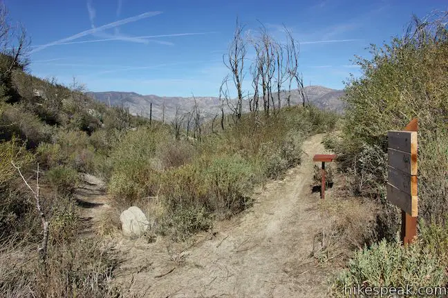
Continue up the trail and wrap around a bend when you’ll trade views of Mount Wilson for views of Strawberry Peak. The trail remains gradual as it passes through more bends, even as the terrain above and below the trail becomes quite steep. Strawberry Peak Trail actually turns downhill as you approach Lawlor Saddle, a notch between Mount Lawlor and Strawberry Peak. Reach the saddle after hiking 2.5 miles, gaining 560 feet.
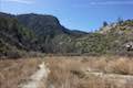
On the other side of Lawlor Saddle, Strawberry Peak Trail heads north and down to a junction with Colby Canyon Trail next to Strawberry Meadow, which is an alluring flat area below a big granite cliff on the north side of Strawberry Peak. It is about 2 miles from Lawlor Saddle to Strawberry Meadow.
Lawlor Saddle to Strawberry Peak
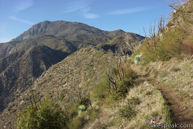
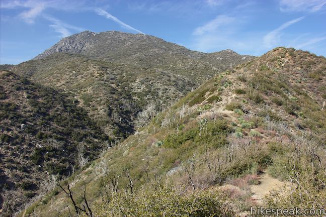
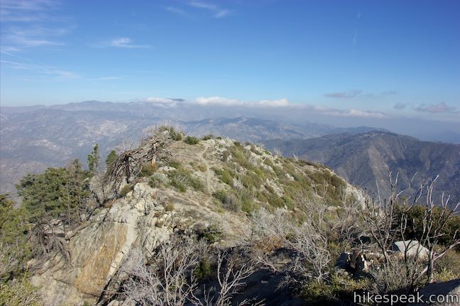
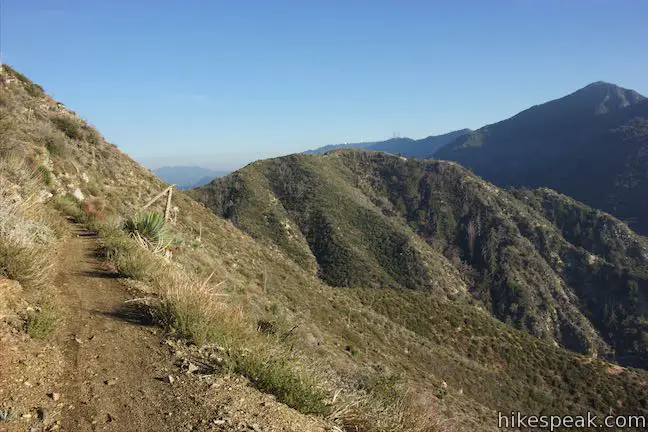
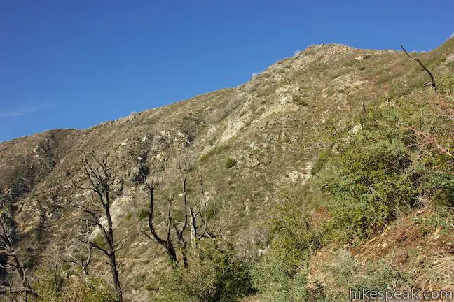
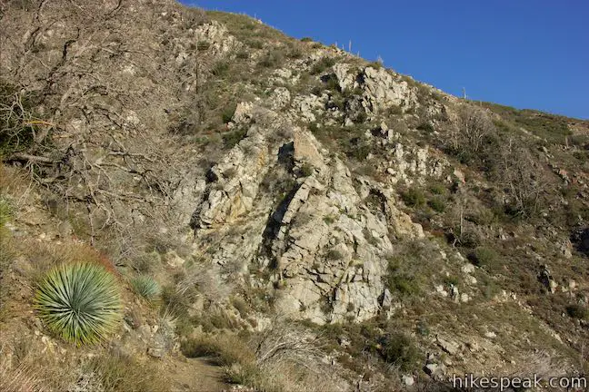
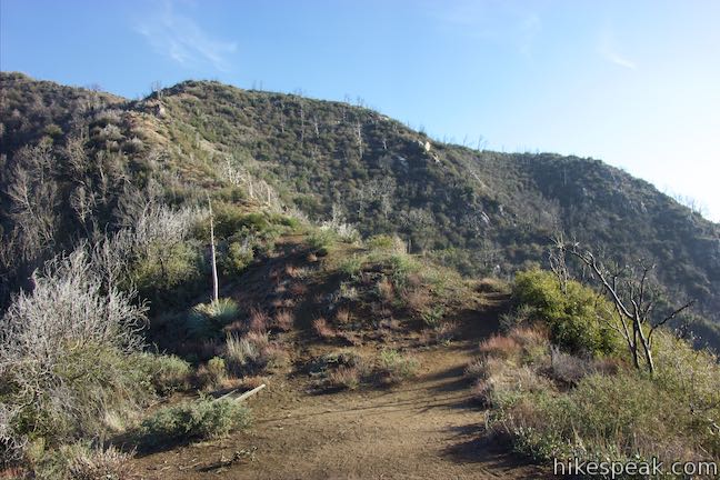
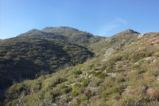
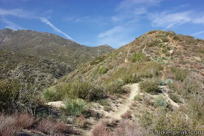
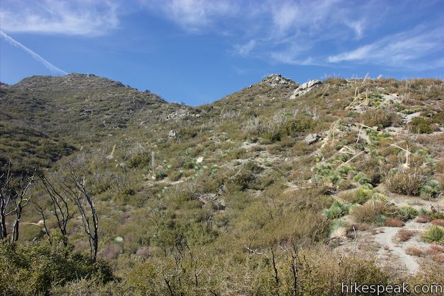
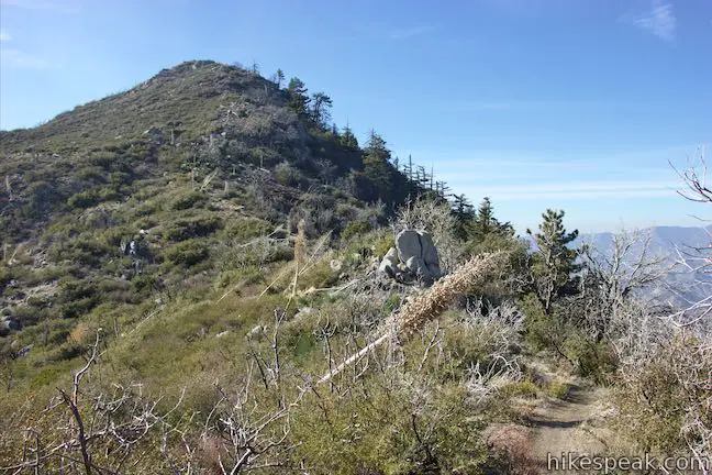
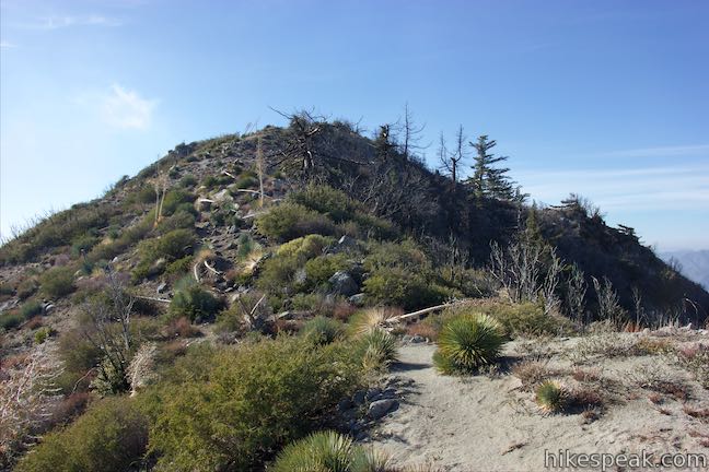
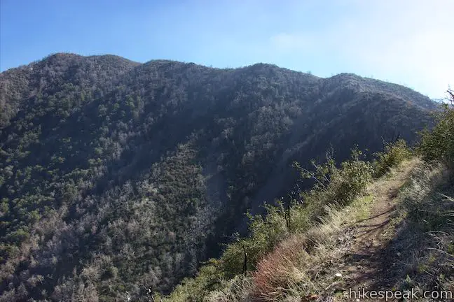
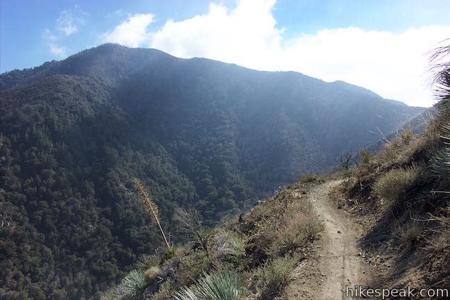
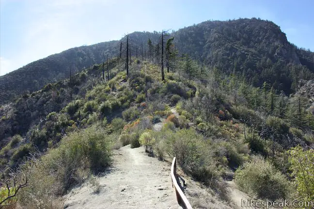
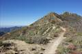
To get to the summit of Strawberry Peak, you must leave the comforts of the well maintained trail for a rougher track that follows an undulating ridge up the east side of Strawberry Peak. The summit of Strawberry Peak is visible, 950 feet above you, looking a good distance away.
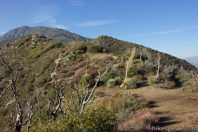
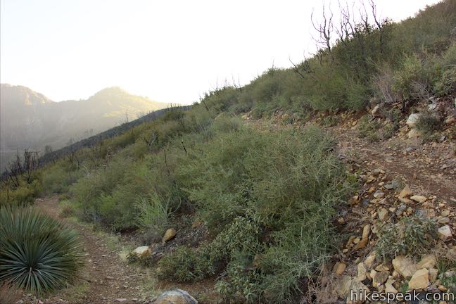
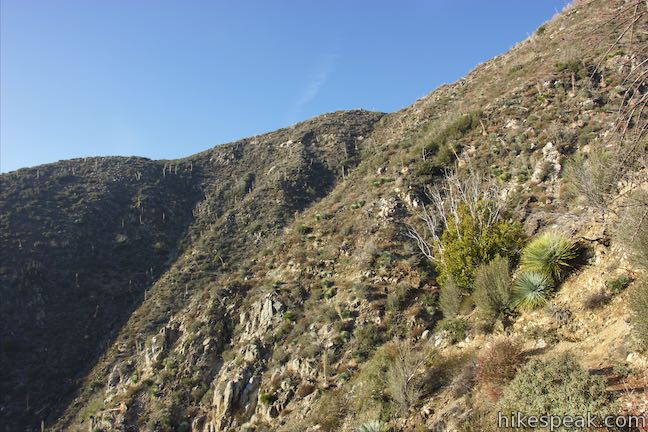
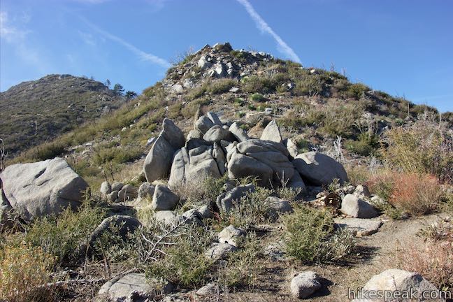
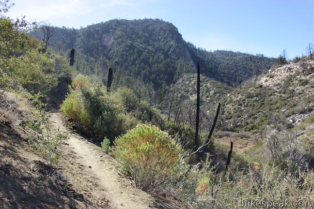
Turn left off Strawberry Peak Trail and find the path going over a crest on the ridge and farther up the mountain. Cross the bump and then a dip and continue to climb. Unfortunately, there are several points where the trail gives up hard-earned elevation to drop across depressions before continuing up the mountain. Yucca, sage, and other low plants dominate the landscape. You may choose to use your hands at a couple places to get over boulders that cover the ridge, but the ascent is non-technical.
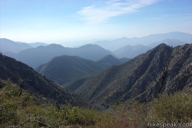
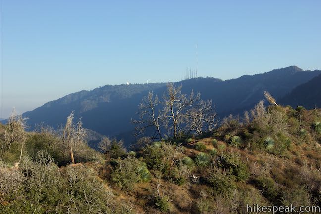
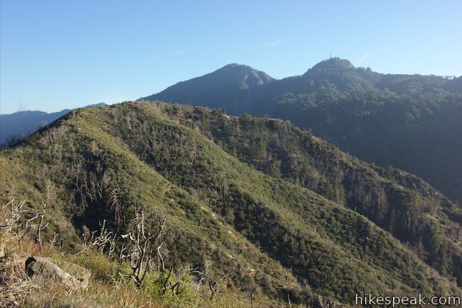
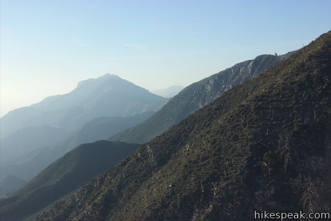
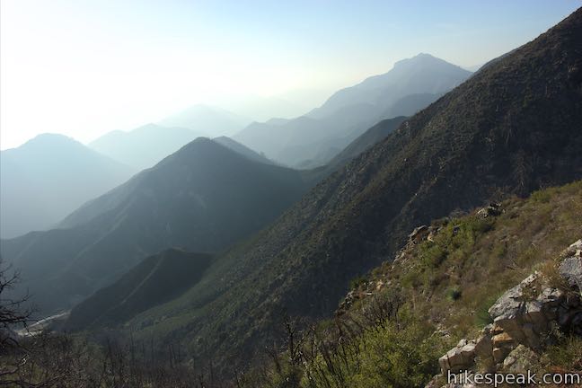
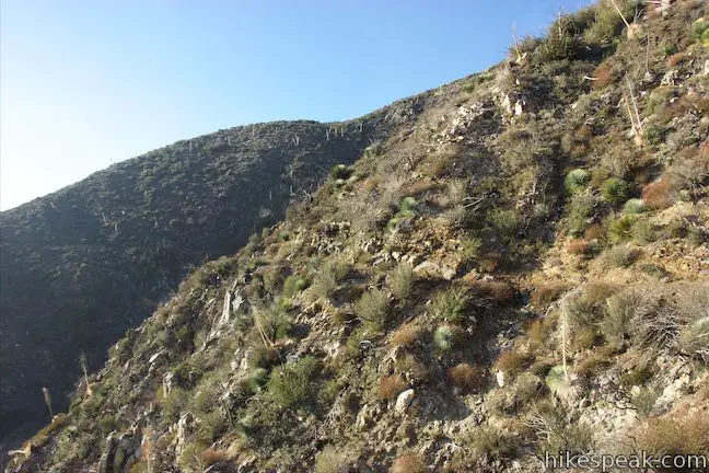
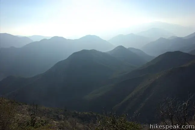
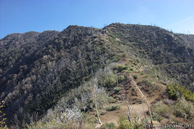
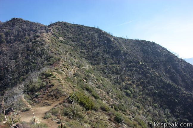
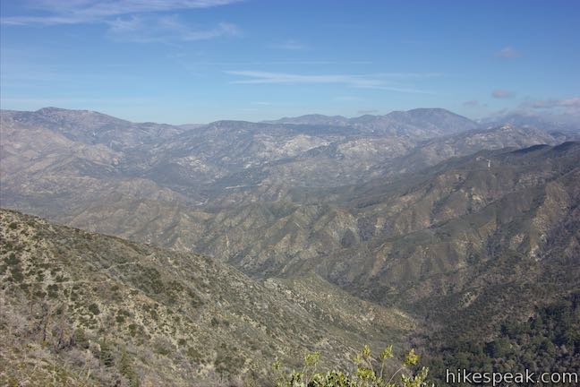
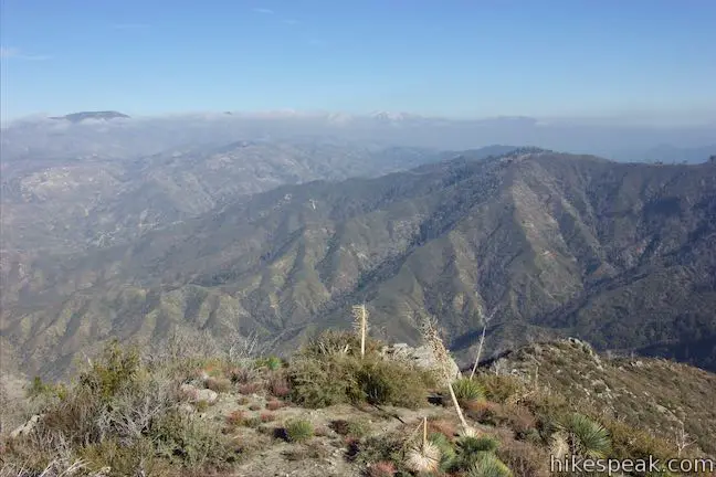
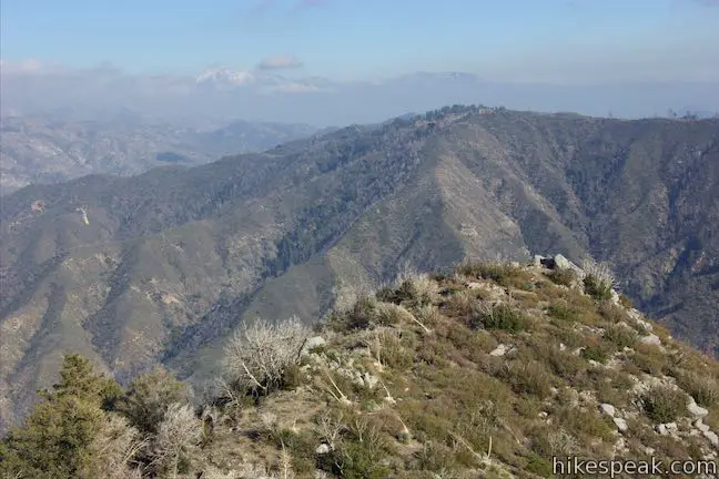
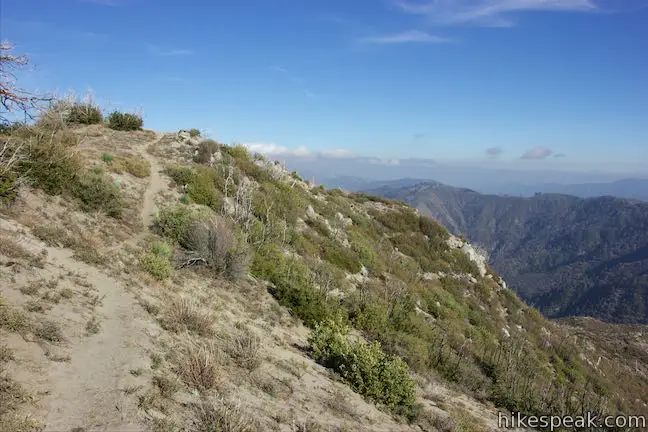
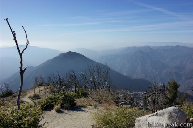
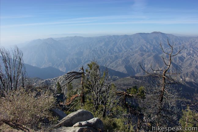
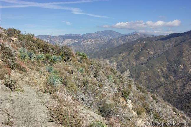
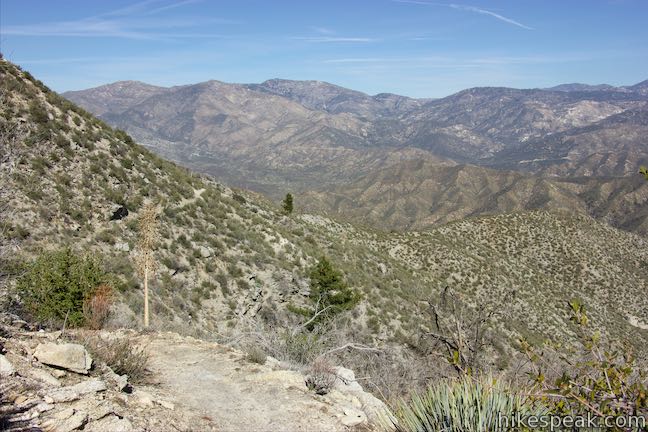
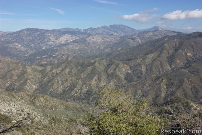
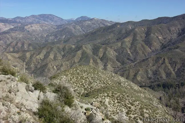
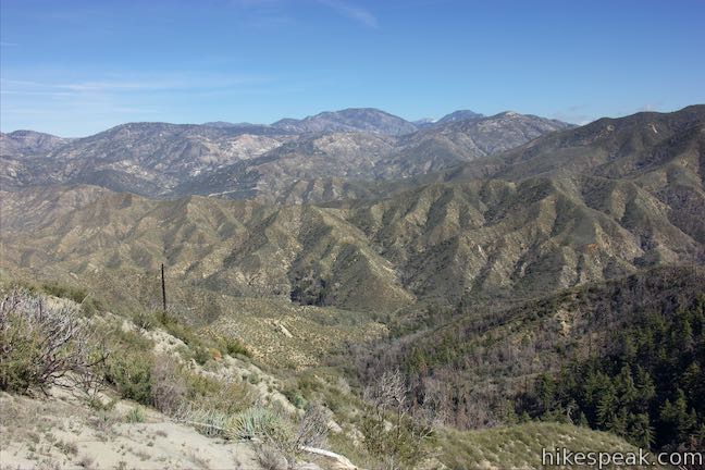
The views looking back down at a shrinking Lawlor Saddle should inspire you forward. Mount Lawlor rises to the east, looking like a worthy ascent of its own. Getting higher up the mountainside, you’ll catch sight of the observatory on Mount Wilson to the southeast. You’ll also find new perspectives north across Big Tujunga Canyon and a broad expanse of the San Gabriel Mountains. There are noticeably less vegetation on the ridges to the north on the more arid side of the range.
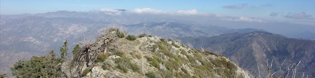
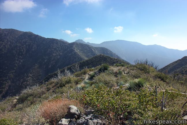
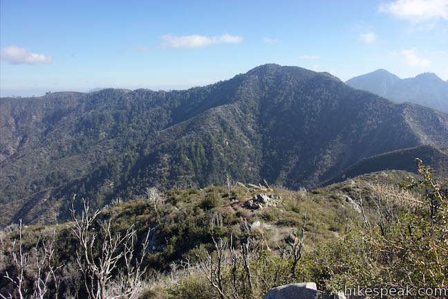
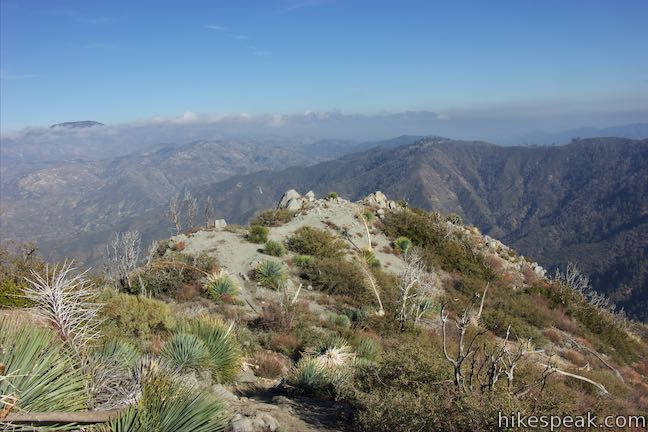
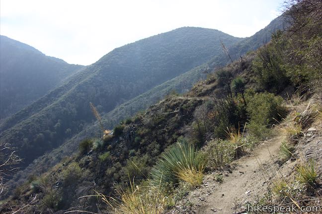
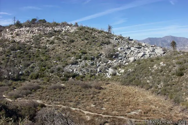
The route breaks up into smaller paths at points, becoming temporarily hard to follow. Keep heading up the ridgeline and you’ll stay on course. Eventually, the trail comes up alongside a false summit east of the actual peak. Catch your breath from the effort and walk across a shallow dip to the actual peak.
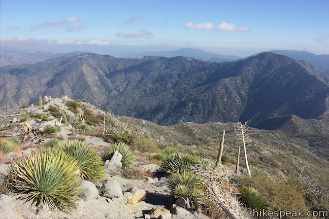
The summit of Strawberry Peak has a small bump surrounded by short brush (most of the larger trees around the peak were destroyed by the Station Fire). To the west, a trail descends to Josephine Saddle. This trail is a mountaineering route, tackling some sheer cliffs on the west side of the mountain.
Supposedly, Strawberry Peak got its name for resembling a stem-down strawberry, a shape imaginative hikers may be able to identify when gazing at Strawberry Peak from the south in Colby Canyon. This could also be called Strawberry Peak for its sweet summit views, which shouldn’t take any imagination to appreciate.
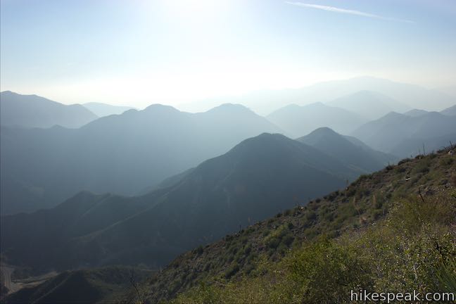
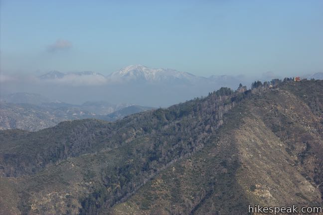
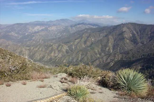
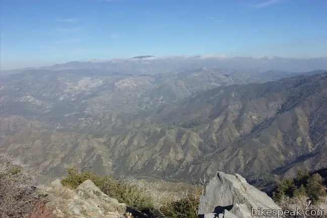
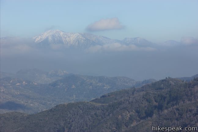
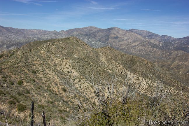
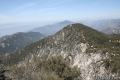
Gaze north and northwest across Big Tujunga Canyon, a wide divide in the San Gabriels. Look east toward snowcapped mountains like Mount Baldy, the highest mountain in the range. Josephine Peak rises to the west, followed by Mount Lukens and shorter peaks as the range drops toward Los Angeles. Colby Canyon runs south from Strawberry Peak to Angeles Crest Highway, which roughly follows the canyon carved by Arroyo Seco to travel out of the mountains to La Cañada Flintridge. Look down this gap in the mountains toward the cities below. Unless conditions are hazy, you’ll have a good perspective of the skylines of Glendale and downtown Los Angeles. Maybe the ocean will be visible as well.
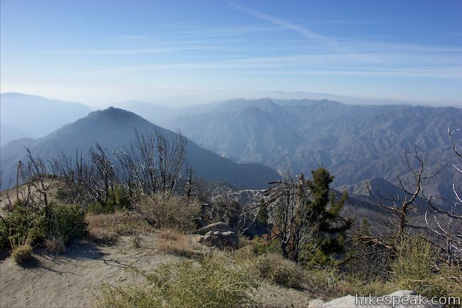
The 6,164-foot summit’s views are excellent, so take some time to enjoy them, especially given the effort it took to get up here. Hike down the way you came, descending 950 feet over 1.25 miles to Lawlor Saddle and another 560 feet over 2.5 miles down to Red Box Station to complete this 7.5-mile round trip hike. Of course, you could extend the outing by hiking farther north on Strawberry Peak Trail to Strawberry Meadow.
Lawlor Saddle to Strawberry Meadow
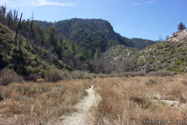
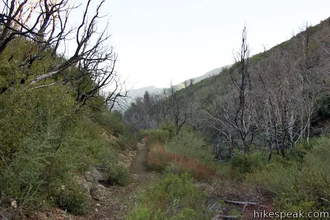
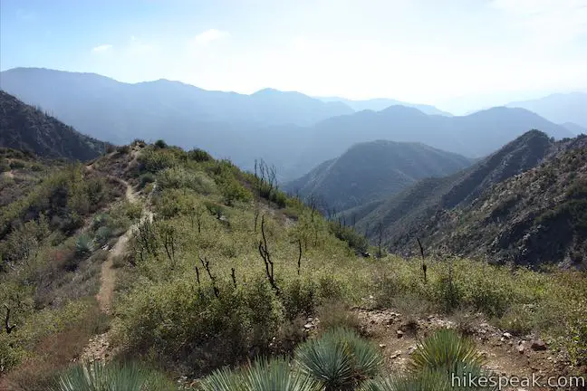
Beyond Lawlor Saddle, Strawberry Peak Trail goes gradually downhill across slopes on the east side of Strawberry Peak. Start with views of Mount Lawlor, rising to the east above the top of Wickiup Canyon, which drops to the north toward Big Tujunga Canyon. Wrap around the side of the canyon and lose sight of Lawlor Saddle after 3/4 of a mile. Don’t be concerned about this lost vantage as you’ll get a lot more to look at, facing out toward Big Tujunga Canyon, which forms a deep east-west gap in the terrain to the north.
The trail continues around the northeast side of Strawberry Peak, coming down to a horseshoe bend to the left, 1 2/3 miles from Lawlor Saddle. Below the turn, the trail drops from a ridge and this spot has the feel of a scenic overlook with grand views down the ridge into Big Tujunga Canyon.
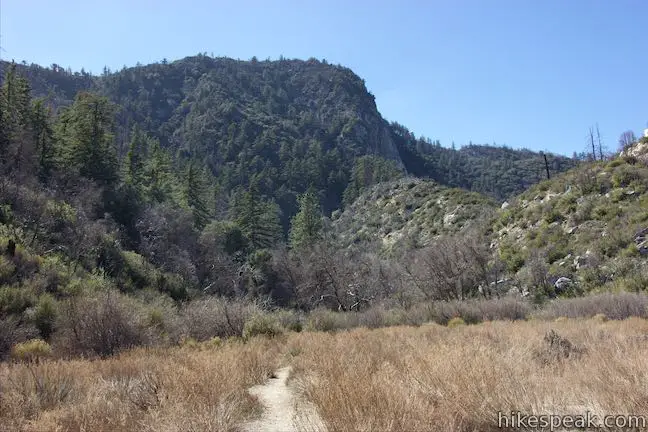
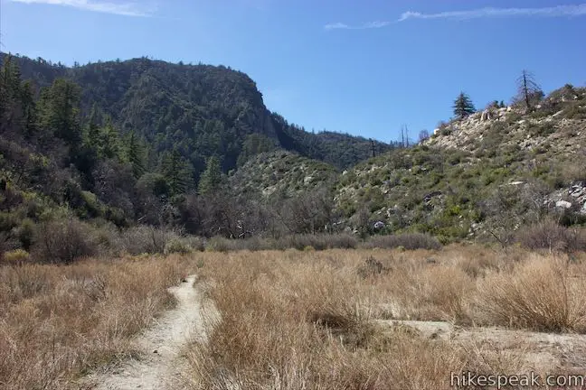
The trail now descends toward Strawberry Meadow, which you’ll see below the ridge to the east, looking a bit like a landscape transplanted from somewhere in the Sierra Nevada Mountains. Strawberry Meadow lies below a cliff of granite on the north side of Strawberry Mountain that must be 400 feet tall. The grand cliff face gets more impressive when you get underneath it.
Strawberry Meadow
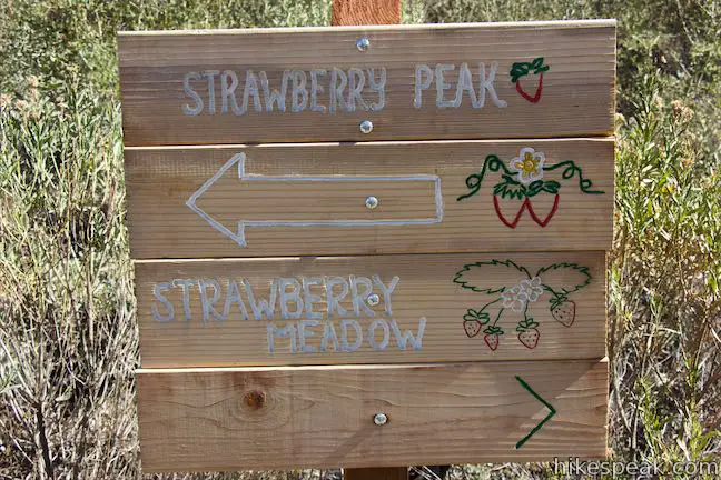
At 1.85 miles from Lawlor Saddle and 4.35 miles from Red Box Station, Strawberry Peak Trail comes to a junction with Colby Canyon Trail. The junction is marked by a trail register and a nice wood sign with painted strawberries. On your right, a trail continues down to Colby Ranch. Bear left to walk into Strawberry Meadow, which lies just beyond a gap in the terrain.
Go up Colby Canyon Trail into a meadow that is backed by the north face of Strawberry Peak. The meadow is about a tenth of a mile long. Leaving it, the trail passes through a thicket before venturing up a boulder-strewn gap to another flat area. This spot has tall pines and grassy openings that would be good for stretching out for a picnic. Look up through the trees for a daunting view of the granite cliffs.
A large boulder in this area has “trail” painted on it in large red letters with an arrow. The boulder is 0.8 miles up from the Colby Canyon Trail – Strawberry Peak Trail Junction and makes a nice turnaround point if you are heading back on Strawberry Peak Trail, resulting in a 10.3-mile out and back trek.
Ahead, Colby Canyon Trail wraps around Strawberry Peak for another 2.45 miles up to Josephine Saddle, located on the west side of Strawberry Peak near Josephine Peak. From there, Colby Canyon Trail descends 2.25 miles down Colby Canyon to a trailhead on Angeles Crest Highway not far from Switzer Picnic Area. A through hike on Strawberry Peak Trail and Colby Canyon Trail to Strawberry Meadow is a possibility.
Poodle-dog Brush Warning: Avoid the poodle-dog bush (Turricula parryi) that became abundant after the 2009 Station Fire, but is now easy to stay away from. Poodle-dog brush can irritate skin and cause itching, rashes, and blisters. Do not touch poodle dog-brush (or its purple trumpet-shaped flowers). After your hike, wash exposed areas with cold running water and wash any clothes that may have touched these plants. Symptoms may take 12 to 36 hours to appear and can be similar to poison oak. Wearing long pants is recommended. The Sierra Club did excellent work rebuilding Strawberry Peak Trail after the Station Fire, which should allow you to keep your distance from most of the poodle-dog brush.
To get to the trailhead: From the 210 Freeway in La Cañada Flintridge, take Angeles Crest Highway (CA 2) northwest for 13.8 miles (4.1 miles past the turnoff for Switzer Picnic Area) to an intersection with Mount Wilson Road Box Road. Turn right and pull into the parking area at Red Box Picnic Area, which is next to the intersection. From the picnic area, walk east and cross the road to the start of the trail next to mile marker 38.42.
Trailhead address: Angeles Crest Highway & Mount Wilson Red Box Road, Angeles National Forest, Altadena, CA 91001
Trailhead coordinates: 34.2581, -118.1049 (34° 15′ 29.15″N 118° 06′ 17.64″W)
View Strawberry Peak in a larger map
Or view a regional map of surrounding Los Angeles trails and campgrounds.
Strawberry Peak Trail to Lawlor Saddle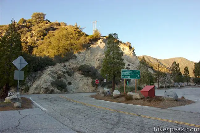


Lawlor Saddle to Strawberry Peak


Lawlor Saddle to Strawberry Meadow


 | Colby Canyon Trail to Josephine Peak This 8.7-mile hike ascends an infrequently visited canyon off Angeles Crest Highway up to a saddle below Strawberry Peak and then takes a wide dirt road up to a summit in the front range of the San Gabriel Mountains with 360-degree over Big Tujunga Canyon and cities to the south. |
 | Strawberry Meadow This 9 to 11-mile hike goes around Strawberry Peak to a remote and scenic flat below a massive cliff on the north side of the peak, offering views of Big Tujunga Canyon and several mountains along the way. |
 | San Gabriel Peak from Mount Lowe Road This 6,161 foot peak is also reachable via a 3.2-mile round trip trail from Eaton Saddle. |
 | San Gabriel Peak from Mount Disappointment Fire Road This 6,161 foot peak is reachable via a 4-mile round trip hike from Mount Disappointment Fire Road. |
 | Inspiration Point & Mount Lowe Trail Camp This 7.25-mile round trip hike descends Mount Lowe Road into the San Gabriel Mountains to a historic scenic overlook and a trail camp built on interesting ruins. |
 | Switzer Falls This 4.5-mile hike starts out above and finishes below a 50-foot tall waterfall. |
 | More trails in the San Gabriel Mountains Explore other destinations in the range. |
Common Questions about Strawberry Peak Trail in the San Gabriel Mountains
- Is the trail open?
- Yes. You should expect to find that Red Box Saddle to Strawberry Peak is open. There are no recent reports of trail closures. If you discover that the trail is closed, please help your fellow hikers by reporting a closure.
- Do I need a permit for this hike?
- Yes. National Forest Adventure Pass.
- How much time does this hike take?
- It takes approximately 4 hours to hike Red Box Saddle to Strawberry Peak. Individual hiking times vary. Add extra time for breaks and taking in the views.
- How long is this hike?
- The hike to Red Box Saddle to Strawberry Peak is a 7.5 mile out and back with 1510 feet of elevation change.
- Are dogs allowed on this trail?
- Yes, dogs are allowed on Red Box Saddle to Strawberry Peak. The trail is open to hikers, dogs, bikes.
- Does this trail go to a summit?
- Yes, Red Box Saddle to Strawberry Peak reaches a summit with panoramic views.
- What mountain range is this trail in?
- Red Box Saddle to Strawberry Peak is located in the San Gabriel Mountains.
- Where is the trailhead located?
- The trailhead for Red Box Saddle to Strawberry Peak is located in Altadena, CA.
Trailhead Address:
Angeles Crest Highway
Altadena, CA 91001
Trailhead Coordinates:
34.2581, -118.1049 - What are the driving directions to the start of the hike?
- To get to the trailhead: From the 210 Freeway in La Cañada Flintridge, take Angeles Crest Highway (CA 2) northwest for 13.8 miles (4.1 miles past the turnoff for Switzer Picnic Area) to an intersection with Mount Wilson Road Box Road. Turn right and pull into the parking area at Red Box Picnic Area, which is next to the intersection. From the picnic area, walk east and cross the road to the start of the trail next to mile marker 38.42.
View custom Google Maps directions from your current location. - Are there other trails near Red Box Saddle to Strawberry Peak?
- Yes, you can find other nearby hikes using the Hikespeak Hike Finder Map.

Topel maps can help out a new hiker with arrows and names and miles from point to point
Is there a downloadable .GPX for this trail?
Hi –
That is not available from this website at this time. Perhaps in the future. Thanks for your interest.
[…] Strawberry Peak is the highest peak in the front range of the San Gabriel Mountains, and includes a steep ridgeline scramble to the summit. The 6,164′ summit rewards your scrambling skills with some sweet summit views. […]
I did this trail from Red Box to Lawlor saddle last week. There was still lots of snow from the recent storms, so the trail was slick in some places. The views were amazing; the sun off the ocean made it hard to look at. I plan to go back soon to bag the peak.
Sounds like you got to enjoy some special conditions. Oh the beautiful San Gabriels…
I’m doing the six Peak challenge is there a sign at the peak because Mount Wilson didn’t have one or what should we use to prove we where there ?
There is an alternate route up Strawberry Peak from Colby Canyon but it involves some 3rd class rock climbing–two pitches; one about 200′ and a second of about 700′. “Third class” means that hand and foot hods must be used but are large, obvious, and easy to reach so that technical equipment such as
rope belays, rope anchors (chocks, pitons and camming devices), carabiners and climbing harnesses are
not needed under normal conditions but should be carried for emergencies such as high winds or ice on the rocks making the hand and footholds slippery since there is some exposure. Some climbing texts recommend that inexperienced climbers should be belayed on third class. Fourth and fifth class climbs require rope belays for most climbers.