Salt Creek
in Death Valley National Park
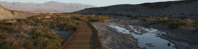
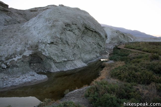
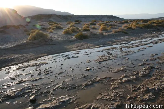
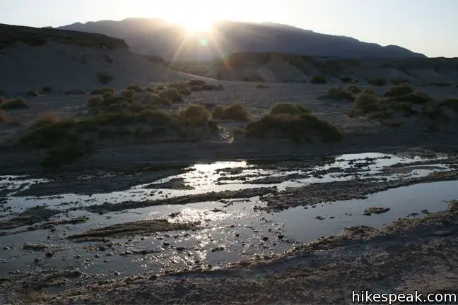
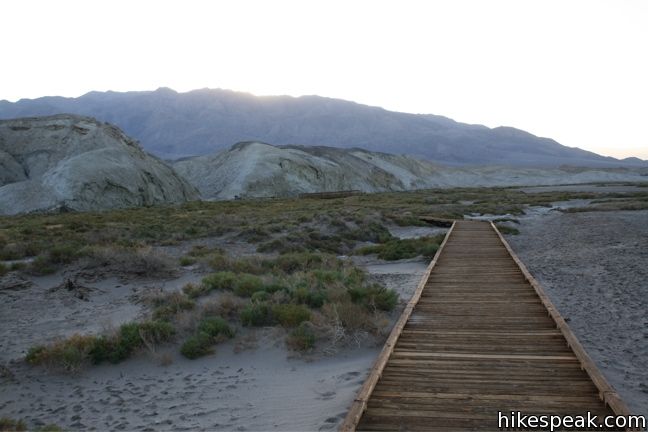
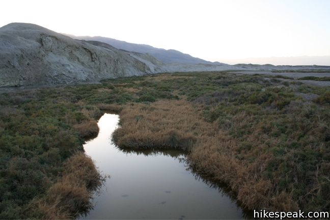
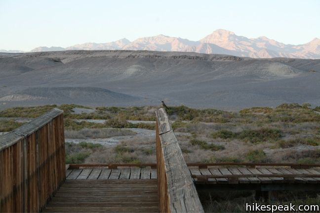
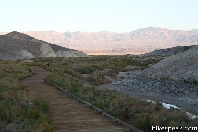
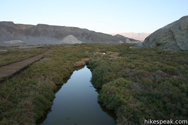
Salt Creek Interpretive Trail is a level, 1-mile long boardwalk loop along what would be considered a pitiful creek anywhere outside of Death Valley National Park. Here it is extraordinary! The salinated stream is home to the Salt Creek Pupfish, a unique and bizarre creature that can survive in these harsh conditions. The small fish is most visible in these waters in the spring.
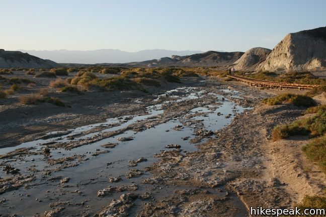
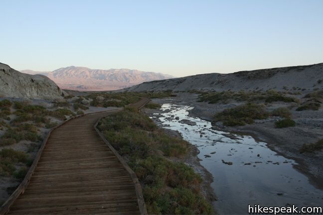
This short easy stroll is suitable for visitors of all abilities. You won’t find trees lining the banks of Salt Creek, only low-lying brush that the boardwalk rises above. A quarter mile up the level and easy trail bordering Salt Creek, you will come to a split. Turn left or right to go through the trail’s loop. Stick to the boardwalk and you can’t get lost. Salt Creek Trail is a 1-mile long lollipop loop with minimal elevation change.
Death Valley National Park has an entrance fee, but no permit is required to hike Salt Creek Trail, so get out and enjoy!
Directions to the Trailhead
- From Furnace Creek drive 13 miles northwest along Highway 190 and turn left down a marked dirt road for Salt Creek.
- Take this road for one mile until it ends at the trailhead.
Trailhead Location
Trailhead address: Unnamed Road off Highway 190, Death Valley National Park, CA 92328
Trailhead coordinates: 36.5906, -116.9906 (36° 35′ 26.2″N 116° 59′ 26.2″W)
You may also view a regional map of surrounding California Desert trails and campgrounds.

 | Harmony Borax The ¼ mile walk around the Harmony Borax plant offers a window into the mining past of Death Valley. |
 | Grotto Canyon This 2 to 4 mile hike requires a bit of climbing and is a lesser-visited trail in Death Valley. |
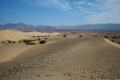 | Mesquite Flat Sand Dunes This 1 + mile hike explores the most visible (but not the largest) sand dunes in Death Valley. |
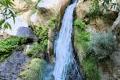 | Darwin Falls This 2-mile hike visits a refreshing year-round waterfall on the western edge of Death Valley. |
 | Death Valley Explore more destinations in Death Valley National Park. |
 | Death Valley Campgrounds Nine campgrounds are spread throughout this large park to facilitate your visit. |
Common Questions about Salt Creek in Death Valley National Park
- Is the trail open?
- Yes. You should expect to find that Salt Creek Boardwalk is open. There are no recent reports of trail closures. If you discover that the trail is closed, please help your fellow hikers by reporting a closure.
- Do I need a permit for this hike?
- Yes. National Park Entrance Fee.
- How much time does this hike take?
- It takes approximately 30 minutes to hike Salt Creek Boardwalk. Individual hiking times vary. Add extra time for breaks and taking in the views.
- How long is this hike?
- The hike to Salt Creek Boardwalk is a 1 mile loop with 25 feet of elevation change.
- Are dogs allowed on this trail?
- No, dogs are likely not allowed on Salt Creek Boardwalk. The trail is primarily open to hikers.
- Is Salt Creek Boardwalk good for kids?
- Yes, this hike is likely suitable for children. It is relatively short (1 miles) with manageable elevation gain.
- Where is the trailhead located?
- The trailhead for Salt Creek Boardwalk is located in Death Valley National Park, CA.
Trailhead Address:
Highway 190
Death Valley National Park, CA 92328
Trailhead Coordinates:
36.5906, -116.9906 - What are the driving directions to the start of the hike?
To get to the trailhead: From Furnace Creek drive 13 miles northwest along Highway 190 and turn left down a marked dirt road for Salt Creek. Take this road for one mile until it ends at the trailhead.
View custom Google Maps directions from your current location.
- Are there other trails near Salt Creek Boardwalk?
- Yes, you can find other nearby hikes using the Hikespeak Hike Finder Map.

Go the extra miles...
Submit a rating of this hike to go with your comment. Contribute to the average trail rating.