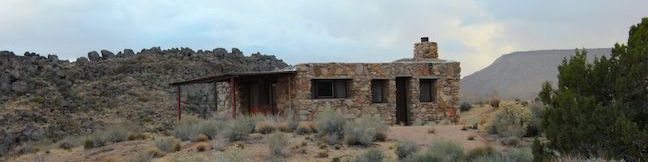
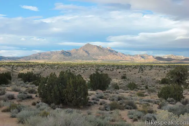
Water is something you don’t see much of in Mojave National Preserve, certainly not just pooling on the ground as it does at Rock Spring. The constant source at Rock Spring helped inhabitants survive in the Mojave Desert for thousands of years and was even the site of a small U.S. Army post in the 1860s. Today you can reach the spring easily, along with a Rock House built in the 1920s and the ruins of a mill used by miners, on a 1 1/3-mile loop with 100 feet of elevation change that also features panoramic desert views.
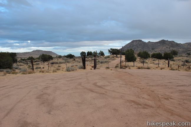
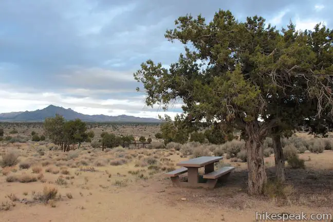
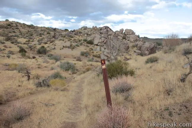
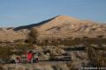
At first glance, the desert can seem like a big empty place, but there is a lot to see on this short loop. Start from a parking area off Cedar Canyon Road in a remote but relatively central area of Mojave National Preserve. Pass through a gate and walk up a driveway toward the Rock House. A sign reading “come on up!” lets you know that you’re welcome. There is also a table beneath a juniper tree on the left side of the trail, where you can sit for a picnic.
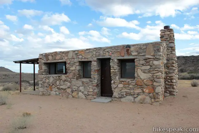
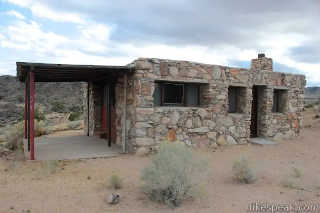
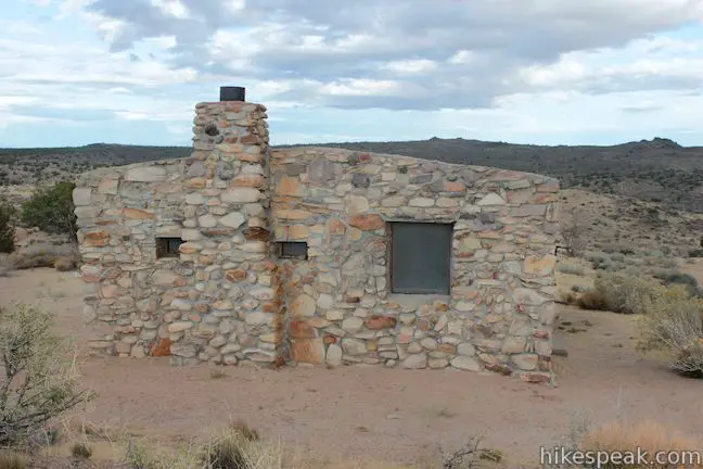
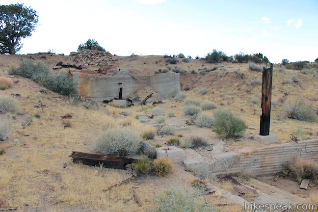
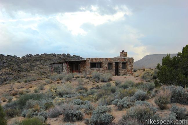
After a tenth of a mile, you will reach the Rock House, a cabin with walls made of rocks collected nearby. Beyond the house to the south, you will see similar colored boulders on the hill that rises above Rock Spring, farther to the southwest, you’ll also spot the flat summit of Table Top Mountain. The Rock House was built in 1929 by a man recovering from an exposure to poison gas during the First World War, as a panel outside the house explains:
While fighting in Europe during World War I, Bert Smith was exposed to poison gasses used during that war. Returning to the U.S. with scarred lungs, Bert eventually moved to the Mojave Desert in the late 1920s. When Bert built his Rock House and started living here in 1929, it was a desperate attempt to regain his health. Although he expected to survive only a short time, he lived here until 1954 – 25 years!
Maybe there was something in the water?
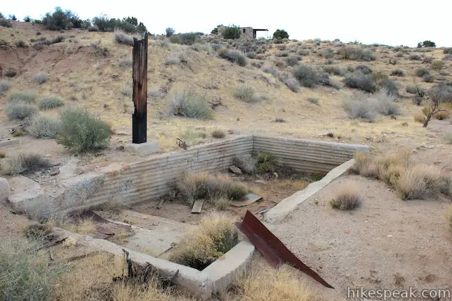
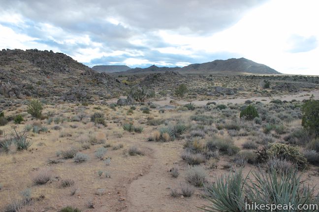
The loop trail to Rock Spring begins on the right side of the Rock House. The dirt track heads south across the desert for 0.15 miles to the ruins of a miners’ mill. The mill was used briefly in the 1930s when prospectors crushed rocks from nearby Watson Wash to release copper ore. Like so many desert mines, the prospect proved unproductive and was abandoned.
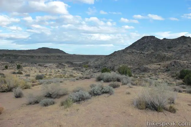
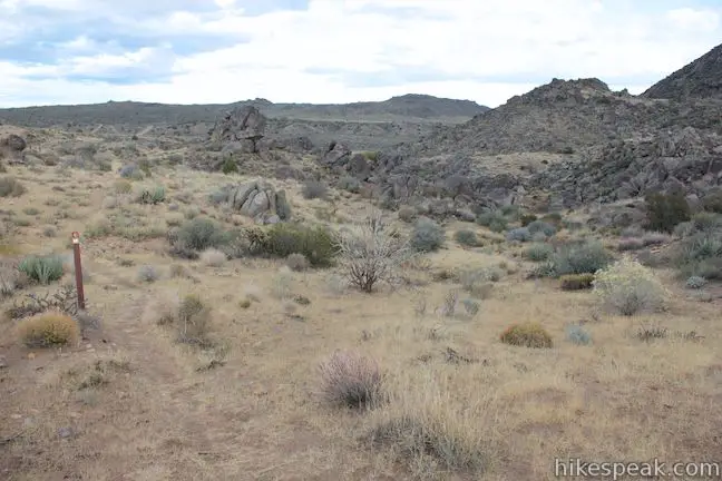
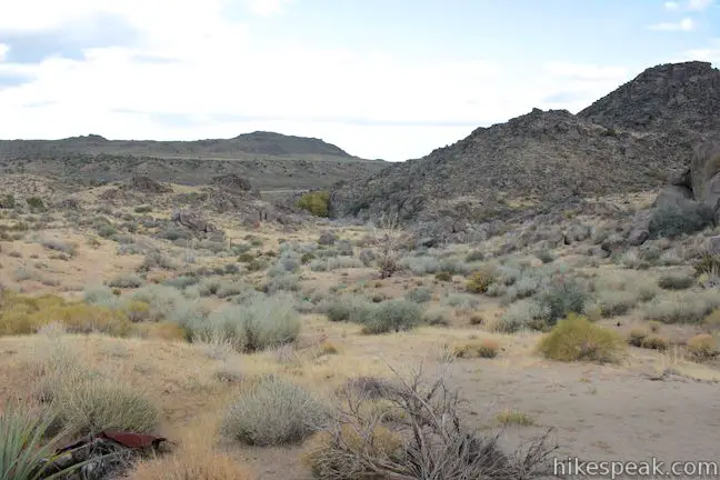
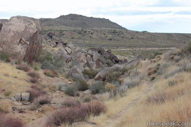
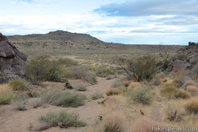
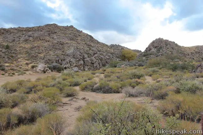
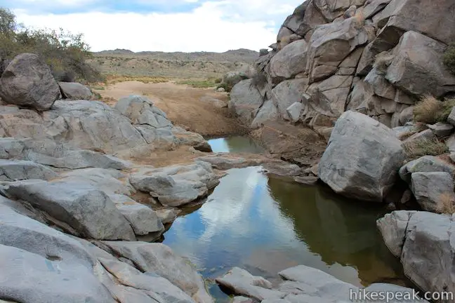
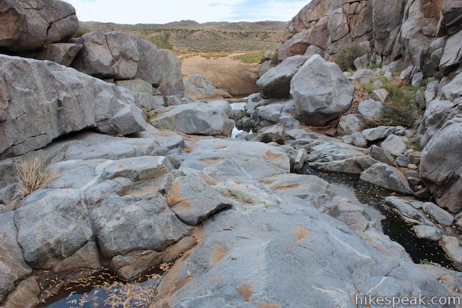
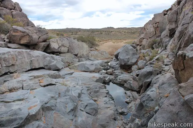
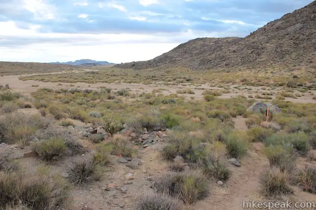
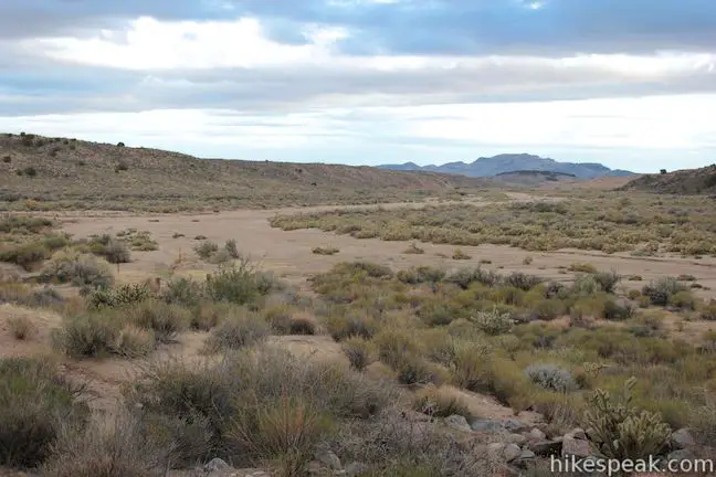
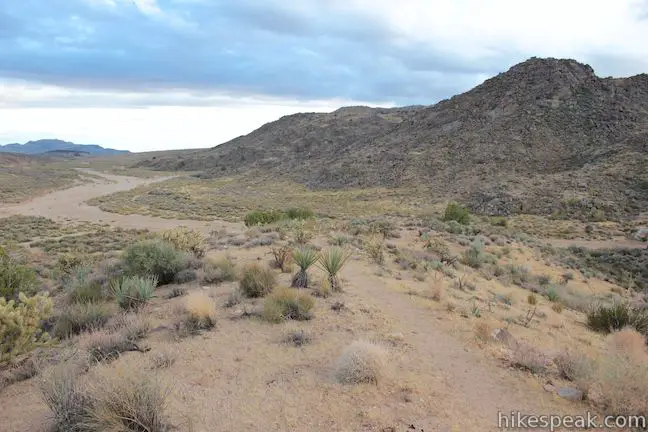
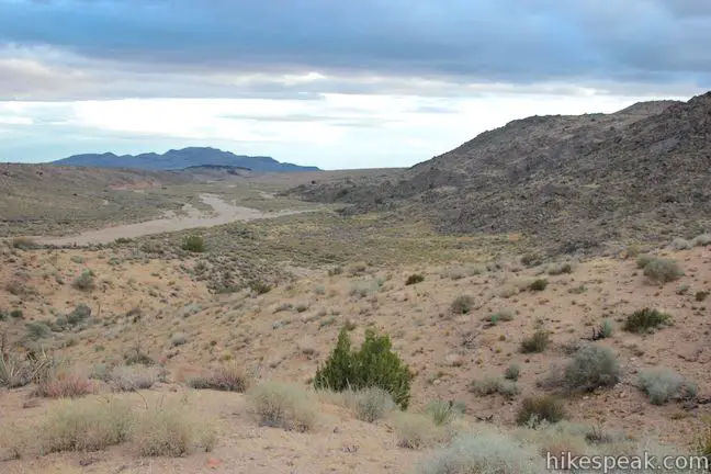
Continue down the trail and you will pass through a cattle fence after another 0.05 miles. The trail drops into a ravine bordered by dark boulders. At the bottom of the ravine, 0.5 miles from the start, you will reach a junction at the edge of Watson Wash. The loop trail continues to the left, but first turn right to reach Rock Spring.
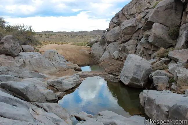
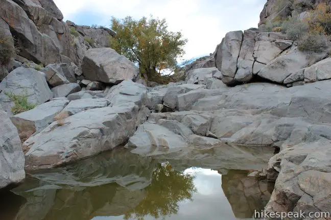
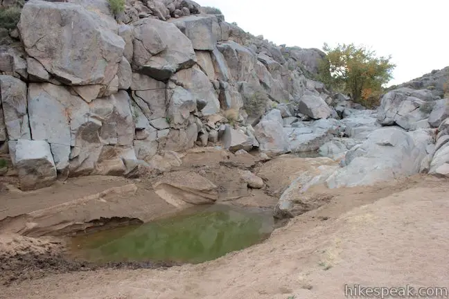
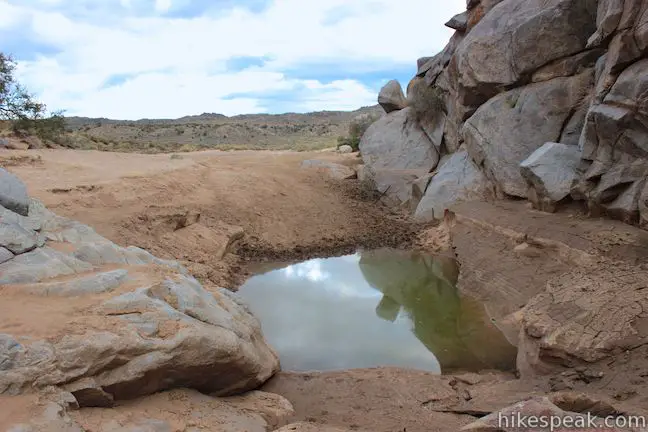
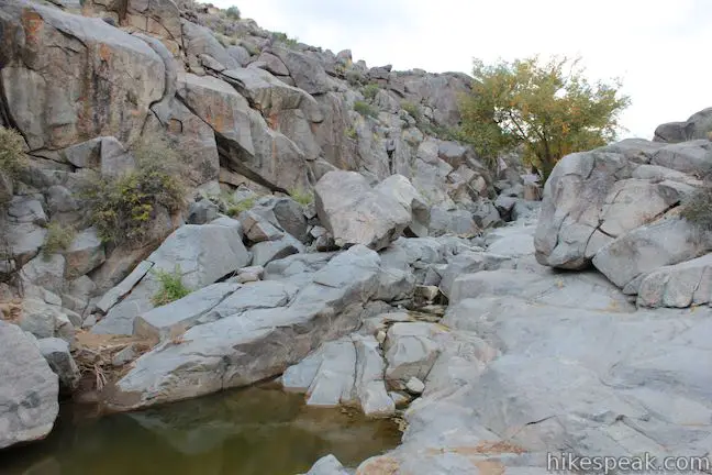
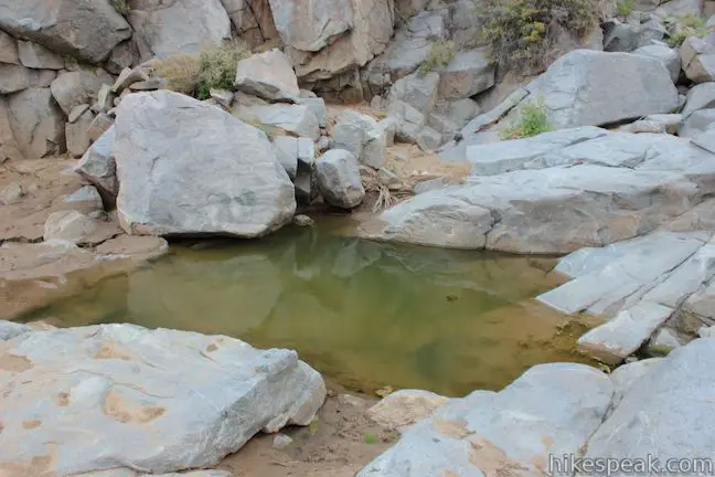
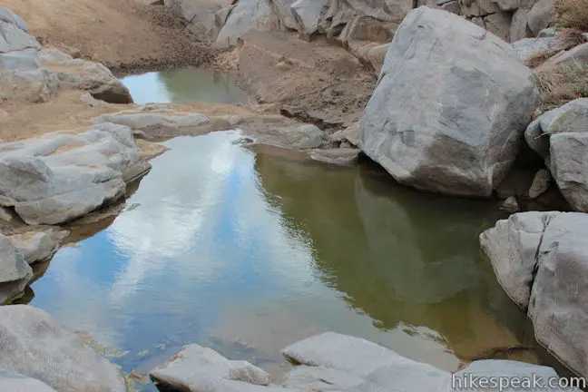
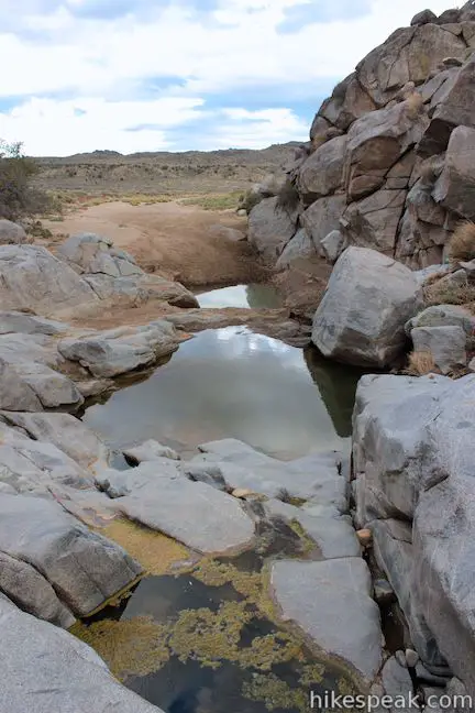
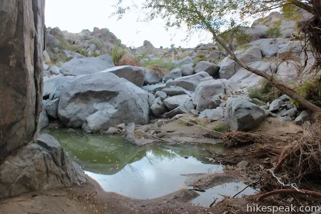
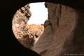
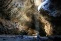
In a few hundred feet you will spot the spring, set beneath stone cliffs in a small canyon off Watson Wash. You should see water pooling around the rocks, although at times the spring can appear dry. Venture up the rocky canyon to find a string of stagnant pools. None of the water looks too appealing to drink today (unless there is a stream from recent rain), but in the past Rock Spring was a rare source of desert salvation, as a panel explains:
For thousands of years, Rock Spring was a crucial link in a chain of springs that allowed early travelers to cross the unforgiving desert. American Indians, then miners, then cowboys – all stopped here to quench their thirst and rest before moving on.
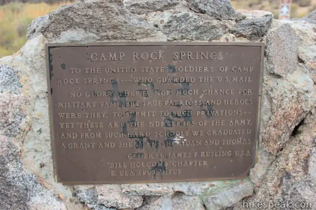
When you are ready to move on yourself, walk back out from Rock Spring to the loop trail and continue east toward Watson Wash. In just a couple hundred feet you will pass a panel at the site of Camp Rock Spring, a briefly established U.S. Army post. The panel explains:
This is the site of Camp Rock Spring, a U.S. Army post established in the late 1860s after gold and silver were discovered in the Arizona Territory and Prescott became its capital. The citizens of Prescott needed dependable mail service because all supplies and manufactured good for the area came from California. The Army set up a string of posts to protect this mail-and-supply route on the Mojave Road.
Camp Rock Spring closed after just 17 months, when the mail-and-supply route was shifted to a new road farther to the south.
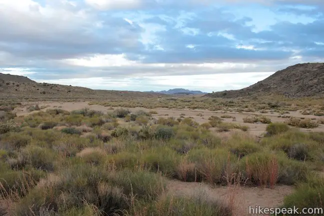
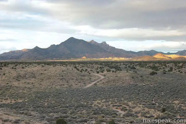
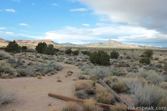
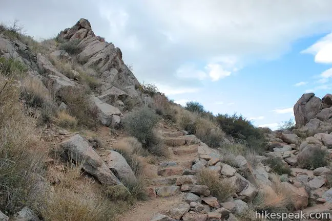
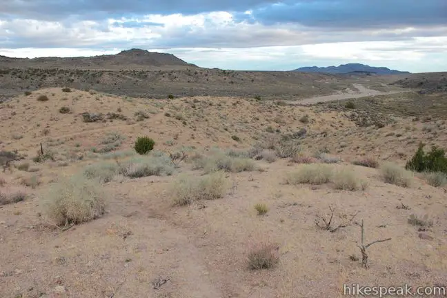
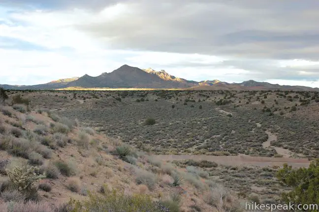
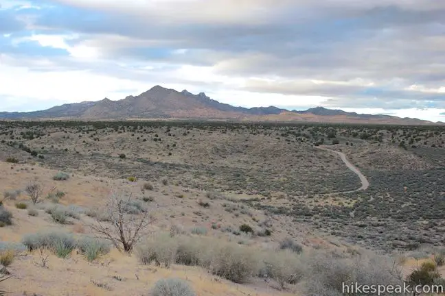
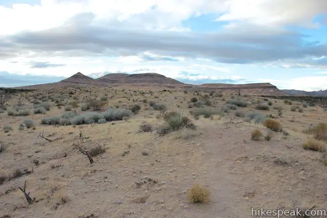
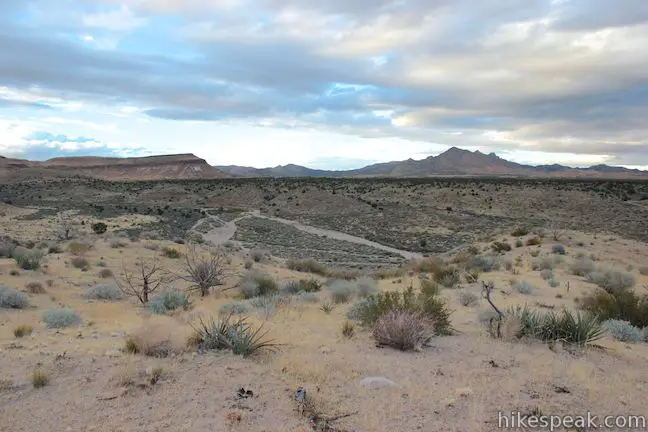
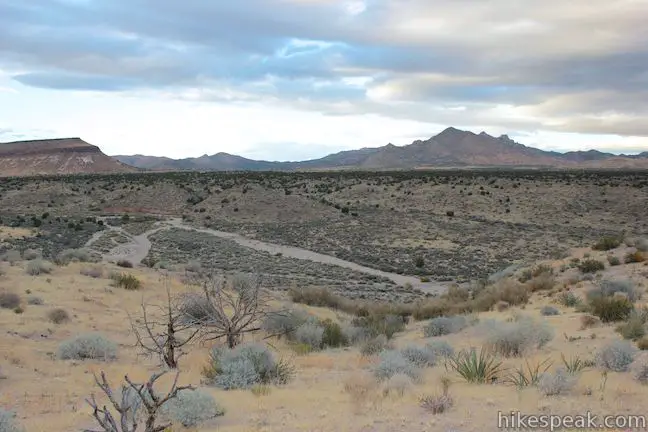
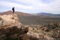
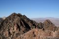
A few hundred feet farther down the trail, you will find a plaque built into a rock honoring the men who served at Cap Rock Spring. Just past the plaque, Rock Spring Loop Trail turns left and climbs above Watson Wash. The trail ascends a round ridge and delivers broad views up and down the desert wash. The Hackberry Mountains rise above the wash to the southeast. In the other direction, to the northwest, there are views of nearby Pinto Mountain. The most impressive mountains are farther north up Watson Wash, the New York Mountains, which are one of the larger micro-ranges in Mojave National Preserve. If you’re intrigued by the New York Mountains, you can check out an on and off-trail hike to the summit of New York Peak.
After hiking 0.55 miles past Camp Rock Spring, the trail will return to the Rock House. Turn right and walk a short distance back down the road to the parking area where there is a vault toilet. No fee or permit is required to hike Rock Springs Loop Trail in Mojave National Preserve, so get out and enjoy!
The basic directions for Rock Spring Loop Trail are:
- Hike up a 4X4 road from the parking area toward the Rock House (0 miles)
- Reach the Rock House and start the loop to the right of the house (0.1 miles)
- Pass the miners’ mill site (0.25 miles)
- Reach Watson Wash and turn right at a junction toward Rock Spring (0.5 miles)
- Reach Rock Spring (0.6 miles)
- Return to the junction after exploring Rock Spring and head east (0.65 miles)
- Pass through Camp Rock Spring and take the trail on the left leaving Watson Wash (0.7 miles)
- Complete the loop near the Rock House and turn right to hike back to the trailhead (1.25 miles)
- Return to the trailhead (1.33 miles)
Directions to the Trailhead
- From Barstow, head east on the Interstate 40.
- Take exit 100 and go north up Essex Road.
- After 10 miles, turn right onto Black Canyon Road and continue north for another 19 miles.
- You will pass Hole-in-the-Wall after 10 miles and then the road will go from pavement to dirt.
- At the end of Black Rock Road, turn right on Cedar Canyon Road.
- Drive 4.8 miles east and look for a marked road to Rock Spring on the right.
- Take this dead-end road for half a mile to the trailhead parking area, where there is a gate to prevent vehicles from driving all the way up to the Rock House.
Trailhead Location
Trailhead address: Cedar Canyon Road, Mojave National Preserve, CA 92332
Trailhead coordinates: 35.15502, -115.3348 (35° 09′ 18.1″N 115° 20′ 05.3″W)
You may also view a regional map of surrounding California Desert trails and campgrounds.


 | Hole-in-the-Wall Rings Trail This 1.5-mile loop takes visitors through a landscape of pocketed rocks. Ringbolts allow fun passage through narrow canyons. |
 | Teutonia Peak This 3.4 to 4-mile round trip hike crosses the world's densest Joshua tree forest, passing an abandoned silver mine to reach a rocky summit with views of Cima Dome. |
 | Fountain Peak This 5-mile off trail trek summits a peak with commanding views over the Providence Mountains. |
 | Kelso Dunes This 3-mile round trip hike climbs 470 feet to the highest point in this 45 square mile dune field. |
 | New York Peak This 7 to 9-mile round trip hike summits the highest point of the New York Range in the northeast corner of the preserve. |
 | Silver Peak This 8.5-mile hike summits a 6,365-foot peak in the Granite Mountains. |
 | Lava Tube This short 0.6-mile hike drops below the surface into an old lava tube. |
 | Petroglyphs near Seventeen Mile Point This quarter-mile path visits ancient engravings in the volcanic rock at the western rim of the cinder fields just off Kelbaker Road. |
 | Hikes in the California Desert Explore more trails in Death Valley National Park, Joshua Tree National Park, Anza-Borrego Desert State Park, and Mojave National Preserve. |
 | Mojave National Preserve There are a few campgrounds and endless roadside camping within the preserve. |
Common Questions about Rock Spring Loop Trail in Mojave National Preserve
- Is the trail open?
- Yes. You should expect to find that Rock Spring Loop Trail is open. There are no recent reports of trail closures. If you discover that the trail is closed, please help your fellow hikers by reporting a closure.
- Is this trail free to access?
- Yes, Rock Spring Loop Trail is free to access. No entrance fee, pass, or permit is required. If you discover that access rules have changed, please provide feedback on your experience.
- How much time does this hike take?
- It takes approximately 30 minutes to hike Rock Spring Loop Trail. Individual hiking times vary. Add extra time for breaks and taking in the views.
- How long is this hike?
- The hike to Rock Spring Loop Trail is a 1.33 mile loop with 100 feet of elevation change.
- Are dogs allowed on this trail?
- No, dogs are likely not allowed on Rock Spring Loop Trail. The trail is primarily open to hikers.
- Is Rock Spring Loop Trail good for kids?
- Yes, this hike is likely suitable for children. It is relatively short (1.33 miles) with manageable elevation gain.
- Where is the trailhead located?
- The trailhead for Rock Spring Loop Trail is located in Mojave National Preserve, CA.
Trailhead Address:
Cedar Canyon Road
Mojave National Preserve, CA 92332
Trailhead Coordinates:
35.15502, -115.3348 - What are the driving directions to the start of the hike?
To get to the trailhead: From Barstow, head east on the Interstate 40. Take exit 100 and go north up Essex Road. After 10 miles, turn right onto Black Canyon Road and continue north for another 19 miles. You will pass Hole-in-the-Wall after 10 miles and then the road will go from pavement to dirt. At the end of Black Rock Road, turn right on Cedar Canyon Road. Drive 4.8 miles east and look for a marked road to Rock Spring on the right. Take this dead-end road for half a mile to the trailhead parking area, where there is a gate to prevent vehicles from driving all the way up to the Rock House.
View custom Google Maps directions from your current location.
- Are there other trails near Rock Spring Loop Trail?
- Yes, you can find other nearby hikes using the Hikespeak Hike Finder Map.

What great information, maps and pictures. I think I can find my way to a lot of beautiful places wherever I happen to be. Thanks for the good work –
unfortunately stories like this don’t exist anymore, because your govt. now runs these same people out of the wilderness at the will of the hard line environmentalists , so future Americans cant wonder off into the desert in an effort to rebuild their lives.oh, im sorry i forgot ILLEGALS “undocumented” are trespassing all over OUR deserts, with out reproach !!!!
I lived in the Rock House in the Mojave National Preserve. This would have been in about 1982-84. I replaced the caved-in roof and built new window and door casements and replaced the windows and doors. Also installed the kitchen cabinets and a propane fridge and stove. This was before it became the preserve and was surrounded by BLM land. It was owned by the Eldridges, a local ranching family at that time. I have since written about that experience in a book called The Ogallala Road.
Cool
Amazing place. I just stumbled upon this area this past weekend. The rock house is in great shape.