Quarry Loop in Forrestal Nature Reserve
on Palos Verdes Peninsula
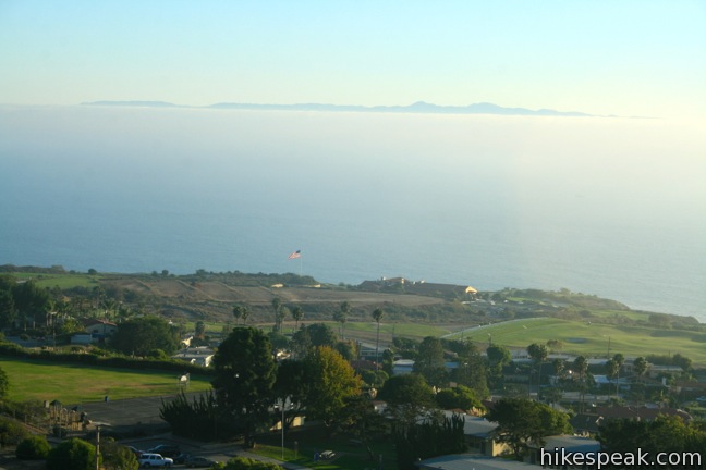
On the southwest side of the Palos Verdes Peninsula, Forrestal Nature Reserve protects 155-acres of green space on the cliffs above the Pacific. Within the park, Quarry Loop circles an old basalt quarry and provides tons of ocean views. The hike combines four trails (Quarry Trail, Basalt Trail, Mariposa Trail, and Pirate Trail) on a short 1.25-mile loop.
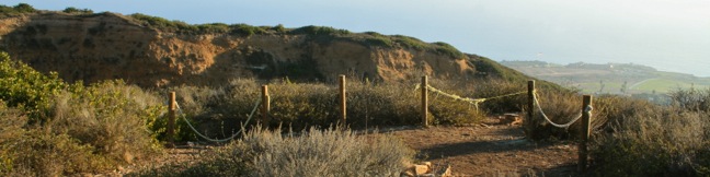
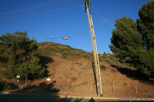
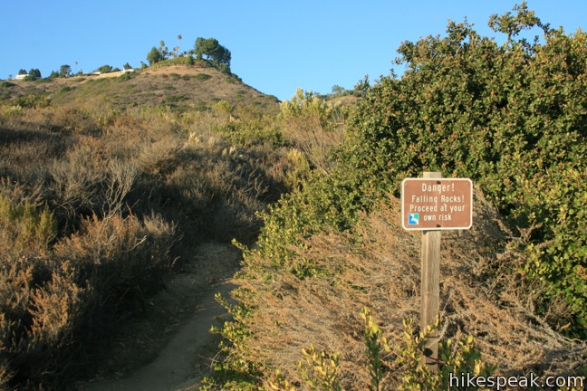
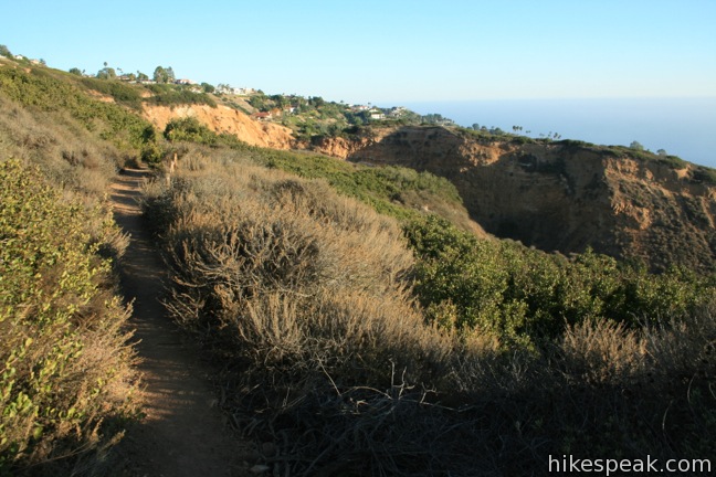
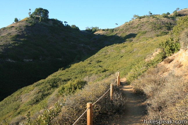
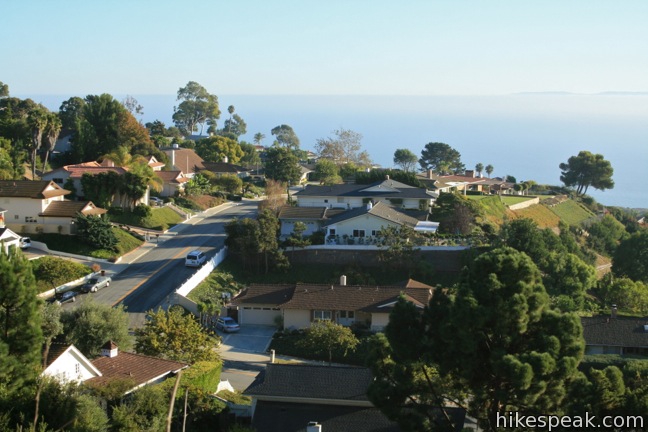
Walk through the yellow gate at the top of Forrestal Drive and look for the trailhead on the right at a gap in the fence (across from the drinking fountains). Hike twenty paces up the dirt single track to a junction where the loop begins. To the right, Pirate Trail climbs 325 feet over 0.3 miles to the high point of the loop. If you head that way, you’ll have to look over your shoulder to enjoy the coastal views. It is better to avoid the steep climb and hike down Pirate Trail after a gradual ascent up Quarry Trail, Basalt Trail, and Mariposa Trail. With this in mind, proceed to the left at the split onto Quarry Trail.
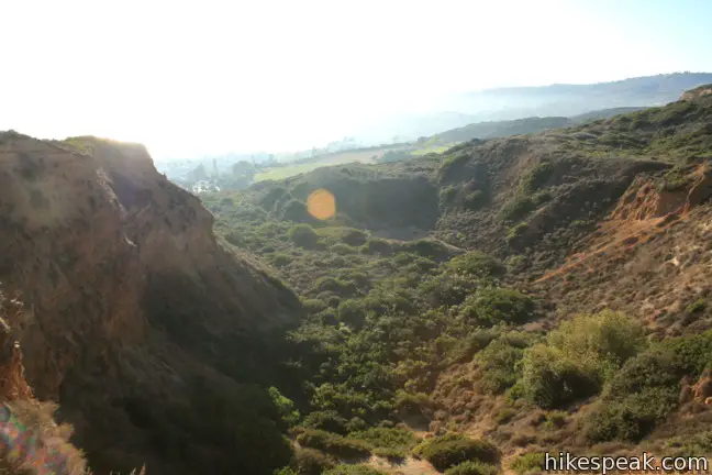
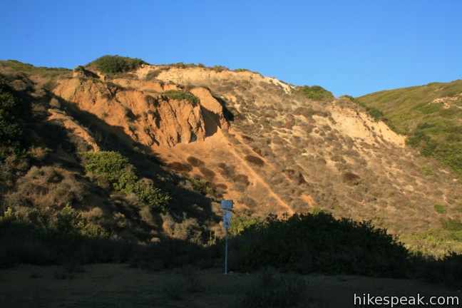
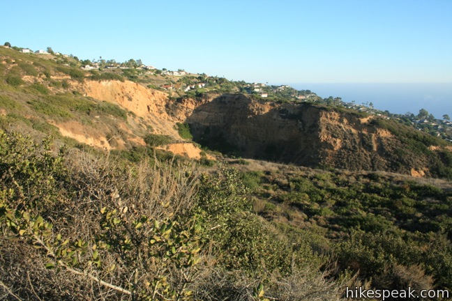
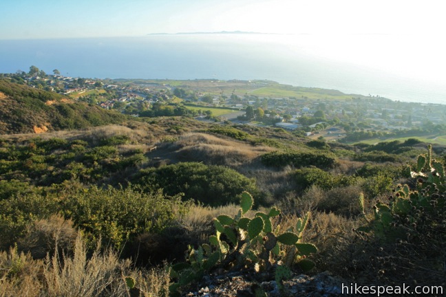
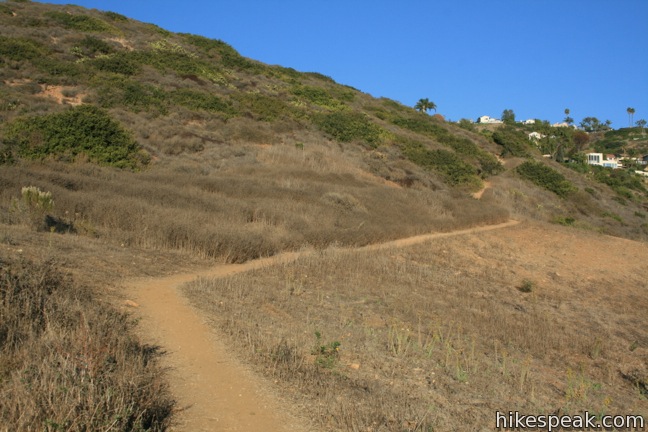
Quarry Trail takes you into a bowl-shaped quarry carved into the hillside. Look up at the steep eroding rock walls – you’ll be hiking on top of them soon. The trail curls out of the center of the old quarry and rises through sagebrush to offer electrifying views up the coast. Quarry Trail transitions into Basalt Trail and reaches a junction with Mariposa Trail, 0.4 miles from the start.
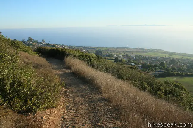
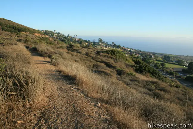
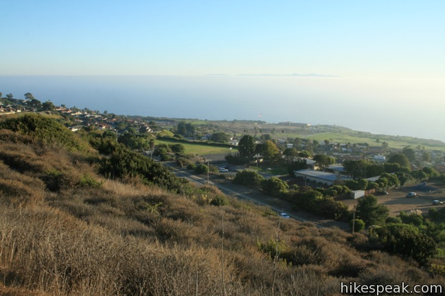
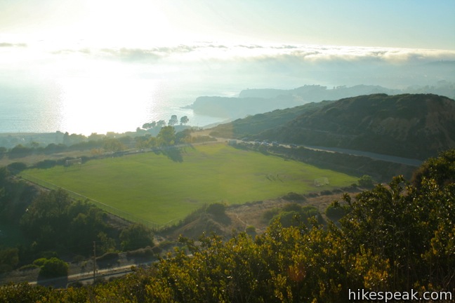
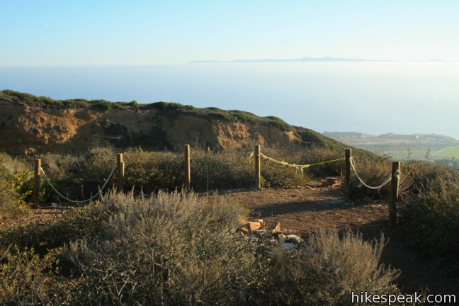
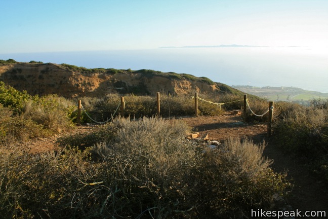
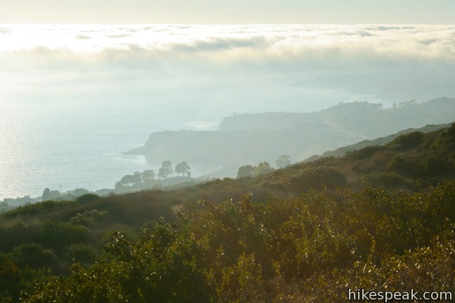
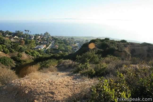
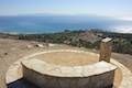
Turn right on Mariposa Trail and ascend to an overlook on the rim of the quarry. Take in the exceptional view of the Palos Verdes coastline before turning inland around the edge of the quarry into a riparian canyon. Cross the perennial stream at the back of the canyon and make a sharp turn toward the east rim of the quarry. As you climb to the high point of the loop, you will be in line for a lofty view of the quarry and the ocean beyond, including a silhouette of Catalina Island.
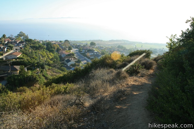
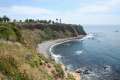
Stay to the left through two quick junctions to descend Pirate Trail and finish out the loop. The trail goes downhill fast, but the views don’t. Pirate Trail offers some of the best ocean vistas of the hike. No fee or permit is required to hike Quarry Loop in Forrestal Nature Reserve. Dogs are welcome, so get out and enjoy!
Directions to the Trailhead
- From Los Angeles take the 405 or 110 Freeway south to the 405-110 interchange near Carson.
- Continue south on the 110 Freeway for 8 miles to the end of the freeway.
- Turn left on Gaffey Street and make the third right on First Street.
- After one mile, turn left on Western Avenue (Route 213) and drive 1.7 miles south to an intersection with West 25th Street.
- Turn right and drive 1.3 miles until 25th Street becomes Palos Verdes Drive.
- Continue another 0.9 miles and turn right on Forrestal Drive.
- Proceed 0.3 miles to the yellow gate at the top of the road and park.
- The trailhead is on the right, just past the gate.
Trailhead Location
Trailhead address: 32323 Forrestal Drive, Rancho Palos Verdes, CA 90275
Trailhead coordinates: 33.73764, -118.347464 (33° 44′ 15.5″N 118° 20′ 50.87″W)
View Palos Verdes Peninsula in a larger map
Or view a regional map of surrounding Los Angeles trails and campgrounds.


 | Portuguese Bend Reserve This 5.15-mile double loop explores the scenic coastal hillsides and canyons in Portuguese Bend Reserve on the Palos Verdes Peninsula and can easily be shortened to 3 miles round trip by omitting the lower loop. |
 | Deane Dana Friendship Park This 1.1-mile loop circles a park with panoramic ocean views over the south end of the Palos Verdes Peninsula. |
 | White Point Nature Preserve This 1 to 2.5-mile hike explores an open space containing a military bunker built to defend the west coast during World War II. |
 | Seascape Trail This level family-friendly 1.5-mile hike explores scenic coastal bluffs north of the historic Point Vicente Lighthouse. |
 | Lunada Canyon Trail This short trail explores an overgrown canyon between two residential ridges inland of Lunada Bay. |
 | More trails in the Los Angeles Explore other destinations in the Santa Monica Mountains, San Gabriel Mountains, and elsewhere. |
Common Questions about Quarry Loop in Forrestal Nature Reserve on Palos Verdes Peninsula
- Is the trail open?
- Yes. You should expect to find that Quarry Loop is open. There are no recent reports of trail closures. If you discover that the trail is closed, please help your fellow hikers by reporting a closure.
- Is this trail free to access?
- Yes, Quarry Loop is free to access. No entrance fee, pass, or permit is required. If you discover that access rules have changed, please provide feedback on your experience.
- How much time does this hike take?
- It takes approximately 45 minutes to hike Quarry Loop. Individual hiking times vary. Add extra time for breaks and taking in the views.
- How long is this hike?
- The hike to Quarry Loop is a 1.25 mile loop with 325 feet of elevation change.
- Are dogs allowed on this trail?
- Yes, dogs are allowed on Quarry Loop. The trail is open to hikers, dogs.
- Is Quarry Loop good for kids?
- Yes, this hike is likely suitable for children. It is relatively short (1.25 miles) with manageable elevation gain.
- Are there ocean views on this hike?
- Yes, Quarry Loop offers views of the ocean.
- Where is the trailhead located?
- The trailhead for Quarry Loop is located in Rancho Palos Verdes, CA.
Trailhead Address:
32323 Forrestal Drive
Rancho Palos Verdes, CA 90275
Trailhead Coordinates:
33.73764, -118.347464 - What are the driving directions to the start of the hike?
To get to the trailhead: From Los Angeles take the 405 or 110 Freeway south to the 405-110 interchange near Carson. Continue south on the 110 Freeway for 8 miles to the end of the freeway. Turn left on Gaffey Street and make the third right on First Street. After one mile, turn left on Western Avenue (Route 213) and drive 1.7 miles south to an intersection with West 25th Street. Turn right and drive 1.3 miles until 25th Street becomes Palos Verdes Drive. Continue another 0.9 miles and turn right on Forrestal Drive. Proceed 0.3 miles to the yellow gate at the top of the road and park. The trailhead is on the right, just past the gate.
View custom Google Maps directions from your current location.
- Are there other trails near Quarry Loop?
- Yes, you can find other nearby hikes using the Hikespeak Hike Finder Map.

Surprised by how few people were on this trail on a Sunday morning considering it’s nestled in among a ocean side neighborhood. Nice ocean views, diverse flora, and if you want to add some distance and elevation on to it, you can continue up another trail that splits off and heads straight up towards an unseen road at the top of the hill. Great short hike near the city.