
La Tuna Canyon Trail explores a pair of canyon on the northwest side of the Verdugo Mountains between Burbank and Sunland. There are views north toward the San Gabriels and west toward the San Fernando Valley from this dirt trail as it ascends 975 feet over 2.25 miles on a winding route through the 1,100 acres of La Tuna Canyon Park. At the top, there is a bench offering relaxing views and a junction with Verdugo Fire Road, the main trail across the top of the range, which allows you to explore even farther.
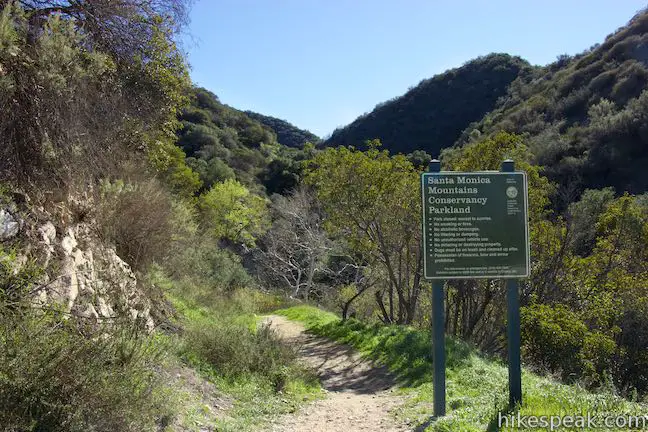
Start from a turnout along La Tuna Canyon Road at the bottom of a canyon that cuts into the mountains that rise to the south. On the east side of the canyon (left end of the parking area), there is a park sign by the start of La Tuna Canyon Trail. Begin up this dirt single track, which heads up the canyon past a few large sycamores. Before it can run into a rocky, overgrown corner of the canyon, the trail turns sharply to the left and ascends the side of the canyon.
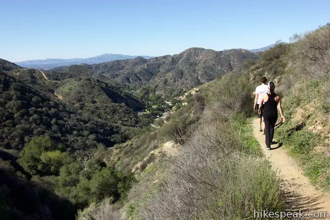
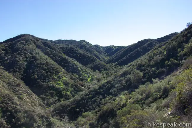
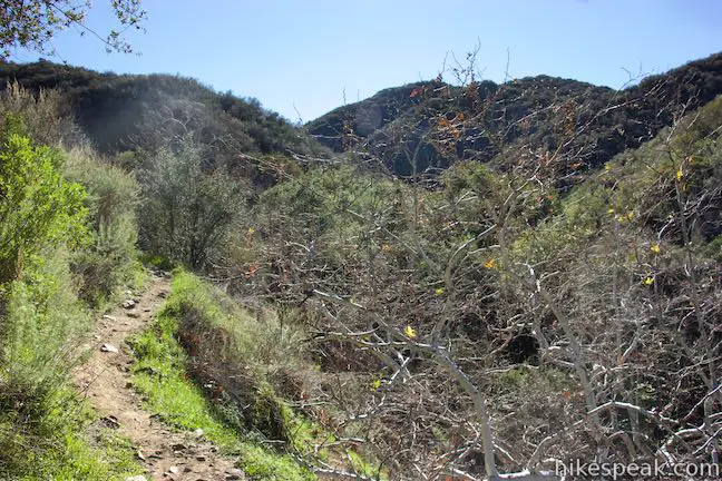
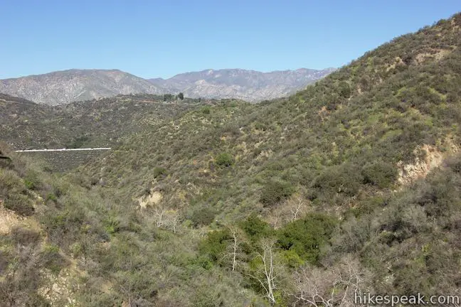
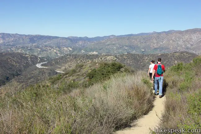
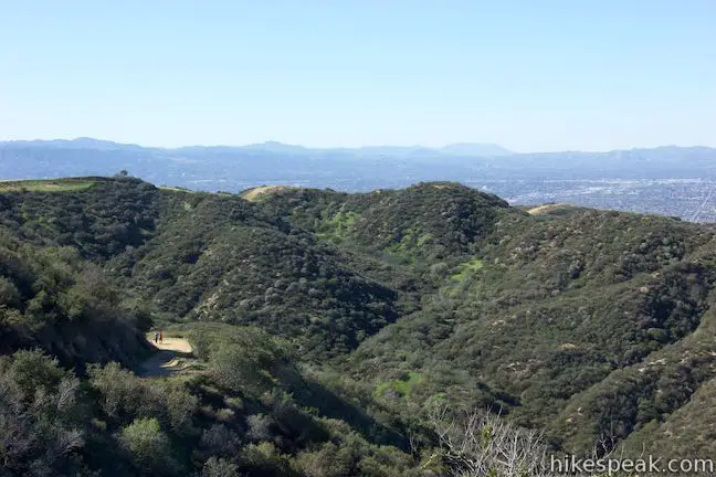
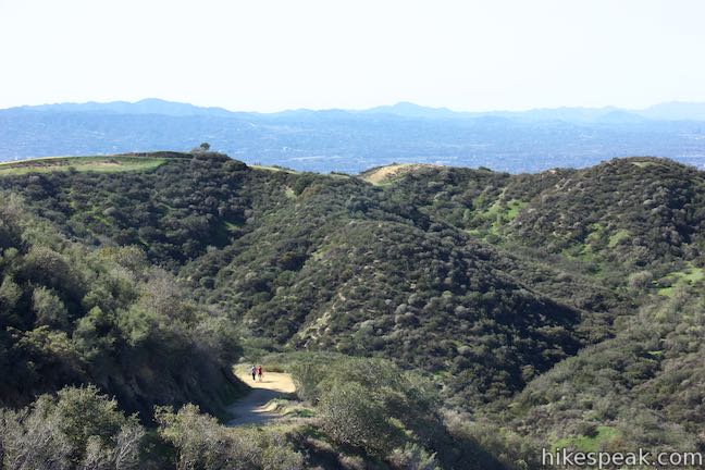
Several switchbacks take you up a steep ridge that presents views over the canyon and higher up into the Verdugo Mountains.
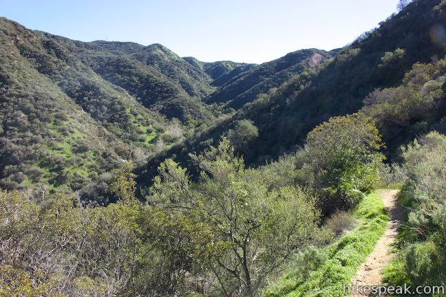
At 0.8 miles from the start, as the trail begins to round the north end of the ridge, a short spur trail on the left goes out to a landing that’s a scenic overlook. Opposite that, a narrow path takes a steep route up the ridge, reconnecting with La Tuna Canyon Trail above. Continue straight on La Tuna Canyon Trail, which wraps around to the east side of the ridge for views over another canyon carved out of the Verdugo Mountains.
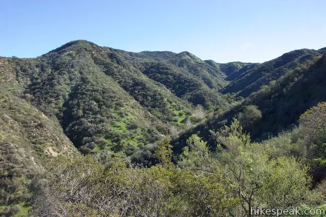
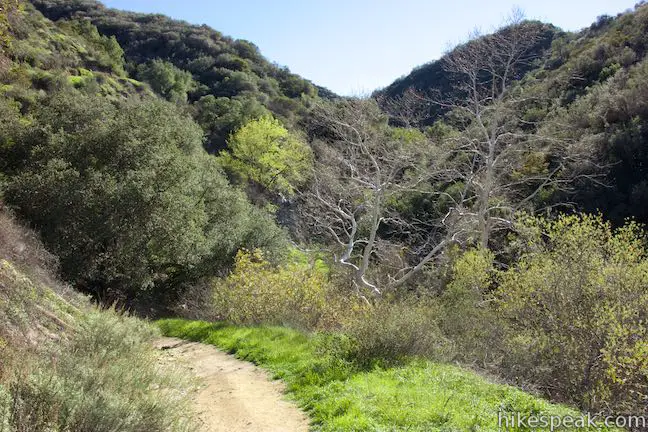
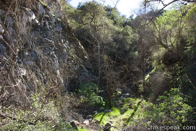
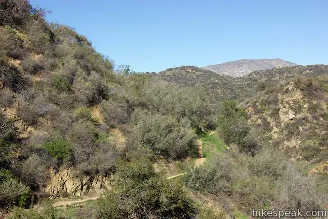
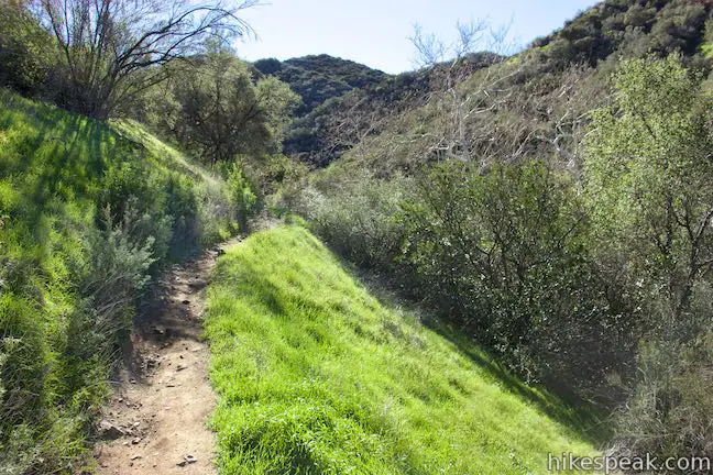
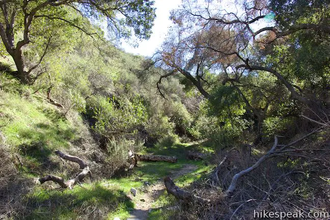
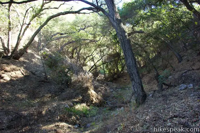
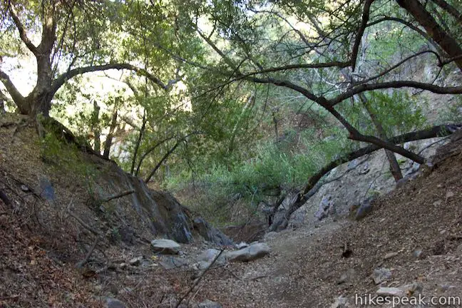
La Tuna Canyon Trail ascends about 350 feet in the first mile. Then, disregarding that effort, the trail actually turns downhill and drops into the second canyon. The reward for the sacrificed elevation is a shaded canyon enveloped in sycamores, oaks, and bays. Reach the floor of the canyon, 1.3 miles from the start, where a path coming up from farther down the canyon joins the trail on the left as La Tuna Canyon Trail swings to the right and heads up the quiet canyon. Briefly rise up along the east side of the canyon, passing some large sycamores before dropping back down into an oak grove. The trail goes through a small clearing on the canyon floor with a pair of logs for benches that make a nice spot for a break.
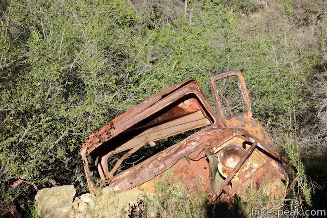
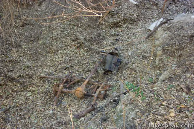
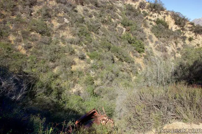
Leaving the trees, the trail shoots back up the ridge on the west side of the canyon. This is the steepest part of the hike, but push through. At 1.75 miles from the start, you’ll pass a rusting old car just below the right side of the trail. It’s hard to imagine that someone actually drove a car up here, but the trail must have been wide enough for vehicles at one time.
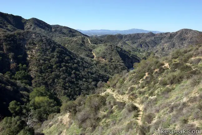
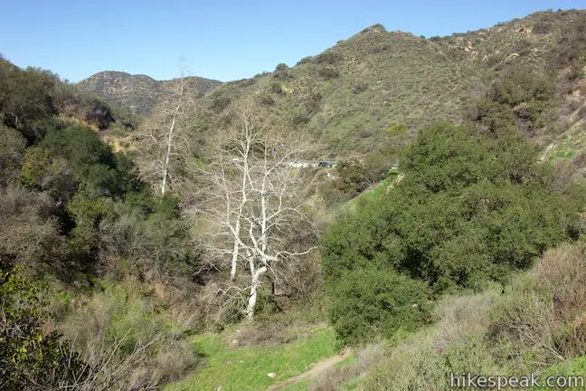
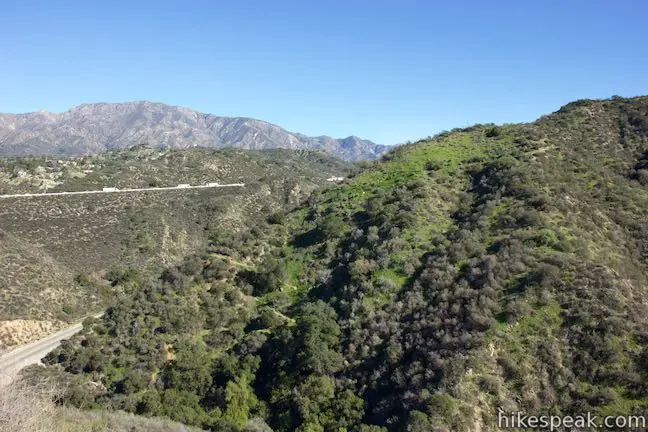
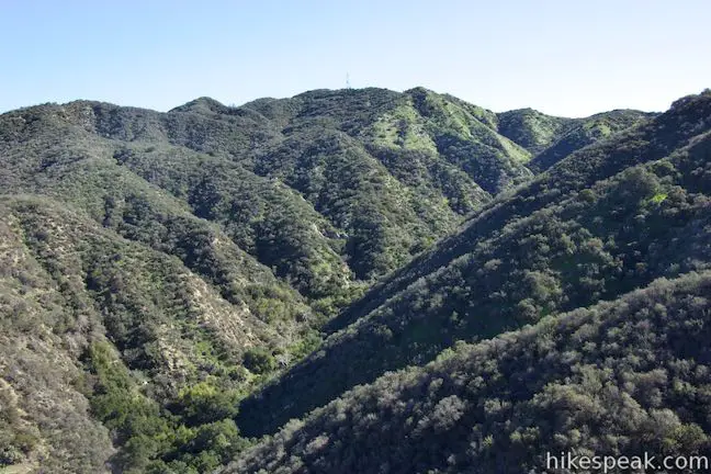
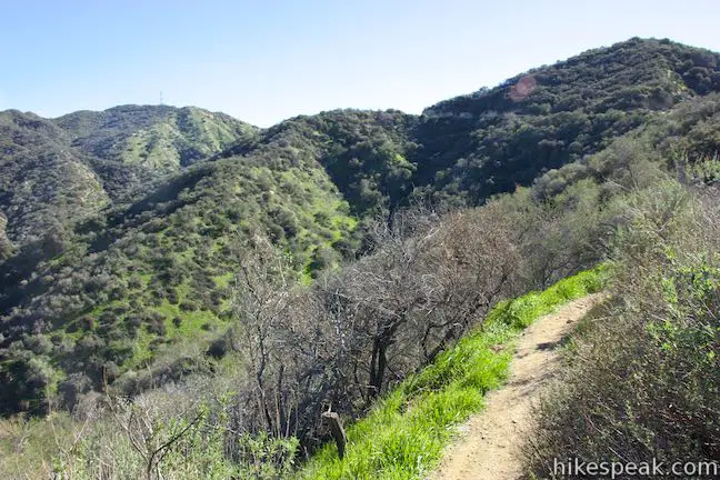
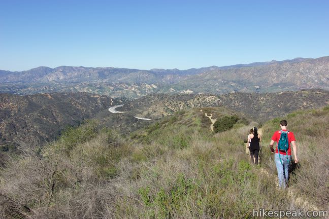
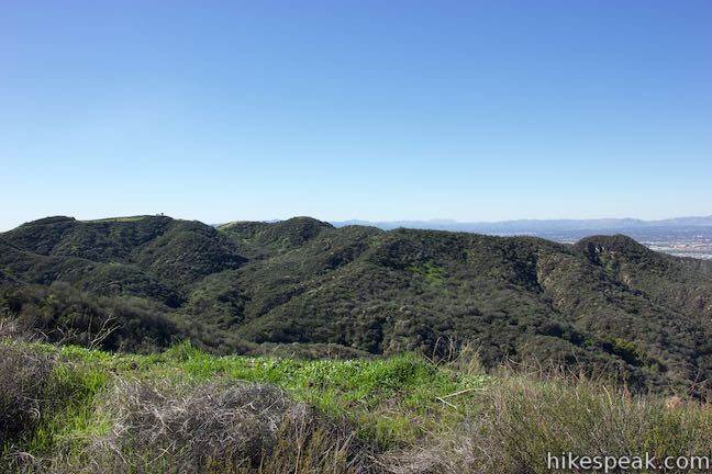
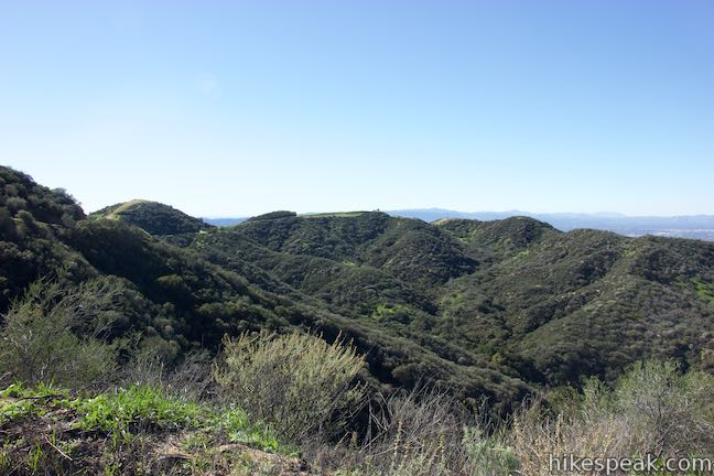
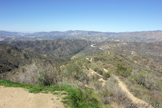
As La Tuna Canyon Trail weaves higher up the ridge, there are nice views looking up the canyon toward radio tower-covered peaks to the southwest. You can also look north toward the San Gabriel Mountains, where communication towers are also visible on Mount Lukens. At the 1.9-mile mark, a short spur to an overlook on a small landing really lets you take in the views.

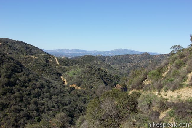
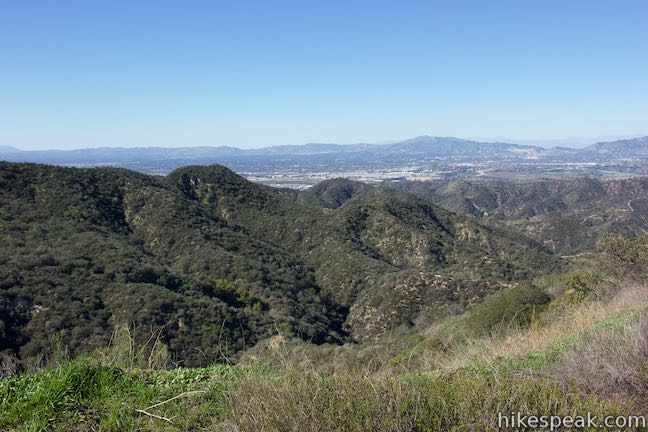
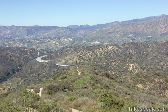
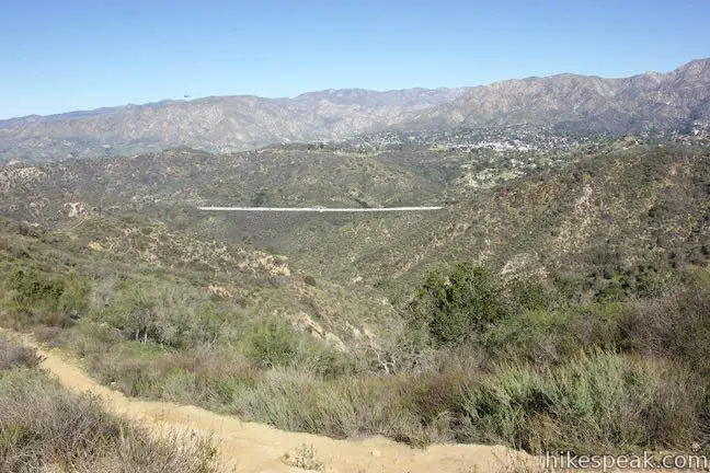
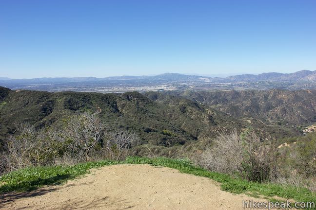
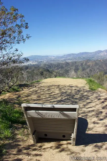
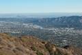
After 1.95 miles of hiking, La Tuna Canyon Trail reaches the top of the ridge and turns south, heading higher still (to the right, a path goes out to a crest on the ridge and eventually descends toward the trail below). La Tuna Canyon Trail kicks up one last time as you come the end, at a T-junction with Verdugo Motorway (aka Verdugo Fire Road). At the top of the trail on the right, there is a reclined wooden bench. Relax and enjoy a view over the landscape you just conquered. The canyons you passed through frame the ridge below, surrounded by more rippling ridges and peaks in the Verdugo Mountains. The San Gabriel Mountains rise high to the north. The northwest end of the San Fernando Valley is visible to the west backed by the Santa Susana Mountains.
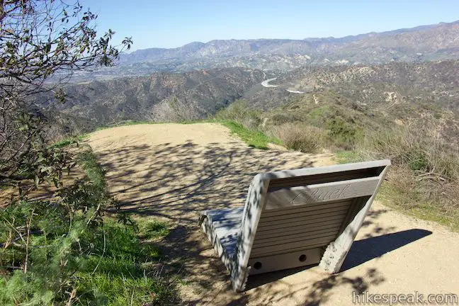
After taking in the views, you can press farther into the Verdugo Mountains or just hike back down La Tuna Canyon Trail to complete this 4.5-mile round trip hike. Dogs and bikes are allowed on this trail. No fee or permit is required to hike in La Tuna Canyon Park, so get out and enjoy!
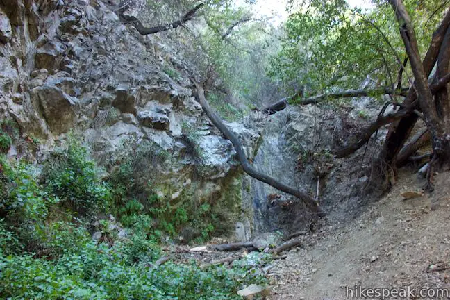
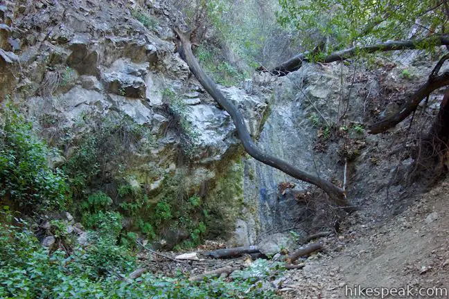
Want an extra mini-hike? There is a seasonal cascade and pool called the Grotto at the bottom of the second canyon crossed by La Tuna Canyon Trail. The easiest way to reach it is to drive 1/3 of a mile farther up La Tuna Canyon Road from the trailhead for La Tuna Canyon Trail to a second turnout where there are a couple picnic tables. A 0.15-mile round trip trail goes up the canyon and hooks to the right, where you’ll see a rock face that glistens with water during the rainy season, but may otherwise be dry. If you’re feeling adventurous, there is a steep path going past the Grotto that should connect with La Tuna Canyon Trail farther up the canyon.
To get to the trailhead: Take Interstate 5 to exit 150 for Sunland Boulevard. At the end of the offramp, head north on Sunland Boulevard. Drive 0.8 miles and turn right onto La Tuna Canyon Road. Take this road for 3.3 miles and pull into the dirt turnout on the right (if you reach the 210 Freeway, you went 1.2 miles too far).
Trailhead address: La Tuna Canyon Road, Sun Valley, CA 91352
Trailhead coordinates: 34.23314, -118.31137 (34° 13′ 59.30″N 118° 18′ 40.93″W)
View Verdugo Mountains in a larger map
Or view a regional map of surrounding Los Angeles trails and campgrounds.


The Grotto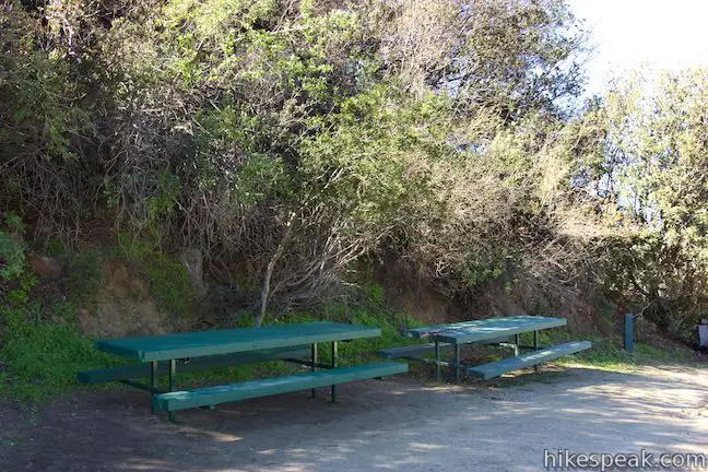


 | Hostetter Fire Road to Verdugo Peak This 7.5-mile round trip hike on the north side of the Verdugo Mountains ascends from La Tuna Canyon to the highest summit in the range. |
 | Old Youth Camp Loop in Stough Canyon This 2.6-mile loop passes the ruins of an abandoned camp in the Verdugo Mountains with views across the San Fernando Valley. |
 | Vital Link Trail This hike of 3 miles round trip or more ascends 1,275 feet (or more) up a ridge on the side of the Verdugo Mountains for a steep hike with satisfying views. |
 | Skyline Motorway This 6.1 to 6.6-mile hike (or more) ascends an abandoned fire road in the Verdugo Mountains with expansive views that include the skyline of downtown Los Angeles. |
 | Beaudry Motorway Loop to Tongva Peak This 6.15-mile loop climbs 1,475 feet to the summit of Tongva Peak on the east end of the Verdugo Mountains. |
 | Las Flores Motorway to Mount Thom This 5.3-mile hike follows a wide dirt road to the summit of Mount Thom, offering panoramic views from the southeast end of the Verdugo Mountains. |
 | More trails in Los Angeles Explore other destinations around Los Angeles. |

Great! I’ve been driving by for years and agree, the lushness right now looks too good to ignore. Thanks for the writeup and enticing pics! Can’t wait!
While the medic for Battery 543rd AA AW Bn. in WWII we made a march to the top of Verdugo Mtn. on Easter Sunday 1943 One of the Jewish lads sang Ali, Ali. We tried to see the Lockheed plant in Burbank that was hidden under chicken wire and coated with painted feathers.
Thank you Sir for being part of the greatest generation and for fighting to keep our freedoms. I salute you for your service!
As of today, May 12, 2018, the trailhead for La Tuna Canyon Trail is not accessible. The entire turn-off from La Tuna Canyon Road is currently blocked off by metal fencing I’m assuming put up by Parks & Rec. I drove by twice and did not see a sign explaining why.
As of May 25, 2019, the trail is quite overgrown and washed out in several places. The Grotto is fenced off for construction.
I hiked this trail semi-regularly in 2016 or 2017. I came back for the first time in a few years on 8/7/21 and I second Ken’s comment above: it’s now definitely overgrown and, I would say, impassable.
[…] La Tuna Canyon Trail: This path may be only a bit over two miles, but with viewpoints at an elevation of 975 feet, your life is going to get sweaty fast. One perk of finishing it: When you reach the top, there’s a cute seat to relax in before starting the trek back. Thighs will cry out; calories will burn; Instagram dreams will come true […]