Harmony Borax
in Death Valley National Park
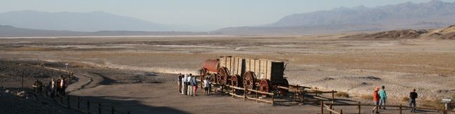
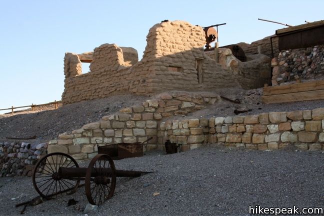
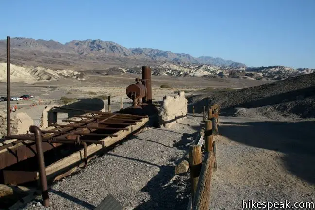
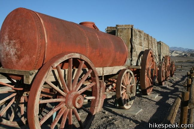
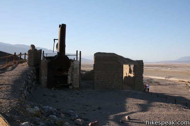
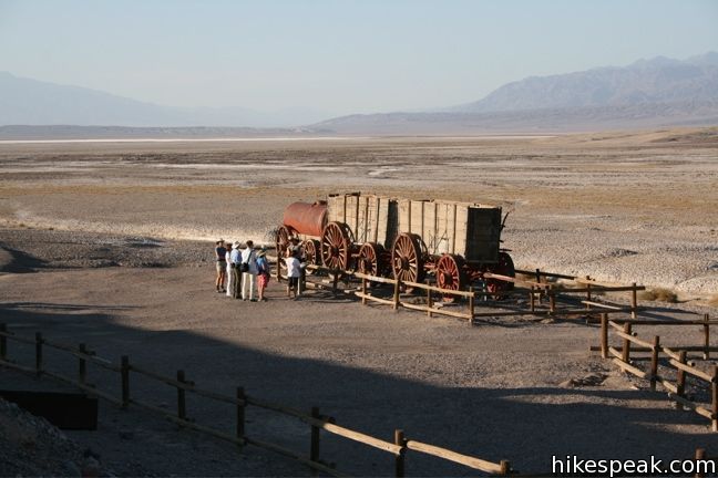
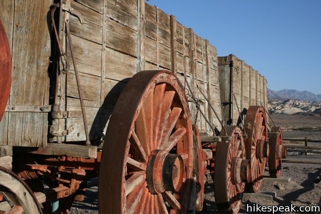
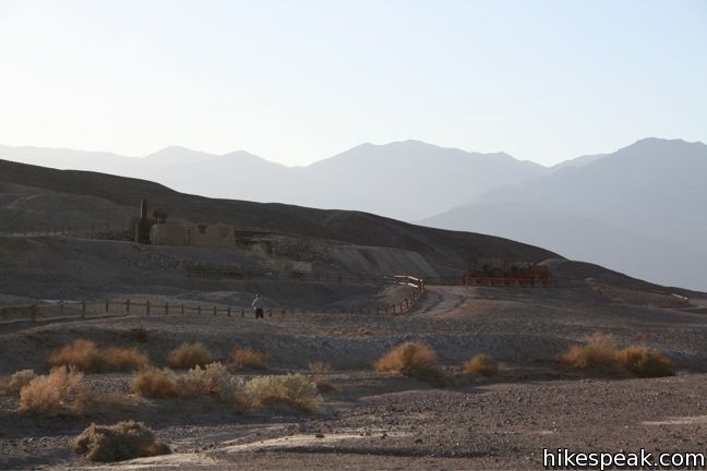
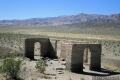
Take a 00.25-mile walk around a Harmony Borax Plant to see a window into the mining past of Death Valley National Park. The Harmony Borax Site is considered to be an outdoor museum because the natural atmosphere in Death Valley preserves artifacts so well. The Harmony Borax plant and wagon cart are left right out in the open for visitors to come see.
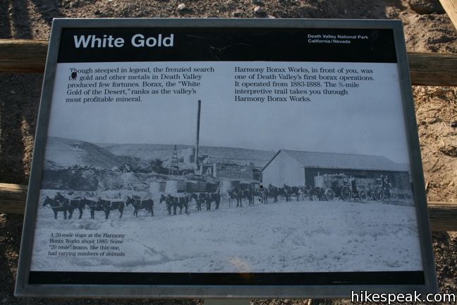
Along this paved loop, illustrated panels tell the story of the sites past. Borax, called white gold by miners in the late 1800s, was mined heavily in the area around Death Valley. In the 1800s The Harmony Borax Works was constructed to process the borax before it was hauled away on a twenty-mule team wagon toward the train depot in Kelso, which is now the visitor center for Mojave National Preserve, 165 miles to the south.
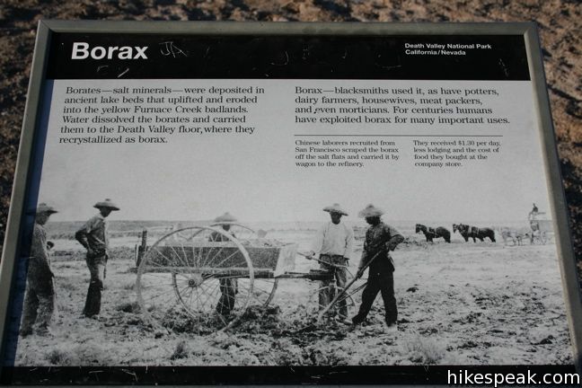
What is borax? A panel along the loop explains:
Borates – salt minerals – were deposited in ancient lake beds that uplifted and eroded into yellow Furnace Creek Badlands. Water dissolved the borates and carried them to the Death Valley floor, where they crystalized as borax.
Directions to the Trailhead
- From Furnace Creek drive north on highway 190.
- After 1.5 miles turn left on Borax Mine Road.
- Park in the lot at the start of the paved loop.
Trailhead Location
Trailhead address: Harmony Borax, Borax Mill Road, Death Valley National Park, Death Valley, CA 92328
Trailhead coordinates: 36.48003, -116.87335 (36° 28′ 48.1″N 116° 52′ 24.1W)
You may also view a regional map of surrounding California Desert trails and campgrounds.

 | Mesquite Flat Sand Dunes This 1 + mile hike explores the most visible (but not the largest) sand dunes in Death Valley. |
 | Salt Creek This easy one mile out-and-back crosses a short boardwalk bordering a little creek. |
 | Ashford Mill These ruins, where gold was once processed for the Ashford Mine, provide an example of how tough life can be in this harsh desert. |
 | Death Valley Explore more destinations in Death Valley National Park. |
 | Death Valley Campgrounds Nine campgrounds are spread throughout this large park to facilitate your visit. |
Common Questions about Harmony Borax in Death Valley National Park
- Is the trail open?
- Yes. You should expect to find that Harmony Borax is open. There are no recent reports of trail closures. If you discover that the trail is closed, please help your fellow hikers by reporting a closure.
- Do I need a permit for this hike?
- Yes. National Park Entrance Fee.
- How much time does this hike take?
- It takes approximately 15 minutes to hike Harmony Borax. Individual hiking times vary. Add extra time for breaks and taking in the views.
- How long is this hike?
- The hike to Harmony Borax is a 0.25 mile loop with 25 feet of elevation change.
- Are dogs allowed on this trail?
- No, dogs are likely not allowed on Harmony Borax. The trail is primarily open to hikers.
- Is Harmony Borax good for kids?
- Yes, this hike is likely suitable for children. It is relatively short (0.25 miles) with manageable elevation gain.
- Where is the trailhead located?
- The trailhead for Harmony Borax is located in Death Valley, CA.
Trailhead Address:
Borax Mill Road
Death Valley, CA 92328
Trailhead Coordinates:
36.48003, -116.87335 - What are the driving directions to the start of the hike?
To get to the trailhead: From Furnace Creek drive north on highway 190. After 1.5 miles turn left on Borax Mine Road. Park in the lot at the start of the paved loop.
View custom Google Maps directions from your current location.
- Are there other trails near Harmony Borax?
- Yes, you can find other nearby hikes using the Hikespeak Hike Finder Map.

Go the extra miles...
Submit a rating of this hike to go with your comment. Contribute to the average trail rating.