Beyond the trails maintained by the park, numerous peaks in Mojave National Preserve can be reached with off-trail hiking and scrambling. One worthy candidate is Fountain Peak.
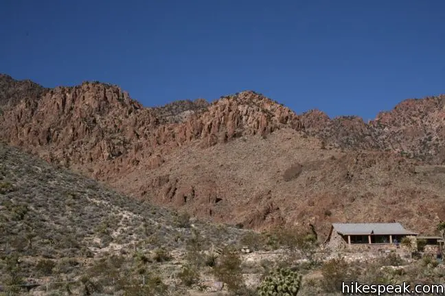
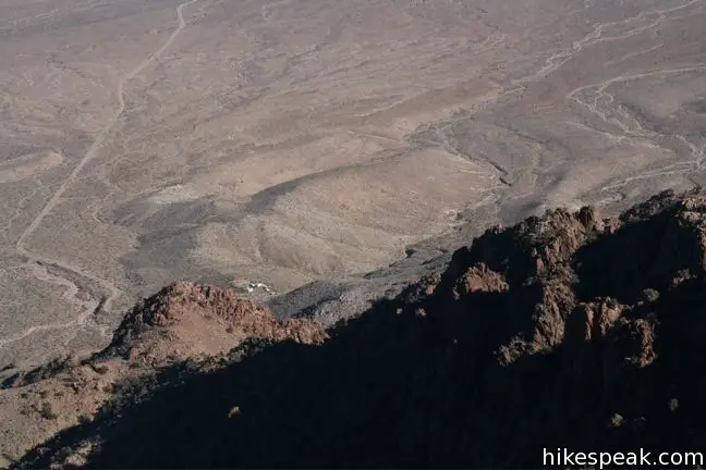
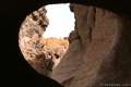
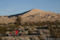
Fountain Peak is located near Mitchell Caverns whose parking lot in the Providence Mountains State Recreation Area provides a serviceable base camp. Before setting out, download the USGS topographical map of Fountain Peak. Making your own trail is a rewarding feeling, but hiking off-trail should only be attempted with preparation and precaution.
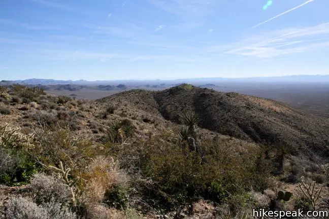
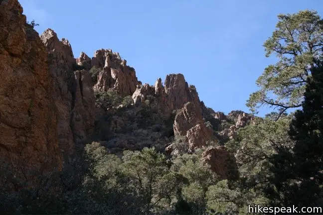
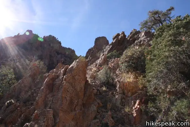
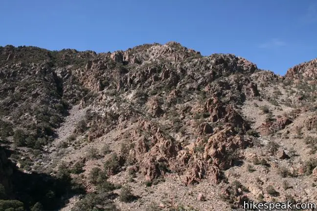
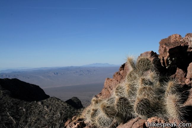
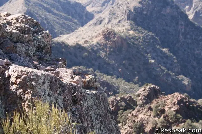
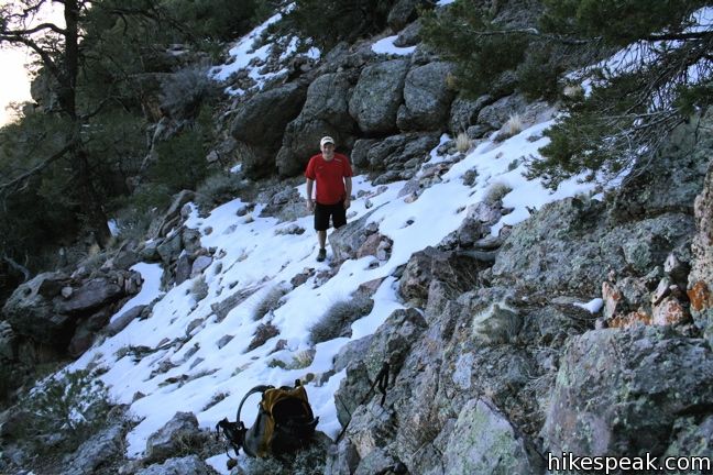
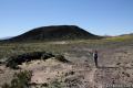
Head north from the visitor center by Mitchell Caverns through cactus-filled desert. Meet a gully that runs down the eastern side of Fountain and turn left. start up the canyon or the ridge on the south side (which should prove to be easier). As mentioned, there is nothing even resembling a trail, so the path is yours to make.
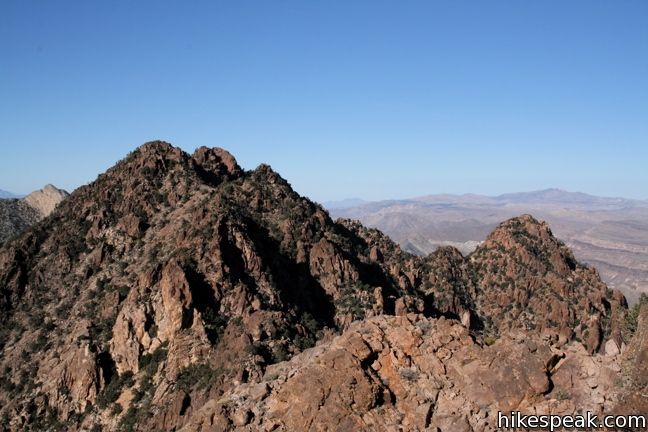
Approaching the summit via the main wash directly to the east will lead hikers to a position that required about forty feet of near vertical climbing. Obviously, this is not the suggested route. Before things get to steep, gain the ridgeline on the left side of the canyon and approach the summit from there.

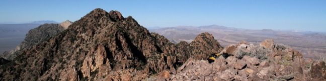
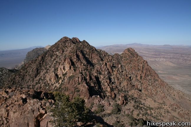
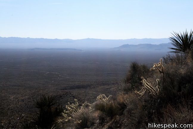
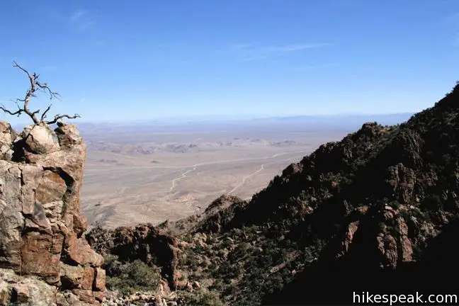
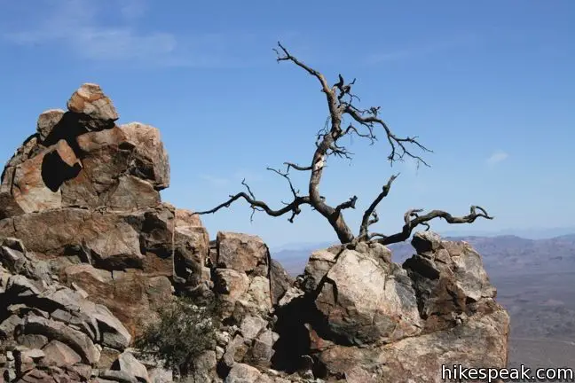
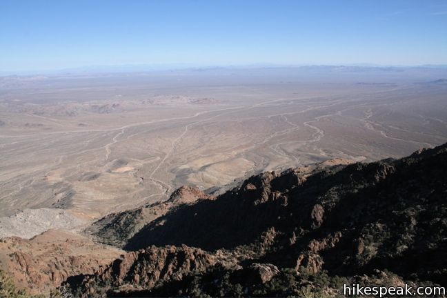
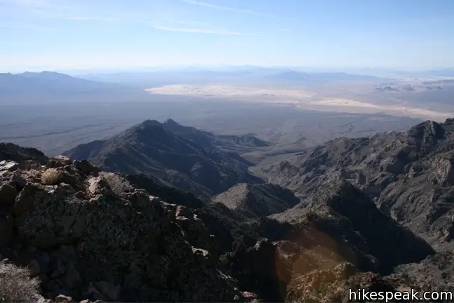
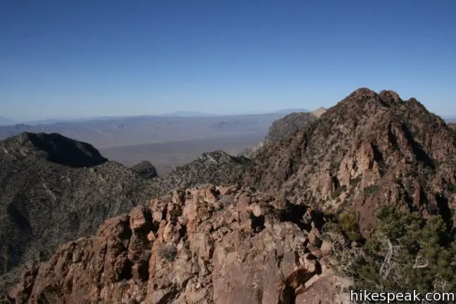
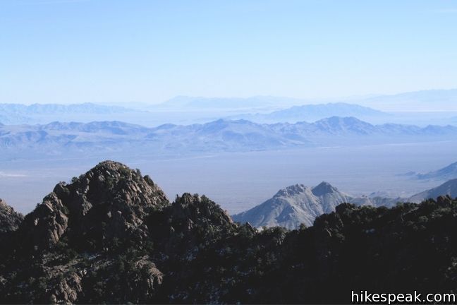
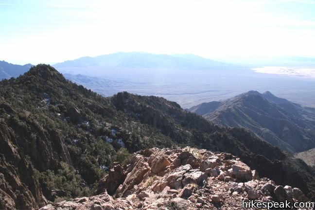
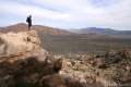
The rocky summit of Fountain Peak has panoramic views. Look east over an expansive desert. Look up the rugged ridgeline to the north toward Edgar Peak, the highest point in the Providence Range. To the east, you can look down over the Kelso Dunes or admire Silver Peak in the Granite Mountains.
The terrain is slow going and scrambling is required in several places, but the views from 6,996 feet made it all worthwhile. From the parking lot to the summit is about 5 miles round trip with 2700 feet of elevation gain.
Directions to the Trailhead
- From Barstow, head east on Interstate 40.
- Take exit 100 and go north on Essex Road.
- Take this road for 16 miles to Mitchell Caverns at road's end.
Trailhead Location
Trailhead address: Essex Road, Essex, CA 92332
Trailhead coordinates: 34.9432, -115.51268 (34° 56′ 35.5″N 115° 30′ 45.6″W)
View Mojave National Preserve in a larger map
Or view a regional map of surrounding California Desert trails and campgrounds.


 | Teutonia Peak This 3.4 to 4-mile round trip hike crosses the world's densest Joshua tree forest, passing an abandoned silver mine to reach a rocky summit with views of Cima Dome. |
 | New York Peak This 7 to 9-mile round trip hike summits the highest point of the New York Range in the northeast corner of the preserve. |
 | Rock Spring Loop Trail This 1 1/3-mile loop visits a rare desert spring, a Rock House built in the 1920s, a miners' mill site, and an old U.S. Army post on a short and scenic circuit. |
 | Lava Tube This short 0.6-mile hike drops below the surface into an old lava tube. |
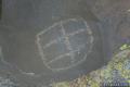 | Petroglyphs near Seventeen Mile Point This quarter-mile path visits ancient engravings in the volcanic rock at the western rim of the cinder fields just off Kelbaker Road. |
 | Hole-in-the-Wall Rings Trail This 1.5-mile loop takes visitors through a landscape of pocketed rocks. Ringbolts allow fun passage through narrow canyons. |
 | Kelso Dunes This 3-mile round trip hike climbs 470 feet to the highest point in this 45 square mile dune field. |
 | Silver Peak This 8.5-mile hike summits a 6,365-foot peak in the Granite Mountains. |
 | Amboy Crater This 3-mile round trip hike travels up and into this crater adjacent to Mojave National Preserve. |
 | Hikes in the California Desert Explore more trails in Death Valley National Park, Joshua Tree National Park, Anza-Borrego Desert State Park, and Mojave National Preserve. |
 | Mojave National Preserve There are a few campgrounds and endless roadside camping within the preserve. |
Common Questions about Fountain Peak in Mojave National Preserve
- Is the trail open?
- Yes. You should expect to find that Route to Fountain Peak is open. There are no recent reports of trail closures. If you discover that the trail is closed, please help your fellow hikers by reporting a closure.
- Is this trail free to access?
- Yes, Route to Fountain Peak is free to access. No entrance fee, pass, or permit is required. If you discover that access rules have changed, please provide feedback on your experience.
- How much time does this hike take?
- It takes approximately 3 hours 45 minutes to hike Route to Fountain Peak. Individual hiking times vary. Add extra time for breaks and taking in the views.
- How long is this hike?
- The hike to Route to Fountain Peak is a 5 mile out and back with 2700 feet of elevation change.
- Are dogs allowed on this trail?
- No, dogs are likely not allowed on Route to Fountain Peak. The trail is primarily open to hikers.
- Is Route to Fountain Peak a difficult hike?
- This hike should be considered strenuous. Hikers should be prepared for a workout covering 5 miles and 2700 feet of climbing.
- Does this trail go to a summit?
- Yes, Route to Fountain Peak reaches a summit with panoramic views.
- Where is the trailhead located?
- The trailhead for Route to Fountain Peak is located in Essex, CA.
Trailhead Address:
Essex Road
Essex, CA 92332
Trailhead Coordinates:
34.9432, -115.51268 - What are the driving directions to the start of the hike?
To get to the trailhead: From Barstow, head east on Interstate 40. Take exit 100 and go north on Essex Road. Take this road for 16 miles to Mitchell Caverns at road's end.
View custom Google Maps directions from your current location.
- Are there other trails near Route to Fountain Peak?
- Yes, you can find other nearby hikes using the Hikespeak Hike Finder Map.

Tried heading up a couple of weeks ago, but the ranger at the Mitchell Caverns visitor center said that the backcountry (including Fountain Peak) is closed to the public until further notice, supposedly due to their not yet having worked out what agency would handle response to criminal activity or accidents.
2700 feet up in two miles through brutal cacti and yucca. Seriously brutal but the summit was a magic moment.