Dante’s View
in Death Valley National Park
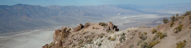
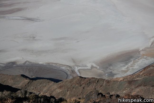
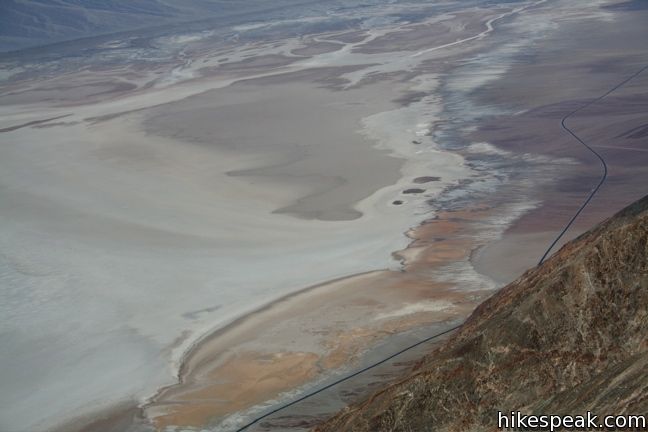
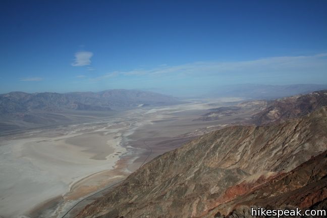
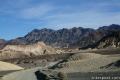
Dante’s View is the primary overlook in Death Valley National Park because it offers premier panoramic views. Below Dante’s View is Badwater Basin, the lowest point in North America. Across the valley rises Telescope Peak, the highest in the park. Under the morning light, the views are breathtaking in every direction. It feels like cheating to be able to drive right up to such amazing views.
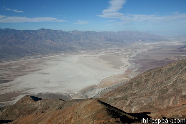
Perched atop the Black Mountains at 5,475 feet, Dante’s view is tall and wide. Both of Death Valley’s elevation extremes, 282 feet below sea level and 11,049 feet above, can be seen in a single glance.
Those who have already walked out on Badwater Basin and looked up at the Black Mountains, can now look down on the little dark specks moving across the salt flat. Understanding that those little specks are people provides a real perspective on the vastness of Death Valley.
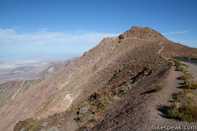
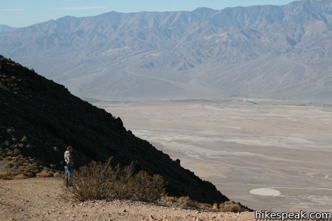
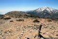
From the parking lot, trails extend along the ridges to the north and south allowing visitors to look farther up and down the valley. Neither path is more than a mile long and each is worthy of exploring if time permits.
Wardrobe note: Pack a sweatshirt or a windbreaker. The elevation and wind make Dante’s View noticeably chillier than the valley below.
Directions to the Trailhead
- From Furnace Creek, drive southeast for 11 miles (passing Zabriskie Point).
- Turn right on Dante's View Road and drive 13 miles up to the road's end at Dante's View.
Trailhead address: Dante’s View, Dantes View Road, Death Valley National Park, Death Valley, CA 92328
Trailhead coordinates: 36.2206, -116.7266 (36° 13′ 14.2″N 116° 43′ 35.8″W)
View Death Valley National Park in a larger map
Or view a regional map of surrounding California Desert trails and campgrounds.


 | Badwater Basin This is the lowest place in North America -- a required stop for first time visitors to Death Valley. |
 | Zabriskie Point Zabriskie Point offers a stunning panorama of the badlands near Furnace Creek. |
 | Twenty Mule Team Canyon This 2.8-mile one way road is just up the road from Zabriskie Point. The fine canyon that can be experienced right from the driver's seat. |
 | Wildrose Peak This 8.4-mile hike summits a 9,064-foot peak in the Panamint Mountains north of Telescope Peak. |
 | Death Valley Explore more destinations in Death Valley National Park. |
 | Death Valley Campgrounds Nine campgrounds are spread throughout this large park to facilitate your visit. |
Common Questions about Dante’s View in Death Valley National Park
- Is the trail open?
- Yes. You should expect to find that Dante's View Trails is open. There are no recent reports of trail closures. If you discover that the trail is closed, please help your fellow hikers by reporting a closure.
- Do I need a permit for this hike?
- Yes. National Park Entrance Fee.
- How much time does this hike take?
- It takes approximately 30 minutes to hike Dante's View Trails. Individual hiking times vary. Add extra time for breaks and taking in the views.
- How long is this hike?
- The hike to Dante's View Trails is Up to 1 mile or more (out and back) with 200 feet of elevation change.
- Are dogs allowed on this trail?
- No, dogs are likely not allowed on Dante's View Trails. The trail is primarily open to hikers.
- Is Dante's View Trails good for kids?
- Yes, this hike is likely suitable for children. It is relatively short (1 miles) with manageable elevation gain.
- Where is the trailhead located?
- The trailhead for Dante's View Trails is located in Death Valley, CA.
Trailhead Address:
Dantes View Road
Death Valley, CA 92328
Trailhead Coordinates:
36.2206, -116.72660 - What are the driving directions to the start of the hike?
- To get to the trailhead: From Furnace Creek, drive southeast for 11 miles (passing Zabriskie Point). Turn right on Dante's View Road and drive 13 miles up to the road's end at Dante's View.
View custom Google Maps directions from your current location. - Are there other trails near Dante's View Trails?
- Yes, you can find other nearby hikes using the Hikespeak Hike Finder Map.

[…] it be great to have a bird’s eye view of Death Valley? Dante’s View is the answer. A branch road off of highway 190 takes us up 5,500 feet for a spectacular view of […]
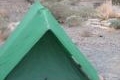
What is the significance of the can that is concreted in the ground at the peak?
Did you get an answer? I was just there and can’t find anything about it.
[…] dan bedenk je gewoon een plekje 1 ½ uur verderop om te gaan lunchen. Geen probleem. We rijden naar Dantes View. Het is heel rustig en dus heerlijk tussen deze prachtige steenformaties te […]
Did that hike yesterday, start was sketchy, right on edge of the mountain, narrow trail slanted down towards the valley. Coming back I took a slightly different route to avoid those long dropoffs adjacent to that part of the trail–right down the center rather than on that edge.