Beaudry Motorway Loop to Tongva Peak
in the Verdugo Mountains
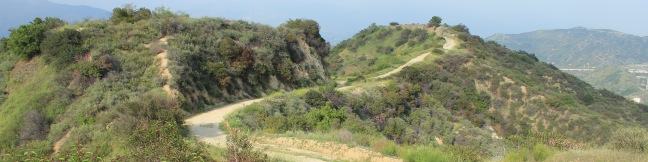
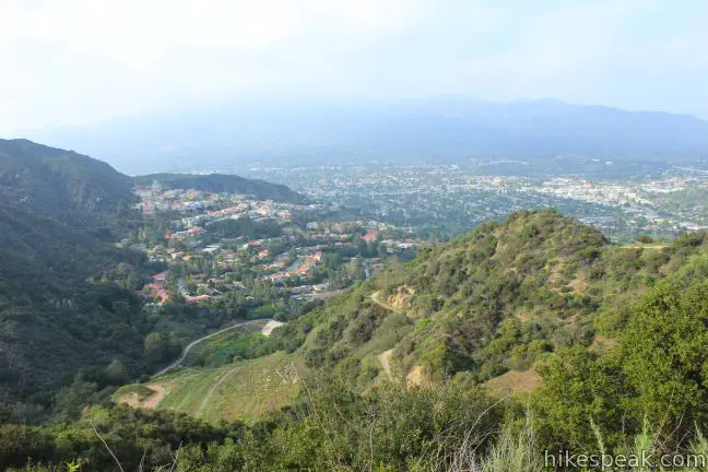
On the east end of the Verdugo Mountains between Glendale and Burbank, there is a scenic 6.15-mile loop on wide dirt service roads. North and South Beaudry Motorways circle past Tongva Peak and Mount Thom, which rise above the micro-range’s eastern ridges. The high point of the loop, and a highlight of the hike, is a scenic overlook on the 2,656-foot summit of Tongva Peak. There are big views of the massive metropolitan area below, and surprising peace to be found on this loop hike with 1,475 feet of elevation gain.
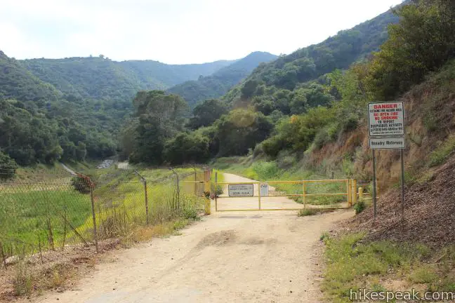
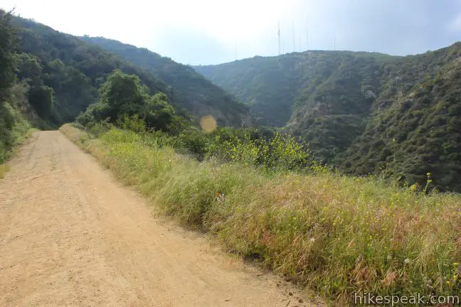
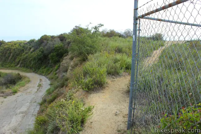
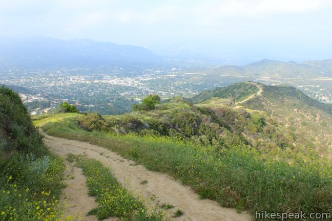
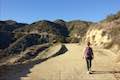
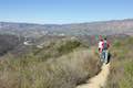
The hike begins from a not-so-obvious trailhead along Beaudry Boulevard in a neighborhood at the northeast base of the Verdugo Mountains. Pass through a gate and warm up on a level dirt road bordering a flood control drainage area. A small grove of sycamores provide a brief stretch of early shade, until the trail climbs a switchback to the start of the loop, just under half a mile from the start.
South Beaudry Motorway breaks off to the left, while North Beaudry Motorway heads to the right. The south side of the loop has more down-facing views away from the mountains toward the cityscape below. On the north side of the loop, there is a stronger draw to look upward toward the summits. To make the north side even more appealing for the ascent, the motorway has the potential to deliver some mountainside-provided shade, which is a welcome relief when hiking up the trail on a hot day. For these reasons, it is recommended that you tackle the loop in a counter clockwise direction, hiking up North Beaudry Motorway and down South Beaudry Motorway.
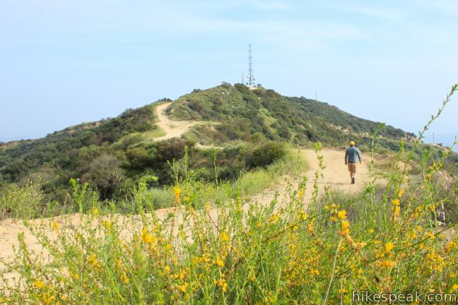
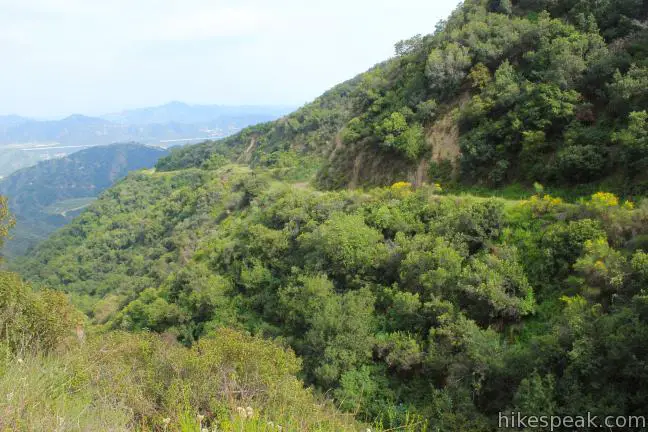
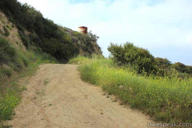
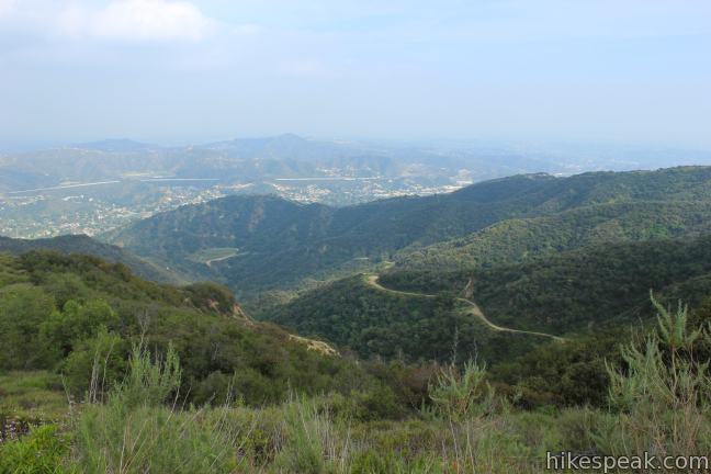
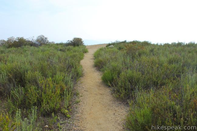
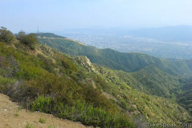
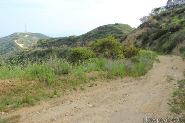
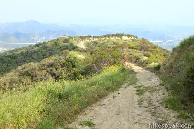
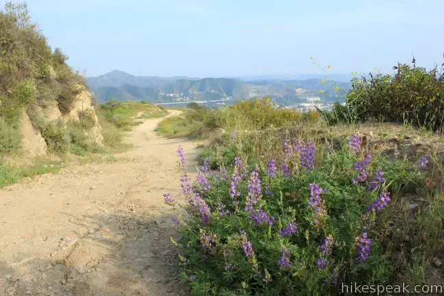
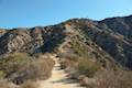
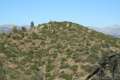
Heading up the north side offers plenty to look at, with views toward the San Gabriel Mountains expanding as you climb. In the spring and early summer, you can spot lupines, sage, sticky monkeyflower, and even occasional California poppies blooming along the trail. There are very few trees along the way. Chaparral and sage-covered slopes clear the way for panoramic views. The winding road weaves up the mountainside, passing beneath the steep east face of Tongva Peak, which is marked by a radio-towered summit.
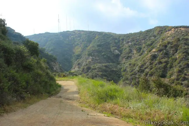
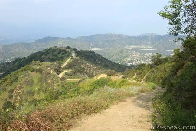
The steady climb provides a good workout. After gaining 1,175 feet over 2.3 miles, reach another junction (2.75 miles from the start). Straight ahead Verdugo Motorway continues east toward Verdugo Peak, the highest summit in the range at 3,126 feet.
From the top of North Beaudry Motorway, it is an additional 2.5 miles to Verdugo Peak, with 625 feet of elevation gain. You may also save Verdugo Peak for another hike in the Verdugo Mountains, reaching the summit via Hostetter Fire Road.
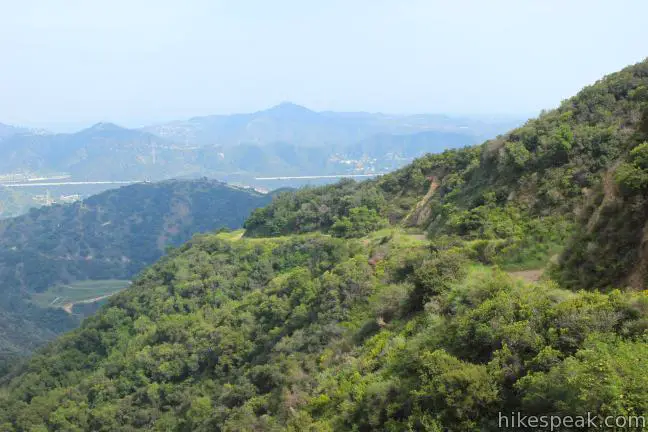
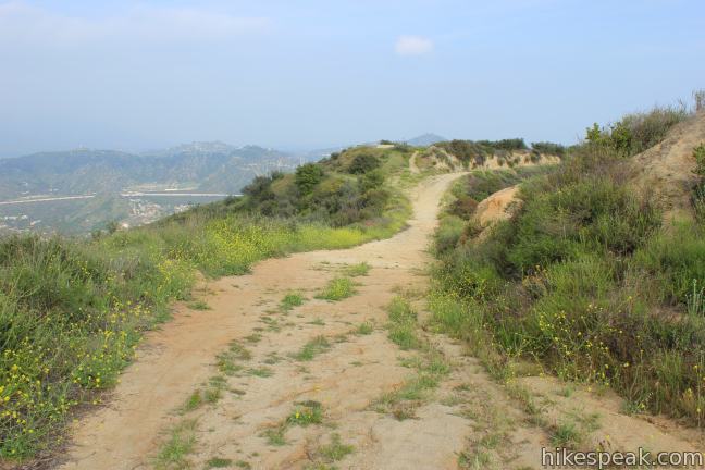
To continue the Beaudry Motorway Loop, turn left up South Beaudry Motorway, climbing 150 feet over a third of a mile to the loop’s highest point at Tongva Peak (2,656 feet). Just after you make the turn, the trail passes through a saddle on the ridgeline with an open view south over Burbank. This is the first taste of the southward views offered on the second half of the loop.
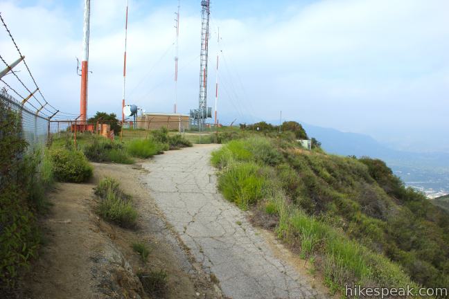
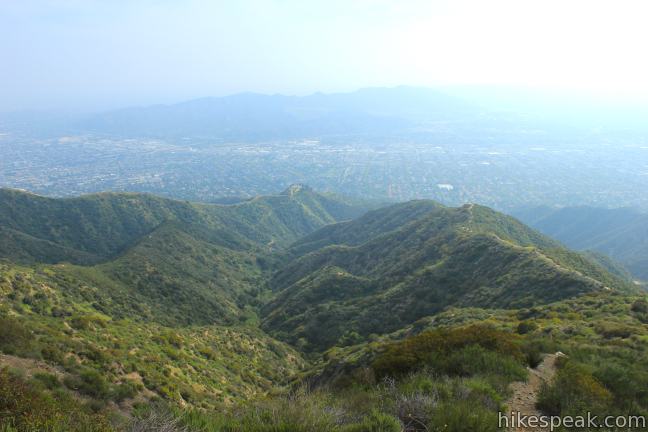
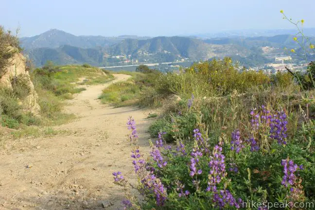
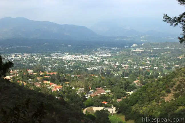
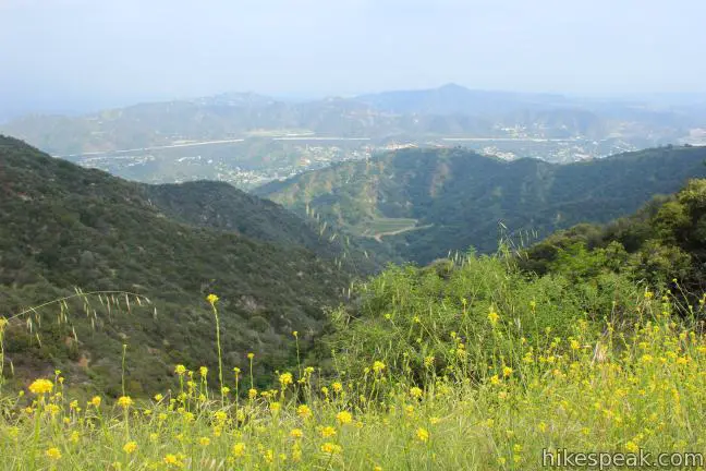
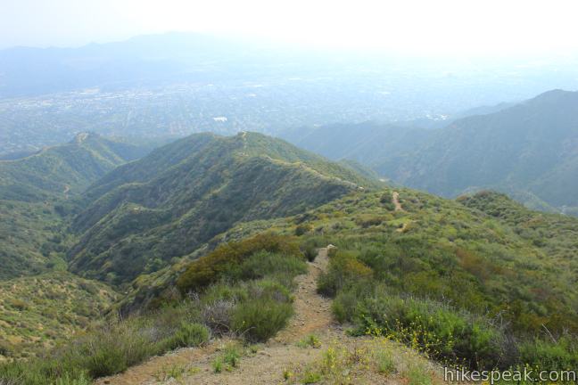
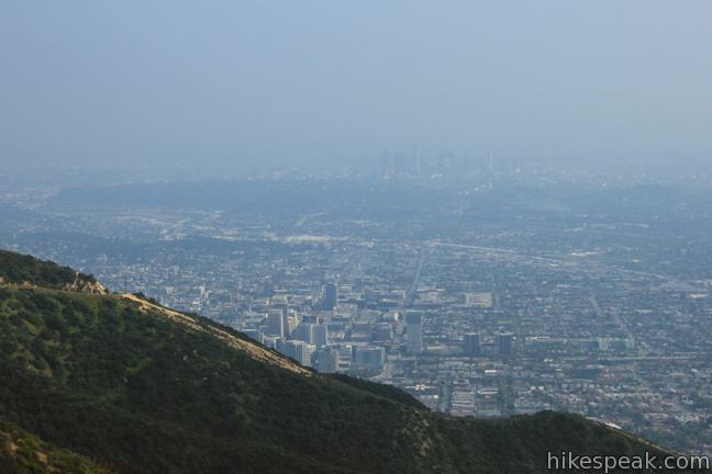
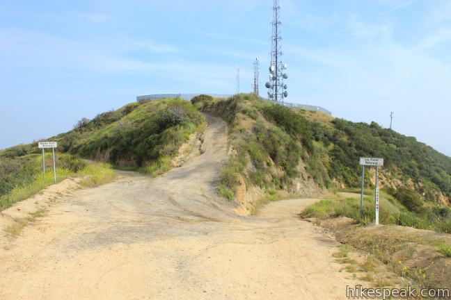
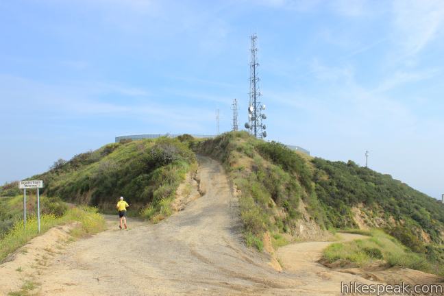
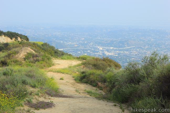
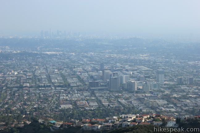
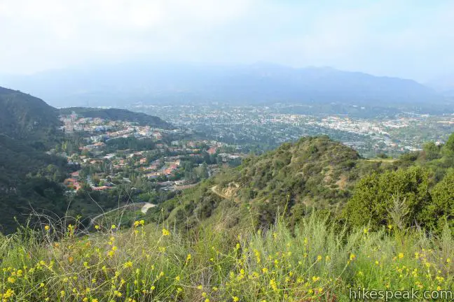
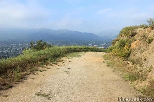
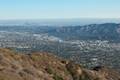
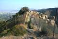
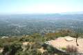
The motorway becomes temporarily paved as you reach the summit of Tongva Peak, just over three miles from the start, where you will see a cluster of tall radio towers wrapped in a chain link fence. Before turning down the road away from the towers, follow a path along the fence out to a landing south of the towers. Here you will find a summit marker for Tongva Peak and the finest overlook of the hike. Look down the ridges on the south side of the mountain toward the expansive city sprawl below. Gaze out across Burbank toward downtown Los Angeles, and look west over more valley cities toward the Santa Monica Mountains. Have a seat and relax. It’s almost all downhill from here!
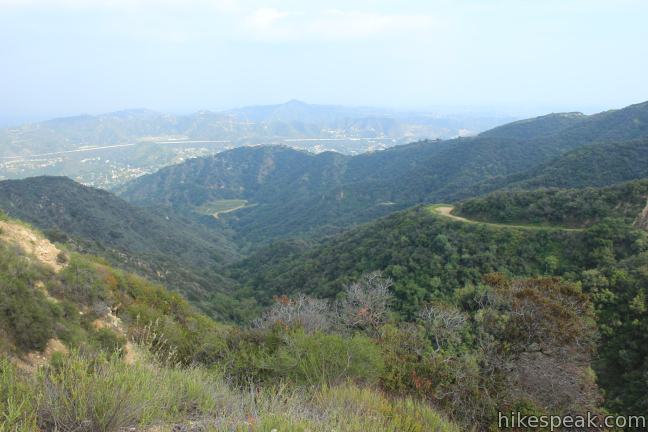
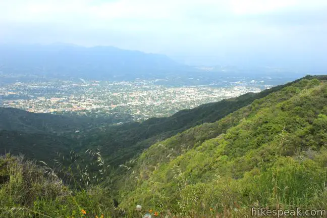
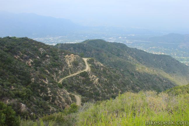
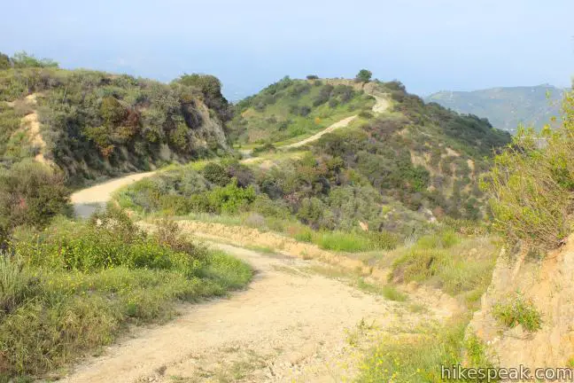
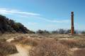
Return to the road and continue down South Beaudry Motorway. After 0.6 miles, arrive at another summit crowned by fenced-in communication towers. This is Mount Thom, where you will pass the top of Las Flores Motorway on the right. Just past the junction, a short spur heads up to the 2,460-foot summit.
You can walk around the fences on the flattened mountaintop to find a viewpoint on the south side of the peak with broad views toward downtown Los Angeles. Stay to the left down South Beaudry Motorway to continue the loop.
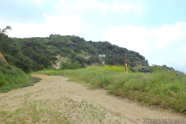
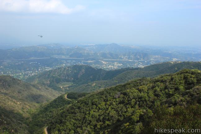
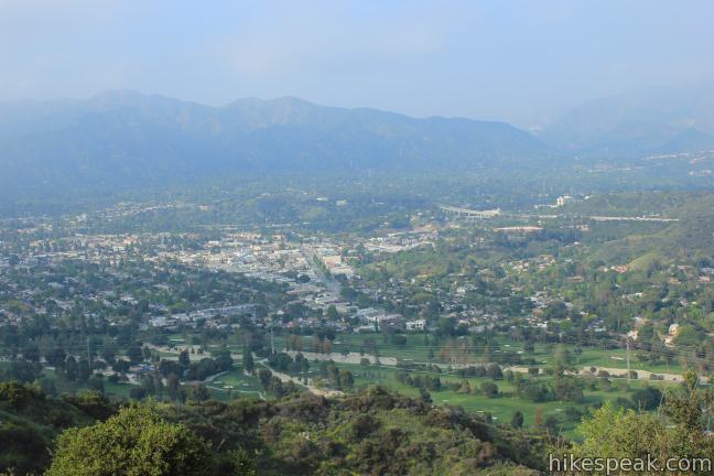
South Beaudry Motorway wraps down the easternmost ridges of the Verdugo Mountain Range, delivering good views of the front range of the San Gabriel Mountains. The trail winds nearer to La Cañada Flintridge, Glendale, and Eagle Rock, offering an abundance of city views. Eventually, the weaving dirt road leads back to the initial split with North Beaudry Motorway, closing out the loop. From there it is just 0.45 miles back down to the trailhead.
This loop is mountain bike and dog friendly. No fee or permit is required to hike Beaudry Motorway Loop, so get out and enjoy!
Directions to the Trailhead
- From downtown Los Angeles, take the 5 Freeway north to the Glendale Freeway (CA 2).
- Drive 4.8 miles north and take exit 18 onto Mountain Avenue.
- Turn left on East Mountain Avenue.
- Make the second right onto Verdugo Road.
- After 0.2 miles, take a left at the split onto Cañada Road.
- Drive 1.6 miles north and turn left onto Country Club Road.
- Go half a mile and turn left up Beaudry Boulevard.
- Drive 1/3 of a mile to the trailhead on the left.
- Park along the road.
Trailhead address: 1300 Beaudry Boulevard, Glendale, CA 91208
Trailhead coordinates: 34.193363, -118.241163 (34° 11′ 36.10″N 118° 14′ 28.18″W)
View Verdugo Mountains in a larger map
Or view a regional map of surrounding Los Angeles trails and campgrounds.


 | Las Flores Motorway to Mount Thom This 5.3-mile hike follows a wide dirt road to the summit of Mount Thom, offering panoramic views from the southeast end of the Verdugo Mountains. |
 | Skyline Motorway This 6.1 to 6.6-mile hike (or more) ascends an abandoned fire road in the Verdugo Mountains with expansive views that include the skyline of downtown Los Angeles. |
 | Vital Link Trail This hike of 3 miles round trip or more ascends 1,275 feet (or more) up a ridge on the side of the Verdugo Mountains for a steep hike with satisfying views. |
 | Old Youth Camp Loop in Stough Canyon This 2.6-mile loop passes the ruins of an abandoned camp in the Verdugo Mountains with views across the San Fernando Valley. |
 | Hostetter Fire Road to Verdugo Peak This 7.5-mile round trip hike on the north side of the Verdugo Mountains ascends from La Tuna Canyon to the highest summit in the range. |
 | La Tuna Canyon Trail This 4.5-mile round trip hike ascends a ridge and a pair of canyons in La Tuna Canyon Park on the northwest side of the Verdugo Mountains. |
 | Beacon Hill This 2.75 to 3.9-mile hike in Griffith Park climbs 500 feet to the easternmost summit in the Santa Monica Mountains. |
 | Bee Rock This hive-shaped point on the east side of Griffith Park is reached via a 1.7 to 4-mile round trip hike. |
 | Echo Mountain via Sam Merrill Trail This 5.8-mile hike visits a historic railway and ruins from a century old resort overlooking Pasadena. |
 | Rubio Canyon Trail This 1.3-mile round trip hike ventures into a rustic canyon to a double waterfall. |
 | More trails in Los Angeles Explore other destinations around Los Angeles. |
Common Questions about Beaudry Motorway Loop to Tongva Peak in the Verdugo Mountains
- Is the trail open?
- Yes. You should expect to find that Beaudry Motorway Loop is open. There are no recent reports of trail closures. If you discover that the trail is closed, please help your fellow hikers by reporting a closure.
- Is this trail free to access?
- Yes, Beaudry Motorway Loop is free to access. No entrance fee, pass, or permit is required. If you discover that access rules have changed, please provide feedback on your experience.
- How much time does this hike take?
- It takes approximately 3 hours 30 minutes to hike Beaudry Motorway Loop. Individual hiking times vary. Add extra time for breaks and taking in the views.
- How long is this hike?
- The hike to Beaudry Motorway Loop is a 6.15 mile loop with 1475 feet of elevation change.
- Are dogs allowed on this trail?
- Yes, dogs are allowed on Beaudry Motorway Loop. The trail is open to hikers, dogs, bikes.
- Does this trail go to a summit?
- Yes, Beaudry Motorway Loop reaches a summit with panoramic views.
- What mountain range is this trail in?
- Beaudry Motorway Loop is located in the Verdugo Mountains.
- Where is the trailhead located?
- The trailhead for Beaudry Motorway Loop is located in Glendale, CA.
Trailhead Address:
1300 Beaudry Boulevard
Glendale, CA 91208
Trailhead Coordinates:
34.193363, -118.241163 - What are the driving directions to the start of the hike?
- To get to the trailhead: From downtown Los Angeles, take the 5 Freeway north to the Glendale Freeway (CA 2). Drive 4.8 miles north and take exit 18 onto Mountain Avenue. Turn left on East Mountain Avenue. Make the second right onto Verdugo Road. After 0.2 miles, take a left at the split onto Cañada Road. Drive 1.6 miles north and turn left onto Country Club Road. Go half a mile and turn left up Beaudry Boulevard. Drive 1/3 of a mile to the trailhead on the left. Park along the road.
View custom Google Maps directions from your current location. - Are there other trails near Beaudry Motorway Loop?
- Yes, you can find other nearby hikes using the Hikespeak Hike Finder Map.

[…] Chandler Fire Road until I encountered a fork in the road. I had the option to continue on to the Verdugo Motorway, which would have taken me to the route from our previous post, or take the other road, pointing […]
[…] Beaudry Motorway Loop to Tongva Peak – Hikespeak […]
Beaudry Motorway Loop by Bike
You will wind up walking your bike up AND down this one.
Steep grade makes this a tough one, mostly bike hiking the way up. Great scenery at the summit. Although it may be possible to ride short stretches of this (mostly from peak to peak) it’s tough to ride down any of the Beaudry South section. Nearly impossible to descend with any control, so be very careful. Kevin B.
This is definitely not a hike for beginners. I (unfortunately) went in the middle of August and started at the hottest time of day, extremely dusty, and chose the Southern Loop at the fork, which some people coming the other direction told me is the steeper of the two ascents. If you try this one, make sure to have plenty of water and pace yourself carefully. That being said – the view and feeling of accomplishment were worth it! (I’m definitely going to wait until the weather cools off a bit before trying it again — K.S.