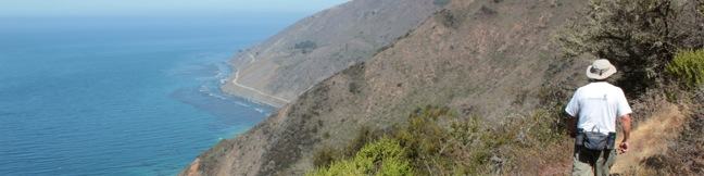
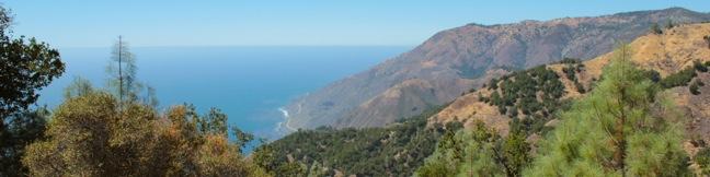
Hikes in Ojai

The city of Ojai lies on the southern edge of Los Padres National Forest, and there is great hiking in the green mountains around the city. Route 33, Mariposa Highway, heads north of Ojai into the breathtaking mountains, offering a scenic drive with numerous hairpin switchbacks. Along the way, there are several places to hike and camp. The largest campground in the area is Wheeler Gorge with seventy sites and a pleasant one-mile loop trail. ... Read more.
Rocky Peak in the Santa Susana Mountains
Rocky Peak is a panoramic 2,715-foot summit on the border between Los Angeles and Ventura counties in the Santa Susana Mountains. The county line-straddling peak stands at the center of a 4,800-acre park bearing the same name. The shortest hike to Rocky Peak takes Rocky Peak Trail from Rocky Peak Road through Rocky Peak Park. Oh boy, we're off to a rocky start. ...Read more.
Distance: 4.75 miles · Elevation change: 900 feet
By: Published: October 30, 2012 Last updated: December 5, 2025
Cruickshank Trail in the Silver Peak Wilderness
For backpackers and day hikers, Cruickshank Trail offers an extraordinary opportunity to explore the wilderness off Highway One on the beautiful Big Sur Coast. The single track starts by climbing to lofty ocean views, and then heads inland along a canyon wall with relaxing pockets of oaks and redwoods toward a handful of trail camps. The excellent trail to Upper Cruickshank Camp crosses diverse scenery for a 5-mile round trip hike with 1,150 feet of elevation gain, and there are several possible extensions. ...Read more.
Distance: 5 miles · Elevation change: 1150 feet
By: Published: September 17, 2012 Last updated: April 16, 2026
Buckeye Trail in the Silver Peak Wilderness
It can sound like hyperbole when you try to put into words the breathtaking, jaw-dropping stop-you-in-your tracks ocean views found on trails in Big Sur. Never the less, Buckeye Trail has absolutely extraordinary views over the Pacific that you need to see to believe. Rising above Highway One, the trail ventures through the Silver Peak Wilderness, ascending coastal canyons and ridges to panoramic vistas and a number of trail camps. ...Read more.
Distance: 6.5 miles · Elevation change: 1450 feet
By: Published: September 16, 2012 Last updated: April 16, 2026
Bob Jones City to the Sea Bike Trail in Avila Beach and Avila Valley
Are you jonesing for an easy trail that leads to a beach town brimming with oceanfront fun? Take a relaxing trip down Bob Jones Bike Trail to Avila Beach, a small bayside hamlet that can bustle with beachgoers on weekends. The level 5-mile round trip trail is suitable for hikers, joggers, walkers, and bikers. You will enjoy refreshing shade from oaks as you follow San Luis Obispo Creek down Avila Valley to its pacifying ending in Avila Beach. ...Read more.
Distance: 5 miles · Elevation change: 50 feet
By: Published: September 15, 2012 Last updated: April 10, 2026
Chumash Painted Cave State Historic Park in Santa Barbara
Chumash Painted Cave State Historic Park preserves centuries old Native American artwork that graces the wall of a sandstone cave in the Santa Ynez Mountains behind Santa Barbara. Chumash Painted Cave can be reached by walking a couple hundred feet up a trail on Painted Cave Road. The trailhead is just two miles from California Route 154, making it a quick, convenient, and interesting stop for travelers crossing the 154 between Santa Barbara and the Santa Ynez Valley. ...Read more.
Distance: 0.1 miles · Elevation change: 20 feet
By: Published: July 13, 2012 Last updated: December 5, 2025