Lava Tube in Mojave National Preserve
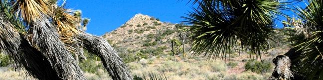
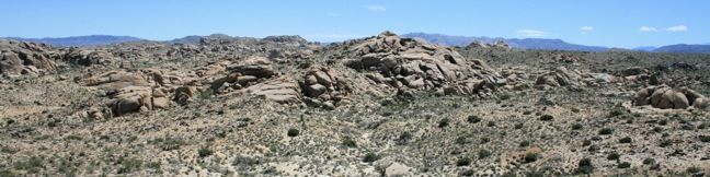
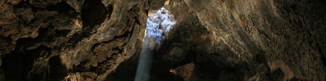
A field of cinder cones stands out dramatically from the surrounding Mojave Desert between the city of Baker and Kelso Depot Visitor Center in Mojave National Preserve. Within the lava field is a short trail leading to a tube formed long ago by molten lava. A ladder takes hikers down into the tube where skylights (holes in the rock ceiling) illuminate a subterranean world. ...Read more.
Tagged with · Caves · Free Trails · Lava · Lava Tubes
Distance: 0.6 miles · Elevation change: 150 feet
By: Published: May 17, 2010 Last updated: December 5, 2025
Warren Peak in Joshua Tree National Park
Warren Peak is a high point on the western edge of the Little San Bernardino Mountains in Joshua Tree National Park. Located away from Park Boulevard, Warren Peak offers private peace of mind and near endless views. A 5.5-mile round trip hike to the 5,103-foot summit begins from Black Rock Campground, the only campground in the park where visitors can sleep surrounded by Joshua trees. ...Read more.
Tagged with · National Parks · Summits
Distance: 5.5 miles · Elevation change: 1000 feet
By: Published: May 14, 2010 Last updated: December 5, 2025
Lucky Boy Vista in Joshua Tree National Park
Lucky Boy Vista Trail offers a level 2.5-mile round trip hike to a modest overlook at the site of an old mine. The trailhead is a half-mile from the Pine City - Desert Queen Mine Trailhead and easy to find. There are no junctions along the trail to be concerned with. From the parking area, hike southeast across the desert on an easy track that climbs just 125 feet over 1. ...Read more.
Tagged with · National Parks
Distance: 2.5 miles · Elevation change: 125 feet
By: Published: May 13, 2010 Last updated: December 5, 2025
Inspiration Peak from Keys View in Joshua Tree National Park
With its vast view of Coachella Valley, the Salton Sea, and Mount San Jacinto, Keys View is the principal overlook in Joshua Tree National Park. The excellent vantage more than justifies the 7-mile drive from Park Boulevard, but why stop there? Keys View is also the starting point for a short trek to Inspiration Peak. Leave the crowds behind and visit this 5,550-foot summit, which is just 0. ...Read more.
Tagged with · National Parks · Summits
Distance: 1.2 miles · Elevation change: 425 feet
By: Published: May 11, 2010 Last updated: December 5, 2025
Santa Ynez Falls in the Santa Monica Mountains
Santa Ynez Falls Trail follows a shaded creek to a gorge containing a short waterfall. This 2.5-mile hike is a popular family outing because it is fairly level (just 250 feet of elevation change) and interesting enough to hold a child's attention for the duration. Santa Ynez Falls is one of the Los Angeles waterfall hikes. The hike begins from a free trailhead into Topanga State Park in the Pacific Palisades. ...Read more.
Distance: 2.5 miles · Elevation change: 250 feet
By: Published: April 29, 2010 Last updated: April 7, 2026
Lower Canyonback Trail in the Santa Monica Mountains
Lower Canyonback Trail crosses Canyonback Ridge between Brentwood and a development of estate homes built along the ridge. The trail offers views of west Los Angeles, Santa Monica Bay, and neighboring ridges in the Santa Monica Mountains. The Getty Museum to the east is also in view and on the same plane with trail. From the top of Kenter Avenue to Mountain Gate Country Club Estates is 4. ...Read more.
Distance: 4.2 miles · Elevation change: 500 feet
By: Published: April 28, 2010 Last updated: December 5, 2025
Upper Canyonback Trail in the Santa Monica Mountains
Canyonback Ridge runs north to south in the area of the Santa Monica Mountains known as the Big Wild. The ridge is located east of Mandeville Canyon near San Vicente Mountain. Much like the neighboring ridges, Westridge, Sullivan Ridge, and Temescal Ridge, there is both a wide fire road and a narrow single-track running along Canyonback Ridge allowing hikers to choose their own adventure on the trail. ...Read more.
Distance: 3 miles · Elevation change: 200 feet
By: Published: April 28, 2010 Last updated: May 20, 2026
Monarch Lakes in Sequoia National Park
The beautiful Monarch Lakes grace the Sierra in an alpine cradle beneath Sawtooth Peak in the Mineral King Region of Sequoia National Park. A 9.4-mile round trip hike climbs over 2,500 feet to visit the picturesque pair of high-elevation lakes. Make your way to the Sawtooth Trailhead near the end of Mineral King and start up the trail. The first 0. ...Read more.
Tagged with · Lakes · National Parks
Distance: 9.4 miles · Elevation change: 2500 feet
By: Published: April 27, 2010 Last updated: December 5, 2025
Eagle Lake in Sequoia National Park
Eagle Lake is nestled within a high-elevation granite cirque in the Mineral King region of Sequoia National Park. The robust hike to the lake climbs 2,200 feet over 3.6 miles and delivers a steady climb with expanding views. Start from Eagle-Mosquito Trailhead at the end of Mineral King Road and commence hiking up the west rim of the valley. Cross the wooden footbridge that has been built over Spring Creek and continue uphill. ...Read more.
Tagged with · Lakes · National Parks
Distance: 7.2 miles · Elevation change: 2200 feet
By: Published: April 26, 2010 Last updated: December 5, 2025
Hockett Trail in Sequoia National Park
Campers at Atwell Mill in the Mineral King region of Sequoia National Park are in a perfect position to take a stroll down Hockett Trail. This forest path descends southeast for 1.5 miles to a footbridge that crosses the East Fork of the Kaweah River. Along the way, the trail passes pines, firs, incense cedars, and the occasional Giant Sequoia. Hockett Trail continues far beyond the bridge, passing through the East Fork Sequoia Grove after another mile. ...Read more.
Tagged with · National Parks · Sequoia Groves
Distance: 3 miles · Elevation change: 600 feet
By: Published: April 26, 2010 Last updated: December 5, 2025