Henninger Campground San Gabriel Mountains Henninger Flats Trail Camp Altadena tent camping
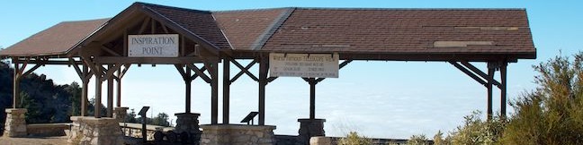
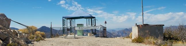
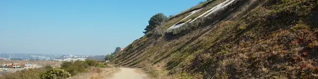
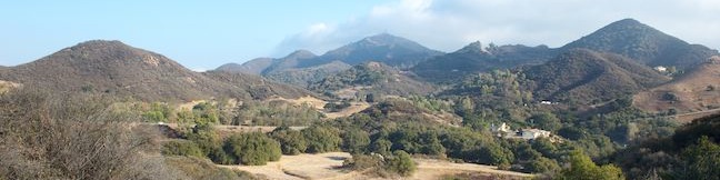
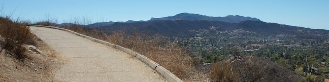
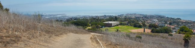
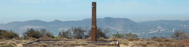
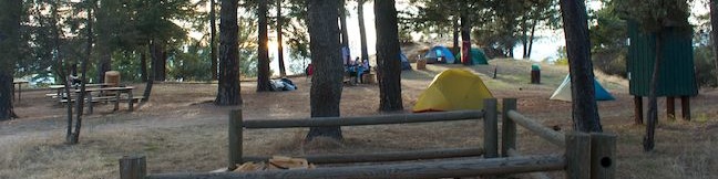
Henninger Campground is a sprawling trail camp in a scenic and special pine forest on Henninger Flats in the San Gabriel Mountains. From Altadena, it is a 3-mile one-way hike up Mount Wilson Toll Road to Henninger Flats, where the charming campground is accompanied by a visitor information center and tree nursery operated by the Los Angeles County Fire Department. ...Read more.
TagsA green icon depicting a tags represents a list of words and phrases that this content is tagged with Tagged with · Altadena · Tent Camping · San Gabriel Mountains
By: Published: Last updated: January 2, 2018
Inspiration Point hike Mount Lowe Road Mt. Lowe Railway hike San Gabriel Peak Mount Lowe Trail Camp Angeles National Forest hiking trail Mount Lowe Railroad
Sometimes it can seem ambitious just to go for a hike in the rugged San Gabriel Mountains, but Thaddeus Lowe was way more determined than that, devising an incline tram and railway to bring guests to a resort, tavern, and mountain overlooks that he created in the San Gabriel Mountains about a century ago. His railway and resorts have long been destroyed, but hikers can still visit the remnants. ...Read more.
My Hikes: Completed hikeA green icon of shows a picture of a landscape with a check mark in the upper right corner, signifying that this is a hike you would like to put on your completed list.OK! Add to trails I've hiked
My Hikes: Want to hikeA green icon of shows a picture of a landscape with a heart in the upper right corner, signifying that this is a hike you would like to put on your to-do list.OK! Add to trails I want to hike
TagsA green icon depicting a tags represents a list of words and phrases that this content is tagged with Tagged with · Adventure Pass · Altadena · Angeles National Forest · Ruins · Tent Camping · Trail Camp · Walk-in Camping · Dog-Friendly Trails · Mountain Biking Trails · San Gabriel Mountains
Hike DistanceA green icon of a hiker used to label information about the length of the hike Distance: 7.25 miles · Elevation change: 900 feet
By: Published: Last updated: August 31, 2019
Vetter Mountain hike Vetter Mountain Fire Lookout Tower Vetter Mountain Road Silver Moccasin Trail San Gabriel Mountains summit hike Angeles National Forest Vetter Mountain Lookout hike Charlton Flats Picnic Area
Vetter Mountain has got to be one of the more scenic peaks in the San Gabriel Mountains, boasting a 360-degree summit that's a total stunner. For decades, hikers marched up the mountain to see the historic fire lookout tower that stood at the summit, but in 2009, the Station Fire destroyed the tower and scorched Vetter Mountain. The area is still in recovery from the wildfire, but trails to the 5,908-foot summit are open, allowing hikers to enjoy spectacular views over the San Gabriels. ...Read more.
My Hikes: Completed hikeA green icon of shows a picture of a landscape with a check mark in the upper right corner, signifying that this is a hike you would like to put on your completed list.OK! Add to trails I've hiked
My Hikes: Want to hikeA green icon of shows a picture of a landscape with a heart in the upper right corner, signifying that this is a hike you would like to put on your to-do list.OK! Add to trails I want to hike
TagsA green icon depicting a tags represents a list of words and phrases that this content is tagged with Tagged with · Adventure Pass · Angeles National Forest · Azusa · Lookout Towers · San Gabriel Mountains National Monument · Silver Moccasin Trail · Summits · Dog-Friendly Trails · Mountain Biking Trails · San Gabriel Mountains
Hike DistanceA green icon of a hiker used to label information about the length of the hike Distance: 3.8 miles · Elevation change: 525 feet
By: Published: Last updated: May 13, 2025
LMU Trail Westchester Fire Road hike Los Angeles Loyola Marymount University trail LMU walking trail
For those times when you can’t get out of LA to go for a hike, the city offers several urban trails. Those who live around Loyola Marymount University (in Culver City, Ladera Heights, Marina Del Rey, Playa Vista, Westchester, West LA, etc.) may enjoy getting a taste of the outdoors along with some exercise on the LMU Trail, also know as Westchester Fire Road. ...Read more.
My Hikes: Completed hikeA green icon of shows a picture of a landscape with a check mark in the upper right corner, signifying that this is a hike you would like to put on your completed list.OK! Add to trails I've hiked
My Hikes: Want to hikeA green icon of shows a picture of a landscape with a heart in the upper right corner, signifying that this is a hike you would like to put on your to-do list.OK! Add to trails I want to hike
TagsA green icon depicting a tags represents a list of words and phrases that this content is tagged with Tagged with · Free Trails · Playa Vista · Dog-Friendly Trails · Mountain Biking Trails
Hike DistanceA green icon of a hiker used to label information about the length of the hike Distance: 4.7 miles · Elevation change: 125 feet
By: Published: Last updated: April 12, 2017
Rocky Oaks Park hike Santa Monica Mountains National Recreation Area Pond Trail Rocky Oaks Loop Trail Malibu California hiking
Good things do come in small packages, like Rocky Oaks, one of the tinier parcels in the Santa Monica Mountains National Recreation Area. The park covers less than 200 acres, but a collection of interwoven trails allow visitors to hike about 2 miles in this park. For a short and level half-mile loop, stroll around a seasonal pond that was used as a cattle pond when Rocky Oaks was a ranch. ...Read more.
My Hikes: Completed hikeA green icon of shows a picture of a landscape with a check mark in the upper right corner, signifying that this is a hike you would like to put on your completed list.OK! Add to trails I've hiked
My Hikes: Want to hikeA green icon of shows a picture of a landscape with a heart in the upper right corner, signifying that this is a hike you would like to put on your to-do list.OK! Add to trails I want to hike
TagsA green icon depicting a tags represents a list of words and phrases that this content is tagged with Tagged with · Free Trails · Malibu · Santa Monica Mountains National Recreation Area · Dog-Friendly Trails · Mountain Biking Trails · Santa Monica Mountains
Hike DistanceA green icon of a hiker used to label information about the length of the hike Distance: 2 miles · Elevation change: 175 feet
By: Published: Last updated: May 21, 2024
Tarantula Hill Trail Thousand Oaks California Dawns Peak hike
The foreboding sounding Tarantula Hill, which also goes by the more welcoming name of Dawn's Peak, is a small, isolated mound in Thousand Oaks that hikers can summit for views over the Conejo Valley and into the nearby Santa Monica Mountains. If your spider senses are detecting pavement, that's because the entire half-mile-long trail up Tarantula Hill is paved. ...Read more.
My Hikes: Completed hikeA green icon of shows a picture of a landscape with a check mark in the upper right corner, signifying that this is a hike you would like to put on your completed list.OK! Add to trails I've hiked
My Hikes: Want to hikeA green icon of shows a picture of a landscape with a heart in the upper right corner, signifying that this is a hike you would like to put on your to-do list.OK! Add to trails I want to hike
TagsA green icon depicting a tags represents a list of words and phrases that this content is tagged with Tagged with · Conejo Valley · Free Trails · Summits · Thousand Oaks
Hike DistanceA green icon of a hiker used to label information about the length of the hike Distance: 1 mile · Elevation change: 275 feet
By: Published: Last updated: April 12, 2017
Cave of Munits hike Upper Las Virgenes Open Space Preserve Castle Peak El Escorpion Park Simi Hills El Escorpion Trail West Hills California
Are you looking for a hike that's an action-packed adventure? Rarely does a 2.1-mile loop offer as much excitement as the hike to the Cave of Munits and Castle Peak. You'll start with a gradual warm-up across El Escorpion Park to Upper Las Virgenes Open Space Preserve to find a fun vertical cave just begging to be explored. You won't need any ropes or gear to get through the cave, just an adventurous spirit that will lead you out the top of the cave to a tough off-trail ascent to Castle Peak, a panoramic summit towering over the west end of the San Fernando Valley. ...Read more.
My Hikes: Completed hikeA green icon of shows a picture of a landscape with a check mark in the upper right corner, signifying that this is a hike you would like to put on your completed list.OK! Add to trails I've hiked
My Hikes: Want to hikeA green icon of shows a picture of a landscape with a heart in the upper right corner, signifying that this is a hike you would like to put on your to-do list.OK! Add to trails I want to hike
TagsA green icon depicting a tags represents a list of words and phrases that this content is tagged with Tagged with · Caves · Free Trails · Mountains Recreation and Conservation Authority · Off Trail · Simi Hills · West Hills · Dog-Friendly Trails · Mountain Biking Trails
Hike DistanceA green icon of a hiker used to label information about the length of the hike Distance: 2.1 miles · Elevation change: 725 feet
By: Published: Last updated: May 13, 2025
Deane Dana Friendship Park hike Palos Verdes Peninsula Fowler Trail San Pedro
Perched atop a hill on the south side of Palos Verdes Peninsula, Deane Dana Friendship Park offers hikers panoramic ocean views on an easy 1.1-mile loop. While exploring the 123-acre park, the hike gains 200 feet to views west across the Pacific Ocean toward Catalina Island and around the south end of the peninsula toward Long Beach Harbor to the east. ...Read more.
My Hikes: Completed hikeA green icon of shows a picture of a landscape with a check mark in the upper right corner, signifying that this is a hike you would like to put on your completed list.OK! Add to trails I've hiked
My Hikes: Want to hikeA green icon of shows a picture of a landscape with a heart in the upper right corner, signifying that this is a hike you would like to put on your to-do list.OK! Add to trails I want to hike
TagsA green icon depicting a tags represents a list of words and phrases that this content is tagged with Tagged with · Free Trails · Ocean Views · San Pedro · Dog-Friendly Trails · Palos Verdes Peninsula
Hike DistanceA green icon of a hiker used to label information about the length of the hike Distance: 1.1 miles · Elevation change: 200 feet
By: Published: Last updated: April 12, 2017
Old Youth Camp Loop Trail Stough Canyon Verdugo Mountains hike Burbank
Old Youth Camp Loop presents a short hike and a decent workout to the cool ruins of an abandoned and burned down camp in the Verdugo Mountains. In addition to the old camp, the 2.6-mile loop with 700 feet of elevation gain passes an overlook with broad views over the San Fernando Valley and several other scenic spots. The hike begins from the Stough Canyon Trailhead, where there is a nature center for another environmental experience. ...Read more.
My Hikes: Completed hikeA green icon of shows a picture of a landscape with a check mark in the upper right corner, signifying that this is a hike you would like to put on your completed list.OK! Add to trails I've hiked
My Hikes: Want to hikeA green icon of shows a picture of a landscape with a heart in the upper right corner, signifying that this is a hike you would like to put on your to-do list.OK! Add to trails I want to hike
TagsA green icon depicting a tags represents a list of words and phrases that this content is tagged with Tagged with · Burbank · Free Trails · Ruins · Dog-Friendly Trails · Mountain Biking Trails · Verdugo Mountains
Hike DistanceA green icon of a hiker used to label information about the length of the hike Distance: 2.6 miles · Elevation change: 700 feet
By: Published: Last updated: July 2, 2021
Skyline Motorway hike Skyline Trail Downtown Los Angeles Skyline Mountainway Verdugo Mountains hike Burbank
Within the Verdugo Mountains, the small mountain range north of Burbank, you'll find a big league suburban hike up an abandoned fire road called Skyline Motorway. Skyline Motorway should probably be renamed Skyline Trail since the overgrown track is no longer suitable for vehicles. The Skyline half of the name is still quite valid though, as the trail presents sensational sights over the skyline of downtown Los Angeles (as well as Glendale, Studio City, and Burbank). ...Read more.
My Hikes: Completed hikeA green icon of shows a picture of a landscape with a check mark in the upper right corner, signifying that this is a hike you would like to put on your completed list.OK! Add to trails I've hiked
My Hikes: Want to hikeA green icon of shows a picture of a landscape with a heart in the upper right corner, signifying that this is a hike you would like to put on your to-do list.OK! Add to trails I want to hike
TagsA green icon depicting a tags represents a list of words and phrases that this content is tagged with Tagged with · Burbank · Free Trails · Dog-Friendly Trails · Mountain Biking Trails · Verdugo Mountains
Hike DistanceA green icon of a hiker used to label information about the length of the hike Distance: 6.1 miles · Elevation change: 1625 feet
By: Published: Last updated: December 7, 2018